Legendary Stone: OS Grid Reference – NM 86972 44042
Also Known as:
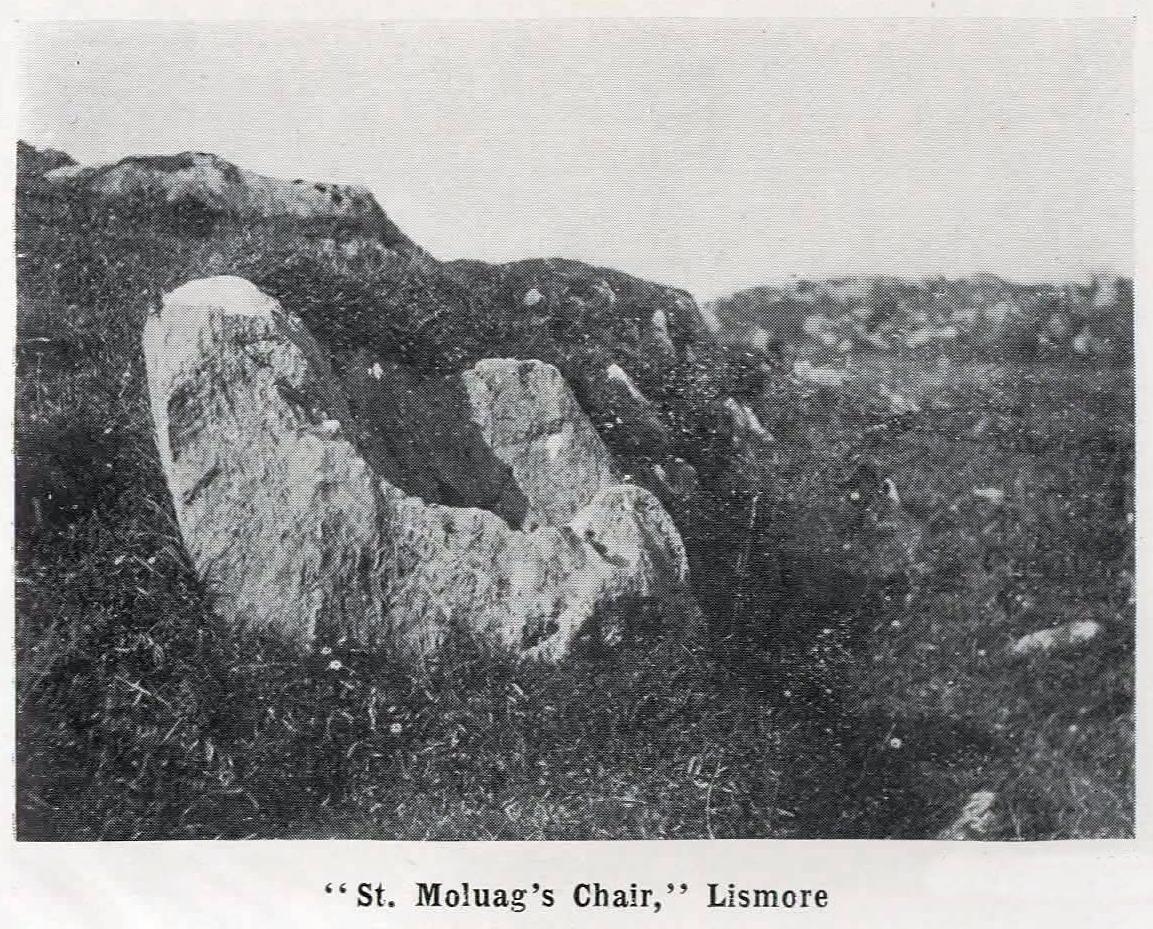
- St. Maluag’s Chair
Getting Here
From the Port Appin ferry onto the northern tip of the island, go along the B8045 road for literally 3.5km (2.17 miles) and, shortly after passing Achuaran, a single small white house is on your right. Just yards before here is a small raised rocky knoll. …Or from the Achnacroish ferry, up the road for nearly a mile, then turn right along the B8045 road to Clachan. A half-mile past the hamlet, go past the old School House, then past Mountain View cottage, and the next small white house on the left has a rocky knoll just past it. Just over the wall from the road, a sign points out the legendary Chair that you’re seeking!
Archaeology & History
St Moluag, a contemporary of the renowned St Columba, was a 6th century Irish saint who came to reside on Lismore—“the sacred isle of the western Picts”—and here taught the early christian doctrines, fused with indigenous animistic traditions. He used sites of Nature as places of reflection and meditation and this chair-shaped boulder came to be a place renowned as one of his ritual sites, not far from his church. It was described in Frank Knight’s (1933) huge work as possessing healing properties:
“To sit in it used to be considered a sovereign remedy for rheumatism.”
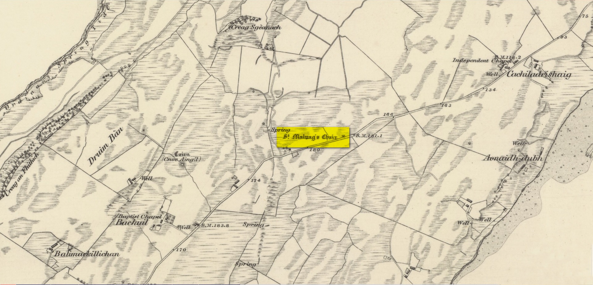
The site was highlighted on the earliest Ordnance Survey map of the island and its lore was remembered by local people of the time. The chair had wider ‘arms’ until the beginning of the 20th century when in widening the road, they were accidentally broken off by one of the workmen.
References:
- Knight, G.A. Frank, Archaeological Light on the Early Christianizing of Scotland – volume 1, James Clark: London 1933.
Acknowledgements: Huge thanks for use of the Ordnance Survey map in this site profile, reproduced with the kind permission of the National Library of Scotland.
© Paul Bennett, The Northern Antiquarian