St. Helen’s Well, Barmby-on-the-Marsh, East Yorkshire

Holy Well (destroyed):  OS Grid Reference – SE 6900 2841

Archaeology & History

Site shown on 1853 map

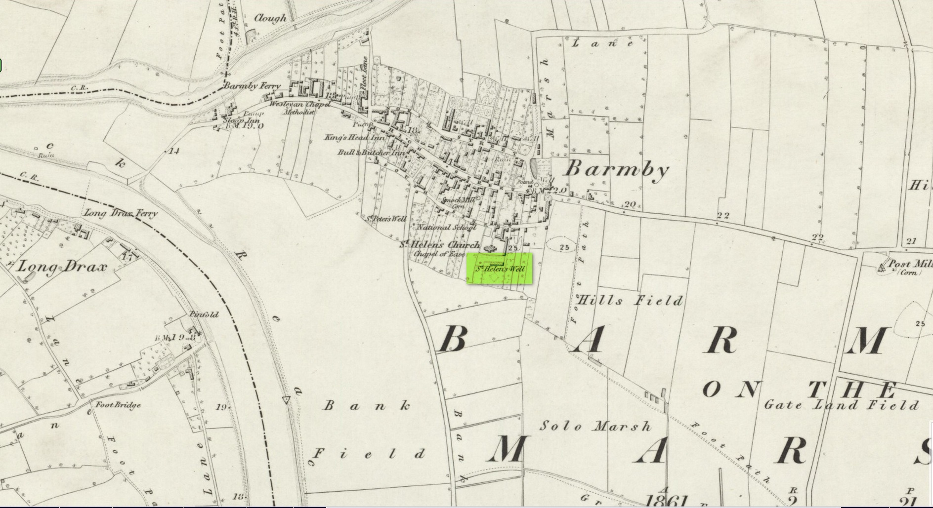
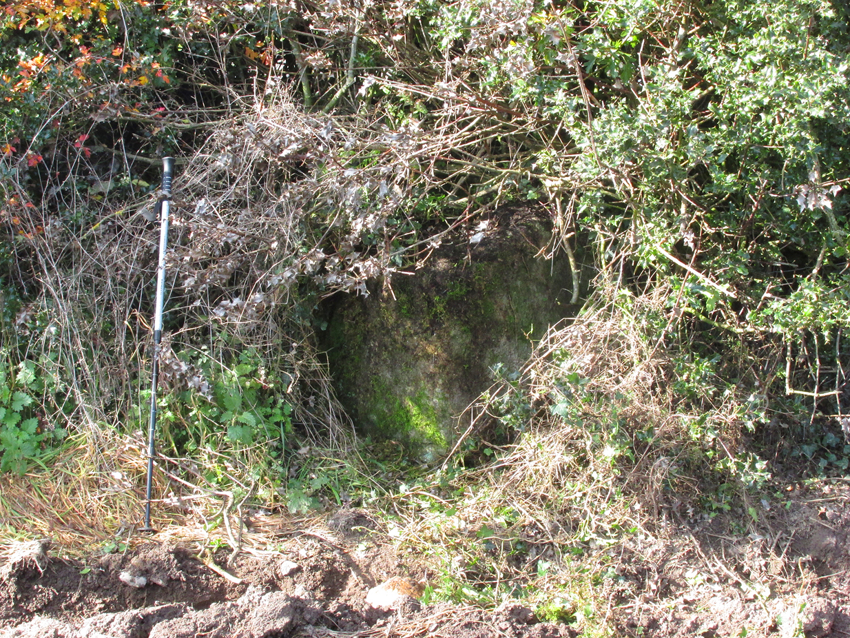
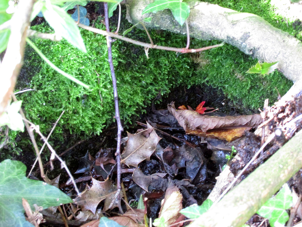
One of two holy wells in Barmby village which, like its compatriot St Peter’s Well, was destroyed sometime in the 19th century.  Not good!  It was located in the southwest section of the graveyard of St Helen’s Church and was apparently alive and running when the Ordnance Survey lads visited here in 1851 (as shown on their 1853 map).  But when the site was revisited by them in 1905, it seems to have gone.  However, as with the neighbouring St Peter’s Well, there are conflicting reports as to when it was destroyed, for although the Ordnance Survey lads spoke of it in the present tense when they went there, Thomas Allen (1831) told that “within the last six years (it has) been wantonly filled up.”  Despite this, less than ten years later William White mentioned it in the present tense, also saying how it was “said to possess medicinal properties.”  These healing qualities were, according to Allen, due to its iron-bearing or chalybeate nature, meaning that it would revive a weak and feeble constitution.  Iron-bearing wells are damn good for such things!

As the years passed, St. Helen’s Well fell into folk memory.  When William Smith (1923) surveyed the many holy wells in this part of the world he found how “old parishioners have said that as school-children they both drank of and washed in its water”, but little else.

References:

  1. Allen, Thomas, A New and Complete History of the County of York – volume 2, I.T. Hinton: London 1831.
  2. Gutch, E., Examples of Printed Folk-lore Concerning the East Riding of Yorkshire, Folk-Lore Society: London 1912.
  3. Harte, Jeremy, English Holy Wells – volume 2, Heart of Albion press: Wymeswold 2008.
  4. Smith, William, Ancient Springs and Streams of the East Riding of Yorkshire, A. Brown: Hull 1923.
  5. White, William, History, Gazetteer and Directory of the East and North Ridings of Yorkshire, R. Leader: Sheffield 1840.

© Paul BennettThe Northern Antiquarian

Nor Hill, Skipton Moor, North Yorkshire

Cup-Marked Stone:  OS Grid Reference – SE 02181 51125

Getting Here

Along the A65 near Draughton, go (south) uphill at Height Lane until it levels out.  ¾-mile (1.2km) up, a modernized stone milepost is where the road crosses the ancient Roman Road. From here, walk west for just over a mile (1.8km), past the trees on yer right, until you approach a small copse on yer right. In the field just before the copse, walk uphill until you reach the highest of the two rises and walk about. You’re damn close!

Archaeology & History

Nor Hill cup-marked stone
Cupmarks, top & side

This small cup-marked rock was rediscovered by Chris Swales in April 2018.  It’s probably only for the purist petroglyph fanatics amongst you, consisting of just a single cup-mark on its vertical west-face, and another near its top western edge.  Official records show no other carvings in the immediate vicinity, but local antiquarians may find it profitable in surveying the area.

© Paul BennettThe Northern Antiquarian


Hill Chapel Cross, Goosnargh, Lancashire

Wayside Cross : OS Grid Reference – SD 57273 38505

Also Known as:

  1. Historic England Monument No. 42648

Getting Here

Cross shown on 1912 OS-map

The Cross base is situated in a thick hedgerow on the east side of Horns Lane, opposite St Francis’ Hill Chapel, just to the north of and on the field side of the electricity transmission line that crosses the road at this point. It can be accessed from the field to the north by crossing the stream. In winter the Cross base is just visible from the road side through the hedge.

Archaeology & History

This cross is not described or noted by Henry Taylor in the 1906 edition of his Ancient Crosses and Holy Wells of Lancashire. All that survives is the substantial socketed base of what is likely to have been a mediaeval cross. It is almost completely hidden in the hedge, and is only accessible for ‘hands-on’ inspection from the field side of the road.

It was described by Historic England as:

‘The socket-stone of a probable wayside cross 1.0m square and 1.5m high…. Its present position in a pasture field suggests that it is not in situ.’

Cross position highlighted
Hidden in the boscage

Despite this description, the substantial nature of the base leads me to query why anyone would wish to move it from elsewhere. It is more likely that past land-owners have encroached on to the ancient highway, and fenced it accordingly. Maybe the Hill Chapel congregation will at some consider exposing the base on its hill crest position and insert a replica cross?

There is no record of what happened to the original Cross.  According to a pamphlet describing Hill Chapel, “this house appears to have always been in Catholic hands”, but no mention is made of the Cross.  A likely culprit for its destruction is the early nineteenth century Protestant fundamentalist the Reverend Richard Wilkinson.

The leaf-filled cross-base

In view of the continuity of Catholic ownership and worship at the Hill Chapel site over the road since before the Reformation, and the sustained persecution suffered by local Catholics in the centuries following the Reformation, it is very unlikely that they would have drawn attention to themselves by erecting the Cross, making it almost certainly of pre-Reformation construction.

Reference:

  1. Anonymous, Hill Chapel Goosnargh, privately published pamphlet available from Hill Chapel, n.d..

© Paul T Hornby, The Northern Antiquarian, 2018


Cunnel Fold Well, Marsett, Bainbridge, North Yorkshire

Healing Well:  OS Grid Reference – SD 88727 85543

Archaeology & History

Cunnel Fold Well on 1856 map

Found high on the moors several miles south of Hawes, this is a small almost insignificant water source that I sat with, drinking in both the landscape and the waters many moons ago in a daydreaming amble.  It’s history is only remembered in the name it was given, no doubt by some local to the Ordnance Survey lads in their own, albeit more focussed assessment on these hills.  Its name puzzled me for a long while and I wondered if some untold story lay behind it.  Sadly that doesn’t appear to be the case.  Although there are doubtless many tales that could be told of the people who, through the centuries, have sat and drank the waters here, we know none.

Its name very probably derives from the misapprehended dialect word ‘cannel’ which, as Mr Wright (1898) explains, is simply “a ditch…gutter, watercourse,” which seems appropriate here.  Of the place-names shown on the 1856 OS-map, it seems the most likely solution to the word.

As for a place to sit and have a drink, it’s very refreshing after the rains have fallen.  All too often nowadays, as with many of the old hilltop watercourses, their life-blood is falling back to Earth…

References:

  1. Wright, Thomas (ed.), English Dialect Dictionary – volume 1, Henry Frowde: London 1898.

© Paul BennettThe Northern Antiquarian


Ruston Beacon, Ruston Parva, East Yorkshire

Tumulus (destroyed):  OS Grid Reference – TA 0584 6128

Archaeology & History

Ruston Beacon tumulus on 1854 map

Ruston Beacon tumulus on 1854 map

A fallen tumulus that once marked the southwestern side of the village boundary line, and was once adjacent to the prehistoric Green Dikes earthworks that once passed here.  Sadly however, sometime early in the 20th century, this ancient burial mound fell victim to usual ignorance of arrogant land-owners who place money ahead of history and local tradition and it was ploughed-up and destroyed.  Thankfully we have an account of the site in J.R. Mortimer’s (1905) incredible magnum opus.  Listing it as ‘Barrow no.272’ in the number of tombs excavated, he told us that:

“It is situated on elevated ground about half-a-mile (south)west of Ruston Parva.  On September 20th and 21st, 1886, it measured about 70 feet in diameter and 2 feet in elevation; and had originally been several feet higher, as an old inhabitant remembered assisted in removing its upper portion, which was carried away and spread on the surrounding land many years previously.  At the base of the barrow, near the centre, was a long heap of cremated bones which had been interred in a hollow log of wood with rounded ends, about 3 feet in length and 14 inches in width, well shown by impressions in the plastic soil, and by the remains of the decayed wood.  The heap of bones was rather large and probably consisted of the remains of more than one body.  No relic accompanied them.  Several splinters and flakes of flint were picked from the mound.”

The tumulus (as its name implies) became a spot besides which one of East Yorkshire’s many ancient beacons were built.  In Nicholson’s (1887) survey of such monuments, he told that

“the modern beacon, apparently, stood on the site of the old one, on the high ground in the angle of the road from Driffield to Kilham.  It was a prominent object and would be well-known to the coachmen and guards…for it stood on the side of the road from Driffield to Bridlington.  Mr John Browne, of Bridlington, remembers it; and says, ‘It would be the last of the beacons that remained in this district and was removed between fifty and sixty years ago.  My recollection of it is that it was a tall pole, with a tar barrel at the top, and had projected steppings to reach the barrel.”

One of the earliest accounts of the beacon from the late-1500s told that it took signal for its light from the beacon at Rudston, which stood upon one of the Rudston cursus monuments, a short distance from the massive Rudston monolith.

References:

  1. Mortimer, J.R., Forty Years Researches in British and Saxon Burial Mounds of East Yorkshire, Brown & Sons: Hull 1905.
  2. Nicholson, John, Beacons of East Yorkshire, A. Brown & Sons: Hull 1887.

© Paul Bennett, The Northern Antiquarian


Foldys Cross, Towneley, Burnley, Lancashire

Cross:  OS Grid Reference – SD 8523 3066

Also Known as:

  1. Foldy’s Cross

Getting Here

To get to Towneley Park head to the south side of the town close to a junction of two roads heading towards Todmorden and Bacup, from here the park and hall are signposted. The old cross stands 300 metres south-west of Townley Hall in the centre of some pathways leading in the direction of Todmorden road (the A671).

Archaeology & History

Foldys Cross, Burnley (Taylor, 1906)

Foldy’s Cross is a tall slender monument on a carved circular pedestal which sits upon a set of seven square-shaped steps. It dates from 1520 when it stood at the south side of St Peter’s parish church, Burnley. It was set up to commemorate a chaplain of St Peter’s church by the name of John Foldy or Foldys, and was then the town’s market cross or St Peter’s churchyard cross. In 1780 it was badly damaged by a Puritan mob, but the Towneley family rescued it and had it brought to their estate where it was repaired in a haphazard way and placed at the north-eastern side of the hall on the Avenue. In 1911 Burnley Borough Council had the cross completely restored for its Jubilee Year celebrations with various sandstone pieces added to replace sections of the cross including the plinth and set of seven steps – which are thought to be an exact copy of the original ones. The cross was then placed in its current position 300 metres to the south-east of Towneley Hall at an intersection of footpaths leading towards Todmorden road.

The original design of Foldy’s Cross was of the Gothic style which can be seen in the cross-head. It is made of sandstone and has an octagonal shaft with a moulded plinth with sunken panels. These panels contain lettering in the Gothic script. The cross-head is very nice with its decorated four arms, one of which is sunk into the shaft to support the head itself; this appears to be the original moulded head or cap with nicely carved emblems and fleurons on the collar – all typically Gothic in style. In the middle of the cross-head is a rather crude crucifix scene and on the other side the letters “IHS”. On the plinth the inscription reads in Latin:

‘Orate pro anima Johannes Foldys, capellani qui istam crucem fieri fecit Anno Domini MCCCCCXX’

— which when translated reads as, “Pray for the soul of John Foldys, chaplain who caused this cross to be made in the year of Our Lord 1520”.

The cross is now grade II listed and the English Heritage Building identity number is 467232.

References:

  1. Peace, Richard, The Curiosities of England – Lancashire Curiosities, The Dovecot Press Ltd 1997.
  2. Taylor, Henry, The Ancient Crosses and Holy Wells of Lancashire, Sherratt & Hughes: Manchester 1906.

© Ray Spencer, 2011


Dean Church, Cumbria

Cup-and-Ring Stone:  OS Grid Reference – NY 0708 2536

Getting Here

Photo & drawing of Dean’s cup-and-ring (after Beckensall, 1992)

St Oswald’s church stands at the western edge of the village of Dean beside the road to Branthwaite. The village is located some 5 miles due south-west of Cockermouth and about 6 miles to the south-east of Workington.

Archaeology & History

In the nave of St Oswald’s church there is now housed a small sandstone boulder that has a well-defined central cup-mark around which are two large concentric rings, a third ring being left open – perhaps indicating a portal (gateway), and three other well defined cup-marks at the side of that, one of which has become almost adjoined to the other through erosion.

The boulder was ploughed up in a field at nearby Park Hill to the south-west of the village in 1918. It was then placed in the churchyard but, in recent times it was brought into the church for safety reasons.

References:

  1. Beckensall, Stan, Cumbrian Prehistoric Rock Art, Abbey Press: Hexham 1992.
  2. Beckensall, Stan, British Prehistoric Rock Art,Tempus: Stroud 1999.
  3. Beckensall, Stan, Prehistoric Rock Art in Cumbria, Tempus: Stroud 2002.

© Ray Spencer, 2011


Bride Stone, Farnley Moor, North Yorkshire

Standing Stone:  OS Grid Reference – SE 1991 4932

Getting Here

From Otley go north straight over the river and upwards into the countryside for nearly two miles (past the TV mast on the right).  As you reach near the top of the hill, there’s a turn to your right.  Go on here for a hundred yards or so, then walk along the footpath to your right.  After a few hundred yards, keep your eyes out for the stone just through the gate, in the walling on your left.

Archaeology & History

Although we see named on the 1853 Ordnance Survey map the respective place-names of Bride Cross House and Bride Cross Allotment, the first literary reference to any site here as a standing stone appears to be Eric Cowling (1946) who, when commenting on the pagan tradition and folklore of ancient sites, told that

“The name of Bride Cross Farm, Dob Park, is very significant, for at the meeting place of several tracks to the south-east is a squat standing stone built into a wall and marked as a boundary stone, which was probably Brides Cross.”

Bride Stone, Farnley Moor
Boundary markers on top

Although I’d read about this place as a kid, it was Graeme Chappell who first brought me here some twenty years back, in one of our many exploratory forays into the prehistory of this area.  It’s a nice fat squat standing stone, similar in stature to the more famous Bull Stone near Otley Chevin, a few miles to the south — though our Bride Stone here is about half as high.  Only about three-feet tall, it stands by the gate at the wall-side about 200 yards down the footpath from the Dob Park Lodge road and does seems to have been used as a boundary marker, as the letters “F.F.” are carved deeply on top of the upright (possibly denoting the Fawkes family of Farnley).

Cowling’s assertion that this old stone accounts for the ‘Bride Cross’ place-name is probably right, as the site is roughly midway between the respective place-names of the House and Allotment.  There is an old field-name of Crosse Close in the vicinity, from 1692, but I haven’t located it.  If such a cross ever existed nearby (most likely, it’s gotta be said), it’s obviously the relic which left the place-names — though the standing stone was certainly here first!  As yet, we’ve found no references to this place before 1853…which can’t be right…

Folklore

Seems to be a petrification legend in here somewhere. Although the short tale doesn’t say as much, it is supposed to have got its name through “the murder of a bride, rejected by a suitor, on her return from a wedding.”  Indeed, I’d go so far as to say ‘fertility’ as well!

Eric Cowling (1946) really stuck his neck out and reckoned sacrifices occurred here in the not too distant past. This may relate to the nearby Haddock Stones, a few hundred yards south, thought to derive its name from a cairn and ‘altar stones.’

References:

  1. Bennett, Paul, The Old Stones of Elmet, Capall Bann: Milverton 2001.
  2. Cowling, E.T., Rombald’s Way, William Walker: Otley 1946.
  3. Phillips, Guy Ragland, Brigantia — A Mysteriography, RKP: London 1976.
  4. Smith, A.H., The Place-Names of the West Riding of Yorkshire – volume 5, Cambridge University Press 1961.

© Paul Bennett, The Northern Antiquarian


Buckton Castle, Mossley, Lancashire

Hillfort:  OS Grid Reference – SD 9892 0161

Archaeology & History

Buckton Castle on 1882 map

This giant site—deemed as Iron Age by some and medieval by others—is on the verge of complete destruction as the adjacent quarrying company cuts closer and further into the sides and top of the monument. Local people and archaeologists need to do something about this, or it will be lost forever as the Industrialists once again destroy more of our ancient heritage in order that they can feed their god of Money.

Folklore

Legend has always told that great treasure existed beneath the grounds of this Brigantian hillfort, found on the moor-edges to the east of Manchester. Long ago, one man came along to see if he could find the treasure, said to consist of a huge chest of gold. The man brought two horses and the ground within the fort was gradually cleared away until, to the man’s surprise, the legendary chest was revealed!

Attaching chains to it and the horses, the man shouted:

“Gee, whoa, whoo! Bonny, Buck and Bell,
I’ll have this chest o’ gowd, i’ spite o’ all t’ devils in hell!”

But barely had the words left his mouth and the chest began to move, when the devil himself appeared in the shape of a huge hen that breathed fire! This scared the horses so much that they bolted and snapped the chains, taking their master with them but leaving the treasure-chest still in the ground. To this day the chest still remains, hidden in the Earth.

References:

  1. Winterbottom, Vera, The Devil in Lancashire, Cloister: Stockport 1962.

© Paul Bennett, The Northern Antiquarian