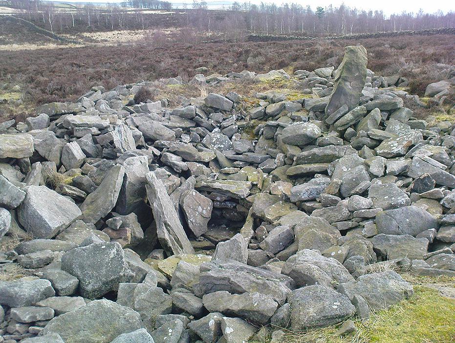
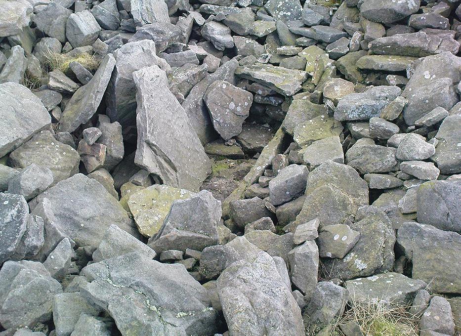
St. Serf’s Water, Crieff, Perthshire

Cist:  OS Grid Reference – NN 8488 2344

Also Known as:

  1. Canmore ID 25503

Archaeology & History

Were it not for the valuable records in the Scottish Statistical Accounts, we’d have lost all knowledge of this site.  It was described in notes by by Colin Baxter (1793), where he told us:

“About 200 yards west from the church of Monivaird, a barrow was opened some years ago, in which two urns were found, each containing a stone of a bluish colour, very hard about four inches long, and of a triangular shape, somewhat resembling the head of an axe.”

The site was subsequently mentioned in the Ordnance Survey Name Book of the parish, with some additional bits of information:

“In the year 17–, there was found, about one hundred yards to the westward of the old church of Monzievaird, a barrow containing a stone-coffin, in which were inclosed two coarse earthen urns, the one filled with burnt bones, the other containing the bones of the head.  Of these, the under jawbone and the teeth were very entire.  In the stone coffin was also found a stone hatchet, bluish-coloured, very hard, about four inches long, and of a triangular shape, a remain which proves the barrow of very remote antiquity – prior to the use of iron. The stone hatchet is preserved at Ochtertyre.”

No traces remain of the site; and although the stone axes came to be in the possession of Sir William Murray of Ochtertyre, the urns and other remains have long since been lost.

Folklore

The name of ‘St Serf’s Water’ derives from it this area being dedicated to St Servanus in early times; the holy well of St Serf could be found a short distance south from where this tomb was built.

References:

  1. Baxter, Colin, “United Parishes of Monivaird and Strowan,” in Statistical Account of Scotland – volume 8, William Creech: Edinburgh 1793.
  2. Porteous, A., “Extracts from a History of the Parishes of Monivaird and Strowan“, in Archaeologia Scotica, volume 2, 1822.

© Paul BennettThe Northern Antiquarian

Longbarrow Field, Timble, North Yorkshire

Cairn (lost):  OS Grid Reference — SE 18 53

Archaeology & History

Described in the Field Lore of Timble village by William Grainge (1895) are the names and short histories of some of the local place-names—with this in particular standing out like a veritable sore thumb!  Quite plainly, as Grainge told us,

“The name ‘Longbarrows’ is indicative of some burial mounds of a very early day.  None exist at present.  The land is under the plough, and is about the best in the township.”

But I cannot locate the position of this long-lost site and it’s not shown on any of the early OS-maps hereby.  Grainge said that the land on which it once stood was owned by a local farmer called Charles Dickinson, who leased it out to others.  He wrote:

“Dickinson had in Longbarrows 3 roods* and 23 perches*, and William Jackson’s share in Longbarrows was 1 acre, 3 roods and 21 perches.  Besides these, John Ward of Nether Timble had 1 rood and 17 perches int he same field, a long narrow slip without fence, between Dickinson’s and Jackson’s lots.”

Does anyone know where this was?  One of my suspects is the gathering place of the Fewston witches, a half-mile south of the village; but no remains of anything can be found there today and I may just be barking up the wrong tree.

The area south and west of here is rich in little-known prehistoric heritage, from the cairn-fields of Askwith Moor, the cairn circle at Snowden Crags, the settlements of Snowden Carr and the extensive petroglyphs all over the place!  Giants cairns of the early Bronze Age and neolithic period were also once more numerous upon the moors to the west and south, so the former existence of a long barrow in Timble wouldn’t necessarily be too unusual.  But where was it?!

References:

  1. Grainge, William, The History and Topography of the Townships of Little Timble, Great Timble and the Hamlet of Snowden, William Walker: Otley 1895.

*  A rood is an English unit of area, equal to a quarter of an acre or 10,890 square feet; a perch was a more variable unit of measure, being lengths of 1612, 18, 21, 24 and 25 square feet.

© Paul BennettThe Northern Antiquarian 


Craigenkirn, New Kilpatrick, Dumbartonshire

Long Cairn:  OS Grid Reference – NS 51839 78157  —  NEW FIND

Getting Here
Aerial view of the cairn

Aerial view of the cairn

Take the A809 road several miles north out of Glasgow, between Bearsden and Drymen.  Once out of the suburban sprawl, passing Milngavie, you’re heading to the famous Carbeth hutters.  Before this, note the gold course on your right (east).  Park here and cross the road where a gate and overgrown footpath takes you onto the grassy hills.  Keep to the fence-side for about 700 yards until it veers downhill.  Don’t walk downhill!  Keep in the same direction into the short grasses and, veering gradually left, downhill for a couple hundred yards ahead and, across a small boggy area, you’ll note some large upright stones in front of a mound.  That’s it!

Archaeology & History
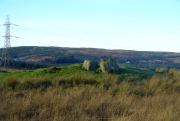
The SE stone 'entrance'

The SE stone ‘entrance’

There is no previous reference to this site which was found, quite fortuitously, by Nina Harris of Organic Scotland a few years ago.  She visited the site a number of times, puzzling over the curious line of possible standing stones at the edge the grass-covered mound—wondering if it was anything at all.  A few months ago she took us to see the place…
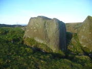
Modern gunshot cup-marks on entrance stone

Modern gunshot cup-marks on entrance stone

The site has been damaged and elements of it have been stripped for walling that are visible all around here.  The cairn is more than 55 yards in length, running from its southeastern stone ‘entrance’ to the gradually diminishing northwestern edges.  At its widest it is 14.6 yards (13.5m) across, near its southeastern end.  The main three standing stones at its entrance are four-feet tall at the highest, with one of them leaning upon another; an adjacent fourth stone, smaller than the main three, is more embedded into the cairn mass a couple of yards away.  Cup-marks on one of the three larger uprights here are recent gunshot marks; whilst the possible cup-marks on the largest upright are natural.
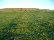
Line of ealling runs to the cairn

Line of ancient wall runs up and over the cairn
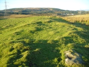
Looking NW along the cairn mass

Looking NW along the cairn mass

In standing on top of the long cairn, just above the large stones, you can see how sections of it have been stripped away.  Just beneath the surface is a line of internal walling, with what seems to be another one running parallel.  These run for a few yards until we reach a large circular depression within the overall cairn mass, a yard deep and 6-7 yards across; on the northern edge of which we can clearly see a section of walling beneath the surface.  When we look at the aerial view of this on Google Earth, we can clearly see how this walling actually begins way outside of the cairn mass itself, as a much denuded line of it (probably medieval in origin, though possibly Iron Age) curves across the grasslands from the west, crosses the long cairn and re-emerges on the other side of the adjacent boggy ground at its southeastern edges and continues on its way: indicating that the cairn mass beneath the wall is much older than the walls running across it.
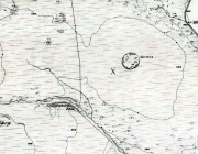
"X" marks the spot!

“X” marks the spot!

The main three 'entrance' stones

The main three ‘entrance’ stones

Audrey Henshall (1972) described the existence of another prehistoric chambered tomb like this one at Cairnhowit 1.95 miles (3.14km) southwest, and we find the Stockie Muir long cairn 3.12 miles (5.02km) to the northwest, clearly showing that the incidence of this monument is not an isolated one.  Others can be found not much further away.  The existence of the raised geological plate known as Carneddans Wood just over a mile south may have once been home to another chambered cairn.

Please note that the grid reference for this site fixes on the southeastern section of the cairn, where the upright stones are.

References:

  1. Henshall, Audrey S., The Chambered Tombs of Scotland – volume 2, Edinburgh University Press 1972.

Acknowledgements:  First and foremost to Nina Harris, for unknowingly finding the place; also to Paul Hornby and Marion Woolley for visits to the site.

© Paul BennettThe Northern Antiquarian


Upper Killay, Swansea, Glamorgan

Long Barrow (destroyed):  OS Grid Reference – SS 5848 9227

Also Known as:

  1. Cae Bryn-y-garn

Archaeology & History

Described in 1925 in a report by the Royal Institute of South Wales as “the remains of a long barrow,” it seems that all remains of this old site have been destroyed.  Where the long tomb once stood are now some bungalows (anyone know if they’re haunted!?).

The tomb was quite an impressive one from all accounts: aligning north-northeast, it was some 20 yards long and 10 yards wide (at its widest), standing between 6-8 feet tall.  When building operations started here in 1959, a disturbed mound of stones was noticed, but by 1965 the bungalows had been built where once rested the ancient dead.

The field-name to its immediate east — Cae Bryn-y-garn — tells us the old name of the cairn, as known to local folk.  Quite what its folklore may have been, I’ve yet to hear…

References:

  1. Royal Commission on the Ancient & Historical Monuments, Wales, An Inventory of the Ancient Monuments in Glamorgan – Volume 1, HMSO: Cardiff 1976.

© Paul Bennett, The Northern Antiquarian


Black Hill Long Cairn, Low Bradley, Skipton, North Yorkshire

Cairn:  OS Grid Reference – SE 0092 4756

Also Known as:

  1. Black Hill Long Barrow
  2. Bradley Moor Long Barrow
  3. Bradley Moor Long Cairn
  4. King’s Cairn

Getting Here

Follow the same directions for getting to the Black Hill Round Cairn.  It’s less than 100 yards away – you can’t miss it!

Archaeology & History

This is a superb archaeological site — and it’s bloody huge! It’s big and it’s long and it sticks out a bit – which is pretty unique in this part of the Pennines, as most other giant cairns tend to be of the large round variety.  Although the site was originally defined by Arthur Raistrick (1931) as a long barrow, J.J. Keighley (1981) told how, “it was found to be a round cairn imposed on a long cairn.”  And it’s an old one aswell…

Near the SE end of the giant cairn
Close-up of the main cist

More than 220 feet long and 80 feet in diameter at its widest southeastern end, as we walk along the length of the cairn to its northwestern edge, its main body averages (only!) 45 feet in diameter.  Made up of tens of thousands of rocks and reported by Butterfield (1939) to have had an upright stone along its major axis, the “height varies from 4-8ft, but the cairn has been much despoiled and disturbed,” said Cowling in 1946. He also told how,

“Excavation revealed that almost in the centre of the mound were the remains of a cist made of roughly dressed stone flags and dry walling, covered by a large stone. Under a stone slab, laid on the floor of the cist, were fragments of (burnt and unburnt) bone and a small flint chipping.”

This is a very impressive site and deserving of more modern analysis. The alignment of the tomb, SE-NW, was of obvious importance to the builders, believed to be late-neolithic in character.  The tomb aligns to two large hills in the far distance in the Forest of Bowland which we were unable to identity for certain.  If anyone knows their names, please let us know!

Folklore

The older folk of Bradley village below here, tell of the danger of disturbing this old tomb. In a tale well-known to folklorists, it was said that when the first people went up to open this tomb for the very first time, it was a lovely day. But despite being warned, as the archaeologists began their dig, a great storm of thunder, lightning and hailstones erupted from a previously peaceful sky and disturbed them that much that they took off and left the old tomb alone. (I must check this up in the archaeo-records to see if owt’s mentioned about it.)

References:

  1. Ashbee, Paul, The Earthen Long Barrow in Britain, Geo Books: Norwick 1984.
  2. Butterfield, A., ‘Structural Details of a Long Barrow on Black Hill, Bradley Moor,’ in YAJ 34, 1939.
  3. Cowling, E.T., Rombald’s Way, William Walker: Otley 1946.
  4. Keighley, J.J., ‘The Prehistoric Period,’ in Faull & Moorhouse’s West Yorkshire: An Archaeological Survey, I, WYMCC: Wakefield 1981.
  5. Raistrick, Arthur, ‘Prehistoric Burials at Waddington and Bradley,’ in YAJ 30, 1931.

© Paul Bennett, The Northern Antiquarian