Cup-and-Ring Stone (destroyed?): OS Grid Reference – SE 314 537
Archaeology & History
The chances of this carving still being alive, so to speak, are pretty slim. It was reported by a Mr. Sullivan to the old Yorkshire petroglyph researcher Stuart Feather back in 1965, in the days when English archaeologists didn’t really give a shit about rock art. Sad but true. The carving was found in the grounds of what used to be the ICI Fibres Research Centre, in the present landscape of Hornbeam Business Park, a hundred yards or more west of Hookstone Beck. According to Feather’s report, the carving consisted of “a single-ringed cup and a groove” surrounding “two short pecked grooves and a meandering groove leading off,” all with clear signs of being pecked and carved in the old-school manner. All trace of the carving has vanished and it was probably destroyed by the Industrialists. (the grid-reference to this site is an approximation)
This is an outstanding site visible for miles around in just about every direction – so getting here is easy! If you’re coming from Harrogate, south down the A658, turn right and go thru North Rigton. Ask a local. If you’re coming north up the A658 from the Leeds or Bradford area, do exactly the same! (either way, you’ll see the crags rising up from some distance away) As you walk to the main crags, instead of going to the huge central mass, you need to follow the line of walling down (south) to the extended cluster of much lower sloping rocks. Look around and you’ll find it!
Archaeology & History
On the evening of May 27, 2024, I received a phone call from a Mr James Elkington of Otley. He was up Almscliffe Crags and the wind was howling away in the background, taking his words away half the time, breaking the sentences into piecemeal fragments. But through it all came a simple clarity: as the sun was setting and the low light cut across the rocky surface, a previously unrecorded cup-and-ring design emerged from the stone and was brought to the attention of he and his compatriot Mackenzie Erichs. All previous explorations for rock art here over the last 150 years had proved fruitless—until now!
Looking northwestCentral cup-&-ring
On the east-facing slope of the stone, just below the curvaceous wind-and-rain hewn shapes at the very top of the boulder, is a singular archetypal cup-and-ring. It’s faint, as the photos show, but it’s definitely there. What might be another cup-and-ring is visible slightly higher up the sloping face, but the site needs looking at again when lighting conditions are just right! (you can just about make it out in one of the photos) But, at long last, this giant legend-infested mass of Almscliffe has its prehistoric animistic fingerprint, bearing fruit and giving watch to the countless heathen activities going back centuries. Rombald’s wife Herself might have been the mythic artist of this very carving! (if you want to read about the many legends attached to the major Almscliffe rock outcrop, check out the main entry for Almscliffe Crags)
Coming from Harrogate, take the B6162 and B6161 road to Beckwithshaw, through the village and, 4-500 yards on, turn right onto Norwood Lane. 2 miles along, keep your eyes peeled on your left for a gravelled parking spot and you’ll see the large rock outcrop 200 yards south of the road. …Otherwise, from Otley: go over the river bridge and turn right up Farnley Lane and follow the B6451 for a few miles, thru Farnley village up the Washburn valley, past Norwood and at Bland Hill, turn right along Broad Dubb Road for 1¾ miles where you’ll reach that same gravelled parking spot.
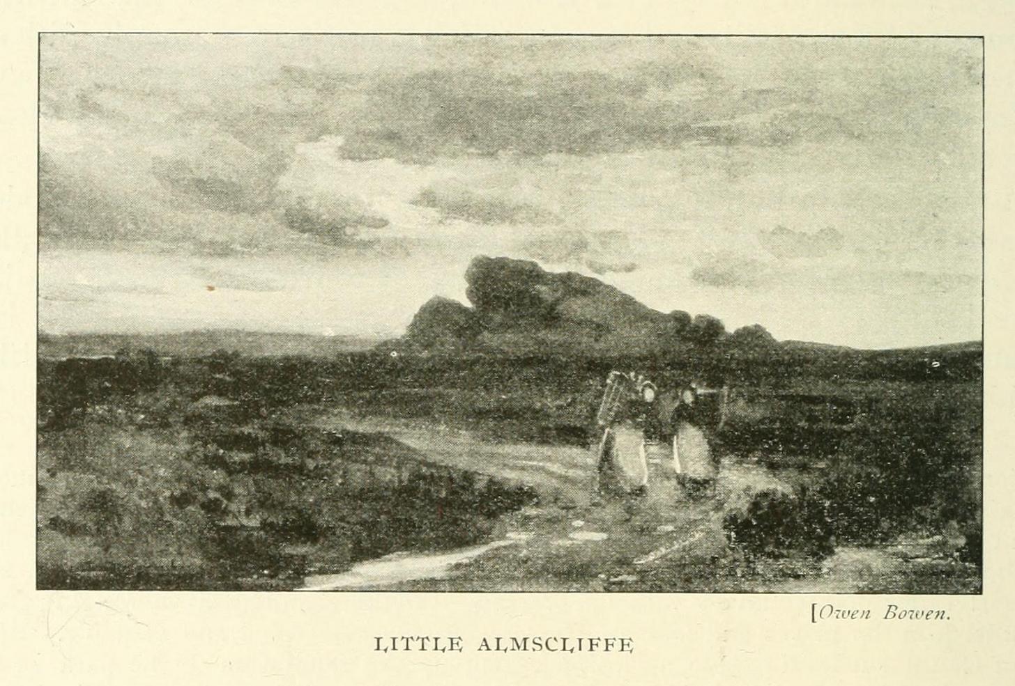
Archaeology & History
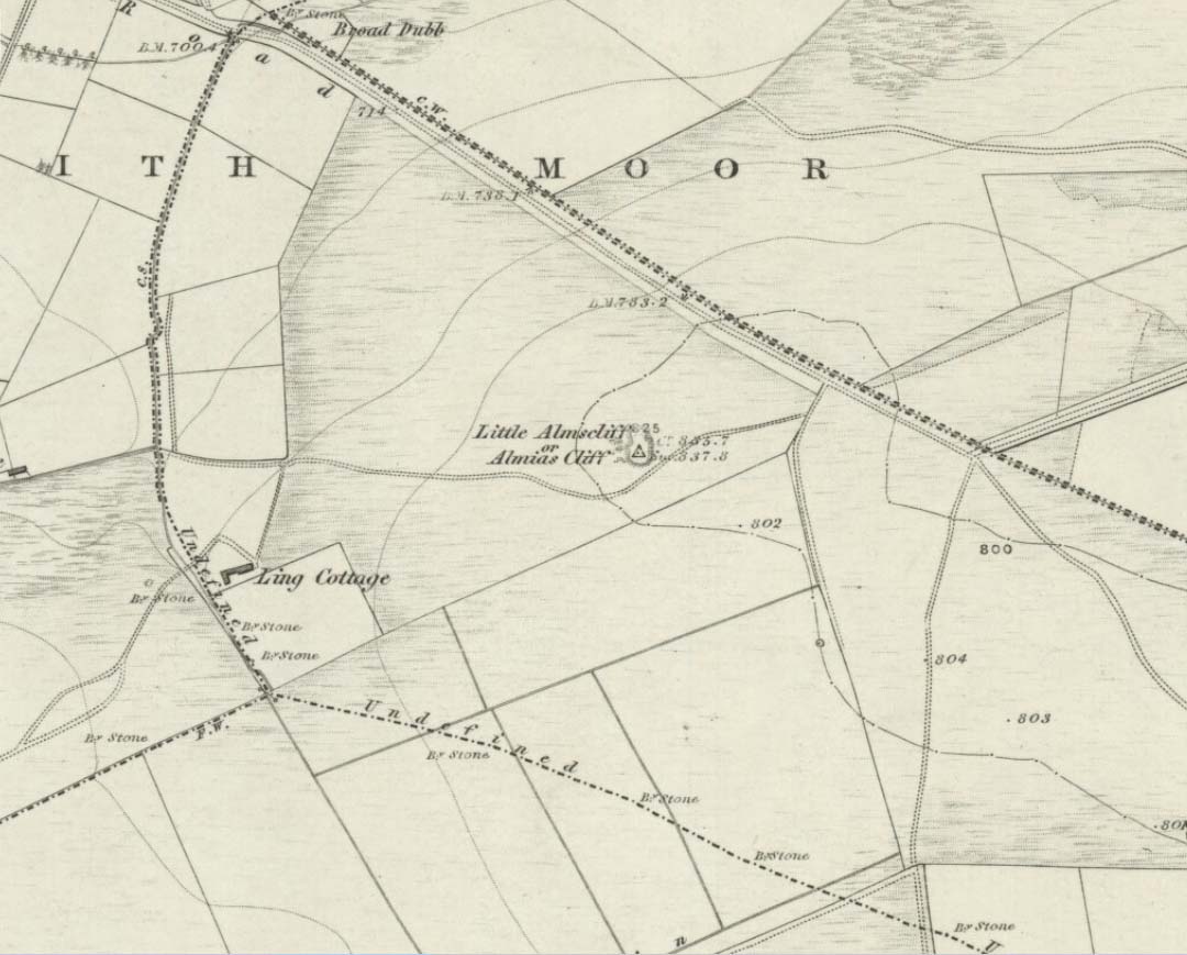
Very much the ‘little brother’ of Great Almscliffe, 3 miles (4.83km) to the southeast, this site would be more of interest to the travelling geologist, perhaps, than to antiquarians. But that depends what tickles y’ fancy I s’ppose.
In 1702 when the northern antiquarian Ralph Thoresby mentioned this and its big brother to the southeast, he described the “two famous crags of Almes Cliff—in some old writings called Aylmoys ut dicitur—but have seen nothing memorial of it, saving its remarkable lofty situation.” He missed the cup-and-ring carving on the east-side of the crags, obviously, which indicates that it had some form of animistic sanctity in ancient times.
The location on 1851 mapLittle Almscliffe c.1900
Little Almscliffe was one of many impressive places located within the ancient Forest of Knaresborough; and although it wasn’t on the original boundary line, a perambulation (i.e., annual ritual walking to the old stones, trees and wells defining the region) of the area written in 1770, in what Mr Grainge called “the Copyhold Forest”, was undertaken by the Enclosure Commissioners. It differed from the more ancient perambulation rite, in that the newer one included a mention of,
“five bounder stones also marked F to an earth-fast stone, lying northeast of Little Almes Cliffe, marked also with an F; (and) from thence by other four bounder stones marked F to Sandwith Wath…”
The letter ‘F’ here signifying the word ‘forest’, as in the Forest of Knareborough.
William Grainge (1871) also believed these crags to have been a place of druidic worship. He wasn’t the only one. Many other writers of the time thought the same thing; and although we have no concrete evidence to prove this, it is highly likely that these rocks would have served some ritual purpose in pre-christian days. Certainly in more recent times (during the 1980s and ’90s) we know that ritual magickians used this site for their workings. On a more mundane level, the crags were previously used as a site for for beacon fires. One was erected here in 1803 when the first Bonaparte threatened to invade England; but I can find no written accounts of earlier beacons here.
References:
Bennett, Paul, The Old Stones of Elmet, Capall Bann: Milverton 2001.
Bogg, Edmund, From Eden Vale to the Plains of York, James Miles: Leeds 1895.
Bogg, Edmund, Higher Wharfeland, James Miles: Leeds 1904
Cowling, E.T., Rombald’s Way, William Walker: Otley 1946.
Grainge, William, History & Topography of Harrogate and the Forest of Knaresborough, J.R. Smith: London 1871.
Parkinson, Thomas, Lays and Leaves of the Forest, Kent & Co.: London 1882.
Holy Well (destroyed): OS Grid Reference – SE 2997 5561
Also Known as:
St. George’s Spa
Archaeology & History
About 50 yards away from the Royal Promenade on the east-side of Parliament Street, there used to flow the healing waters of an old holy well, that later became one of Harrogate’s many spa wells. It was first recognized as a medicinal spring about 1792 when Thomas Garnett (1794) uncovered it beneath the overgrowth of vegetation surrounding the spring-head. In doing so, it became evident that at some time in the past it had been used by local people as,
“a wall was discovered round the spring, but whether this had been built with an idea of its being a medicinal water, or with an intention of collecting water for cattle, I cannot determine.”
Chalybeate (iron-bearing) in nature, the waters were analyzed by Adam Hunter (1830) in the 1820s and, although possessed of soluble iron, had less than its medicinal compatriots nearby, meaning that its fortifying qualities weren’t quite as good. He told us how,
“it had been known (by locals) for many years, but at no time much used internally; it had acquired some celebrity however as a wash for sore eyes, for which purpose it was well adapted. As chalybeate water has long been a favourite popular remedy for a wash in various weaknesses, and chronic affections of the eyes, it is proper to state that (the nearby) John’s Well, the Tewit Spa, or the succeeding one at Starbeck, are the only three chalybeates which can at present be recommended for that purpose.”
A few years after Hunter had been here, the well was destroyed “by the making of a highway drain.” (Jennings 1981)
Folklore
St George (saint’s day – April 23) was one of the christian dragon-killers. There is no known tradition of the saint or festivities that may once have occured here.
References:
Garnett, Thomas, A Treatise on the Mineral Waters of Harrogate, Thomas Gill: Leeds 1794.
Hunter, Adam, The Waters of Harrogate and its Vicinity, Langdale: Harrogate 1830.
Jennings, Bernard, A History of the Wells and Springs of Harrogate, Interprint: Harrogate 1981.
Very little is now known about this sacred site that was once found “a few hundred yards east from the New Church at Low Harrogate.” (Hunter 1830) Even most of travellers and medical experts who wrote about the numerous Harrogate wells in the 18th and 19th century bypassed its quietude; and by the time Mr Hunter wrote about it in his great descriptive catalogue, its healing or medicinal qualities had been forgotten.
He told that “the spirit in the water…or that with which it is infused, has long been most actively engaged in adding real or fancied comforts to the (Harrogate) Fair, and is now in much more general use” than the two other holy wells in the town. It was, he said, “the best water for making tea and more extensively used for that purpose than any in the neighborhood of Harrogate.” It would also appear to have been built over at some time in the not-too-distant past…
Folklore
St Ann (saint’s day – July 26) was a giant in early christian and Islamic myths. An apocryphal figure, She was the Great Mother of the mother of Christ—the Virgin Mary—and was Herself a Virgin until, in Her old age, after seeing a bird feeding a chick, decided She wanted a child and so eventually gave birth to Mary. An old woman giving birth when the Springtime appears (when birds and other animals become fertile) is the same motif found in the lore of the Cailleach in Ireland and Scotland (and parts of northern England). Pre-christian lore at this old well would seem evident here.
References:
Hunter, Adam, The Waters of Harrogate and its Vicinity, Langdale: Harrogate 1830.
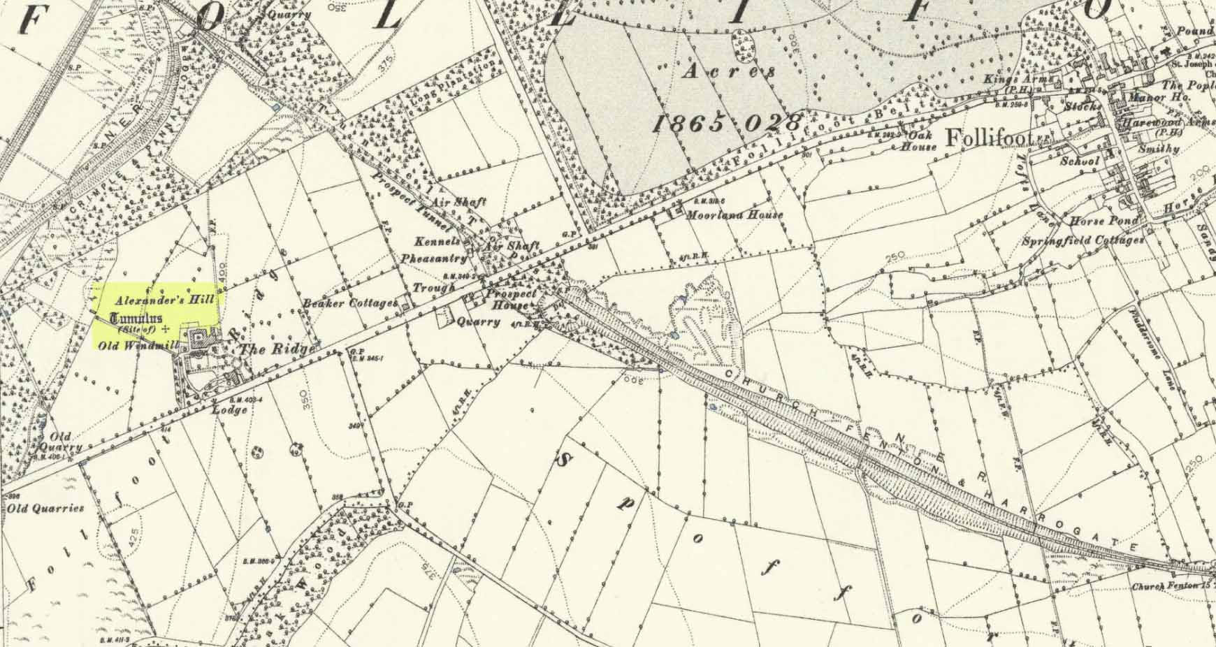
Tumulus (destroyed): OS Grid Reference – SE 3222 5211
Archaeology & History
Site of tomb on 1894 map
We are thankful that the antiquarian James Wardell (1881) gave us some details of this long lost site in his survey of prehistoric remains, otherwise information about it would certainly have been lost. Prehistoric burial mounds are rare in this part of Yorkshire, but on the rise of land behind Follifoot Ridge house could once be seen “a large barrow measuring 50 feet in diameter.” Believed by Challis and Harding (1975) to have been a late Bronze Age structure, the story of its demise was told by Wardell as follows:
“This monument of a former age…exists no longer, owing to the ignorance and cupidity of the surveyors of the highways of the township in which it was situate; by whose orders the stones, of which it was partially composed, were carted away at intervals, during a period of some five or six years, to keep in repair a neighbouring road. At the base were several very large stones, probably a kistvaen, and at the same time were found fragments of urns, bones and ‘pieces of brass’, which immediately became dispersed. Some of the latter articles came into the possession of the village smith, from whom this information was obtained, and were disposed of by him to a brass-founder as old metal, and in due time, doubtless, found their way to the foundry. From the description given of them by this person, there seems to have been amongst them some spear-heads and a palstave, but after a most diligent inquiry, there could not, as might be expected, anything whatever be recovered. I should say that from weapons of bronze being found in this huge sepulchral mound, it was not one of the most ancient kind, but has perhaps covered the remains of British warriors slain in conflict with the Roman invaders… I am indebted to Mr John Dixon of Leeds for the information relating to the demolition of this barrow, which was only obtained by him after a lengthy enquiry; and he states that on his visit to the site, it could distinctly be traced by the grass there being of a darker hue than in other parts of the field.”
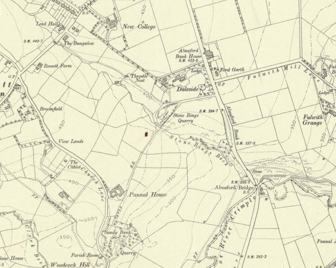
A mile to the northwest, one would have been able to see the Stone Rings of Pannal, also destroyed, and the two sites may have served some geomantic relationship with each other.
References:
Challis, A.J. & Harding, D.W., Later Prehistory from the Trent to the Tyne, BAR: Oxford 1975.
Wardell, James, Historical Notes of Ilkley, Rombald’s Moor, Baildon Common, and other Matters of the British and Roman Periods, Joseph Dodgson: Leeds 1869. (2nd edition 1881).
Acknowledgements: Big thanks for being able to use the 1st edition OS-map for this site profile, Reproduced with the kind permission of the National Library of Scotland.
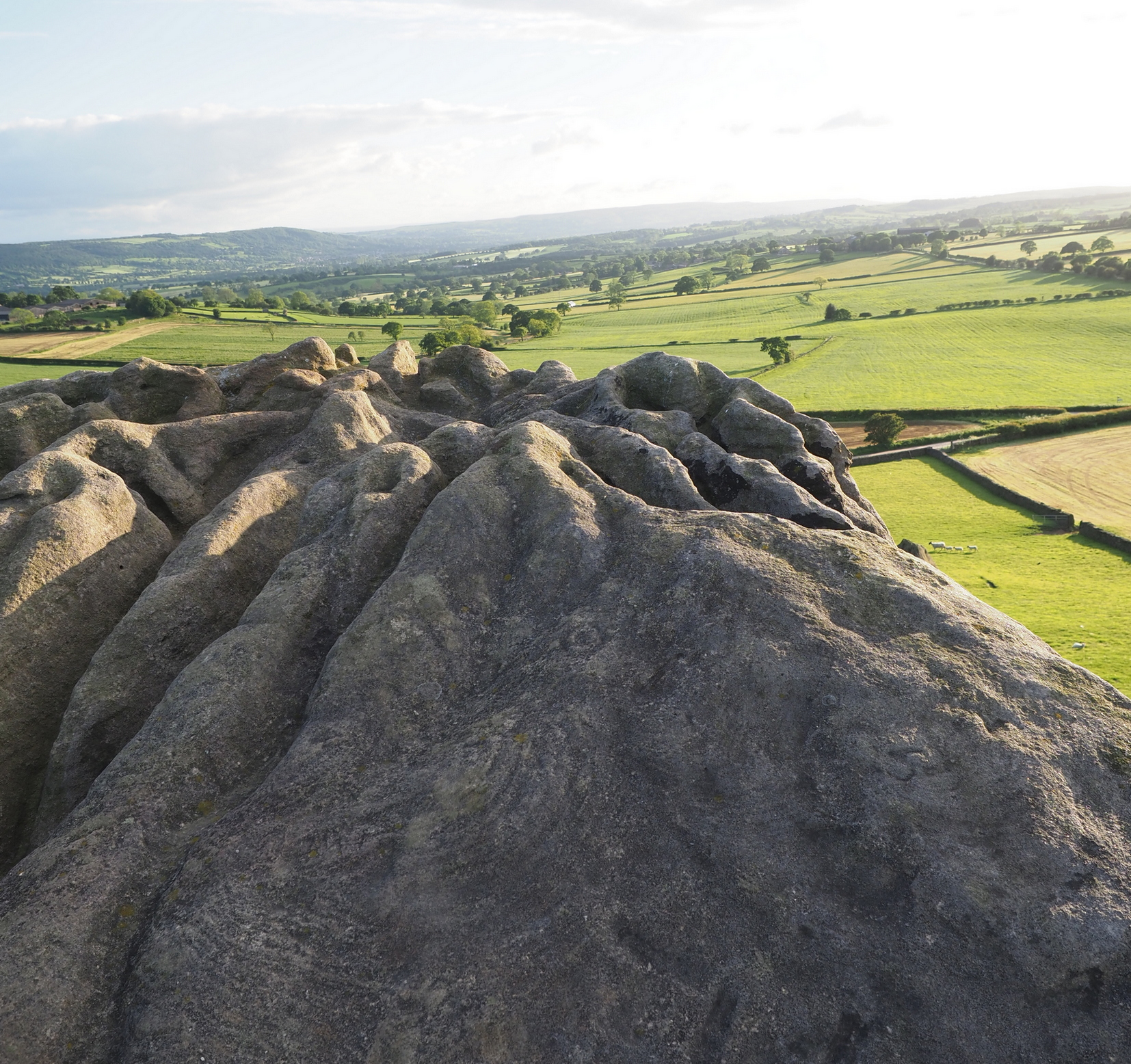
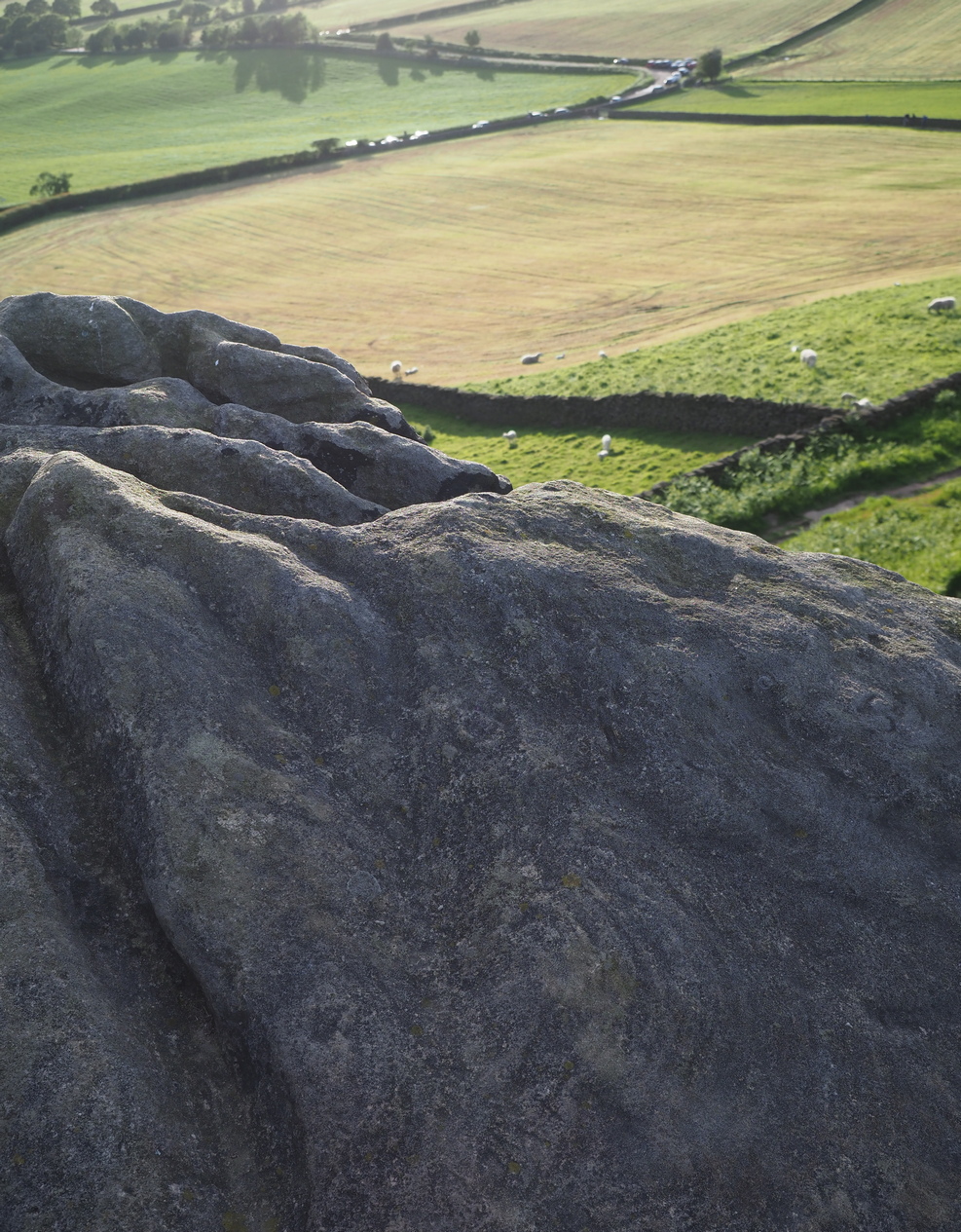
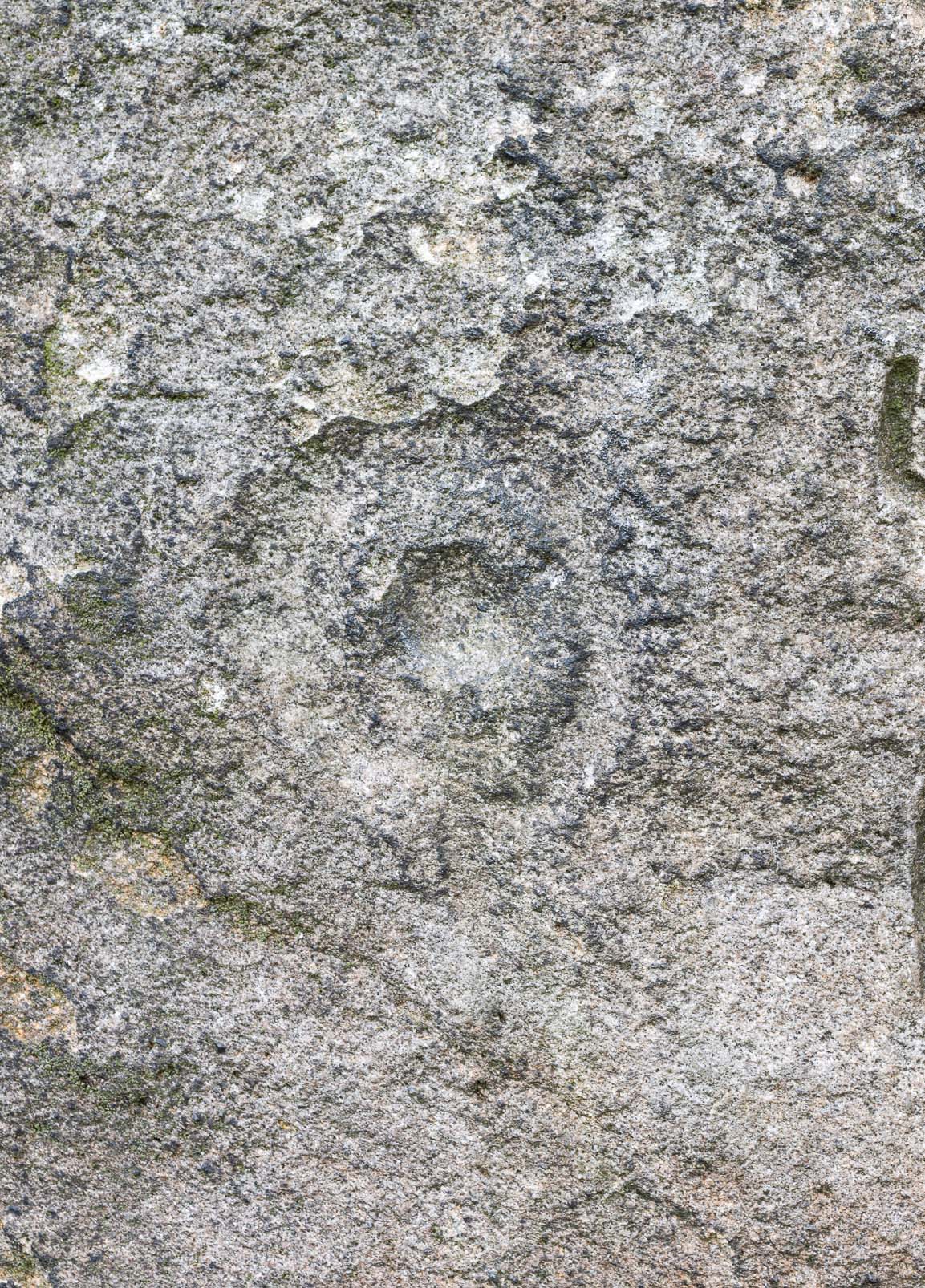
The crags of Little Almscliffe are today peppered with many modern carvings, such as are found on many of our northern rock outcrops. Yet upon its vertical eastern face is a much more ancient petroglyph – and one that seems to have been rediscovered in the middle of the 20th century. When the great northern antiquarian William Grainge (1871) visited and wrote of this place, he told us that, “the top of the main rock bears…rock basins and channels, which point it out as having been a cairn or fire-station in the Druidic days; there are also two pyramidal rocks with indented and fluted summits on the western side of the large rock” – but he said nothing of any prehistoric carvings. Curiously , neither the great historian Harry Speight or Edmund Bogg saw anything here either.
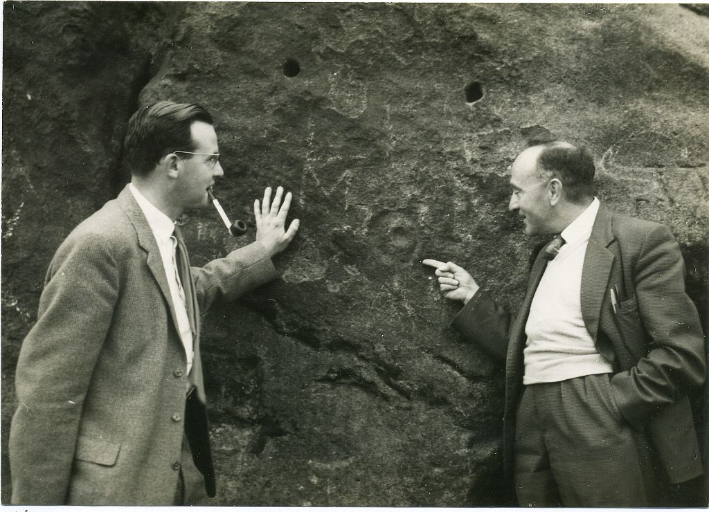
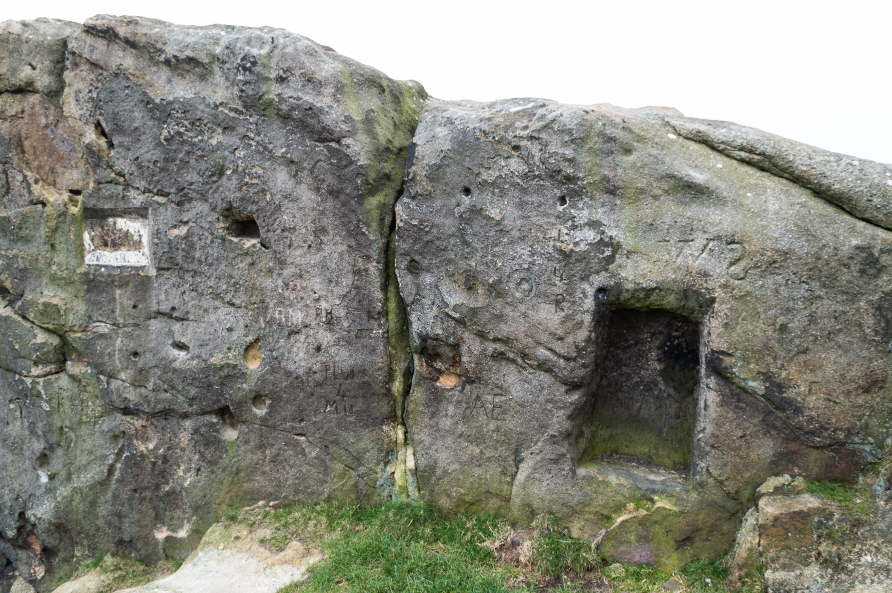
Stuart Feather & Joe Davies here, c.1955Cup&Ring, left of ‘door’ (photo by James Elkington)
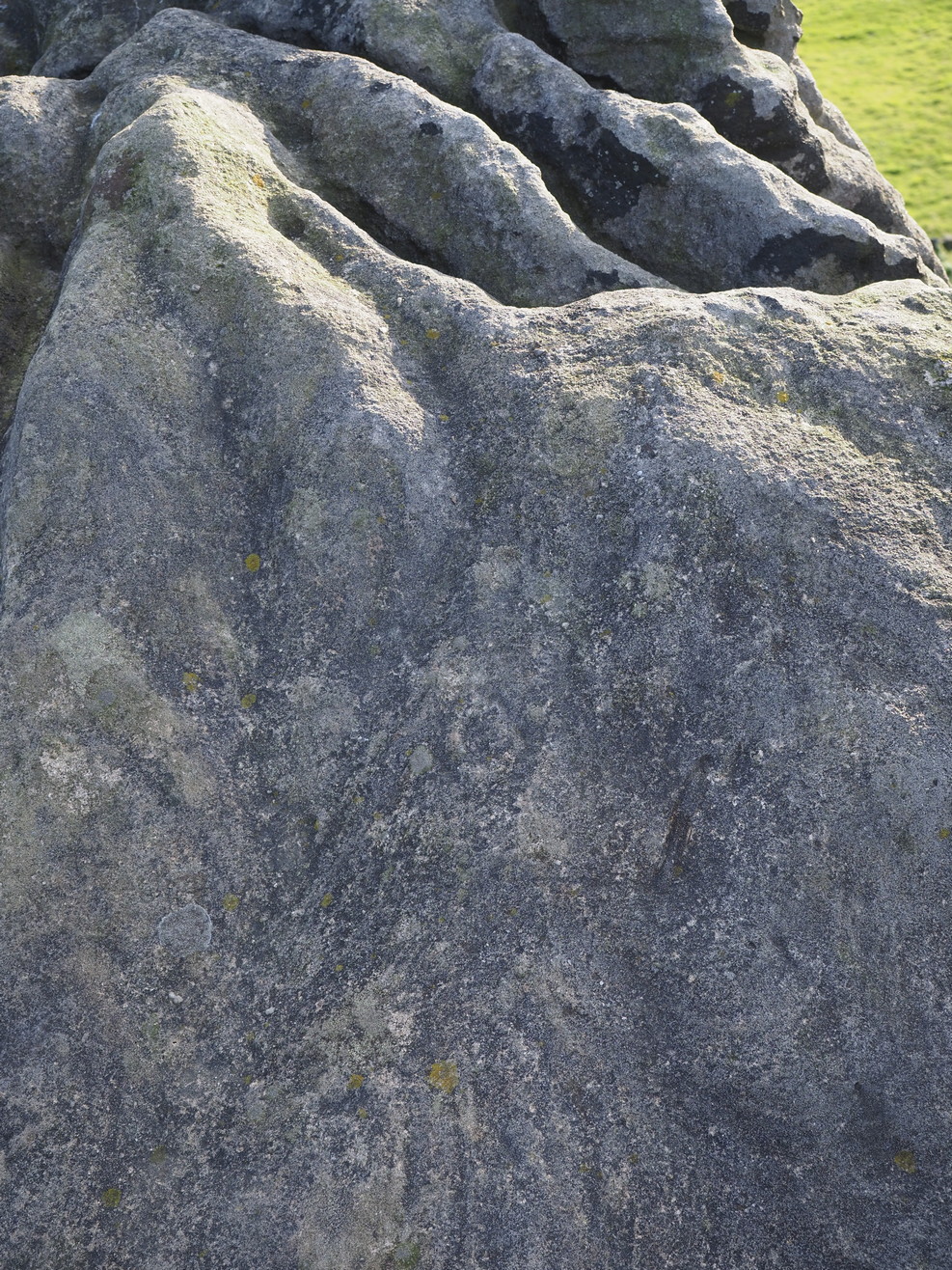
This singular cup-and-ring design seems to have been reported first in E.S. Wood’s (1952) lengthy essay on the prehistory of Nidderdale. It was visited subsequently by the lads from Bradford’s Cartwight Hall Archaeology Group a few years later; and in the old photo here (right) you can see our northern petroglyph explorer Stuart Feather (with the pipe) and Joe Davis looking at the design. In more recent times, Boughey & Vickerman (2003) added it in their survey of, telling briefly as usual:
“On sheltered E face of main crag above a cut-out hollow like a doorway is a cup with a ring; the top surface of the rock is very weathered and may have had carvings, including a cupless ring.”
Close up of design
Indeed… although the carving is to the left-side of the large hollow and not above it. Scattered across the topmost sections of the Little Almscliffe themselves are a number of weather-worn cups and bowls, some of which may have authentic Bronze age pedigree, but the erosion has taken its toll on them and it’s difficult to say with any certainty these days. But it’s important to remember that even Nature’s ‘bowls’ on rocks was deemed to have importance in traditional cultures: the most common motif being that rain-water gathered in them possessed curative properties.
References:
Bennett, Paul, The Old Stones of Elmet, Capall Bann: Milverton 2001.
Bogg, Edmund, From Eden Vale to the Plains of York, James Miles: Leeds 1895.
Bogg, Edmund, Higher Wharfeland, James Miles: Leeds 1904
Cowling, E.T., Rombald’s Way, William Walker: Otley 1946.
Grainge, William, History & Topography of Harrogate and the Forest of Knaresborough, J.R. Smith: London 1871.
Parkinson, Thomas, Lays and Leaves of the Forest, Kent & Co.: London 1882.
Acknowledgements: Huge thanks to James Elkington for use of his fine photos on this site.
Stone Circle (destroyed): OS Grid Reference – SE 308 527
Archaeology & History
‘Stone Rings’ place-names on the 1910 OS-map
The plurality of the place-name implies that there was more than one circle, but we don’t that know for sure either! But if there was more than one, it is more likely they were cairn circles than traditional free-standing stones circles. But once again, we simply don’t know….No remains exist of the “stone rings”—or rings of stone—that once stood here in bygone centuries. The only remains left are in the place-names of the stream and roads hereby, highlighted on several of the early OS-maps: Stone Rings Lane, Stone Rings Beck and the Stone Rings Quarry—the latter of which is probably the reason why there is nothing to be seen here anymore. But we don’t know for sure.
The grid-reference given here is an approximation.
References:
Smith, A.H., The Place-Names of the West Riding of Yorkshire – volume 5, Cambridge University Press 1961.
Settlement (destroyed): OS Grid Reference — SE 2581 5100
Archaeology & History
Briscoe Rigg on 1851 map
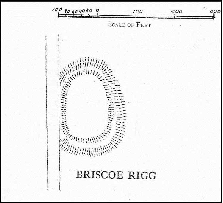
Highlighted on the 1851 OS-map of the area as a ‘Camp’, all trace of this ancient settlement would seem to have been destroyed. It was already on its way out when the Ordnance Survey lads looked at it for a second time in 1888, finding barely a trace of it. Thankfully though, when the clearer eyes of that great northern antiquarian Eric Cowling visited the site in the early 1930s, traces of it could still be made out. Both he and fellow antiquarian, Mr B.J.W. Kent of Beckwithshaw, did their own investigations; and it is their notes we are most grateful for in describing this forlorn antiquity. Mr Cowling (1946) wrote:
“On the highest point of the enclosed land on the east side of the Briscoe Rigg (to) Rigton road is a small entrenched site. The enclosed area measures 130 yards from north to south and 70 yards from east to west. The camp is six-sided, but this appears to be due to bad workmanship and layout rather than intention. One gains the impression that the original plan was oblong and that the longer sides were bent to conform to the shorter ones. It is slightly hollow and the whole area is almost levelled by heavy ploughing; the outer bank barely being one foot above the surroundings. The ditch and outer bank now cover a spread of 60 feet.
“Recent hurried investigations by Mr Kent showed interesting details. The area seems to have been occupied by hut-sites previous to the hurried digging of a trench some 16ft wide and 6ft deep, going down into the bed-rock nearly 6 feet. Son after, the ditch was half-filled by boulders and earth amongst which was a fragment of pottery, black in colour and indefinite in type, but probably Roman. When the ditch was half-full it was used for some time for cooking…”
Cowling’s 1946 site-plan
Cowling also told us there was “a tradition that tools, which by description appear to be socketed celts, were found here when the site was brought under cultivation”, in about 1840. Mr Kent also discovered various flints hereby, many Mesolithic scrapers and “a fine Bronze Age barbed and tanged point and also a transverse cutting arrow point of the early four-sided types.”
Although these finds from much earlier periods show that people have been living and hunting in the area for an exceptionally long period, the settlement or camp at Briscoe Rigg was probably built in the early Iron Age period and continued to be used into Romano-British times (somewhere between between 500 BCE and 500 CE).
References:
Cowling, E.T., Rombald’s Way, William Walker: Otley 1946.
Settlement (destroyed): OS Grid Reference – SE 2905 5035
Archaeology & History
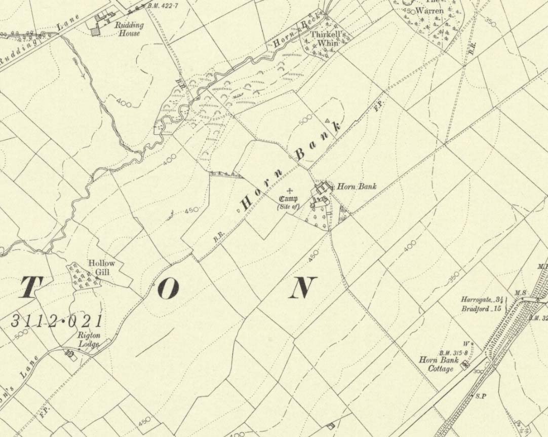
Upon the top of the old ridge where ran the ancient trackway between Rigton and Pannal, could once be found a multi-period settlement, long since gone – as happens all too often in this neck o’ the woods. And unfortunately there doesn’t appear to be any sketch plans of the site. It was first described by Edward Hargrove (1789) in his historical old rambles around Harrogate and district. When the scribe reached Horn Bank, he told that here,
“was lately discovered the remains of several entrenchments forming three distinct enclosures, two of a square and one of a circular form. Not far from these entrenchments, which were probably of Danish origin, was found, in May 1787, the umbo of a shield, with several other fragments of gilt brass…”
In William Grainge’s (1871) magnum opus he told that,
“At Horn Bank, on the crest of the hill east of Rigton, near a farm-house, are the remains of three camps—two of a square, and one of a circular form; they are probably of British and Roman origin. The location is a lofty and commanding one; but the ploughshare has so often passed over them that they are nearly obliterated.”
Just below the settlements Grainge also said how, “a fine spring of water was formed into a bath here many years ago, but the whole is now in a state of ruin.” This would have likely been the main water supply for the people living here. Harry Speight (1903) implied the same thing when he investigated the site, saying:
“At a place called Horn Bank, near Rigton, on the west side of the parish, on the crest of the hill on the north side of the Horn Bank farmhouse, there were formerly to be seen very distinct indications of three camps, each encompassed with fosse and rampart. Hargrove supposed them to be Danish, but as two of them were of a square or rectangular form, and the other circular, they were in all probability relics of the Romano-British contest, at first occupied by the native tribes and subsequently as a temporary camp and look-out post by their conquerors. The site commands a wide and uninterrupted view in every direction, while close at hand is a copious spring of good water. This spot many years ago was converted into a bathing-place, but is now broken down and abandoned… The site has long been ploughed, and little or no trace of these earthworks is now discernible.”
The only thing Eric Cowling (1946) could find when he came to the place were faint scars of walling whose shadows were highlighted by the sun when the conditions were just right. He thought the settlements were Iron Age in nature, but would have continued to be used in subsequent centuries by local people. It seems a sensible suggestion…
References:
Cowling, E.T., Rombald’s Way, William Walker: Otley 1946.
Grainge, William, History & Topography of Harrogate and the Forest of Knaresborough, J.R. Smith: London 1871.
Hargrove, E., The History of the Castle, Town and Forest of Knaresborough with Harrogate, W. Blanchard: York 1789.
Speight, Harry, Kirkby Overblow and District, Elliot Stock: London 1903.