The history of the site is scanty to say the least. It first seems to have been recorded when the Ordnance Survey lads came here in the 1840s, although they left no record as to why the site was given such a dedication. It’s a decidedly pre-christian title as the name “old Wife” is usually indicative in northern counties as being related to the primal Earth deity of northern England and lowland Scotland (when we reach the Highlands and Ireland, She becomes known—amongst other names—as the cailleach). However, apart from its name we have no additional information. Neither the holy wells writer Edna Whelan (1989; 2001), nor hydrolatry researcher Graeme Chappell were been able to find anything about the place in their own researches. And so we must go on name alone…
The waters bubble up into a small stone-lined chamber with the words Nattie Fontein carved into the lintel. This is something of a mystery in itself, for, as Edna Whelan (1989) told,
“it would be most unusual for the word fonten to be used for a spring in North Yorkshire: ‘keld’ is the local word. The rather roughly inscribed word may be a corruption of Fons Natalis, the name of a Celtic water nymph.”
Graeme Chappell (2000) meanwhile, noticed in a visit to the site in June 1999,
“that the N and A in “NATTIE” are carved in such a way that the word could be read as “MATTIE FONTEIN” perhaps meaning “Mother Fountain”. This might then be another reference to the Old Wife?”
He then goes on to note how,
“the latin word ‘natalis‘ meaning ‘birth’ and its link with the roman Festival ‘Dies Natalis Sol Invictus‘ (day of the birth of the unconquered sun) which took place on the 25th December. Natalis also gave rise to the welsh word ‘Nadolig‘ – meaning Christmas.”
This Yuletide element has an intriguing relationship with the name of the well; for to the west of Yorkshire’s borders into Cumbria there was annual gathering known as Old Wives’ Saturday that took place on the first Saturday after Christmas, or first Saturday of the New Year in a person’s house or inn, where a feast was had to bring in the New Year; but there is no known written lore of such a tradition here.
Nowadays the old tradition of hanging rags on the trees surrounding the well as offerings to the spirit of the place (known as memaws in parts of Yorkshire, and clooties in Scotland) has become a regular practice of those who hold such sites as sacred in their own way. Whelan mentioned seeing memaws here in the 1908s, but the Northern Antiquarian contributor Jon Barker told that, “The rags are a comparatively recent addition to the well, it is not a tradition there. When I used to go in the ’60s therewere no rags.”
On an even more curious note: very recently (from when this profile was written), the Northern Antiquarian contributor and photographer James Elkington visited Old Wives’ Well for the first time. It was a grey overcast day and when he arrived here, there was a woman ahead of him at the head of the well. I’ll let him tell the rest of it in his own words:
The Old Wives Well, Stape (James Elkington)Old Wives Well at Stape (James Elkington)
“In front of the well was a lady dressed in what looked like a white nighty, she had her back to me. There was a candle lit nearby, and her hands were in the water moving slowly about like she was washing something. She had long dark shoulder length hair. As I was about 25 feet away I was sure she wasn’t aware of me, and I thought it would make a good photograph. I quietly put my bag on the ground and got my camera out, and looked up and…she was gone! I couldn’t have taken my eye off her for more than 5 or 6 seconds. I looked all around and there was no sign of her. Even if she had legged it through the woods I would have seen her. I think it was then that I realized that I may have had ‘an encounter’. I quickly took three pics of the Well and got the hell out of there!”
He rang me once he had regained his senses in a somewhat emotional state and recounted over and over what had just happened. Whether this was a visual manifestation of the genius loci of the we can’t say. But such encounters are not unknown at numerous sacred water sites all over the world. We can only hazard a guess that this is what he was fortunate to encounter.
Just a few hundred yards north is the old Mauley or Malo Cross, which may or may not have had some mythic relationship with our Old Wives…
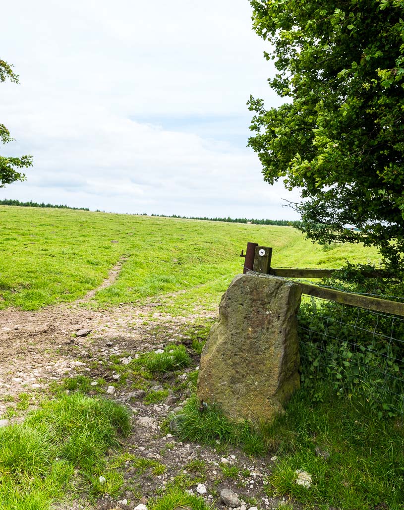
From Pickering take the moor road towards Whitby (A169) for approx. 12 miles. After passing the Fylingdales Early Warning radar on the right (you can’t miss it), the road dips down to cross Eller Beck as a dog leg. After a half mile turn off left (west) towards Goathland (signposted). Follow the road under the North Yorks Moor railway bridge and after a third-of-a-mile the road turns slightly left. Park in the little layby and follow the track onto the moors. Cross the small stream and walk along the narrow track through gorgeous heather for a mile and a half. Ahead you will see Simon Howe prominent on a ridge, with a stone row leading to it.
Archaeology & History
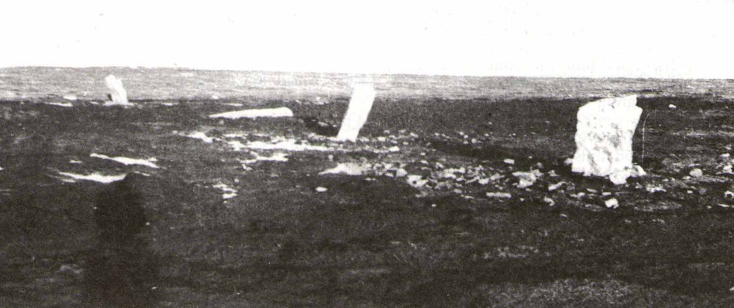
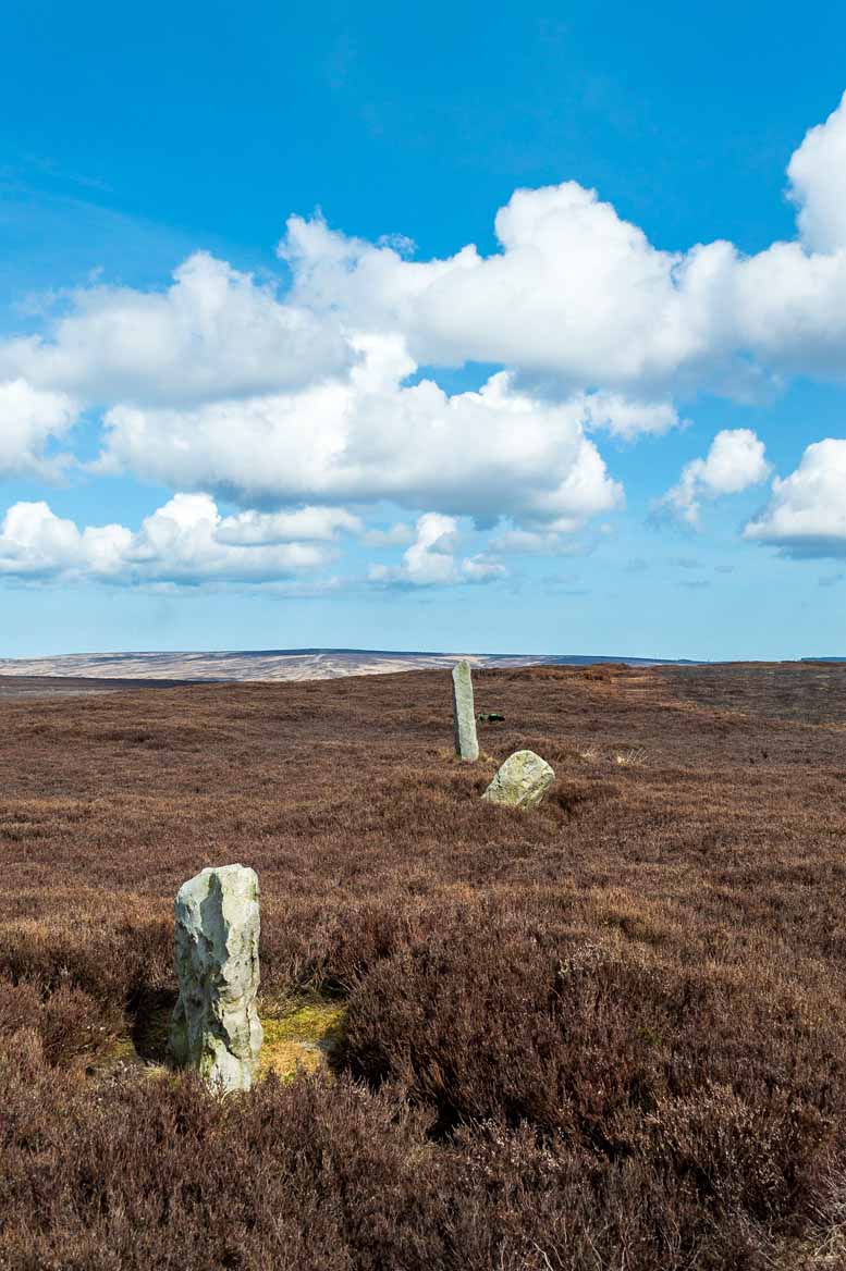
Not included in either of the giant megalithic alignments surveys of Burl or Thom, it seems that the first archaeological reference to this site was made by Raymond Hayes (1988). He visited the site in 1947, shortly after a moorland fire had cleared away all the vegetation, allowing for a clearer view of the stones and, after his brief description of the adjacent Simon Howe tomb, he told that,
“The ridge is also the site of what is an unusual feature for the moors: a stone alignment consisting of three, formerly five upright stones that lead to a low eroded cairn c.65m to the south(west). A moor fire in 1947 revealed the fourth, fallen stone, and I was able to locate the socket of a fifth.”
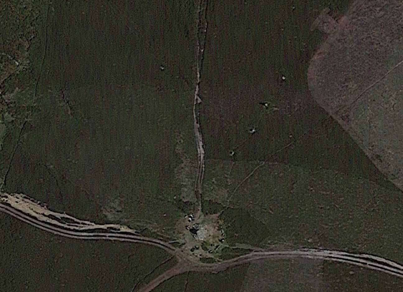
Raymond Hayes 1947 photoStone row on GoogleEarth
From hereon, Hayes seemed to more interested in seeking out and describing a large number of flints that he found scattered on the ground around Simon Howe and its associated monoliths than the stones themselves. Very sad… The exact position of the missing fifth stone seems to be shown on Hayes’ plan as being closest to the cairn, about 10-15 yards away, but no trace of this remains. However, of the remaining monoliths, they are all clearly visible from the air on Google Earth!
The most southerly of the four stones (SE 83016 98119) stands just over 3 feet tall and the second upright, leaning at an angle, is just slightly taller, with the tallest of the three uprights at the northeastern end, being some 6 feet tall. The fourth fallen stone (SE 83031 98142) lies just beyond this in the heather and which, if resurrected, would stand some 4 feet in height. The length of the row, stone-to-stone, is just over 29 yards (26.6m). I’m not aware if this site has ever been assessed as having an astronomical function, but its angle to the northeast might suggest a lunar rising. Perhaps more pertinent would be another prehistoric cairn that can be seen less than 100 yards away past the northern end of the stone row: as North is the cardinal direction symbolizing Death in traditional lore…
From Pickering take the moor road towards Whitby (A169) for approx. 12 miles. After passing the huge Fylingdales Early Warning radar on the right (you can’t miss it), the road dips down to cross Eller Beck as a dog leg. After a half mile turn off left (west) towards Goathland (signposted). There’s a free car park on the left where you can sit for awhile and enjoy the views. Follow the road under the North Yorks Moor railway bridge, and after a third-of-a-mile the road turns slightly left. Park in the little lay-by and follow the track onto the moors. Cross the small stream and walk along the narrow track through gorgeous heather for a mile and a half. Ahead you will see Simon Howe prominent on a ridge, with a stone row leading to it.
Archaeology & History
This impressive prehistoric tomb was first described in deeds as early as 1335 as Simondshou, which A.H. Smith (1928) translates to mean ‘Sigemund’s mound’ – alluding it to have been either the burial of someone with that name, or a name given to it by the incoming Vikings, oh so many centuries ago. The latter is the more probable of the two…
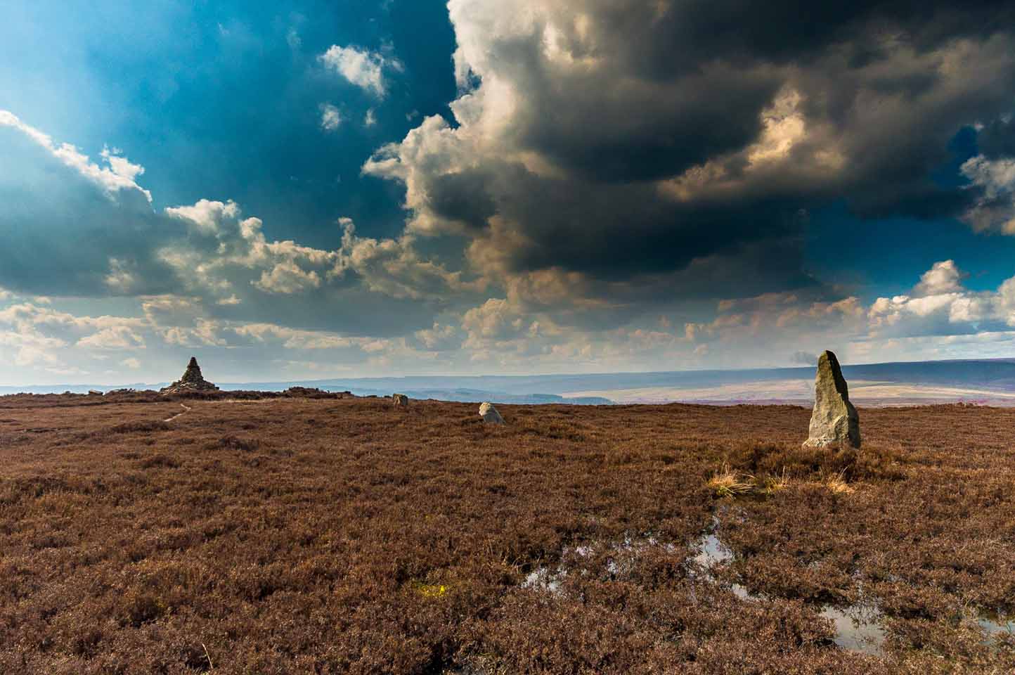
Simon Howe (photo by James Elkington)Hayes’ 1947 photo of Simon Howe
With excellent views in all directions, this monument is found high up in the landscape at the meeting of four paths that are closely aligned to the cardinal directions. It was highlighted as a tumulus on the 1854 OS-map of the region and subsequently included in Windle’s (1909) listings as a “round barrow”, found in association with “three upright stones” running to the northeast. There are in fact four stones.
Not much has been written about it in archaeological circles. Thankfully a brief survey of it was undertaken in 1947 by Raymond Hayes (1988) after a moorland blaze had cleared the heather, enabling good conditions to see the site more clearly. He told that,
“Simon Howe…is very mutilated, what survives indicates that it was 11.50m in diameter and it is clear that it incorporated a stone kerb.”
This “stone kerb”, or surrounding ring of stones, is a feature found at other tombs on these hills—Flat Howe (1) being just one example. However, in contrast to Flat Howe (1), Simon Howe has had most of its central mound totally stripped by peoples unknown a few centuries ago. The remains we see today look more like a small ruined stone circle with internal rubble and a new walker’s cairn growing slowly from its centre. Outside the cairn, just a few yards northeast, a fascinating megalithic stone row emerges. Whether these were erected at the same time (in the early to mid-Bronze age, in my opinion) only an excavation would tell.
Acknowledgements: A huge thanks to James Elkington for use of the photograph in this site profile, as well as telling us about Getting Here. And the map accompanying this site profile is Reproduced with the kind permission of the National Library of Scotland.
From Pickering, take the A169 towards Whitby. When you get to the Car Park at the ‘Hole-of-Horcum’ – (you can’t miss it), park the car and walk North along the side of the road towards Whitby. After 60 yds, take the track East. Follow this for approximately a mile until the track splits. Take the concrete track left towards the farm-house of ‘Newgate Foot’. Go through the yard past the house on the right, and you will come to a stream and a gate. Enter the field on the right and up the track. The stones are in front of you.
Archaeology & History
The great rounded hill of Blakey Topping—recorded as early as 1233 CE and meaning the ‘black mound’ or ‘black meeting-place’— has the ruins of a stone circle living several hundred yards to its south, little-known to many. The early writer George Young (1817) seemed to come close here, mentioning the ‘druidic’ standing stones of Blakey Moor and district, but gave no specific indication of the ruinous ring we’re visiting here. Instead, the first real description was penned by Robert Knox (1855) who, at the time of writing, was under the academic spell of druidism: prevalent as it was amongst most universities and places of learning back then. Also, beset by the equally sad plague of Biblical comparitivism—beloved even to this day by halfwits—Knox’s formula about this ancient ring was founded on the druidical reverence of Blakey Topping as a site beneath which our Bronze age tribal ancestors erected their stones with the rounded hill immediately to the north, as signified by its early name, black. (In early place-names, ‘black’ and its variants—dubh, dove, etc—relates to the cardinal direction of ‘north’ and actually means ‘shining’; and white or ban is ‘south’, when both elements are located in relative proximity.) Knox told us:
“At the southwest side of this arch-Druid’s tomb-like hill (Blakey Topping) a far more conspicuous cluster of larger Druid stones occurs; here three pillars form a triangle…and a smaller one…stands one hundred and fifty paces east of these nearer to the farmhouse there. These single stones, possibly, once formed part of a circle… The diameter of a circle formed on this triangle of stones would be about fifty-five feet; but as these pillars form a nearly equilateral triangle, the number of stones in that circle cannot now be correctly ascertained, if, indeed, they ever formed part of a circle…
“These three sandstone pillars, untouched by tools…are much weather-worn; and hence it may be inferred that they are very ancient. I shall only add that the tallest pillar here is nine feet high, from two-and-a-half to three feet wide, and rom fifteen to twenty inches thick, and is the tallest ancient pillar next to the celebrated one in Rudston churchyard, now standing in the eastern part of Yorkshire. When I last visited the Blakey Topping Druid-stones in 1836, I learned that the farmer, on whose ground they stand, “had talked about breaking the three large ones to pieces,” and perhaps nothing but the trouble of doing so has hitherto preserved them, and many others. I told him what had been their use, and begged he would preserve them.”
Stone re-used as gatepost (James Elkington)
And thankfully they remain there to this day! Around the same time of Mr Knox’s visit, the Ordnance Survey lads came here too and, in 1854, highlighted the remaining ‘Druidical Stones’ on the first map of the area. But references to the stones from here onwards are sparse and add nothing pertinent to its archaeomythic status. It was a Mr & Mrs Elgee (1930) who were the next to tell us about the site in their exposition on Yorkshire archaeology. They wrote:
“Three large standing stones about 6 feet high on the south-west side of Blakey Topping…are the remains of a circle about 18 yards in diameter. Two or three hollows in the ground indicate the position of other stones, some of which are serving as gateposts nearby. Others have been broken up to help build a wall. These stones are associated with a large settlement sites similar to (one) on Danby Rigg not very far from the imposing Bridestones and approached by an ancient trackway known as the Old Wife’s Trod.”
The general interpretation by the great megalithic archaeologists Aubrey Burl, John Barnatt and their fellow associates, is that these stones are the remains of a stone circle – which seems apt. But of even greater importance seems to be the great hill of Blakey Topping itself, to which this olde ring no doubt related to. Many other prehsitoric sites once scattered this area, but sadly most of them have been destroyed.
References:
Barnatt, John, Stone Circles of Britain (2 volumes), BAR: Oxford 1989.
Burl, Aubrey, A Guide to the Stone Circles of Britain, Ireland and Brittany, New Haven & London 1995.
Burl, Aubrey, The Stone Circles of Britain, Ireland and Brittany, Yale University Press 2000.
Elgee, F., Early Man in Northeast Yorkshire, Frank Bellows: Gloucester 1930.
Elgee, F. & H.W., The Archaeology of Yorkshire, Methuen: London 1933.
Gutch, Mrs E., Examples of Printed Folklore Concerning the North Riding of Yorkshire, David Nutt: London 1899.
Acknowledgements: Big thanks to the photographer James Elkington, for use of his photos in this profile. Cheers mate. Also, accreditation of early OS-map usage, reproduced with the permission of the National Library of Scotland.
Standing Stone (missing): OS Grid Reference – SE 881 947
Archaeology & History
A number of standing stones were reported by regional historian Robert Knox (1855) in his antiquarian work of this area, but forestry and vandalism has seen the demise of some. This one, however, may possibly still be found, laid down somewhere on the tops, along the ridge aptly-named as Stone Hill Head. Where precisely it might be, we know not—but one of you Yorkshire antiquarian ramblers might be able to find and resurrect it by following old Mr Knox’s notes. Writing extensively of the ancient remains around nearby Blakey Topping this is what he told us of the Stone Hill Head monolith:
“The pillar…standing erect, is five and a half feet high, three broad, and from ten inches to two feet thick. This is much corroded either by natural decomposition, or designedly made so by manual labour; some of the holes in it being circular, as if intended to fit the heads of human beings into them, at the time of their immolation, while laid prostrate on the ground… This stone stands northeast from Blakey Topping, distant about six furlongs, and is the furthest pillar in this collection from that hill.”
If the real explorers amongst you manage to rediscover the stone, please let us know.
References:
Knox, Robert, Descriptions Geological, Topographical and Antiquarian in Eastern Yorkshire, London 1855.
Dead easy. Take the A170 road from Pickering to Thornton-le-Dale and as you go into the large village, you’ll hit the old crossroads with the village green. Here be your cross!
Archaeology & History
Shown on the 1854 OS-map, I first came across a description of this old site in Creaser & Rushton’s (1972) scarce but lovely little work on the history of the old village here, where they told that,
“A cross has stood here since John de Eston in 1281 had the grant of a Tuesday market and two yearly fairs. It was repaired in 1820. Every year, the Abbot of Whitby unloaded 1500 red and 1500 white herrings here from his packhorse ponies for transhipment to the Master of St. Leonard’s Hospital at York.”
Or at least, that’s what he got folk to write down in the record-books! Close by were the old village stocks of the village (whose usage should be resurrected in many parts of this country nowadays).
References:
Creaser, A. & Rushton, J.H., A Guide and History of Thornton-le-Dale, Pickering, Yorkshire, E. Dewing: Pickering 1972.
In James Simpson’s precursory essay (1866) to his monumental Archaic Sculpturings (1867), he details the former existence of a decent piece of prehistoric rock art, lost to us until very recently by the intrusive diggings of one Thomas Kendall of Pickering. Simpson wrote:
“A large mass of sandstone in the moor above Robin Hood’s Bay, near Whitby, had some sculpturings upon it, part of which were split off by Mr Kendall of Pickering, in whose garden I have seen the slab of carvings which he thus procured. Mr Kendall’s slab is about five feet long and two and a-half broad. Upon its surface are three or four isolated cups about an inch and a-half in breadth, and five or six others surrounded by ring-cuttings… Two or three of the ring-cuttings consist of single circles. One consists of a triple circle and straight radial groove. The ends of the circles, as they reach the traversing groove, turn round and unite together, as in the horse-shoe pattern… The two remaining circles, which are respectively five inches and eight inches in breadth, and consist of cups surrounded by two and by three circles, are conjoined together by a long gutter. The upper circle shows a single-and the lower a double horse-shoe pattern. In the uppermost or double circle the rounded ends of the rings are united and bestridden by a shallow right-angled line; and the ends of the lowest or triple circle are in part also conjoined by the gutter which runs from the double circle above, and by a cross straight line which runs off from it. The circles are more imperfectly finished than usual, and at some parts present almost an appearance of being punched out rather than cut out.”
Cup-and-Ring Stone, once near Robin Hood’s Bay
In recent years, thanks to the cup-and-ring huntings of Chris Evans and Graeme Chappell, the carving has re-emerged from its lost position and, it would seem, is located in someone’s garden in Pickering. The carving is catalogued as Stone REM 1/P1 in Brown & Chappell’s (2005: 257) work on North Yorkshire rock art. Hopefully, in the months to come, we’ll have a decent photograph and description of its present condition. Fingers crossed!
References:
Brown, P.M. & Chappell, Graeme, Prehistoric Rock Art in the North York Moors, Tempus: Stroud 2005.
Simpson, J.Y., ‘On Ancient Sculpturings of Cups and Concentric Rings’, in PSAS volume 6, 1866.
Simpson, James Y., Archaic Sculpturings of Cups, Circles, etc., upon Stones and Rocks in Scotland, England and Other Countries, Edmonston and Douglas: Oxford 1867.