Fairy Knowe, Bridge of Allan, Stirlingshire

Tumulus:  OS Grid Reference – NS 79616 98191

Also Known as:

  1. Ben Rhi
  2. Canmore ID 45986
  3. Fairy Knowe of Pendreich
  4. Hill of Airthrey
  5. King’s Hill

Getting Here

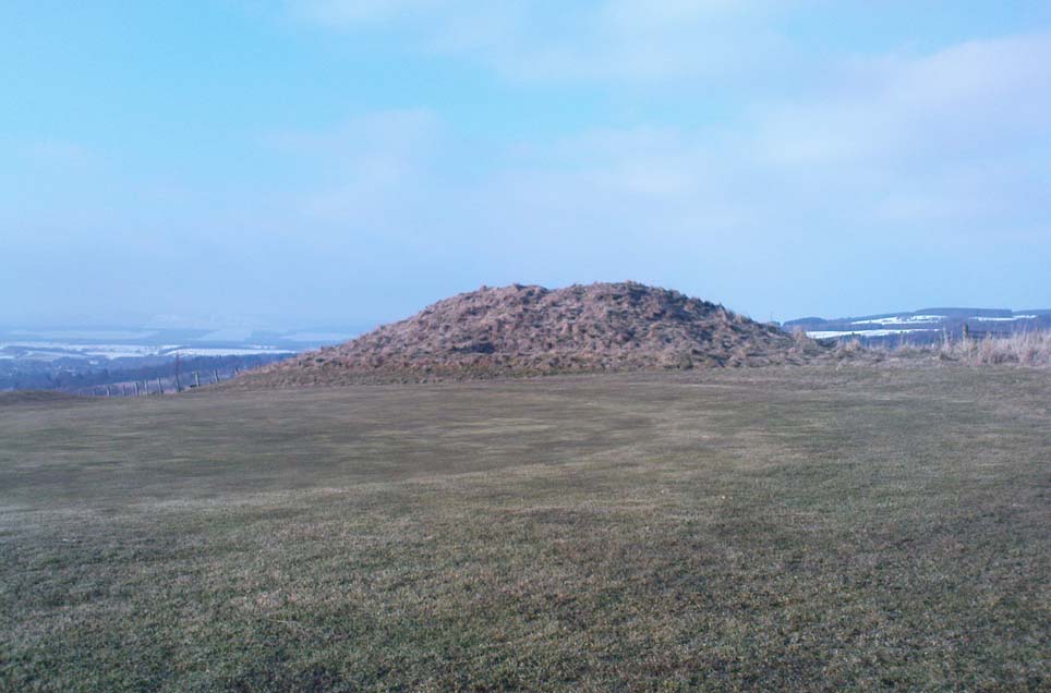
Fairy Knowe, looking north

Various ways to get here.  Probably the easiest is via the golf course itself, walking up towards the top where the trees reach the hills, but keeping your eyes peeled for the large archetypal tumulus or fairy mound near the top of the slope.  Alternatively, come up through the wooded slopes from Bridge of Allan and onto the golf course, keeping your eyes ready for the self same mound sat in the corner by the walls.  You can’t really miss it to be honest!

Archaeology & History

This is an impressive-looking burial mound sat, intact, on the edge of those painful golf courses that keep growing over our landscape — and you can see for miles from here!  It would seem to have been placed with quite deliberate views across the landscape, reaching for countless miles into the Grampian mountains north and west across the moors of Gargunnock and Flanders towards Lomond and beyond…
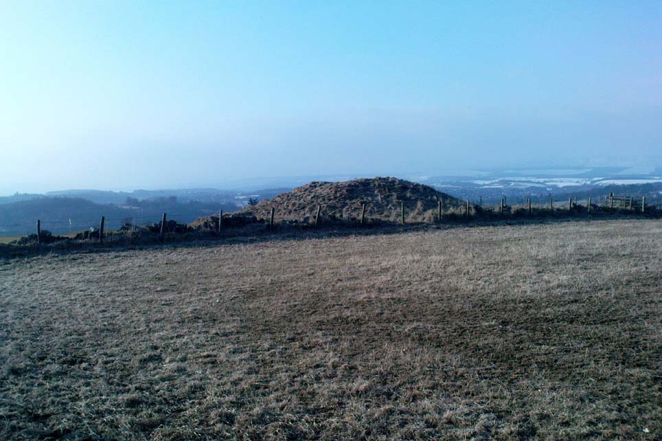
Fairy Knowe, facing west
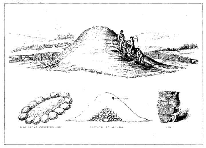
Sir Armstrong’s old drawing

The Fairy Knowe was first excavated in 1868 by Sir J.E. Alexander and his team, when their measurements found it to be some 80 yards in circumference, 78 feet across and 21 feet high — compared to less than 60 feet across and only 8 feet tall today.  The findings were recorded in one of the early PSAS reports, and more recently a synopsis of the account was made of it by the Royal Commission (1963) lads who summarized his early findings and told:

“The excavation revealed a cist in the centre of the cairn, laid on the original surface of the ground and measuring 2ft 6in in length, 1ft 6in in breadth and 3ft in depth.  Its walls were formed partly of upright slabs and partly of small stones laid horizontally, while the floor and the roof each consisted of a single slab.  Within it there was a deposit, 6in in depth, of black earth, charcoal and fragments of human bone among which pieces of a skull were conspicuous.  The cist was covered by a heap of large stones, 8ft in diameter and 13ft in height, and this in turn was covered with earth, in which there were charcoal, blackened stones, fragments of human and animal bones and unctuous black earth.  Among these remains were found six flint arrowheads, a fragment of what was once thought to be a stone spear-head, and a piece of pine which, it was suggested, might have formed part of a spear-shaft.”

Also, near the top of the cairn in the fairy mound, Sir Alexander’s team located a prehistoric beaker vessel and fragments of what they thought were other beakers pots.  Archaeologist Richard Feachem (1977) also mentioned this site in his gazetteer, simply copying the words of previous researchers.

Other prehistoric cairns can be found nearby: one in Cuparlaw Woods less a mile north; plus the Pendreich cairns on the edge of the moors just over 1 mile to the northeast.

Folklore

Obviously an abode of the faerie folk in bygone times, the tales of the place are sadly fading from local memory… Mr Alexander (1868) thought this place may have been an important site for the Pictish folk, and he may well have been correct, as the legendary hill of Dumyat (correctly known as Dun Myat) 2  miles east of here has long been regarded as an outpost of one Pictish tribe.

The main piece of folklore attached to this place relates to its very name and how it came about.  In R.M. Menzies (1912) rare work on the folklore of the Ochils, he narrates the local tale that used to be spoken, which describes a procession here from the Fairy Well, just over a mile to the east.  Whether this folktale relates to some long lost actual procession between the two sites, we don’t know for sure.  Mr Menzies told:

“Once upon a time, when people took life more leisurely, and when the wee folk frequented the glens and hills of Scotland, there was one little fairy whose duty it was to look after certain wells renowned for their curative properties.  This fairy was called Blue Jacket, and his favourite haunt was the Fairy Well on the Sheriffmuir Road, where the water was so pure and cool that nobody could pass along without taking a drink of the magic spring.  A draught of this water would have such a refreshing effect that the drinker could go on his journey without feeling either thirsty or hungry.  Many travellers who had refreshed themselves at the Fairy Well would bless the good little man who kept guard over its purity, and proceed upon their way dreaming of pleasant things all the day long.

“One warm day in June, a Highland drover from the Braes of Rannoch came along with a drove of Highland cattle, which he was taking to Falkirk Tryst, and feeling tired and thirsty he stopped at the Fairy Well, took a good drink of its limpid water, and sat down beside it to rest, while his cattle browsed nearby.  The heat was very overpowering, and he fell into a dreamy sleep.

“As he lay enjoying his noonday siesta, Blue Jacket stepped out from among the brackens and approaching the wearied drover, asked him whence he came.  The drover said:

“‘I come from the Highland hills beside the Moor of Rannoch; but I have never seen such a wee man as you before.  Wha’ may you be?’

“‘Oh,’ said the fairy, ‘I am Blue Jacket, one of the wee folk!’

“‘Ay, ay man, ye have got a blue jacket, right enough; but I’ve never met ony o’ your kind before. Do ye bide here?’

“‘Sometimes; but I am the guardian of the spring from which you have just been drinking.’

“‘Weel, a’ I can say is that it is grand water; there is no’ the likes o’t frae this to Rannoch.’

“‘What’s your name?’ asked the fairy.

“‘They ca’ me Sandy Sinclair, the Piper o’ Rannoch,’ was the reply.

“‘Have you got your pipes?’ asked Blue Jacket.

“‘Aye, my mannie, here they are.  Wad ye like a tune?  Ye see there’s no’ a piper like me in a’ Perthshire.’

“‘Play away then,’ said Blue Jacket.

“Sandy Sinclair took up his pipes and, blowing up the bag, played a merry Highland reel.  When he finished, he was greatly surprised to see above the well a crowd of little folk, like Blue Jacket, dancing to the music he had been playing.  As he stopped they clapped their little hands and exclaimed, ‘Well done Sandy! You’re the piper we need.’

“Thereupon Blue Jacket blew a silver whistle, which he took from his belt, and all the wee folk formed themselves into a double row.  Blue Jacket then took the Highland piper by the hand, led him to the front of the procession, and told him to play a march.  Sandy felt himself unable to resist the command of the fairy, and, putting the chanter into his mouth, blew his hardest and played his best, marching at the head of the long line of little people, who tripped along, keeping time to the strains of the bagpipes.  Blue Jacket walked in front of the piper, leading the way in the direction of the Fairy Knowe.

“Sandy Sinclair never marched so proudly as he did that day, and the road, though fairly long, seemed to be no distance at all; the music of the pibroch fired his blood and made him feel as if he was leading his clansmen to battle.   When the Fairy Knowe was reached, the wee folk formed themselves into a circle round the little hill, and sang a song the sweetest that ever fell upon the ears of the Highlandman.  Blue Jacket once more took his whistle and, blowing three times upon it, held up his hand, and immediately the side of the knoll opened.  Bidding the piper to play on, Blue Jacket led the procession into the interior; and when all were inside, the fairies formed themselves into sets, and the piper playing a strathspey, they began dancing with might and main.

“One dance succeeded another, and still Sandy played on, the wee folk tripping it as merrily as ever.  All thoughts of Sandy’s drove had gone quite out of his head, and all he thought of now was how best to keep the fairies dancing: he had never seen such nimble dancers, and every motion was so graceful and becoming as made him play his very best to keep the fun going.  Sandy Sinclair was in Fairyland, and every other consideration was forgotten.

“Meanwhile his cattle and sheep were following their own sweet will, the only guardian left to take care of them being his collie dog.  This faithful animal kept watch as well as he could, and wondered what had become of his master.  Towards evening another drover came along with his cattle for the same tryst.  He knew the dog at once, and began to pet the animal, saying at the same time, ‘Where’s your master, Oscar? What’s become o’ Sandy?’

“All the dog would do was to wag his bushy tail, and look up with a pleading air, as if to say, ‘I don’t know; will you not find him?’

“‘My puir wee doggie, I wonder what’s come over Sandy?  It’s no like him to leave his cattle stravaiging by the roadside.  Ay ay man; and at the Fairy Well too!  Indeed, this looks unco bad.’

“The newcomer, who was also a Highlander, made up his mind to spend the night with his own drove and that of Sandy Sinclair, thinking that the missing man would turn up in the morning.  But when the morning came there was no sign of Sandy.

“Taking Sandy’s collie and leaving his own dog in charge of the combined droves, he said, ‘Find master, Oscar!’  The wise beast sniffed around for a little and then trotted off in the direction taken the day before by Sandy Sinclair and the fairies.  By and by they reached the Fairy Knowe; but there was nobody there as far as the drover could see.  The dog ran round and round the knoll, barking vigorously all the time, and looking up into the face of the drover as if to say, ‘This is where he is; this is where he is.’  The drover examined every bit of the Fairy Knowe, but there was no trace of Sandy Sinclair.  As the drover sat upon the top of the Fairy Knowe, wondering what he should do next, he seemed to hear the sound of distant music.  Telling the faithful dog to keep quiet, he listened attentively, and by-and-by made out the sound of the pibroch; but whether it was at a long distance or not, he could not be certain.  In the meantime, the dog began to scrape at the side of the mound and whimper in a plaintive manner.  Noticing this, the drover put his ear to the ground and listened.  There could be no mistake this time: the music of the pibroch came from the centre of the Fairy Knowe.

“‘Bless my soul!’ exclaimed Sandy’s friend. ‘He’s been enticed by the fairies to pipe at their dances.  We’ll ne’er see Sandy Sinclair again.’

“It was as true as he said.  The Piper of Rannoch never returned to the friends he knew, and the lads and lasses had to get another piper to play their dance music when they wished to spend a happy evening by the shore of the loch.  Long, long afterwards, the passers-by often heard the sound of pipe music, muffled and far away, coming from the Fairy Knowe; but the hidden piper was never seen.  When long absent friends returned to Rannoch and enquired about Sandy Sinclair, they were told that he had gone to be piper to the wee folk and had never come home again.”

References:

  1. Alexander, J.E., “Opening of the Fairy Knowe of Pendreich, Bridge of Allan,” in Proceedings of the Society of Antiquaries, Scotland, volume 7, 1868.
  2. Feachem, Richard, Guide to Prehistoric Scotland, Batsford: London 1977.
  3. Fergusson, R. Menzies, The Ochil Fairy Tales, David Nutt: London 1912.
  4. Roger, Charles, A Week at Bridge of Allan, Adam & Charles Black: Edinburgh 1853.
  5. Royal Commission on the Ancient & Historical Monuments Scotland, Stirling – volume 1, HMSO: Edinburgh 1963.
  6. Stevenson, J.B., Exploring Scotland’s Heritage: The Clyde Estuary and Central Region, HMSO: Edinburgh 1985.

© Paul Bennett, The Northern Antiquarian

Elphillock, Kildrummy, Aberdeenshire

Cairn:  OS Grid Reference – NJ 4907 1274

Also Known as:

  1. Elf Hillock

  2. Elphhillock

Archaeology & History

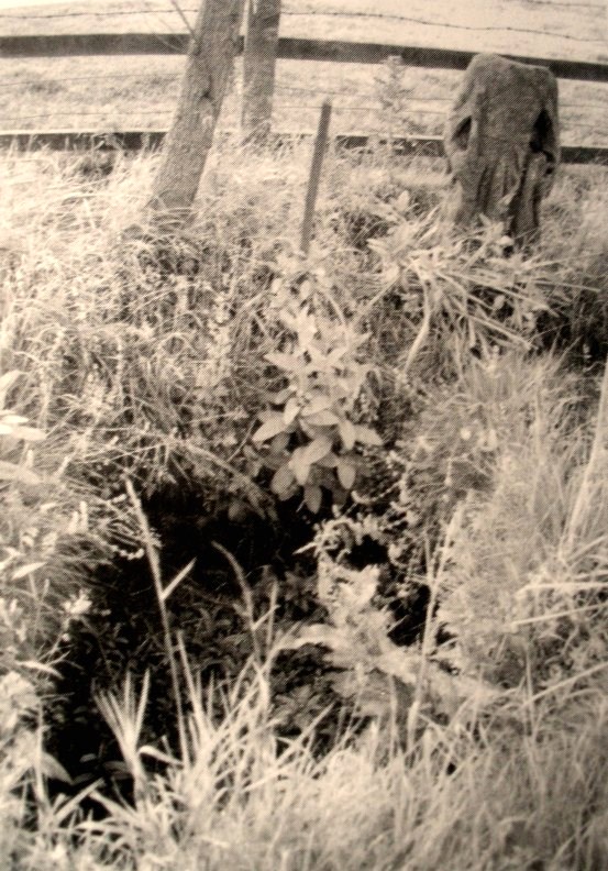
There is some confusion as to whether this mound of earth, barely four feet high but some 50 feet across, is actually prehistoric.  But the folklore has that common ring to it, found at olde sites from Cornwall to northern Scotland, speaking of old tombs and ancient ways…

Folklore

In modern times apparently, earthlights have been reported flitting about around this earthen ridge, but the old mound has older, more familiar tales spoken of it.  In Rev. Williams’ (1901) article on the folklore of Stirlingshire, he made a considerable detour to tell of some old faerie-lore he’d heard when he was younger, from the prehistoric tomb on the northern side of Elphillock, a few miles south of Kildrummy.  In talking with some of the local people about old beliefs, one local man told him:

“The fairies of my native parish made their abode in a round knoll, known as Elfhillock.  My friend, James Smith, now no more, was ploughman at Cairncoullie, in the neighbourhood.  Passing the hillock one evening, he heard the sound of music and dancing.  James drew near to the spot and saw the revels.  He waited and enjoyed himself for a short space and then returned to Cairncoullie and went to bed.  He found to his amazement that he had been away a year and a day!  Every field on the farm and the new ploughmen bore evidence to the fact; and Jamie believed till his dying day that he was a year older than he was aware of, and all because he had given heed to matters he had no business with.”

Not only were the little people said to live within this small tomb, but the hillock must also be cared for and never damaged.  Rev. Williams also narrated that the grandfather of the same local man told him that he had,

“pulled some heather from this elf hillock.  He was compelled by the women to replace it, otherwise he would have to encounter the wrath of the fairies.”

Thankfully the old hillock is still here, just off the roadside.  Not far from here are a number of other prehistoric sites with faerie and ghost-lore and mythological place-names, long since fallen into memories old…soon to be lost perhaps…

References:

  1. Williams, George, “Local Superstitions,” in Transactions of the Stirling Natural History and Archaeological Society, 1901.

© Paul Bennett, The Northern Antiquarian

Peg o’ Nell’s Well, Clitheroe, Lancashire

Sacred Well:  OS Grid Reference – SD 7355 4257

Also Known as:

  1. St. Margaret’s Well

Getting Here

Peg o’ Nells Well

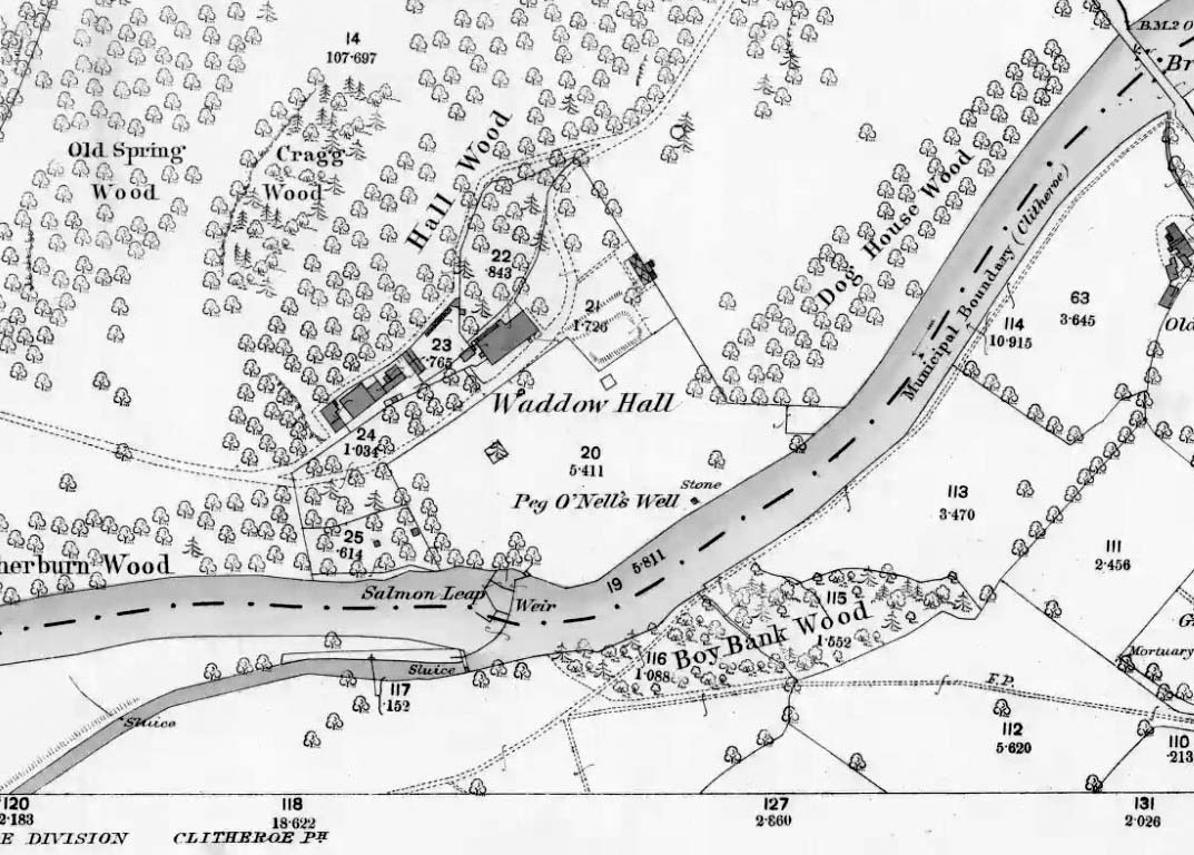
The well is located in the grounds of Waddow Hall close by Brungerley Bridge, near Waddington, in the Ribble Valley. The hall is just off the B 6478 road about three-quarters of a mile south-east of Waddington village. It is on private land, but you can see the well by walking along a footpath at the western side of the hall running along the banks of the River Ribble at the southern side of the hall grounds.

Folklore

The legend originates from the 18th century although the well is a pre-Christian spring. According to this most often told ‘legend’ Peg O’ Nell was a servant girl at Waddow Hall.  However, she often fell out with her masters, the Starkie family, often quarreling with and being disobedient to them. One night, in particular, Peg had a blazing row with Mistress Starkie after saying she didn’t want to fetch water from the well; the mistress was so enraged that she shouted at the servant saying “I hope you fall and break your neck”. At a later date this came true when on a particularly icy night Peg went to fetch water from the well, but on her way there she slipped on some ice and fell into the River Ribble, at a treacherous spot, and did indeed break her neck. From that time on there seems to have been a curse on the Starkie family – anything and everything that happened at the hall was blamed on Peg, or her ghost, which was now haunting the house and grounds. Mistress Starkie became so fed up with the curse that she took an axe and chopped off the head of a statue that had earlier been placed beside the well in memory of poor Peg. Thinking that by doing this the curse would come to an end, and it seems to have done just that, because afterwards peace and quiet seems to have come upon the hall.

Peg o’ Nells Well on 1884 map

Another legend or tale says that Peg dwelt by the well, perhaps as a kind of sprite, but that she caused a local Puritan preacher to fall into the River Ribble.  As a punishment for this dastardly trick the head of the statue was chopped off.  Folklore says that a water spirit or “sprite” lived in the well which was connected underground to the nearby River Ribble.

But the truth about this seems to be that the headless statue is that of St Margaret of Antioch who was beheaded for her faith in the early centuries of Roman rule. St Margaret’s feast day was on 20th July. Apparently, her statue was brought to Waddow Hall from either Sawley Abbey or Whalley Abbey where it had stood in its own niche, or possibly it came from a local Catholic church. The headless statue appears to be holding a bible in one hand; so it was probably placed at the side of the well in order to make the well holy and sacred to pilgrims who used to visit the site for healing purposes on the saint’s day. The head of the statue used to reside in an upstairs room at the hall, but it was lost for a time, only to be re-discovered and embedded into a wall at Brungerley farm not far from the bridge.

But we may never know what really did happen here because legend and folklore have become mixed in with other tales that may, or may not, be true. The holy well stands in a meadow in the hall grounds and is a square-shaped hollow in the ground where water still flows, possibly fed by the river close by. The statue still stands at the side; and fencing now surrounds this sacred site. The hall and grounds are still said to be haunted by a ghost, but whether it is Peg’s ghost we do not know, because this particular ghost is said to be hooded ? The curse itself used to claim a victim once every seven years; the screaming spirit of Peg would rise up from the murky waters of the river on stormy nights – an animal could apparently suffice as a victim, rather than a human.   This story was almost certainly made-up probably to frighten the Starkie family who it was originally aimed at.

Waddow Hall is now a Training and Activity Centre, but it used to be a Centre for girl guides and during the second world war it was an isolation hospital.

References:

  1. Bord, Janet & Colin, Sacred Waters, Paladin Books 1986.
  2. Hilton, J.A., “Return to Peggy’s Spout”, in NEM 70, 1997.
  3. Nelson, Carole, “Peg o’ Nell’s Well, Clitheroe, Lancashire,” in Source No.6, Summer 1998.
  4. Harte, J., “Death by Water – Rivers and Sacrifice,” in White Dragon 1998.
  5. Taylor, Henry, The Ancient Crosses and Holy Wells of Lancashire, Sherratt & Hughes: Manchester 1906.
  6. Whitaker, Terence W., Lancashire’s Ghosts and Legends, Robert Hale: London, 1980.

© Ray Spencer, 2011


Emmott Cross, Colne, Lancashire

Cross:  OS Grid Reference – SD 888 401

Also Known as:

  1. Touch Cross

Archaeology & History

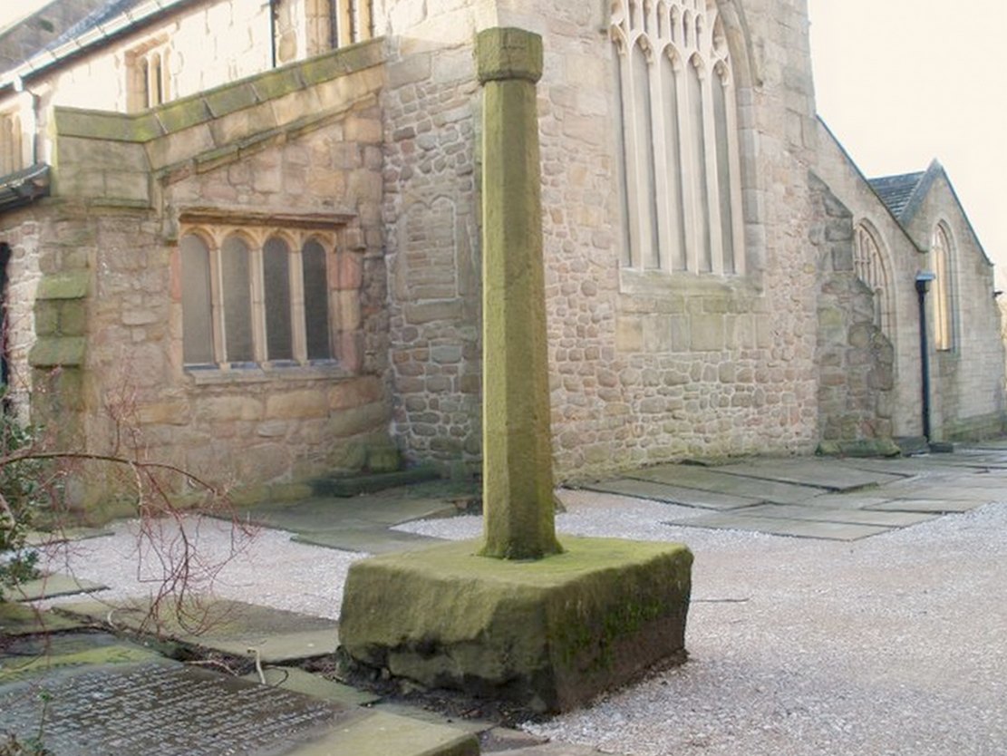
The Emmott Cross

At the north side of St Bartholomew’s church-yard, Colne, stands the medieval Emmott Cross or Touch Cross. It was re-erected here in 1967 by local historian Mr Wilfred Spencer and a team of volunteers having being removed from the grounds of Emmott Hall, Laneshawbridge, when the old hall was being pulled down. The cross had stood for centuries close to the famous Hallown Well, both of which were highly venerated by pilgrims travelling between Whalley Abbey and Yorkshire. It appears that originally the cross had stood at the side of the Stanbury to Haworth road over Herders, close by Emmott.

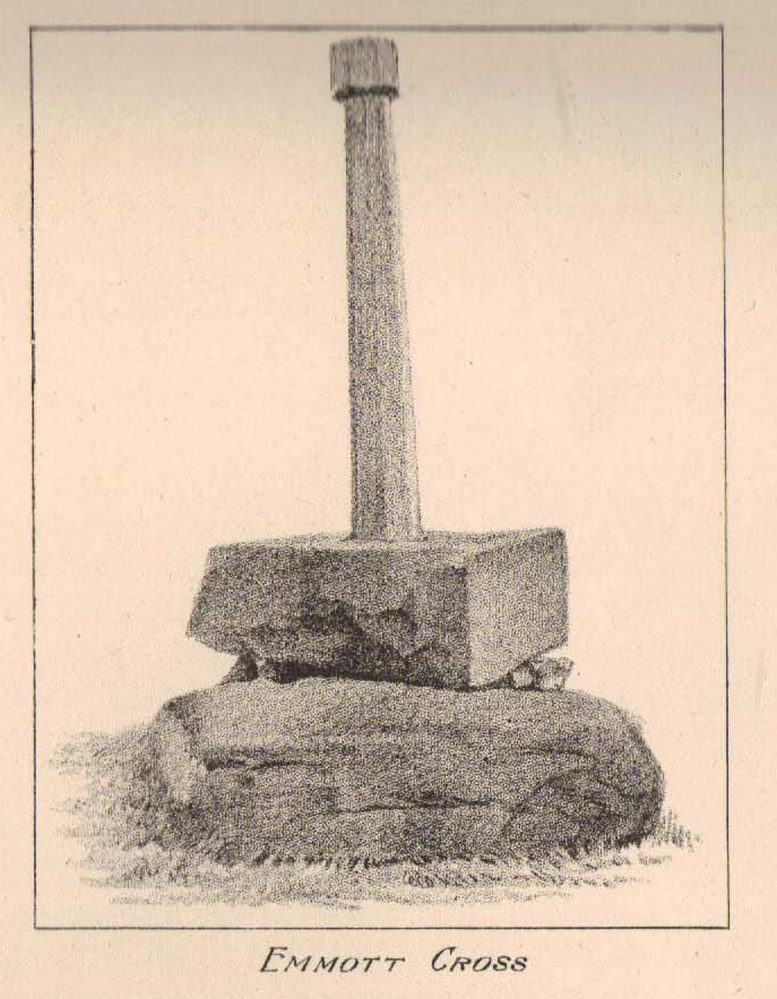
The cross shaft stands 7 feet tall and is referred to as of the English Gothic style, probably 13th century. It stands in an octagonal socketed stone base which is 2 foot high and 4 foot square. Its slender octagonal shaft tapers away towards the top where there is a carved capital or corona – this may once have held a cross head or some other religious object. There used to be some faint lettering on the shaft but this has now worn away. A local historian Dr Whitaker described the lettering as “I.H.S.” along with the Greek omega symbol.

Taylor’s 1906 sketch

It was to all intent and purposes a preaching cross to which pilgrims would congregate and listen to the word of God and many would be baptised in the Hallown Well at the same time. In the penal times of the 16th century the cross was in great use, but by the 17th century it was being referred to as a “papist cross”.  During this period in history it suffered damage and the shaft broken in two places; the cross-head taken away and smashed. For safety reasons the cross-shaft was removed to Colne church-yard but returned to the grounds of Emmott Hall in 1728 when relative calm had returned.

The slender cross shaft and its hefty base are said to weigh about 2 tons and I have no doubt it does. It is now grade 11 listed.

Folklore

The name Touch Cross probably comes about in the sense that pilgrims touched the cross in the hope of a safe pilgrimage, or the name may be something to do with a troop of soldiers who were stationed at the hall in the past. They touched the stone too, but for different reasons – that they would live to fight another day in battle.

References:

  1. Byrne, Clifford H., “A Survey of the Ancient Wayside Crosses in North East Lancashire,” unpublished manuscript, 1974.
  2. Taylor, Henry, The Ancient Crosses and Holy Wells of Lancashire, Sherratt & Hughes: Manchester 1906.
  3. Whitaker, Thomas Dunham, An History of the Original Parish of Whalley and Honor of Clitheroe, Nichols, Son & Bentley: London 1818.

© Ray Spencer, 2011


Robin Hood’s Bed, Blackstone Edge, Lancashire

Legendary Rocks: OS Grid Reference – SD 97204 16356

Getting Here

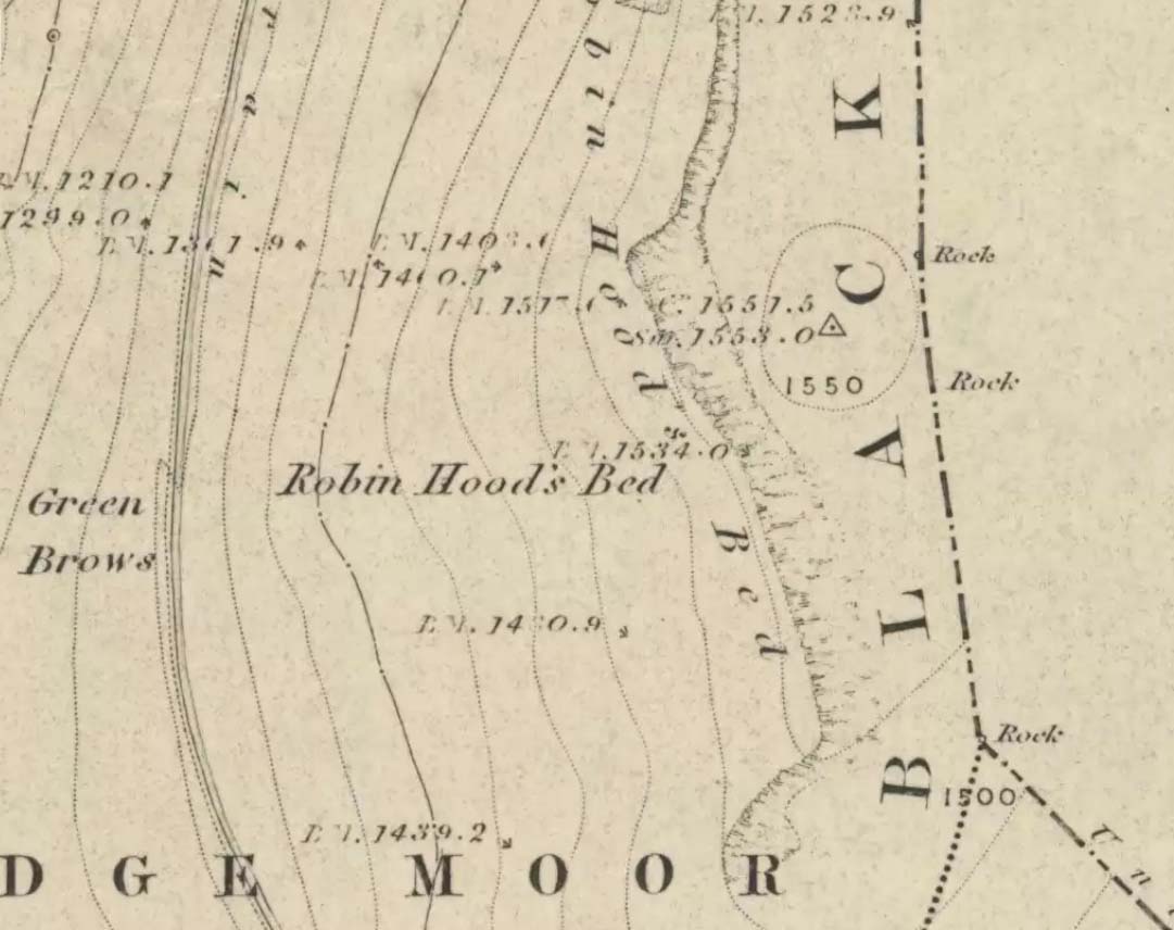
Robin Hoods Bed on 1851 map

Follow the same directions to get to the Aiggin Stone.  Once here, go over the stile by the fence opposite towards the great geological ridge less than half-a-mile south.  Head for the triangulation pillar right on the top of the ridge, and there, about 20 yards past it, higher-up than the triangulation pillar at the very top of Blackstone Edge, is Robin Hood’s legendary stone bed!

Archaeology & History

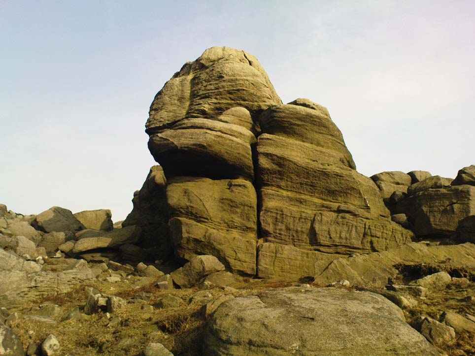
Robin Hoods Bed, looking north

There’s very little of archaeological interest known up here, save a mass of flints and scrapers that have been found scattering the moorland heights hereby, from the mesolithic period onwards.  But we have a relative lack of neolithic to Iron Age remains — officially anyhow!  A possible standing stone can be found a few hundred yards south, but there’s little else.

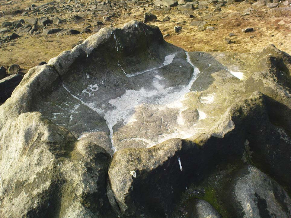
The rock that’s given its name to Robin Hood’s Bed overlooks the very edge of the ridge, detached from the main section, with a large and very curious nature-worn ‘bed’ on its very crown, more than 4 feet wide and about 7 feet long, into which one comfortably lays.  It was named in the boundary records of the township of Rishworth in 1836, where it describes other historical stones, saying:

“thence under Robin Hood’s Bed to a stone marked ‘W.S.G.S. 1742, 1770, 1792, and the following figures and letters, ‘1826 I.L.S.'”

Folklore

This enormous millstone grit boulder, sitting 1550 feet upon the high moors is, according to legend, a place where our famous legendary outlaw once slept.  Whilst sleeping here, some of his followers were said to have kept guard and looked over him.

Robin Hood’s Bed, from below

A rather odd piece of folklore recited by Jessica Lofthouse (1976) is that “no winds ever blow” at Robin Hood’s Bed, who then went on to tell of the time she visited the place.  Walking along the rocky ridge where the stone bed is found, the winds were such that “we had almost been blown over the edge,” until just a few hundred yards further when they eventually reached the fabled site, Nature granted them a sudden calmness unknown to all the high moorlands around, affirming the curious folklore.

The ceremonial stone ‘bed’

Robin Hood’s Bed itself was undeniably an important ceremonial site for both rites of passage and ritual magick to our indigenous ancestors.  The place screams of it!  It also seems very likely that the hero figure of Robin Hood replaced an earlier mythological character, akin to the fabled female creation deity, the cailleach, found commonly in more northern and Irish climes, whose echoes can still be found around our Pennine hills.  For we find that Robin Hood was said to have taken a large boulder from here and with a mighty heave threw it six miles across the landscape due west into the setting sun, where it eventually landed at Monstone Edge, near Rochdale!  Local people were so astounded at this feat that the stone was given the name of Robin Hood’s Quoit.

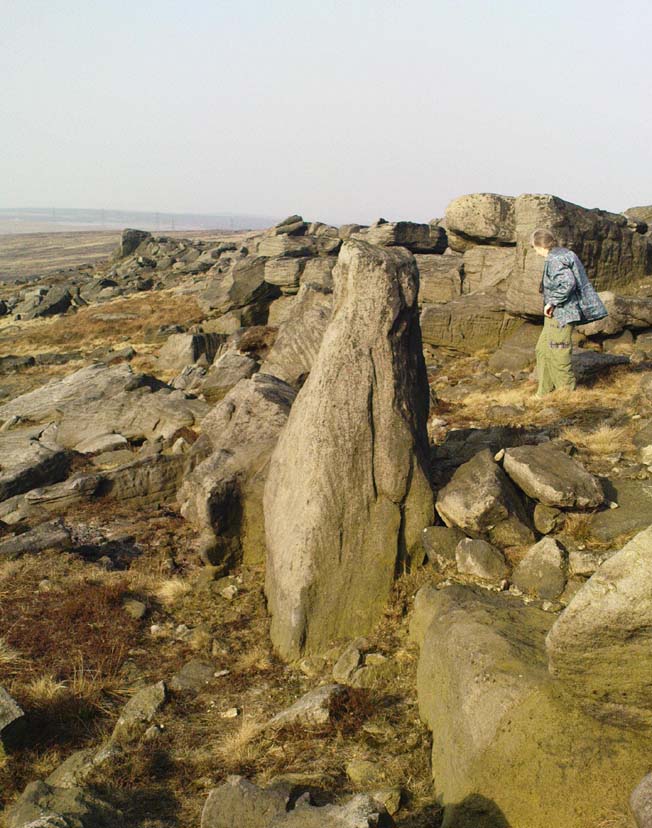
7ft tall natural standing stone

The old place-name authority Eilert Ekwall (1922) related the folklore that the giant ridge of Blackstone Edge “is said to refer to a boundary stone between Yorkshire and Lancashire.”  Which may be the curious upright standing stone, more than 7 feet tall, less than 50 yards NNE which gives a very distinct impression of having been deliberately stood upright, amidst this mass of loose geological droppings!  It would be helpful if there was a geologist in the house who could tell us decisively one way or the other…

Another etymological possibility that has been posited relates to the word ‘bed’ at this site.  Ordinarily it would be sensible to attach the word to the great stone ‘bed’ atop of the poised boulder.  But with the attached legends symptomatic of prehistoric monuments, it would not be improper to highlight that the old Welsh word ‘bedd‘ (a place-name element that is not uncommon in Lancashire) means, “a grave or tomb”.  And this site would be ideal for such an old prehistoric cairn…

References:

  1. Bennett, Paul, The Old Stones of Elmet, Capall Bann: Milverton 2001.
  2. Ekwall, E., The Place-Names of Lancashire, Manchester University Press 1922.
  3. Lofthouse, Jessica, North Country Folklore, Hale: London 1976.
  4. Smith, A.H., The Place-Names of the West Riding of Yorkshire – volume 3, Cambridge University Press 1961.

© Paul Bennett, The Northern Antiquarian

St. Helen’s Well, Sefton, Lancashire

Holy Well:  OS Grid Reference — SD 3544 0128

Getting Here

It is best to start at the Punch Bowl Inn car park, Sefton, then travel a short distance along Lunt Road by St Helen’s church. A footpath/lane is reached where a barrier stands and about 10 metres opposite the main road beneath the undergrowth is St. Helen’s holy well, or what remains of it.

Archaeology & History

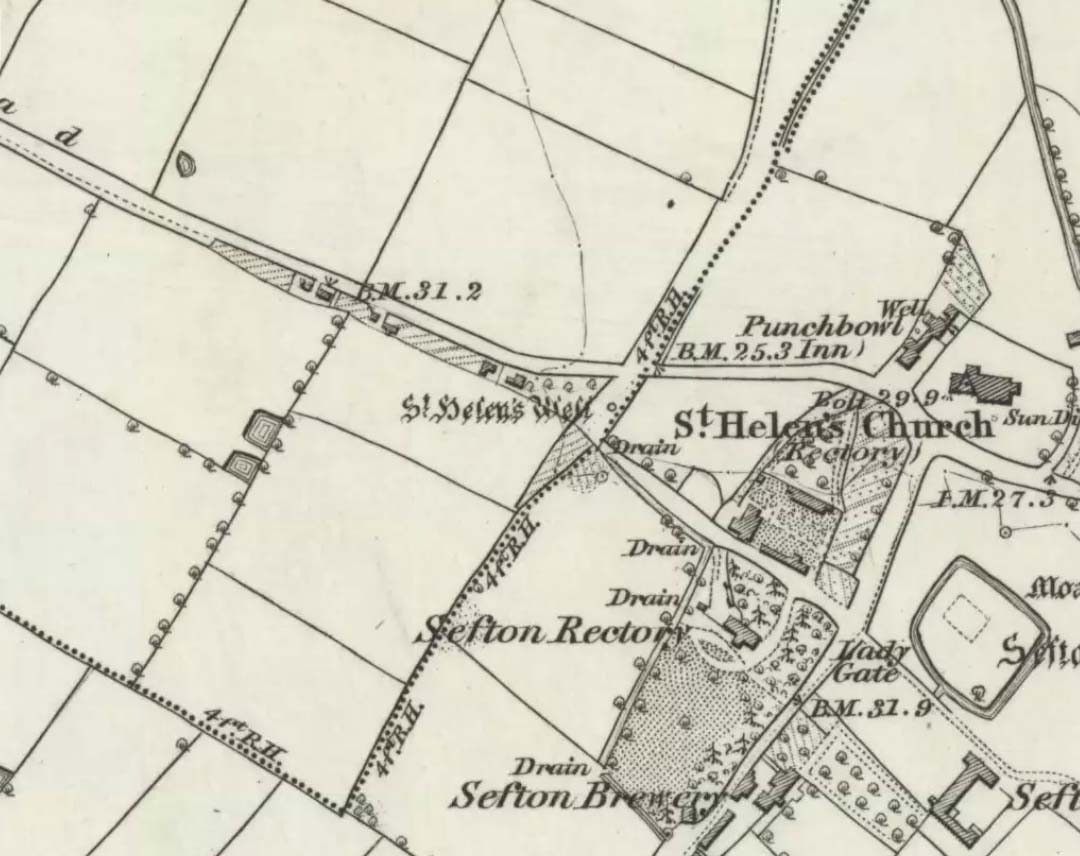
St Helens Well, Sefton 1850
St Helen’s Well on 1850 map

The well is now, sadly, capped off with an inscribed stone that recalls ST HELEN’S WELL.  The well originally stood inside a rather nice little wellhouse with a pyramid-shaped, overlapping roof, with railings running around it.  It was renowned for its icy waters which were especially good for people suffering from rheumatism, sprains, bruising and, also nervous problems.  It had a hand pump at the side of the well-house to enable people to drink the water. But all this has now gone, though the church congregation still visit the site on the saint’s feast day and are still hoping that some day the well will be restored again.

It was probably a pre-Christian spring that in the Middle Ages turned into a pilgrimage site, especially so in the 14th century when the church was built close by.

Folklore

In pre-Reformation times it was much in use, but later on and in more recent times it had become a wishing well; pins were thrown into the well by young folk. Apparently, if the pin could be seen at the bottom of the well a favourable outcome was likely with regard to good luck in a forthcoming marriage by a couple much in love.

Addenda:

To complement Ray’s entry, here are Mr Taylor’s notes from his Ancient Crosses and Holy Wells (1906), in which he wrote the following:

“This celebrated spring rises at a distance of three hundred yards in a westerly direction from Sefton Church.  In the year 1891 the well was walled round, and a handsome canopy placed over it, from the designs of Mr John Douglas, at the cost of William Philip, fourth earl of Sefton.  The traditions connected with this holy well are thus graphically summed up in the History of Sefton:-

“”We must not omit to mention St Helen’s Well, which springs near the first cottage in the Thornton Road, beyond the inn.  Formerly a ‘pad-road’ only led from the well to the church, the Thornton Road passing through the Rectory grounds.  In the Churchwarden’s accounts we find several items of expenditure incurred for the keeping in order of St Helen’s Well.  Thus we read in 1758: ‘For a new Dish and Chain for S. Ellen’s Well, 2/-.’  Ashcroft  [writing about the year 1819] tells us ‘that this well was once in great repute for curing rheumatism, strains, bruises and weaknesses of the nerves.  It has no mineral quality, however, and he remarks that its principal virtue seems to have been its coldness.’  In different times great respect was paid to wells ’eminent for curing distempers upon the Saint’s Day whose name the well bore,’ and it was once the custom to decorate the wells of Holy Thursday with boughs of trees, garlands of flowers, etc, places in various devices, and after service in the church the parson and singers repaired to the well, where they sang psalms and prayed.  The bottom of the well, which is of no great depth and very clear, may generally be strewn with pins which are dropped in by superstitious young country folks to denote to them the probability of their marriage, which is said to be near if the pin falls pointing towards the church.  Pins and pebbles were often dropped into wells, and the circles formed thereby on the surface of the water (or the question whether the water was troubled at all) were used as omens by which the observers drew inferences of future events.  Mr Hampson, in his Medii Ævi Kalendarium, says: ‘I have frequently seen the bottom of S. Helen’s Well, near Sefton, Lancashire, almost covered with pins, which I suppose must have been thrown in for like purposes.'”

“…Mr Gregson wrote: ‘With regard to the curious frequency of well dedication to S. Helen, I formed a theory many years ago that the S. Helen of the county of Lancaster is not unconnected with the Celtic S. Elian, who is a frequent patron saint of wells in North Wales.  Do they not both draw a common ancestry from Ella, the water sprite?'”

References:

  1. Caroe, W.D. & Gordon, E.J.A., Sefton: A Descriptive and Historical Account, Longmans Green: London 1893.
  2. Taylor, Henry, The Ancient Crosses and Holy Wells of Lancashire, Sherratt & Hughes: Manchester 1906.

© Ray Spencer, 2011


Great Bride Stones, Todmorden, West Yorkshire

Sacred Rocks:  OS Grid Reference – SD 93329 26737

Getting Here

Follow the same directions to find the Blackheath Circle, but instead of turning onto the golf course, keep going up the steep road until you reach the T-junction at the top; then turn left and go along the road for about 200 yards, past the second track on the left, keeping your eyes peeled across the small moorland to your left where you can see the rocks rising up.  Walk along the footpath towards them.  You can’t really miss the place!

Archaeology & History

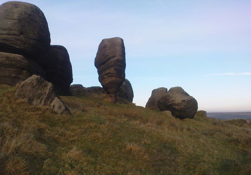
The Bride at sunset – the fallen Groom to her left

If you’re a heathen or geologist and you aint seen this place, check it out – you won’t be disappointed!  First mentioned in 1491, this has always been a place of some repute. Its legendary companion, the ‘Groom’, lays resting on the Earth after being felled sometime in the 17th century.

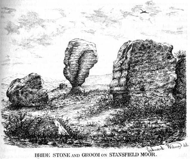
F.A. Leyland’s 1860s drawing

A beautiful, remarkable and powerful site of obvious veneration.  First described in local deeds as early as 1491, there are a great number of severely weathered boulders all round here, many like frozen rock giants haunting a magickal landscape.  The modern lore ascribes the stones to be dedicated to Bride, goddess of the Brigantian people.  And like Her legendary triple-aspect, we find here in the landscape a triple aspect to the outcrops themselves: to the west are the Bride Stones; to the east, the Little Bride Stones; with the Great Bride Stones as the central group, surveying everything around here.

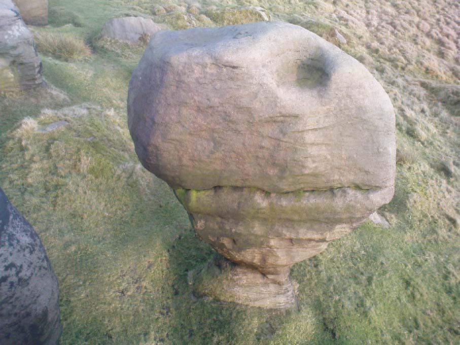
At the main complex is what is singularly known as the Bride itself: a great smooth upright pillar of stone fourteen feet tall and nine feet wide at the top, yet only about two feet wide near its base, seemingly defying natural law.  Watson (1775) described, next to the Bride herself, “stood another large stone, called the Groom…(which) has been thrown down by the country people” – probably under order of the Church.  Crossland (1902) told how the Bride also acquired the title, “T’ Bottle Neck,” because of the stone’s simulacrum of an upturned bottle.

The Bride & her Groom (laid on the earth)
The ‘head’ or top of the Bride Stone

Scattered across the tops of the many rocks hereby are many “druid basins” as Harland and Wilkinson (1882) described them.  Many of these are simply basins eroded over the millenia by the natural elements of wind and rain.  It is possible that some of these basins were carved out by human hands, but it’s nigh on impossible to say for sure those that were and those that were not.  If we could find a ring around at least one of them, it would help — but in all our searches all round here, we’ve yet to locate one complete cup-and-ring.  So we must remain sceptical.

On the mundane etymological side of things, the excellent tract by F.A. Leyland (c.1867) suggested the Bride Stones actually had nothing to do with any goddess or heathenism, but derived simply from,

“the Anglo-Saxon adjective Βñáð, signifying broad, large, vast — hence the name of the three groups known as the Bride Stones.  The name of The Groom, conferred on the prostrate remains, appears to have been suggested by the fanciful definition of the Saxon Brád, as given by (Watson).”

However, the modern place-name authority A.H. Smith (1963:3:174) says very simply that the name derives from “bryd, a bride.”

A “rude stone” was described in one tract as being a short distance below this great rock outcrop; it was turned into a cross by the local christian fanatics and moved a few hundred yards west, to a site that is now shown on modern OS-maps as the Mount Cross.

Folklore

Although local history records are silent over the ritual nature of these outcrops, tradition and folklore cited by the antiquarian Reverend John Watson (1775) tell them as a place of pagan worship.  People were said to have married here, although whether such lore evolved from a misrepresentation of the title, Bride, is unsure.  In the present day though there have been a number of people who have married here in recent years.

If the Brigantian goddess was venerated here, the date of the most active festivities would have been February 1-2, or Old Wives Feast day as it was known in the north.  The modern witches Janet and Stewart Farrar, who wrote extensively about this deity (1987), said of Bride: “one is really speaking of the primordial Celtic Great Mother Herself,” i.e., the Earth Mother.

Telling of further lore, Watson said that weddings performed here in ages past stuck to an age-old tradition:

“during the ceremony, the groom stood by one of these pillars, and the bride by the other, the priests having their stations by the adjoining stones, the largest perhaps being appropriated to the arch-druid.”

New Age author Monica Sjoo felt the place “to have a special and uncanny power.”  This almost understates the place: it is truly primal and possesses the virtues of strength, energy, birth and solace.

References:

  1. Bennett, Paul, The Old Stones of Elmet, Capall Bann: Milverton 2001.
  2. Crossland, Charles, “Place-Names in the Parish of Halifax in Relation to Surrounding Natural Features,” in Halifax Naturalist, volume 7, 1902.
  3. Farrar, Janet & Stewart, The Witches’ Goddess, Hale: London 1987.
  4. Harland, John & Wilkinson, T.T., Lancashire Folklore, John Heywood: Manchester 1882.
  5. Leyland, F.A., The History and Antiquities of the Parish of Halifax, by the Reverend John Watson, M.A., R.Leyland: Halifax n.d. (c.1867).
  6. Smith, A.H., The Place-Names of the West Riding of Yorkshire – volume 3, Cambridge University Press 1963.
  7. Watson, John, The History and Antiquities of the Parish of Halifax, T. Lowndes: London 1775.

© Paul Bennett, The Northern Antiquarian

Robin Hood’s Penny Stone, Midgley Moor, West Yorkshire

Legendary Rock:  OS Grid References – SE 01831 28436

Also Known as:

  1. Robin Hood’s Pennystone
  2. Robin Hood’s Rock

Getting Here

If you follow the directions to reach the Churn Milk Joan stone, then continue onto the moor following the same directions to find the Miller’s Grave, once you’ve reach this you’ll see a large rounded boulder a couple of hundred yards away on your left, to the northwest.  That’s Robin Hood’s Penny Stone!

Archaeology & History

Robin Hood’s Pennystone, Midgley Moor

In terms of this site’s archaeology, it has none to write home about in official records (other than a few flints found nearby), but there’s more to this place than meets the eye.  A large rounded boulder sat upon the moorland plain with a large Nature-worn bowl on its top, the site is some 112 yards (102m) northwest of the little-known, but impressive Miller’s Grave prehistoric cairn (close to being a midsummer/midwinter line).  North and south of the rock are small lines of prehistoric walling — though their context is difficult to assess.  The Greenwood Stone and Greenwood B stone can be found about 200 yards west.

Folklore

A singular footpath once led up to this old boulder, atop of which – in its large ‘bowl’ – vinegar used to be poured. In this, coins were left by local people who suffered the plague and in return food was left for them.  And of course it is said that Robin Hood frequented the place in bygone times.

References:

  1. Bennett, Paul, The Old Stones of Elmet, Capall Bann: Milverton 2001.
  2. Robert, Andy, “Our Last Meeting,” in NEM 37, 1989.
  3. Robert, Andy, Ghosts and Legends of Yorkshire, Jarrold: Sheffield 1992.

© Paul Bennett, The Northern Antiquarian

Martinsell Hill, Oare, Pewsey, Wiltshire

Hillfort:  OS Grid Reference – SU 1764 6396

Also Known as:

  1. Martin’s Hill

Archaeology & History

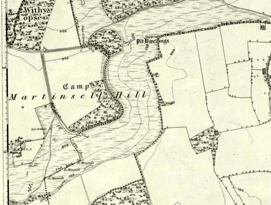
Martinsell Hill on 1888 map

The second highest of Wiltshire’s prehistoric camps or hillforts, Martinsell Hill was described as early as the 13th century as ‘Mattelsore’ and was known in local dialect and literary forms as variants around the word mattels, until the 16th century, when the title became altered in literature and for the first time became known as ‘Martinshall’ (and variants thereof), which has stuck ever since.  As the etymologists Gover, Mawer & Stenton (1939) proclaimed,

“the first element (mattels, PB) must be associated with the old english name for the camp which stands on top of it: the Mætelmesburg of the Pewsey charter” —

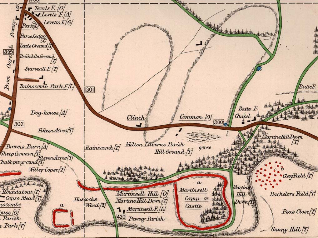
A.C. Smith’s old map

Which the authors think derived from “Mætelmesora, i.e., ‘Mæþelhelm’s bank'”, being the name of a tribal leader or elder who gave his name to the hill upon which the fort was built.  Margaret Gelling echoes the sentiment in her Place-Names in the Landscape, but we must keep in mind that such derivation is still a quite speculative etymology and one which doesn’t seem to be able to be proven (as yet!).

The hillfort and its remains were described in some detail in the second volume of Colt Hoare’s classic Ancient Wiltshire (1819: 107), where he wrote:

“Martin’s Hill or Martinshal Hill is in North Wilts what Long Knoll near Maiden Bradley is in South Wilts, ‘collis longe spectabilis’.  This elevated point commands a most advantageous prospect of the rich vale that separates the northern and southern districts of our county, , and is rendered interesting to the antiquary by an extensive earthenwork that crowns the summit of the hill.  Its form resembles an oblong square on all sides, except towards the east, where it bends inward in order to humour the natural shape of the hill.  Its area, which is in tillage, comprehends thirty-one acres; and as several entrances have been made through the ramparts for the convenience of agriculture, it is difficult to ascertain on which side were the original approaches to the camp.  This hill, in its formation, presents a peculiarity rather contrary to the usual system of nature, by rising in height towards the east, where a bold and tremendous precipice of smooth turf shelves down from the summit to the base of the hill.  This eminence is more remarkable for the rich and extensive prospect which it affords than for the plan of its entrenchments, which consists of a single vallum and fosse.  Not having discovered by digging any certain marks of ancient populations within its area, I am inclined to think that it may be considered as an asylum to which the Britons, who were very numerous in its environs, sent their families and herds in times of danger: the single vallum and ditch prove its British origin, and the great extent of its area seems to warrant this conjecture.”

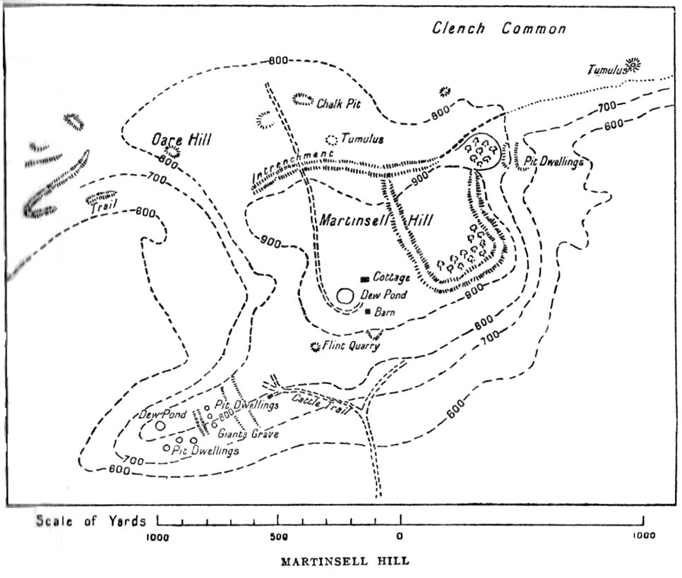
Hippisley Cox’s ground-plan

This aint a bad assumption for a fella who wrote this 200 years ago without the aid of excavation or modern archaeocentric analysis.  But we can see that Hoare was utilizing that dying virtue of common sense here, and find that much of what he said remains the echoed narrative of modern archaeologists who, I believe, still aint done a detailed excavation on the site themselves. (weird for down South!)  Later in the 19th century, when the reverend A.C. Smith (1885) visited and wrote about the hillfort, he added little to Hoare’s earlier words.  And the descriptive narrative of the site remained roughly the same (Massingham’s intriguing ascriptions aside!) even after a small excavation was undertaken in 1907, which found very little.  Hippisley Cox (1927) passed this way in his fine travelogue of ancient roads and trackways in Wessex, describing the enclosed top of this hill as

“the site of a complete neolithic settlement, including dew-ponds, a cattle compound, a flint quarry, lynchetts, dicthes of defence and deep cattle tracks formed by much going and coming of beasts from the valley.”

He may have been right!  In more recent times Geoffrey Williams (1993) describes the Martinsell hillfort, which again only gives slightly more info than Colt Hoare’s 1819 narrative.  The site covers 32 acres in size, is roughly rectangular in form, measuring roughly 330 yards (302m) across east to west, and 480 yards (439m) north to south.   There appears to be at least one entrance on its northeastern edge.

Folklore

What seems to be a survival of prechristian sun lore is found in one or two of the events that used to happen upon and around Martinsell.  A number of local history books give varying descriptions of the events here, but Devereux and Thomson (1979) condense the information nicely, telling us that

“The camp seems to have been a focus for curious Palm Sunday ‘games’ in past centuries, one of which involved a line of boys standing at intervals  from the base to the summit of the hill.  Using hockey sticks, they then proceeded to knock a ball in succession up the hill to the top.  Another activity was the throwing of oranges down the hill slopes with boys going headlong after them.  Evene more strangely, local youths used to slither down the escarpment on horses skulls.”

Mythographer and writer Michael Dames (1977) thought that such festive activities on and around the hill related to remnants of ancient goddess worship here.

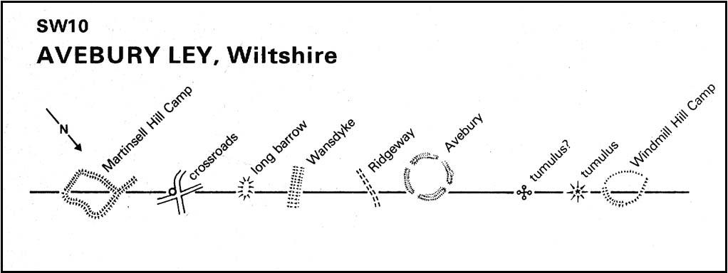
Ley line running from Martinsell (image courtesy Paul Devereux)

In Paul Devereux & Ian Thomson’s (1979) ley hunter’s guide, the Martinsell Hill site stands at the beginning of a ley, which then runs northwest for more than seven miles, eventually ending at the well known causewayed enclosure of Windmill Hill — but not before passing by the Avebury stone circle and several prehistoric tombs on route.  This ley is a simple alignment between sites (as the ‘discover’ of leys, Alfred Watkins described them) and has nothing to do with the modern contrivance of energy lines.

…to be continued…

References:

  1. Bradley, A.G., Round about Wiltshire, Methuen: London 1948.
  2. Dames, Michael, The Avebury Cycle, Thames & Hudson: London 1977.
  3. Devereux, Paul & Thomson, Ian, The Ley Hunter’s Companion, Thames & Hudson: London 1979.
  4. Gomme, Alice B., “Folklore Scraps from Several Localities,” in Folklore Journal, 20:1, 1909.
  5. Gover, J.E.B., Mawer, A. & Stenton, F.M., The Place-Names of Wiltshire, Cambridge University Press 1939.
  6. Harding, D.W., The Iron Age in Lowland Britain, RKP: London 1974.
  7. Hoare, Richard Colt, The Ancient History of North Wiltshire, Lackington, Hughes, Mavor & Jones: London 1819.
  8. Massingham, H.J., Downland Man, Jonathan Cape: London 1926.
  9. Partidge, T.B., “Wiltshire Folklore,” in Folklore Journal, 26:2, 1915.
  10. Smith, A.C., A Guide to the British and Roman Antiquities of the North Wiltshire Downs, Wiltshire Archaeological & Natural History Society 1885.
  11. Williams, Geoffrey, The Iron Age Hillforts of England, Horace Books 1993.

© Paul Bennett, The Northern Antiquarian


Two Lads, Withens Moor, West Yorkshire

Cairns: OS Grid Reference – SD 98394 22116

Getting Here

Best way here is, from Mytholmroyd go up the Cragg Vale road for a coupla miles, then turn right and heading down, then up, towards Withens Clough reservoir.  Once there, walk onto the moor to your left (south) until you’re on the ridge above you.  Keep walking until y’ see the rocky cairn-like creatures stood in isolation on a flat moorland plain.

Archaeology & History

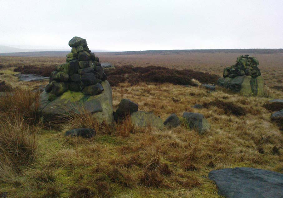
Two Lads – on a dark, rainy, windy day

Truly weird spot this one, but I love it! Seemingly miles from anywhere, it’s one helluva walk to most folk, but utterly worthwhile when your arrive.   On a clear day you can see for miles and the landscape is adorable!  On a cloudy rainy day, the feel of the place changes if you take care to stay with the site, saturated, meditating (as no other people ever turn up when She’s like that – so you and the place get the best from each other!).

The site comprises of two boulders, each crowned with a cairn of stones.  The westernmost one of the two (SD 98392 22111) is intriguing as it has, carved upon the rock beneath the stone cairn on the northwestern edge of the stone, what looks like a singular cup-marking, plus a large water-worn bowl on its northern edge, and a very distinct deeply-cut cross-base, several inches deep, near the northeastern corner of the rock.  This cross-base seems slightly more rectangular in form than square; although the large covering of stones makes an accurate ascription difficult.  If this cross-base and cup-markings are authentic, we would have here a clear example of the christianization of a previously heathen site.

A cursory examination of the easternmost of the Two Lads (SD 98397 22117) doesn’t indicate any artificial workings on the rock surface.

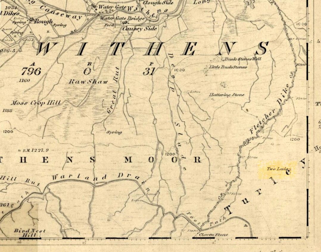
Two Lads on 1853 OS-map

Although the two ‘cairns’ on top of these two rocks are not prehistoric in nature, about 20 yards behind the Two Lads (south) may once have been the severely denuded remains of a once large prehistoric cairn.  Although the position in the landscape is perfect for such a construction, this is somewhat tentative, it’s gotta be said!  Further examinations are obviously necessary here.

The studious A.H. Smith (1961-63) believes that a field-name record from 1624, describing some ‘Lad Stones’ in the parish of Heptonstall relates to this site.  We know with certainty however, that this site was first illustrated on Greenwood’s 1771 map of Yorkshire, then highlighted on more recent 19th century Ordnance Survey maps as ‘cairns.’

Folklore

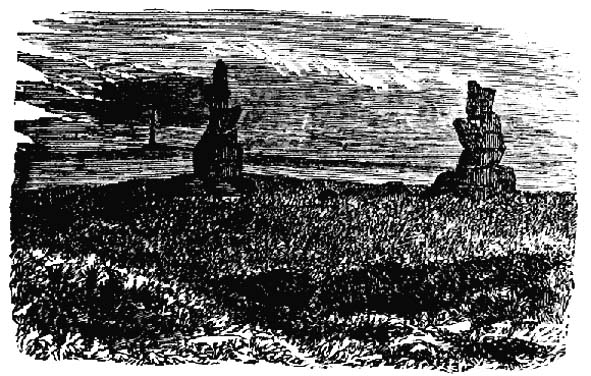
Drawing of the Lads in 1877

The creation myth behind this place is that two lads were walking over the moor in midwinter and got caught in a blizzard. Losing all sense of visibility they tried to shelter from the wind and snow by hiding behind these rocks, but perished. Sometime later their bodies were found and the curious “cairn” of rocks were mounted onto the boulders to mark where they’d died.  This is a folktale we find at many other old stone remains on the hilltops of northern England and Scotland.

The Two Lads seems to be very close to a midwinter alignment (or izzit a lunar standstill line?), linking it with the huge Rudstoop Standing Stone and, eventually, Robin Hood’s Penny Stone on Midgley Moor – which might be the root of the folktale. (i.e. midwinter, snow, death)  Any archaeoastronomy buffs out there wanna check this one out?  Then we can confirm or dismiss it.

References:

  1. Anonymous, “The ‘Two Lads’, Withens Moor,” in Todmorden & Hebden Bridge Historical Almanack, T. Dawson: Todmorden 1877.
  2. Bennett, Paul, The Old Stones of Elmet, Capall Bann: Milverton 2001.
  3. Smith, A.H., The Place-Names of the West Riding of Yorkshire, Cambridge University Press 1961-63.

© Paul Bennett, The Northern Antiquarian