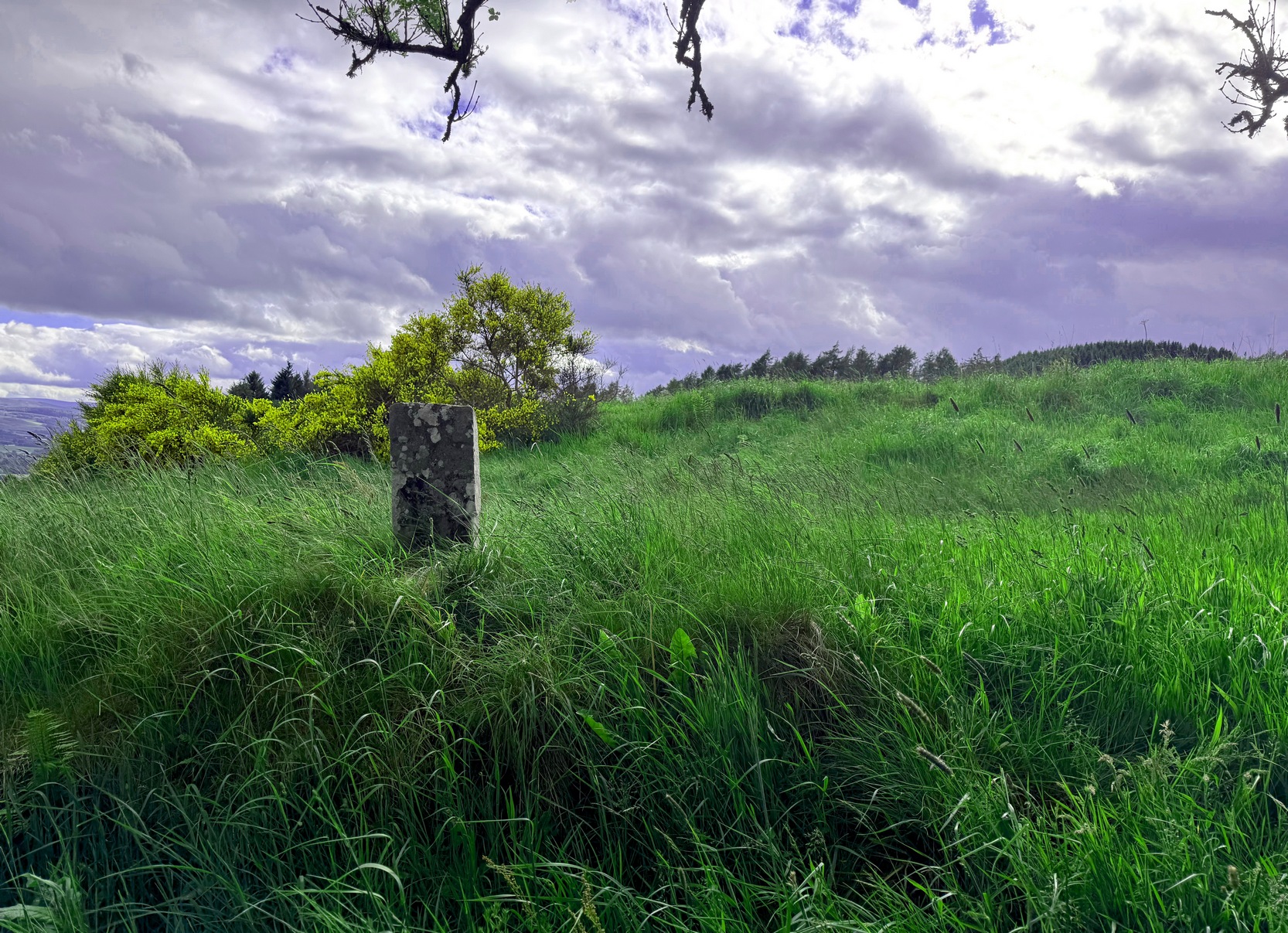
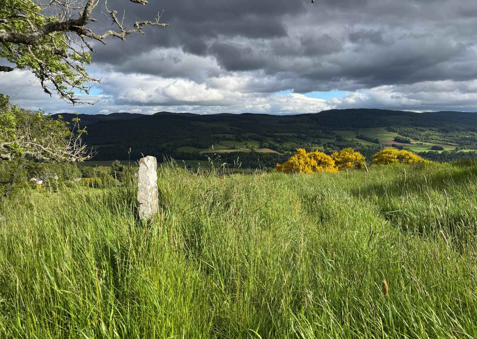
From the red phone-box at the road junction in Strathtay village, walk aling the road, east (slightly downhill) for less than 50 yards then turn left and walk up the track. After 70-80 yards, keep your eyes peeled for the footpath that runs up the slope into the tgrees (don’t head to the house in front of you). After a half-mile you reach the gorgeous old Tullypowrie farmhouse on your left; keep walking uphill for another 300 yards until your reach a large tree on your left, above which, sat on some very low walling, you’ll see a small upright stone.
Archaeology & History
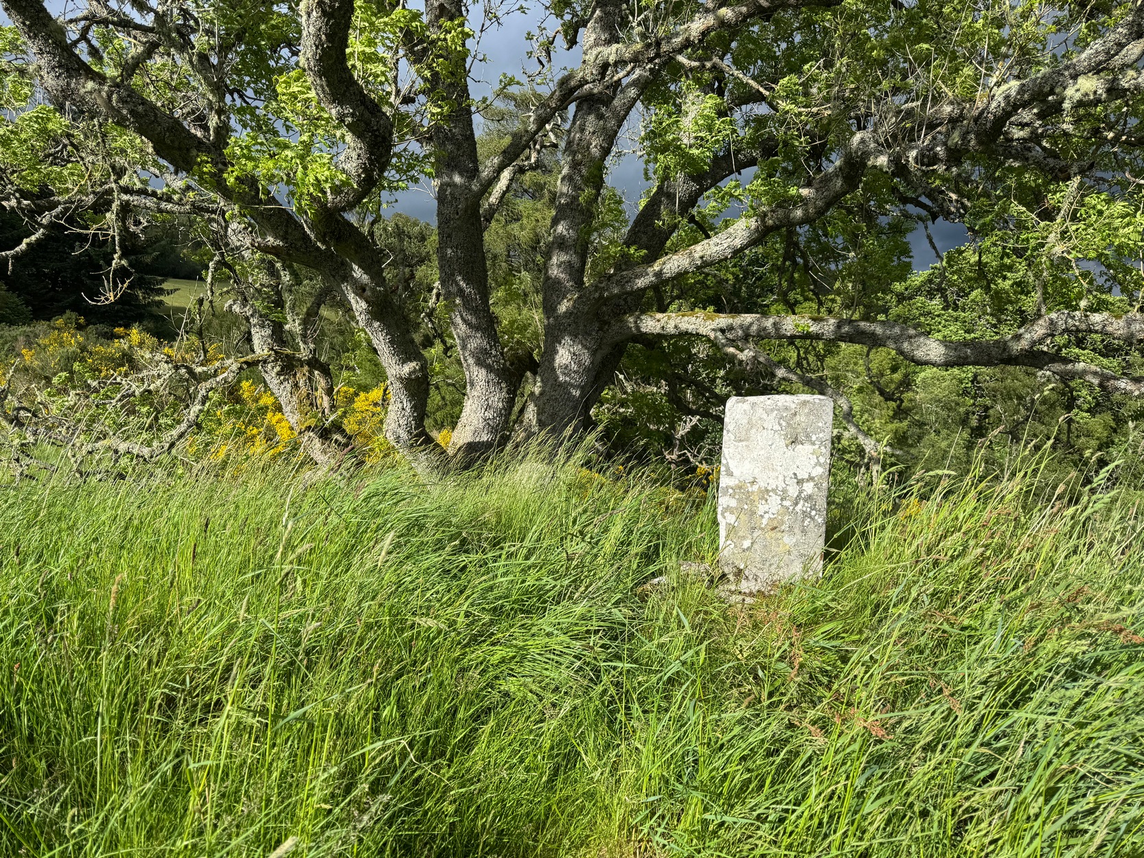
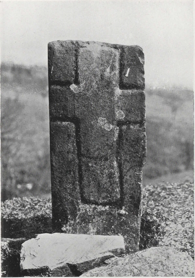
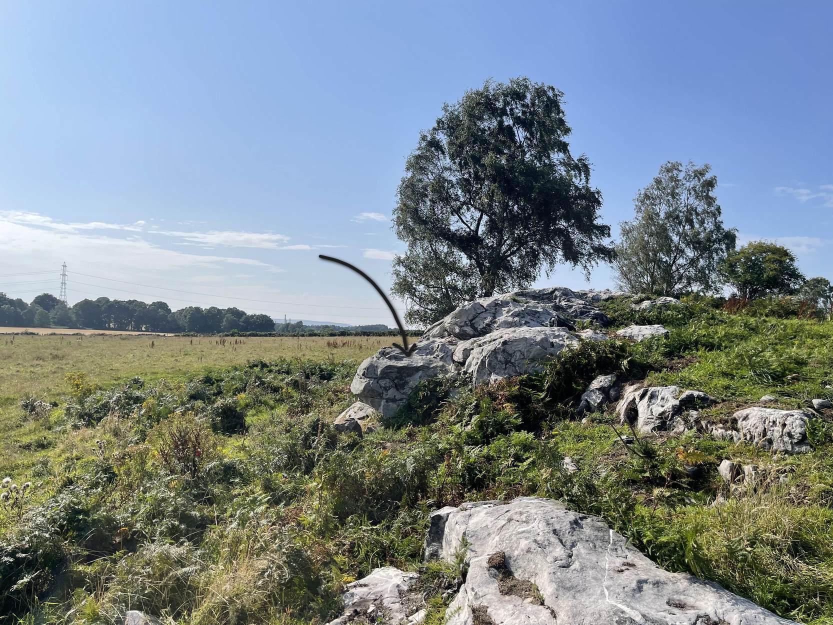
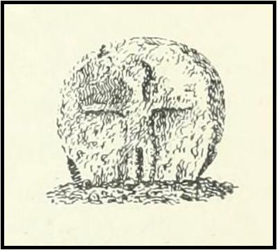
Faint cross on western face
This little-known early christian carved stone, sitting on the vague remains of an old Roman Catholic church, located on what local folks used to call “the route to the stones” (meaning to the Clachan an Diridh, much to the minister’s considerable disdain), has had less said of it than the more ancient stone circle a little further up the footpath. But then, not much is known of either the carving or the church itself, whose remains can barely be seen amongst the grasses. But the upright ‘cross’ at least proclaims itself to the eye.
On our recent visit here, the crosses (on both side of the stone) were somewhat faint, as my photos show. But it wasn’t always this way. During a visit to nearby Aberfeldy in September 1900, the antiquarian Dave Landsborough (1901) found himself ambling about “among the ruins of a small hamlet” that was the olde settlement of Tullypowrie and came upon this little-known monument. He subsequently wrote an excellent description of the stone, which cannot be equalled. “The cross,” he told,
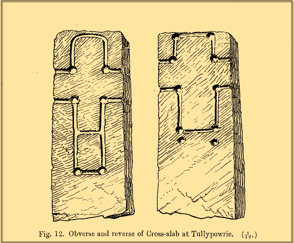
Landsborough’s sketch
“is of the rudest character, consisting of a schistose slab 30 inches in length, 11⅜ inches in width at the top, about half an inch wider at the bottom, and about 4½ inches in thickness. It is roughly squared at the top and sides, but at the bottom the base is unsquared, one side being longer than the other. On both faces of the slab a cross is formed by a shallow incised sinking, a little more than an inch in breadth, with circular sinkings slightly deeper than the rest of the outline at each corner of the shaft and summit of the cross, and at the intersections of the arms with the shaft and summit. The cross on the east face of the stone has its top almost level with the top of the slab, but the shaft does not reach nearly to the bottom. The top part of the cross above the arms is 4½ inches high by 4½ inches in width. The arms reach across the whole width of the slab, and the shaft is little more than the length of the part above the arms, the base being somewhat rounded. Below the termination of the shaft are two slight circular sinkings almost in line with the perpendicular outlines of the sides, but at unequal distances from their terminations, the one being 1½ inches and the other 2½ inches below the similar sinkings which mark the corners of the shaft. The cross on the west face of the slab is in every way similar, except that the shaft is longer, reaching to a length of 10½ inches below the arms, and the circular sinkings at the top are nearly effaced. It has, however, the curious feature of a slight cut-off at about the same length as the shaft of the other cross, but the circular sinkings occur at the top and bottom, and at the intersections as in the case of the other cross.
“The slab is not fastened in a socket, but is kept nearly erect leaning against a large stone, while smaller stones keep it firm at the back. I have since been told by the Rev. Mr McLean of Grandtully that the place where it stands is the site of an old and very little chapel, the south wall of which may still be recognised by its remaining foundations.”
Tullypowrie cross looking SDixon’s old photo
On the other side of the burn from here was the great Whooping Cough Well, with the heathen Clach na Buidseach against the wall of Tullypowrie Farm just below (subsequently moved to the field west of the cross). These sites (and others nearby) and the animistic traditions associated with them, probably had something to do with the positioning of the church here, and the cross would be the attempt to give a Christian veneer to usurp the more archaic natural practices. We don’t know that for sure, but it’s more than likely. The old Logierait schoolmaster James Kennedy (1927) makes constant references to the animistic lore of the region, which was legion until quite recently.
No additional lore, sadly, is known of this old cross, which is deemed to be medieval in origin. Both Mitchell (1923) and Dixon (1925) make mention of the monument in their respective guidebooks, but add no further information.
References:
Dixon, John H., Pitlochry, Past and Present, L. Mackay: Pitlochry 1925.
Kennedy, James, Folklore and Reminiscences of Strathtay and Grandtully, Munro Press: Perth 1927.
Landsborough, David, “Rubbings of both Faces of an Erect Incised Cross-slab, at Tullypowrie, near Grandtully, Perthshire,” in Proceedings Society of Antiquaries, Scotland, volume 35, 1901.
Mitchell, Hugh, Pitlochry District: Its Topography, Archaeology and History, L. Mackay: Pitlochry 1923.
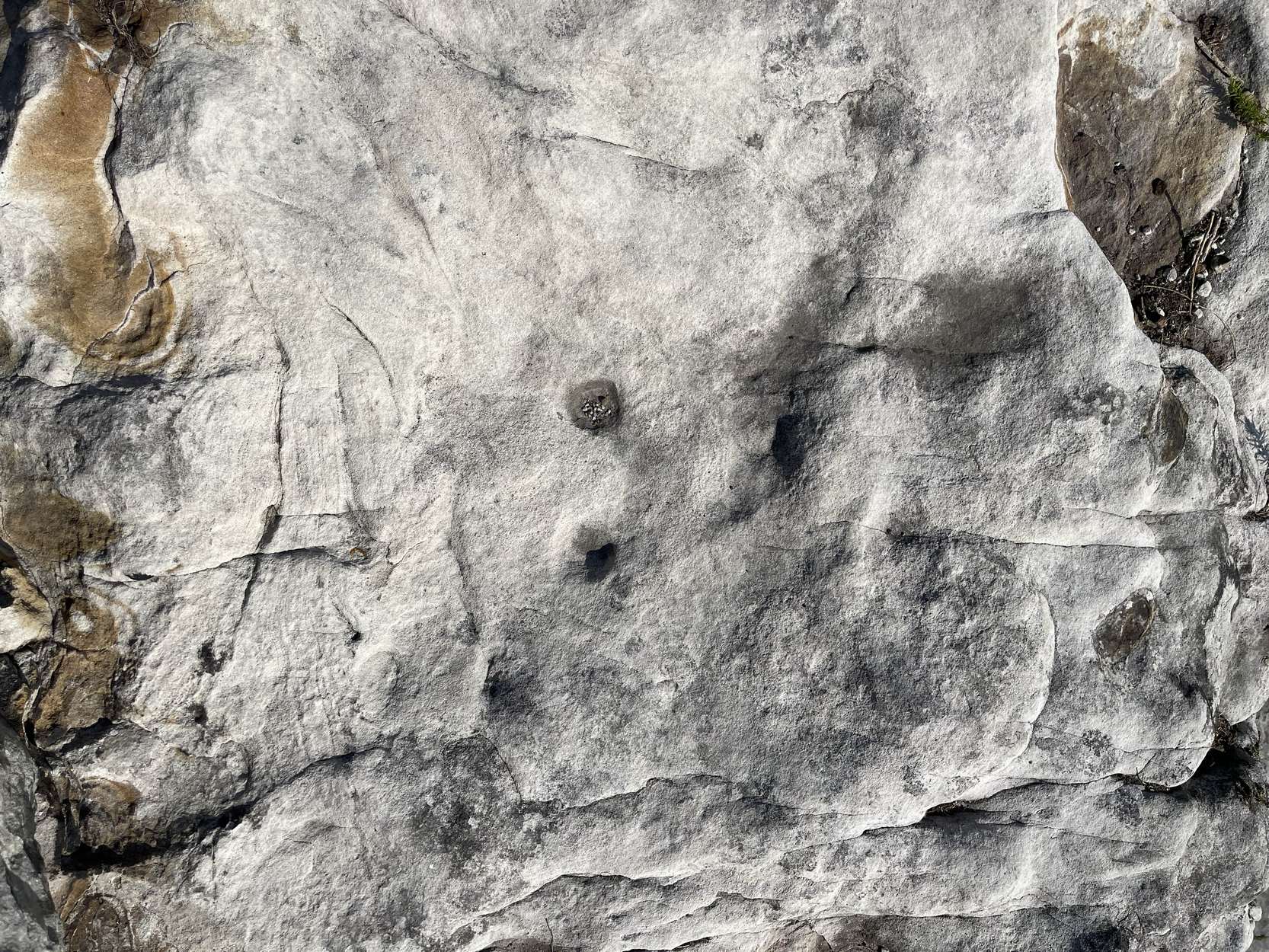
Follow the directions as if you’re visiting the impressive multi-ringed design of the Castleton (10) carving. Once there, walk south-east along the geological ridge for 45 yards where the small cliff drops down to the field. Just where this drop occurs, on a lower horizontal level of the rock face (only a small section) you’ll notice two distinct “cups”. You can’t really miss it!
Archaeology & History
This very basic cup-marked stone was, until recently, covered in dense gorse, making access to the site almost impossible. But following a fire that happened here not too long ago, the smoldering remains needed to be cleared and, once the job was done, we were able to see the two distinct ‘cups’ that were first described in Maarten van Hoek’s (1996) survey. But the cups that he described are, most likely, little more than Nature’s handiwork. I’m somewhat skeptical of them as being the real deal. In the same survey, he added another site, which are just natural bowls in the rock just over 100 yards southwest of here as being cup-marks — which they’re not!
References:
van Hoek, M.A.M.,”Prehistoric Rock Art around Castleton Farm, Airth,” in Forth Naturalist & Historian, volume 19, 1996.
Cross (replaced): OS Grid Reference – SD 8936 2883
Archaeology & History
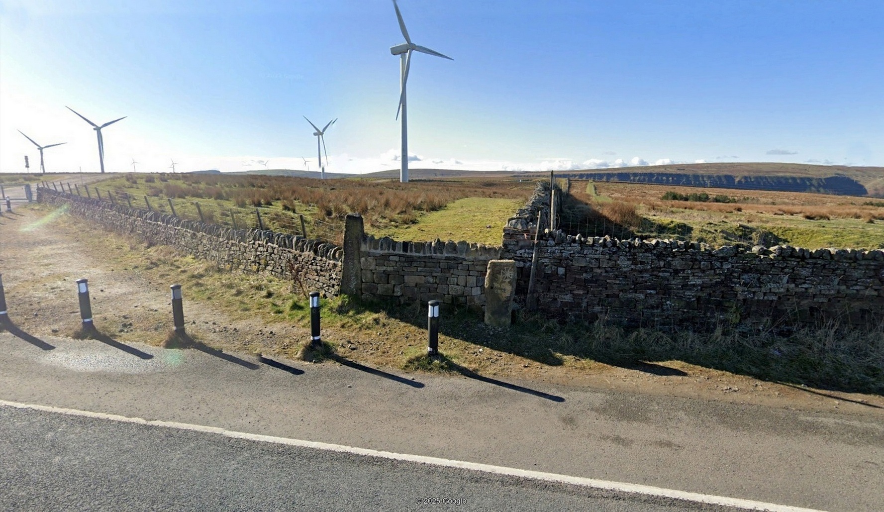
“Maiden Cross” stone
Highlighted on the 1848 Ordnance Survey map, the original stone ‘cross’ has apparently been moved from its location up against the walling 30-40 yards away and placed by the roadside, just as you’re going into where the windmills are, right at the very crown of the hill, across from the car-park. I’m not so sure it’s the original one to be honest—but I may be wrong. Clifford Byrne (1974) certainly thought this is the original stone. He may be wright. Byrne told that “the Marquis of Colne had a photograph of the stump of the cross in situ,” which would be good to compare. It’s nowt special to look at, but at least the site has been remembered, so to speak.
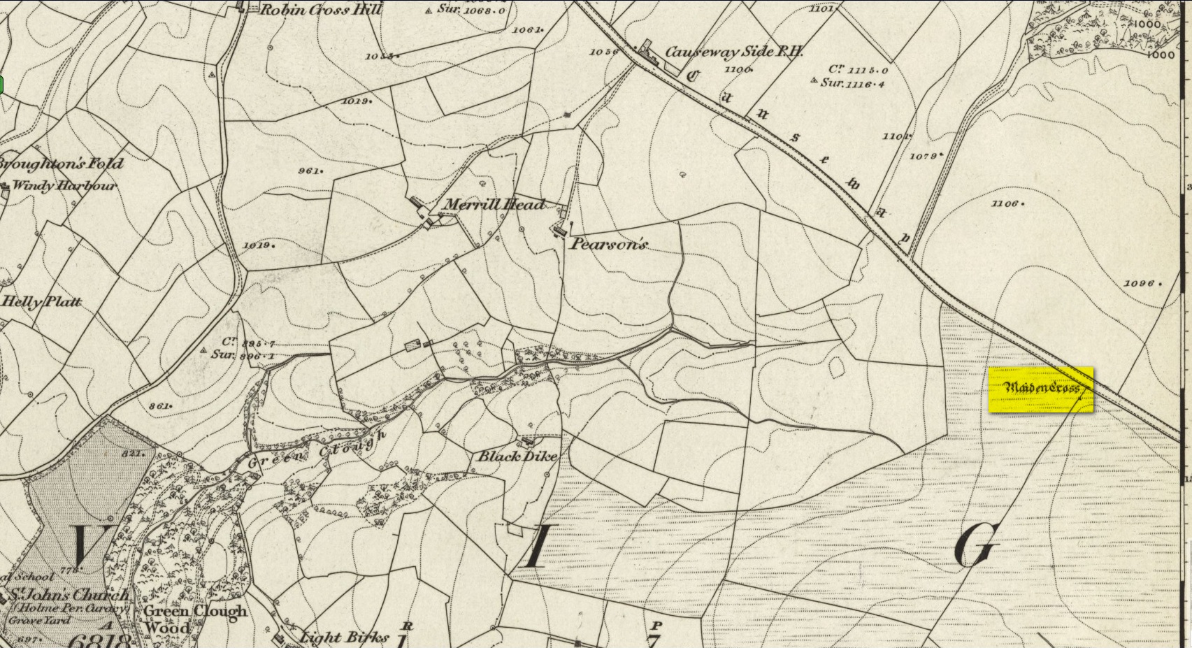
Site shown on 1848 map
The Maiden Cross was one in a series of wayside crosses along this ancient high road—known as the Long Causeway—not only marking it out when the snows covered it in the old Winters that we used to get, but also possessing religious importance to travellers. It was first moved sometime in the 19th century and “utilised as a gatepost into Maiden Cross colliery”—itself long gone.
Folklore
The name given to the ‘cross’ comes from a story that’s found at a number of other ‘maiden’ place-names. There may be an element of truth in it. It was told to the great historian and folklorist T.T. Wilkinson by his grandfather in 1766 and, according to him, his grandfather before that! J.A. Waddington (1884) subsequently wrote down the tale that Wilkinson told him:
“During the time of the great rebellion, this was the trysting-place of a young shepherd with his lady love. Often did they meet to pledge their simple vows at this lonely place, until one day a messenger came from Towneley to collect as many young men as he could get to swell the ranks of Rupert when he passed through this part to join the Royal forces at York, a march which ended with the disastrous fight at Marston Moor, on whose bloody sod lay stretched the chivalrous Towneley, and a many of his followers, including this young man, the victims of a tyrannical and ambitious king. For many a long year after this tragical event the poor demented maiden would repair to this hallowed spot, repeating with a sorrowful voice his promise to return.”
This was curiously described by Ormerod (1906) as “a pathetic tradition”! He much preferred the simple idea of this (and the other crosses along the road) as merely serving “the capacity of guideposts to the traveller (overtaken in a mist or by the swiftly lowering shades of light) who might be traversing these lonely roads”, as Waddington put it. Ormerod cited a conversation he had with “an old road mender” which for him confirmed the idea:
“Asked if he had heard what was the object of these crosses, he said, that “Joonas Lee said as they were put up 250 yer sin, for guideposts for’t pack horses, between Halifax and Brunshaw” (Burnley), adding, as if to give more weight to the authority he had quoted: “An he wur a far larned chap wur Joonas—he wur a preycher.”’
Walter Bennett (1941) meanwhile, thought its name derived from the Virgin Mary and this cross, at least, possessed religious importance.
References:
Bennett, W., The History of Burnley – volume 1, Burnley County Council 1946.
Byrne, Clifford, A Survey of the Ancient Wayside Crosses in North-East Lancashire, privately printed 1974.
Holden, Joshua, A History of Todmorden, Manchester University Press 1912.
Waddington, J. Arthur, ‘The Crosses in and Around Burnley’, in Transactions Burnley Literary & Scientific Club, volume 1, 1884.
Acknowledgements:Huge thanks for use of the Ordnance Survey map in this site profile, reproduced with the kind permission of the National Library of Scotland.
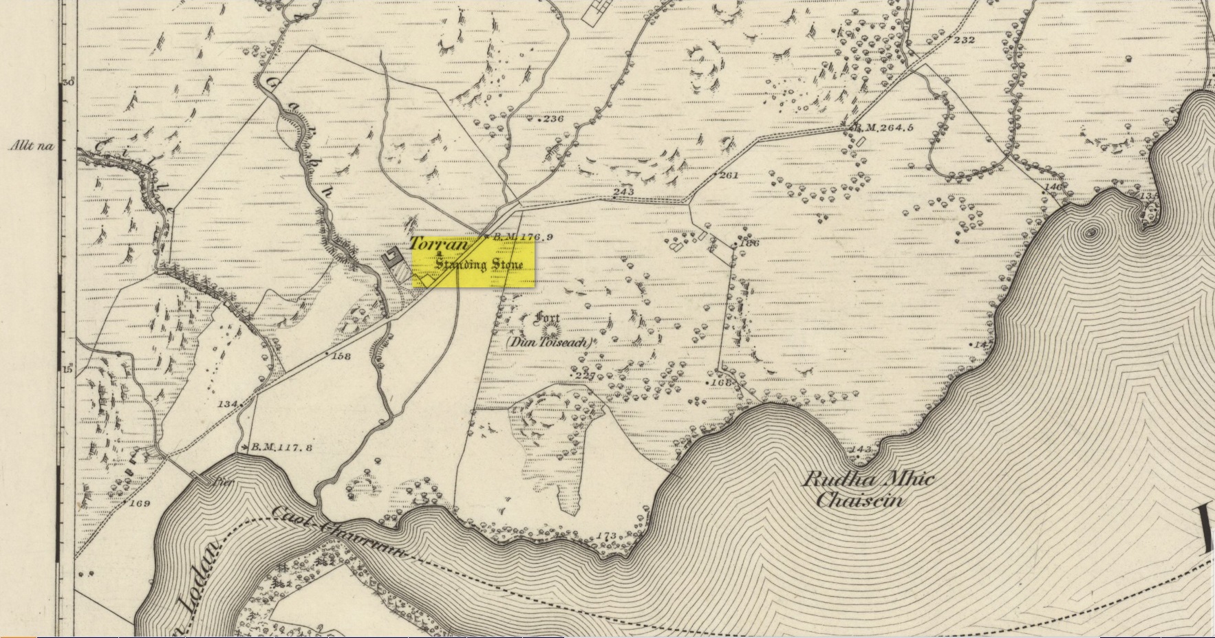
On the A816 road, a mile-and-a-bit north of Kilmartin, take the small road (east) to Ford—passing the Creagantairbh stone on your right, then a bit further on the Auchinellan stone on your left. Go through Ford village, making sure to stick to the road that goes along the north side of Loch Awe — as if you’re heading to Dalavich. Just fractionally over a mile out of Ford village, just where the road begins to swerve into a large bend, there’s a small left-turn that takes you to some houses. Just 60-70 yards along this little road, take the trivial little path on your right that takes you straight to a piece of manicured scrubland. If you walk into it, and bear left, you’ll see what you’re looking for. It’s unmissable!
Archaeology & History
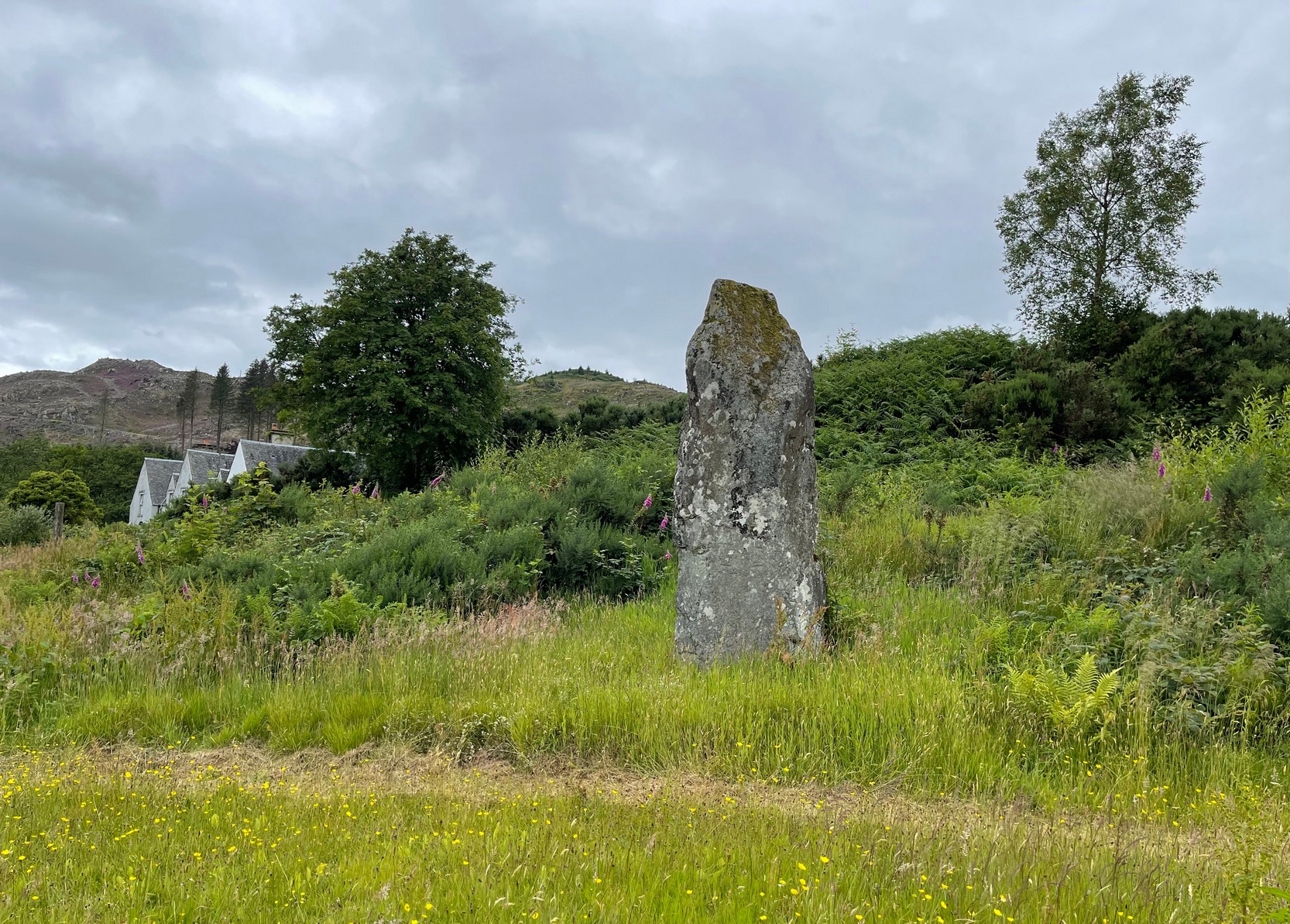
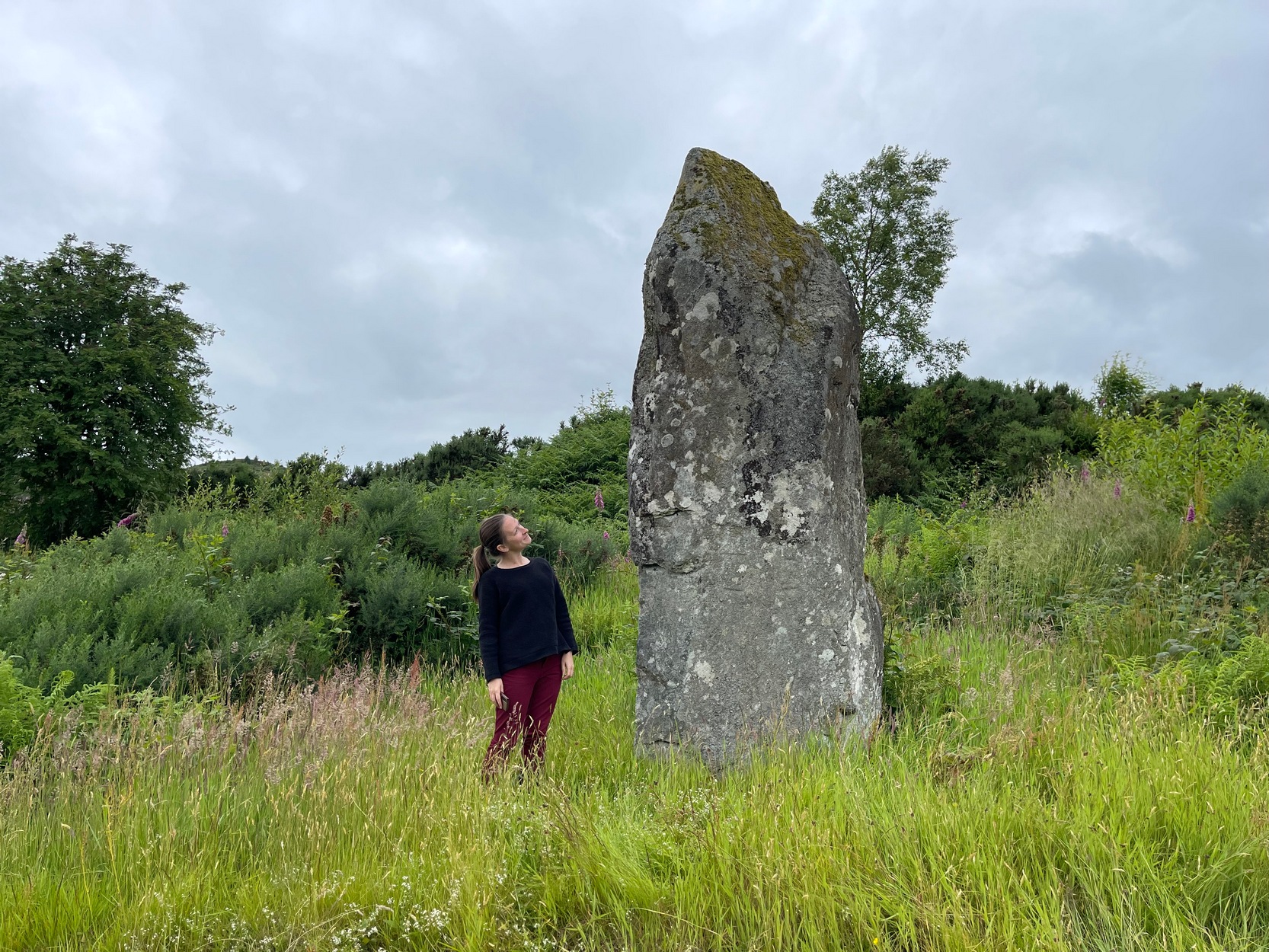
When I first visited here in the 1990s, a farm building stood by this huge standing stone and there were no other houses nearby. How things change—but thankfully our old sentinel stone is still living here.
Site shown on 1875 map
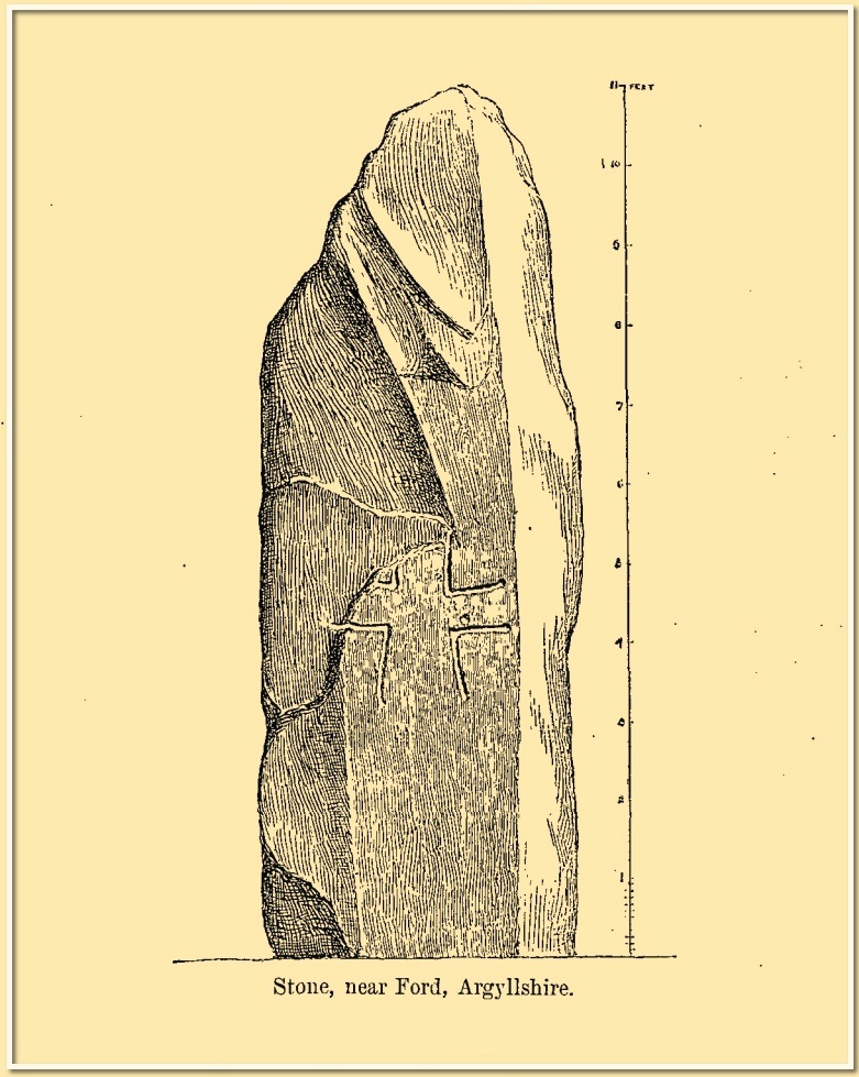
Romilly Allen’s 1880 sketch
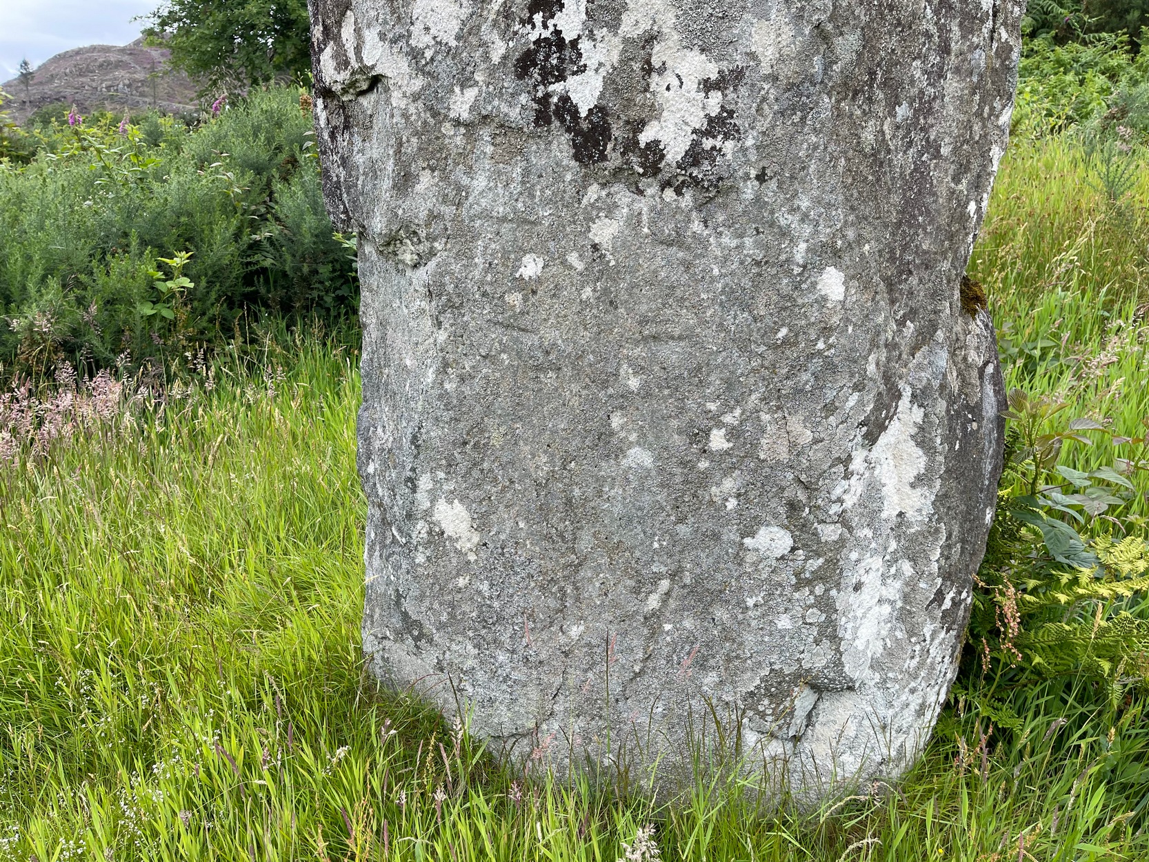
It was highlighted by the Ordnance Survey lads on their early map of the area, and visited a few years later by the great petroglyphic pioneer J. Romilly Allen. (1880) Standing eleven feet tall and more than four feet across at the base, Allen noticed that, about four feet above ground-level, someone had carved an old cross onto the northeast face of the stone (you can just make it out in the attached photos). It had obviously been carved many centuries ago, by a wandering christian no doubt—although it was incomplete and never finished. Perhaps the person who carved it was chased away by local folk, who would have obviously and rightly seen such an act as outright vandalism. The cross was deemed by Ian Fisher (2001) and the Royal Commission (1992) to be medieval in nature. Apparently there’s another, much fainter cross that was first mentioned by Marion Campbell etched on the other side of the stone, but in all the times I came here I was never able to make it out.
Old faint cross carving
Small person, big stone!
But even further back in time someone had carved a cup-marking on the stone—and the cross was etched onto the same spot, enclosing the cup-mark. When I lived nearby, I made a sketch (long since lost) of what seemed to be two other faint cup-marks at one end of the extended arms of the cross, but on our recent visit here these were very hard to make out. When Ron Morris (1981) mentioned the stone in his survey, he mentioned its proximity to other cup-and-ring carvings immediately to the southeast and a hillock thereby, wondering whether there was “an astronomical complex” going on here. I doubt it—but I like the idea!
But it’s the size of the stone that’s most impressive here and keeps up with the tradition of similar megaliths in and around the Kilmartin area. Check the place out when you’re hunting the other stones nearby. You won’t be disappointed!
Folklore
Local tradition ascribed this great stone as marking the grave of an ancient warrior. The full folk tale seems to have been lost.
Fisher, Ian, Early Medieval Sculpture in the West Highlands and Islands, RCAHMS: Edinburgh 2001.
Morris, Ronald W.B., The Prehistoric Rock Art of Southern Scotland, BAR: Oxford 1981.
Royal Commission on the Ancient & Historical Monuments of Scotland, Argyll – Volume 6: Mid-Argyll and Cowal, HMSO: Edinburgh 1988.
Royal Commission on the Ancient & Historical Monuments of Scotland, Argyll – Volume 7: Mid-Argyll and Cowal: Medieval and Later Monuments, HMSO: Edinburgh 1992.
Ruggles, Clive, Megalithic Astronomy, BAR: Oxford 1984.
Swarbrick, Olaf, A Gazetteer of Prehistoric Standing Stones in Great Britain, BAR: Oxford 2012.
Acknowledgements:Huge thanks for use of the Ordnance Survey map in this site profile, reproduced with the kind permission of the National Library of Scotland.
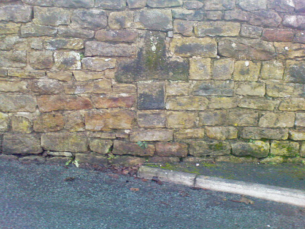
If you’re coming up to Oxenhope from Keighley, up the A6033 road, when you reach the school on the right-hand side of the road, a one-way street (Cross Lane) is where you need to walk down, for 200 yards, and keep your eyes peeled in the walling just before Cross Farm Court. Alternatively, via Haworth, go along Marsh Lane for a few hundred yards until your reach Moorhouse Lane on your left. Go down here for ⅓-mile (0.5km) and then go up Cross Lane on your right. About 120 yards up, in the walling just past the entrance into Cross Farm Court is where you’ll find it.
Archaeology & History
Very little seems to be known about the remains of this cross, embedded into the old walling. When it was described by Brigg & Villy (1914), they could find no information about it, and surmised that it marked the original track or road to Oxenhope from both Haworth and Halifax, “on the line of the old road by Withens.” Ostensibly it would seem to have been a wayside cross, marking old trackways (ley hunters take note!).
Visitors looking at it today can see that it’s barely noticeable. It looked no different even in Brigg & Villy’s days. It simply consists of only part of the original head of the cross, “the shaft having been broken off flush with the horizontal limb.” Some of the other stones that make up the bottom of this very poor-looking excuse of a cross were probably not part of the original, but were assembled into the wall to at least leave of memory of what it used to look like. It’s in a sorry state to be honest. A historic plaque should be placed here.
References:
Brigg, J.J. & Villy, F., “Three Ancient Crosses near Keighley,” in Bradford Antiquary, New Series 6, 1921.
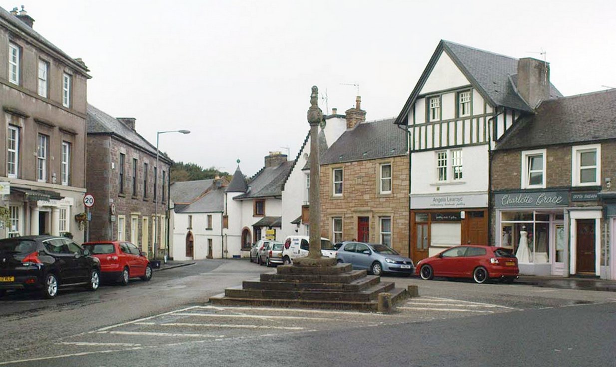
Easy to find: get into the middle of the village where the shops are in the main street and where another road veers off, the cross sits there in the middle in the traffic island. The photo here shows its location clearly.
Archaeology & History
Doune’s Mercat Cross
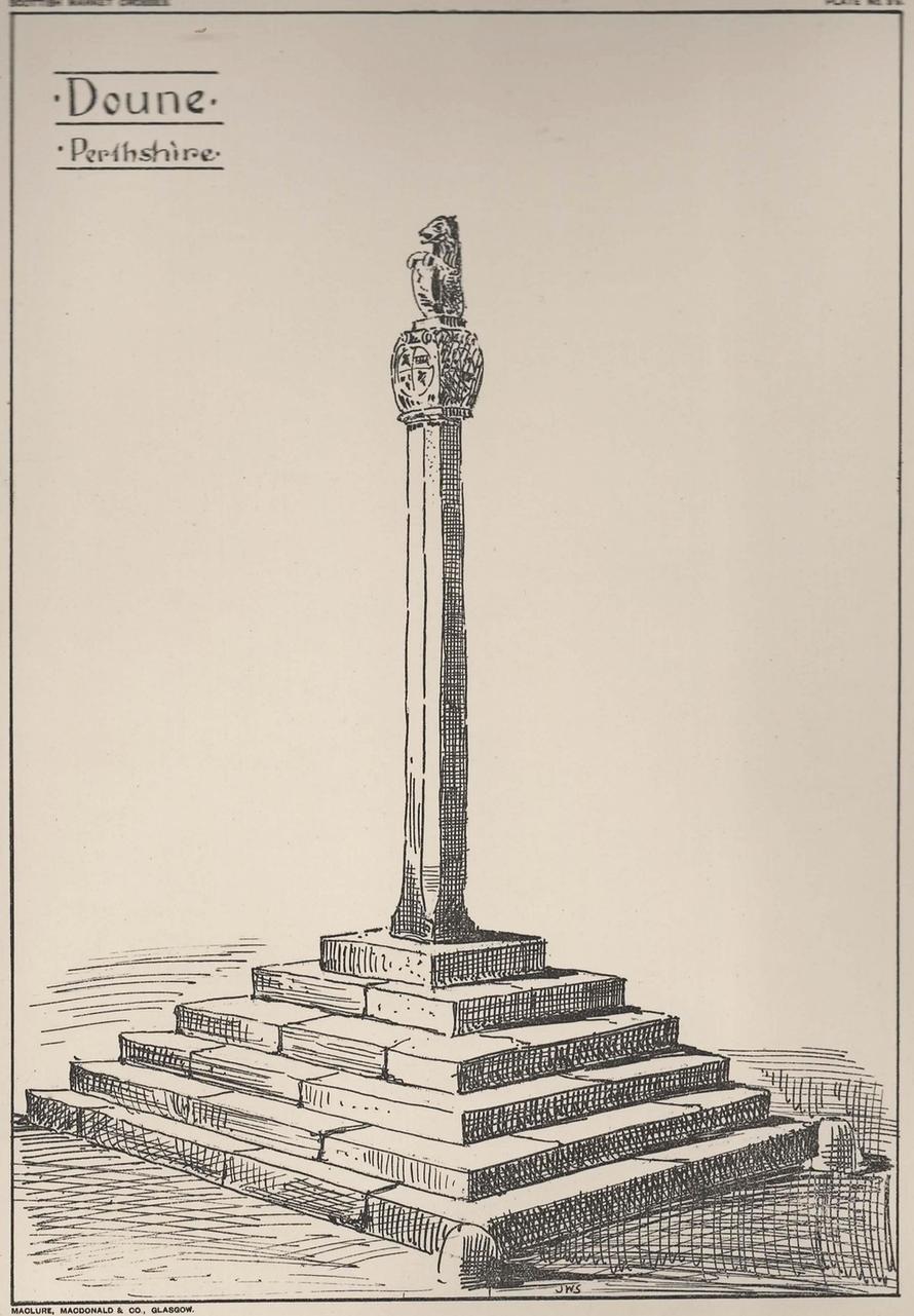
Found at the meeting of the roads in the centre of this old lovely village, the Mercat Cross in its present state was, according to Act of Parliament, erected a few years prior to 1696. Set on a square base of six steps in traditional pyramidal fashion, near the top of the 12-foot tall shaft are carvings on the sides of the stone. On the east-face was carved the Moray arms, and on the west face were carved sundials. John Small (1900) told how the top of the cross is crowned by the figure of a lion, “holding in its paws a circular shield or escutcheon, surrounded by a ribbon enclosing he Moray crest, and bearing the motto, ‘Salus per Christum.’
John Small’s 1900 sketch
It has been damaged a few times over the years. Sometime around 1800, Moray Mackay (1953) told that “the lion fell of and was damaged”, but was repaired shortly afterwards by a local man. He also told, with considerable indignation, how the local authorities were responsible for damaging what used to be “four short pillars which stood at the corners of the base,” when they were “smashed off and removed , impairing the balance of the whole (cross) for the sake of six inches more traffic room”! There are two such short pillars at the edges, but these aren’t the original stones. There used to be a water pump in front of the cross, but this was removed many years ago.
Cross (destroyed): OS Grid Reference – SE 2546 3537
Archaeology & History
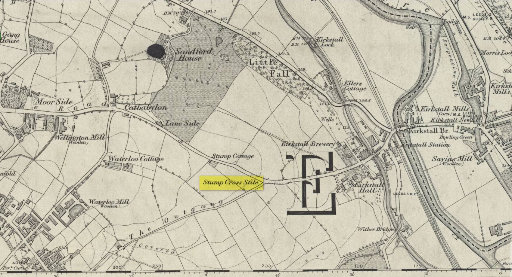
Location of the old cross
In medieval times an old stone cross was erected at the edge of Bramley where two old tracks once met, and which today is the junction where Broad Lane meets with Outgang Lane. The cross is long gone – and even the stone cross base on which it stood no longer existed when the Ordnance Survey lads came here in the 1840s. All that remained when they came here were the place-names which have forever kept a memory of its former existence: Stump Cross Stile and Stump Cottage. It was mentioned, albeit briefly, in Wardell’s (1890) survey of Kirkstall Abbey where he told simply that a
“stone cross formerly stood some distance south of the Abbey by the side of the Old Road to Bradford, at the junction of the lane leading to Bramley, called the Outgang, but no remains of it are left; the site, however, is still known by the name of ‘Stump Cross Stile.’ Whether this cross marked the extent of some boundary, or was erected by the monks or others for the purposes of devotion for wayfarers, I am unable to ascertain.”
References:
Wardell, James, An Historical Account of Kirkstall Abbey, Yorkshire, Samuel Moxon: Leeds 1890.
Acknowledgements:Huge thanks for use of the Ordnance Survey map in this site profile, reproduced with the kind permission of the National Library of Scotland.
Cross (destroyed): OS Grid Reference – SE 3071 3463
Archaeology & History
In James Wardell’s (1890) work on Kirkstall Abbey he describes several of the long lost stone crosses that used to exist in the area. This one,
“formerly stood by the road side at the south end of Sheepscar Bridge, in Leeds.”
The cross had already been destroyed by the time the Ordnance Survey lads explored the area in the 1840s, as there’s no showing of it on any of their maps. Wardell further stated that it was,
“called Killingbeck Cross, from being erected by either the Abbot of Kirkstall or the Vicar of Leeds, of that name.”
References:
Wardell, James, An Historical Account of Kirkstall Abbey, Yorkshire, S. Moxon: Leeds 1890.
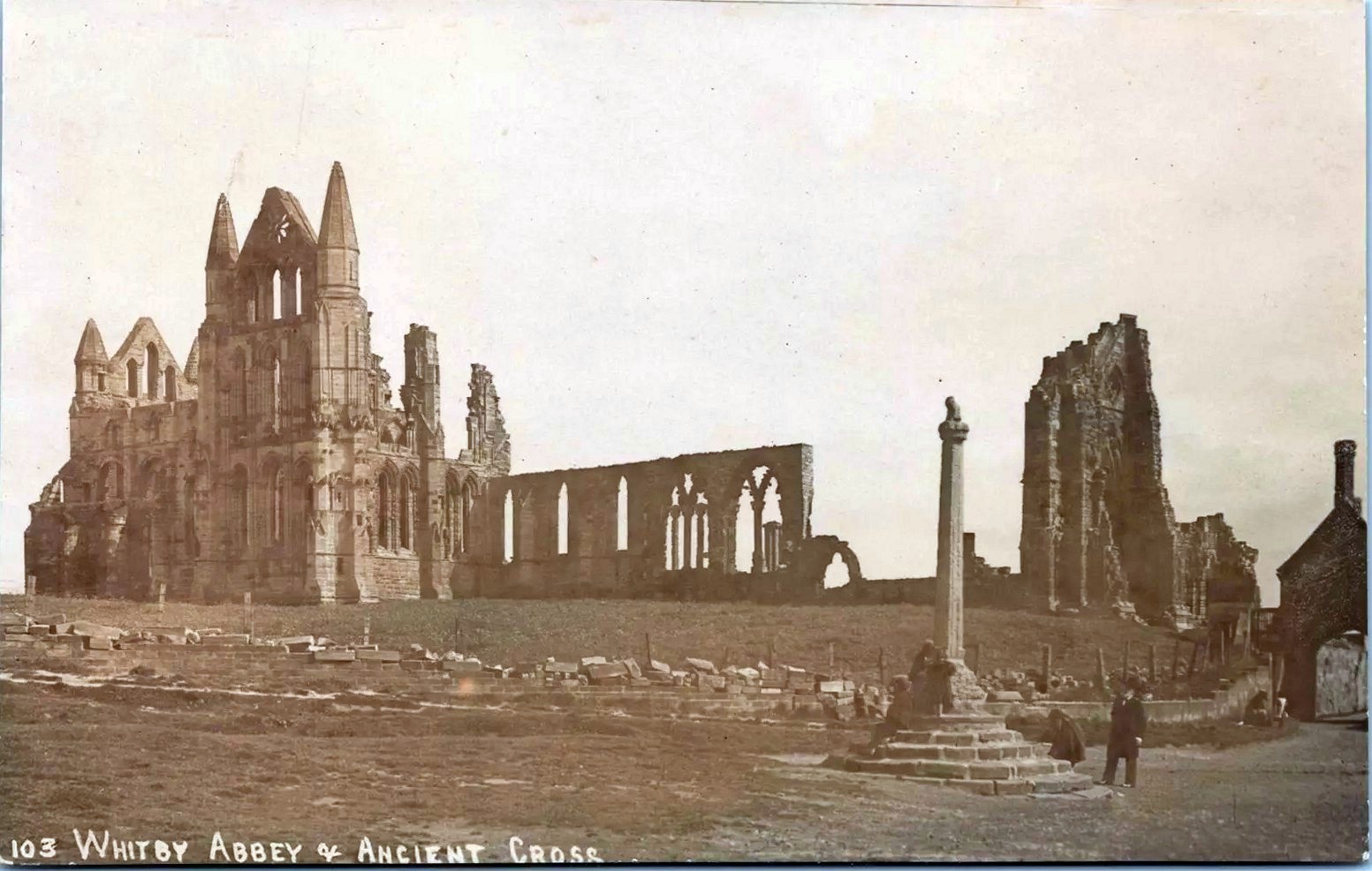
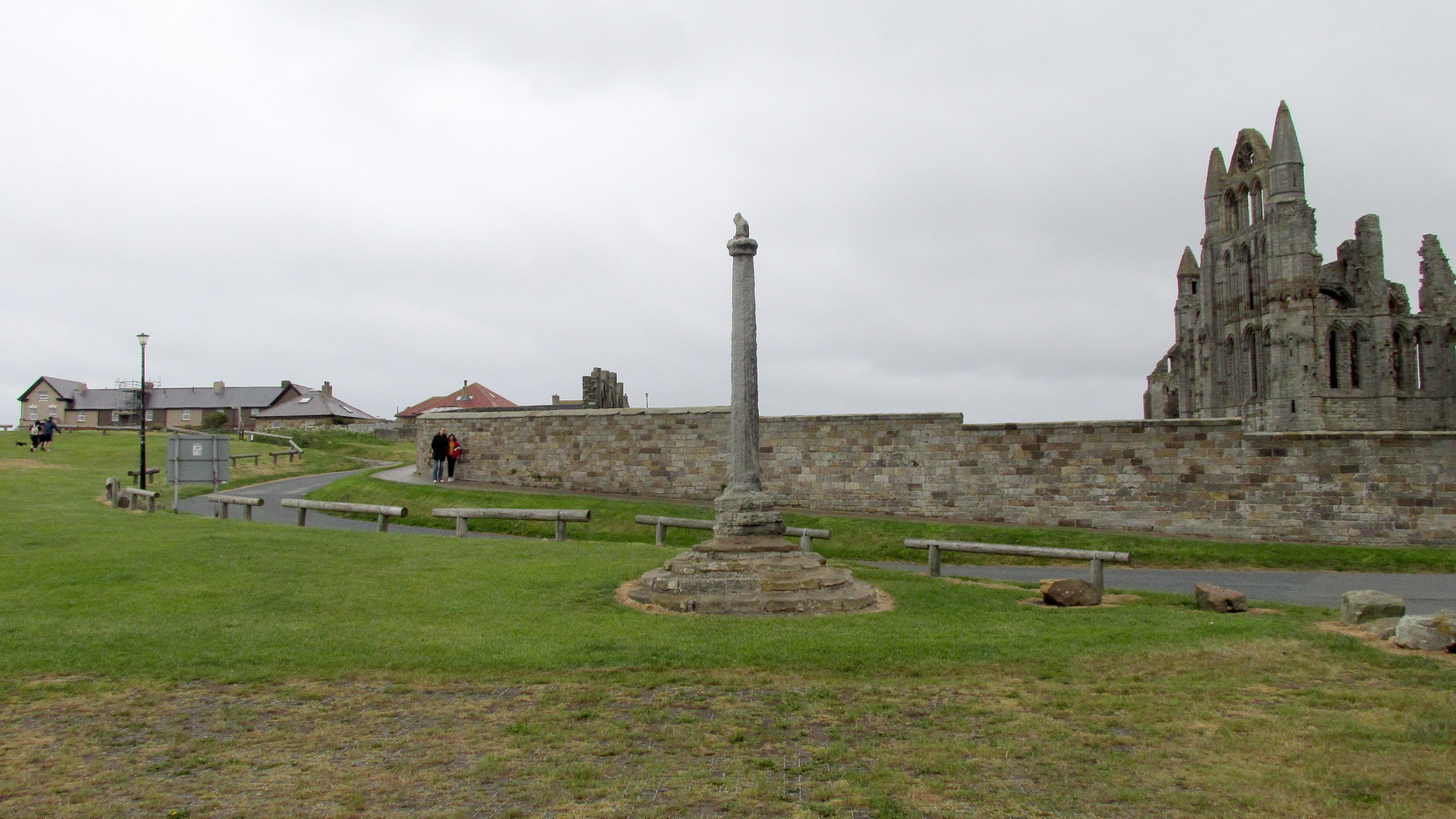
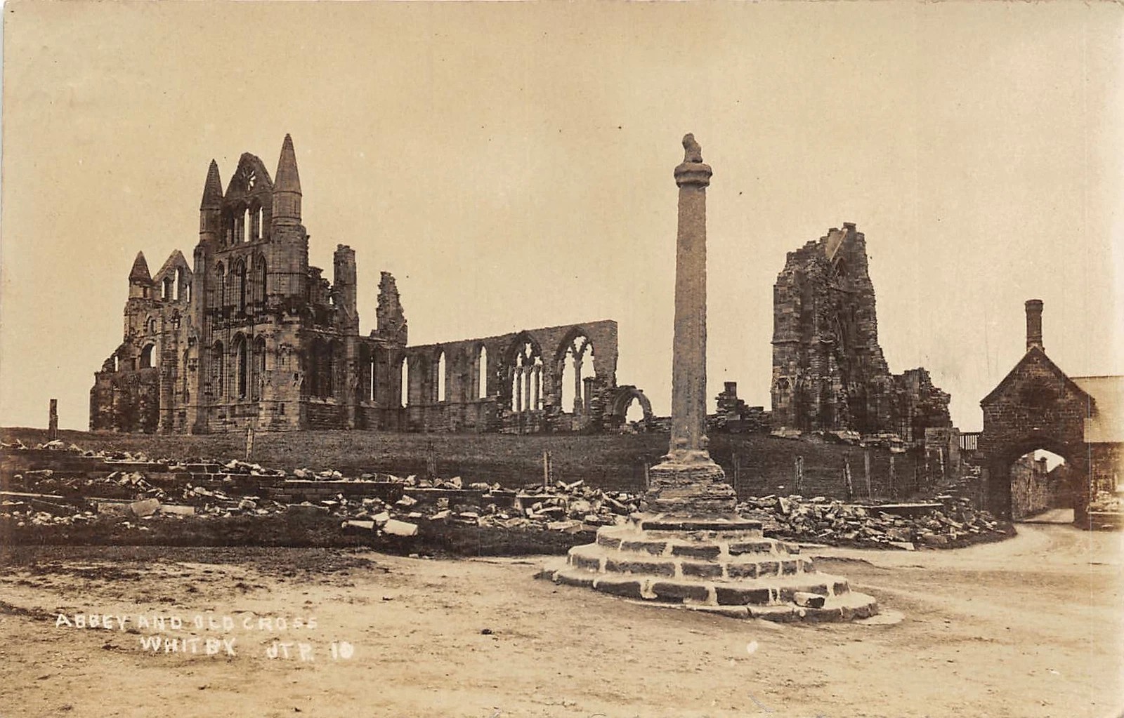
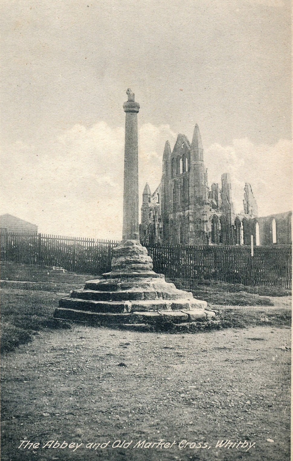
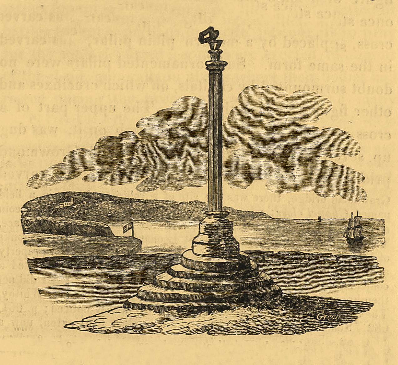
Pretty easy to find: from Whitby town centre, head uphill to the great ruins of Whitby Abbey. You go past Caedmon’s Cross and past the more recent church and graveyard to the car-park at the top, outside the abbey. At the edge of the car-park on the grass, you’ll see this tall hard upright, nice and erect!
Archaeology & History
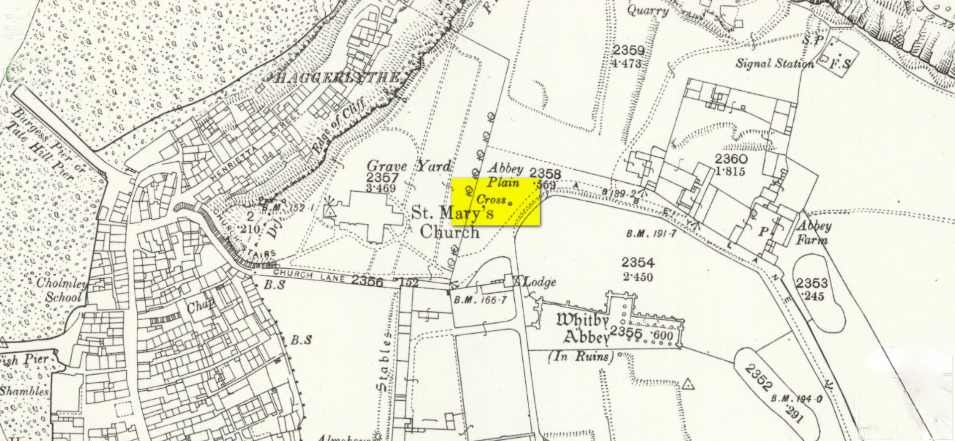
Cross shown on 1894 map
Highlighted on the earliest OS-maps and not to be confused with the nearby and more modern Caedmon’s Cross, this tall large monolith stands upon a stepped plinth comprising of six steps (originally five), about 18 feet high. The top of the cross was knocked off a century or two ago, when it was reported to have been twenty feet! Initially it stood about fifty yards closer to the Abbey, but was removed to its present position following the Dissolution.
The brief history regarding its origin was described in George Young’s (1817) major work, in which he told that in 1474, on John Nightingale, rector of Sneaton parish, in his will “appointed his burial to be on the north side (of the Abbey), before the cross,” which was already standing at that time. Young wrote:
“By this it would appear that the ancient cross, now standing in the abbey plain was then within the cemetery of the abbey.”
Abbey Cross, c.1900Young’s 1817 sketch
This has subsequently been taken as the standard regarding its origin. Tradition also told that it was an old market cross, but this was treated with considerable scepticism by George Young, who believed that the monks here simply wouldn’t have allowed such a thing at the edge the abbey and burial ground. He found evidence to indicate that it “was at the port or harbour of Whitby that corn was bought or sold, that here were kept the standard bushels for measuring corn, and that here the market-clerk had his station.” In spite of this, T.H. Woodwark (1934) reported that fairs had been held at the cross early in the 20th century. In a thoroughly profane way, electrical wiring was wrapped around the bottom of the cross and led to a generator, along with washing-lines running from it to a caravan! Mr Young would have been apoplectic!
References:
Atkinson, J.C., Memorials of Old Whitby, MacMillan: London 1894.
Holt, Robert B., Whitby, Past and Present, Copas: London 1890.
Woodwark. T.H., The Crosses on the North York Moors, Whitby Literary & Philosophical Society 1934.
Young, George, A History of Whitby and Streonshalh Abbey (2 volumes), Clark & Medd: Whitby 1817.
Acknowledgements:Massive thanks to Lindsay (wherefore art thou…?) Mitchell for getting us up here… Huge thanks for use of the Ordnance Survey map in this site profile, reproduced with the kind permission of the National Library of Scotland.
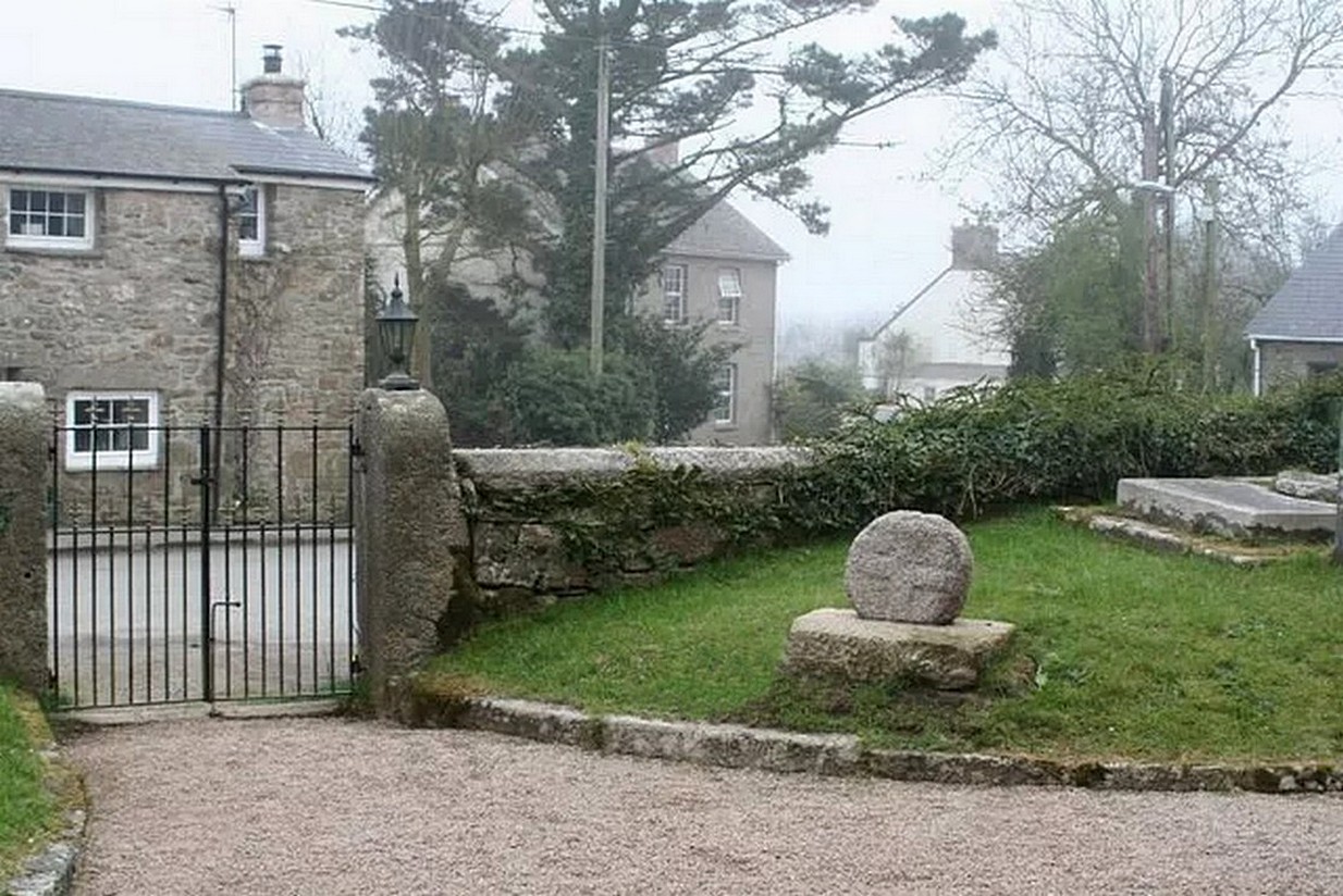
Nice ‘n easy: get into the village and walk through the church gates and there, on your left on the grass verge, a plinth and the cross-head sits before thee!
Archaeology & History
When the great Arthur Langdon (1896) wrote about Crowan’s cross-head, he was puzzled. At the time it was in the garden of a local surveyor in the nearby village of Praze-an-Beeble, but its origins seemed mysterious. The surveyor in question, a Mr William Carah, wrote to Langdon and said,
“It seems a mystery where the cross we have originally came from. A friend of mine, living abroad at present, saw it, I think, at a farm-place, being used as a bottom for a beehive. He asked the people for it, intending to fix it somewhere. At any rate, when he left England he had not done so, and at my request they gave the cross to me.”
The condition of the cross-head wasn’t too good and Langdon suggested it had “received some very rough treatment” – no doubt when it was hacked from its shaft. With his usual precision he gave the dimensions of the cross-head as follows:
“Height, 1 ft. 6 in.; width, 1 ft. 8 in.; thickness: at the bottom 6½ in., at the top 5½ in.
Front. — Part of a small conventional figure of Christ, extending to the knees, at which point the fracture occurred which separated the head from the shaft.
Back. — The remains of a mutilated Latin cross in relief.”
The stone shaft or menhir that once supported this carved head has, it would seem, long since been destroyed.
References:
Blight, J.T., Ancient Crosses and other Antiquities in the West of Cornwall, Simpkin Marshall: London 1858.
Courtney, R.A., The Evolution of the Wheel Cross, Beare & Sons: Penzance 1914.
Doble, Gilbert H., A History of the Parish of Crowan, King Stone Press: Shipston-on-Stour 1939.
Langdon, Andrew, Stone Crosses in West Cornwall, Federation of Old Cornwall Societies 1999.
Langdon, Arthur G., Old Cornish Crosses, Joseph Pollard: Truro 1896.