Walshaw Dean, Wadsworth Moor, West Yorkshire

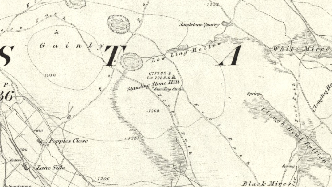
Stone Circle:  OS Grid Reference – SD 9647 3355

Getting Here

Walshaw Dean stone circle

The site is usually invisible, being under the waters of Walshaw Dean Middle Reservoir.  But in good droughts you can catch a glimpse of the place.  So take the Widdop road as it’s known locally, from either Hebden Bridge up past Heptonstall, or from Burnley, Nelson & Colne side, and park-up by the pub a few hundred yards east of Widdop Reservoir.  Walk a few hundred yards back down the road (east) and take the dirt-track on the other side of the road on the Calder-Aire link leading to the Pennine Way.  Walk up past the first reservoir, keeping to its west-side, until you reach the Lodge house where the second lake appears.  Now, if the water’s down, walk along its western-edge for about 50 yards, looking into the dried flat ahead of you and you’ll see the loose ring of small stones.  That’s it!  Or as Mr Roth described the place in 1906, “The position of the circle is on the left-hand side of the valley going up, a few yards above the dam of the second reservoir.”

Archaeology & History

Earliest photo of the circle

This is a somewhat bizarre archaeological site, whose nature we may never fully recover.  Although listed and scheduled as a plain stone circle by Aubrey Burl (2000) and others, both the placement and structure of the site implies a more funerary aspect to it.  This was suggested by Ling Roth (1906) when he first wrote about it.  But for me, the position of the site in the landscape calls into question the archetypal ‘stone circle’ category, as it is somewhat hemmed-in both east and west, with limited views north, and only a good view of open lands to the south (summer).  It’s just a bit odd when compared to other megalithic rings in the Pennines.  But perhaps this ‘privacy’ was intended — as there is only scattered evidence of other human activity in this valley and on the moors above.  Perhaps this site was meant to be ‘cut off’ from the rest of the world.  We might never know…

There is also the peculiar addition inside this stone circle of an arc of walling facing southeast, which is unique in this part of Britain.  But this walling seems to have been a later addition and has the hallmarks of being some small shelter, or even an early grouse-shooting butt (there’s tons of game-birds here, and this would be an excellent spot to shoot from)  This internal wall may have been constructed from stone that came from the circle itself: perhaps in a rubble wall, perhaps an internal cairn.  It seems likely.  Mr H. Ling Roth (1906) also mentions this feature in what was the first description of the site, where he told:

“The stone circle at Walshaw Dean Reservoir…was discovered by Mr W. Patteson, the resident engineer, in July 1902.  The circle consists of ten irregular stones apparently local rock, varying considerably in size, one measured 6ft 3in (1.9m) long and stood about 30 inches (76cm) above the clay when the peat surface was removed.  Whether the stones are deeply embedded has not been ascertained, but where they were covered by the peat a clear white band is apparent.  The circle is 36 feet (11 metres) is diameter and of very fair exactitude.  Inside the circle as shewn on the plan and in the view there was a rouhg carved wall which measured across the ends 12ft (3.7m).  The wall had been partly pulled down and reset immediately before examination by a party of visitors soon after the discovery.  Its presence in the circle may be fortuitous, but after the two unsystematic disturbances to which the ground had been subjected, it is not possible to form an opinion about it.  That something had been buried in the centre of the circle is probable when we bear in mind the circumstances of stone circles elsewhere, but an examination shewed only that the ground had been disturbed and Mr Patteson explained to me that such disturbance was not of recent date.”

To my knowledge, no subsequent excavation of the site has ever been done, but it would appear that the waters have washed part of the site away and any remains that may once have been found within the ring have been discarded by more than a century of erosion.  Traces of small walled structures have also been noted close to the circle in recent years, suggestive of settlement remains.  On a TNA outing last year, we also found previously unrecorded prehistoric remains on this hills above here.  When Geoffrey Watson (1952) wrote his survey on prehistoric Calderdale, he suggested that the Walshaw Circle may have been placed alongside the branch of an early trade route running along the northern edge of the valley.  Not so sure misself…

References:

  1. Bennett, Paul, The Old Stones of Elmet, Capall Bann: Milverton 2001.
  2. Burl, Aubrey, The Stone Circles of Britain, Ireland and Brittany, Yale University Press 2000.
  3. Roth, H. Ling, The Yorkshire Coiners, 1767-1783; and Notes on Old and Prehistoric Halifax, F.King: Halifax 1906.
  4. Watson, Geoffrey G., Early Man in the Halifax District, HSS: Halifax 1952.

Links:

  1. Walshaw Dean Stone Circle on The Megalithic Portal

© Paul Bennett, The Northern Antiquarian 


Greenwood Stone, Midgley Moor, West Yorkshire

Boundary Stone:  OS Grid Reference – SE 01652 28514

Getting Here

Greenwood Stone, Midgley Moor

Follow the directions to reach Churn Milk Joan, the head 100 yards east till reaching the crossing of footpaths, beneath Crow Hill.  Take the northern (left) route and keep walking.  Half a mile along you’ll see the tall upright stone to your left.  You can’t really miss it!

Archaeology & History

The Greenwood Stone is an old boundary stone and is not prehistoric.  It stands more than four feet tall.  I first visited the site in 1988 in the company of several folklore and antiquarian writers, including Andy Roberts, Edna Whelan and Graeme Chappell.  Twas a good day and coincided with a small collection of Psilocybes being gathered!

The tall upright is a boundary stone that was erected in 1775, as evidenced by the date carved on its southern face.  I must emphasize however that this was not when the stone came to acquire its name: this was defined in 1594 as evidenced by a boundary perambulation written that year where it is described as being recumbent: “thence to one lying stone, newly named Greenwood Stone.”  About 10-15 yards away is what may have been that very “lying stone,” the original Greenwood Stone, half-buried in the heather some six or seven feet long.   It is possible this may have stood upright in the distant past.

Greenwood Stone, looking south

Moving about 75 yards south we come across another small standing stone at 1360 feet (412m) above sea level. This I’ve called the ‘Greenwood B stone’.  It was marked on an old map as a boundary stone and is distinctly shaped to stand upright, marking a point separating the moors of Midgley and Wadsworth.  When stood upright it is just visible on the horizon when looking from the Miller’s Grave prehistoric tomb several hundred yards east of here and is close to being an equinox indicator.

References:

  1. Bennett, Paul, The Old Stones of Elmet, Capall Bann: Milverton 2001.

© Paul Bennett, The Northern Antiquarian 


Standing Stone Hill, Heptonstall, West Yorkshire

Standing Stone:  OS Grid Reference – SD 95355 30184

Getting Here

Standing Stone Hill monolith

From Hebden Bridge, go up the Heptonstall road, going round the village and onto and through Slack, keeping straight on the road until it goes uphill for a short distance, then levels out; then watch out for the small right-turn and the single-track road heading to a dead-end.  Go right to the end, the very end, and go through the gate and walk up the track onto the moor.  As you reach the ridge and the moorlands north open-up before you, note the small ‘standing stone’ on your right, about 10 yards off-path.  Go up past it, following the path up the small hill and keep going till you hit the triangulation pillar.  From here, keep walking on the same path ESE for another 200 yards.  Y’ can’t miss it!

Archaeology & History

The name of the place rather gives the game away a bit, yeah…?  When I first moved to nearby Hebden Bridge in the 1990s, I noted the conspicuous place-name ‘Standing Stone Hill’ on the maps — so when I met local earth-mystery enthusiast John Billingsley and asked him about any remains up here, he said, with conviction, “there’s nowt up there!” (or words to that effect)

“Are y’ sure?” I asked. To which he repeated his dictum. But I wasn’t convinced of his words and, like any decent chap with energy for old stones and such things, wouldn’t take ‘no’ for an answer and went to check for myself – and wasn’t too surprised when I found this lovely looking standing stone — and a fine specimen of a monolith it is indeed!

Standing stone, looking south
Standing Stone, looking east

Although not a tall specimen by any means, this rounded and weather-worn upright has fine character and age to it.  Standing more than 3 feet in height and nearly as wide, the stone has a faded but distinct artistic carving of the letter ‘T’ on its western face (which you can make out on the photo, hopefully).  It was thought this may have been an old boundary marking, but the stone aint on any boundary line so possibly relates to some local family who marked it with that deluded notion of ‘ownership’ of this part of the desolate moors.

It’s a beautiful spot up here, out on its own.  I’ve sat here many times, both alone and with good heathen friends, gazing across the endless silence on days coloured with snows, mists, bright sunshine and heavy rains.  It has that feeling of solitude, of being forgotten, of being truly untouched.

Standing Stone Hill on 1851 map

There are a couple of other possible standing stones on this section of moorland.  One in particular appears to have been taller in bygone times and is marked on the 1851 OS-map of the region about 100 yards southwest of the triangulation pillar (you’ll notice it on your right, off-path, as you’re walking towards the pillar—shown at the position on the map here, right).  Further west is the tall medieval Reaps Cross, where corpses were rested in their journey over the moors.

References:

  1. Bennett, Paul, The Old Stones of Elmet, Capall Bann: Milverton 2001.

© Paul Bennett, The Northern Antiquarian


Robin Hood’s Penny Stone, Midgley Moor, West Yorkshire

Legendary Rock:  OS Grid References – SE 01831 28436

Also Known as:

  1. Robin Hood’s Pennystone
  2. Robin Hood’s Rock

Getting Here

If you follow the directions to reach the Churn Milk Joan stone, then continue onto the moor following the same directions to find the Miller’s Grave, once you’ve reach this you’ll see a large rounded boulder a couple of hundred yards away on your left, to the northwest.  That’s Robin Hood’s Penny Stone!

Archaeology & History

Robin Hood’s Pennystone, Midgley Moor

In terms of this site’s archaeology, it has none to write home about in official records (other than a few flints found nearby), but there’s more to this place than meets the eye.  A large rounded boulder sat upon the moorland plain with a large Nature-worn bowl on its top, the site is some 112 yards (102m) northwest of the little-known, but impressive Miller’s Grave prehistoric cairn (close to being a midsummer/midwinter line).  North and south of the rock are small lines of prehistoric walling — though their context is difficult to assess.  The Greenwood Stone and Greenwood B stone can be found about 200 yards west.

Folklore

A singular footpath once led up to this old boulder, atop of which – in its large ‘bowl’ – vinegar used to be poured. In this, coins were left by local people who suffered the plague and in return food was left for them.  And of course it is said that Robin Hood frequented the place in bygone times.

References:

  1. Bennett, Paul, The Old Stones of Elmet, Capall Bann: Milverton 2001.
  2. Robert, Andy, “Our Last Meeting,” in NEM 37, 1989.
  3. Robert, Andy, Ghosts and Legends of Yorkshire, Jarrold: Sheffield 1992.

© Paul Bennett, The Northern Antiquarian


Churn Milk Joan, Midgley Moor, West Yorkshire

Standing Stone:  OS Grid Reference – SE 01974 27684

Also Known as:

  1. Saville’s Low

Getting Here

Churn Milk Joan, Midgley

From the village of Midgley, high above the A646 Halifax-to-Todmorden road, travel west along the moorland road until you reach the sharp-ish bend in the road, with steep wooded waterfall to your left and the track up to the disused quarry of Foster Clough.  Go up the Foster Clough track for 100 yards and, when you reach the gate in front of you, go over it but follow the line of the straight walling uphill by the stream-side (instead of following the path up the quarries) all the way to the top. Here you’ll see the boundary stone of  Churn Milk Joan.

Archaeology & History

The present large standing stone you see before you isn’t prehistoric.  However, the small broken piece on the ground by its side may have been its prehistoric predecessor; and there is certainly something of an archaic nature here — albeit a contentious one — as we find old cup-markings cut into its eastern face.

Two ‘cup-marks’ on eastern face

The upright is roughly squared and faces the cardinal points.  It was described in Mr Heginbottom’s  (1977) unpublished survey on Calderdale rock art, where he described there being a few cup-markings inscribed on its east- and south-facing edges, some of which may be prehistoric — though they would obviously have had to have been carved upon the upright stone when it still lay earth-fast.  However, we must posit the the notion (unless some of you have better ideas) that the tradition of etching cup-marks onto rocks was still occurring in this part of Yorkshire until the late Middle Ages, as this stone was, as we know from boundary records, only placed upright to mark the meeting of the three boundaries of Wadsworth, Hebden Royd and Sowerby.

Churn Milk Joan’s other name, Saville’s Low, originates from the great Saville family who owned great tracts of land across the region in the fourteenth century, possibly when the Churn Milk Joan we see today was created.  The word “lowe” may derive from the old word meaning, “moot or gathering place,” which this great stone probably served as due to its siting at the junction of the three townships.*

Folklore

In modern times the stone has become a focus for a number of local pagans and New Agers who visit and ‘use’ the site in their respective ways at certain times of the day, albeit estranged (ego-bound) from the original mythic nature of the site.

The name of the stone comes from an old legend about a milk-maid named Joan who, whilst carrying milk across the moors between Luddenden and Pecket Well, got caught in a blizzard and froze to death.  When her body was found many days later, the stone we see here today was erected to commemorate the spot where she died.  Although such a scenario is quite likely on these hills, as Andy Roberts (1992) said,

“Considering the sheer amount of sites with similar legends this explanation is unlikely to be true and we should looker deeper for the meaning behind Churn Milk Joan, to be found in its positioning in the landscape and ourindividual feelings about it.”  [see profiles for the Two Lads and the Lad o’ Crow Hill sites)

The monolith’s other title, Churnmilk Peg, is the name given to an old hag who is said to be the guardian of nut thickets.  How this female sprite came to find her abode upon these high hills is somewhat of an enigma, but it was first stated as such in an article by Andy Roberts (1989) in “Northern Earth Mysteries” magazine.  E.M. Wright (1913) noted this supernatural creature in her work on folk dialect, describing it as a West Yorkshire elemental who, along with another one known as Melsh Dick:

“are wood-demons supposed to protect soft, unripe nuts from being gathered by naughty children, the former being wont to beguile her leisure by smoking a pipe.”

Another legend of the stone tells how it is said to spin round three times on New Year’s Eve when it hears the sound of the midnight bells at St. Michael’s church (St. Michael was a dragon-slayer) at Mytholmroyd in the valley below.  Another piece of folklore tells that coins used to be left in a small hollow at the very top of the stone which, according to Haslem (1981), was “a gift to the spirit world, to bring luck” – a common folk motif.  It may equally originate from the custom of it as a plague stone.  This tradition of leaving coins atop of the stone is still perpetuated by some local folk.

Mr Haslem also made some interesting remarks about the nature of Churn Milk Joan standing as a boundary stone, representing something which stands not just as a physical boundary, but as a boundary point between this and the Other- or spirit world.  In folklore, streams and rivers commonly carry this theme.  But here on Midgley Moor, as a standing stone at the junction of three boundaries, we may be looking at the place as an omphalos: a centre point from which the manifold worlds unfold. (see Almscliffe Crags, the Ashlar Chair and the Hitching Stone)

The other motif here, of milk and snow [both white], have been speculated to represent power of the sun at midwinter, and geomantically we find the position of the stone in the landscape exemplifying this: it stands midway in the moorland scenery facing south, the direction of solar power, yet is bounded as an equinox marker from east and west.  The winter tales it has nestled around it are merely complementary occult augurs of its more wholesome elements at this point in the hills.

There is however, another much more potent element that has not been conveyed about the site and its folklore—and one which has more authenticity and primary animistic quality.  Regardless of ‘Joan’ or ‘Peg’ being the elemental preserved in the landscape title, the ‘churning’ in its name and the ‘spinning’ of the stone in myth at the end of one year and the start of the next at New Year, are folk memories of traditional creation myths that speak of the cyclical seasons endlessly perpetuated year after year after year, in what Mircea Eliade (1954) called the ‘myth of the eternal return.’  As season follows season in the folk myths of our ancestors, everything related to the natural world: a world inhabited (as it still is) by feelings and intuitions learned from an endless daily encounter, outdoors, with the streams, hills, gales, snow and fires.  Their entire cosmology, as with aboriginal people the world over, saw the cycles of the year as integral parts of their daily lives.  Here, at Churn Milk Joan with its central landscape position along an ancient boundary, the churning and turning of the year was commemorated and mythologized year after year after year; with maybe even the Milky Way being part of the ‘milk’ in its title, from which, in the shamanistic worlds that were integral to earlier society, the gods themselves emerged and came down to Earth.

References:

  1. Bennett, Paul, The Old Stones of Elmet, Capall Bann: Milverton 2001.
  2. Eliade, Mircea, The Myth of the Eternal Return, Bollingen 1954.
  3. Haslem, Michael, “Churn Milk Joan: A Boundary Stone on Midgley Moor,” in Wood and Water, 1:8, 1980.
  4. Heginbottom, J.A., “The Prehistoric Rock Art of Upper Calderdale and the Surrounding Area,” Yorkshire Archaeology Society 1977.
  5. Ogden, J.H., “A Moorland Township: Wadsworth in Ancient Times,” Proceedings of the Halifax Antiquarian Society, 1904.
  6. Robert, Andy, “Our Last Meeting,” in NEM 37, 1989.
  7. Robert, Andy, Ghosts and Legends of Yorkshire, Jarrold: Sheffield 1992.
  8. Wright, Elizabeth Mary, Rustic Speech and Folk-Lore, Oxford University Press 1913.

* The great stone at the cente of the Great Skirtful of Stones, Burley Moor, which previously stood at the centre of the Grubstones Circle, was just such a moot stone.  Upon it is carved the words “This is Rumble’s Lawe”.

© Paul Bennett, The Northern Antiquarian


Roms Hill, Wadsworth, Hebden Bridge, West Yorkshire

Standing Stone:  OS Grid Reference – SE 0080 3261

Getting Here

Roms Hill Stone

Whether coming from Hebden Bridge or Oxenhope: at the very top of the long uphill road, at the very top where a small radio station sits by the roadside (the views from here are effing superb!) – stop! On the opposite side of the road from the radio station, get over the fence (I think there’s a gate nearby) and walk roughly westwards down the gently inclining grassland slope.  Keep westward-ish for about 200 yards (if that) and you’re damn close!

Archaeology & History

Rediscovered in January 2002, this is a very curious stone, over a metre in height, isolated on the southern edge of Roms Hill, close to the folklore-sounding Halfpenny Hole Clough, near the very top of the hill between Hebden Bridge and Oxenhope. The base of the stone is almost wedged into a space between two rocks and its positioning here seems quite deliberate.  It stands upon a small geological ridge in the ground that stretches for some distance, east and west, either side of here.

Roms Hill Stone in good fog!

Despite this, it seems unlikely to have an authentic prehistoric pedigree, but as there’s little else been said of the stone (apart from Dave Shepherd’s (2003) article on local megalithic remains, many of which are highly dubious as archaeological remains), it deserves a mention here.  It’s not recorded in any of the old boundary records — unlike the upright boundary stone that can be found a few hundred yards northwest of here on the same moorland plain.

The land here has an etymological relationship with the Roms Law (or Grubstones) Circle on Rombald’s Moor, but as yet we can ascertain little more about this site.  Well worth a visit — if only for the superb views it affords!

References:

  1. Shepherd, David, “Prehistoric Activity in the Central Pennines,” in Transactions of the Halifax Antiquarian Society, volume 11 New Series, 2003.

© Paul Bennett, The Northern Antiquarian


Dove Stones, Widdop Moor, West Yorkshire

Legendary Rocks:  OS Grid Reference – SD 9333 3479

Also Known as:

  1. Dew Stones

Getting Here

Dove Stones (after ‘QDanT’)

Get to Widdop reservoir in the hills west of Hebden Bridge and park up. The great rock faces to your right (north) is where you’re going. Clamber to the top until the moor levels out, making sure you head NNW for less than a mile. The moors you’re now on are supposed to be private – but folk like me pay no attention!  There are no footpaths to this great outcrop, only the heathlands and scattered stones – but keep walking for a half-mile north and you’ll get to them!

Archaeology & History

Erroneously ascribed by the place-name masters Eilert Ekwall and A.H. Smith (1961) as being ‘a place where doves gathered,’ this gigantic rock outcrop on the Yorkshire-Lancashire border — as shown on early maps — is actually the Dew or Black Stones (from the Gaelic, dubh).  It’s an awesome place!  Takes a bitta getting to, but it’s well worth the venture.

Dove Stones on 1848 map

This long geological ridge, rising higher as you walk along it to the north, has the occasional cup-mark on it, with the giant Dove Stone at the very end having a cup-and-half-ring on its crown (be careful not to fall off). From here, you look across a huge, desolate, U-shaped valley, the far side of which we rise to 1700 feet and the grand setting of the Lad Law.

Folklore

The folklorists Harland and Wilkinson (1882) included this in their survey of druidical sites, mentioning the several cup-markings, or druid basins as they called them. (though most of ’em on here are Nature’s handiwork)

For me, this is an incredible place – full of raw power and magick. It has a curious geomantic relationship with the Whinberry Stones, a couple of miles to the south, around which should be a ring of stones…though none can be found.

References:

  1. Bennett, Paul, The Old Stones of Elmet, Capall Bann: Chieveley 2001.
  2. Harland, John & Wilkinson, T.T., Lancashire Folk-lore, John Heywood: Manchester 1882.
  3. Smith, A.H., Place-Names of the West Riding of Yorkshire – volume 3, CUP 1961.

Links:

  1. More images of the Dove Stones

© Paul Bennett, The Northern Antiquarian