Maen Achwyfan, Whitford, Flintshire

Cross: OS Grid Refence – SJ 129 788

Also Known as:

  1. The Stone of Lamentation
  2. St Cwyfan’s Stone

Getting Here

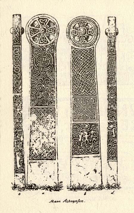
Maen Achwyfan Cross (after J.O. Westwood)

Go north on the A5026 from the town of Holywell for about 3 miles; at the hamlet of Lloc take the turning first right towards Trelogan village for another mile – the ancient cross stands in the corner of a field at the junction of 3 roads at the turning from Whitford to Trelogan, halfway between Whitford and Sarn. The cross can also be reached via Pantasaph from the A55.

History

The cross probably dates from 1000 AD and is said to be the tallest wheel-headed cross in Wales, standing at 11 feet 3′ in height. The metal fence surrounding the cross spoils the monument quite a bit, but it is there for security reasons.  It is richly decorated on all sides and on the cross-head. Much of the decoration is Celtic in origin, but there are also Viking influences here, probably Northumbrian. On the south face there is a human figure standing on a serpent that has associations with the Norse god Odin; also a three-legged horse that may also be connected to Odin. The north-west face has Celtic pattern-work in the form of the letter “X” and below that another figure (naked) holding a spear. The north-east face is rather eroded, but there is some Celtic-style decoration. There is more knotwork and chainwork elsewhere on the cross with other animal figures.  The wheel-head has a distinctive central boss and a four star-shaped cross radiating from the boss.

Folklore and Legend

The cross is also called ‘The Stone of Lamentation’ because penances were carried out at the cross in the Middle Ages. This act would have concluded with weeping and the ‘act of contrition’ by pilgrims visiting the site whilst making their way between St Winifred’s Well and St David’s.  Legend says that St Cwyfan, a local 7th century Celtic saint preached on this site and set-up the cross – hence the name, Maen Achwyfan.  One local legend tells us that Queen Boudica fought her last battle against the Romans close by in the fields called ‘Cydio ar Leni’ or ‘The fields of the seizing legions’.  During the Middle Ages the monks of Basingwerk Abbey preached at the cross and also set up a chapel for pilgrims just to the south at Whitford.

References:

  1. Allen, J. Romilly, “Celtic Crosses of Wales”, in Archaeologia Cambrensis, 1899.
  2. Owen, Rev. Elias, Old Stone Crosses of the Vale of Clwyd and Neighbouring Parishes, Bernard Quaritch: London & Oswestry 1886.
  3. Sharkey, John, Celtic High Crosses of Wales, Carreg Gwalch: Llanrwst 1998.
  4. Westwood, J.O., Lapidarium Walliæ – The Early Incised and Sculptured Stones of Wales, Oxford University Press 1879.

Copyright © Ray Spencer 2011

Newhall Bridge, Kenmore, Perthshire

Standing Stones:  OS Grid Reference – NN 7926 4668

Also Known as:

  1. Canmore ID 24910
  2. Newhall Stones
  3. Taymouth Standing Stones
Newhall Stones, Kenmore

Getting Here

Pretty easy to find.  At the eastern end of Loch Tay, go through the old village of Kenmore along the A827, towards Aberfeldy, for about a mile.  At least a mile past Kenmore, keep your eyes peeled for a small left turn which takes you back into the grounds of Taymouth Castle.  Go on this small road, pass the ornate walling, and you’ll see these two standing stones in front of you, before the trees, on the left.  If you reach the Croftmoraig Stone Circle, you’ve gone a few hundred yards past the turning.

Archaeology & History

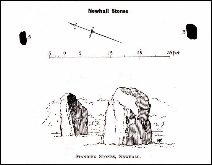
Fred Coles’ drawing & lay-out

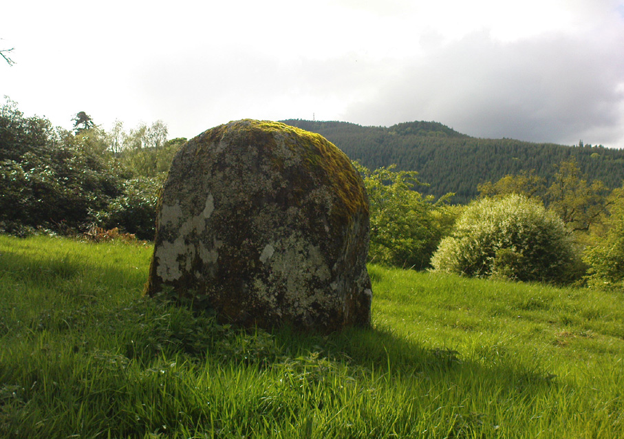
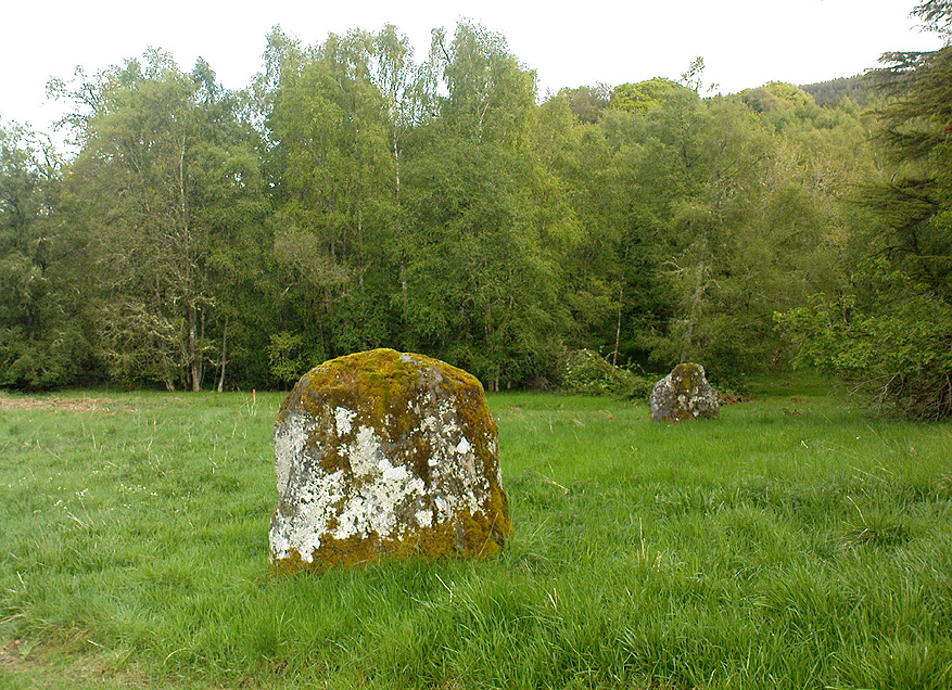
These fine-looking standing stones a mile northeast of Kenmore village, on the edge of the grounds of the superb Taymouth Castle, are worthy old monoliths, encrusted by the lichens of many centuries, resting within the long grass beside the track that runs to the castle.  But they have received little attention in archaeological terms.  When Fred Coles (1910) described them, he thought them to be the remains of a stone circle — an impression echoed by Margaret Stewart (1966) many years later (I got the same impression aswell), but no other stones have been found to substantiate this (although Mr Gillies’ folklore remnant is intriguing).  There is a notable rounded hillock immediately behind the two stones which may, or may not, have had other uprights surrounding it; though I can find no further data anywhere to substantiate such a thing.

In William Gillies’ (1938) historical survey of the area he related Mr Coles’ earlier findings of the two stones, telling us:

“There are two great standing stones just within the Principal Gate leading to Taymouth Castle.  The stone A (see plan) stands at a distance of 54 feet to the NNW of B — a somewhat greater diameter than is common among the Perthshire Circles.  These stones are almost equal in height — A is 4ft 9in, B is 4ft 7in — and they are both rugged blocks of a rough species of diorite.  Stone A measures round the base 10ft 8in, and stone B 14ft.”

The western stone
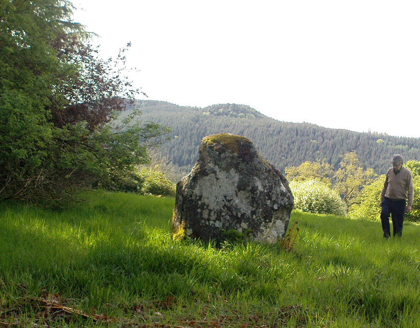
The eastern stone

But it seems that little else has been found about the place.  It’s in a gorgeous setting (but, round here, everything’s in a gorgeous setting!) and must have related to other sites in the area, but it’s hard to contextualize the place on a single visit.  If you stand behind the two stones, the shape of their ‘heads’ fits very nicely onto the rounded hillock on the northwestern skyline — which seems to have later been used as a hillfort.  Whether this has any astronomical potential, I aint checked. (though Thom says nothing about them)

In geomantic terms both of these stones possess a distinct female flavour to them; the easternmost thinner of the two, particularly so.  But then I could just be talking bullshit!  I’d have loved to have spent more time with these two stones — bimbling, sitting, focussing, dreaming — as people of olde naturally did; but we were on the move and had other places to see.  Tis a delightful spot indeed…

(NOTE – This site was first given a grid reference of NN 801 477 in Margaret Stewart’s (1967) fine essay on the standing stones at nearby Lundin; and the grid-ref has since been reproduced in texts by Burl (1993), Thom (1990) and others.  Please note that this grid-ref is incorrect and is nearly a mile away from the actual position of the stones.)

Easternmost stone from another angle

Folklore

There is the possibility that this site once played a part in an important megalithic stone row.  Mr Gillies (1938) once again notes an old tradition told by local people which “says that at one time there was a paved way connecting the circle, of which these stones are the remains, with the great Croftmoraig circle.”  Very intriguing indeed…

References:

  1. Burl, Aubrey, From Carnac to Callanish, Yale University Press 1993.
  2. Coles, Fred, “Report on Stone Circles Surveyed in Perthshire,” in Proceedings of the Society of Antiquaries, Scotland, volume 44, 1910.
  3. Gillies, William A., In Famed Breadalbane, Munro Press: Perth 1938.
  4. Stewart, M.E.C., “The excavation of a setting of standing stones at Lundin Farm near Aberfeldy, Perthshire“, in Proceedings of the Society of Antiquaries, Scotland, volume 98, 1966.
  5. Thom, A., Thom, A.S. & Burl, Aubrey, Stone Rows and Standing Stones – 2 volumes, BAR: Oxford 1990.

© Paul Bennett, The Northern Antiquarian


Eyam Cross, Eyam, Derbyshire

Cross:  OS Grid Reference — SK 2178 7639

Getting Here

The village of Eyam is located some 9 miles south-east of Chapel-en-le-Frith and about the same from Sheffield, which lies to the north-east. Go to the centre of the village and find the church of St Lawrence standing beside the road to Foolow close to Eyam Hall and just west of the B6521 road to Sheffield.  The Saxon cross stands in the churchyard.

History and Folklore

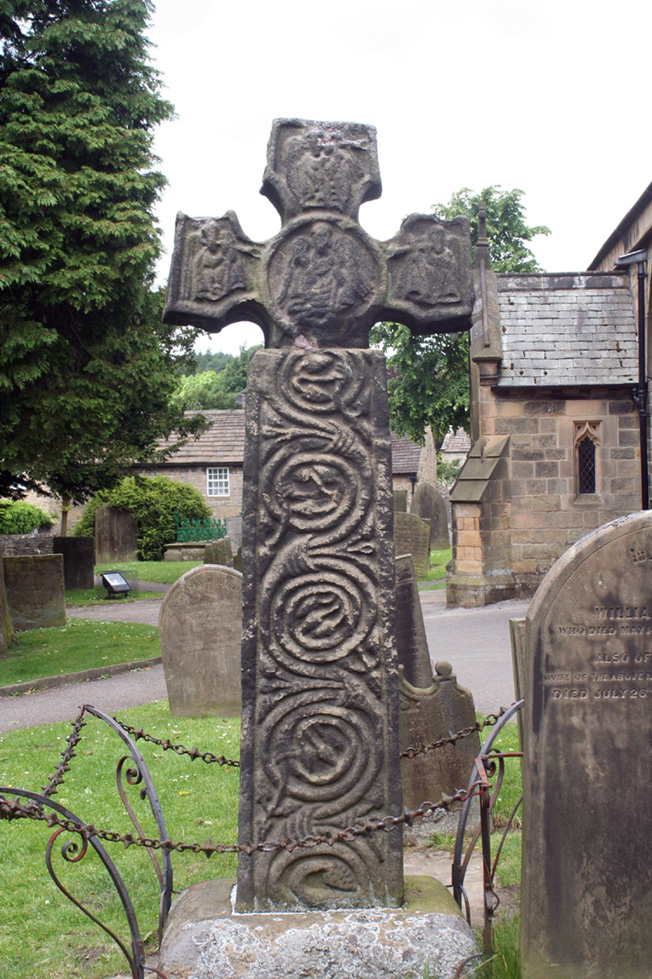
Eyam Cross, east face (from Wikipedia)

This very fine Anglo-Saxon (Mercian) cross stands 8 foot tall and dates from the 8th-9th centuries. It was apparently set up by missionaries from the north at Cross Low on the moors to the west of Eyam. Originally it was a wayside preaching cross that was 10 feet high and certainly must have looked very spectacular, but now it is only 8 feet high due to it being knocked about a bit in more recent times and losing one of its shaft sections. In the 18th century the cross was discovered beside a trackway on the moors, from whence it was brought to the churchyard of St Lawrence’s church;  but then for a long time it stood abandoned and uncared for in the corner of the churchyard. Eventually  it was restored and placed in the churchyard where it now stands proudly.

The cross is said to be the only one of its type in the Midlands that retains its cross-head. It has some very rich decoration on the west face with fabulous interlacing scroll-work running up the shaft that is typically Mercian in origins. On the west-face, especially the upper section, there are human figures probably St Mary the Virgin with the baby Jesus, angels and Christ in glory, each in their own sections or panels. The cross is grade 1 listed.  St Lawrence’s church houses a Saxon font.

References:

  1. Rev. Arthur, C., Illustrated Notes on English Church History, Society for Promoting Christian Knowledge: London 1901.
  2. Rodgers, Frank, Curiosities of Derbyshire and the Peak District, Derbyshire Countryside Ltd 2000.

Copyright ©  Ray Spencer 2011 

Rudston Monolith, East Yorkshire

Standing Stone:  OS Grid Reference – TA 09803 67740

Getting Here

Rudston’s monolith (photo by ‘QDanT’)

To get to the monolith travel along the B1253 road to the west of Bridlington for about 5 miles or from York take the A166 in an easterly direction then onto the B1251 and at Fridaythorpe take the B1253 east again toward Bridlington. The huge stone cannot be missed from the road and from the surrounding area. It stands within the graveyard of All Saints’ church at the north-eastern side of Rudston village.

Archaeology & History

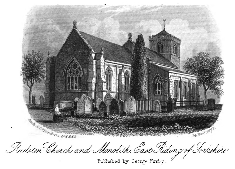
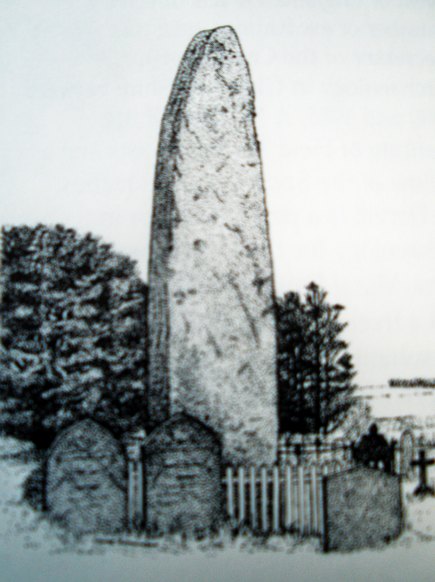
Located in the graveyard of All Saints’ church, this huge and mighty monolith or menhir stands at 25 foot 9 inches high (7.7 metres), and is the tallest prehistoric standing stone in Britain. It is estimated to weigh 40 tons, and it is thought to be the same in height below ground as what it is above the ground, though I don’t know whether anyone has ever checked that theory out. It probably dates from the Bronze-Age about 1,600 BC. Because of vandalism and erosion the top of the stone now has a lead cap, so it is said the stone could have originally been 28 feet high. So where has the top part gone to, I wonder. We are told that the stone was dragged, or rolled on logs, all the way from an outcrop at Cayton Bay some 10 miles as the crow flies to the north.

Royston’s 1873 drawing
Rudson Monolith (Louise Hutchinson 1988)

Rudston monolith stands at the end of at least one cursus monument on an old prehistoric alignment (see the Rudston B Cursus entry).  It would appear to have played an important ingredient in a huge ceremonial landscape on the Gypsey Race.  Also in the churchyard (north-east corner) there is a large slab-stone cist which was removed from a nearby round barrow and also a gritstone. At Breeze Farm about one mile to the south-west of the village is the site of a Roman villa.

Folklore

The folklore elements tell us that this is, in fact, a phallic stone and in pagan times some form of ritual was held around the monolith, but then the Christian church was built around it in the Dark Ages – it was a case of Christianity adopting the pagan religion and allowing the stone to stay where it was, but what else could they do because the stone was to big to move, so a lot of tolerance was in order here. The present church of All Saints’ dates from the Norman period. In any case the stone had stood here for a good 2,000 years or more before any church was established in the village. According to the legend, the devil hurled the huge stone at the first Christian church on the site, but as usual he just missed – doesn’t he always!

References:

  1. Bord, Janet & Colin, Ancient Mysteries of Britain, Diamond Books: London 1991.
  2. Anderton, Bill, Guide To Ancient Britain, Foulsham: London 1991.
  3. Darvill, Timothy, AA Glovebox Guide – Ancient Britain, AA Publishing Division: Basingstoke 1988.
  4. Royston, Peter, Rudston: A Sketch of its History and Antiquities, George Furby: Bridlington 1873.

© Ray Spencer, The Northern Antiquarian 2011


Great Stone of Fourstones, Lowgill, North Yorkshire

Legendary Stone:  OS Grid Reference – SD 66972 66292

Also Known as:

  1. Big Stone
  2. Four Stones

Getting Here

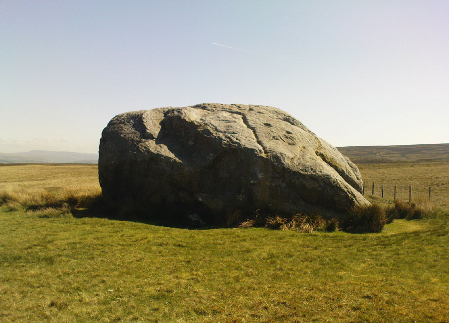
The Great Stone of Fourstones

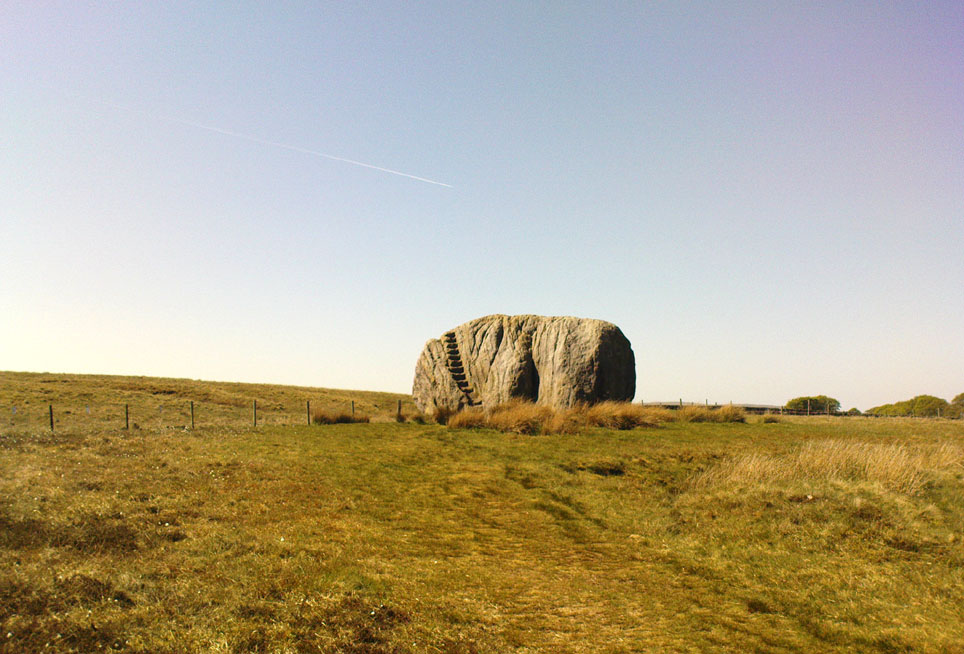
From near the middle of the large village (or small town!) of High Bentham, go down Station Road, over the river — where the road becomes known as Thickrash Brow! — and keep going for about a mile.  The landscape opens up into the hills and there, on the left-hand side of the road, is a car-parking spot with a footpath taking you straight up to the large boulder a 100 yards on: that’s our Great Stone!  You can’t really miss it.

Archaeology & History

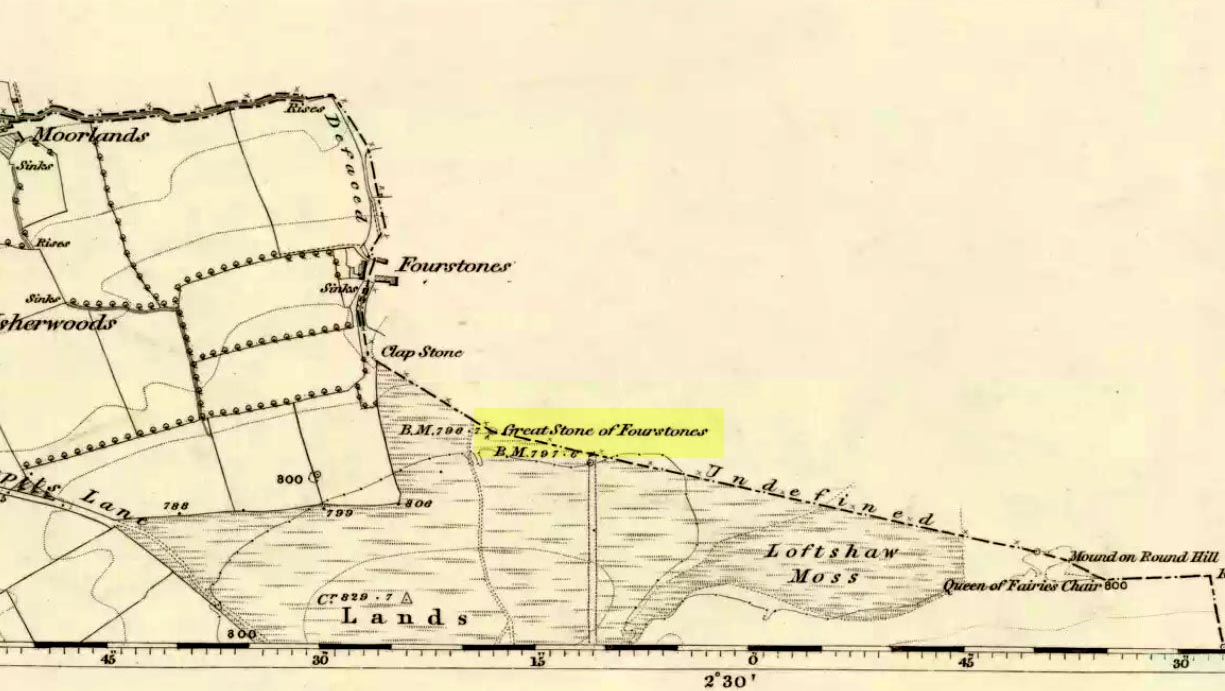
Great Stone on 1847 map

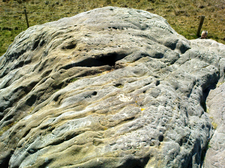
A meeting place of local tribes in more ancient days, the moorland plain upon which the Great Stone sits, beckons to a vast landscape on all quarters (north, south, east and west) calling the elders from their lands for annual rites and decisions to befit the health of the land and the people.  The stone rests on the ancient boundary of Yorkshire and Lancashire, just on the Yorkshire side, and was visited annually in more later centuries during the beating of the bounds, to define the edges of the local township.

Graffiti & cup-marks on the top

First described in a Yorkshire inquisition account from 1307, this Big Stone was visited by Harry Speight (1892) who described it as measuring 30 feet round and 12 feet high.  I came here for the first time in the 1980s when I was hitch-hiking into the Scottish mountains, but a good old “local” (from the Yorkshire side) took a detour to show me the place!  Once here, I climbed up the very worn “steps” which were carved into the side of the boulder several centuries back and it didn’t surprise me to find a number of cup-markings (no discernible rings) on its top surface.  When I came here again with Michala Potts and Paul Hornby yesterday, I couldn’t believe how many people had carved their names on top of the Great Stone in the intervening years — it’s almost covered in modern graffiti and the old cup-markings were much harder to see.  Taylor (1906) mentions them briefly in his holy wells survey, saying how,

“This great boulder is ascended on its eastern side by fourteen steps, and on the top are two circular holes about two inches deep and two inches in diameter.”

There used to be three others boulders very close to this one (hence its title), making a natural stone circle, but they were “broken up for sharpening scythes” a couple of hundred years back.  A much wider archaeological survey of this region is long overdue.

Folklore

Great Stone, looking east

Harry Speight (1892) told how the (original) Four Stones were the creation of our old friend the Devil, long ago, who dropped them in one his many megalithic travels across our land. The stones were also the meeting place of ancient councils, from the tribes either side of the Yorkshire-Lancashire border. Their presence here also had mythic relationship with the Queen of the Fairies Chair, about a mile southeast, along the same boundary line.

Weird how folklore changes. Whilst old Mr Speight told how the devil created the once great four stones that were here, many years later Jessica Lofthouse (1976) told how the three missing stones – which had been here “since the world began” – were actually taken from here by Old Nick. Carrying them over the land,

“His load he dropped on Casterton Fell, where the rocks he discarded, the Devil’s Apronful, are still lying around. He selected the most suitable, dressed them and carried them in panniers down to the (River) Lune”

— and built the legendary Devil’s Bridge at Kirkby Lonsdale – which itself has strange tales to tell.  Another creation myth about the Great Stone is told on the plaque near the stone, alongside the footpath, which tells:

“Legend has it that it is a small part of the debris hurled by the giant Finn McCool across the Irish Sea in a fit of anger.”

It’s very obvious that a lotta mythic landscape material has been neglected and overlooked around this site.  Something we need to remedy, if we can, in the coming years…

References:

  1. Lofthouse, J., North Country Folklore, Hale: London 1976.
  2. Speight, Harry, The Craven and Northwest Yorkshire Highlands, Elliott Stock: London 1892.
  3. Taylor, Henry, The Ancient Crosses and Holy Wells of Lancashire, Sherratt & Hughes: Manchester 1906.

© Paul Bennett, The Northern Antiquarian 


Fairy Stone, Clunbury, Shropshire

Legendary Rock:  OS Grid Reference – SO 3723 7958

Also Known as:

  1. The Devil’s Stone

Archaeology & History

The Fairy Stone, on the south-west corner of Clunbury Hill, measures some 3ft by 2 ft 3 in and is some 2ft 6 in high.  Local lore tells that it was once a standing stone, but this may not be the case; it’s thought more likely to be a simple glacial erratic.  The stone is granite with quartz veins and stands very close to the local boundary line.

Folklore

Local researcher Jonathon Mullard found this stone, not surprisingly, to have “had a long tradition of fairy lights associated with it; they were said to appear at certain times of year.”  And Mullard found one very intriguing encounter of these supernatural forms, later narrated in Paul Devereux’s (1990) excellent tome, which told:

“The legend would seem to relate to actual folk knowledge of the site, because Mullard was informed by an elderly woman living locally that she recalled her grandfather telling of an encounter with the lights.  Returning home one evening across Clunbury Hill, he saw the whole area around the stone filled with small lights of a gaseous appearance bobbing up and down a short distance above the ground.  Not wanting to go out of his way, the man walked through them. He found that any lights he happened to touch against adhered to his trousers.  He briskly brushed them off, but found when he got home that the fabric was scorched.  The woman had actually kept the trousers up until a decade or so before talking with Mullard!”

References:

  1. Devereux, Paul, Places of Power, Blandford: London 1990.

© Paul Bennett, The Northern Antiquarian 


St. Peter’s Cross, Stoke-on-Trent, Staffordshire

Cross:  OS Grid Reference – SJ 8792 4521

Getting Here

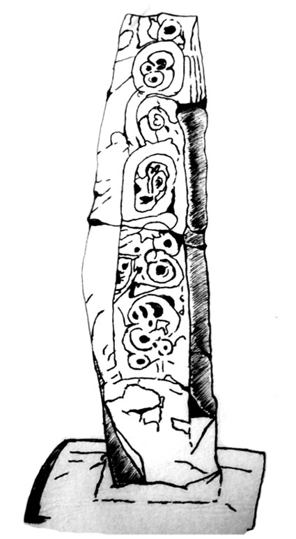
Drawing of carved cross shaft (© Ray Spencer)

From the centre of Stoke head west onto Glebe Street and just a couple of hundred yards or so south of the town hall is the minster church of St Peter Ad Vincula (St. Peter in Chains). Go into the large graveyard and there the ancient Saxon cross-shaft stands behind some modern iron railings. There are many other things of interest to see in the churchyard, including some old arches and monuments / gravestones in memory of some famous potters that made Stoke famous during the industrial revolution.

Archaeology & History

The Mercian cross-shaft stands 4 feet high on a 19th century square, socketed lump of stone. It is said to date from about AD 1000 when it was in use as a preaching cross, but could in fact be from earlier than that according to some local historians – perhaps it was originally a Christianized stone. The first Saxon settlement at Stoke (Stoiche) was said to date from c 800 AD. The cylindrical shaped shaft was discovered in 1876 by a gravedigger who spotted it being used as a door lintel inside the old church which was being demolished to make way for a newer church building. During its recovery the shaft broke in two so it was placed in storage, but in 1935 it was formally identified by Mr Charles Lynam who had it restored and re-erected in the churchyard.

Sadly the shaft is quite badly eroded with the carvings on one side being difficult to make out, but the front face has interlacing and scroll-work; there is some key-patterning on the sides and reverse side along with a series or section of small holes – these perhaps done in more recent times. The break across the middle of the shaft can still be seen today, but that does not detract from its great antiquity, the ancient monument being carefully restored. On the base there is an inscription that reads:

‘This fragment of a pre-Norman cross identified by Chas Lynam F.S.A. was re-erected near to its original position in the 25th year of the reign of H.M. King George V by P.W.L.Adams F.S.A.’

The cross-shaft is a Grade II listed monument.

References:

  1. Pickford, Doug., Staffordshire – Its Magic & Mystery, Sigma Press Wilmslow, Cheshire 1994.

© Ray Spencer, 2011


Grimeford Cross, Adlington, Lancashire

Cross:  OS Grid Reference – SD 6200 1284

Also Known as:

  1. Headless Cross

Archaeology & History

Within the Harris Museum, Preston can be found the Upper section of a pre-Conquest stone ‘cross’. Though much damaged on three of its sides the main face displays the upper section of a horned-helmeted figure holding a sword before it. The spreading horns suggest an important figure from the Viking period in Lancashire (c.900). This large and important piece of sculpture was found during the construction of Rivington reservoir on the River Yarrow near the village of Grimeford, Anderton in the 19th century.

Also found at that time during the reservoir construction was the lower section of a ‘cross’ shaft. This shaft is decorated on all four sides with carvings which include: the figure of a man from the waist down; a trellis filled with geometrical ornamentation of horizontal and vertical straight lines repeated to form a band known as a fret; a modified version of T-fret; and a combination of vine scroll and frets. The top of the shaft serves as the base for what is possibly a post medieval sundial base which has been adapted for use as a direction stone with directions to “Preston, Wiggan, Boulton, and Blagburn” (spelled as on the stone) being carved on the sides.  I would suggest that the two fragments are parts of the same monolith and may even depict the Viking Gunnolf (the latter being my own fancy).  This headless ‘cross’ is sited at the junction on the old road near the Millstone pub in Anderton and Grimeford Lane on the way to Rivington (SD 618 130). The stone is known as the ‘Grimeford Headless Cross’ or more locally as the ‘Headless Boggart’.

Folklore

Legend has it that there used to be a chapel near the junction and a tunnel running to a nearby farm on a hill. In the 16th century shortly before troops came to destroy the chapel, a priest hid in the tunnel and became trapped underground. His body was never found. Many people are said to have seen a ghost at the Headless Cross.

Addenda

To complement John’s entry, here are Mr Taylor’s notes written more than a hundred years ago in his Ancient Crosses and Holy Wells (1906), where he told:

“The HEADLESS CROSS — These words appear on the ordnance maps at a hilly spot in the extreme south-eastern corner of the hundred, five hundred feet above sea level, and distant one mile from the village of Adlington and about the same distance north from Blackrod.  Both villages have histories going back into the far past… A ‘Windy Harbour’, near the cross, sufficiently indicates the breezy nature of the situation.  The well and the ancient stocks are shown in close proximity to the cross.  The remains of the stocks are still in existence.

“Respecting the Headless Cross and others in this locality, Mr J.W. Crompton of Rivington Hall, writes (February, 1899):

“‘In reply to your note, I never heard of any cross, ancient or modern, in Rivington proper.  There was a tenement known as Butter Cross. Possibly some ancient cross may have existed there, but I know of no record to it.  There used to be a Headless Cross in Anderton, but old Mr Ridgeway, of Ridgemont, removed it many years ago, when he had sporting rights rented in that township, and I believe and old road surveyor broke up a cross in Anglezark to repair his roads early in this century: his name was Gerrard.  Crosses seem to have been specially erected to warn people of dangerous moors they were about to cross, and as a call to prayer in this part of the country, they were frequent.’

“…The subjoined deed is printed in the Chartulary of Cockersand Abbey, circa 1184-1190:

‘Grant in frankalmoign from Ranulf Gogard and his heirs to God [and the canons of Cockersand] for the health of the souls of his mother and his wife Edith, of all the land from Fulford to the path which crosses Rascahay Brook, between Heath Charnock and Adlington, as it was marked out by the crosses and marks of the said canons; with comon right of Charnock, in wood and plain, feeding grounds and mast in all other liberties.'”

References:

  1. Taylor, Henry, The Ancient Crosses and Holy Wells of Lancashire, Sherratt & Hughes: Manchester 1906.

© John Dixon, 2010


Lilla Cross, Fylingdales Moor, North Yorkshire

Cross:  OS Grid Reference – SE 88923 98686

Also Known as:

  1. Lilla’s Cross

Getting Here

Lilla Cross is situated on Fylingdales Moor, north Yorkshire, between Pickering and Whitby at the junction of two major moorland footpaths. It is located close to the Fylingdales Ballistic Missile Early Warning Station – which resemble giant golf balls on the horizon.

Archaeology & History

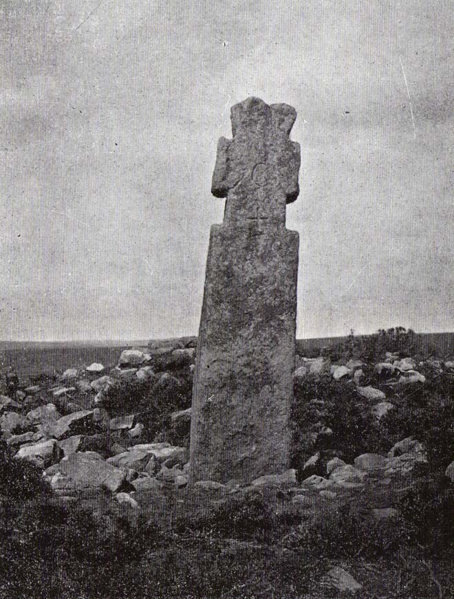
Woodwark’s 1930s photo of Lilla Cross

The ancient cross is 10 foot high and free-standing but it sits upon what is probably a ruined Bronze-Age bowl barrow called Lilla Howe; the recumbent stones that lie around the base of the cross may form part of that. It is a sturdy, stocky cross that has some letters carved onto it, one in particular being a large letter “C” possibly meaning Christos (Christ) and with that a small thin cross; there are a few other faint letters but these are difficult to decipher now. A plaque on a nearby stone gives information about the cross. I think Lilla Cross was used as a sort of Medieval milestone or way-marker – hence the lettering on the cross.

In 1952 the cross was moved to Sil Howe near Goathland but 10 years later in 1962 it was returned to its original site on top of Lilla Howe. In the 1920s excavations on the barrow revealed some artefacts of jewellery, but no remains of Edwin’s trusty chief minister were found; the jewellery was, in fact, said to date from the mid 9th century. Lilla Cross has been referred to by historians as the oldest christian cross on the north York Moors.

Folklore

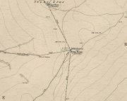
Lilla Cross on 1854 Map

According to the legend, in AD 625 or 626 King Edwin of Northumbria was travelling with his entourage across the moors, but an assassin had been dispatched by the king of the west Saxons to kill Edwin. The assassin lunged forward with his poison tipped sword, but Lilla his chief minister at the king’s court, leapt in between his sovereign and the swordsman. Poor Lilla took the full thrust of the sword and died on the spot thus saving the king from being murdered. King Edwin, who was greatly impressed by this selfless act of devotion, ordered that Lilla being a newly converted christian be buried here in a christian way though he asked that a number of articles be placed with the body including gold and silver. The king then had a cross erected in memory at the spot where Lilla died. But it seems likely that the cross dates from the 10th century, though there may have been an earlier Saxon cross here.

References:

  1. Ogilvie, Elizabeth & Sleightholme, Audrey, An Illustrated Guide to the Crosses on the North Yorkshire Moors, Village Green Press: Thorganby 1994.
  2. White, Stanhope, Standing Stones and Earthworks on the North Yorkshire Moors, Fretwell & Cox: Keighley 1987.
  3. Woodwark, T.H., The Crosses on the North York Moors, Whitby Literary & Philosophical Society 1934.

© Ray Spencer, 2011 


Ralph Cross, Westerdale Moor, North Yorkshire

Cross:  OS Grid Reference – NZ 67724 02092

Also Known as:

  1. Ralph’s Cross
  2. Young Ralph’s Cross

Getting Here

The cross stands high-up on Danby High Moor between Hutton-le-Hole and Castleton, just by the junction of two moorland roads to Rosedale and Westerdale, in north Yorkshire.  The monument stands on private land. (Ed. – though in Yorkshire, many of us ignore such signs)

Archaeology & History

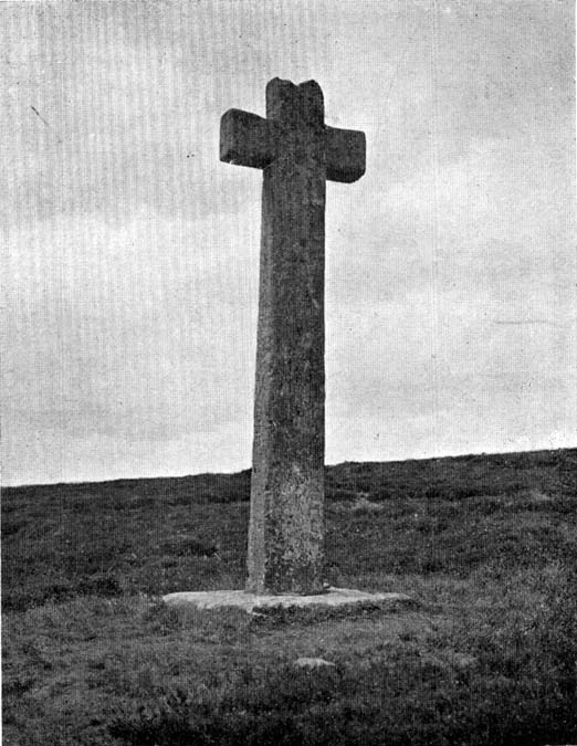
Mr Woodwark’s 1930s photo of Young Ralph

First described in old deeds from the early 13th century, Ralph’s Cross stands nine feet high on a solid stone base.  There is uncertainty about its age; the present-day cross could date from the 18th century though some historians date it to around 1200, certainly the base could date from that time.  It seems likely that a much older cross once stood on this site — perhaps an Anglo-Saxon one that was actually made of wood.  At that time it may have been referred to as ‘The Roda Cross’ (Rude Cross).  More than likely the cross acted as a medieval highway marker because it stands at the junction of two moorland roads. Originally there were some letters carved on the cross, one in particular, being the letter “R” for Ralph was carved on the south face.

Over the centuries the cross has suffered damage and vandalism by being knocked down, particularly in the 1960s and again in 1984 after which it lay in two pieces. However, in 1985 the cross was lovingly restored and re-erected by some local men, Mr Robert Dixon, Mr Tom Rudd and Mr Michael Smith, at the English Heritage Commission’s stone masonry workshop at Mount Grace Priory.  The middle section of the cross was made from new stone from nearby quarries; the top section was not badly damaged, but a section of delta metal was inserted inside the shaft to make a secure link between the sections and the cross-head.  The cross is a listed monument.

A few hundred yards to the south stands another cross called ‘Old Ralph’ which is just 5 feet high and is located on Blackey Ridge. This cross dates from the beginning of the 13th century and is perhaps a memorial to Ralph, bishop of Guisborough.

Folklore

According to legend, the cross was set up to mark the resting place of a monk from Farndale and a nun from Rosedale.  They would often meet here and a romantic liason of sorts occurred, but they were found out by their superiors and came to a nasty end, possibly with their deaths.  But the most common folk-tale tells us that a farmer called Ralph from Danby found the dead body of a traveller at this spot.  He was so moved by this that he decided to erect a cross in memory of this poor unfortunate traveller, who had starved to death and was found to be penniless.  Ralph had a hollow carved into the top of the cross so that more wealthy travellers, those on horseback, might place a few coins for the benefit of any less fortunate travellers, or as a thanksgiving for having reached this point on their journey. The poor traveller was able to take a coin, if he/she could reach the hollow, and buy a hot meal at the nearest inn.  Ralph then vowed that such a terrible thing would never ever happen again, and it seems to have worked, thanks to him.

References:

  1. Ford, Joseph, Some Reminiscences and Folk-Lore of Danby Parish & District, Horne and Son: Whitby 1953.
  2. Ogilvie, Elizabeth & Sleightholme, Audrey, An Illustrated Guide to the Crosses on the North Yorkshire Moors, Village Green Press: Thorganby 1994.
  3. Woodwark, T.H., The Crosses on the North York Moors, Whitby Literary & Philosophical Society 1934.

© Ray Spencer, 2011