Rudstoop Monolith, Cragg Vale, West Yorkshire

Standing Stone/s:  OS Grid Reference – SD 99269 23652

Getting Here

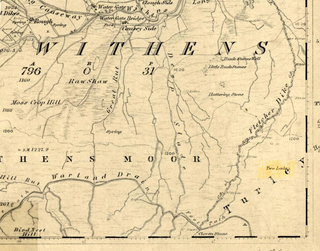
1st edition OS-map showing the stone

From Mytholmroyd, go up the Cragg Vale Road, then 2 miles up take the road steep on your right down and round St. John’s Church, then keep going along the road up to Withens.  About a mile up, a road turns sharply right.  Go up here for a few hundred yards, past the trees, and 100 yards on the road splits in a ‘V’.  Stop here.  Go into the field on your left which slopes downhill and less than 100 yards down you’ll see the large long stone laid in the grass.  That’s it!

Archaeology & History
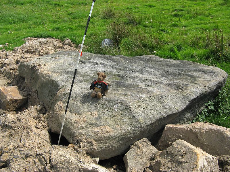
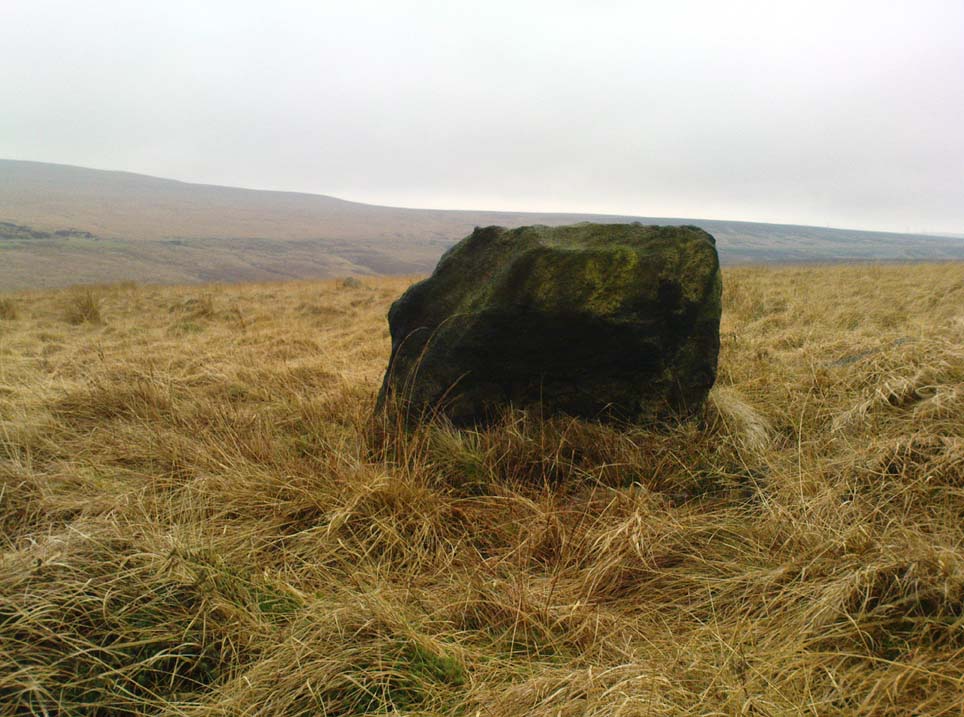
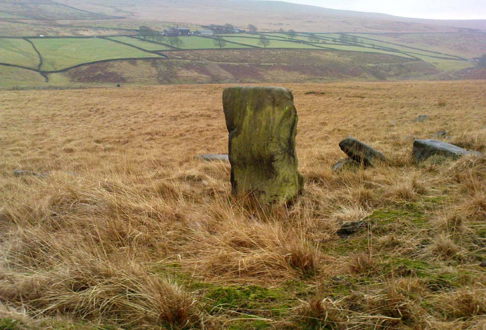
The fallen stone, with Teddy! (image courtesy ‘QDanT’)

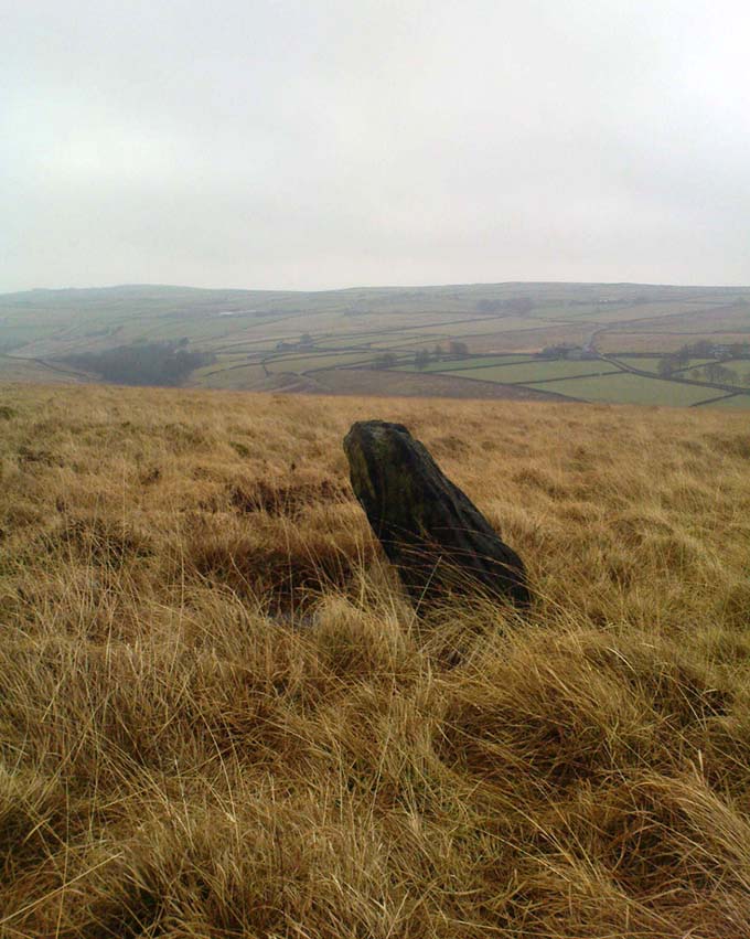
Included in the Addenda of The Old Stones of Elmet (p.222), here is a recumbent monolith more than 8 feet long and 6 feet across which really needs to be resurrected as it would be an impressive sight! Found halfway up Withens Clough, a local land-owner told me it was one in a row of several such stones, though no trace of the others can be found. Found in the appropriately called Standing Stone Fields, it was last shown on the 1850 OS-map, as the attached illustration shows and is positioned just above the “S” of the smaller highlighted “standing stone”, just where the little blob is! The small valley to its immediate west is called Rudstoop, from which I give the stone its name.

A description of the site is given in F.A. Leyland’s scarce commentary on the History of Halifax (c.1867), where he wrote:

“Standing Stone Fields: Not far distant from Hill Top, in this township (Erringden), there is a rough piece of ground known by this name.  It is situated on the slope of the same hill as the remain last described and commands a view of the northern side of Sowerby, with the outlines and rocks of Langfield and the Withens. The locality was anciently the site of a number of upright single stones: most of these have been broken up and used in the construction of the adjoining fences. But one, the last of the series, which the quarrying operations on the spot respected during the whole time they were carried on, was undermined and overthrown a few years ago, by a number of mischievous boys. The rock is a slab of millstone grit, measuring upwards of 9 feet in length, 7 feet 8 inches in width, at the base, and 4 feet 9 inches at the top: at the latter point it is 9 inches thick, and is 1 foot 6 thick at the base. The remain has, originally, been pyramidal in form, but the apex has been either broken off by violence or reduced to its present dimensions by decay.”

An impression of the land here indicates the other, lost monoliths, were in a row which headed east from here, towards the cup-and ring-marked ‘Upper Lumb Stone’.  There is also the possibility that these monoliths were aligned with the enigmatic Two Lads cairns less than a mile SW of here.

Well worth checking out!

References:

  1. Bennett, Paul, The Old Stones of Elmet, Capall Bann: Milveton 2001.
  2. Leyland, F.A., The History and Antiquities of the Parish of Halifax, by the Reverend John Watson, M.A., R.Leyland: Halifax n.d. (c.1867)

Links:

  1. More images of the fallen monolith

© Paul Bennett, The Northern Antiquarian

Aiggin Stone, Blackstone Edge, Lancashire

‘Standing Stone’:  OS Grid Reference – SD 97329 17069

Getting Here

From Littleborough, take the Ripponden and Halifax A58 road up-uphill till you get to the White House pub near the very top.  From here, cross the road and walk  along the track below the disused quarry for a coupla hundred yards till you meet with the straight uphill track.  Go up here and, near the very top, you’ll see the upright stone right beside the footpath on your left.

Archaeology & History

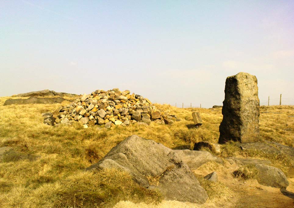
Aiggin Stone and cairn

This ancient boundary stone has long been an etymological oddity.  It aint a prehistoric stone by any means (soz…), though its nature has never truly been decided for sure.  Some have posited it as Roman in origin, others that it’s merely a waymarker (in case y’ get lost in the fog up here), others that it’s a milestone, and the more common notion is that it’s a boundary marker of the counties of Yorkshire and Lancashire (it’s position in the landscape presently sits it in Lancashire).  As far as I’m concerned, the stone’s late-medieval in nature…

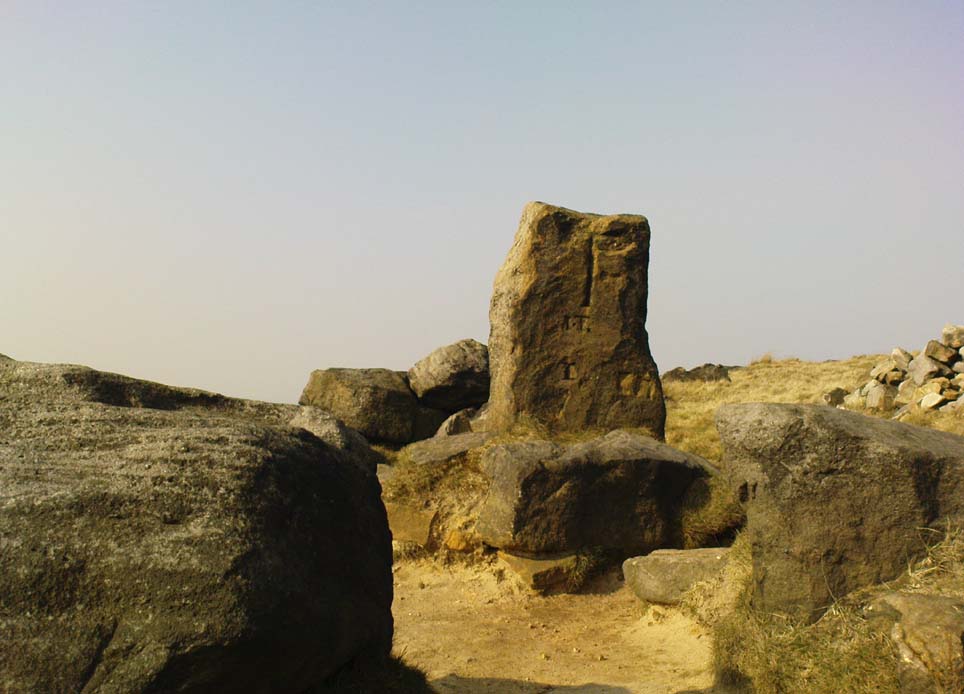
Standing by the old Roman road a short distance from the very top of these high Pennine hills on the Yorkshire-Lancashire border, a faint old Latin cross, plus the letters “I.T.” are etched onto its sides.  In the 1930s the stone was found laid in the moorland heather, but was thankfully resurrected in 1933.  Since then however, it’s been knocked over a couple more times, but presently stands proudly upright — until the day comes when some other halfwits decide to knock it down again!  In its earlier days, James Maxim (1965) described the stone thus:

“It is an irregular block of gritstone 7 feet long, tapering from 2 feet 6 inches to 2 feet wide and it is about 10 inches thick.  On one bedding face and a few inches from the top is an incised cross with the ends of the arms slightly expanded.  This is 1 foot 4 inches long and 10 inches wide, the horizontal bar crossing the vertical at about 5 inches from its upper end.”

Looking northeast

First highlighted on an engineer’s map from 1800, Herbert Collins (1950) assumes Aiggin to be “a corruption of Agger”, being a Latin word meaning, “a pile, heap, mound, dike, mole, pier – in Roman antiquity, an earthwork or other artificial mound or rampart.”  Due to the monolith’s proximity to the supposed Roman road there is great likelihood in it being as such, plus “agger” can also mean a Roman road or military way.  Collins cites other possibilities: aggerere, “to bear to a place, to heap up,” or “that which is gathered to form an elevation above a surface” – which is certainly applicable here!  James Maxim (1965) thought,

“The name ‘Aiggin’ suggests a pronunciation resembling either ‘edge’ or ‘hedge’ and thus it might mean ‘Edge Stone’. Alternatively it could be derived from the French ‘aguille’, meaning a needle or sharp-pointing rock.”

The view from here is truly excellent — though if you walk to the rocky crags of Blackstone Edge a half-mile to the south (y’ can’t miss ’em from here) and sit by Robin Hood’s Bed, it gets even better!  A smaller, possible standing stone can be seen just 200 yards northwest of our Aiggin Stone; with the top of the stone seemingly knocked off in bygone years. Not far from here are the remains of some old hut circles, emerging from beneath the old landscape.

References:

  1. Collins, Herbert C., The Roof of Lancashire, J.M. Dent: London 1950.
  2. Maxim, James L., A Lancashire Lion, J.L. Maxim Trustees: Leeds 1965.

Links:

  1. Ray Spencer on the Aiggin Stone

© Paul Bennett, The Northern Antiquarian 

Turley Holes Stones, Cragg Vale, West Yorkshire

Standing Stones: OS Grid Reference – SD 9954 2199

Also Known as:

  1. Turley Holes Moor Standing Stones

Getting Here

The 3 main stones (on a piss-wet thru afternoon!)

Get right to the top of the valley, past the end of the tree-line where the moor opens up ahead of you. Keep going till you reach the farmhouse on the left (there are usually sheepdogs outside, barking their heads off!). Take the track on the right, making sure y’ close the gate (the farmer here is infamous – so please shut the gate!). Cross the yummy stream at the bottom & double-back on y’self. If or when y’ reach the derelict house (an old shooting house), drop down the small valley, over the stream and stick to the bottom edge of the slope. (if y’ don’t reach the house, just cross the stream and keep to the contours) Keep walking for about 200 yards, keeping your eyes peeled for some uprights!

Archaeology & History

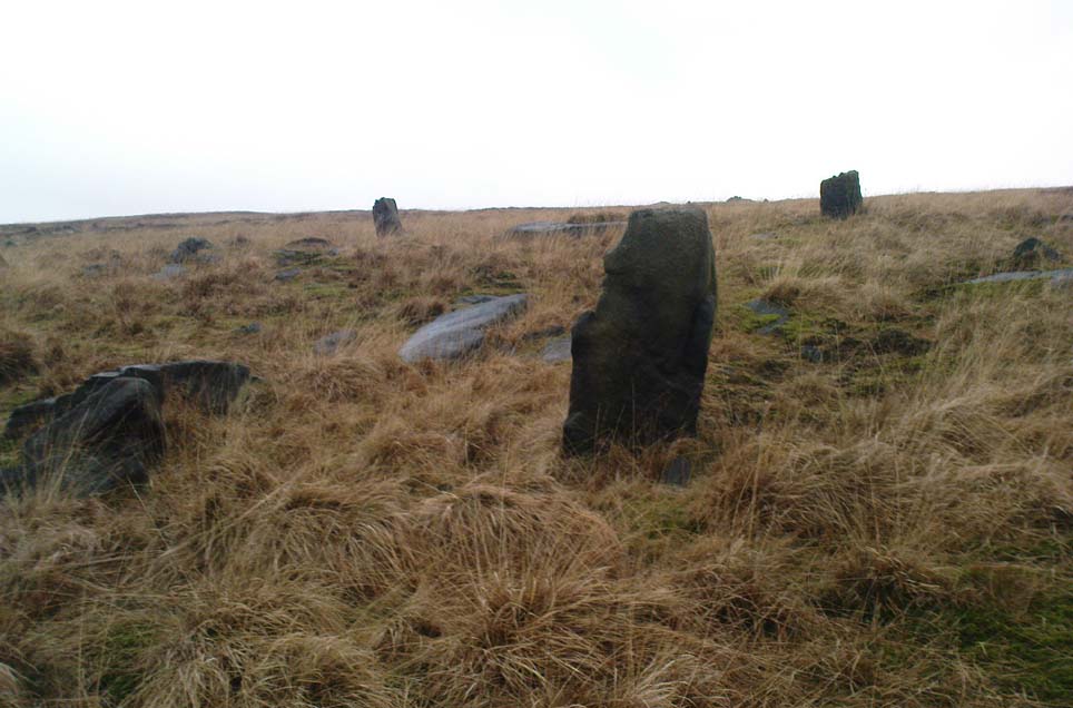
As with the Turvin Stone a half-mile southwest of here, this too is a very peculiar site.  ‘Peculiar’ inasmuch as no-one really seems to be able to make head or tails what the place actually was.  As you’re approaching the place, it looks like some decent ‘four-poster’ stone circle is ahead of you; but once you reach the place there are a veritable number of other earthfast rocks and tumbled stones all round, making your initial appraisal of the place suddenly grind to a halt! Added to this is the oddity of finding the standing stones on a considerable geological slope, unlike most other megalithic sites in the region (and elsewhere for that matter!).

The tallest standing stone

The tallest, easternmost of the three stones (SD 99547 21992) is more than five-feet tall and is lower down the slope than the other uprights here.  Almost ‘surrounded’ by some denuded stone enclave (a large robbed cairn perhaps?), this is the most visually impressive of the stones here.  Up the slope from here 15 yards (13.56m) away is what may, or may not, be a simple earthfast boulder (at SD 99535 21999): but it’s upright, about 3 feet tall, and due to proximity gives the impression that it was part of whatever monument this site once was.  Due west of the tallest standing stone nearly 20 yards (17.6m) away, is a more rounded stone of ‘female’ character, less than 4 feet tall (at SD 99528 21993).  That’s the general gist of the place.

If you visit here you’ll notice another smaller upright a short distance further down the slope in the green, less than three feet tall  And there’s possibly another one of similar stature more than  200 yards SSE.  But what is this place?  Is it prehistoric?  Was it built in the Dark Ages?  Medieval times?  Does anyone have a clue!?

References:

  1. Bennett, Paul, The Old Stones of Elmet, Capall Bann: Milverton 2001.
  2. Burl, Aubrey, Four Posters: Bronze Age Stone Circles of Western Europe, BAR 195: Oxford 1988.

© Paul Bennett, The Northern Antiquarian

Turvin Stone, Cragg Vale, West Yorkshire

Standing Stone:  OS Grid Reference – SD 98924 21378

Getting Here

Turvin Stone (lookin’ south)

From Mytholmroyd, take the Cragg Vale road (B6138) up and up and up, until you get past the tree-level and the hills open up on either side of you.  Take note of the farmhouse on the right-hand side of the road a half-mile on and park where you can.  Walk down the track by the farmhouse (known as Washfold Road) and cross the stream at the bottom.  OK – from here walk straight up the hill in front of you! (not along the footpath)  In less than 100 yards it levels out and you’re onto the moorland proper.  From here walk straight west for about 400 yards.  If you deviate a little, don’t worry.  You’ll see this small upright stone as you’re getting closer, seemingly in line with several other rocks, almost giving the impression you’ve come across a stone row.  Good luck!

Archaeology & History

The slim upright

This small squat standing stone is just over three feet tall (1m), about 10 inches thick and 3½-feet across.  Leaning at an angle into the ground, this broad but thin monolith has sunk some distance into the moorland peat.

It was located on February 15, 2011, in the company of Dave Hazell (pacemaker in tow!) on our first sojourn of the year.  It hasn’t been mentioned in any previous surveys and aint in anyway what you’d call impressive.  Nearby are the early remains of old walling north, east and west of here (one of them being a small enclosure of some type), for which I can again find no other references.  What looks distinctly like the remains of a large cairn isn’t far away either.  However, it may be that some of the remains up here are medieval in nature and it would be of benefit if someone who specializes in remains from that period could have a look here.  The equally curious Turley Holes standing stones can be seen a half-mile northeast of here.

© Paul Bennett, The Northern Antiquarian

Two Lads, Withens Moor, West Yorkshire

Cairns: OS Grid Reference – SD 98394 22116

Getting Here

Best way here is, from Mytholmroyd go up the Cragg Vale road for a coupla miles, then turn right and heading down, then up, towards Withens Clough reservoir.  Once there, walk onto the moor to your left (south) until you’re on the ridge above you.  Keep walking until y’ see the rocky cairn-like creatures stood in isolation on a flat moorland plain.

Archaeology & History

Two Lads – on a dark, rainy, windy day

Truly weird spot this one, but I love it! Seemingly miles from anywhere, it’s one helluva walk to most folk, but utterly worthwhile when your arrive.   On a clear day you can see for miles and the landscape is adorable!  On a cloudy rainy day, the feel of the place changes if you take care to stay with the site, saturated, meditating (as no other people ever turn up when She’s like that – so you and the place get the best from each other!).

The site comprises of two boulders, each crowned with a cairn of stones.  The westernmost one of the two (SD 98392 22111) is intriguing as it has, carved upon the rock beneath the stone cairn on the northwestern edge of the stone, what looks like a singular cup-marking, plus a large water-worn bowl on its northern edge, and a very distinct deeply-cut cross-base, several inches deep, near the northeastern corner of the rock.  This cross-base seems slightly more rectangular in form than square; although the large covering of stones makes an accurate ascription difficult.  If this cross-base and cup-markings are authentic, we would have here a clear example of the christianization of a previously heathen site.

A cursory examination of the easternmost of the Two Lads (SD 98397 22117) doesn’t indicate any artificial workings on the rock surface.

Two Lads on 1853 OS-map

Although the two ‘cairns’ on top of these two rocks are not prehistoric in nature, about 20 yards behind the Two Lads (south) may once have been the severely denuded remains of a once large prehistoric cairn.  Although the position in the landscape is perfect for such a construction, this is somewhat tentative, it’s gotta be said!  Further examinations are obviously necessary here.

The studious A.H. Smith (1961-63) believes that a field-name record from 1624, describing some ‘Lad Stones’ in the parish of Heptonstall relates to this site.  We know with certainty however, that this site was first illustrated on Greenwood’s 1771 map of Yorkshire, then highlighted on more recent 19th century Ordnance Survey maps as ‘cairns.’

Folklore

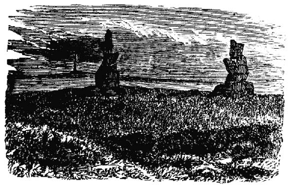
Drawing of the Lads in 1877

The creation myth behind this place is that two lads were walking over the moor in midwinter and got caught in a blizzard. Losing all sense of visibility they tried to shelter from the wind and snow by hiding behind these rocks, but perished. Sometime later their bodies were found and the curious “cairn” of rocks were mounted onto the boulders to mark where they’d died.  This is a folktale we find at many other old stone remains on the hilltops of northern England and Scotland.

The Two Lads seems to be very close to a midwinter alignment (or izzit a lunar standstill line?), linking it with the huge Rudstoop Standing Stone and, eventually, Robin Hood’s Penny Stone on Midgley Moor – which might be the root of the folktale. (i.e. midwinter, snow, death)  Any archaeoastronomy buffs out there wanna check this one out?  Then we can confirm or dismiss it.

References:

  1. Anonymous, “The ‘Two Lads’, Withens Moor,” in Todmorden & Hebden Bridge Historical Almanack, T. Dawson: Todmorden 1877.
  2. Bennett, Paul, The Old Stones of Elmet, Capall Bann: Milverton 2001.
  3. Smith, A.H., The Place-Names of the West Riding of Yorkshire, Cambridge University Press 1961-63.

© Paul Bennett, The Northern Antiquarian