Along the A827 Loch Tay road, halfway between Fearnan and Lawers just beyond the forestry, a track goes up into the fields across from Feadan house (big shed above you in field). Careful, or you’ll miss it. Go up here and head all the way up the steep winding track for 700 yards (as the crow flies) until, where the land starts levelling out, you hit the long straight line of old walling. Go over it and walk to your right (northeast) for a few hundred yards until it bears sharp left (NW), keep walking along it for another 45 yards and, where the fence turns down to the water, just keeping walking up the slope to the scatter of rocks. Look around!
Archaeology & History
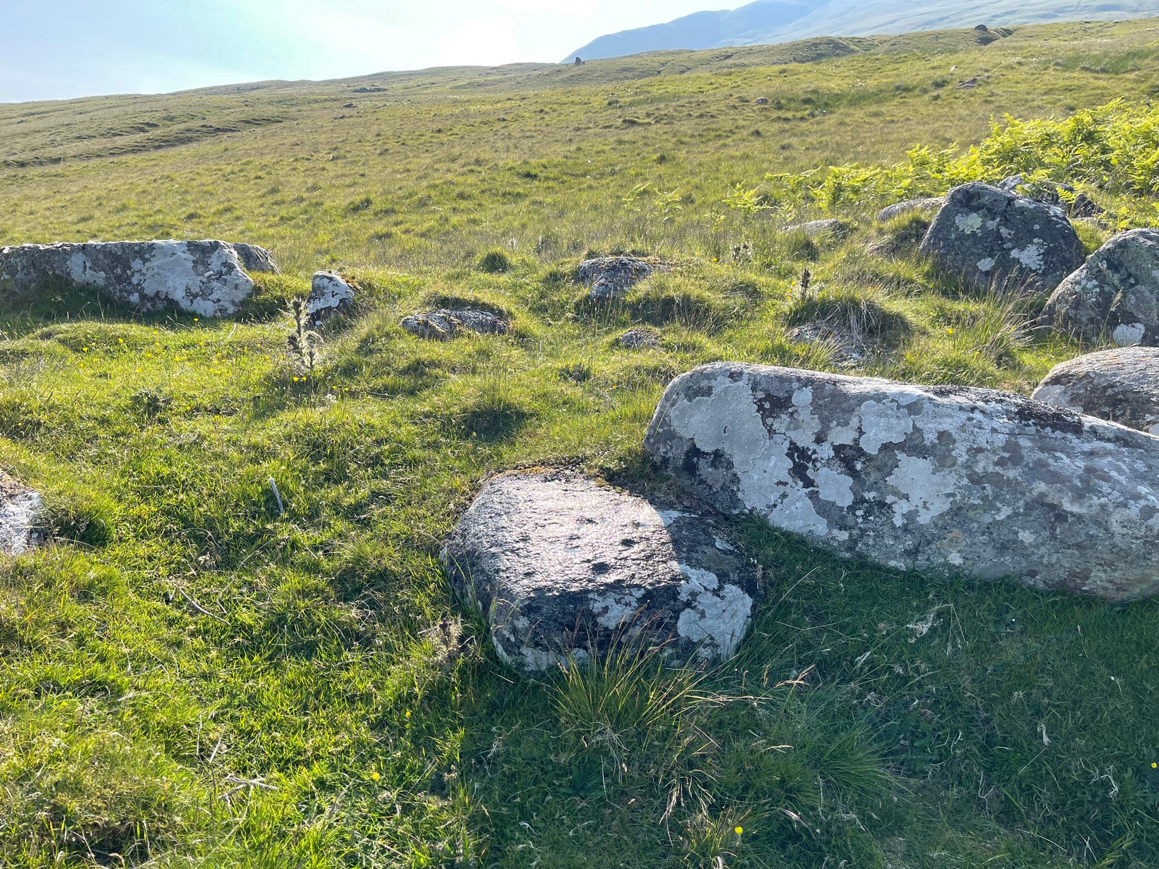
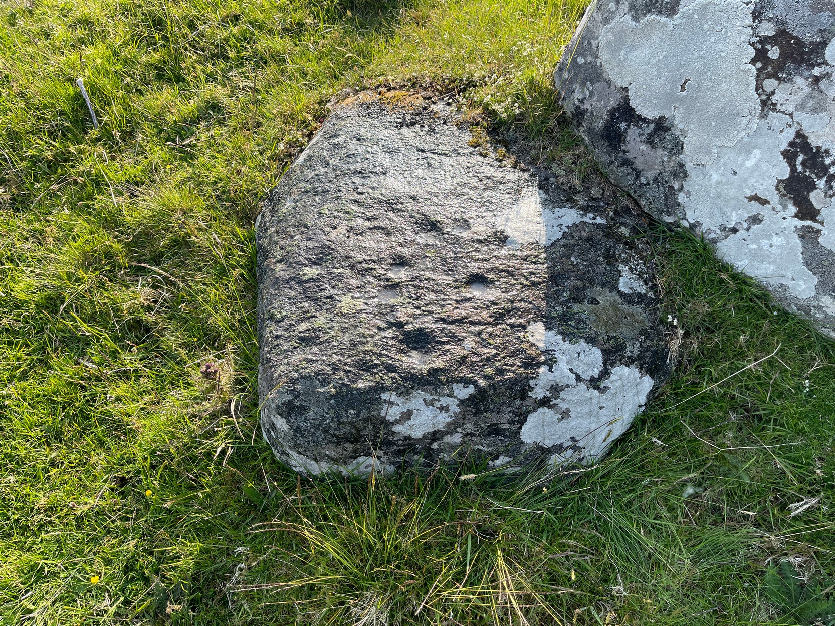
Looking down at the cups
When you consider there are multiple-ringed carvings close by on the same geological ridge as this carving, there’s little wonder this fella hardly gets any attention: the design here is nothing special compared to its close neighbours. That aside: on this small flat surface we have six or seven simple cup-marks; most of them quite small, with the largest of the lot having what looks like a small carved arc around one side of it—although I couldn’t make my mind up one way or the other to be honest. A few more visits might prove more conclusive.
Folklore
The stream at the side of this carving and others nearby—the Allt Coire Phadairlidh, or Padderlie’s Burn—was the haunt of an urisk, who gave his name to the waters. He lived a little further up on the knoll. Several other carvings are just below here. Urisks were plentiful in this area. They are variously described as demonic creatures, referred to by Alexander Carmichael as “a monster, half human half goat, with abnormally long hair, long teeth and long claws.” (teeth aside, that sounds like me! 🙂 ) They mainly live by lonely waterfalls and a small beautiful fall is very close by. They are associated in some places with cup-marked stones, where offerings of milk were made to placate them. In truth, these nature spirits seem to be folk remnants of solitary shaman figures cast into the edges of hills. A local lady who lived in this area said she’d met an urisk near here and he was anything but the fearful creatures they are made out to be…
References:
Currie, George, “Kenmore: Allt Coire Phadairlaidh (AP1): Cup-Marked Rock,” in Discovery & Excavtion Scotland, vol. 9 (new series), 2008.
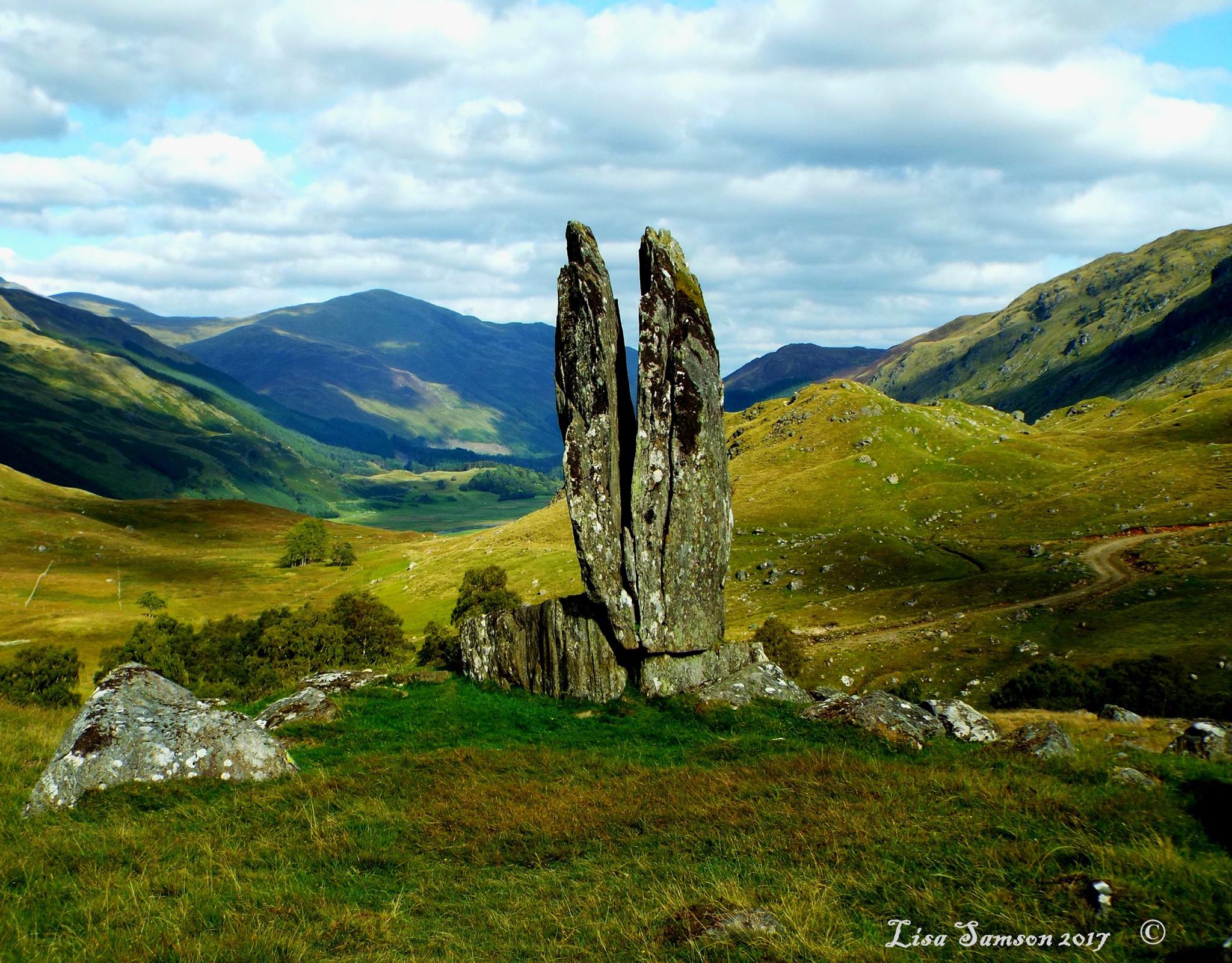
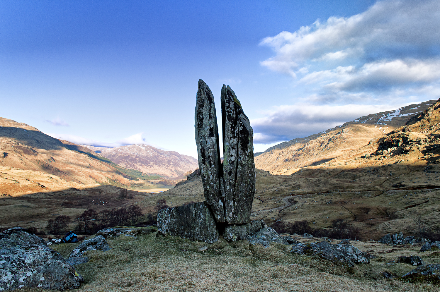
Clach na Sgoltadh, Glen Lyon (photo – Lisa Samson)
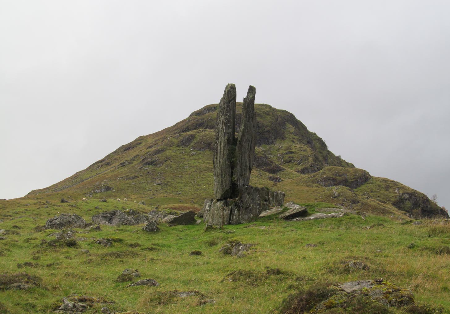
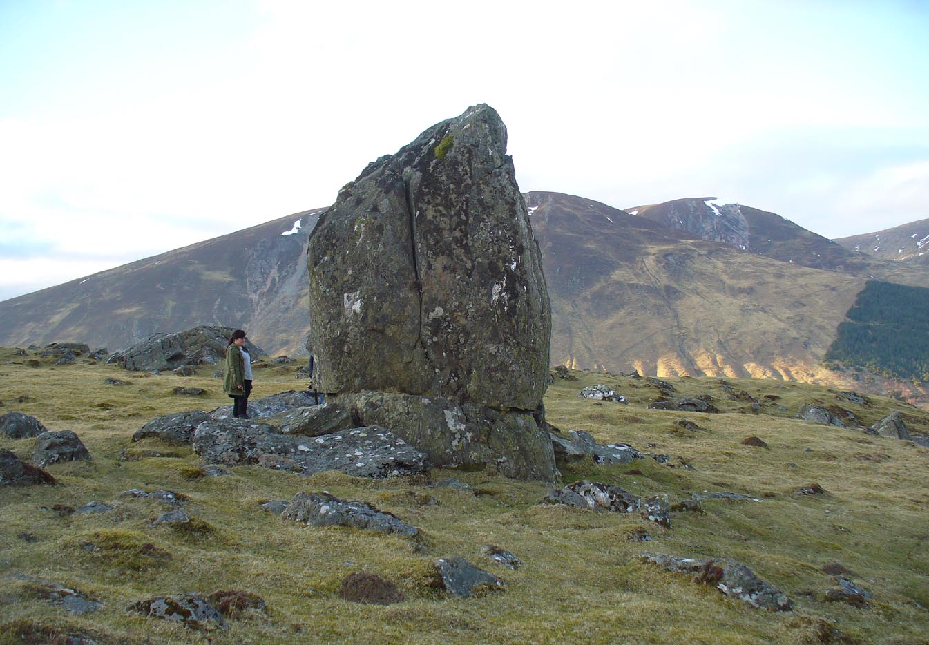
From Fortingall take the road into the legendary Glen Lyon. About 8 miles along, a short distance past the Adamnan’s Cross standing stone, you reach the tiny hamlet of Camusvrachan. On your left is a singular dirt-track, past some cottages. Go along here and over the river bridge until you reach the junction on the other side. From here, turn right and a half-mile on when you reach the farm and manor-house on your right, park up. From here you’ll see a track going uphill. Walk straight up and after a half-mile or so, keep your eyes peeled to your right. You cannot fail to see this impressive giant on the slopes above you!
Archaeology & History
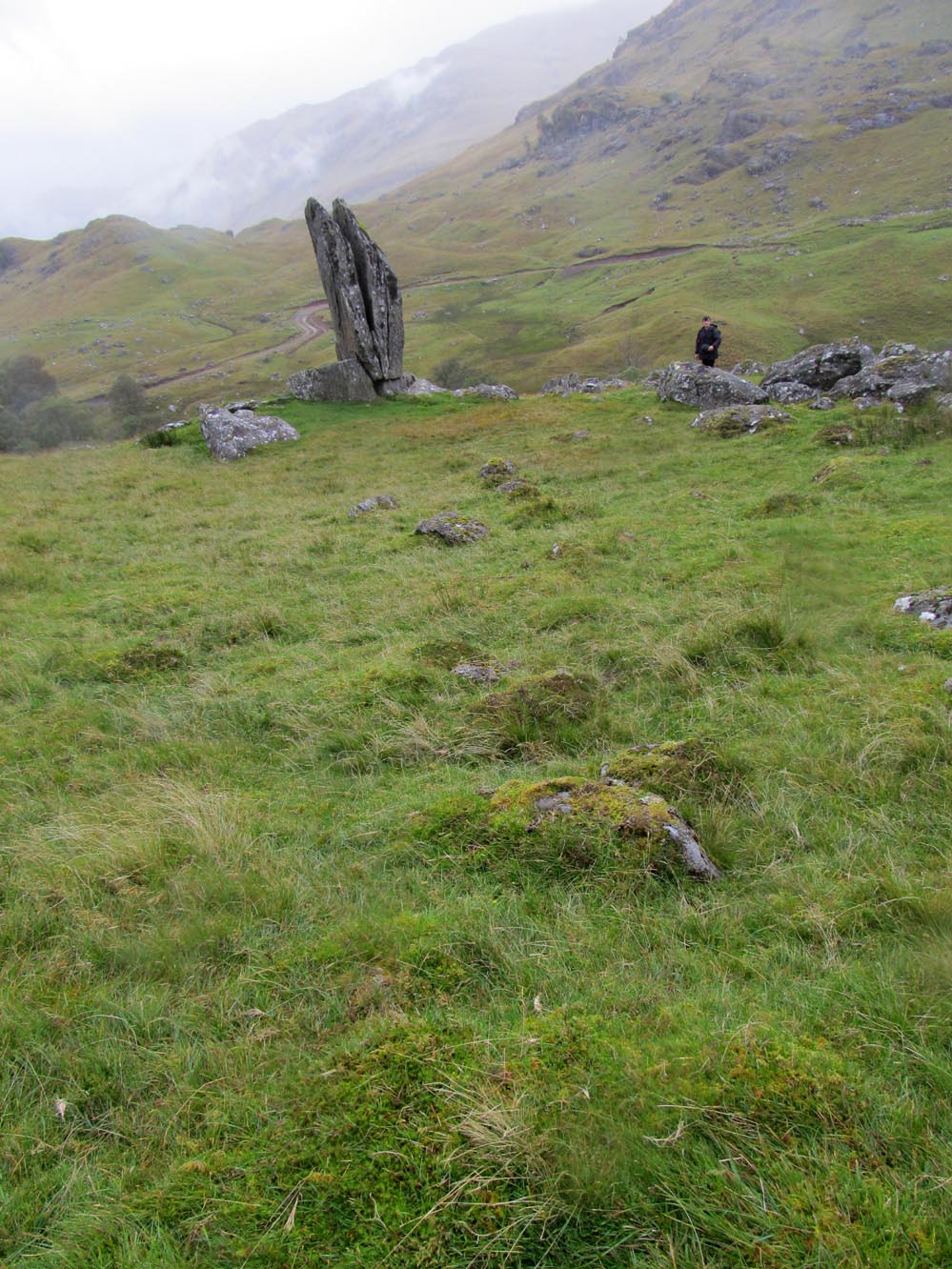
This is a truly mighty monolith! — a beauty no less! Standing upon a rocky ridge nearly halfway along the glen, the landscape it looks across is, without doubt, some of the finest in the British Isles. To our ancestors who, until just two hundred years ago peopled this and nearby glens in great numbers, this great stone would have been well known and had old myths told of it. Today we have only bare fragments.
To give an ‘archaeological survey’ of any kind to this site would seem somewhat of an anathema, as it is generally deemed to be little other than one of Nature’s incredible creations. We’ll come to that in a minute. But what is quite certain is that a line of very old and very low-lying walling runs from up the slope and almost straight down to Clach na Sgoltadh. You can see it pretty clearly in the photograph below. The walling stops at the giant stone and continues no further downhill from the other side of the giant upright.
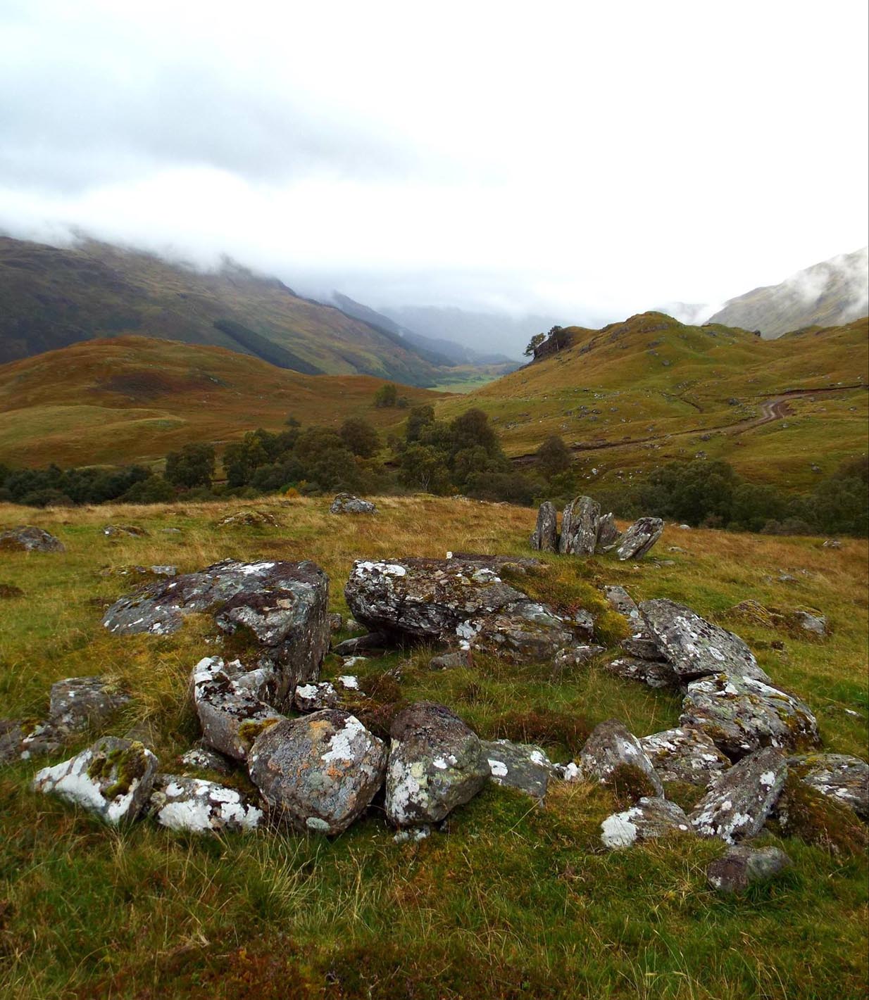
Walk diagonally down the slope about 30 yards south-east from the stone and you’ll find a small but distinctly man-made ring of stones, low to the ground, with an entrance on its northeastern side. It’s somewhat of a puzzle as it’s too small for a hut circle (I laid down in it in various ways and found you’d have to lie foetal all night if you were to use it as your own little abode), and it equally too small as an animal pen – unless it was for just one animal, which is most unlikely. The small circular construction wouldn’t seem to be prehistoric, but it would be good to know what it is.
So, we do have some very slight archaeological association with the site, albeit minimal, with the very ancient walling that leads to the stone being the most intriguing.
Small stone ‘hut’Low line of walling
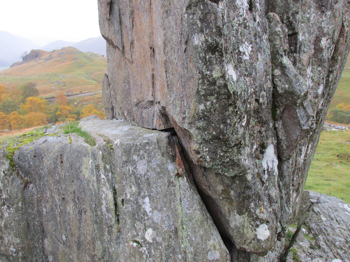
The stone is generally attributed to be a geological creation. I certainly cannot say, as I have no expertise in the subject. However, in the opinion of just about everyone with whom I’ve visited this stone, I seem to be the only one who doesn’t think it’s man-made. A number of people have each insisted to me that it’s been stood upright by humans due to the quite distinct ‘squaring’ of the upright stone, particularly at the north-facing base. —and been seemingly bemused at my own lack of conviction. It does look as if it could have been cut and squared just as they all say but, let me repeat, I’m no expert at geology, and so all I can say is that I simply don’t know one way or the other. (useless prick that I am!)
“Perhaps a stone mason might know?” someone suggested—which seemed to be a good idea. Certainly a stone mason would surely be able to tell if it had been cut and dressed at the base, where it fits into the large earthfast rock….
Cue Chris Swales: a reputable stone mason from near Skipton, North Yorkshire. Chris and his friends took a week long whistle-stop tour in and around the Loch Tay region and thought they’d visit Glen Lyon. I heard about this and so asked him if he’d have the time to visit this stone giant and, if possible, let us know his opinion: is is a natural obelisk, or does it look to have been erected by humans? I told him my opinion and that of the geologists who give it an entirely natural provenance.
It was a few weeks later when he got back in touch and I asked him if he’d been up to Clach na Sgoltadh.
“I did,” he said. “it’s bloody impressive Paul. And what a gorgeous landscape too. I’d love to go there again.”
“Aye, it is Chris. And what did you think of the giant stone then? In your opinion is it man-made or natural?”
“Well I don’t know for certain Paul,” he said, “but in my opinion I’m 95% sure that it’s man-made.” He said it plain as day, just like a typical daan-to-Earth Yorkshireman. Chris isn’t into any the energy ley-line stuff, so his words carry more weight than those who wanna spice-up a site by projecting their own beliefs onto a place. As a result, I was somewhat taken aback by his words.
“What—are you sure Chris?!” I asked.
Cut & dressed stone?
“Like I said – I’m not 100% sure Paul. I can’t really say it 100% – but I’m 95% certain that people cut and dressed the base of that stone and put it there. If it’s natural, then I’d like to know how they think that’s the case. I’m willing to be shown otherwise, but in my opinion, on the whole, it’s man-made. People stuck that stone there!”
It would be great to get another stone mason’s opinion about this site; and it would definitely be good to read a geological viewpoint, but I’m not aware of any papers regarding this stone. (does anyone know of any?) For my part: I can only reiterate that I’m ‘unsure’ whether or not this is man-made. I’m simply not qualified to give an objective opinion.
The curious thing is: if this isNature’s handiwork, then it would have been held in greater reverence to our ancestors than if it had been erected by people. Impressive creations of Nature were always deemed to be inhabited by genius loci of truly archaic potency. And in these deep impressive mountains, where the names of nature spirits still abound, this—without doubt!—would have been a place of considerable awe and sanctity. May it remain as such…
Folklore
Looking to the west immediately uphill and behind Clach na Sgoltadh is the rising rounded hill of Creag nan Eildeag. Legend has it that the great Celtic hero Fionn stood atop of this crag and fired one of his arrows at the stone, splitting it in half and leaving the stone as we see it today.
In a small cleft in the stone, quartz deposits can be seen along with an effigy of the Virgin Mary. However, the title of the Praying Hands of Mary is a modern attribution and has no historical or mythic veracity.
References:
Stewart, Alexander, A Highland Parish; or, The History of Fortingall, Alex MacLaren: Glasgow 1928.
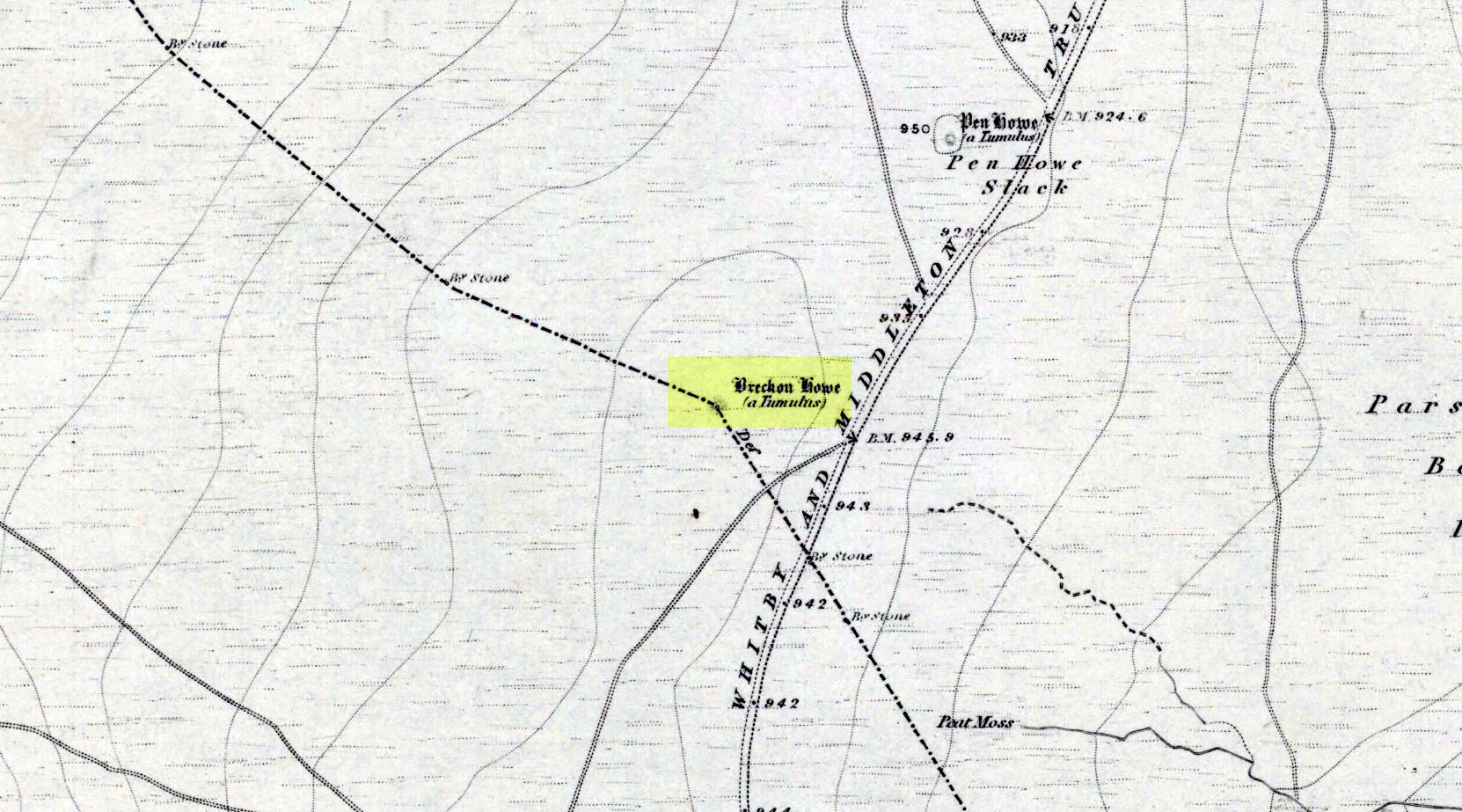
Along the A169 road between Sleights and Pickering, some two miles south of Sleights at the highest point on the moors just above the west side of the road, you’ll see a large mound with what looks like a standing stone on top of it. A minor road turns off the A169 at this point, heading southeast, and the large mound is 150 yards from the roadside. You can’t really miss it!
Archaeology & History
Shown on the first OS map of the area in 1853, this conspicuous prehistoric tomb surmounted by a relatively recent boundary stone, sits at the highest point on the moors in these parts. Despite this (as with others on these moors), very little has been written about the place and it has received only minimal attention in archaeology tomes. Even the renowned pen of Frank Elgee (1912; 1930) gave it only passing mention. Perhaps it aint a bad thing to be honest.
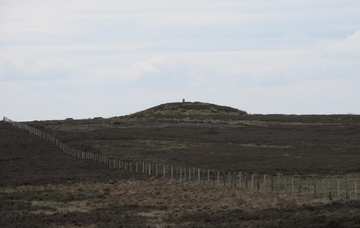
Breckon Howe, from the south
As well as being conspicuous, it’s large. Rising some six feet above the natural ground level, it measures 26 yards across its east-west axis, and 29 yards north-south, with a rough circumference of 88 yards. The boundary stone that surmounts its crown sits in a hollow that looks like it was opened up a century or two ago by antiquarians (much like ourselves). But its position of the tomb in the landscape that is most striking. The view from here is considerable, having a clear 360º view for many miles around. Other prehistoric tombs can be seen from here, but more importantly this tomb can be seen on the skyline from many others. This was probably a deliberate feature intended by its builders–and it’s not uncommon, as many of our upland regions are crowned with ancient tombs like Breckon Howe. In all likelihood this would have been the resting place of some important ancestral figure: a tribal elder or a shaman, whose spirit after death could view and travel across the landscape they inhabited in life.
Although the tomb presently sits amidst an endless sea of heather (Calluna vulgaris) typical of moorland across our northern lands, the name of the site ‘breckon’, according to George Young (1817) derives from the dialect word meaning ferns or bracken. This is echoed in Francis Kildale’s (1855) local dialect study and subsequently in Joseph Wright’s (1898) unequalled magnum opus.
Folklore
In the early 19th century, one George Calvert who lived in the area, collected as much folklore as he could, as it was dying off with the coming of the Church. One such piece told that there was once a hob who lived by this old tomb. A hob is generally known as a supernatural creature, but in this area it can also be a medicine man. Some hobs were good, others were malicious. We know not what type of hob lived lived here, but Calvert simply told us there used to be “T’ Hob of Brackken Howe”. Nowt more! It would be good to find the story behind this old character, if it hasn’t been lost entirely…
References:
Elgee, Frank, Early Man in Northeast Yorkshire, Frank Bellows: Gloucester 1930.
Elgee, Frank, The Moorlands of North-Eastern Yorkshire, A. Brown: London 1912.
Kildale, Francis, A Glossary of Yorkshire Words and Phrases Collected in Whitby and the Nieghbourhood, J.R. Smith: London 1855.
Home, Gordon, The Evolution of an English Town, J.M. Dent: London 1905.
Wright, Joseph, English Dialect Dictionary – volume 1, .Henry Frowde: London 1898.
Young, George, A History of Whitby and Streoneshalh Abbey – volume 2, Clarke & Medd: Whitby 1817.
Acknowledgements: A huge thanks to Lindsay Mitchell for getting us up to see this great tomb and its companion.
Perusal of a 25″ OS map of 1867 shows, in almost microscopic lettering, a feature marked ‘Bogle Bush’. I transferred the approximate location onto a modern map and set off to make a field visit, honestly not expecting to find anything almost a century and a half later.
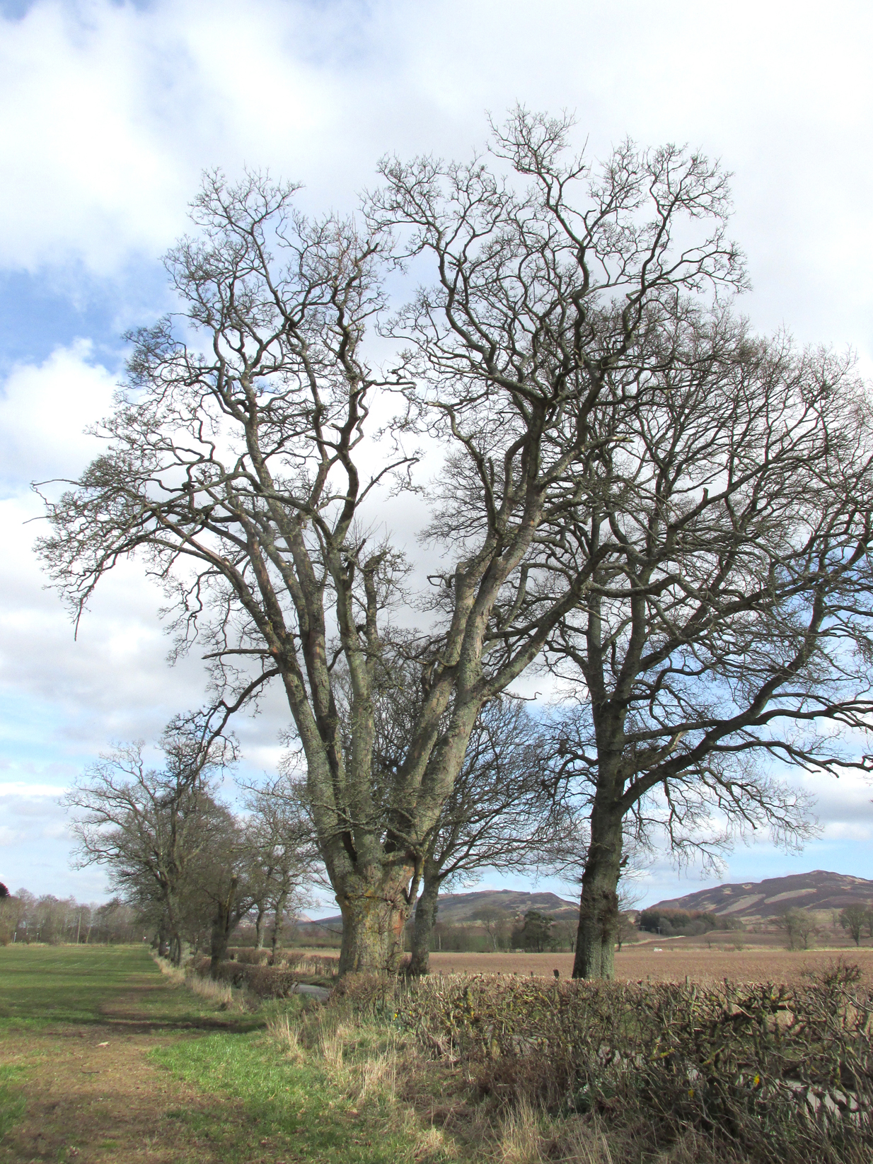
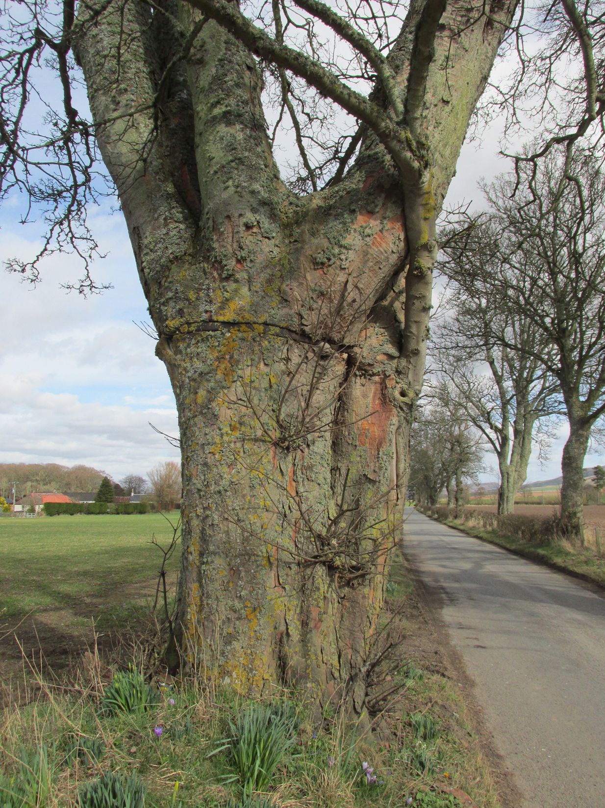
The Bogle Bush
As I walked down the designated road I was drawn to an ancient multi branched or trunked tree, the trunks held together by a hefty iron band. The band had been placed there many years ago as it was being absorbed by the growth of the tree. Unlike the other trees in the road the foot of this tree had crocus and grape hyacinth in flower, as if deliberately planted.
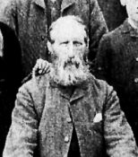
The band was forged and fitted by Kinrossie Blacksmith and Kirk Elder David Gray at the end of the nineteenth century, following the collapse of one of the three trunks then standing.
The band holding the tree together
The online Ordnance Survey Name Books for Perthshire, compiled prior to the survey of the 1867 map, list Robert Millar of Flowerdale, Mr James Stewart of Kinrossie and Mr Fraser of St Euchans as the informants that ‘This name is applied to a Birch Tree situated on the north side of the road leading from Saucher to Kinrossie. Mr Millar says that there is a superstitious tradition existing in the locality that Bogles have been seen &c at this tree’.
Whether Mr Millar and his co-informants were trying to mischievously mislead the (probably) English Ordnance Survey officials, we will never know, but the tree is in fact a Sycamore! And the 1901 25″ OS map shows the tree as the ‘Bogle Busk’.
Folklore
There has been speculation that the Bogle Bush may have long forgotten links with Macbeth whose fortess at nearby Dunsinnan Hill overlooks it, adding the rider that Sycamores only live 200 years or so before falling and then regenerating on the same spot, implying that a mother tree could have been on the same spot in Macbeth’s time.
David Gray, Blacksmith and Kirk Elder of Kinrossie.
Local folklore states that ‘a great calamity will befall Kinrossie’ should the Bush collapse. The tree is a local icon that’s ‘aye been there’ according to a local resident and it seems to be a local geo-caching site, judging by the small container of ‘stuff’ hidden in a plastic container underneath a couple of pieces of bark at the base of the trunk on my visits.
Please note that if you decide to visit, this is not a wishing tree, so do not hammer coins into the bark or suspend rags from the branches. Respect the Bush and the local people to whom this is an iconic tree.
My thanks to local resident Morag Hislop for leading me to further information on this site.
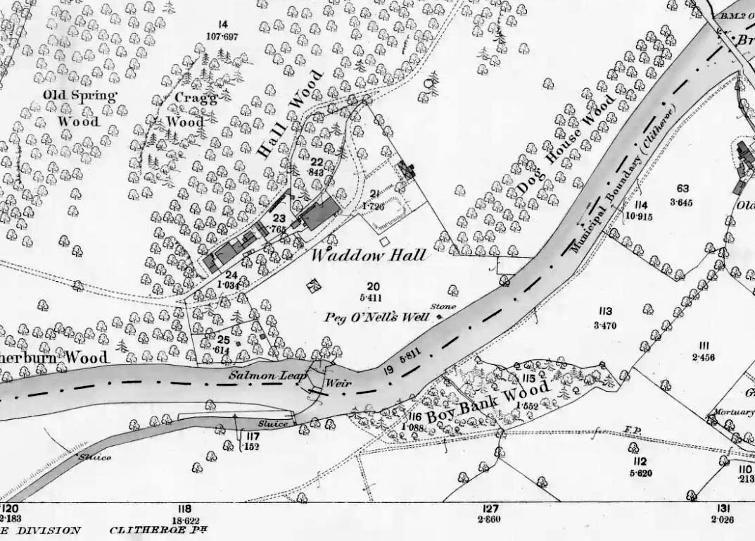
The well is located in the grounds of Waddow Hall close by Brungerley Bridge, near Waddington, in the Ribble Valley. The hall is just off the B 6478 road about three-quarters of a mile south-east of Waddington village. It is on private land, but you can see the well by walking along a footpath at the western side of the hall running along the banks of the River Ribble at the southern side of the hall grounds.
Folklore
The legend originates from the 18th century although the well is a pre-Christian spring. According to this most often told ‘legend’ Peg O’ Nell was a servant girl at Waddow Hall. However, she often fell out with her masters, the Starkie family, often quarreling with and being disobedient to them. One night, in particular, Peg had a blazing row with Mistress Starkie after saying she didn’t want to fetch water from the well; the mistress was so enraged that she shouted at the servant saying “I hope you fall and break your neck”. At a later date this came true when on a particularly icy night Peg went to fetch water from the well, but on her way there she slipped on some ice and fell into the River Ribble, at a treacherous spot, and did indeed break her neck. From that time on there seems to have been a curse on the Starkie family – anything and everything that happened at the hall was blamed on Peg, or her ghost, which was now haunting the house and grounds. Mistress Starkie became so fed up with the curse that she took an axe and chopped off the head of a statue that had earlier been placed beside the well in memory of poor Peg. Thinking that by doing this the curse would come to an end, and it seems to have done just that, because afterwards peace and quiet seems to have come upon the hall.
Peg o’ Nells Well on 1884 map
Another legend or tale says that Peg dwelt by the well, perhaps as a kind of sprite, but that she caused a local Puritan preacher to fall into the River Ribble. As a punishment for this dastardly trick the head of the statue was chopped off. Folklore says that a water spirit or “sprite” lived in the well which was connected underground to the nearby River Ribble.
But the truth about this seems to be that the headless statue is that of St Margaret of Antioch who was beheaded for her faith in the early centuries of Roman rule. St Margaret’s feast day was on 20th July. Apparently, her statue was brought to Waddow Hall from either Sawley Abbey or Whalley Abbey where it had stood in its own niche, or possibly it came from a local Catholic church. The headless statue appears to be holding a bible in one hand; so it was probably placed at the side of the well in order to make the well holy and sacred to pilgrims who used to visit the site for healing purposes on the saint’s day. The head of the statue used to reside in an upstairs room at the hall, but it was lost for a time, only to be re-discovered and embedded into a wall at Brungerley farm not far from the bridge.
But we may never know what really did happen here because legend and folklore have become mixed in with other tales that may, or may not, be true. The holy well stands in a meadow in the hall grounds and is a square-shaped hollow in the ground where water still flows, possibly fed by the river close by. The statue still stands at the side; and fencing now surrounds this sacred site. The hall and grounds are still said to be haunted by a ghost, but whether it is Peg’s ghost we do not know, because this particular ghost is said to be hooded ? The curse itself used to claim a victim once every seven years; the screaming spirit of Peg would rise up from the murky waters of the river on stormy nights – an animal could apparently suffice as a victim, rather than a human. This story was almost certainly made-up probably to frighten the Starkie family who it was originally aimed at.
Waddow Hall is now a Training and Activity Centre, but it used to be a Centre for girl guides and during the second world war it was an isolation hospital.
One of the best known supernatural creatures in the Scottish Highlands and Islands was one called the Glaistig: an elemental described variously as, “a thin, grey woman with yellow hair reaching to her heels and attired in green raiment”; or a deity both beneficial and dangerous, “often described as half-woman, half-goat.” Katherine Briggs (1979) wrote that sometimes this creature
“sometimes has the attributes and habits of the Cailleach Bheur, sometimes assumes animal form, often that of a goat, but more often she is described as half-woman, half-goat.”
Something decidely shaman-like!
In many of the places where she was found, she would tend for the cattle and in order to appease her, local people would pour milk into the hollowed stones by which she lived (at some places these were cup-and-ring stones). The Iona Glaistig was no exception. The great Scottish writer A.A. MacGregor (1947) mentioned this creature and its stone in one of his classic books, saying:
“In the shieling days of Iona when, during the summer months, the inhabitants of the east end and of the west end of that island were wont to pasture their cows alternately for fourteen days on the common grazing at a spot known as Staonnaig, a Glaistig dwelt in a hollow rock near at hand. For this Glaistig, the Iona women at milking-time each evening poured a little milk on what is still pointed out at the Glaistig’s Stone.”
This “pouring of milk” onto hollows in stones is a custom found in cultures from Europe eastwards into India and, no doubt, even further afield. The precise whereabouts of this sacred stone remains hidden.
References:
Briggs, Katherine, A Dictionary of Fairies, Penguin: Harmondsworth 1979.
MacGregor, Alasdair Alpin, The Peat Fire Flame, Ettrick Press: Edinburgh 1947.