Holy Ash Well, Bradford, West Yorkshire

Holy Well (destroyed):  OS Grid Reference – SE 15942 34208

Also Known as:

  1. Ash Well
  2. Holy Well Ash Well
  3. Pin Well

Archaeology & History

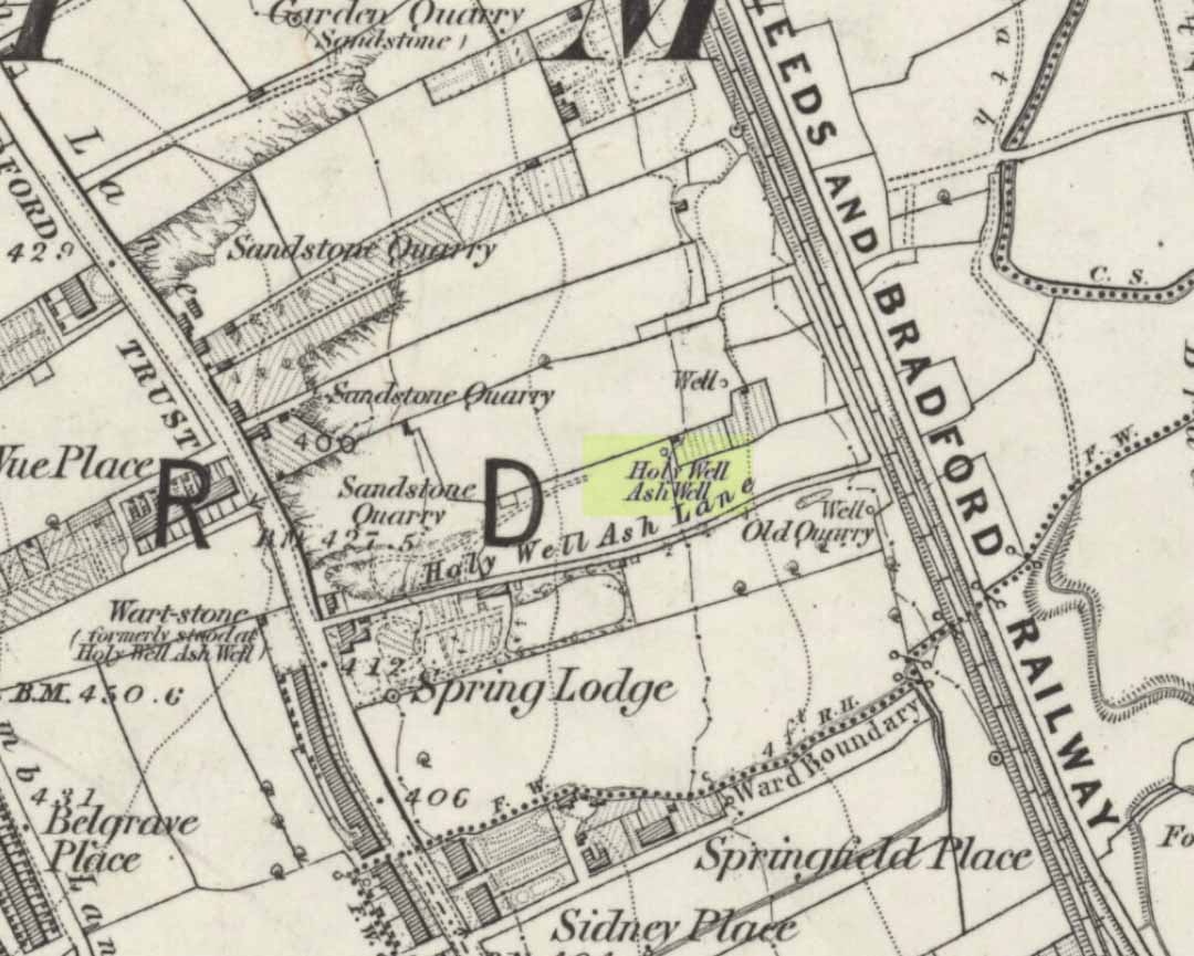
Holy Well Ash on 1852 map

Either right next to, or perhaps now beneath Bradford City’s Valley Parade football ground, was once a very important sacred well site.  Known as the Holy Ash Well and variants thereof, this healing spring was of considerable renown to people all around Bradford district in bygone days.  The site was illustrated on the 1852 OS map, and there was also a sacred stone adjacent to the well known as the Wart or Pin Stone, which had some animistic healing properties related the waters.

The old well was described by local historian Abraham Holroyd (1873) who said that:

“In Manningham Lane there is a fine well, in old deeds called Hellywell, i.e., holy well, in a field now called Halliwell Ash, now a stone quarry… Near this is the ancient Pin Stone.”

A few years later, in Robert Charles Hope’s (1893) monumental study, he described how,

“This holy well, not far from Manningham Lane, probably derived its name from having at some time been dedicated to some saint.  The inhabitants of Bradford were wont in ancient times to resort on Sundays to these wells as a common place of meeting, to drink of the waters and partake of their preternatural virtues.”

Which was another was of saying that he didn’t really know too much about the place!

The Bradford historian William Preston (1933) described this site in one of his early essays, where he informed us that local people knew the accompanying rock hereby as the Ash Stone, due to its proximity and ritual relationship to a great old ash tree (Fraxinus excelsior) that grew next to the well.  The mythic history of this particular tree should not be understated: it was a Creation deity par excellence in northern and Viking myths, but whatever old tales and power might once have been had here, in Bradford, they’ve long since been forgotten.  But it was the industrial historian William Cudworth (1896) who told the most of this all-but forgotten site, saying:

“On the sloping ground between Belle Vue and the Midland Railway there once existed a spring of water, supposed to have preternatural virtues. The name it bore within present recollection is probably a corruption of Holy-well. The holy wells of England as elsewhere had not all the same virtues attached to them. Some were blessed if used for baptisms, to others were attributed curative properties, especially for sore or weak eyes, while others were supposed to possess mystical powers, insomuch as any article dipped in them became charms or safeguards against witchery.  Any traditions associated with the spring at Halliwell (or Holywell) Ash are lost, but certainly in the early part of the present century the place was a favourite resort of the townspeople on Sundays.

“The derivation of the name is doubtful. In the survey of 1638 a close called ” Helliwell Ash” is mentioned as containing 2a. 3r. 26p., but without any indication as to its locality. The spelling of the name is of little moment.  Mr. James, in his “History of Bradford,” states that he had seen the place referred to in old deeds as “Helly-well.” By his will, dated May, 1685, Thomas Lister, of Manningham, devised to his two daughters, Juliana Lambrecht and Elizabeth Stapleton, equal shares in two closes of land called “Holywell Ash” and ” Delf Close,” besides other lands in Manningham. In the will disposing of the possessions of Juliana Lambrecht, her moiety of “Holywell Esh” was bequeathed to Francis Stapleton, her nephew.  In due course the lands in question were inherited by Francis Sharp Bridges, and have latterly belonged to Sir Francis Sharp Powell, M.P., in whose writings the form of spelling is given as ” Halliwell Ash.”

“Upon the ground in question there used to be a fine well of water issuing out of the higher ground, to which tradition assigned healing virtues. Might not the name of “holy” come from this circumstance?  Sufficient importance attaches to the tradition, however, to have led the farmers of the recent ordnance plan of Manningham to preserve the name, although the widening of the Midland Railway below Thorncliffe Terrace has almost obliterated the site.”

A more recent updated overview of the site was written by one of my old school-mates, Dave Pendleton (1997), who said of the place:

“Prior to 1886 the only feature of any real note in the Valley Parade environs was a holy well that emerged near the corner of the football grounds Midland Road and Bradford End stands; hence the road Holywell Ash Lane. Today the site of the well is covered by the football pitch.

Only the road name survives as a reminder of what was apparently one of the district’s foremost attractions. On Sundays and holidays people would gather to take the waters and leave pins, coins, rags and food as offerings to the spirit that resided in the waters.

Accounts suggest that the well was covered and had a great ash tree standing over it (hence ‘holy ash’). There was also a standing stone called the wart stone of unknown antiquity. The stone had a carved depression that collected water. It was believed that the water was a miraculous cure for warts. Indeed, as early as 1638 the Holy Well had been credited with healing powers.

The well suffered a decline in popularity during the late nineteenth century and its keepers resorted to importing sulphur water from Harrogate, which they sold for a half penny per cup. The well disappeared under the Valley Parade pitch during the summer of 1886 and the wart stone was moved to the top of Holywell Ash Lane – which then ran straight up to Manningham Lane. The stone was still there as late as 1911 but thereafter it seems to have disappeared into the mists of time.”

A night-club adjacent to the Valley Parade football ground—called Bibby’s—was said to have had an old well in its cellar, which the owner of the place, Mr Pearl Gladstone Minott, said was ‘haunted’.

Unfortunately I’ve not been able to find any old photos or drawings of this lost holy well – though I imagine that some local, somewhere must be able to help us out with this one.  Surely there’s more of this site hidden away somewhere….?

References:

  1. Bennett, Paul, The Old Stones of Elmet, Capall Bann: Milverton 2001.
  2. Cudworth, William, Manningham, Heaton and Allerton, W. Cudworth: Bradford 1896.
  3. Holroyd, Abraham, Collecteana Bradfordiana, Saltaire 1873.
  4. Hope, R.C., The Legendary Lore of the Holy Wells of England, Elliot Stock: London 1893.
  5. Pendleton, David & Dewhirst, John, Along the Midland Road, Bradford City AFC 1997.
  6. Preston, W.E., ‘Some Bradford Holy Wells’, in Bradford Antiquary, volume 7, 1933.

© Paul Bennett, The Northern Antiquarian 

Caratacus Stone, Winsford, Somerset

‘Standing Stone’:  OS Grid Reference – SS 8896 3355

Getting Here

You can’t really miss this.  Take the road south from Winsford, up the steep hill onto the moors and before you reach the crossroads, look up across the slope on your left where you’ll see a small building on its own.  Go there!

Archaeology & History

A curious upright monolith more than five feet long (though some of this is embedded in the ground) with the words ‘CARAACI NEPVS’ carved on one side, is strangely closetted in a silly ‘house’ of its own on the moortops!  But the origins and history of the stone are contentious.  Some proclaim it as prehistoric, others Romano-British, and others as being from the Dark Ages.  In the 1960s and ’70s, archaeological tradition had its origins in the Romano-British period, and certainly the carved lettering on the sides of the stone seem to indicate a Roman provenance; but as the great Exmoor historian S.H. Burton (1974) told,

“It is possible that the stone was erected hundreds of years before it was inscribed, and the existence of an ancient trackway alongside, leading to the Barle, strengthens this possibility.  But, like most things about the Caratacus Stone, this is guesswork.”

We know it stood here in the 13th century as it was described in perambulation records of 1219 and 1279 AD; but it’s more than likely to be a monolith erected in the Dark Ages.  Grinsell (1970) however is a little more cautious, telling:

“The likelihood of the person in whose memeory this stone was raised claiming kinship with the Caratacus who was the arch-enemy of Rome, c. AD 45-50, has on more than one occasion been questioned.  It is, however, too tempting to be abandoned by the present writer.”

The carving on the stone was deciphered by the legendary Prof. John Rhys at the end of the 1800s, telling it to have been Carataci Nepos, the Kinsman of Caratacus (and variants thereof), who held out against the Romans in south Wales until AD 50.  The old Celtic writer, R.A.S. Macalister, thought the stone to have been dedicated to a local christian hero, St. Carantoc, but this notion has been generally dismissed.

Folklore

The old stone is said to be a site where buried treasure exists — though none has ever been found.  There is also an old tradition that “ghostly horses and waggons rumble towards the stone at midnight” — but this as likely relates to its proximity with the old crossroads a short distance away.

References:

  1. Burton, S.H., Exmoor, Hale: London 1974.
  2. Grinsell, L.V., The Archaeology of Exmoor, David & Charles: Newton Abbot 1970.
  3. Page, John Lloyd Warden, An Exploration of Exmoor and the Hill Country of West Somerset, Seeley 1890.
  4. Vowles, Alfred, History of the Caratacus Stone, privately printed 1939.

© Paul Bennett, The Northern Antiquarian

St. Helen’s Well, Holbeck, Leeds, West Yorkshire

Holy Well (destroyed):  OS Grid Reference – SE 295 329

Archaeology & History

In the Holbeck area of Leeds, one of the three spa wells was previously patronised to this mythical saint, whose wells profuse in this part of the world.  St. Helen’s Well (later becoming the Holbeck Spa Well) was found at the appropriately named St. Helens Bridge.  Ralph Thoresby (1715) wrote of the place: a supposed medicinal holy well, it previously had a chapel by it, of which no trace is seen today. John Mayhall (1860) also mentioned this “medicinal well,” but told little more. It was Andrea Smith (1982), more than a century later, who wrote the most about the place:

“In connection with the well by St.Helen’s Bridge, Holbeck, (Thoresby) refers to “another ancient fabrik called St. Helen’s,” but there is a difficulty in deciding exactly what he means by ancient; it is taken here as meaning more than two hundred years old. This suggests, then, that by St. Helen’s Bridge there was once a well and chapel which gave rise to the dedication and which was probably a Medieval foundation, considering the popularity of St. Helen at that time.”

Both of these sites have long since disappeared. The well eventually became known as a local Spa Well, and was found to possess a high sulphur content.

References:

  1. Mayhall, John, The Annals of Yorkshire, Joseph Johnson: Leeds 1860.
  2. Smith, Andrea, ‘Holy Wells Around Leeds, Bradford & Pontefract,’ in Wakefield Historical Journal 9, 1982.
  3. Thoresby, Ralph, Ducatus Leodiensis: or the Topography of the Ancient and Populous Town and Parish of Leedes, Robinson & Holdsworth: Leeds 1816.

© Paul Bennett, The Northern Antiquarian

Winter Hill Stone, Cowling, North Yorkshire

Cup-Marked Stone:  OS Grid Reference – SD 98288 41976

Getting Here

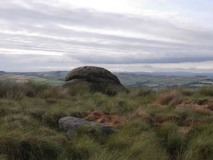
Winter Hill Stone, looking NW

The easiest way to get here if you’re coming for the first time is via the A6068 Glusburn to Cowling road. On the south side of Cowling, take the small road Old Lane, uphill on the east side of the road (very easily missed – keep your eyes peeled!) and keep going up until the road just about levels out, where there’s a muddy parking spot on your left (the giant Wainman’s pinnacle is down the path from here).  Cross over the road and head up towards the giant Hitching Stone. When you reach the first fence, cross over it and follow it into the boggy heathlands to your right (west-ish).  Head into the tribbly grass and keep walking for 3-400 yards till you see the large rock growing out of the Earth.

Archaeology & History

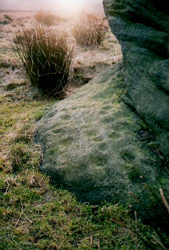
Cup-markings near ground-level
Looking from above

Not far from the legendary Hitching Stone is this curiously-shaped boulder sitting peacefully and alone in its landscape.  It is in fact a large cup-marked boulder, previously unrecorded until being described in The Old Stones of Elmet.  On top of the stone it seems that there are no definite man-made cup-markings, but there are a number of seemingly natural ones (although some could have been etched thousands of years ago and have just eroded well); instead the real cup-markings are found curiously etched at the base of this large rock, just above ground-level.

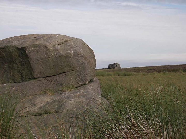
Hitching Stone on horizon

As can be seen in the photos, on its lower south-facing edge there are around 20 well-defined cups that clearly stand out.  No other cup-marked stones appear to be nearby (surely there’s a few more kicking about in the area…?).

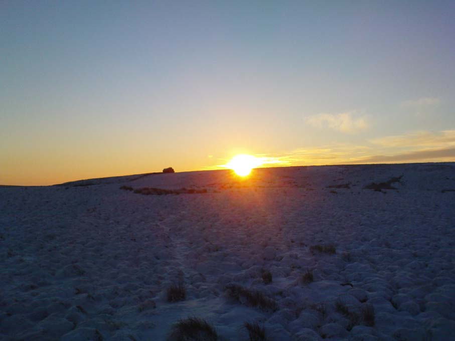
An earlier assertion I made (2001) about the nearby Hitching Stone aligning with the winter solstice sunrise from here was recently put to bed following the morning observations of myself and Dave Hazell on December 21st, 2010, when — as can be seen in the photo here — the midwinter sun emerges from the land a few degrees of arc further southeast than expected.  However, I aint checked what the alignment here would have been when the cup-markings were first etched here, around 5000 years ago perhaps…  Would any of you archaeo-astronomers out there know about this?

References:

  1. Bennett, P., The Old Stones of Elmet, Capall Bann: Milverton 2001.

© Paul Bennett, The Northern Antiquarian

Fenny Shaw Cup-Mark, Bingley Moor, West Yorkshire

Cup-Marked Stone:  OS Grid Reference – SE 11271 43565

Also Known as:

  1. Carving no.112 (Boughey & Vickerman)

Getting Here

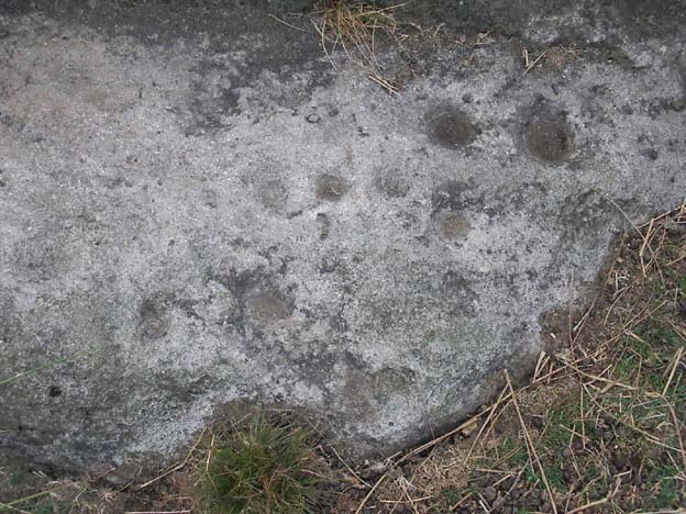
Close-up of 'cup-mark'
Close-up of ‘cup-mark’
Fenny Shaw Cup-Marked Stone

Follow the same directions to reach the Big Rock carving.  From here walk less than 100 yards up the slope, veering to your left and where you reach the rushes (Juncus grasses), walk up and keep your eyes peeled for the singular upright rock.  Or as ‘Redkiteyorks’ said, go “up the slope 82.4 metres, 54.5 degrees(True) from IAG108 (Big Rock).” It aint hard to find really…

Archaeology & History

Another stone mainly for the purists amongst you.  Little has been written on this possible carving.  Boughey & Vickerman (2003) said simply:

“Large rough rock. Two possible cups on top and one further possible cup on W vertical face. Doubtful”.

References:

  1. Boughey, K.J.S. & Vickerman, E.A., Prehistoric Rock Art of the West Riding, WYAS: Leeds 2003.
  2. Hedges, John (ed.), The Carved Rocks of Rombald’s Moor, WYMCC: Wakefield 1986.

© Paul Bennett, The Northern Antiquarian

Bleasdale Circle, Lancaster, Lancashire

Timber Circle:  OS Grid Reference – SD 57717 46004

Getting Here

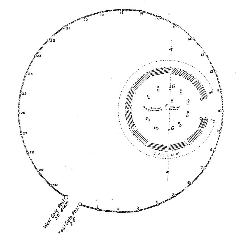
Bleasdale Ring & enclosure plan (Syd Wilson, 1900)

Pretty easy to find, and a nice walk to boot! Head up to Bleasdale Church (worth a look in itself!), keep going up the path north to the aptly named Vicarage Farm.  From here you’ll notice a small copse of trees on your left (east) heading to the hills.  To those of you who like Predator, “it’s up there – in them trees…!”

Archaeology & History

On my first visit here in the company of John Dixon and other TNA regulars, my first impression was “this is a henge” – and noted subsequently that it’s been described as such by several writers.  But the general category given to this fascinating place is a ‘timber circle.’

Bleasdale ‘henge’ circle

First discovered at the end of the 19th century and described in considerable detail by Mr Dawkins (1900), this is a gorgeous-looking monument was erected in at once a gentle and tranquil, aswell as an imposing natural setting, at the foot of Fair Snape Fell (to the northwest) and Bleasdale Fell (due southwest).  These aspects of the landscape would have  had obvious mythic importance to the people who built this ring amongst the trees.  A condensed version of Dawkin’s material was described in J. Holden’s (1980) Story of Preston, that outlined this circle as being,

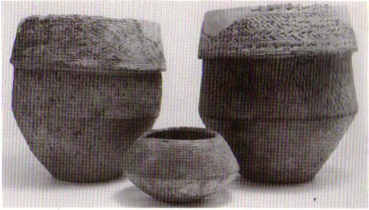
“a centre for religious worship in about 1700 BC.  It was made up of a circle of timber posts which enclosed an area 45 metres in diameter. In the centre was a small mound surrounded by a ring of oak posts and a circular ditch.  Inside the mound there was a grave that had in it two pottery urns filled with human bones and ashes. Examination of the contents of these urns shows that the bodies were wrapped in linen and burnt on a funeral pyre. A small ‘accessory’ cup was found inside one of the urns and this may have contained food or drink for the afterlife.”

Urns from Bleasdale Ring
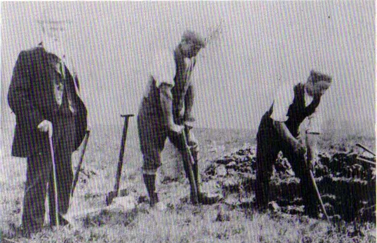
1898 photo of Shadrach Jackson (left) & Tom Kelsall (centre) digging the site

Located within a much larger circular enclosure, the internal Bleasdale ‘henge’ Ring consisted of a small circle of eleven timber posts near the edge of the ditch, and an entrance way to the east, to or from which was an avenue of further wooded posts that led to the edge of the larger enclosure.  It gives the impression that this was some sort of avenue along which a ceremonial procession may have took place, strongly suggesting a ritual function.  Robert Middleton (1996) told that,

“The post circle and barrow appear to respect each other  (in date), whilst the enclosure may be later.  The post circle has been dated to around 2200 BC, although the context and reliability of this date is unclear.”

Looking out eastwards from the middle of the internal henge-style ring and through the ‘entrance’ we find an alignment with a large notch on the skyline which, modern folklore ascribes, is where the midwinter sun rises — which is very believable, but I aint seen it proven anywhere yet.

A much greater and full excavation report of this site was written by Raymond Varley (2010), whose essay I urge fellow antiquarians to read.

References:

  1. Dawkins, W.B., ‘On the Exploration of Prehistoric Sepulchral Remains of the Bronze Age at Bleasdale,’ in Transactions of the Lancashire & Cheshire Antiquarian Society, volume 18, 1900.
  2. Dixon, John, Journeys through Brigantia – volume 8: Forest of Bowland, Aussteiger Publications: Barnoldswick 1992.
  3. Edwards, Ben, “The History of Archaeology in Lancashire”, in Newman, 1996.
  4. Gibson, Alex, Stonehenge and Timber Circles, Tempus: Stroud 1998.
  5. Holden, Jennifer (ed.),  The Story of Preston, Harris Museum: Preston n.d. (c.1980)
  6. Middleton, Robert, “The Neolithic and Bronze Age,” in Newman, 1996.
  7. Newman, Richard (ed.), The Archaeology of Lancashire, Lancaster University 1996.
  8. Sever, Linda (ed.), Lancashire’s Sacred Landscape, History Press: Stroud 2010.
  9. Varley, W.J., ‘The Bleasdale Circle,’ in Antiquaries Journal, volume 18, 1938.
  10. Varley, Raymond, “The Bleasdale Bronze Age Timber Circle,” in Lancashire History Quarterly, 2010.

© Paul Bennett, The Northern Antiquarian

Holed Stone, West Overton, Wiltshire

Enclosure & Stone:  OS Grid Reference – SU 1285 7151

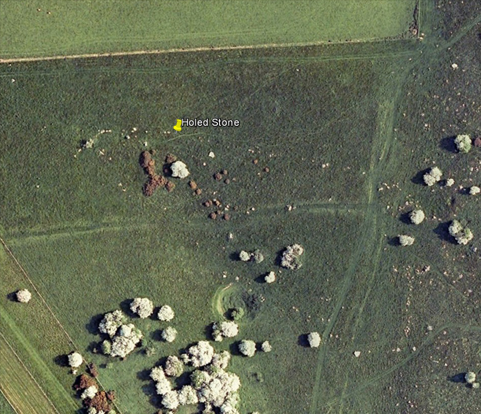
Aerial image of site

Getting Here

Follow the same directions as if you’re visiting the Polisher Stone at the top-end of Overton Down where it meets Fyfield Down.  From here, walk down the slope for a hundred yards or so where you’ll notice, just above the long grassy level, a line of ancient walling running nearly east to west.  It’s very close to the yellow marker in the attached aerial image shot to the right.  If you walk along this line of walling you’ll find what you’re looking for.

Archaeology & History

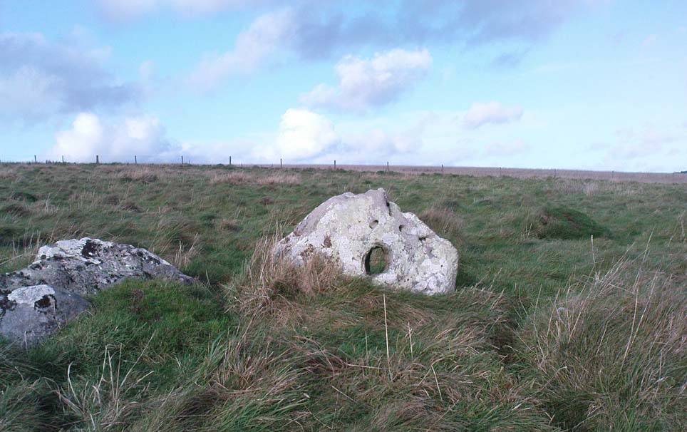
Overton’s Holed Stone

As I’ve only been here once, and briefly — under the guidance of the Avebury expert Pete Glastonbury — my bearings on this site may need revising.  There are two distinct sections of walling here: one has been excavated by Peter Fowler and his team; the other hasn’t. (correct me if I’m wrong Pete)  And in Fowler’s (2000) fine survey of this area he does not describe this very distinct holed-stone in the line of walling, or adjacent “linear ditch F4”, as it was called.  But then, many archaeologists don’t tend to find items such as these of any interest (unless their education stretches to other arenas, which isn’t usually the case). But the stone seems to be in a section of walling that isn’t in their survey; standing out in aerial imagery as a less well-defined, but still obvious line of walling that is closer to the fence, 70-80 yards north, with a decidedly Iron-Age look about it!

But, precision aside! — as you can see in the photos, the holed stone here isn’t very tall — less than 2 feet high; though we don’t know how deep the stone is set into the ground.  This spot is on my “must visit again” list for the next time we’re down here!

Folklore

Veritable vagabonds, Mikki, June, PeteG & Geoff, readying themselves for fertility rites!

There’s nowt specific to this stone, nor line of walling, nor settlement (as far as I know), but it seems right to mention the fact that in British and European folklore and peasant traditions, that holed stones just like the one found here have always been imbued with aspects of fertility — for obvious reasons. Others like this have also acquired portentous abilities; whilst others have become places where deeds and bonds were struck, with the stone playing ‘witness’ to promises made.

References:

  1. Fowler, Peter, Landscape Plotted and Pierced: Landscape History and Local Archaeology in Fyfield and Overton, Wiltshire, Society of Antiquaries: London 2000.

© Paul Bennett, The Northern Antiquarian


Chapel Flat, Dalston, Cumbria

Stone Circle (destroyed):  OS Grid Reference – NY 37 50

Archaeology & History

Listed in Burl’s (2000) magnum opus, this is another long-lost megalithic ring, whose exact location seems to have been forgotten.  An early description of the site by William Whellan (1860) told us that,

“There was formerly a circle of rude stones, ten yards in diameter, near the village, supposed to have been the remains of a Druidical temple; and a little distance from it, was a tumulus, three yards high and eight in diameter.”

More than a hundred years later in Waterhouse’s (1985) fine survey, he described the circle, saying:

“It lay near the village of Dalton…near the River Caldew… An 18th century account describes it as consisting of ‘rude’ stones…set in a circle of diameter about 27m.  East of the the centre of the circle were four large stones lying on top of each other.  They may have been the remains of a cist, or possibly a tumbled cove, like that inside the circle-henge of Arbor Low in Derbyshire.  A tumulus may have stood nearby.”

There are however some discrepancies in the descriptions between Whellan and Waterhouse.  In the former, the site of Chapel Flat is talked of separately as being the abode of a hermit in the lost chapel of St. Wynemius, “in a deep and romantic part of the vale of Caldew.”  The description of the stone circle immediately follows this, but is spoken of as merely being “near the village.”

Does anyone know anything further about this once important site?  Did the lost hermitage on Chapel Flat actually have anything to do with the stone circle?

References:

  1. Burl, Aubrey, The Stone Circles of Britain, Ireland and Brittany, Yale University Press 2000.
  2. Waterhouse, John, The Stone Circles of Cumbria, Phillimore: Chichester 1985.
  3. Whellan, William, The History and Topography of the Counties of Cumberland and Westmoreland, Comprising their Ancient and Modern History, W.Whellan: Pontefract 1860.

© Paul Bennett, The Northern Antiquarian

Smiley Stone Carving, Middleton Moor, North Yorkshire

Cup-and-Ring Stone:  OS Grid Reference – SE 10923 51269

Also Known as:

  1. Carving no.446 (Boughey & Vickerman)

Getting Here

Near the western end of the Middle Ridge, south of Dryas Dike, it’s probably best reached following the same directions to find carving no.435, walking past it but then following the footpath down onto the moor 100 yards further down the slope. Walk along here for about 200 yards till you get to the boundary stone.  You’re close!

Archaeology & History

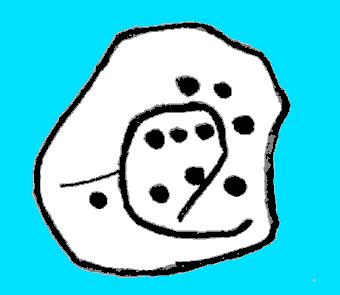
Sketch of carving 446
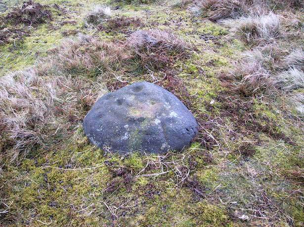
Smiley Stone carving

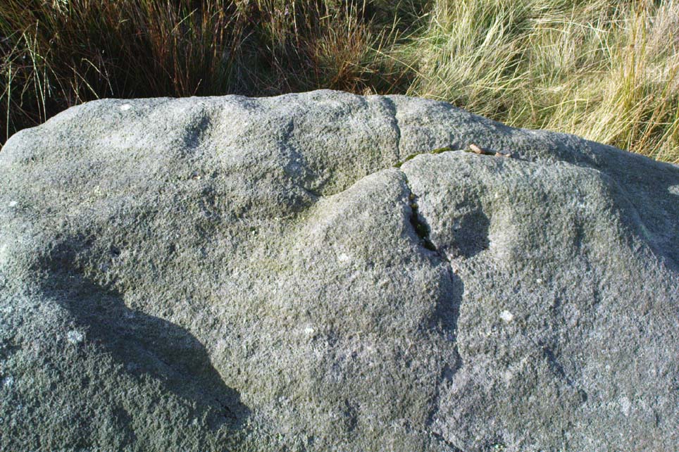
First described by Stuart Feather and described by him in 1966, this small rounded stone comprises of nine or ten cup-markings with a long, enclosing line that circuitously goes around four or five of them.  It’s a curious-looking design which, from one angle, gives the impression of a smiley face — hence the name (this is Boughey & Vickerman’s name for it — not mine!).

References:

  1. Boughey, Keith & Vickerman, E.A., Prehistoric Rock Art of the West Riding, WYAS 2003.
  2. Feather, Stuart, ‘Mid-Wharfedale Cup-and-Ring Markings – no.43 and 44: Middleton Moor, Ilkley,’ in Cartwright Hall Archaeology Group Bulletin, 11:4, 1966.

© Paul Bennett, The Northern Antiquarian


Black Hill Enclosure, Middleton Moor, North Yorkshire

Enclosure:  OS Grid Reference – SE 11757 51949

Getting Here

Just below Black Hill in the Middleton Moor Enclosure, little more than 10 yards east of the footpath on the east side of Loftshaw Gill, the slope drops down and into a slight ‘bowl’ in the landscape.  Here it is!

Archaeology & History

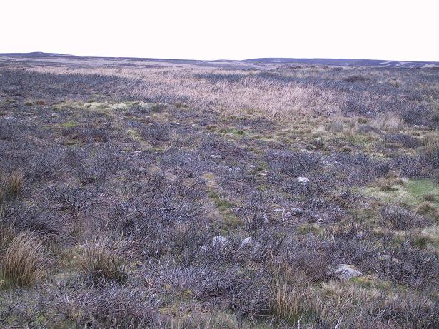
This is a previously undiscovered prehistoric settlement, enclosure, or something along those lines!  We came across it in April 2005 and is found amidst the mixed heather and bracken and has a scattering of small stones, as if in the wake of a dried stream from bygone times.  But whatever stream might once have been here, it’s long since fallen back to Earth — but at a point where a few rushes (Juncus conglomeratus) can be seen we find the aged remains of a large oval enclosure.

Similar in form to the other remains located up here by Eric Cowling (1946) in the 1930s and ’40s, when Richard Stroud and I first found this, structural remains of distinct lengths of walling were visible – but once the vegetation started growing back here again, it was almost impossible to discern.

Faint remains of enclosure walling

The main archaeological remains comprises of an oval-shaped structure, with what seemed liked a distinct Bronze Age note stamped on the walling — though it could be earlier, but without excavation it’s impossible to say. Most of the walling was just above ground-level, making it difficult to appreciate in the photo. It measures approximately 40 feet north-south and 33 feet east-west. The walling itself averages between 18-24 inches wide and was no more than one-foot tall at the highest.  Near the middle of the enclosure there were further sections of walling indicating different ‘rooms’ in the overall structure of things here.

Like I say, we unfortunately couldn’t get a decent image of this site cos the vegetation was already covering it up. So if you wanna see it, gerrup there soon after the heather burning’s been done here — otherwise it’s gonna be at least another year before you getta chance to see anything.  In Richard Stroud’s photo here, you’re looking at the bottom curve of the enclosure. You can just make out the line of walling near the centre of the picture, and two-thirds the way to the right you can see the enclosure wall curve closer to the bottom of the photo. (the site obviously requires a much better assessment from someone far more competent than me!)

References:

  1. Cowling, E.T., Rombald’s Way, William Walker: Otley 1946.

© Paul Bennett, The Northern Antiquarian