Cup-and-Ring Stone: OS Grid Reference – NT 714 275
Archaeology & History
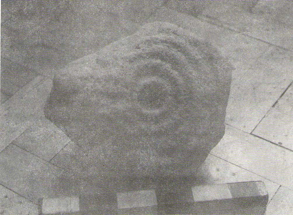
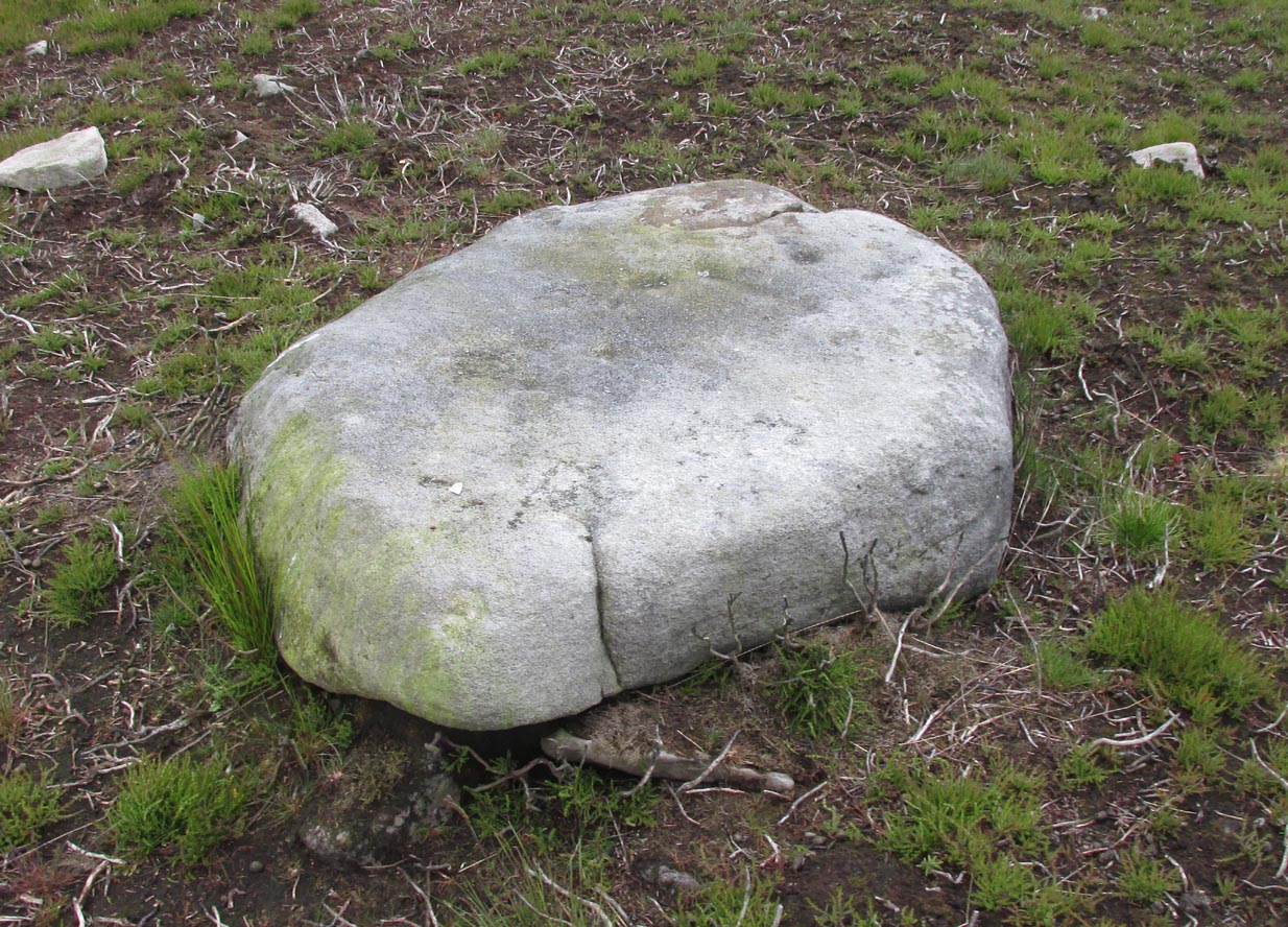
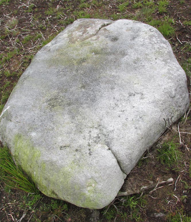
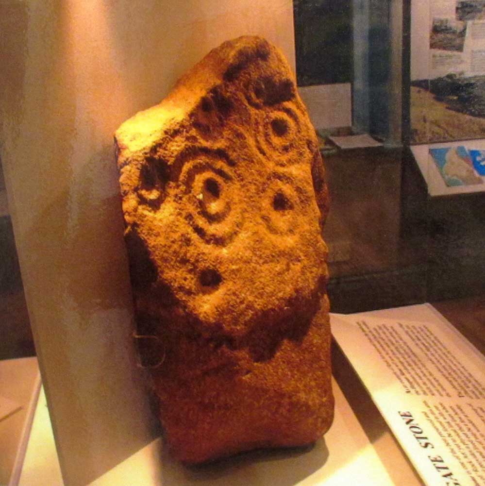
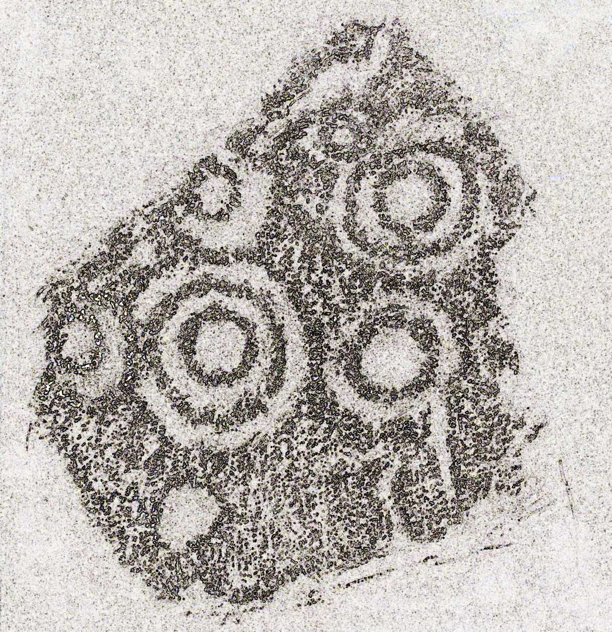
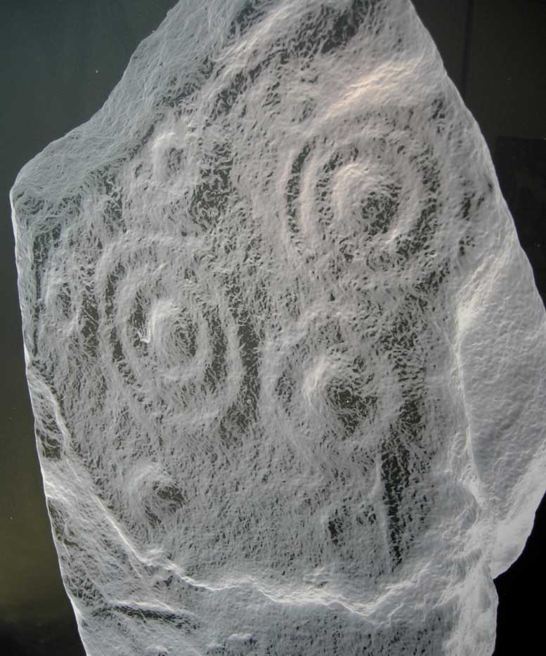
Now housed in the National Museum of Antiquities in Edinburgh, this little-known petroglyph was rediscovered in 1957 by a Mr G.F. Ritchie, not far from the once-large Kalemouth neolithic tomb. It’s a carving that seems to be quite isolated (no others are known about in the immediate area), comprising of an incomplete four-ringed design which, in all probability, is a stray rock that came out of a nearby prehistoric cairn—although we don’t know this for sure.
The carving was described in Ron Morris’ (1981) petroglyph survey, where he told us that,
“In the field “not far from the cairn” (just E of the farm), was a small convex gritstone boulder 25cm by 15cm by 15cm (¾ft x ½ft x ½ft). On its fairly smooth surface is:
a cup-and-four-rings with 2 parallel grooves from the inner ring (which is incomplete) through the others (which are gapped)—the outer two being now incomplete also—a form of ‘keyhole pattern’.”
A near-identical carving on a similiar-shaped portable stone can be seen in Galashiels museum, whose history has seemingly been forgotten.
References:
- Morris, Ronald W.B., “The cup-and-ring marks and similar sculptures of Scotland: a survey of the southern Counties – part 2,” in Proceedings of the Society of Antiquaries, Scotland, volume 100, 1967.
- Morris, Ronald W.B., “The Cup-and-Ring and Similar Early Sculptures of Scotland; Part 2 – The Rest of Scotland except Kintyre,” in Transactions of the Ancient Monuments Society, volume 16, 1969.
- Morris, Ronald W.B., The Prehistoric Rock Art of Southern Scotland, BAR: Oxford 1981.
© Paul Bennett, The Northern Antiquarian