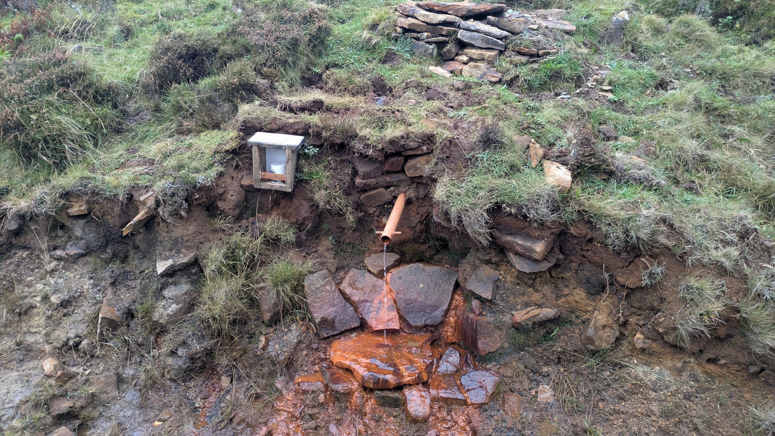
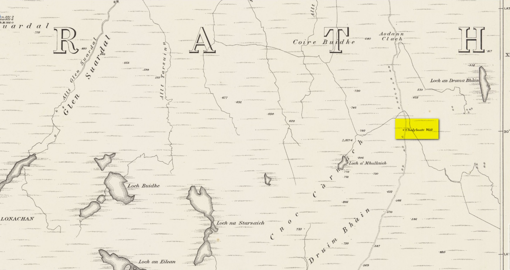
Highlighted on the earliest Ordnance Survey maps of the island, roughly halfway along the Broadford to Heaste road on the right (west) side you will come across the Tabar Ruadh (Gaelic for “Red Well”). For many generations at this point was a Chalybeate well where villagers would stop and drink in a pewter mug from outlet of cast iron pipe which connected to the stone well some nine feet from the road. It was a major stopping point for their horses and ponies to take a drink too.
This set up was functioning in the early 1980’s. At that time I talked to Heaste locals who remembered fishermen from their village taking bottles of this water to pregnant women in the village of Elgol. It was known then for it’s healing properties; this was the early 20th century. The pewter mug was stolen and with road widening and the pipe removed, the site was becoming increasingly overgrown and in danger of being lost for ever.
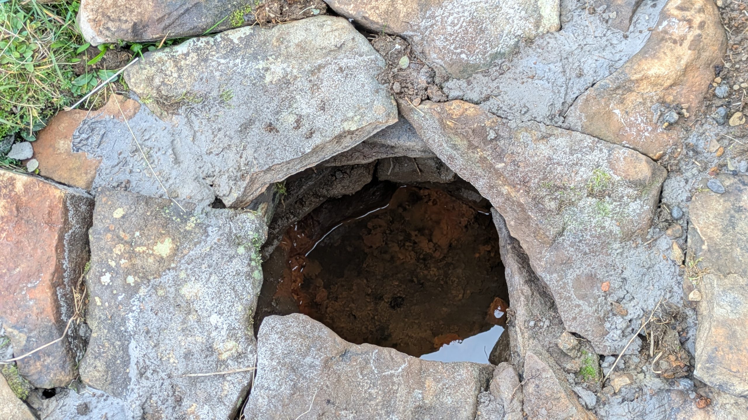
Site shown on 1881 mapWater under the well cover
For the last fifteen years I have been walking this road and had made it a determination to find this well. Success this summer! — and the hidden overgrown well was cleaned out a new steel pipe added. Chalybeate water now flows and a wooden box is at the roadside with a tin mug. On a wet roadside ditch this red water is very obvious where it joins the road.
Acknowledgements:Huge thanks for use of the Ordnance Survey map in this site profile, reproduced with the kind permission of the National Library of Scotland.
Holy Well (destroyed): OS Grid Reference – NT 2611 7600
Also Known as:
Bonnington Mineral Well
Archaeology & History
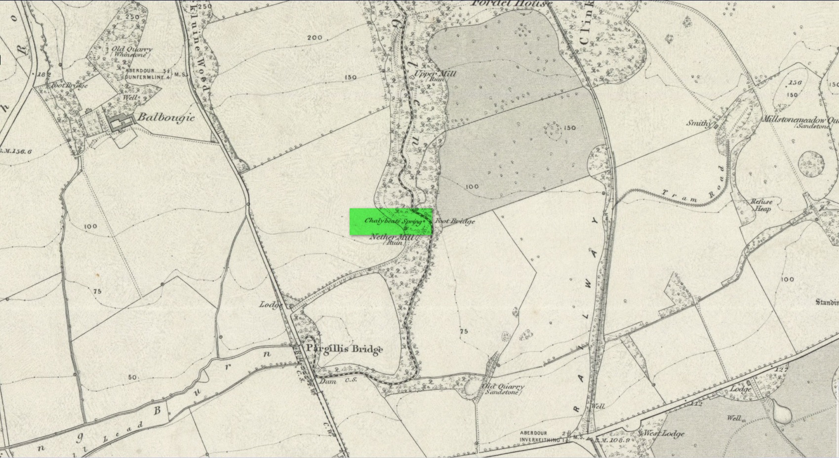
Site shown on 1862 map
If we’d have lived 200 years ago and walked several miles downstream from St Bernard’s Well on the Water of Leith, we would have eventually come across this little-known sacred site, sadly destroyed in the 19th century. It was shown on the earliest OS-map on the south-side of the river, enclosed in a small square building with what looks like two entrances, and what appears to be a covering of the spring on the southeast side. Marked as a chalybeate, or iron-bearing well, this would have obviously have had repute amongst local people and would have worked as a tonic or pick-me-up, aswell as fortifying the blood and a having a host of other benefits.
The Ordnance Survey lads wrote short notes about St. Cuthbert’s Well in the Name Book of 1852-53, where they told:
“A Well Situated at Bonnington. Supposed to have been dedicated to St Cuthbert; about 34 years ago the proprietor repaired the well and at the same time erected a house over it, and fitted it up for Visitors who are charged one penny for a drink. The Water of the well has been analysed by Professor Jameson and Doctor Turner and it was found to Contain Salts of Iron; Soda, magnesia and Lime, also Iodine under the form of Hydrisdate of Potash.”
About the same time as Jameson & Turner’s analysis of St. Cuthbert’s waters, one Dr Edward Schweitzer (1845) wrote one of the most detailed chemical essays on wells, ever!—using Bonnington’s holy well as his primary focus. A near-thirty-page essay found that, along with an excess of iron, the medicinal aspects of the waters were due to the following compounds found, per grains, in each pint of water:
Sulphate of Potassa — 2.46554 gr
Sulphate of Soda — 1.51227 gr
Sulphate of Lime — 6.28816 gr
Iodide of Sodium — 0.00728 gr
Bromide of Sodium — 0.07886 gr
Chloride of Ammonium — 9.49939 gr
Chloride of Sodium — 3.82963 gr
Chloride of Magnesium — 3.12017 gr
Nitrate of Soda — 2.02154 gr
Carbonate of Magnesia — 1.70443 gr
Proto-Carbonate of Iron — 0.05807 gr
Proto-Carbonate of Manganese — 0.01535 gr
Ammonia (united to organic matter) — 0.42285 gr
Alumina — 0.02245 gr
Silica — 0.18651 gr
In 1837, a Mr Robert Fergusson was known to be “the keeper of the Mineral Well, Bonnington,” but much of its traditions and history have fallen outside of memory. The site was soon to become another mid-Victorian ‘Spa Well’, where local people would have to pay for water they had always used as Nature intended. In truth, the waters and its well-house were to become a place where the rich Industrialists could heal their infirm mind-bodies, hoping that the destitution they lacked emotionally and spiritually would be washed away in the sacred waters. But it didn’t last long! What little is known about it historically was best described in John Russel’s (1933) essay on Bonnington in the Old Edinburgh Club journal. He wrote:
“Just where the Bonnington mill lade joins the Water of Leith once flowed St. Cuthbert’s Well, an ancient spring named after the patron saint of the once extensive parish of St. Cuthbert’s, and like the now forgotten mineral well of St. Leonard’s near Powderhall, a relic of a superstitious age. As to when this well was so designated history is silent but it was probably before 1606, when the Leith portions of Bonnington, Pilrig and Warriston were, by the Scots Parliament, included in the Parish of North Leith…
“In May, 1750 St. Cuthbert’s Well was found to be possessed of medicinal properties. The Scots Magazine of that year refers to many persons frequenting it. The Well formed part of a building which included a pump room and a reading room. From advertisements in the periodicals of 1819 we learn that it was open from 6 o’clock in the morning and that newspapers were to be found on the table all day. The tenant also issued handbills headed “St. Cuthbert’s Mineral Well, Bonnington”, giving a chemical analysis of the water and a list of the ailments for which it had been found beneficial. The Well disappeared with the re-construction of Haig’s Distillery in 1857. It now lies beneath the buildings immediately west of the chimney stack of Messrs John Inglis and Sons.”
St. Cuthbert’s feast day was March 20 (Spring Equinox) and September 4.
A half-mile southwest of here could once be seen the waters of St. Leonard’s Well, which Ruth & Frank Morris (1982) erroneously thought to have been this Well of St. Cuthbert.
Healing Well (covered): OS Grid Reference – TQ 6000 3963
Archaeology & History
Shown on early OS maps as a chalybeate spring, the denuded remains of this site can still be seen in Dunorlan Park, between the tearoom and the lake, where the spring can be seen on the left beneath a large tree. It was first described in John Britton’s (1832) famous account of the area, who told us:
Site shown on 1872 map
“There is a spring, called Burnt House Spring, situated in a little dell, in a romantic spot to the right of the road leading from Tunbridge Wells to Pembury. It is a good chalybeate, and the iron is in a state of carbonate. This spring rises rapidly into a stone basin, placed in the centre of a circular excavation, about ten feet in diameter and six or eight feet deep, which is bricked round, and with the remains of stone steps leading down to the basin at the bottom. This spring, therefore, has clearly been, at some time, made use of as a medicinal water. It was accidentally discovered choked up with rubbish. The country about Tunbridge Wells abounds with springs of this character.”
The spring was cleaned up some time ago and its waters rise in a square stone-lined chamber—accessed by four stone steps—into a circular stone basin, before flowing down a short channel and into the drains. I’ve no idea whether or not the water is still drinkable.
References:
Britton, John, Descriptive Sketches of Tunbridge Wells and Calverley Estate, Longman: London 1832.
This little-known iron-bearing spring takes some finding! It’s all but lost beneath a mass of invasive rhododendrons that cover the slopes here (it needs to be severely cut back) and will only be found by the truly adventurous amongst you. In notes of this site by Ordnance Survey in 1854, they told that “there was formerly a fountain to protect the Spring, but the fountain has been allowed to go to ruin” and I could see no remnants here on my visit.
In a detailed and lengthy analysis of the spring water that was done by W. Robertson in 1829, the principal minerals in it were found to be iron, magnesia and lime, but the spring was said to have no medicinal renown locally.
Acknowledgements:Huge thanks for use of the Ordnance Survey map in this site profile, reproduced with the kind permission of the National Library of Scotland.
Healing Well (destroyed?): OS Grid Reference – SD 8047 5700
Archaeology & History
In Thomas Short’s (1765) description of the once-renowned Wigglesworth Sulphur Well, he mentioned briefly that there were “some (other) chalybeates near it.” Thankfully 85 years later, with the aid of William Howson (1850) who gave us a marginally better description, we were able to locate the whereabouts of one of them! From the Sulphur Well, this one could be found,
“two hundred yards above, on the other side of the rivulet there is a chalybeate spring, but (it was) of no unusual strength.”
In fact it’s a little closer to being 300 yards than 200—but that’s a minor issue in the grand scheme of things! The place in question was marked on the 1852 OS-map, marked simply as a “Well.” …This iron-bearing spring would have been a good pick-me-up and, as with all such wells of this nature, fortifies the blood and the immune system. Mr Howson also told us that “ferrugineous springs, stronger than this, are of frequent occurrence in the neighbourhood,” echoing Short’s earlier remark. Sadly, it seems that all trace of this Well has disappeared.
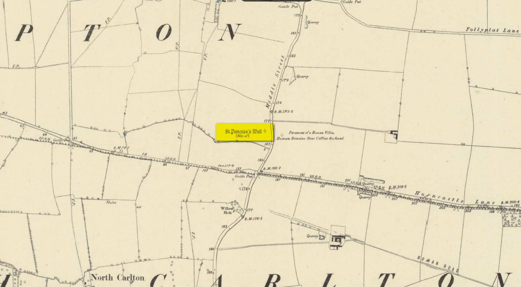
Holy Well (destroyed): OS Grid reference – SK 9542 7853
Archaeology & History
Site shown on 1886 map
Mentioned in Thompson’s (1999) survey but without comment, it was, curiously, Skyring Walters’ (1928) that drew my attention to this site. He added it to his list of St Pancras sites, telling how even in his day, it had fallen into memory. Indeed, it had already gone when the Ordnance Survey lads came here in 1885. Thankfully we were left with an albeit piecemeal account of the place by Cayley Illingworth (1810) before its destruction. It was an iron-bearing well that existed some fifty yards from an ancient Roman villa and was probably the water supply for the Romans who lived here. He told us:
“The circumstance…of the chalybeate spring within a few yards from the entrance of the villa, and still called Saint Pancras Well…favours the conclusion of a chapel having been erected on its site. (This) is supported by the strong evidence of a discovery, upon record, that a chapel dedicated to Saint Pancras did actually exist on this spot, so early as the beginning of the twelfth century; about which period Richard Fitz-Robert of Scampton gave to the monastery of Kirksted three selions of land in that lordship, two of which are described in the gift as lying in the south field, on the south side of the chapel of Saint Pancras.”
He further told that at the bottom of the well an oak floor had been laid, which had been dug up “several years ago.”
St Pancras’s festival date is April 3.
References:
Cameron, Kenneth & Insley, John, The Place-Names of Lincolnshire – volume 7, English Place-Name Society: Nottingham 2010.
Harte, Jeremy, English Holy Wells: A Sourcebook – volume 2, Heart of Albion Press: Loughborough 2008.
Illingworth, Cayley, A Topographical Account of the Parish of Scampton in the County of Lincoln, T. Cadel & W. Davies: London 1810.
Thompson, Ian, Lincolnshire Springs and Well, Bluestone: Scunthorpe 1999.
Walters, R.C. S., The Ancient Wells, Springs and Holy Wells of Gloucestershire, St Stephens Press: Bristol 1928.
Healing Well (destroyed): OS Grid Reference – SP 166 350
Archaeology & History
This is one of several iron-bearing wells (chalybeates) that used exist in and around the village. Mentioned briefly in Alfred Soden’s (1875) history of the parish, he told that,
“years ago, there were several chalybeate springs here, very strongly impregnated. One of these was at the lower end of Westmacott’s Lane: of this spring there is now no visible trace, it having been built over.”
Although Mr Soden said nothing about the healing properties of this well, due to the mineral composition of chalybeates they always tend to be good fortifiers or pick-me-ups, being good for the blood. And in this case, as the waters were “very strongly impregnated” they would have possessed some considerable local renown.
References:
Soden, Alfred J., The History of Blockley, J.W. Parbury: Coventry 1875.
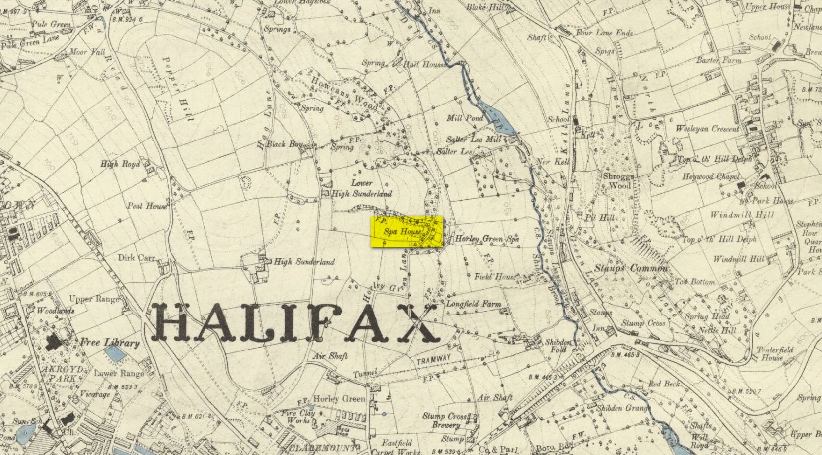
The historian William Addison (1951), in his history on the subject, told how “the spas began as holy wells”; and although no direct accounts are left of early dedications here, the remnants of Mayday traditions tell us there were more archaic goings-on before the waters were taken by the aristocrats. Once it had been designated as a spa, the waters were covered and a typical Spa House constructed over them. From hereon, for more than a century, the waters were accessible only to those with money who wished their ailments to be treated.
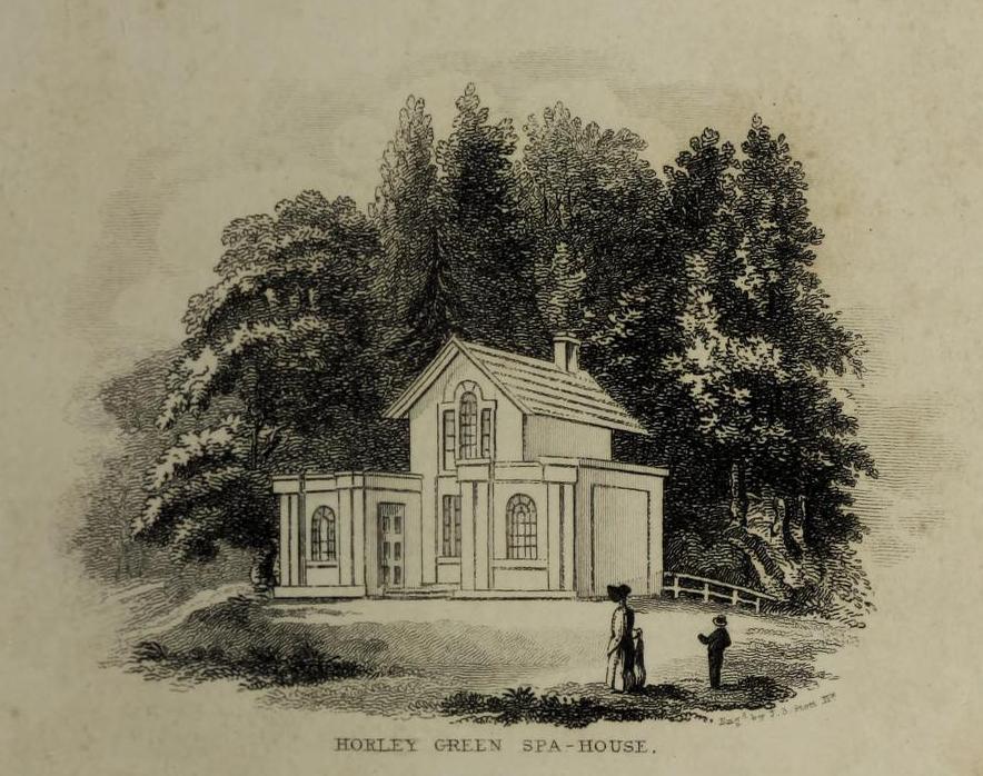
Between the end of the 18th to the end of the 19th century, the Horley Green Spa was a very prominent ingredient in the history of Calderdale. A chalybeate or iron-bearing spring, its waters were directed into a large underground cistern covered by metal. Thomas Garnett (1790) was the first to write about it, telling us:
“The Horley Green water is quite pellucid—sparkles when poured out of one glass into another—and has a sharp, aluminous, styptic taste, not unlike ink. The taste is not unpleasant when the water is taken from the springhead and drank immediately.”
He went on to espouse the waters to be good in healing bone and rheumatic diseases, giving many first-hand accounts from people in Yorkshire and beyond who used the waters here with apparent success, including one case of curing diabetes! Its reputation was later reinforced in a book by William Alexander (1840), who told us how,
“I unhesitatingly affirm that the Horley Green Spa possesses a very strong claim to be regarded as a powerful tonic and chalybeate.”
By the time those words were written, it had already gained a considerable reputation and many were those who’d received treatment.
Spa House on 1894 map
A years after Alexander, the roving doctor A.B. Granville (1841) visited Horley Green—who described it as “a renowned steel-water Spa”. But at the same time he reported how its popularity had started to decline. But, via one Mr West, he did leave us with a greater chemical analysis of the Horley Green waters in an attempt, once more, to certify and prove its curative properties. Their results found the waters to possess, in varying quantities, lime, magnesia, silica, iron oxide, sulphur and silica—all of which further attributed the science of its medicinal actions. A number of case histories of the people cured here can be found in the works of Granville, Garnett and Alexander.
The well-house that stood here eventually fell into disuse. When it was eventually restored as someone’s home in the the late 20th century, the disused spring was found beneath the foundations, filled with stones.
Folklore
Horley Green’s spa well came about as a result of local people visiting the site around Beltane, probably for centuries before the aristocrats and early pharmacists took their hand to the place. But once the spa became renowned, people could only gather here “on the first Sundays in the month of May,” with Sunday being that legendary ‘day of the lord’ crap, to which the people would abide to save them from prosecution. It is obvious though that it had been used as a place of magick thanks to the snippets of lore which have found their way into local history books. We read how, at 6am, people gathered here, to such an extent that the roads were completely crowded. Those who arrived first were given bags of nuts: an archaic traditional motif found at many pre-christian wells in Britain. Occultists and ritual magickians amongst you will note the time when folk frequented the well, at 6am: the time when many nature-spirits are invoked for full effects. We find this time echoed in the ritual gatherings at Lady or St. Anne’s Well in Morley, just a few miles to the east.
References:
Addison, William, English Spas, Batsford: London 1951.
Alderson, Frederick, The Inland Resorts and Spas of Britain, David & Charles: Newton Abbot 1973.
Alexander, William, “On the Mineral Springs of the Parish of Halifax,” in Proceedings Geological & Polytechnic Society, West Riding, Yorkshire, volume 1, Edward Baines: Leeds 1849.
Crabtree, John, Concise History of the Parish and Vicarage of Halifax, Hartley & Walker: Halifax 1836.
Granville, A.B., Spas of England, Henry Colburn: London 1841.
Hembry, Phyllis, The English Spa 1560-1815, Athlone Press: London 1990.
Short, Thomas, The Natural, Experimental and Medicinal History of the Mineral Waters of Derbyshire, Lincolnshire and Yorkshire, privately printed: London 1724.
Short, Thomas, A General Treatise on Various Cold Mineral Waters in England, privately printed: London 1765.
From East Morton village, take the moorland road, east, and up the steep hill. Where the road just about levels out there’s a right turn, plus (more importantly!) a trackway on your left which leads onto the moor. Walk up this track for ⅔-mile until you get to the point where the moorland footpath splits, with one bending downhill to an old building, whilst the other smaller footpath continues on the flat to the north. Go up here for 400 yards then walk off-path, right, for about about 150 yards. But beware – it’s boggy as fuck!
Archaeology & History
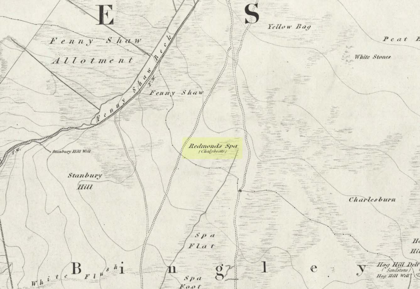
On this featureless southern-side of Rombalds Moor, all but lost and hidden in the scraggle of rashies, a very boggy spring emerges somewhere hereabouts. I say hereabouts, as the ground beneath you (if you can call it that!) is but a shallow swamp and its actual source is almost impossible to locate. If you want to find the exact spot yourself, be prepared to put up with that familiar stench of bog-water that assaults our senses when we walk through this sort of terrain. Few are those who do, I have found… But somewhere here, amidst this bog—and still shown on the OS-maps—is the opening of what is alternatively called Redman’s or Richmond’s Spa. We don’t know exactly when it acquired its status as a spa-well, but the 18th century Halifax doctor, Thomas Garnett—who wrote the early work on the Horley Green Spa—appears to be the first person to describe it. Garnett (1790) said how the place:
“was first mentioned to me by Mr W. Maud, surgeon, in Bradford, who went with me to see it. It is situated on Romalds-moor, about two or three miles from Bingley, and goes by the name of Redmire-spaw. The access to it is by no means good; the ground about it being very spongy and soft. On the bottom and sides of the channel is deposited an ochrey matter, of a very fine, bright, yellow colour; and which I believe is used, by the country people in the neighbourhood, to paint their houses. It sparkles when poured into a glass and has a taste very like the Tewit-well at High-Harrogate; which water it very much resembles in all its properties, and seems to be about the same strength… This water seems to hold a quantity of iron dissolved by means of fixed air. Its taste is very pleasant; it is said to act very powerfully as a diuretic, when drank in considerable quantity, and may prove a useful remedy, in cases where good effects may be expected from chalybeates in very small doses; the fixed air, and even the pure water itself may be useful in some cases. It is, however, necessary to drink it at the well, for it seems to lose its iron and fixed air very soon.”
I’ve drank this water, and believe me!—it doesn’t quite taste as pleasant as Mr Garnett espouses! Its alright I s’ppose—but drinking water from a bog isn’t necessarily a good idea. That aside, I find it intriguing to hear so much lore about such a little-known spring; and it is obvious that the reputation Garnett describes about this spa came almost entirely from the local people, who would have been visiting this site for countless centuries and who would know well its repute. Below the source of the well the land is known as Spa Flat, and slightly further away Spa Foot, where annual gatherings were once held at certain times of the year to celebrate the flowing of the waters. Such social annual gatherings suggests that the waters here were known about before it acquired its status as a spa—which would make sense. The remoteness of this water source to attract wealthy visitors (a prime function of Spa Wells) wouldn’t succeed and even when Garnett visited the place, he said how he had to travel a long distance to get here.
The origin of its name was pondered by the great Harry Speight (1898) who wondered if it derived from the ancient and knightly Redman family of Harewood, whose lands reached over here. But he was unsure and it was merely a thought. As an iron-bearing spring (a chalybeate) you’d think it might derive from being simply a red mire or bog (much like the Red Mire Well at Hebden Bridge), but its variant titles of apparent surnames casts doubt on this simple solution.
No one visits the place anymore. Of the countless times I’ve wandered the moors, rare have been the times when I’ve seen folk anywhere near this old spring. It is still coloured with the same virtues that Garnett described in the 18th century: the yellowish deposits, the boggy ground, much of which reaches to the truly dodgy Yellow Bog a short distance north and which should be completed avoided by ramblers after heavy rains (try it if y’ don’t believe me—but you’ve been warned!).
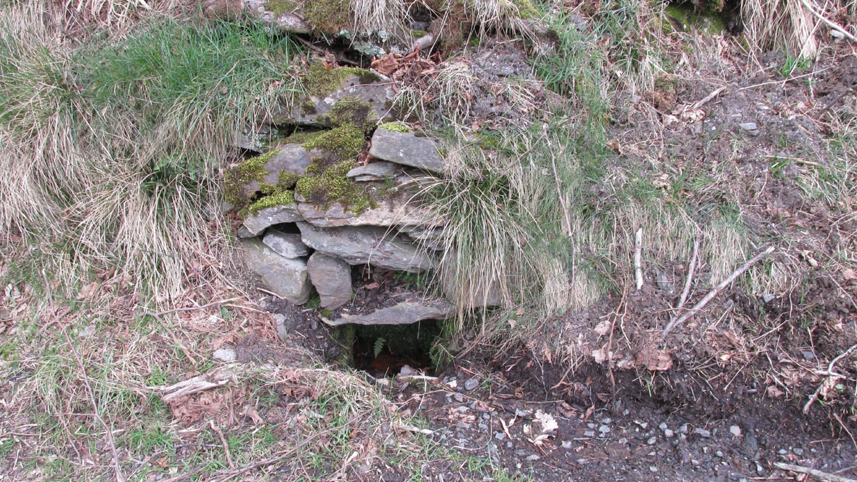
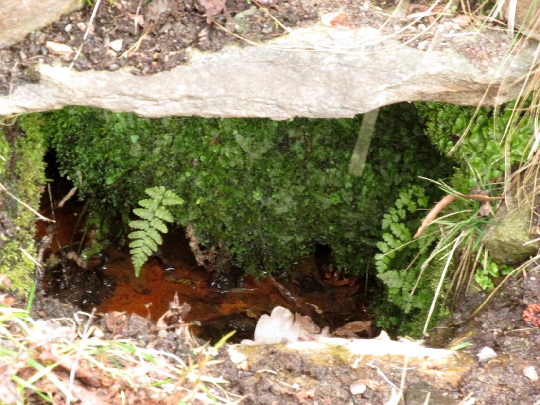
From Fortingall village, head west and turn down into the incredible beauty that is Glen Lyon. As you enter the trees, a half-mile along you pass the small gorge of MacGregor’s Leap in the river below. 2-300 yards pass this, keep your eyes peeled for an old small overgrown walled structure on the left-hand side of the road, barely above the road itself. A large tree grows up above the tiny walled enclosure, within which are the unclear waters that trickle gently….
Archaeology & History
In previous centuries, this all-but-forgotten spring of water wasn’t just a medicinal spring, but was one of the countless sites where sympathetic magick was practised. The old Highlanders would have had a name for the spirit residing at these waters, but it seems to have been lost. The site is described in Alexander Stewart’s (1928) magnum opus on this stunning glen, where he wrote:
“Still a few yards more and Glenlyon’s famous mineral wishing well is seen gushing up, surrounded by its wall of rough stones now sadly in need of repair. It has a stone shelf to receive the offerings of those who still retain a trace of superstition or like to uphold old customs as they partake of its waters. The offerings usually consist of small pebbles, but occasionally something more valuable is found among them. The roadmen may clear that shelf as often as they like, but it is seldom empty for long.”
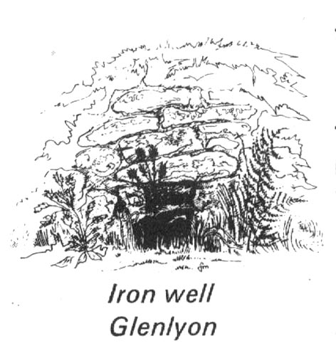
A local lady from Killin told us that she remembers the stone above the well still having offerings left on it 20-30 years ago. Hilary Wheater (1981) sketched it and called it the Iron Well.
Close-up of the waters (photo by Paul Hornby)Hilary Wheater’s sketch
The waters in this small roadside well-house actually emerge some 50 yards up the steep hillside (recently deforested) and in parts have that distinct oily surface that typifies chalybeates, or iron-bearing springs – which this site is an example of. Its medicinal properties would help to people with anaemia; to heal women just after childbirth; to aid those who’d been injured and lost blood; as well as to fortify the blood and stimulate the system.
Across the road from the well, Stewart (1928) told of a giant lime tree that was long known to be the meeting place for lovers (perhaps relating to the well?), and the name of the River Lyon here is the Poll-a-Chlaidheamh, or ‘the pool of the sword’, whose history and folklore fell prey to the ethnic cleansing of the english.
References:
Stewart, Alexander, A Highland Parish, Alexander Maclaren: Glasgow 1928.
Wheater, Hilary, Aberfeldy to Glenlyon, Appin Publications: Aberfeldy 1981.