Healing Well (destroyed): OS Grid Reference – SE 1286 4007
Also Known as:
Loadpit Well
Archaeology & History
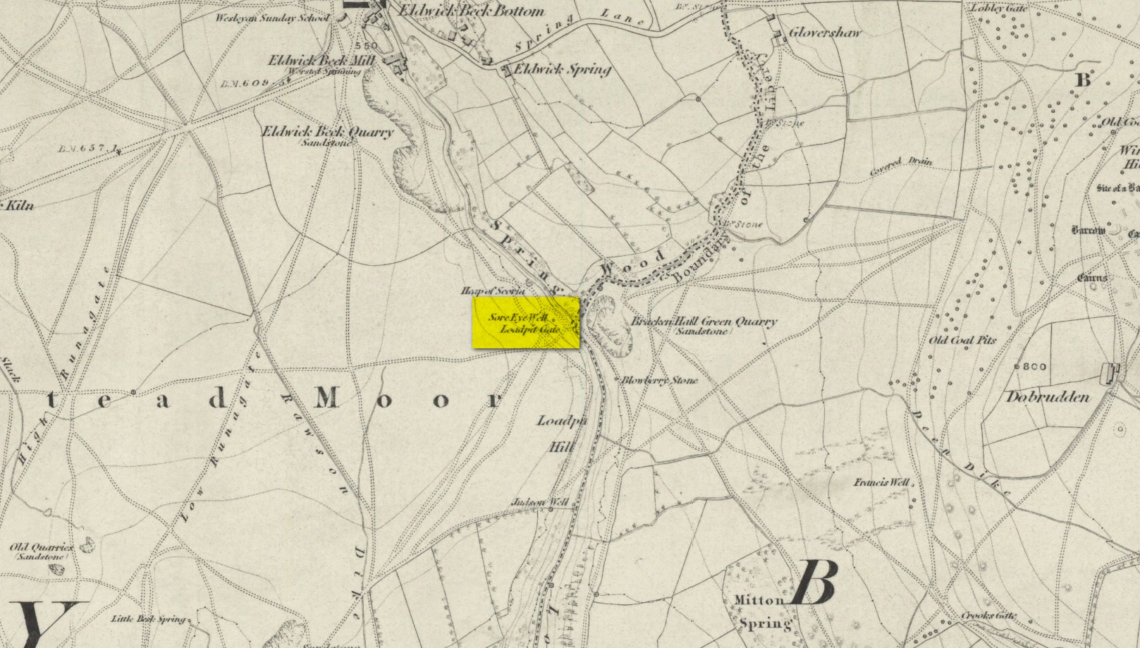
Sore Eye Well on 1852 map
Descriptions of this site are few and far between, despite it having a meaningful name. First recorded on the 1852 OS-map, in the folklore of our ancestors this was a well that local people frequented to wash their face and it was said that the waters would take away the ills of those suffering poor eyesight or other ocular problems. Rags were left hanging over an old rowan tree as offerings to the spirit of the water, in return for curing the afflicted eyes.
When I first came looking for this as a boy, I was frustrated to encounter the water authority’s metal cover ruining the site completely, leaving nothing of the old well as it once was. Around the metal-cover was evidence of a small rock enclave that would have defined the spring as it emerged from the earth—although it was barely noticeable. The remnants of a small path just to the right of the main footpath that reaches up the hillside is apparent, leading to the well. Below it were the remains of a large, water-worn flat rock, with other stones set to its sides, where the water used to flow and be collected, but today everything’s dried up and there’s little evidence of it ever being here.
References:
Shepherd, V., Historic Wells in and Around Bradford, Heart of Albion: Wymeswold 1994.
Cist (destroyed): OS Grid Reference – SE 1196 3824
Archaeology & History
The remains of a prehistoric tomb existed near the foot-bridge on the south-side of the canal at Dowley Gap, but was destroyed during the building of the sewage works there in 1951. It was reported by a Mr Duncanson to Bradford’s Cartwright Hall archaeology group, who told how they accidentally uncovered it during construction work. He told that the
“stone cist (was) about 3½ feet long and 1½ feet deep and was found on rising ground at the western end of the works where the storm water tanks are now situated.”
We obviously don’t know the age of the cist, but such grave monuments are most commonly Bronze Age. The existence of the Crosley Wood Iron Age enclosure 4-500 yards NNW and the prehistoric circle 800 yards east are the nearest other known early period monuments.
References:
Jackson, Sidney, “Stone Cist at Bingley,” in Cartwright Hall Archaeology Group Bulletin, 3:6, 1958.
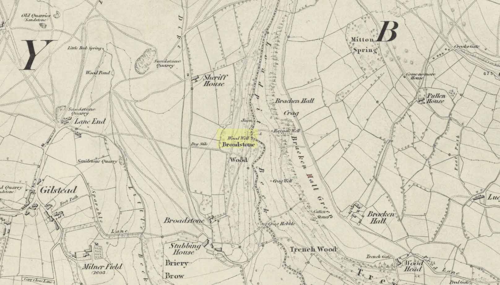
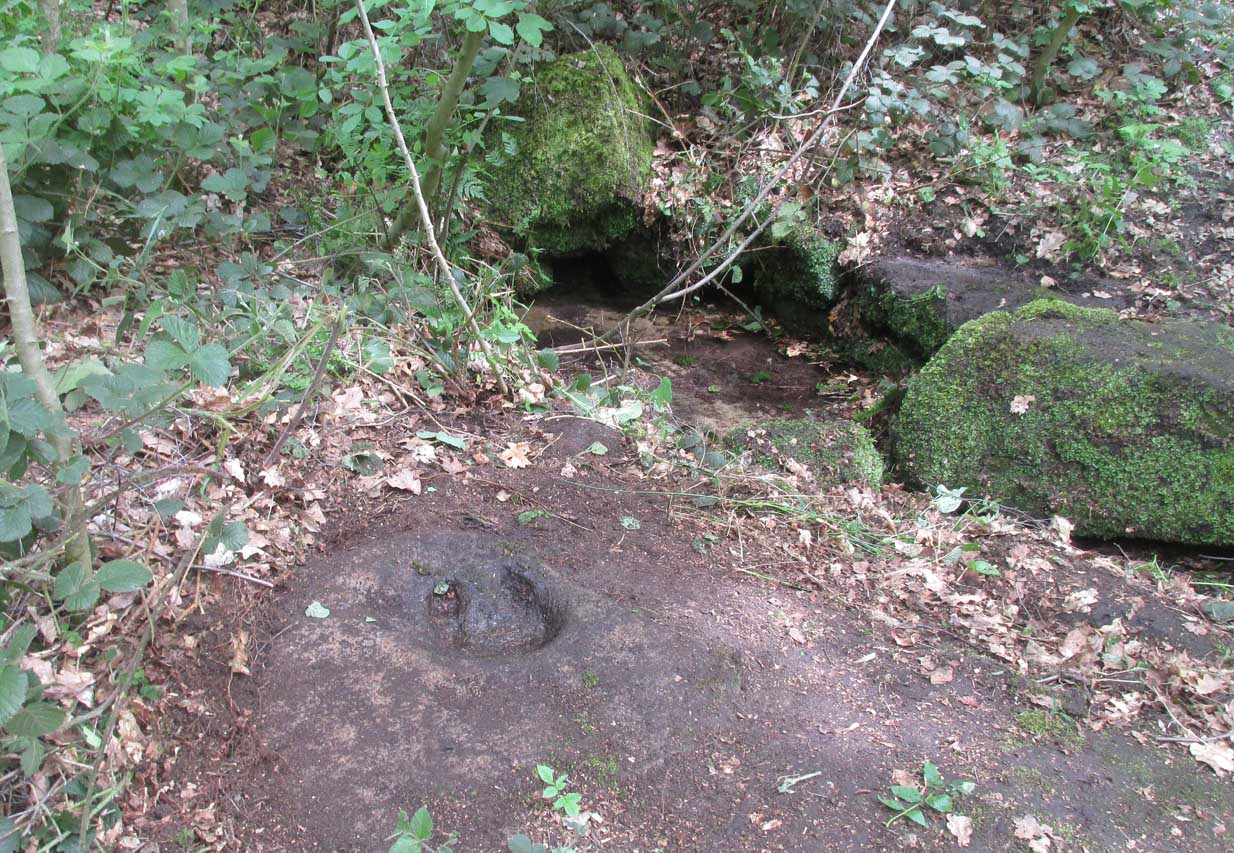
Best reached by going up Shipley Glen, to the Brackenhall Circle enclosure; keep going for a couple of hundred yards and then drop down into the trees, taking the directions directly to the Cloven Hoof Well. Just past the well, a small footpath leads you downhill towards the large stream at the bottom, where there’s a rocky crossing (an old ford). Go over here and, barely 50 yards upstream to your right, a large singular moss-covered boulder is set back, just a few yards above the stream with a small pool in front of it. That’s it!
Archaeology & History
The ‘directions’ to find this might seem a little confusing to locals at first. This is because the whereabouts of the Wood Well is on the eastern boundary edge of Gilstead – which is down at the bottom of Shipley Glen. The steep muddy hill above it is almost always slippy and wet through, so it’s easiest to approach from the Baildon side.
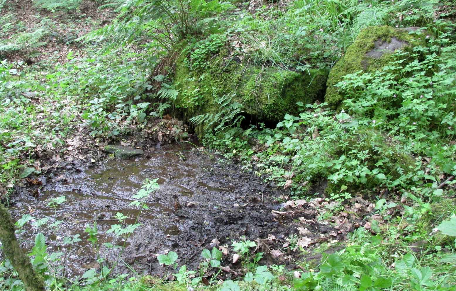
The shallow muddy waters in a hot summer
The site is shown on the 1852 map of the area, but I can find no written material telling of its qualities. If it ever had any medicinal virtues, they have long since been forgotten. Whilst the water here is fresh and drinkable, in times of drought and low rainfall the water subsides and leaves only a muddy pool – just as it was when I last visited, making it quite undrinkable. But to me, the main aspect of this site is its natural spirit, its locale, as it’s surrounded by unerring hues of rich greens, cast out by the landscape of mosses prevalent in a region almost bereft of such voices. If you like y’ wells – check it out!
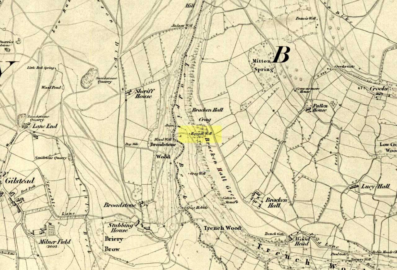
On the roadside at Shipley Glen, from Brackenhall Circlewalk up for about 250 yards, where you’ll notice the land dips as it drops into the woods below. Follow this dried stream down until you reach the mossy Loadpit Beck in the valley. By the waterside is a footpath: follow this upstream for a short distance, keeping your eyes peeled on the Earth below where a smaller stream crosses the path you’re walking on. Follow this uphill to its source!
Archaeology & History
Halfway up (or down) the moss-covered waters of Shipley Glen the all-but-forgotten waters of the Cloven Hoof Well still flows nice and freely, and is still good to drink. It was shown on the first OS-map of the area in 1852, where it was called the Raygate Well, whose derivation neither the great Baildon historian W. Paley Baildon nor the place-name giant A.H. Smith could account for. It sounds just like it was someone’s surname, but local genealogy cannot affirm this. One possibility—and which reflects in the local lore of the site—is that it’s a compound word from the old northern dialect word Rea, “an evil spirit or demon”, and gate, “a hole, an opening or gap.” The terms are used in a prayer given in Mr Sinclair’s Satan’s Invisible World Displayed (1814),
“as recited in the time of Popery by persons when going to bed, as a means of them being preserved from danger:
“Keep this house from the weir… And from an ill Rea, That be the gate can gae.””
But this purely speculative….
Cloven Hoof Well on 1852 map
A photograph and brief description of the Cloven Hoof Well was given in an early edition of the Bradford Scientific Journal after a geological excursion to Shipley, though nothing was said of its curious name. However on a rock below the spring, a hoof-print mark is clearly seen. It appears to be part-natural and partly enhanced. This is an area rich in prehistoric petroglyphs, or cup and rings stones.
Mosses thankfully still cover the rocks from whence the waters flow; and bilberry, blackberry, male fern and bracken also grow around it. Psychoactive plants also abound nearby. The water is healthy and never seems to dry up, even during long warm summers. And below here, on the other side of the stream at the bottom, you can visit the little-known Wood Well.
Folklore
Local lore told that the devil stepped here and left his hoof-mark in the rock, making the waters rise from the Earth. Possibly a venerated site in earlier days, one finds numerous ancient remains nearby (cup and rings, stone circle, walling, cairn fields). Pagans amongst you should love this place!
References:
Armitage, Paul, The Holy Wells and Healing Springs of West Yorkshire, forthcoming
Baildon, W. Paley, Baildon and the Baildons (parts 1-15), St. Catherines: Adelphi 1913-26.
la Page, John, The Story of Baildon, William Byles: London 1951.
Along the main Aire Valley road (A650) between Cottingley and Bingley, turn right by Beckfoot Grammar School and wander along and up the winding road, over the canal bridge where the Fisherman’s pub is on Primrose Lane. On the slope above you amidst the scatter of trees on the left-hand side of the road is this Romano-British site (the map below should help). Check it out!
Archaeology & History
Excavated in the 1960s by the archaeologist P. Mayes, this little-known but reasonably well-preserved enclosure-cum-settlement comprises of a large oval of stone walling, double in places, about 200 feet across at its widest point.
Thought to have been constructed sometime between the Iron Age and Romano-British period, for some reason one of the stones on the western edge has long been given the name of the ‘Giles Stone’ or Stile — though nobody knows for certain why. It’s about three-feet tall with a smaller upright by its side. Any other remains that might once have been here were destroyed by the housing estate that sits above here. When Mr Mayes (1967) and his associates did their work here, cutting across sections of the walling, he told:
“The best preserved section of wall was amongst the trees on the lines of the south wall of the enclosure and included the boulders of both the inner and the outer faces of the wall. A trench 6ft by 38ft was laid out at right angles to it. The turf was removed showing the boulders of the wall with the smaller stone filling between them. On either side of the wall was a relatively small quantity of loosely tumbled stones, the angle of rest of which suggested the wall as their source of origin… Careful examination of the wall filling failed to show any sign of post settings.”
Mr Mayes said that it was “doubtful whether the Crosley Wood site, dated by one pot to the late 3rd or early 4th century AD, was ever conceived of as an occupation site.” In reference to his excavations he continued, “Certainly no evidence of settled living was found” here, concluding:
“It seems probable that the main enclosure at Crosley Wood served as a cattle pound; its defensive potential being invalidated by the scarp to the north, whilst the short stretches of external walling are all that remains of a rectilinear field system for arable or pastoral farming.”
References:
Mayes, P., ‘Excavations at Crosley Wood, Bingley,’ in Yorkshire Archaeology Journal, volume 42, 1967.