Healing Well (destroyed): OS Grid Reference – TQ 3496 9623
Also Known as:
King Ring Well
Tim Ringer’s Well
Archaeology & History
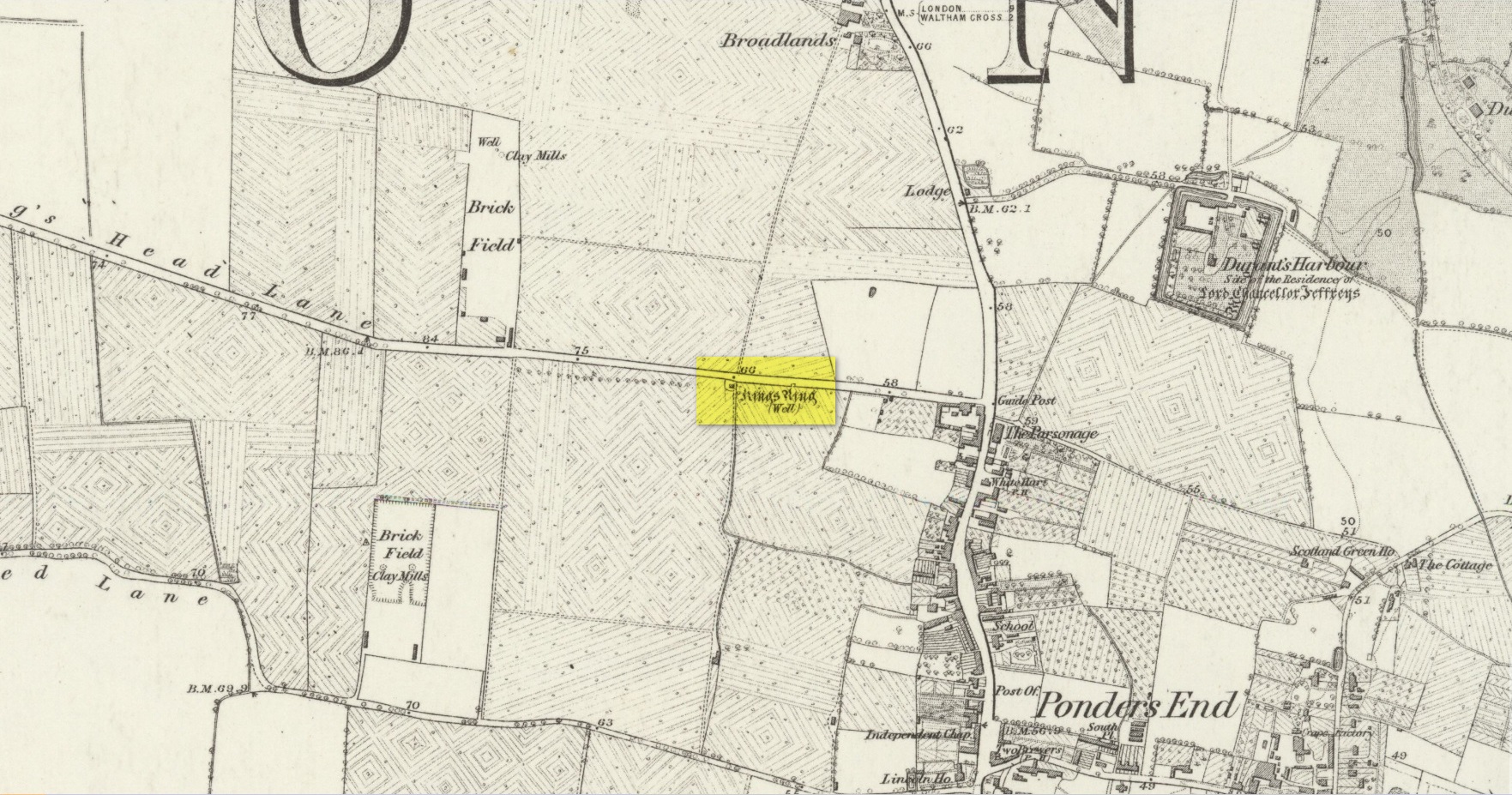
Site shown on 1879 map
Highlighted on the 1879 Ordnance Survey map, on the south-side of Southbury Road close to Ponders End, this curiously-named water source has a somewhat mundane history to it. It’s likely that an old stone conduit that was shown on John Ogilby’s 1698 road map of the area is the King’s Ring Well—although it hadn’t acquired that name at the time. It was described for the first time in Robinson’s (1823) classic work, located “on the south side of Gouldsdown-lane,”—which later became known as Nag’s Head Lane and today is Southbury Road. Anyhow, he continued telling us that here,
“there is a moat dividing two square fields. In the first there are remains of stables, barns, &c. and hollows, as of vaults, among the trees. There is a deep well, bricked, called “King Ring” or “Tim Ringer well,” (Timothy Ring was an opulent farmer who occupied the lands; and it is supposed from his arrogant manner obtained the nic-name of “King Ring.”) whose spring, it is said, never freezes nor dries up, and the water is esteemed very efficacious in disorders of the eyes.”
Robinson noted that the local drovers, “who from being so much exposed to the dust are subject to sore eyes, frequently turn up the lane to use the water, and there have been instances of children being cured of sore eyes by it after the measles.” He also alluded to a tradition that a religious house or convent once stood hereby, although he never obtained accurate information to prove his idea. If that was the case, the site may have been a holy well. The medicinal properties of the waters were repeated in Lewis’ Topographical Dictionary (1848); and again in Hodson & Ford’s (1873) subsequent survey of Enfield, emphasizing that it was “considered infallible as a remedy for inflammation of the eyes.” Sadly the well has long since been destroyed.
Acknowledgements:Huge thanks for use of the Ordnance Survey map in this site profile, reproduced with the kind permission of the National Library of Scotland.
Holy Well (destroyed): OS Grid Reference – TQ 102 952
Archaeology & History
A long lost sacred site (not to be confused with the nearby Bright Well) that has given its name to the district of Holywell. It also gave its name to an early farmstead; and to the place-name of Holywellane recorded as far back 1485. It was also described as a “Holy Well” in a local vestry book in 1698. Nothing more seems to be known of the place.
References:
Gover, J.E.B., Mawer, Allen & Stenton, F.M., The Place-Names of Hertfordshire, Cambridge University Press 1938.
Harte, Jeremy, English Holy Wells – volume 2, Heart of Albion press: Wymeswold 2008.
Healing Well (destroyed): OS Grid Reference – TQ 318 703
Archaeology & History
This was one of several so-called mineral springs in and around the Norwood area, but seemingly the least well-known—certainly in literary terms. Whatever renown it may once have had was overwhelmed by the relative proximity of the much more famous curative waters of the Beulah Spa, a few hundred yards to the southeast. It was mentioned, albeit briefly and already in the past tense, in John Anderson’s (1898) survey, when he told that “There used to be (a) mineral well at Biggin Hill. It is marked on the Croydon Inclosure Map” of 1800 and shown as a “Spring”, north of Biggens Farm. It seems that it had only just been destroyed when Anderson wrote about it, as the research of Alfie Foord (1910) showed. His inquiries found that,
“There used to be another mineral well about half a mile to the north-west of Beulah Spa, at Biggin Hill, the water from which gushed up at the rate of seven gallons a minute. In 1898 it was closed. The subjoined analysis of water from a well, which is at White Lodge, Biggin Hill, formerly the residence of Mr. H. Wilson Holman, was kindly supplied by him to the writer in 1907. This well, he says, undoubtedly taps the same spring that used to come out at the bottom of Biggin Hill, and which was blocked by the sanitary authorities in 1898. The site of the spring was beyond the small tenement houses at the bottom of the hill, and there is still some masonry in existence—the end of the culvert where the water used to run out into a pond. The reason of its being blocked was that it is alleged to have poisoned some domestic animal.”
References:
Anderson, John C., The Great North Wood, Blades: London 1898.
Foord, Alfred Stanley, Springs, Streams and Spas of London: History and Association, T. Fisher Unwin: London 1910.
Gover, J.E.B., Mawer, A. & Stenton, F.M., The Place-Names of Surrey, Cambridge University Press 1934.
Holy Well (destroyed): OS Grid reference – TQ 3337 8245
Archaeology & History
Holywell Lane on 1877 map
First described at the beginning of the 12th century as “fons qui dicitur Haliwelle“, these sacred waters were thereafter described in a variety of documents before eventually, in 1382, giving its name to the road on which it was found. When the topographer John Stow (1603) described the well—along with those of St. Clement’s and Clerken Well—it was once “sweet, wholesome, and clear” and “frequented by scholars and youths of the city in the summer evenings.” However, in his day it was already in decline, as he told that the “Holy well is much decayed and spoiled, with filthiness purposely laid there, for the heightening of the ground for garden plots.”
The history of the site was mentioned in John Noorthouck’s (1773) survey, where he told us:
“In the parish are two prebends, and part of a third, belonging to St Paul’s cathedral, in the city of London: The first dominated by Eald-Street, or Old Street, received that appellation from the Saxons being part of the Roman military way: the second, which had been a separate village for many years, by the name of Hochestone, vulgarly Hoxton, likewise itself to be of a Saxon origin: the third called Haliwell, had its name from a vicinal fountain, which, for the salubrity of its water, had the epithet Holy conferred on it.
In King John’s Court, Holywell-lane, are to be found the ruins of the priory of St. John Baptist, of Benedictine nuns, founded by Robert the son of Gelranni, prependary of Haliwell, and confirmed by charter of Richard I in the year1189. It was rebuilt in the reign of Henry VII by Sir Thomas Lovell, knight of the garter; who was there buried: and the following ditty was in consequence painted in most of the windows.
“All the nuns of Holywell,
“Pray for the soul of Thomas Lovell.”
The complete demise of the well occurred in the early part of the 19th century and efforts to locate its original position have proved troublesome. Indeed, the modern Holywell Lane would seem to be little more than an approximation of its whereabouts. It was an issue explored at some length in the great A.S. Foord’s (1910) magnum opus, who wrote:
“In recent times efforts have been made to locate the well, and some of the results communicated to Notes and Queries. A Mr. R. Clark drew attention, through the medium of that publication, to an article in The Builder of September 19, 1896, which states that ”the ancient holy well should be looked for in the area between Bateman’s Row and New Inn Yard and behind the Board School in Curtain Road, that is to say, west of New Inn Street.” This is all very circumstantial, but the writer bases his statement on the survey by Peter Chassereau, taken in 1745, in which the supposed position of the well is marked by a cross and the words “Ye well from which the liberty derives its name.” It should be borne in mind however that, as pointed out by Colonel W. F. Prideaux, Chassereau did not make his survey till more than two hundred years had elapsed from the date of the dissolution of the Nunnery (1539); the position of the well could therefore have been only a matter of tradition. Another contributor to Notes and Queries (8th Series, May 22, 1897), quotes an article in the Journal of the Royal Institute of British Architects (vol. iv., 3rd series, p. 237), by Mr. E. W. Hudson, who says that the well of the priory was situate on the south side of what is known as Bateman’s Row, but was formerly (before 1799) called Cash’s Alley, near Curtain Road. This agrees substantially with Mr. Clark’s statement. Mr. Lovegrove, writing in 1904, says: “The well itself is to be found in a marble-mason’s yard in Bateman’s Row, but is covered over.” The same writer notes that of the Nunnery buildings only a piece of stone wall about 50 feet long, in a timber yard at 186, High Street, Shoreditch, is now left.”
References:
Foord, Alfred Stanley, Springs, Streams and Spas of London: History and Association, T. Fisher Unwin: London 1910.
Gover, J.E.B., Mawer, Allen & Stenton, F.M., The Place-Names of Middlesex, Cambridge University Press 1942.
Lovegrove, G.H., “Holywell Priory, Shoreditch,” in Home Counties, volume 6, 1904.
Mills, A.D., A Dictionary of London Place-Names, Oxford University Press 2001.
Noorthouck, John, A New History of London, Including Westminster and Southwark, R. Baldwin: London 1773.
Stow, John, A Survey of London, John Windet: London 1603.
Sunderland, Septimus, Old London Spas, Baths and Wells, John Bale: London 1915.
Wood, Alexander, Ecclesiastical Antiquities of London, Burns & Oates: London 1874.
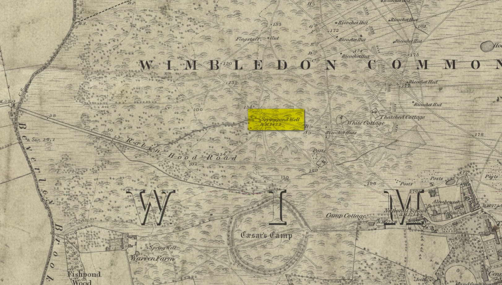
There are numerous ways to get here from all directions: i) from the west-side of Wimbledon Common, on the Robin Hood’s Way A3 road, keep your eyes peeled for the small crossroad of Robin Hood Lane and Road, obivously taking the one into the park. Keep on the dead straight Robin Hood Ride path until your hit the carpark ¾-mile on; and from here, bear sharp left (NW) for 250 yards or so, where a small slope down on your left takes you there; or, ii) from Wimbledon village side on the A219 Parkside A219 road, where the War Memorial stands, head onto the Common along The Causeway, past the Fox & Grapes going on Camp Road, then up the Sunset Road towards the carpark. And then, once again go NW for 250 yards or so, where the small slope on your left takes you there. You’ll find it.
Archaeology & History
Described by William Bartlett (1865) as “the never-failing spring of water, improperly called the Roman Well”, its constant flow was severely tested in the great drought of 1976—and it kept on flowing. Only just though! It was highlighted on the early Ordnance Survey map with the plain name of the Springpond Well. The great historian and folklorist Walter Johnson (1912) gave us the best historical resumé of the site, telling that,
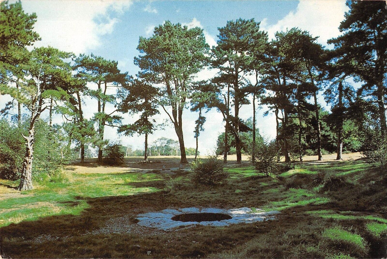
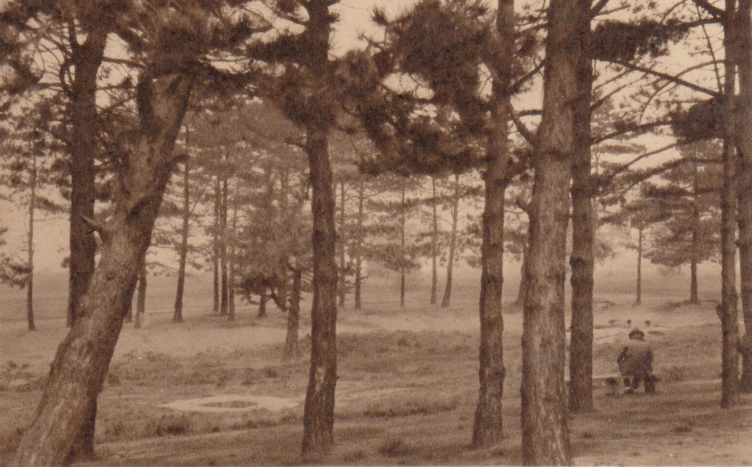
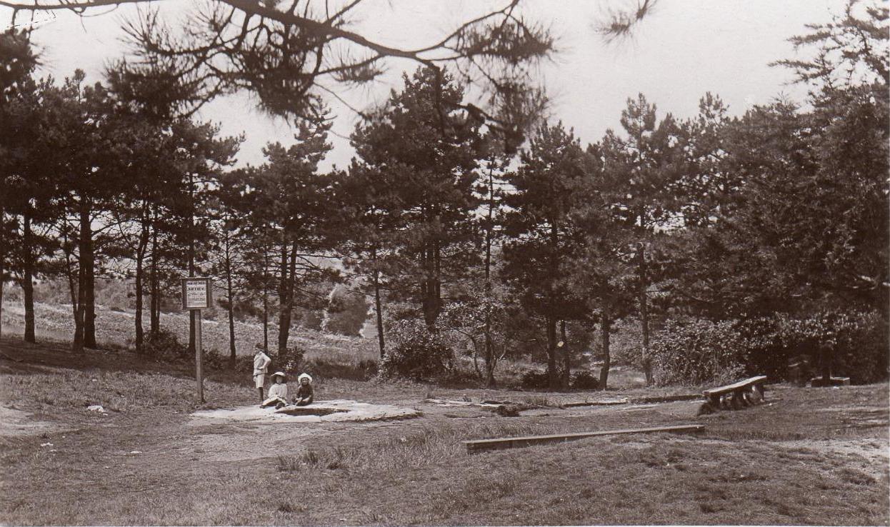
Caesar’s Well around 1900Caesar’s Well around 1911
“Caesar’s Well, formerly known as Robin Hood or Roman Well—the Springpond Well on the Ordnance Map—issues on the other side of the little watershed above mentioned, at a height of 149 feet O.D. The well lies in a little hollow, now ringed with Scottish pines. The gathering ground is the land to the east, rising to 198 feet O.D. This area is not large, but quite sufficient to maintain a permanent rill of pure water. The well, the waters of which once were deemed of special medicinal merit, was enclosed with brick in 1829, and, as the inscription tells us, refaced with granite blocks by Sir Henry W. Peek, M.P., in 1872. The outflowing waters descend to Brickfield Cottage, where they expand into a turbid duckpond; thence the course is through the yard behind the house, and along the north side of Robin Hood Road to Brook Cottage. During 1911 the “Well” proper altogether dried up, but water still issued from the stand spout a few yards below, which is supplied by an artificial boring and pipe that tap the spring at a depth of 18 feet.”
Site shown on the 1874 map
The proximity of this never-failing spring to the huge prehistoric enclosure of Caesar’s Camp just a few hundred yards to the south would indicate it was an important water source in Bronze Age times and, I’d hazard, would have been bestowed with some sanctity, as many such wells tended to be.
Folklore
James Rattue (2008) informed us that the name Robin Hood’s Well was known here in the 18th century prior to it being known as Caesar’s Well, but there seems to be no known relationship between Robin Hood and this site. However, a piece written in 1922 told that there was a lingering tradition that Julius Caesar encamped on Wimbledon Common in 51 BCE and that this folk memory was kept alive in the lore of local children who devoutly believed that the great Roman Emperor drank from the cool depths of this well.
References:
Bartlett, William A., The History and Antiquities of the Parish of Wimbledon, Simpkin Marsall: London 1865.
Hughes, John L., “Caesar’s Well, Wimbledon Common,” in Source magazine, no.9, Spring 1989.
Johnson, Walter, Wimbledon Common – Its Geology, Antiquities and Natural History, T.Fisher Unwin: London 1912.
Rattue, James, Holy Wells of Surrey, Umbra: Weybridge 2008.
Healing Well (destroyed): OS Grid reference – TQ 330 827
Also Known as:
Balsamick Well
Archaeology & History
In that typically rambling style beloved of early writers on medicinal springs, Timothy Byfield (1687) narrated the tale of uncovering this well in an almost alchemical discourse. It was located when digging out the cellar of a house near Charles Square in the 1680s. Upon investigation, the waters were found to possess a good quantity of sulphur and a small amount of iron, leading Byfield to proclaim it could cure a whole army of medical disorders, from cleaning out blockages in the alimentary canal, to treating kidney stones, scurvy, ulcers, headaches, migraines and more. If used correctly and in the right amount,
” There is,” he says, “no unwholesome glebe (concretion) or any dangerous mineral or metal (in them) that casts one unhappy ray into this healing fountain.” On the contrary, they set up ‘* such a pretty bustle or ferment in nature that makes gay a well-temper’d Healthy Body.”
In the early days when Spa Wells were in vogue, the Balsamic Well became a competitor to the nearby St Agnes le Clear Well, which is probably the reason why one doctor dissuaded the toffs of the time to avoid it!
The waters possessed a slight vinegar-esque flavour—hence the name. In John MacPherson’s (1871) work, he described it as a “chalybeate well” and despite it having that typical “bituminous scum on it, strange to say,” it yielded “a pleasant aromatic flavour.” The site has long since been covered over.
References:
Byfield, Timothy, A Short and Plain Account of the late-found Balsamick Wells at Hoxdon, London 1687.
Foord, Alfred Stanley, Springs, Streams and Spas of London: History and Association, T. Fisher Unwin: London 1910.
Hembry, Phyllis, The English Spa 1560-1815, Athlone Press: London 1990.
MacPherson, John, Our Baths and Wells, MacMillan: London 1871.
Sunderland, Septimus, Old London Spas, Baths and Wells, John Bale: London 1915.
Tumulus (destroyed): OS Grid Reference – TQ 222 709
Archaeology & History
It seems that a great number of prehistoric remains used to exist in and around the Wimbledon Common area. This one is mentioned only briefly in Thomas Stackhouse’s (1833) rare work on early British remains, where he wrote:
“Near an old single-trenched Camp at the South West comer of Wimbledon Common, is a very small flat Barrow cut into the form of a cross: I don’t know that it has been noticed by any writer.”
The “single-trenched Camp” he described is today known as Caesar’s Camp hillfort. By the time the Wimbledon historian William Bartlett (1865) came to write his survey, the site had been destroyed. In Mr Johnson’s (1903) survey, he seems to confuse this site with the large barrow cemetery that used to exist on the northern edges of Wimbledon Common described by William Stukeley and others.
(the grid-reference to this site is an approximation).
References:
Bartlett, William A., The History and Antiquities of Wimbledon, Surrey, J. & S. Richards: Wimbledon 1865.
Johnson, Walter, Neolithic Man in North-East Surrey, Elliot Stock: London 1903.
Tumulus (possible): OS Grid Reference – TQ 2856 7555
Also Known as:
Mount Nod
Archaeology & History
Located on the old boundary line between Clapham and Battersea, what might have been a forgotten tumulus, whose memory was thankfully preserved by the renowned folklorist and historian Walter Johnson (1903), was described in his work on prehistoric Surrey. He seemed to think it serious enough to add to his survey, where he told us that,
“there still exists, near Cedars Road, Clapham, what may possibly be a round barrow. It is in the garden of a house opposite St. Saviour’s Church, and is visible to anyone passing along the old, narrow passage called Wix’s Lane. Mr. J.W. Grover, who brought the matter before the Archaeological Association in 1884, had been struck by the discovery that old maps marked the spot ‘Mount Nod Fields.’ …The mound must originally have been 70 or 80 feet across, but had been tampered with on one side for the construction of an ice-house. Mr. Grover suggested that the mound may be of Celtic date. To us, the height—some 12 feet or more—together with marked signs of reconstruction at a comparatively modern date, indicate the necessity of withholding judgment. The original tumulus may simply have been increased in height, but…digging alone could settle the question.”
Local historian Michael Green (2010) has found that there were prehistoric tombs on Clapham Common only 500 yards away, so this one along Cedar Road was not in isolation. Is the site named on the boundary perambulation records? Has it been explored since Johnson wrote about it and, if so, has its veracity as a prehistoric tomb been ascertained, or is it merely the remains of some post-medieval creation?
Healing Wells (destroyed): OS Grid Reference – TQ 3094 7889
Also Known as:
Lambeth Spa
Near Well and Far Well
Archaeology & History
This once famous healing or spa well has long gone. It was located where the buildings that now constitute 104-105 Lambeth Walk presently stand: an area which the great London historian William Thornbury (1878) told was already “a favourite resort of Londoners, and celebrated for the variety of sweet-smelling flowers and medicinal herbs growing there,” complementing the healing waters before and during the spa craze. The great herbalist John Gerard did his collections here.
I can find no information regarding its early use by our peasant ancestors, so its written history simply begins when it had been appropriated by those well-to-do up-market types who took this medicinal spring for their commercial gain in the early days of the trendy spas. Supplied by two separate springs known as the Nearer and Farther Wells respectively, the Well House built here was “formally opened in April 1696” and subsequently had almost daily accompaniments of music, including French and country dancing! But as the popularity of the Lambeth Spa increased, so did its problems. Phyllis Hembry (1990) told that by July 1715, one visitor to the spa,
“was so depressed to find that the many people there were mostly rakes, whores and drunkards, idlers such as Guard officers, or young pleasure-seeker like attorneys’ clerks, mingling with loose women of the the meanest sort. The Lambeth Wells also became a public nuisance, so a dancing license was refused in 1755.”
The so-called Great Room which had been the place of great occasions by spa users ended up being the meeting place “for Methodist meetings.” Oh how the winter nights must have flown by…..
There was a decided improvement in the years that followed and social events at the spa increased again. It became what Thornbury said “was another place of amusement.” The Lambeth Wells, he wrote,
“were held for a time in high repute, on account of their mineral waters, which were advertised as to be sold, according to John Timbs, at “a penny a quart, the same price paid by St. Thomas’s Hospital.” About 1750, we learn from the same authority, there was a musical society held here, and lectures, with experiments in natural philosophy, were delivered by Dr. Erasmus King and others. Malcolm tells us that the Wells opened for the season regularly on Easter Monday, being closed during the winter. They had “public days” on Mondays, Thursdays, and Saturdays, with “music from seven in the morning till sunset; on other days till two!” The price of admission was threepence. The water was sold at a penny a quart to the “quality” and to those who could pay for it; being given gratis to the poor. We incidentally learn that there were grand gala and dancing days here in 1747 and 1752, when “a penny wedding, in the Scotch manner, was celebrated for the benefit of a young couple.”
By this time, a rival St. George’s Spa of had been created a short distance away on the parish boundary and with it, the popularity and attendance at Lambeth Wells began to decline. By the end of the 18th century, the rot had truly set in and its days were finally numbered.
As for the medicinal properties of these wells, little seems to have been recorded. Aside from repeating the common description of them being mineral waters, William Addison (1951) simply added that they were also purgative.
References:
Addison, William, English Spas, Batsford: London 1951.
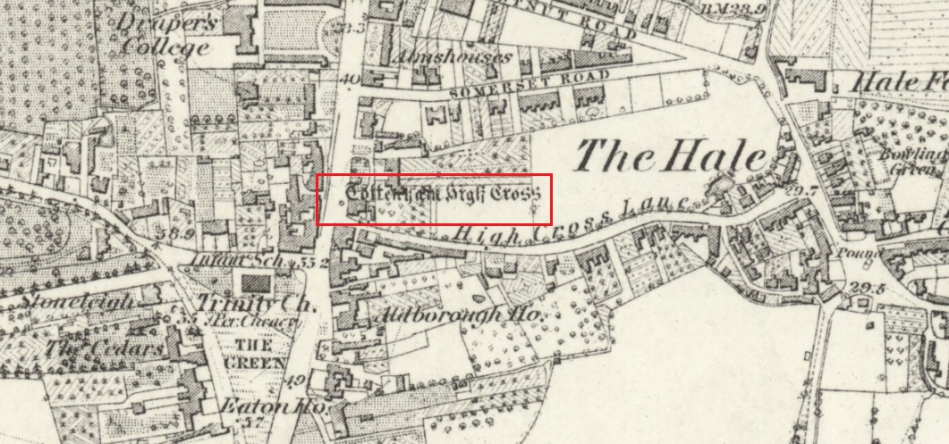
The Cross is on the east side of the A10 Tottenham High Road, on the traffic island at the Monument Way Junction.
Archaeology & History
Cross shown on 1873 map
One of the earliest records of what was called the “hie crosse” is contained in a court-roll of 1456. It was at that time a wooden wayside cross, but there are hints that its origins may go back to Roman times. The Cross is next to what was the southern end of Ermine Street, built by the Romans where there was no pre-existing roadway and described as the most important thoroughfare in Britain: built to give direct communication to the main centres of the military occupation at Lincoln and York. Writing of Roman land survey marks, the now discredited early 20th century Middlesex historian Sir Montagu Sharpe (1932) thought Tottenham Cross possibly marked an earlier (i.e. Roman) stone, although no archaeological evidence has been found to support this. As it was next to Ermine Street it could equally have been a milestone or ceremonial pillar. After the Romans left it may have become a local heathen shrine which, with the coming of Christianity, was ultimately replaced by a wooden cross—but this is speculation, and we will probably never know why and when the original cross was placed where it was.
Originally in the historic County of Middlesex, the settlement of Tottenham surrounding the Cross was known from mediaeval times to the 19th century as ‘Tottenham High Cross’. Local historian William Robinson writing prior to 1840 thus describes the Cross:
“About the year 1580, a column of wood was standing, with a square sheet of lead on the top to throw off the water, supported by four spurs: these, being decayed and rotten, were taken down, about the year 1600, by Dean Wood, Dean of Armagh, who at that time resided in a house on the east side of it, and who erected on its site an octangular brick column, pointed at the top and crowned with a weathercock, and the initials of the four cardinal points, and under the neckings, small crosses, which were called tau-crosses, according to the true cross or Greek letter T.
“Tottenham High Cross, as it appeared in 1788, was an octangular brick pillar, divided into four stories, viz.: a double plinth, first portion of the pillar; second portion, of the same; and a pinnacle; each plinth and story rendered distinct one from the other by certain appropriate mouldings ; and the whole design appeared without any kind of ornament, pointed at the top and crowned with a weathercock. The Cross having fallen into decay, several of the inhabitants of the parish entered into a subscription, in the year 1809, for the purpose of putting it into a proper state of repair, and about the sum of £300. was raised. It was accordingly repaired, and covered with Parker’s cement. The octangular plan, and the proportions of the Cross in its four stories, have not been departed from ; but in other respects it is a new work ; some of the decorations seem to be formed from the exterior and interior of the chapel of Henry VIII; the double plinths or pedestals are as plain as before, but the intermediate mouldings are new; the first portion of the pillar consists of angular pilasters at each cant done with a pointed head; compartment of five turns, connecting itself with another compartment; above it diamonded, with a shield containing an imitation of the black letter. As there are eight faces to the upright, of course there are as many shields, each bearing a letter of the same cutting, beginning at the west face, TOTENHAM: in consequence of there being but eight shields, one of the T’s in the spelling has been necessarily dispensed with. The mouldings between this story and the second are worked into an entablature, with modern fancy heads and small pieces of ornaments alternately set at each angle.
“Second story—small buttresses at the angles of the octagon, with breaks and pinnacles, but no bases. The face of each cant has a compartment embellished with an ogee head, backed with narrow pointed compartments. The mouldings between this story and the pinnacle, making out a fourth story, give, at each angle, crockets, and its termination is with a double finial, but not set out in geometrical rule to the crockets below : there is at the top a vane, with N. E. W. S. The base is surrounded with a neat iron railing on Portland stone curb. The date at which these alterations were made is not placed in any conspicuous part of the structure.”
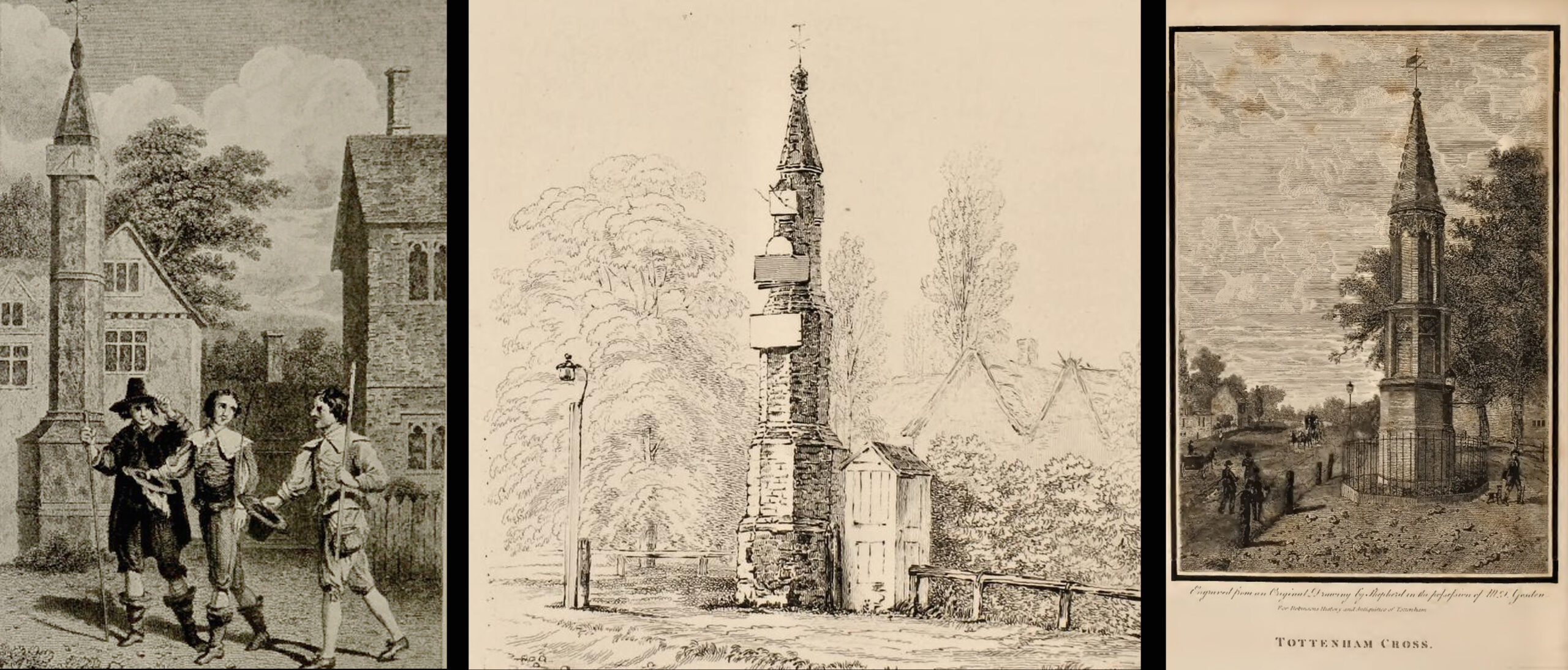
(left) engraving based on Samuel Wale’s 1759 illustration to Compleat Angler; (centre & right) 19th C views pre- and post-renovation
The craftsman who carried out the modernisation was a Mr. Bernasconia, working to the designs of a Mr. Shaw. Not everyone was pleased by the transformation. A regular contributor identified only as ‘An Architect’ made these caustic comments in the November 1809 edition of the Gentleman’s Magazine:
“Tottenham High Cross has this summer been covered over with Compo: it previously bore a simple appearance, but is now rendered of a very rich and elaborate cast, doing away in the first instance the Architectural history of the erection; and allowing it possible that there might once have been on the spot an Eleanora Cross, holding in contempt, by a want of due imitation, the characteristic style of decoration prevailed at at the time of the Queen’s demise. But according to the system of our Professional innovators, to destroy a sacred relick of antiquity, and to restore it as it is called, upon a model quite in a different style and nature, is one and the same thing. “Any thing is Gothick.”
“….Surveyed November 1809. Entirely covered with the proclaimed everlasting stuff, Compo; a stuff now the rage for trowelling over our new buildings, either on the whole surface, or in partial daubings and patchings; it is used in common with stone work, for instance, on an arcade, half one material, half the other; “ making good,” as it is called (abominable expedient) the mutilated parts of Antient Structures, there sticking on until it reverts (after exposure to the air for three or four years, more or less) to its first quality, dirt and rubbish, and then is seen no more….
“Provided this Compo effort had been advanced on any other occasion, and on any other piece of ground, where no piece of Antiquity was to become the spoil, such as an object to mark the centrical point of three or four counties, a general standard of miles or any other common document for the information or amusement of travellers, all would have been well, and some praise might have been bestowed, for its tolerable adherence to the above style, if not for the material wherewith it is made up. But as nothing of this sort will come in aid of the innovators, and only the barefaced presumption, “ alter or destroy, what was,” is to be encountered, let the detail of parts, put this matter to issue….”
Folklore
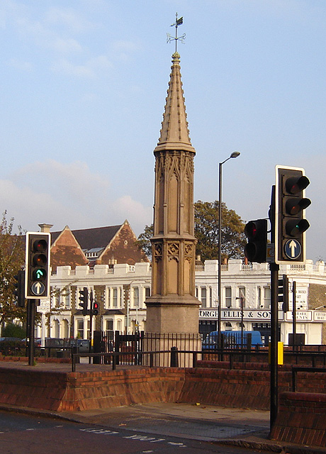
A modern view (Wikipedia Creative Commons)
The Cross stood in front of the Swan Inn, a place frequented by fishing writer Izaak Walton in the 1640s when he would go to fish in the nearby River Lea. In 1653 he published The Compleat Angler describing his fishing activities in the classical form of a philosophical dialogue between him as ‘Piscator’ and ‘Venator’ (hunter) and other passing characters, starting and ending his adventures at the High Cross. The 1759 edition of Compleat Angler contains the earliest illustrations of the Cross, with some slight artistic licence, by Samuel Wale.
Afterword
As the Cross now stands in the maelstrom of North London’s traffic, it is worth recalling American traveller Nathaniel Carter’s 1825 observation when travelling north from London:
“Passing Tottenham Cross, we entered a rich agricultural country, possessing the usual charms of English landscape.”
References:
An Architect (pseud.) – Architectural Innovation No. CXXXIX – The Gentleman’s Magazine, November 1809
Anonymous – Tottenham High Cross, The Gentleman’s Magazine, April 1820
Blair, John, The Church in Anglo Saxon Society, Oxford University Press 2005
Carter, Nathaniel Hazeltine, Letters From Europe..in 1825 ’26 & ’27, G & C & H Carvill, New York, 1829
Margary, Ivan D., Roman Roads in Britain, 3rd Ed., John Baker: London 1973.
Robinson, William, The History & Antiquities of the Parish of Tottenham, 2nd Ed., Nicholls & Son, W. Pickering, W.B. Hunnings: London 1840.
Sharpe, Montagu, Middlesex in British, Roman & Saxon Times, 2nd Ed., Methuen: London 1932.
Walton, Izaak, The Compleat Angler, Facsimile of the 1st Ed., containing illustrations from the 2nd US edition by John Major, No imprimatur, 1907.