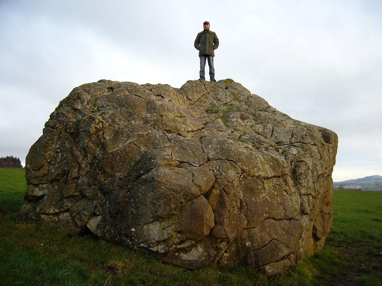
On the outer southern edge of Kilbarchan parish—right near the ancient boundary line itself—this giant stone of the druids is seems to be well-known by local folk. Located about 40 yards away from the sacred ‘St Bride’s Burn’ (her ‘Well’ is several hundred yards to the west), it was known to have been a rocking stone in early traditions, but as Glaswegian antiquarian Frank Mercer told us, “the stone no longer moves.” The creation myths underscoring its existence, as Robert Mackenzie (1902) told us, say
“This remarkable stone, thought by some to have been set up by the druids, and by others to have been carried hither by a glacier, is now believed to be the top of a buried lava cone rising through lavas of different kind.”
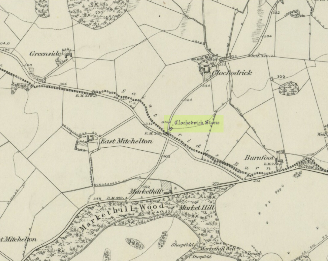
Clochoderick Stone on 1857 map
The site was highlighted on the first OS-map of the area in 1857, but the earliest mention of it seems to be as far back as 1204 CE, where it was named as Clochrodric and variants on that title several times in the 13th century. It was suggested by the old place-name student, Sir H. Maxwell, to derive from ‘the Stone of Ryderch’, who was the ruler of Strathclyde in the 6th century. He may be right.
Folklore
Folklore told that this stone was not only the place where the druids held office and dispensed justice, but that it was also the burial-place of the Strathclyde King, Ryderch Hael.
References:
Campsie, Alison, “Scotland’s Mysterious Rocking Stones,” in The Scotsman, 17 August, 2017.
MacKenzie, Robert D., Kilbarchan: A Parish History, Alexander Gardner: Paisley 1902.
Acknowledgements: Big thanks to Frank Mercer for use of his photos and catalytic inception for this site profile.
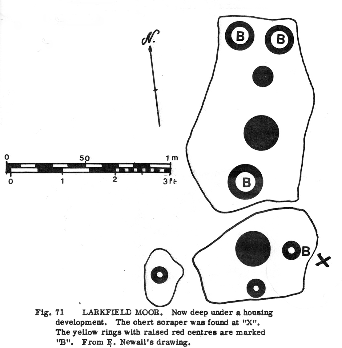
When the moorland here was still free from the dodgy factory workings of Texas Instruments (UK) Ltd, a Mr F. Newall (1960) came across this curious example of ancient rock art—now long gone. He described the find as,
“A series of cup marks and one ring, worked in laminated sandstone (that) has been located on Larkfield Moor by Mr H.M. Sinclair. In several cases the outer edge of the cup has been deeply incised through yellow sandstone to leave a slightly raised boss of red sandstone at the centre. From the side of the outcrop bearing the cups was recovered a chert scraper, doubly notched on one edge.”
Morris’ 1981 sketch
The “chert scraper” is marked on the adjacent diagram with an “X”.
Although this carving is described on the latest Canmore survey as being “possibly a freak geological formation”, we are best erring on the side of caution regarding their note. The cup-marks on this stone were—as the illustration (right) shows—quite large, which is the reason for the geophysical suggestion. However, the site was deemed to be authentic by the rock art authority R.W.B. Morris. (1981) In his account of this petroglyph, Morris told of there being,
“6 rings up to 20cm (8in) diameters, cut so that they penetrated the next lower yellow sandstone layer; but in 4 cases having a ‘boss’ of red sandstone slightly raised in the middle, and also 3 cups. Greatest carving depth 1cm (½ in).”
References:
Morris, Ronald W.B., “The Cup-and-Ring Marks and Similar Sculptures of South-West Scotland,” in Transactions of the Ancient Monuments Society, volume 14, 1967.
Morris, Ronald W.B., The Prehistoric Rock Art of Southern Scotland, BAR: Oxford 1981.
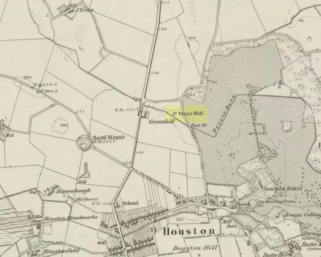
Located on the north side of the village, in a field east of Greenhill Farm, this old Well was once (still is?) covered and protected by an old well-house. References to its mythic history are few and far between. St. Peter’s Day was June 29, which may relate to the last vestiges of midsummer rites local people held here; or perhaps when the genius loci was more notable. The Old Statistical Account of 1790 told that the burn which runs past the well was called St. Peter’s Burn; but T.C.F. Brotchie (1920) thought that an old place-name given to the village is telling:
“Houston is a very ancient village,” he wrote, “and it was known long ago as Kilpeter, which is the ‘cell or church of Peter’. The name of the farm near to the well is Chapelton, ‘the place of the chapel’, and I venture to think that when the saintly Peter came a-wandering to Renfrewshire, he established his habitation or cell adjacent to the well, blessed its water, and in that medieval times a chapel was also built there, its memory being enshrined in the place-name Chapelton. Crawford mentions that on St. Peter’s Day vast numbers of people used to come to Houston. He does not state the reason, but I fancy these people came to pay their devoir at the holy well of St. Peter.”
Mr Brotchie was probably right!
(I haven’t yet visited this site. If you travel to this site, please send us your field notes and accompanying photos to let us know of its present condition. All due credits will be given to any and all contributors, obviously.)
References:
Brotchie, T.C.F., “Holy Wells in and Around Glasgow,” in Old Glasgow Club Transactions, volume 4, 1920.
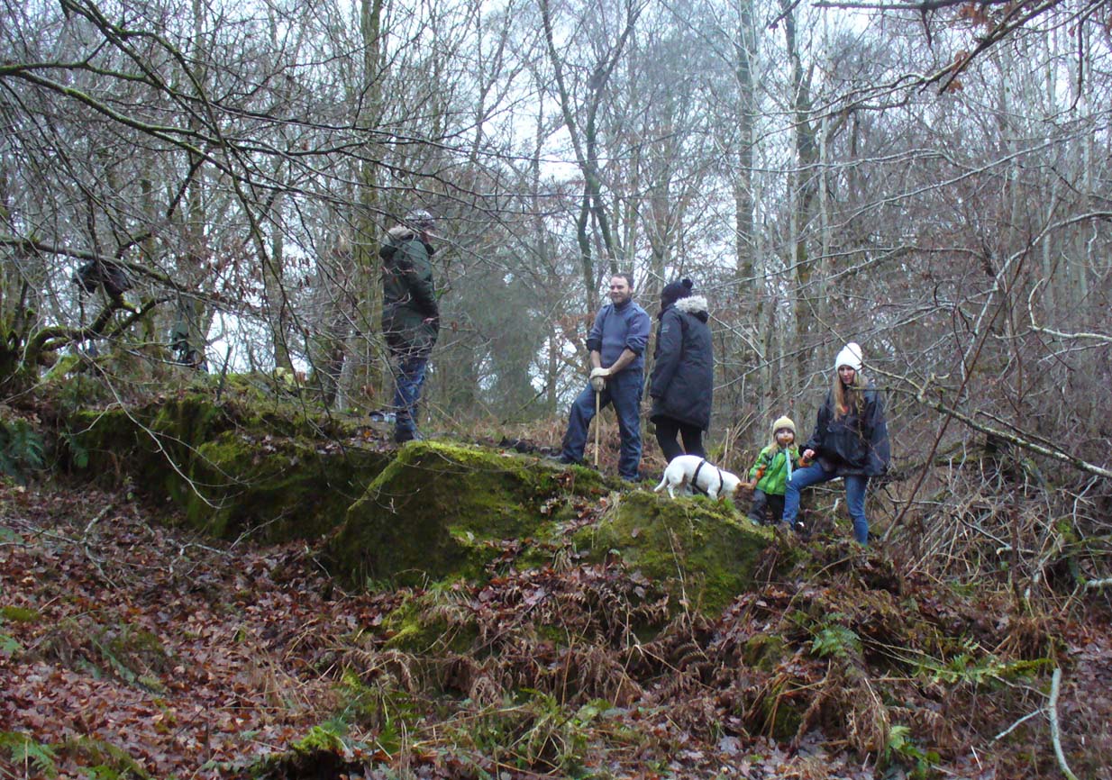
The TNA Rock Art Team on site – Fraser, Frank, Lisa, Leo & Aish
Get yourselves to Johnstone or Elderslie (which just about fuse into each other) and off the B789 road, make your way to Johnstone Castle football ground on Auchenlodment Road and go uphill, past the housing estate, until the fields open up on either side. 350 yards further, woodland appears. Go past the hair-pin kink in the road and, 50 yards or so past this, walk into the trees on your right. About 20 yards in, a large sloping rock face is what you’re looking for… (there’s a decent car-park on the left-hand side of the road 400 yards further along if you’re driving here)
Archaeology & History
4 cup-and-rings in poor light
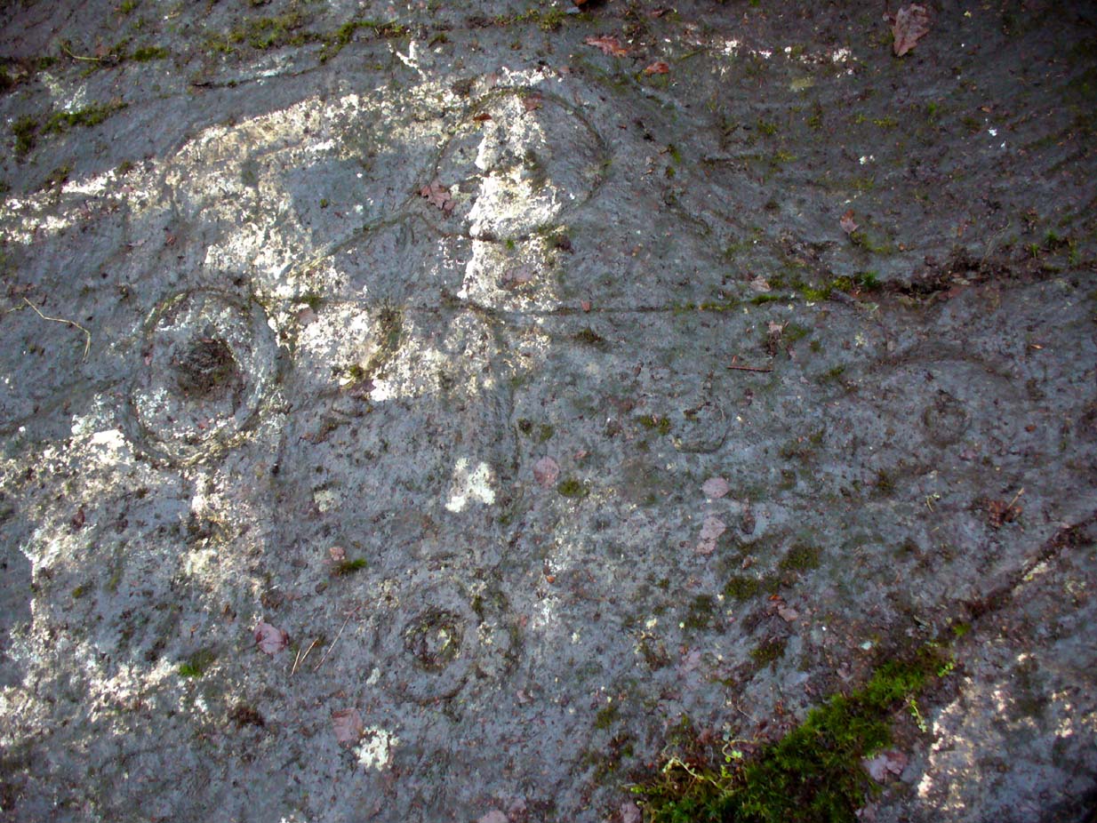
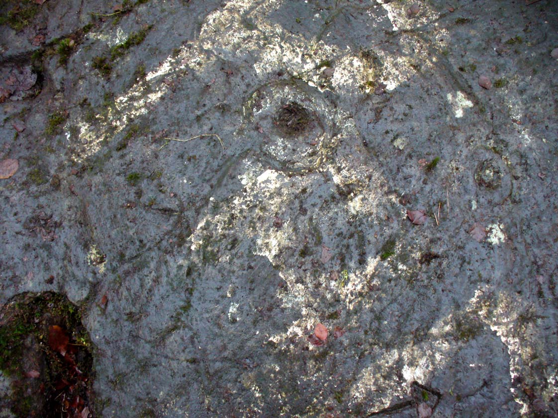
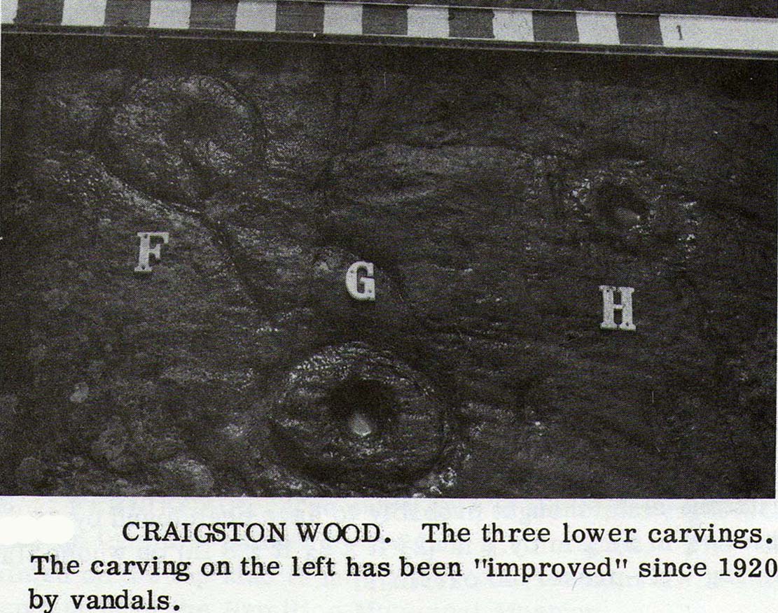
A seemingly solitary but vandalised petroglyph at the top of the Craigton Woods above Johnstone Castle estate: vandalized by the industrialists, whose quarry cut into a once larger rock, at whose edges cup-markings exist and whose design extended much further onto the now-vanished rock. The carving was also painted onto by some ignorant bastard many years ago (as the photos show); and one of the cup-and-rings here has either been damaged or isn’t prehistoric. The paint was daubed onto the stone in the 1960s and is shown in one of Ron Morris’ (1981) several descriptions of the site; and whilst it interferes with the design, it hasn’t damaged it anything like as badly as the industrialists have done.
Craigenfeoch cup-and-rings
Vandalism aside: it’s still quite an impressive carving, albeit hidden in the shadows of the surrounding trees. The design has been etched onto a large rock, some 35 feet long and perhaps up to 10 feet across, sloping at an angle of about 30-35° down (slippery when wet, as we all found out!). When we visited the site a few days ago, low cloud and mist didn’t really allow us a decent inspection of the site. But what we did find was more than our predecessors….
James Kirkwood (1938) gave the first literary account of the site—and in some detail. When he found the place it was “mostly covered with vegetation”, much like we found it on our visit. He wrote:
“The group of markings comprises five cups, each surrounded by a single encircling ring, whole lay-out being contained in an area of about 9 square feet. The setting corresponds almost exactly with the four cardinal points of the magnetic compass. The cup and ring to the north is the best preserved, the cup being 2½ inches in diameter and cut to a depth of 1 inch; the ring is somewhat elliptical, measuring 8½ and 7½ inches on its major and minor axes. A channel or gutter connects this cup with that within the eastern ring. The remaining cups vary from 2 inches to 2½ inches in diameter, and the rings from 6½ to 7 inches diameter. It is significant that the east and west cups are equidistant from the north one at about 15¼ inches; they are also equally spaced from the southeast cup at 19½ inches, and this latter dimension measures the distance from the west to the southwest cup. The four cups and rings on the main cardinal points are all moderately distinct, but the southwest sculpturing can only be very faintly discerned.”
James Kirkwood’s drawingRon Morris’ sketch
Kirkwood’s fascination with the alignments and measurements betwixt certain elements on the petroglyph was something of a fad at the time (resurfacing with some vigour in some quarters today), but is likely to have little if any authentic relevance with the animistic dynamics implicit in the function of the design.
When Ronald Morris (1981) entered the carving into his Southern Scotland survey, he made the now standard bland description of the carved elements:
“At least 5 cups-and-one-complete-ring (some ovoid), at least one with a long wavy groove downhill from the ring, and at least 5 cups, some of which may have been ringed. The ring marked ‘F’ in the (black-and-white photo, below) has been ‘improved’ since 1934 — the author has an older photograph showing it similar to the others. The 2 upper rings can only be seen just after sunrise, when wet—they are much weathered. Greatest ring diameter – 17cm (7in) and carving depths up to 2cm (1in).”
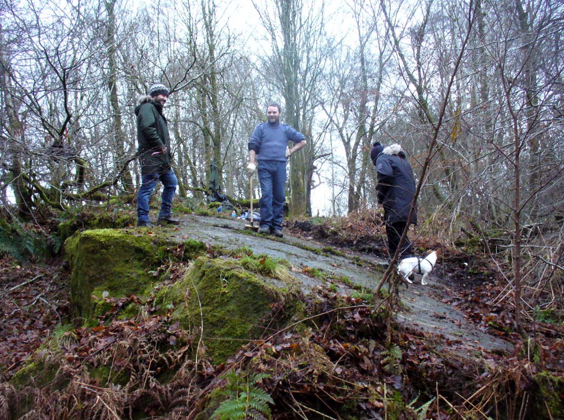
Fraser, Frank & Lisa at work
A good drawing of the carving would be worthwhile (are there any rock art-ists out there wanna join us on our next visit?), as the archaeological blandness never does petroglyphs descriptive justice. Ostensibly, from the bottom slope of the elongated stone—below where Fraser, Frank and Lisa are standing, right—a number of geophysical marks run across the stone. You can see in the photo how several geophysical ‘lines’ cut across the rock at an angle, roughly parallel, marked by the green vegetation. One of these is a small natural tunnel hole running through the stone, possibly made by the softer rock of a fossilized tree root or branch which has since disintegrated over time. Just above this ‘hole’ the carvings begin.
Cup-and-ring & carved lineOuter cup, ‘fan’ & CnRs
A number of possible cup-marks are overshadowed by the definite series of well eroded cup-and-rings (at least four of them) all close to each other, with lines connecting some to the others, including one which runs down to the tunnel hole. Some other lines on this part of the rock may or may not be geophysical (is there a geologist in the house!?). Close to the edge of the stone (where Fraser stands in the photo above) a singular cup-mark has been etched within a series of five lines, like an open fan, that all run to a point at the entrance of the natural tunnel in the stone. We were unsure as to whether these lines were natural or man-made (we need that geologist!); but it should be noted that an element very similar to this ‘fan’ of lines occurs in a carving near Killin, Perthshire, which we have yet to fully excavate—and in the Killin example the lines reach out from a central point like spokes on a bike wheel to an entire surrounding ring of cup-and-rings! Intriguing…
R.W.B. Morris early photo
One of the cup-and-rings in this cluster has clearly been either vandalized or else carved within the last century, as the erosion on it is wholly different to the rest, and the angle of the cuts into the stone shows clearly that a metal tool has made it. However, as Ron Morris stated above, this was apparently not the case with this ‘ring’ when he visited it in 1934 (it would be good to see the photo which he says shows its original state).
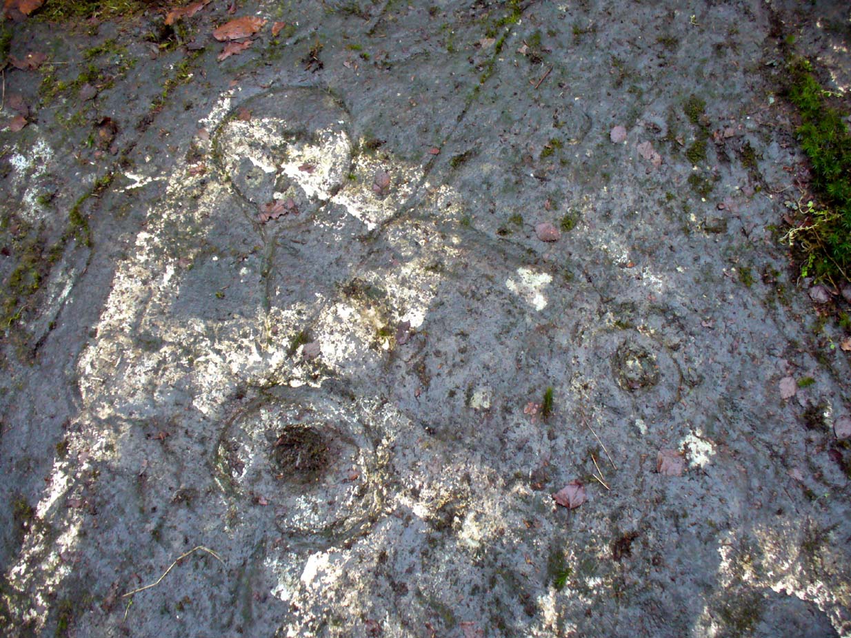
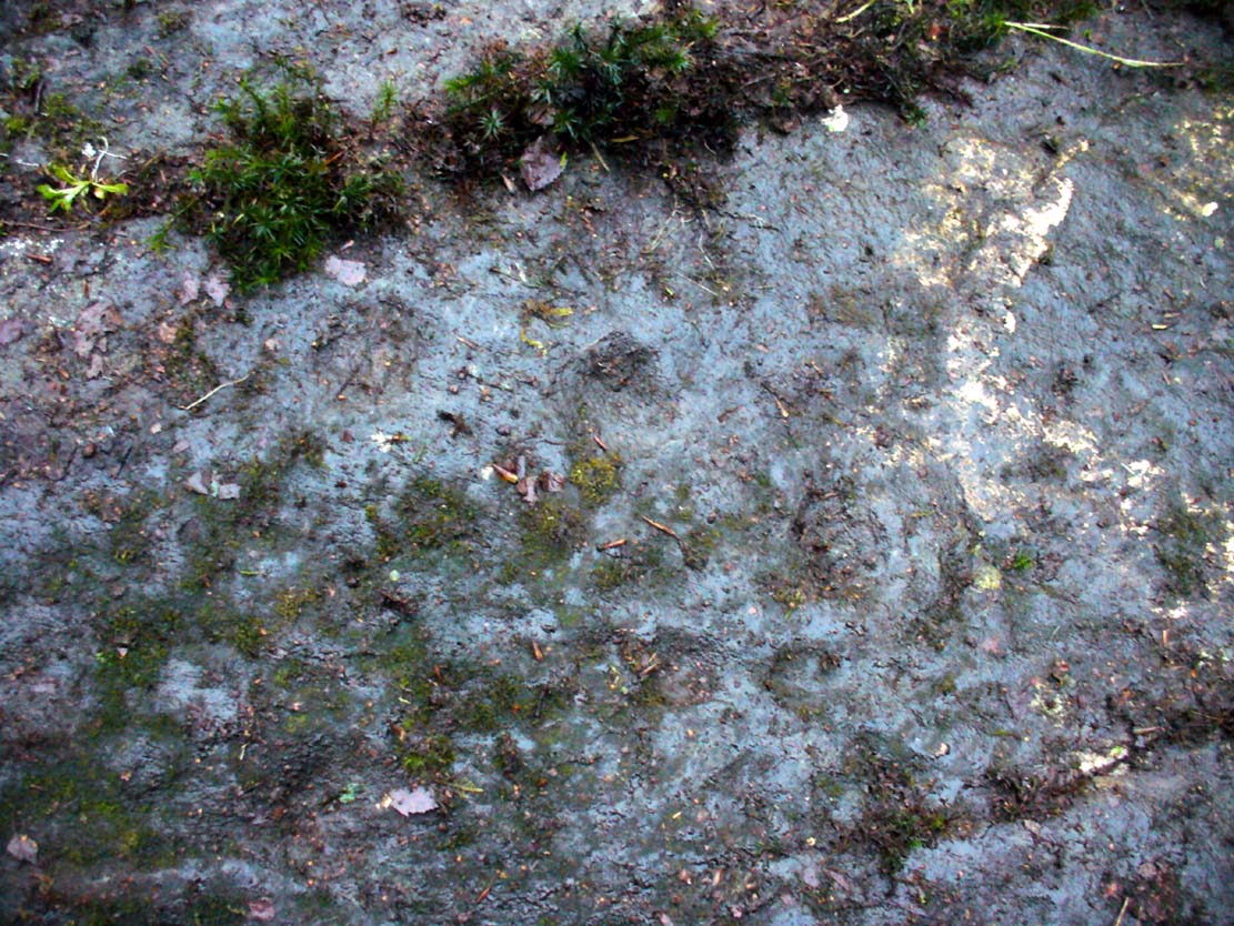
Faint cup-marks halfway up
Further up the slope of the rock we reach a near-parallel row of natural cracks across the stone. Inside this, about halfway along, a cluster of well eroded cup-marks exist—at least four of them. One of them has either a curved line arching out of it, or a semi-circular arc. Above the parallel cracks there is a large and very well eroded cup which, from differing angles, appeared to have faint sections of a ring around it, but we all agreed this was more a Rorschach response in our respective feeble minds!
We need to visit the site again in much better weather to gain a more accurate picture of the entire design. It appeared there were other elements to be seen here, but the lighting conditions were working against us that day…. That’s our excuse anyway!
References:
Kirkwood, James, “Notes on Cup and Ring Markings at Craigenfeoch, Renfrewshire”, in Transactions of Glasgow Archaeological Society, 9:2 (New Series), 1938.
Morris, Ronald W.B., “The Cup-and-Ring Marks and Similar Sculptures of South-West Scotland,” in Transactions of the Ancient Monuments Society, volume 14, 1967.
Morris, Ronald W.B., The Prehistoric Rock Art of Southern Scotland, BAR: Oxford 1981.
Acknowlegdments: With huge thanks to what Nina Harris called “the TNA rock art team” – Aisha Domleo (and Leo), Nina Harris, Frank Mercer, Lisa Samsonowicz & Fraser Harrick.
There is very little known of this once proud standing stone, said by one writer to have been about 12 feet long: six-feet of it in the ground and the other six-feet above ground. A decent monolith by anyone’s standard! But some dickheads forty years or more ago thought it a good idea to destroy the site, or as it was diplomatically put, “was removed in advance of road widening.” Vandalism no less – though it’s demise was recorded by the Department of the Environment “on behalf of the Inspectorate of Ancient Monuments.” (DES, 1973)
A local journalist called Andrew McCallum described the site in his unpublished manuscript on the history of the parish of Mansewood, telling it to be near Cowglen:
“near Boydstone Road, midway between Kennishead and Barrhead Road. 6 feet above the ground, and at least as many below. Age and purpose are unknown.”
Some thirty years later, Miss Adamson (1973) told us that,
“The straight-sided block had its base set on yellow sandstone. Immediately above the bedrock small stones and earth had been packed against the W and N faces of the standing stone. On top of the packing were two boulders set at right angles to wedge the sides of the stone. No burials or cremations were found.”
Though on this latter remark we have to consider the possibility that the standing stone may once have accompanied a burial, as the nearby place-name ‘Carnwadric’ indicates a cairn, or burial site. A field-name survey of the immediate region may prove valuable.
References:
Adamson, H., “Glasgow: Boydstone Road – Standing Stone,” in Discovery & Excavation in Scotland, 1973.