Cup-Marked Stone (lost): OS Grid Reference – SD 950 488
Archaeology & History
When the archaeology assistant Stuart Feather ventured over to look at the prehistoric enclosure on the northwest slope of Raygate Hill, a mile or so south-west of Carleton, like any good petroglyph explorer he looked out for any rock art and—like y’ do sometimes—came across a cup-marked stone that hadn’t been recorded before. He wrote down his finds at home and, following his death, those records were thankfully sent to the Manor House Museum in Ilkley, from where these brief notes are taken. There was at the time of his visit, he said, a
“Rock outcrop with two cup-marks, on August 6th 1960 this outcrop was intact. On a second visit the top layer of the rock had become detached and split into two. The pieces were then removed for preservation.”
By “removed for preservation”, he meant that he took it home to Fernbank Avenue in Keighley (he did this with a few of our old cup-and-rings). However, this one has not been found since and it may simply have been buried in his garden. Does anyone know more about it?
He described another less likely contender of a carving a little closer to the enclosure, telling briefly: “Cup-marked rock, cups only possibly man-made. In close proximity, 75 yards, to (the) earthwork marked on the 6” O.S. map.”
Cup-and-Ring Stone (removed): OS Grid Reference – NT 12364 32627
Also Known as:
Drumelzier Carving
Archaeology & History
Position of stone in cairn
A carving that was located at the edge of a cairn on a knoll on the east-side of the River Tweed, this is an odd design that now lives in Edinburgh’s central museum: odd, inasmuch as the design looks as if it’s a typical cup-and-ring carving, yet none of the cups on this stone were ever hollowed or pecked out, and so the “cups”, so to speak, are actually small rings (if that makes sense!). There are a number of similar unhollowed “cups” on other carvings that are found associated with prehistoric tombs, so perhaps this aspect was something of a burial trend—amongst a very small tribal group, perhaps… It’s an element that was remarked upon in Simpson & Thawley’s (1972) examination of petroglyphs in neolithic tombs that were called “passage grave style” carvings: a sort of dyslexic cup-and-ring design no less! The intriguing thing about this carving is that it’s one in a small cluster of dyslexic cup-and-rings that are found in this part of Scotland—in an area where rock art itself is pretty scarce. Which begs the question: was it a local tribal style? Anyhow…
The carving was first uncovered when J.H. Craw (1930) excavated the aforementioned cairn, finding therein a number of cists. There’s speculation that the petroglyph might originally have been a covering stone for one of the cists, but we don’t know for sure. Craw described the carving as follows:
Craw’s 1930 sketchRon Morris’ 1981 sketch
“The ring-marked slab…measures 3 feet by 2 feet by 6 inches. It lay at the north side of the cairn (highlighted in sketch, PB), outside the encircling ring, but may originally have been the cover of cist No.2. On the upper side are five shallow ring-markings, four being double and one single. The former measure 3 inches to 4 inches in diameter, and the latter 1¾ inch. The figures are thus much smaller than in typical cup-and-ring-marked stones, and the lines are only ¼ inch in width. The only similar markings known to me are on a slab which I found a number of years ago near the site of several former cairns, and forts at Harelawside near Grant’s House, Berwickshire. The stone is now in our Museum.”
The “museum” in question being Edinburgh’s National Museum (I don’t know if it’s in a box somewhere or on public display, which is where it needs to be). If anyone can get a good photo of this carving, please send it to us or add it on on our Facebook group.
Morris, Ronald W.B., “The Cup-and-Ring and Similar Early Sculptures of Scotland; Part 2 – The Rest of Scotland except Kintyre,” in Transactions of the Ancient Monuments Society, volume 16, 1969.
Morris, Ronald W.B., The Prehistoric Rock Art of Southern Scotland, BAR: Oxford 1981.
Ritchie, Graham & Anna, Edinburgh and South-East Scotland, Heinnemann: London 1972.
Royal Commission on the Ancient & Historical Monuments, Scotland, Peeblesshire – volume 1, Aberdeen University Press 1967.
Simpson, D.D.A. & Thawley, J.E., “Single Grave Art in Britain,” in Scottish Archaeological Forum, no.4, 1972.
Acknowledgements:Huge thanks for use of the Ordnance Survey map in this site profile, reproduced with the kind permission of the National Library of Scotland.
A little-known multiple ringed carving was discovered a few years ago during the excavation of a prehistoric cairn just immediately east of the A701 roadside, several miles south of Broughton. The cairn itself had been recognised many years prior to the recent excavation, when one of two cists inside it was noted by R.B.K. Stevenson (1940), and which was subsequently described in slightly more detail in the Royal Commission Inventory (1967). But when the modern investigation was undertaken by the Biggar Archaeology Group in 2008, a damaged but impressive carving was uncovered that somehow hadn’t been noticed before. It was described in Tam Ward’s (2008) excavation report where he told that,
Carving in situ (photo courtesy Jim Ness)Carving looking N: courtesy Jim Ness
“lying almost immediately on the east side of Cist 1 is an angular rock…measuring 1m long and over 0.3m wide on the uppermost face, itself lying at an angle facing SW and away from the cist. The rock has fractured due to weathering in post deposition times, as indeed several other surface stones had, but on the widest part of the upper surface are at least seven concentric lines faintly pecked into the smooth flat surface of the stone. The lines are up to 10mm wide and appear to have been intended to form semi ovals on the edge of the rock. The outer ring forms an arc of c270mm on the long axis by c140mm on the short one (the former measurement being straight between the ends of the lines and the latter being a radius across the design). The terminals of the inner curved line are about 80mm apart. The lines are slightly irregular in distance from one another. Although it is far from certain, it does not appear that the rock has been part of a larger one with a more complete design on it, rather the pecking appears not to have been finished since the surface of the rock is similar in appearance overall while the abrasion of the carving varies.”
Fractured design (photo courtesy Jim Ness)
The carving remains in place with the cist, which was covered back over when the excavation had been finished.
Carvings such as this are uncommon in this neck o’ the woods; although less than a mile downstream from here, on the other side of the river, another petroglyph—known as the Drumelzier carving—accompanied another prehistoric tomb. Apart from this, there’s a great scarcity of carvings scattering the Lowlands—although it’s likely that there are others hiding away, waiting to be found on these hills…
References:
Royal Commission on the Ancient & Historical Monuments, Scotland, Peeblesshire – volume 1, Aberdeen University Press 1967.
Stevenson, R.B.K., “Cists near Tweedsmuir,” in Proceedings Society Antiquaries, Scotland, volume 74, 1940.
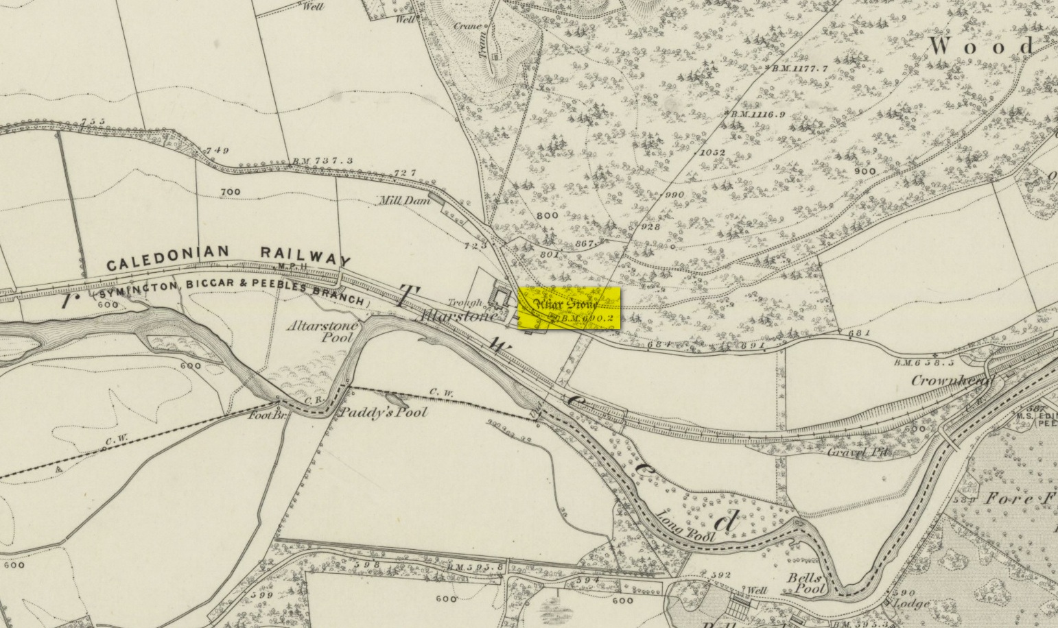
Various ways to get here. From Peebles take the A72 road west to Kirkurd, but after 4 miles turn left onto B712. Several miles down, go past Stobo village and before crossing the bridge over the River Tweed, turn left up minor road leading to Dreva and Broughton. The track into Altarstone Farm is about a mile along and the stone is across the road from there. The other way is going south along the A701 from Broughton village, where you take the left turn towards Stobo. Go along here for just over 3 miles where you reach the woodland (park here where the small track goes into the woods). A coupla hundred yards further along is Altar Stone Farm on your right and the stone is above the verge on your left.
Archaeology & History
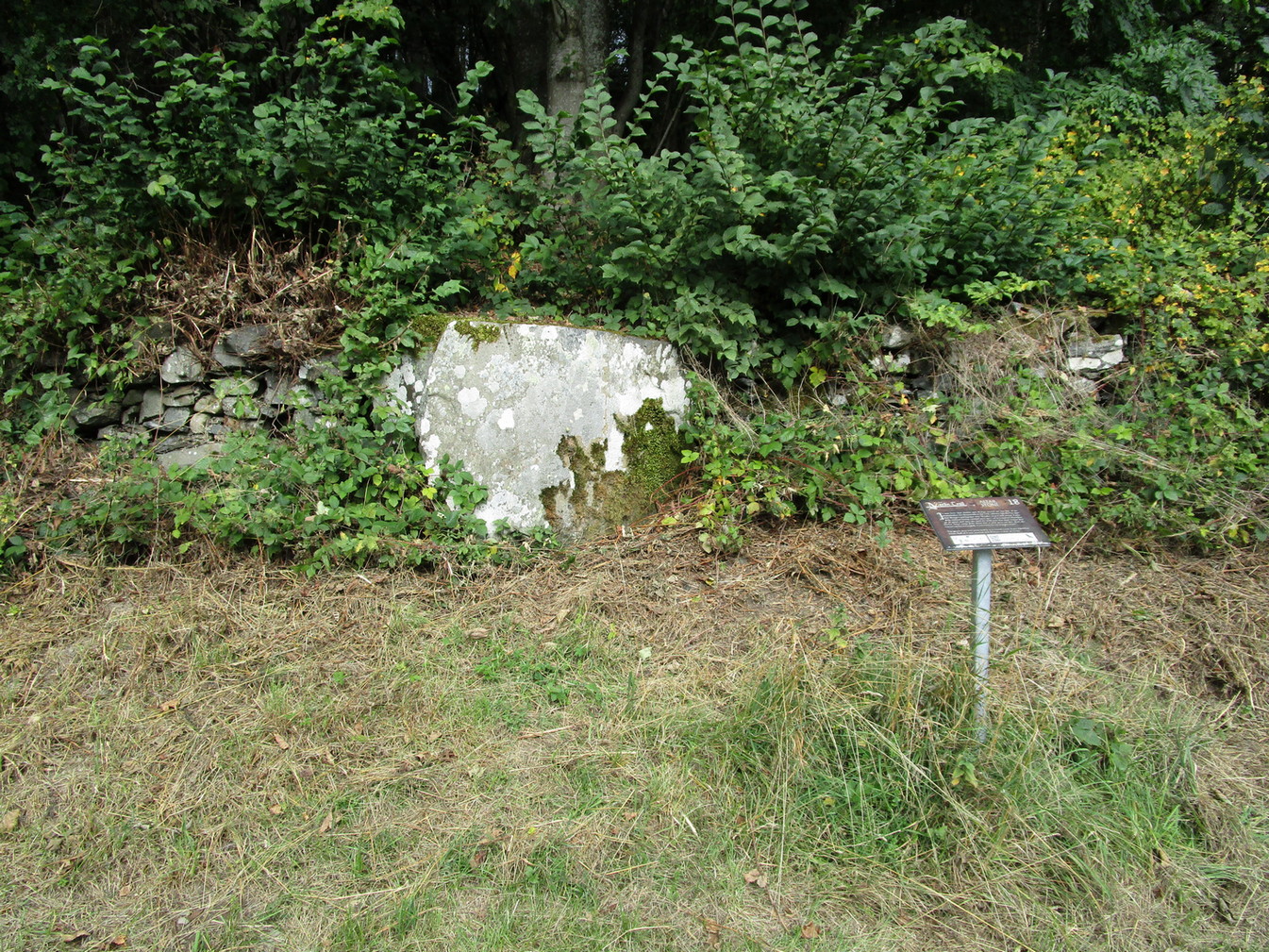
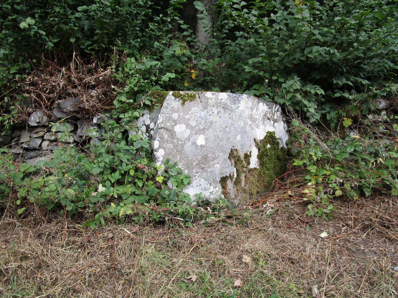
Altar Stone, Stobo
Archaeologically speaking, there’s nowt much to say about this site apart from the usual tedium of its measurements and the rock-type. I’ll give the latter a miss, but the stone stands at nearly five feet high and nearly as broad; with its upper face relatively smooth and the top of it pretty flat. A section from the top of this stone was cut and sliced off a few centuries ago and this was said to have been taken to Stobo church a few miles away, where it was fashioned into a stone font for baptisms. If this is true, then it’s possible that this was once an authentic prehistoric standing stone, but we’ll probably never know for certain. Also on top of the stone you can see a number of geophysical scratches, one of which looks as if it may have been worked by human hands and which has some relevance to the folklore of the stone.
It is shown on the 1859 OS-map of the area and was mentioned in the Ordnance Name Book where they told how it was “supposed to have formed the Altar of a druids Temple or some such object,” but they could find no local verification of such lore at the time of their visit… or at least, no one was telling them anything about it…
Folklore
This fascinating bit of rock—or possible sliced standing stone—is of note due to its association with that old shaman of shamans known as Merlin! Near the end of His days, when He’d truly retired from the world of men and wandered, they say, mad amidst the great lowland forests, an old christian dood by the name of Kentigern—later known as St Mungo—who’d been trying to convert our old magickian away from the animistic ways of Nature, was said to have finally succeeded here, at this very stone. The old Scottish traveller Ratcliffe Barnett (1925) wrote:
“Merlin is the real genius of Drumelzier. Dumelzier means the Ridge of Meldred, a pagan prince of the district. And it was Meldred’s shepherds that slew Merlin the bard. The heathen bard was present at the battle of Arthuret in the year 573, when the christian army gained a victory over the Heathen Host. Merlin fled to the forest of Caledon at Drumelzier and there ever after the old Druid spent his life among the wild hills with a repute for insanity. This poet priest was doubtless heart-broken at the defeat of his pagan friends. The old order was changing. But the christian king had brought his friend, St Kentigern or Munro, to preach the gospel in upper Tweedside at Stobo. One day Kentigern met a weird-looking man and demanded who he was. “Once I was the prophet of Vortigern (Gwendollen). My name is Merlin. Now I am in these solitudes enduring many privations.”
“So Kentigern preached the gospel to the old nature worshipper and won him to Christ. Up yonder, at the east end of the Dreva road, you will find the rude Altar Stone where, it is said, Kentigern received the Druid into the christian church and dispensed the sacrament. But in those dark days of the faith, the Druids and their pagan adherents fought hard against the new religion. So immediately after the admission of Merlin to the Church, the shepherds of Meldred sought him out, stoned him to death on the haugh of Drumelzier, and there, where the Powsail Burn falls quietly into Tweed, Merlin the Martyr was buried. For long his grave was marked by a hawthorn tree.”
These shepherds were said to have stoned him and then threw his body upon a sharp stake and then into the stream. (stone – wood – water)
If there is any hint of truth in this tale, it is unlikely Merlin would have given himself over to the christian ways unless—as any shaman would—he knew of his impending death. In which case it would have done him no harm to pretend a final allegiance to the unnatural spirituality that was growing in the land. But whatever he may have been thinking, it is said that this Altar Stone was where he made such a deed.
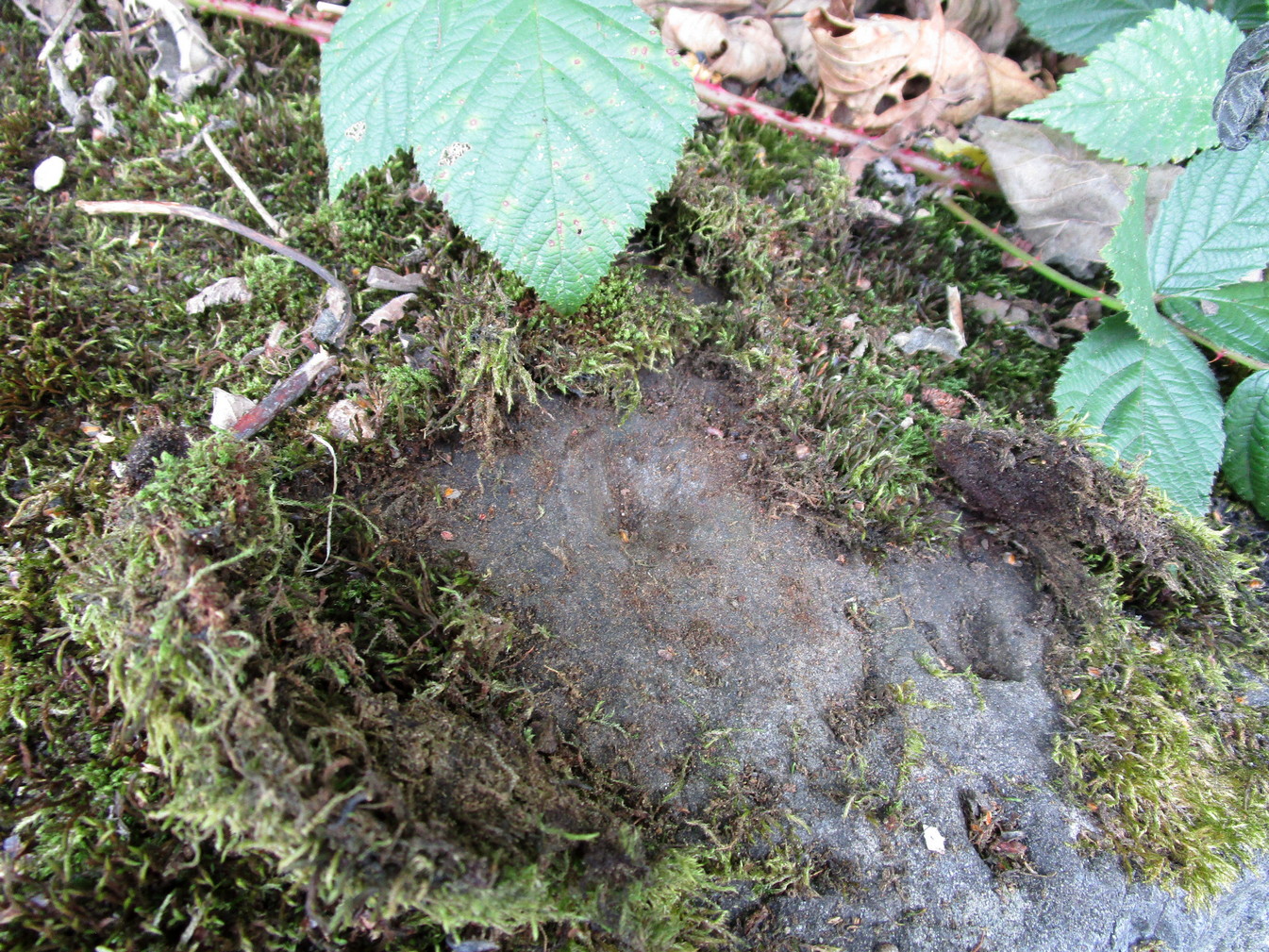
Scratch-marks of the mythic hareAltar Stone, Stobo
An equally peculiar legend—variations of which are found at a number of places in the hills of northern England and Scotland—speaks of another shamanic motif, i.e., of humans changing into animals and back. For here, legend tells, an old witch was being chased (by whom, we know not) across the land. She’d turned herself into the form of a hare and, as she crossed over the Altar Stone, her claws dug so deeply into the rock that they left deep scars that can still be seen to this day. From here, the hare scampered at speed downhill until reaching the River Tweed at the bottom, whereupon transforming itself back into the form of the witch, who promptly fled into the hills above on the far side of the river.
One final thing mentioned by Barnett (1943) was the potential oracular property of the Altar Stone:
“You have to only place your hand on top of this rude altar, shut your eyes, and if you have the gift you will see visions.”
References:
Ardrey, Adam, Finding Merlin, Mainstream 2012.
Barnett, Ratcliffe, Border By-Ways and Lothian Lore, John Grant: Edinburgh 1925.
Buchan, J.W. & Paton, H., A History of Peeblesshire – volume 3, Glasgow 1927.
Crichton, Robin, On the Trail of Merlin in a Dark Age, R. Crichton 2017.
Glennie, John Stuart, Arthurian Localities, Edmonston & Douglas: Edinburgh 1869.
Moffat, Alistair, Arthur and the Lost Kingdoms, Phoenix: London 1999.
Rich, Deike & Begg, Ean, On the Trail of Merlin, Aquarian: London 1991.
Wheatley, Henry B., Merlin, or, The Early History of King Arthur – 2 volumes, Trubner: London 1865.
Acknowledgements: Big thanks for use of the 1st edition OS-map in this site profile, Reproduced with the kind permission of the National Library of Scotland.
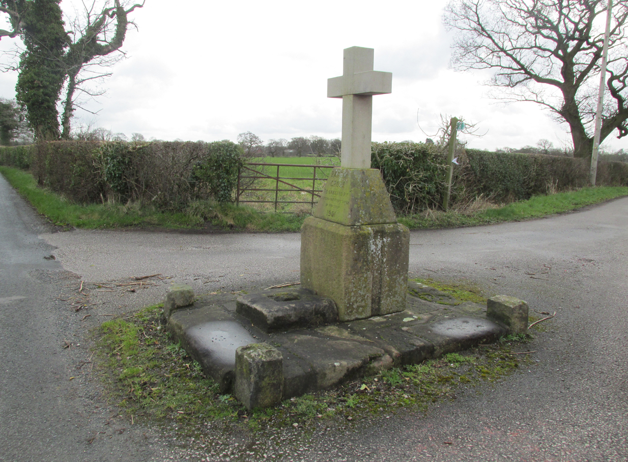
At the roadside, on the south side of Barton Lane, where it crosses the minor road joining Cross House Farm and Barton House, you’ll see the Barton Cross standing upright. You can’t miss it!.
Archaeology & History
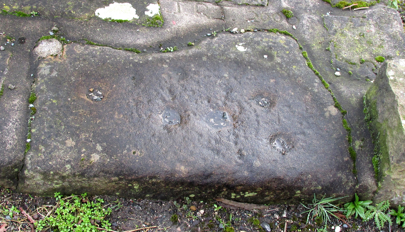
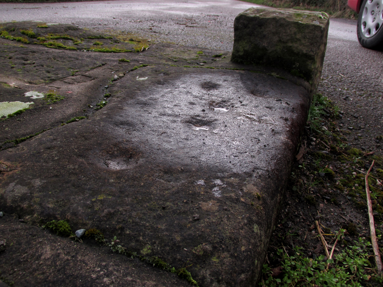
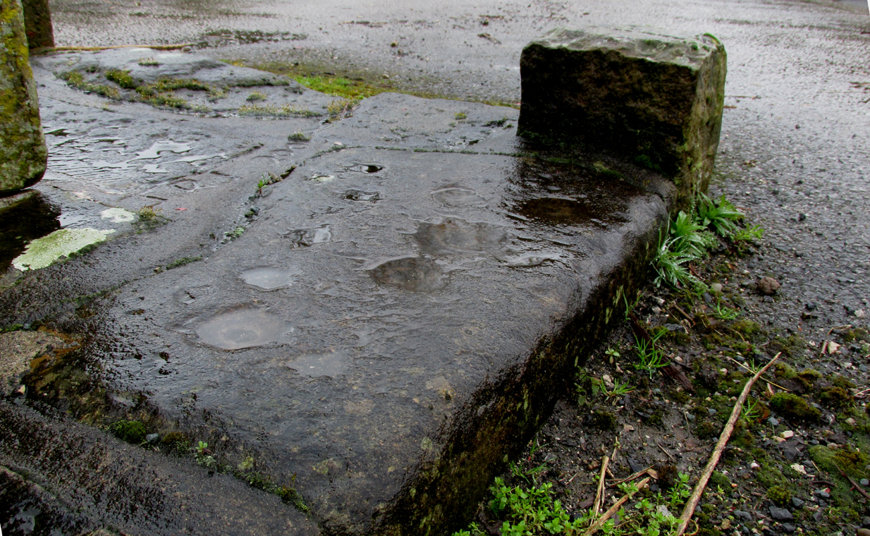
Carved stone cut to shape
Apparently never before described, this stone has very likely been removed from another locality and cut to shape to form part of the surrounding platform base to Barton Cross, where it is at the southwest corner. It has ten cup marks.
Until or unless more such stones are located, it is a unique example of rock art in this part of Lancashire.
Nine cups visible here10th cup nr camera, after rain
Henry Taylor, in his 1906 work The Ancient Crosses and Holy Wells of Lancashire writes inter alia about the Barton Cross that it had been demolished sometime after 1848, and that the base and part of of the Cross shaft had been ‘lately restored to the old site‘. Thus the cup-marked stone may or not be in its original position as part of the Cross surround, and may have just been a conveniently available slab of stone that was used, rather than a deliberate use of a pre-existing sacred stone.
References:
Taylor, Henry, The Ancient Crosses and Holy Wells of Lancashire, Sherratt & Hughes, Manchester, 1906.
Tumulus (destroyed): OS Grid Reference – SP 8601 7510
Archaeology & History
According to a Mr Abner Brown (1846), this was one of two prehistoric cemeteries that once existed in Pytchley village, but very little seems to have been written about it. Found on the north side of the village in the field where an old limekiln once stood, this “apparently pagan” site was “about 350 yards northwards of the church.” From his brief description it seems that a large barrow here was accompanied by other smaller ones of the same period. They have all been destroyed.
Royal Commission Ancient & Historical Monuments, An Inventory of the Historic Monuments in the County of Northamptonshire – volume 2, HMSO: London 1979.