Lamancha, Newlands, Peeblesshire

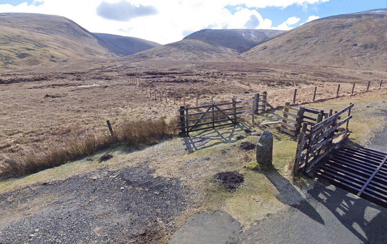
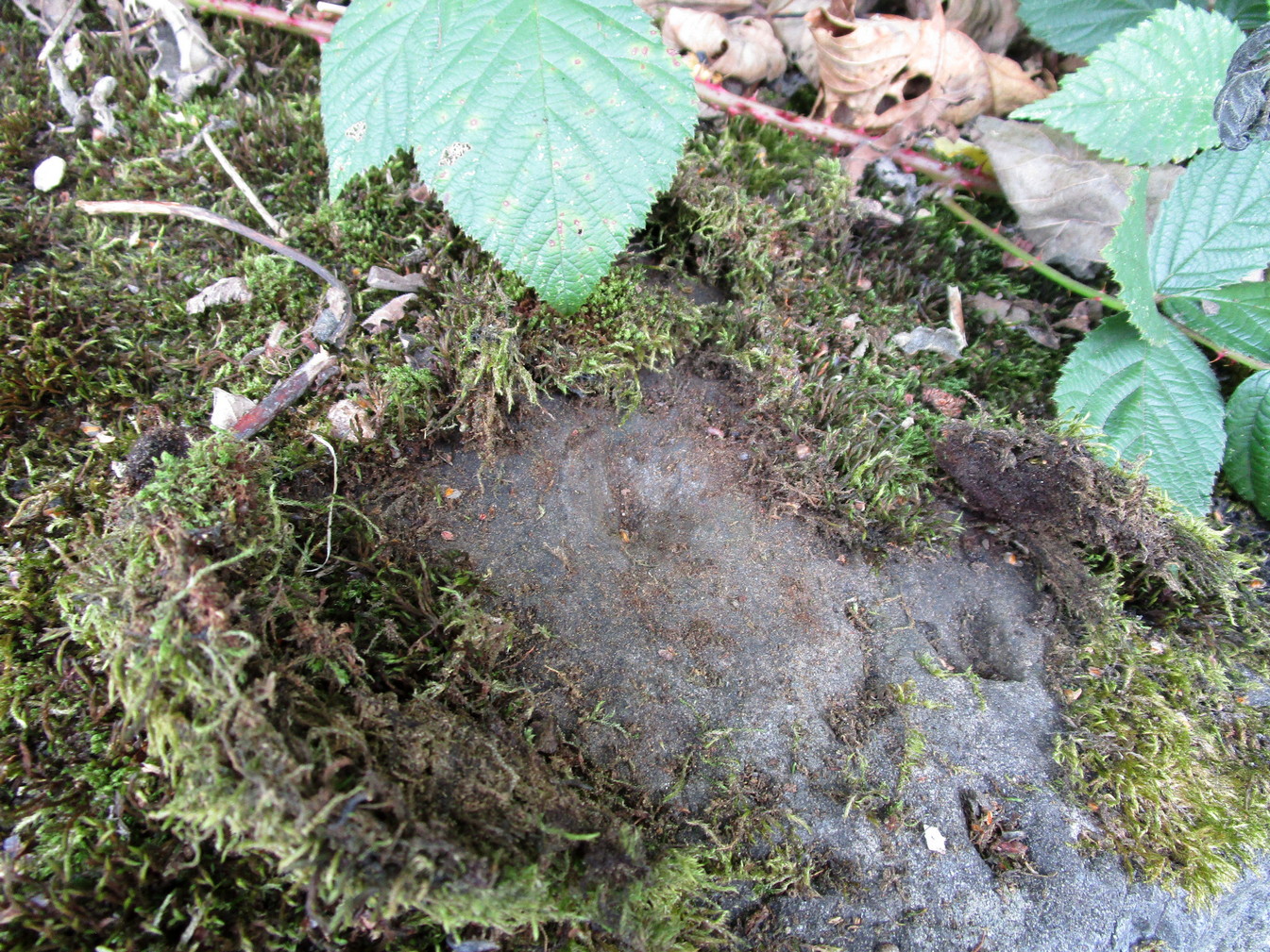
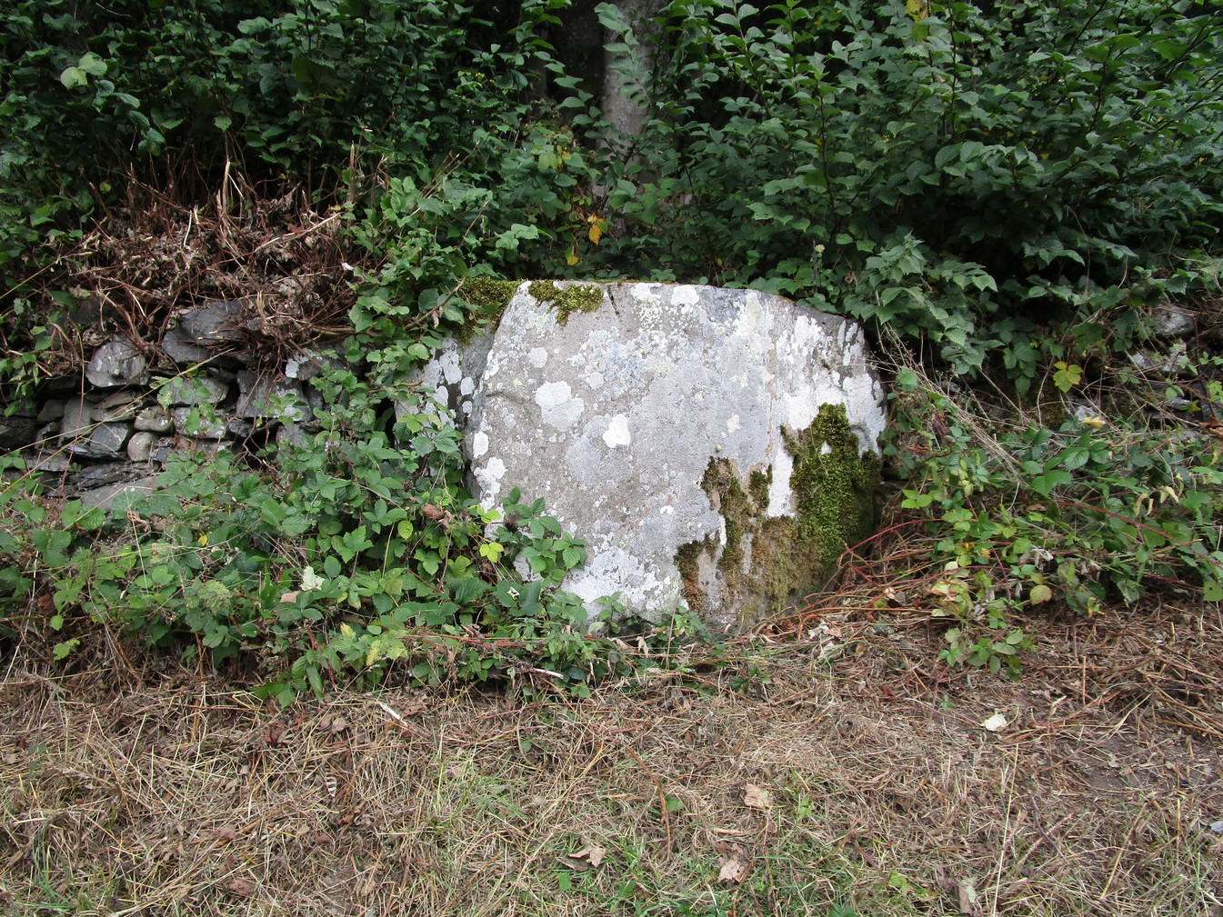
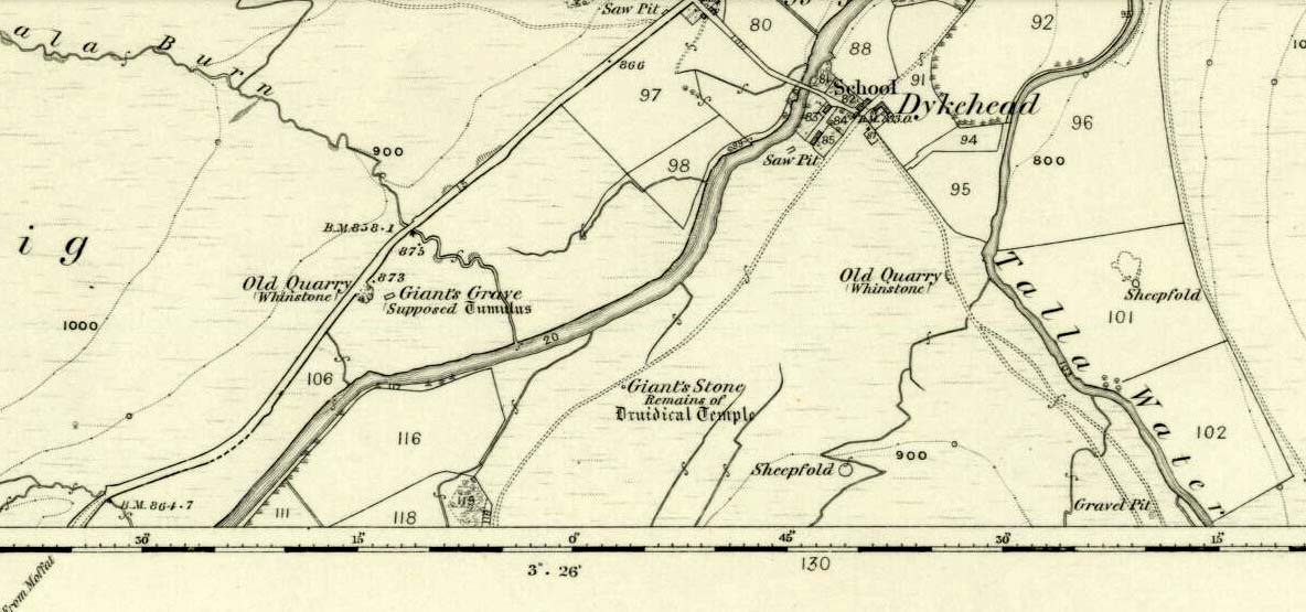
Cup-and-Ring Stone:  OS Grid Reference – NT 200 522

Also Known as:

  1. La Mancha

Archaeology & History

Simpson’s 1867 drawing

This is what I’ve come to term dyslexic cup-and-rings, due simply to the fact that it’s a cup-and-ring stone carving, but the cup in the centre hasn’t been carved out or pecked away.  They’re rare – but for some odd reason, a small cluster of them occurs in this part of lowland Scotland.  The Drumelzier carving 13 miles SSW is one; Carnwath carving is 14 miles west another; the multiple-ringed carving in the Woodend cairn had no defined pivotal cup, 14 miles south; and in Childe & Taylor’s (1938) short piece on the Hawthornden petroglyphs near Roslyn (less than 10 miles northeast), they noted—like Simpson & Thawley (1972) years later—the peculiarity of “the complete absence of cups”, akin to Lamancha’s carved rings. (although we have to be sceptical about the archiac nature of the Hawthornden carvings)

The carving here was first mentioned by one of the great petroglyphic pioneers James Simpson (1866; 1867):

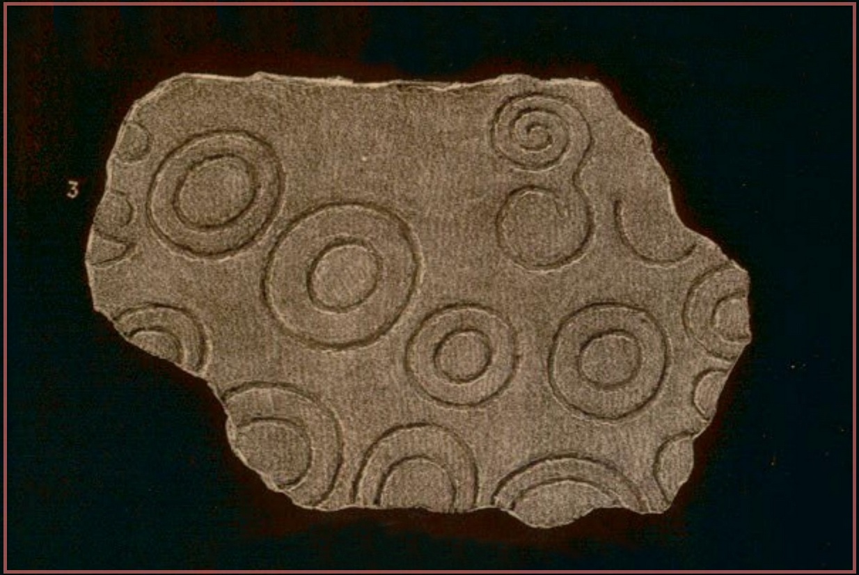
“A broken slab, about two feet square, covered with very rude double rings and a spiral circle, was found by Mr Mackintosh, at La Mancha, in Peeblesshire, in digging in a bank of gravel.  There were some other large stones near it; none of them marked.  Possibly this stone, therefore, is sepulchral in its character.”

Lamancha carving (G. & A. Ritchie, 1972 )

Eoin MacWhite (1946) was somewhat sceptical of Simpson’s “sepulchral” association, simple due to their being no record of a burial here.  But in Simpson & Thawley’s (1972) survey of passage grave art, they thought the Lamancha carving was from “a possible cist slab.”  We might never know for sure one way or the other.

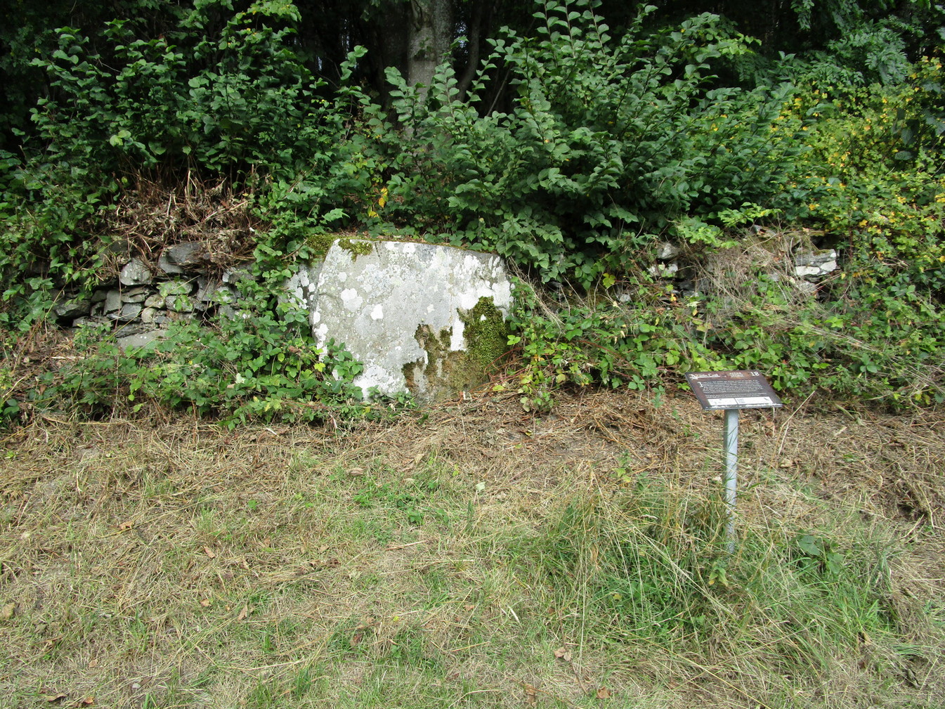
The carving ended up living in Edinburgh’s National Museum where it should hopefully still be on display.  As a result of this, it received the attention of the Royal Commission doods who gave a good description of the design in their Peeblesshire Inventory (1967).  They state that it

“is irregular in shape and has maximum dimensions of 2ft 6in by 1ft 10in; it averages 4in in thickness. The markings, which have all been formed by the pecking technique, occur mainly on one face, the most common symbol being single or double rings. There are four complete double-ring symbols, in which the outer rings measure from 5in to 7in in diameter, and the inner rings from 2in to 4in.  Round the margin of the face there are the broken arcs of five more double-ring symbols and of five single rings and one small V -shaped figure. As well as the ring markings there is a double-spiral, each lobe of which measures about 4in in diameter.  In one lobe the spiral has two and a half turns and in the other only one turn.  In addition, in a space which is otherwise free of  markings, there is an area, about 4in square, heavily pitted with punch-marks measuring one-eighth of an inch across and one-sixteenth of an inch in depth.  A remarkable feature of the stone is that three incomplete single ring symbols have been made on one edge. They have been formed by the same technique and measure 3in across; as in all the other symbols, the grooves themselves  measure about half an inch in width and about one-eighth of an inch in depth.”

References:

  1. Childe, V.G. & Taylor, John, “Rock Scribings at Hawthornden, Midlothian,” in Proceedings Society Antiquaries, Scotland, volume 73, 1938.
  2. McWhite, Eoin, 1946 “A New View on Irish Bronze Age Rock-Scriblings”, in Journal Royal Society Antiquaries, Ireland, vol. 76, 1946.
  3. Morris, Ronald W.B., “The Cup-and-Ring Marks and Similar Sculptures of South-West Scotland,” in Transactions of the Ancient Monuments Society, volume 14, 1967.
  4. Morris, Ronald W.B., “The Cup-and-Ring and Similar Early Sculptures of Scotland; Part 2 – The Rest of Scotland except Kintyre,” in Transactions of the Ancient Monuments Society, volume 16, 1969.
  5. Morris, Ronald W.B., The Prehistoric Rock Art of Southern Scotland, BAR: Oxford 1981.
  6. Ritchie, Graham & Anna, Edinburgh and South-East Scotland, Heinnemann: London 1972.
  7. Royal Commission on the Ancient & Historical Monuments, Scotland, Peeblesshire – volume 1, Aberdeen University Press 1967.
  8. Simpson, D.D.A. & Thawley, J.E., “Single Grave Art in Britain,” in Scottish Archaeological Forum, no.4, 1972.
  9. Simpson, J.Y., “On Ancient Sculpturings of Cups and Concentric Rings,” in Proceedings of the Society of Antiquaries, Scotland, volume 6, 1866.
  10. Simpson, James, Archaic Sculpturings of Cups, Circles, etc., Upon Stones and Rocks in Scotland, England and other Countries, Edmonston & Douglas: Edinburgh 1867.

© Paul BennettThe Northern Antiquarian

Tweed Ford, Drumelzier, Peeblesshire

Cup-and-Ring Stone (removed):  OS Grid Reference – NT 12364 32627

Also Known as:

  1. Drumelzier Carving

Archaeology & History

Position of stone in cairn

A carving that was located at the edge of a cairn on a knoll on the east-side of the River Tweed, this is an odd design that now lives in Edinburgh’s central museum: odd, inasmuch as the design looks as if it’s a typical cup-and-ring carving, yet none of the cups on this stone were ever hollowed or pecked out, and so the “cups”, so to speak, are actually small rings (if that makes sense!).  There are a number of similar unhollowed “cups” on other carvings that are found associated with prehistoric tombs, so perhaps this aspect was something of a burial trend—amongst a very small tribal group, perhaps… It’s an element that was remarked upon in Simpson & Thawley’s (1972) examination of petroglyphs in neolithic tombs that were called “passage grave style” carvings: a sort of dyslexic cup-and-ring design no less!  The intriguing thing about this carving is that it’s one in a small cluster of dyslexic cup-and-rings that are found in this part of Scotland—in an area where rock art itself is pretty scarce.  Which begs the question: was it a local tribal style?  Anyhow…

The carving was first uncovered when J.H. Craw (1930) excavated the aforementioned cairn, finding therein a number of cists.  There’s speculation that the petroglyph might originally have been a covering stone for one of the cists, but we don’t know for sure. Craw described the carving as follows:

Craw’s 1930 sketch
Ron Morris’ 981 sketch

“The ring-marked slab…measures 3 feet by 2 feet by 6 inches.  It lay at the north side of the cairn (highlighted in sketch, PB), outside the encircling ring, but may originally have been the cover of cist No.2.  On the upper side are five shallow ring-markings, four being double and one single.  The former measure 3 inches to 4 inches in diameter, and the latter 1¾ inch.  The figures are thus much smaller than in typical cup-and-ring-marked stones, and the lines are only ¼ inch in width.  The only similar markings known to me are on a slab which I found a number of years ago near the site of several former cairns, and forts at Harelawside near Grant’s House, Berwickshire.  The stone is now in our Museum.”

The “museum” in question being Edinburgh’s National Museum (I don’t know if it’s in a box somewhere or on public display, which is where it needs to be).  If anyone can get a good photo of this carving, please send it to us or add it on on our Facebook group.

References:

  1. Craw, J.H., “The Excavation of a Cairn at Drumelzier, Peeblesshire,” in Proceedings of the Society of Antiquaries, Scotland, volume 65, 1930.
  2. Morris, Ronald W.B., “The Cup-and-Ring and Similar Early Sculptures of Scotland; Part 2 – The Rest of Scotland except Kintyre,” in Transactions of the Ancient Monuments Society, volume 16, 1969.
  3. Morris, Ronald W.B., “The Cup-and-Ring Marks and Similar Sculptures of Scotland: A Survey of the Southern Counties – part 2,” in Proceedings of the Society of Antiquaries, Scotland, volume 100, 1969.
  4. Morris, Ronald W.B., The Prehistoric Rock Art of Southern Scotland, BAR: Oxford 1981.
  5. Ritchie, Graham & Anna, Edinburgh and South-East Scotland, Heinnemann: London 1972.
  6. Royal Commission on the Ancient & Historical Monuments, Scotland, Peeblesshire – volume 1, Aberdeen University Press 1967.
  7. Simpson, D.D.A. & Thawley, J.E., “Single Grave Art in Britain,” in Scottish Archaeological Forum, no.4, 1972.

Acknowledgements:  Huge thanks for use of the Ordnance Survey map in this site profile, reproduced with the kind permission of the National Library of Scotland

© Paul BennettThe Northern Antiquarian

Woodend, Mossfennan, Broughton, Peeblesshire

Cup-and-Ring Stone:  OS Grid Reference – NT 12136 31360

Also Known as:

  1. Mossfennan Farm

Archaeology & History

Carving, looking W: courtesy Jim Ness

A little-known multiple ringed carving was discovered a few years ago during the excavation of a prehistoric cairn just immediately east of the A701 roadside, several miles south of Broughton.  The cairn itself had been recognised many years prior to the recent excavation, when one of two cists inside it was noted by R.B.K. Stevenson (1940), and which was subsequently described in slightly more detail in the Royal Commission Inventory (1967).  But when the modern investigation was undertaken by the Biggar Archaeology Group in 2008, a damaged but impressive carving was uncovered that somehow hadn’t been noticed before.  It was described in Tam Ward’s (2008) excavation report where he told that,

Carving in situ (photo courtesy Jim Ness)
Carving looking N: courtesy Jim Ness

“lying almost immediately on the east side of Cist 1 is an angular rock…measuring 1m long and over 0.3m wide on the uppermost face, itself lying at an angle facing SW and away from  the cist.  The rock has fractured due to weathering in post deposition times, as indeed several other surface stones had, but on the widest part of the upper surface are at least seven concentric lines faintly pecked into the smooth flat surface of the stone. The lines are up to 10mm wide and appear to have been intended to form semi ovals on the edge of the rock.  The outer ring forms an arc of c270mm on the long axis by c140mm on the short one (the former measurement being straight between the ends of the lines and the latter being a radius across the design). The terminals of the inner curved line are about 80mm apart. The lines are slightly irregular in distance from one another. Although it is far from certain, it does not appear that the rock has been part of a larger one with a more complete design on it, rather the pecking appears not to have been finished since the surface of the rock is similar in appearance overall while the abrasion of the carving varies.”

Fractured design (photo courtesy Jim Ness)

The carving remains in place with the cist, which was covered back over when the excavation had been finished.

Carvings such as this are uncommon in this neck o’ the woods; although less than a mile downstream from here, on the other side of the river, another petroglyph—known as the Drumelzier carving—accompanied another prehistoric tomb.  Apart from this, there’s a great scarcity of carvings scattering the Lowlands—although it’s likely that there are others hiding away, waiting to be found on these hills…

References:

  1. Royal Commission on the Ancient & Historical Monuments, Scotland, Peeblesshire – volume 1, Aberdeen University Press 1967.
  2. Stevenson, R.B.K., “Cists near Tweedsmuir,” in Proceedings Society Antiquaries, Scotland, volume 74, 1940.
  3. Ward, Tam , “Excavation of a Bronze Age burial cairn at Woodend, Mossfennan Farm, Upper Tweeddale,” Biggar Archaeology 2008.

Acknowledgements:  Huge thanks to Jim Ness and Tam Ward of the Biggar Archaeology Group for use of the photos in this site profile. 

© Paul BennettThe Northern Antiquarian

Megget Stane, Yarrow, Selkirkshire

Standing Stone:  OS Grid Reference – NT 15061 20292

Also Known as:

  1. Meggat Stane

Archaeology & History

Small stone by the roadside

This curiously-named and barely frequented Megget Stane has seen better days.  Found in the middle of a veritable nowhere, when Duncan Fraser (1901) first wrote about it there was only a solitary pathway running between these uninhabited glens, with this old stone standing as a solitary sentinel—albeit a not very grand one!  It’s present position at the roadside was given it following a forced removal into a nearby ditch, when the old Edinburgh District Water authority who built the Talla Reservoir a couple of miles away all but destroyed it!  On one of Mr Fraser’s many visits, in August 1899, he found what he called his “old friend…lying among the heather broken into three pieces.”

“I frankly confess that this wanton act of vandalism filled me with the deepest indignation,” he wrote—and so he sought to redress the situation and find out who’d damaged the old stone.  It transpired that,

“The Edinburgh District Water Trust had a few months before this time purchased from Lord Wemyss the ground at the head of Meggat, which slopes down to Talla.  In marking off their new possession, the Trust had run a strong five-barred wire fence along the march, and as Meggatstane stood on the line, why, Meggatstane was bound to go!”

He contacted a local farmer and, between them, they protested to the water company who, eventually, fixed the pieces of the stone back together and erected it in the position that we see today, very close to its original spot.  Prior to it being damaged, Fraser told that it stood four feet tall, but when cementing it all back together again, some of its original size was lost.

Its history and legends had been forgotten even in his day and despite enquiries with other local wanderers, all that was ever told of it were variants on it standing hereby since time immemorial.  For my part, I’m somewhat sceptical about it having a prehistoric provenance, despite the Royal Commission (1957) lads suggesting a Bronze Age origin—but that’s just my own feeling on the place.  I’m more inclined to see this as an early mediaeval stone—but would love to be wrong.  It may, perhaps, even date from Viking times…..

Fraser told us an intriguing note when the stone was eventually re-assembled,

” I was interested to learn that when they dug to the bottom of the stone, they found the part underground covered with certain runic-like characters.”

These don’t appear to have been seen since.

References:

  1. Fraser, Duncan, “Meggatstane – An Incident in a Riverside Ramble,” in Border Magazine, volume 6, no.70, November 1901.
  2. Royal Commission Ancient & Historic Monuments, Scotland, An Inventory of the Ancient and Historical Monuments of Selkirkshire, HMSO: Edinburgh 1957.

Acknowledgements:  Huge thanks for use of the Ordnance Survey map in this site profile, reproduced with the kind permission of the National Library of Scotland

© Paul BennettThe Northern Antiquarian

St. Bride’s Well, Traquair, Peeblesshire

Holy Well (destroyed):  OS Grid Reference – NT 3190 3339

Also Known as:

  1. St Bryde’s Well

Archaeology & History

Site shown on 1858 map

Two hundred years ago, located halfway between Traquair’s present parish church and that of the demolished (apparently) 12th century church of St. Bride to the southwest, were the flowing waters of this once sacred water source.  But it’s long since been destroyed.  It was drained sometime prior to when the Ordnance Survey lads came here in 1856 and its water taken to supply the nearby manse.  Subsequent surveys by the Royal Commission (1967) and Mr & Mrs Morris (1982) affirmed its demise.  It was listed in the early Scottish holy well surveys, without comment, and I can find no local history accounts of the place.

References:

  1. Hallen, A.W. Cornelius, “Holy Wells in Scotland,” in The Scottish Antiquary, volume 9, 1895.
  2. Morris, Ruth & Frank, Scottish Healing Wells, Alethea: Sandy 1982.
  3. Royal Commission on the Ancient & Historical Monuments, Scotland, Peeblesshire – volume 2, Aberdeen University Press 1967.
  4. Walker, J. Russel, “‘Holy Wells’ in Scotland,” in Proceedings of the Society of Antiquaries of Scotland, volume 17,, 1883.

Acknowledgements:  Huge thanks for use of the Ordnance Survey map in this site profile, reproduced with the kind permission of the National Library of Scotland

© Paul BennettThe Northern Antiquarian

Traquair Churchyard, Traquair, Peeblesshire

Cup-Marked Stone (lost):  OS Grid Reference – NT 3202 3347

Archaeology & History

In 1974, Ordnance Survey reported the existence of “a large piece of sandstone containing two depressions resembling cup marks” in the churchyard wall which, tradition told, originally came from the ruined 12th century parish church (long gone) more than 300 yards to the southwest (at NT 3185 3328).  However, in recent years the cup-marks seem to have disappeared and may be hiding behind the overgrowth of ivy in the boundary wall.  It needs to be recovered.

Halfway between the location of the original church and the present one, waters from the heathen St Bryde’s Well used to flow, but it had already been drained by 1856.

© Paul BennettThe Northern Antiquarian

Altar Stone, Stobo, Peeblesshire

Legendary Stone:  OS Grid Reference – NT 15710 35754

Also Known as:

  1. Arthur’s Stane

Getting Here

Altar Stone on 1859 map

Various ways to get here.  From Peebles take the A72 road west to Kirkurd, but after 4 miles turn left onto B712.  Several miles down, go past Stobo village and before crossing the bridge over  the River Tweed, turn left up minor road leading to Dreva and Broughton.  The track into Altarstone Farm is about a mile along and the stone is across the road from there.  The other way is going south along the A701 from Broughton village, where you take the left turn towards Stobo.  Go along here for just over 3 miles where you reach the woodland (park here where the small track goes into the woods).  A coupla hundred yards further along is Altar Stone Farm on your right and the stone is above the verge on your left.

Archaeology & History

Altar Stone, Stobo

Archaeologically speaking, there’s nowt much to say about this site apart from the usual tedium of its measurements and the rock-type.  I’ll give the latter a miss, but the stone stands at nearly five feet high and nearly as broad; with its upper face relatively smooth and the top of it pretty flat.  A section from the top of this stone was cut and sliced off a few centuries ago and this was said to have been taken to Stobo church a few miles away, where it was fashioned into a stone font for baptisms.  If this is true, then it’s possible that this was once an authentic prehistoric standing stone, but we’ll probably never know for certain.  Also on top of the stone you can see a number of geophysical scratches, one of which looks as if it may have been worked by human hands and which has some relevance to the folklore of the stone.

It is shown on the 1859 OS-map of the area and was mentioned in the Ordnance Name Book where they told how it was “supposed to have formed the Altar of a druids Temple or some such object,” but they could find no local verification of such lore at the time of their visit… or at least, no one was telling them anything about it…

Folklore

This fascinating bit of rock—or possible sliced standing stone—is of note due to its association with that old shaman of shamans known as Merlin!  Near the end of His days, when He’d truly retired from the world of men and wandered, they say, mad amidst the great lowland forests, an old christian dood by the name of Kentigern—later known as St Mungo—who’d been trying to convert our old magickian away from the animistic ways of Nature.  Legend says that He succeeded.  The old Scottish traveller Ratcliffe Barnett (1925) wrote:

“Merlin is the real genius of Drumelzier.  Dumelzier means the Ridge of Meldred, a pagan prince of the district.  And it was Meldred’s shepherds that slew Merlin the bard.  The heathen bard was present at the battle of Arthuret in the year 573, when the christian army gained a victory over the Heathen Host.  Merlin fled to the forest of Caledon at Drumelzier and there ever after the old Druid spent his life among the wild hills with a repute for insanity.  This poet priest was doubtless heart-broken at the defeat of his pagan friends.  The old order was changing.  But the christian king had brought his friend, St Kentigern or Munro, to preach the gospel in upper Tweedside at Stobo.  One day Kentigern met a weird-looking man and demanded who he was.  “Once I was the prophet of Vortigern (Gwendollen).  My name is Merlin.  Now I am in these solitudes enduring many privations.”

“So Kentigern preached the gospel to the old nature worshipper and won him to Christ.  Up yonder, at the east end of the Dreva road, you will find the rude Altar Stone where, it is said, Kentigern received the Druid into the christian church and dispensed the sacrament.  But in those dark days of the faith, the Druids and their pagan adherents fought hard against the new religion.  So immediately after the admission of Merlin to the Church, the shepherds of Meldred sought him out, stoned him to death on the haugh of Drumelzier, and there, where the Powsail Burn falls quietly into Tweed, Merlin the Martyr was buried.  For long his grave was marked by a hawthorn tree.”

These shepherds were said to have stoned him and then threw his body upon a sharp stake and then into the stream. (stone – wood – water)

If there is any hint of truth in this tale, it is unlikely Merlin would have given himself over to the christian ways unless—as any shaman would—he knew of his impending death.  In which case it would have done him no harm to pretend a final allegiance to the unnatural spirituality that was growing in the land.  But whatever he may have been thinking, it is said that this Altar Stone was where he made such a deed.

Scratch-marks of the mythic hare
Altar Stone, Stobo

An equally peculiar legend—variations of which are found at a number of places in the hills of northern England and Scotland—speaks of another shamanic motif, i.e., of humans changing into animals and back.  For here, legend tells, an old witch was being chased (by whom, we know not) across the land.  She’d turned herself into the form of a hare and, as she crossed over the Altar Stone, her claws dug so deeply into the rock that they left deep scars that can still be seen to this day.  From here, the hare scampered at speed downhill until reaching the River Tweed at the bottom, whereupon transforming itself back into the form of the witch, who promptly fled into the hills above on the far side of the river.

One final thing mentioned by Barnett (1943) was the potential oracular property of the Altar Stone:

“You have to only place your hand on top of this rude altar, shut your eyes, and if you have the gift you will see visions.”

References:

  1. Ardrey, Adam, Finding Merlin, Mainstream 2012.
  2. Barnett, Ratcliffe, Border By-Ways and Lothian Lore, John Grant: Edinburgh 1925.
  3. Buchan, J.W. & Paton, H., A History of Peeblesshire – volume 3, Glasgow 1927.
  4. Crichton, Robin, On the Trail of Merlin in a Dark Age, R. Crichton 2017.
  5. Glennie, John Stuart, Arthurian Localities, Edmonston & Douglas: Edinburgh 1869.
  6. Moffat, Alistair, Arthur and the Lost Kingdoms, Phoenix: London 1999.
  7. Rich, Deike & Begg, Ean, On the Trail of Merlin, Aquarian: London 1991.
  8. Wheatley, Henry B., Merlin, or, The Early History of King Arthur – 2 volumes, Trubner: London 1865.

Acknowledgements:  Big thanks for use of the 1st edition OS-map in this site profile, Reproduced with the kind permission of the National Library of Scotland

© Paul BennettThe Northern Antiquarian

St. Mungo’s Well, Peebles, Peeblesshire

Holy Well (destroyed):  OS Grid Reference – NT 2523 4045

Archaeology & History

St Mungo’s Well, 1858 map

Highlighted on the 1858 OS-map, two-thirds the way up the High Street, this long forgotten sacred well was described by the Ordnance Survey lads in their Name Book (1856) as “an excellent spring”—and no doubt an ever-flowing one, even in the greatest of droughts.  But it had already been destroyed when they came here.  It was mentioned in passing by William Chambers’ (1856), who described it as a “public fountain” dedicated to old Mungo, a.k.a. St Kentigern.  But its position in the High Street wasn’t where it originally emerged.  Local tradition told it was once on the slopes of Venlaw immediately north of the town, possibly making it into the folklore category of “Wells that Move”—usually because the spirit of the place has been offended.

But in truth, little is known about its mythic history.  Its origin seems, as with so many ancient sites, entangled in what Dr Gunn (1908) in his definitive work on the history of Peebles church explained, the heathen “superstitious regard for fountains”, pre-dating the christian dedications.  St Mungo himself, said Gunn,

“is remembered in Peebles to-day by his holy well upon the slopes of Venlaw, hallowed by its use in the Sacrament of Baptism.”

It’s profane history tells simply that, in 1728, its waters were piped into the trough on High Street for public use.  It became damaged sometime in the early 19th century, but some remains of the  stonework were found when roadworks were done here in 1845.  It would be good if we could recover further information about this important holy well.

References:

  1. Chambers, William, A History of Peeblesshire, W. & R. Chambers: Edinburgh 1864.
  2. Gunn, P., The Book of Peebles Church, A. Walker: Galashiels 1908.

© Paul BennettThe Northern Antiquarian 


Portmore Loch, Eddleston, Peeblesshire

Cist (destroyed):  OS Grid Reference – NT 2601 5074

Archaeology & History

Cist site on 1906 OS map

It seems that very little is known about this site, long since gone when quarrying operations did what quarrying operations do.  The site was recorded by the Ordnance Survey lads on their 1908 map of the region, on which they noted: “Stone coffin containing human remains found AD 1905.”  The Royal Commission boys visited the site in April 1962 and reported that “nothing now survives.”  They listed it in their inventory as a prehistoric cist, or small stone-lined burial chest.  Such remains tend to be either neolithic or Bronze Age in nature.

References:

  1. Royal Commission Ancient & Historical Monuments, Scotland, Peeblesshire – volume 1, HMSO: Edinburgh 1967.

© Paul BennettThe Northern Antiquarian


Giant’s Stone, Tweedsmuir, Peeblesshire

Standing Stones:  OS Grid Reference – NT 0953 2398

Also Known as:

  1. Canmore ID 48527
  2. Menzion Farm

Getting Here

The small Giant's Stone

The small Giant’s Stone

Take the long long A701 road betwixt Moffat and Penicuik, and in the middle, somewhere, keeps your eyes attentive to the Tweedsmuir hamlet, across the small bridge almost lost in the expanse of old hills.  Once over the bridge, park up by the edge of the forest.  Walk along the small road that follows the riverside – and after a few hundred yards you’ll see, either side of the small road, three stones. Our “giant” is the tallest of the smallests here, right by forestside.

Archaeology & History

Giant's Stone & Grave on 1865 OS-map

Giant’s Stone & Grave on 1865 OS-map

Hiding away in the Back-of-Beyond, amidst a small cluster of other small megalithic remains, sleeps this quiet standing stone and its companions – three of them altogether, almost lost to anyone but old locals, whose tongues have sadly all but died.  Very little has been written about the place in any archaeology tomes and the earliest mention of the site seems to have been in the Second Statistical Account of 1845, when the surveyors told:

“Close by the road leading from the church to Menzion House, there are the remains of a Druidical temple or Pictish court of justice. Only one stone is left of a number similar in appearance and size which stood together, and which have been removed for the purpose of dike-building, &c. It is called the Standing Stone, and is five feet above the surface of the earth.”

Stone 2, across the road

Stone 2, across the road

More than a century later, the Royal Commission (1967) lads got round to checking the place out, but there seems to be some slight confusion as to what they recorded and the situation as it stands today.  The present Royal Commission lads reports the existence of what they call the Menzion Stones: quite separate standing stones—although ‘fallen’—just a short distance from the Giant’s Stone (Canmore ID 48561), citing them as described in the Peeblesshire (1967) survey which, oddly, neither includes nor names the Giant’s Stone which is only yards away.  It seems safe to assume that the respective Royal Commission inspectors have made erroneous judgements here, brought about due to the repositioning of the original Giant’s Stone when the Forestry Commission afflicted the place and, it seems, damaged the site.  It’s difficult to say with any certainty—but there are definitely some official errors in the description of this site.  Anyway, if we assume that the ‘Menzion’ standing stones in the Peeblesshire Inventory were actually the Giant’s Stone and its companions, this is how they reported it following a visit here in 1956:

“A quarter of a mile NE of Menzion farmhouse, the road to Tweedsmuir passes between two standing stones. The more northerly stone, situated 10 yds W of the roadway measures about 2 ft. 3 in square at ground level and stands to a height of 2 ft 6 in. The other stone is 25 yds SE of the first and 12 yds E of the roadway. It, too, is almost square on plan, measuring about 2 ft 2 in along each side at ground level, and stands to a height of 2 ft.”

Even more peculiar is that today we have three standing stones at this spot!  Like those at Perthshire’s Tigh nam Bodach, perhaps the metamorphosized spirit of the site is reproducing!

Folklore

In the very same Second Statistical Account (1845) was recounted the folklore of the largest stone, which had obviously been told them by local folk.  Twas said that,

“From behind it, a person of diminutive stature, known by the name of Little John, discharged an arrow at the head of a freebooter of formidable dimension who greatly annoyed the peaceful inhabitants, and who, though on the opposite side of the Tweed, was unable to elude the deadly stroke.”

Folklorists Janet & Colin Bord narrated a variation on the above story, telling that,

“This stone and the two nearby mark the place where Jack the Giant Killer despatched his last victim. Jack hid behind the Giant’s Stone to shoot, but unfortunately the mortally wounded giant managed to get a punch in and Jack was himself killed. The stone now acts as his gravestone.”

All three stones together

All three stones together

Invariably, references to “giants” in folklore—be it in mountains or standing stones—indicates early Creation Myth stories that tell about the origin of the given site.  In the case of this standing stone and its companions, and the related Giant’s Grave tomb 320 yards WNW across the River Tweed, it would seem to indicate a folk memory of the hero-figure or giant who was buried here thousands of years ago, and whose spirit inhabits the stone.  This motif is widespread and very archaic.

References:

  1. Bord, Janet & Colin, Atlas of Magical Britain, Sidgwick & Jackson: London 1990.
  2. Eliade, Mircea, A History of Religious Ideas – volume 1, University of Chicago Press 1978.
  3. Johnson, Walter, Folk Memory, Oxford University Press 1908.
  4. Maclagan, David, Creation Myths, Thames & Hudson: London 1977.
  5. Roberts, Anthony, Sowers of Thunder, Rider: London 1978.
  6. Royal Commission on the Ancient & Historical Monuments, Scotland, Peeblesshire – volume 1, Aberdeen University Press 1967.

© Paul BennettThe Northern Antiquarian