Simply follow the same directions as if you’re going to the Allt Thorrisdail (1) petroglyph, and the large, roughly oval-shaped boulder just a few yards away is the one you’re after. You can’t miss it!
Archaeology & History
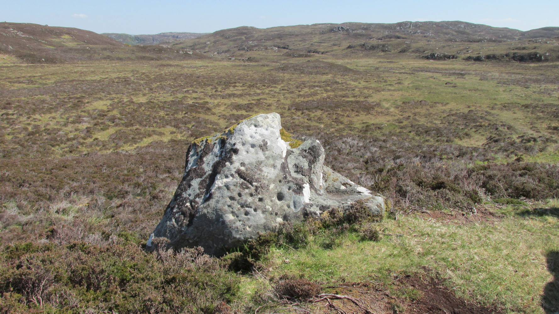
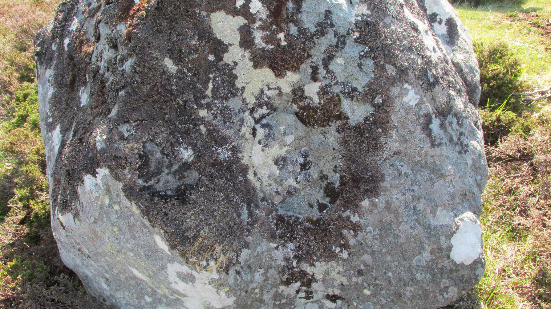
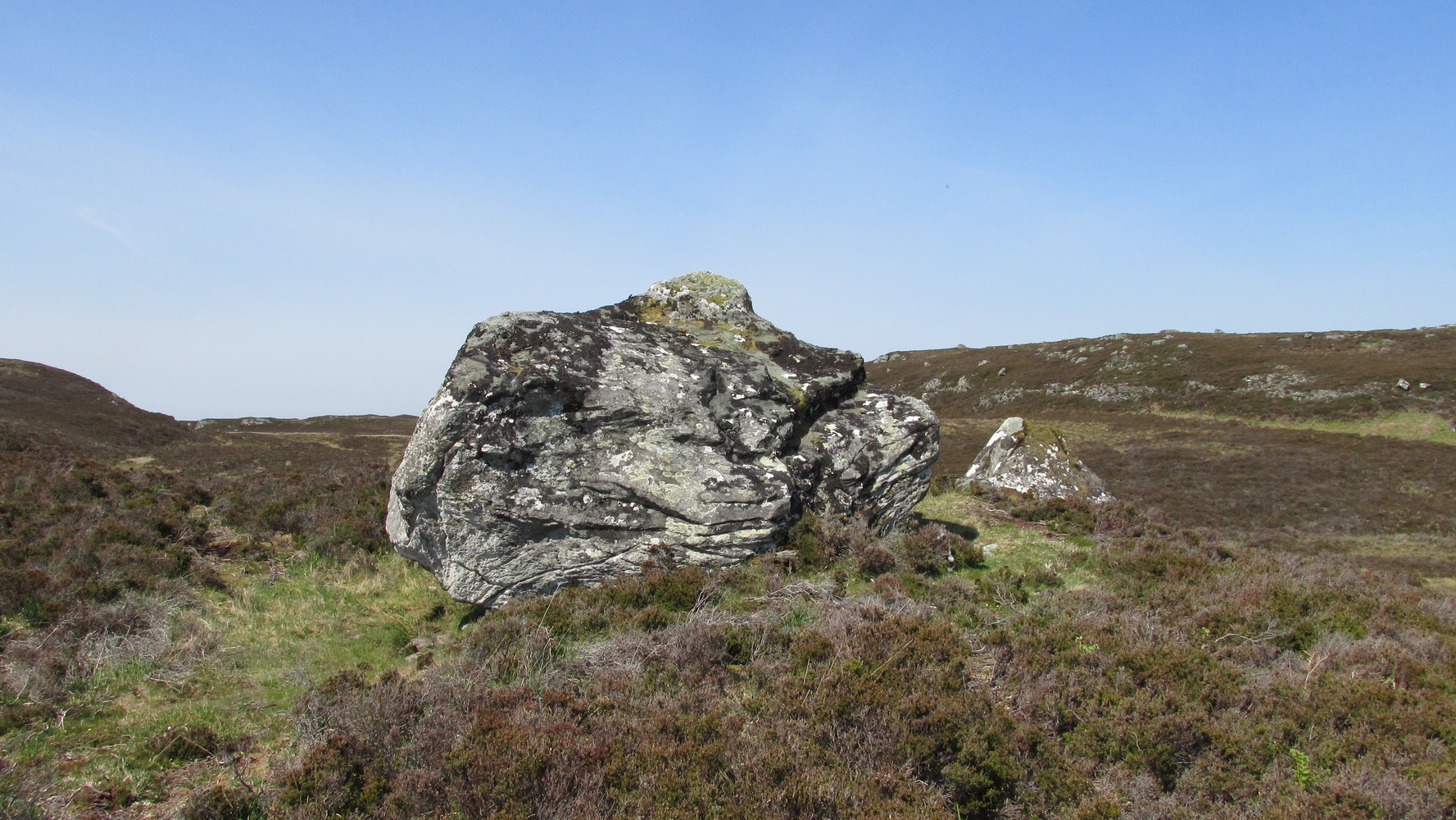
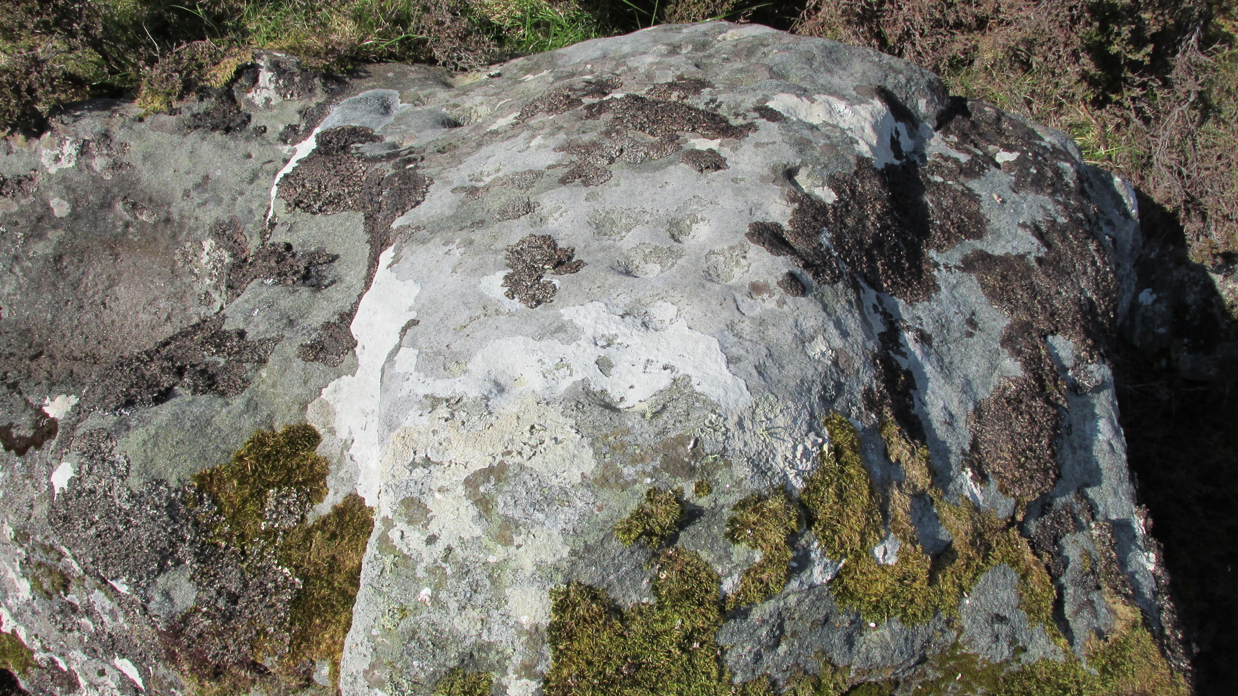
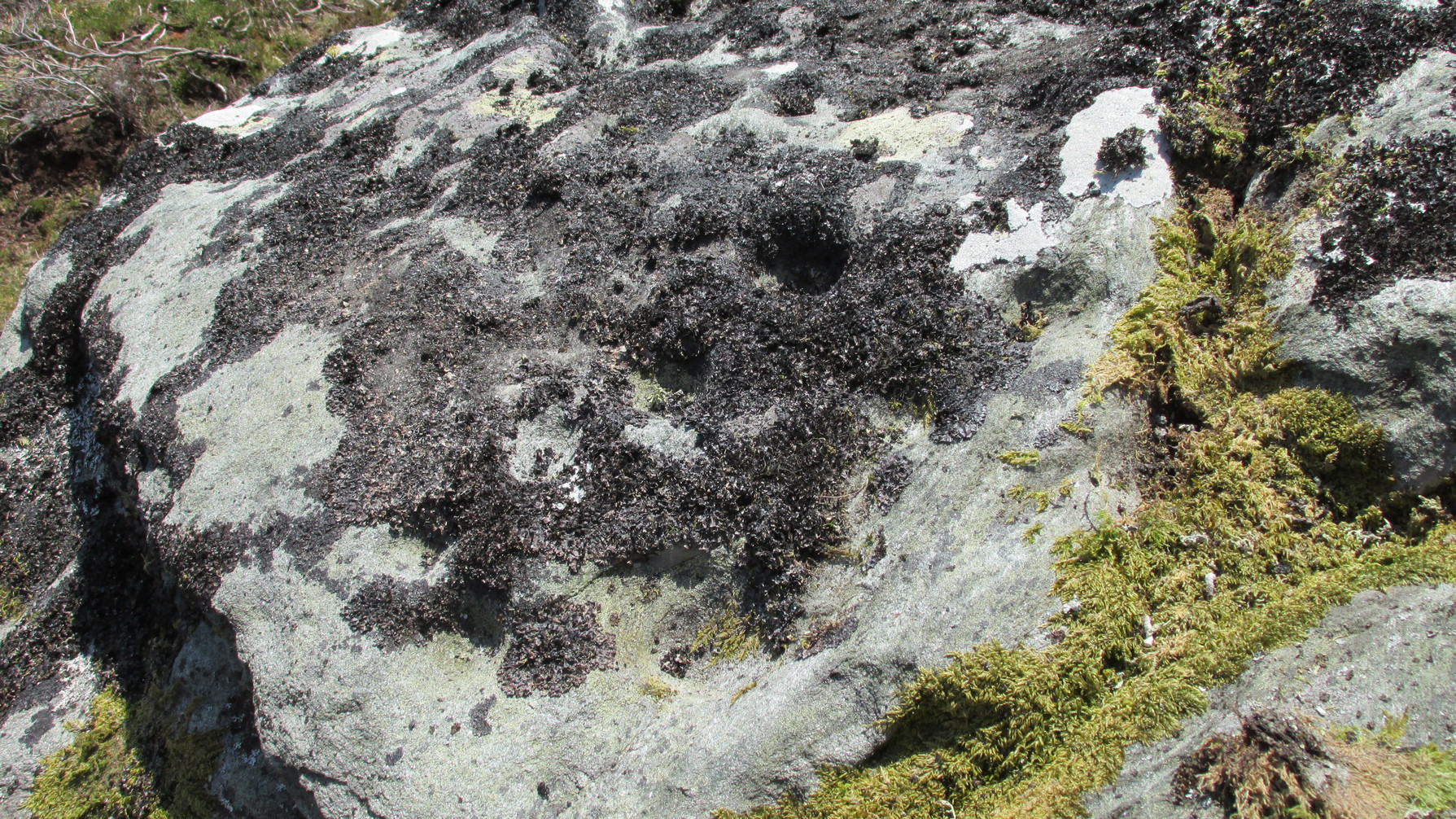
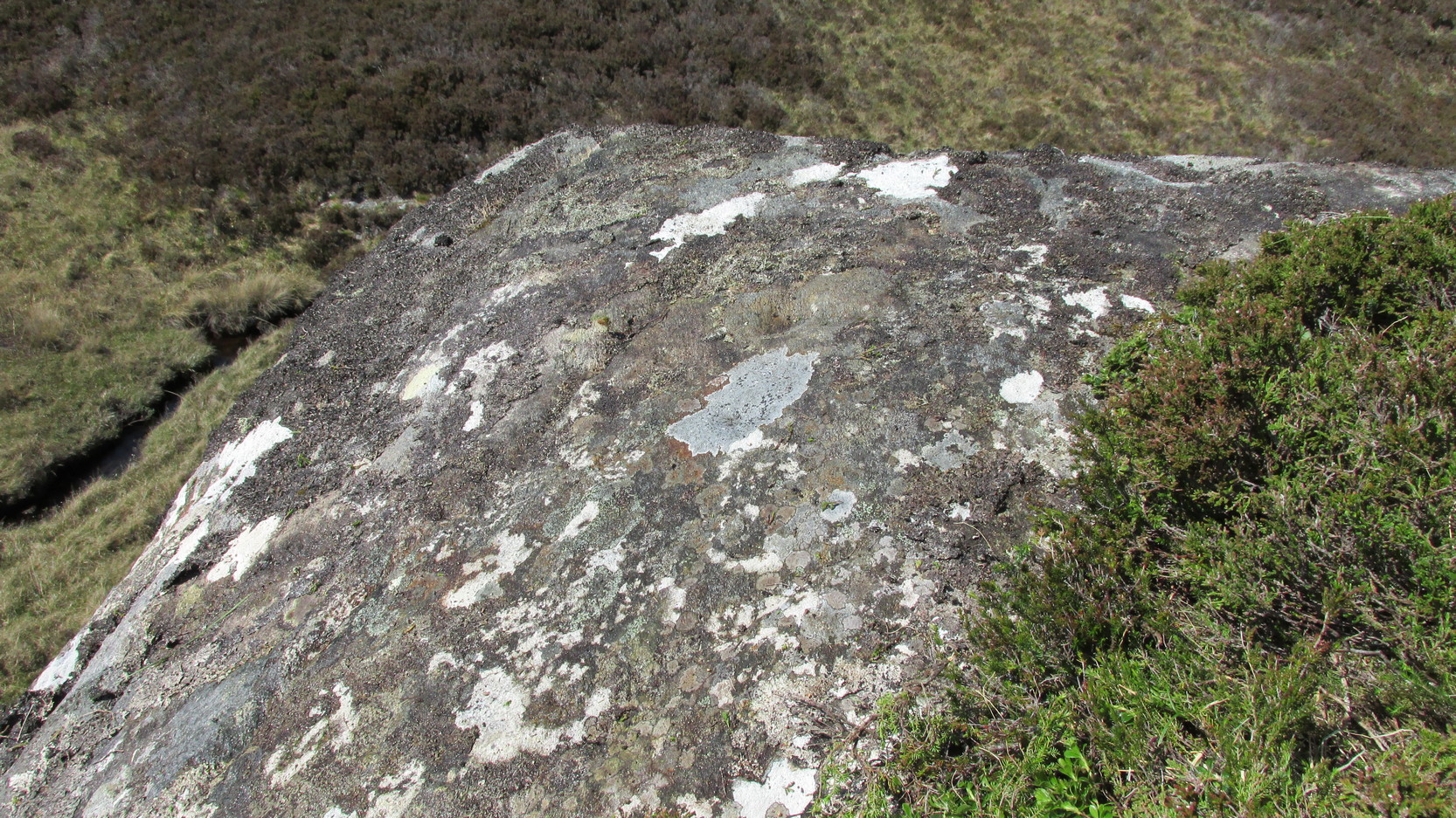
This large, earthfast, ovoid ball of rock has a series of cup-marks on three of its curvaceous faces, some of which seem to be natural, with a number of them “enhanced” by human hands at some time in the long long ago….
The main cluster of these cups can be found on its near-vertical western-face: an unusual feature in itself! There are several cups on its southern curve and, further round, low down on the east side of the rock we see a few more of them hiding away. These, too, seem to have been Nature’s handiwork, then enhanced by the hands of wo/men. The carving was described in Hew Morrison’s (1883) work as possessing two groups of cup-marks,
“similar to that on the neighbouring stone, one of eighteen small and one large cup, and another of eleven small marks. There is a solitary mark on the summit of this stone, and its southern face is marked by lines crossing each other, but without any apparent order or design.”
On its northern face we see a large oval hollow, an inch or so deep throughout, that has all the hallmarks of being a primitive face. There is a tradition of such a rock “face” carving somewhere close by, which seems to be lost—and this would seem to be culprit! If you visit the place, let us know what you think!
One feature that stands out at this site is the nearby pyramidal hill whch, I think, had some mythic relationship with the carvings. Impossible to prove, obviously, but the pyramid is such a dominant feature in this landscape that a relationship seems inevitable. I can only echo what I’ve said in the site profile for the adjacent carving here: tis a ritual place indeed – without any shadow of doubt. And I don’t say such things lightly. This place is truly superb!
References:
Mercer, R.J., Archaeological Field Survey in Northern Scotland 1976-1979, University of Edinburgh 1980.
Royal Commission on Ancient & Historical Monuments, Scotland, Second Report and Inventory of Monuments and Constructions in the County of Sutherland. HMSO: Edinburgh 1911.
Acknowledgements: Huge thanks to Sarah MacLean for her company and landscape knowledge in visiting this and other nearby antiquarian sites. And to Aisha Domleo, for getting me into this neck o’ the woods in the first place….where’er She may be….
Roughly halfway between Bettyhill and Tongue on the A836 road, keep your eyes peeled for the sign to Skerray (4 miles) and travel down that road. About 1¾ mile on, take the tiny lane on your left up the slope for 0.6 miles (1km), and just before the sharp bend in the road (across a small bridge) there’s a gate on your left. Go thru here and follow the tiny path alongside the burn (stream) westwards for half-a-mile until where the waters become a bog within a wide oval bowl in the landscape. At the far-side you’ll see two large boulders sat above this watery bowl. That’s where you need to be!
Archaeology & History
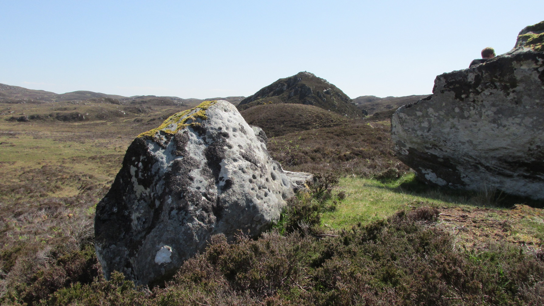
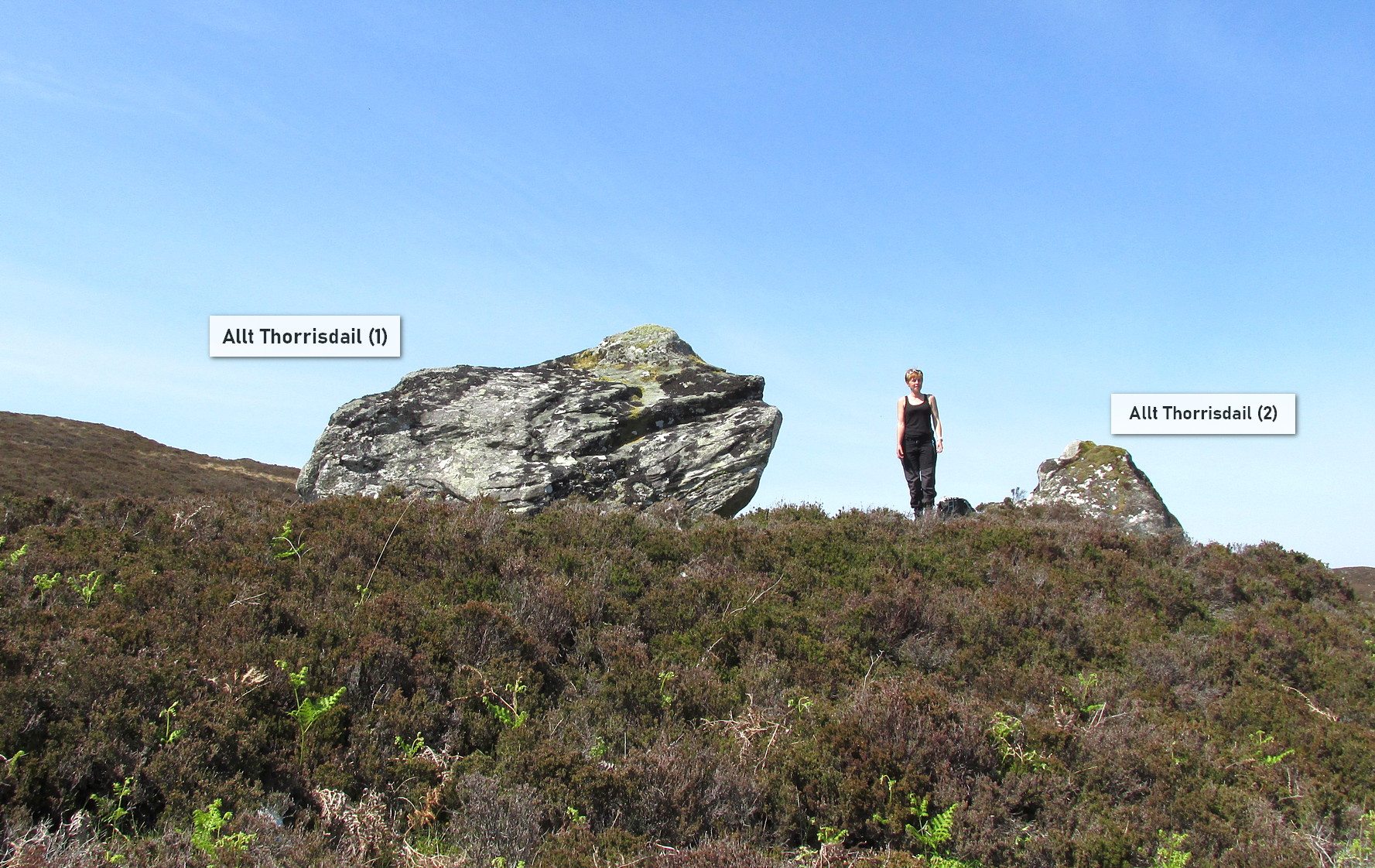
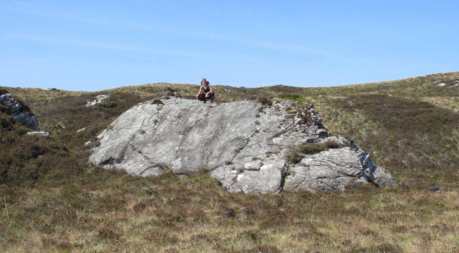
The big fella of the two
This is carving “number one” of two great incised boulders that are sat upon a natural ridge overlooking a dried-up lochan. An impressive spot that give a thoroughly distinct impression of altar stones above the sunken waters, from whence rites and proclamations were performed. It has that look and feel about it—and any animist would tell you the same. My hardcore dreams aside though…
This profile is for the larger of the two boulders that live here (Allt Thorrisdail 2 is here). It has very curious petroglyphic attributes—much like its compatriot—unlike many of those in these northern lands. The pair of them seem to have been described for the first time in Hew Morrison’s (1883) fine meanderings through the mythic history of the region. He told that,
“About a mile distant (from Torrisdale) two large cup marked boulders lie on the slope of a hill. The marks are disposed in groups of one large and nine smaller cups. On the larger boulder there are two of these groups and seven separate marks.”
There are slightly more than that, and this was pointed out when the Royal Commission (1911) lads came to see it:
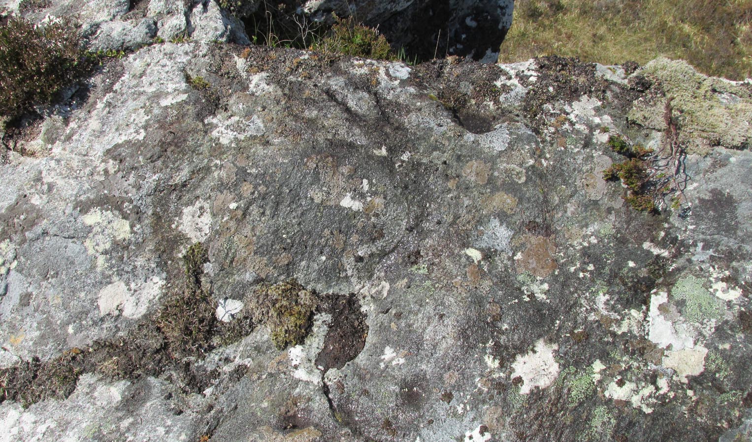
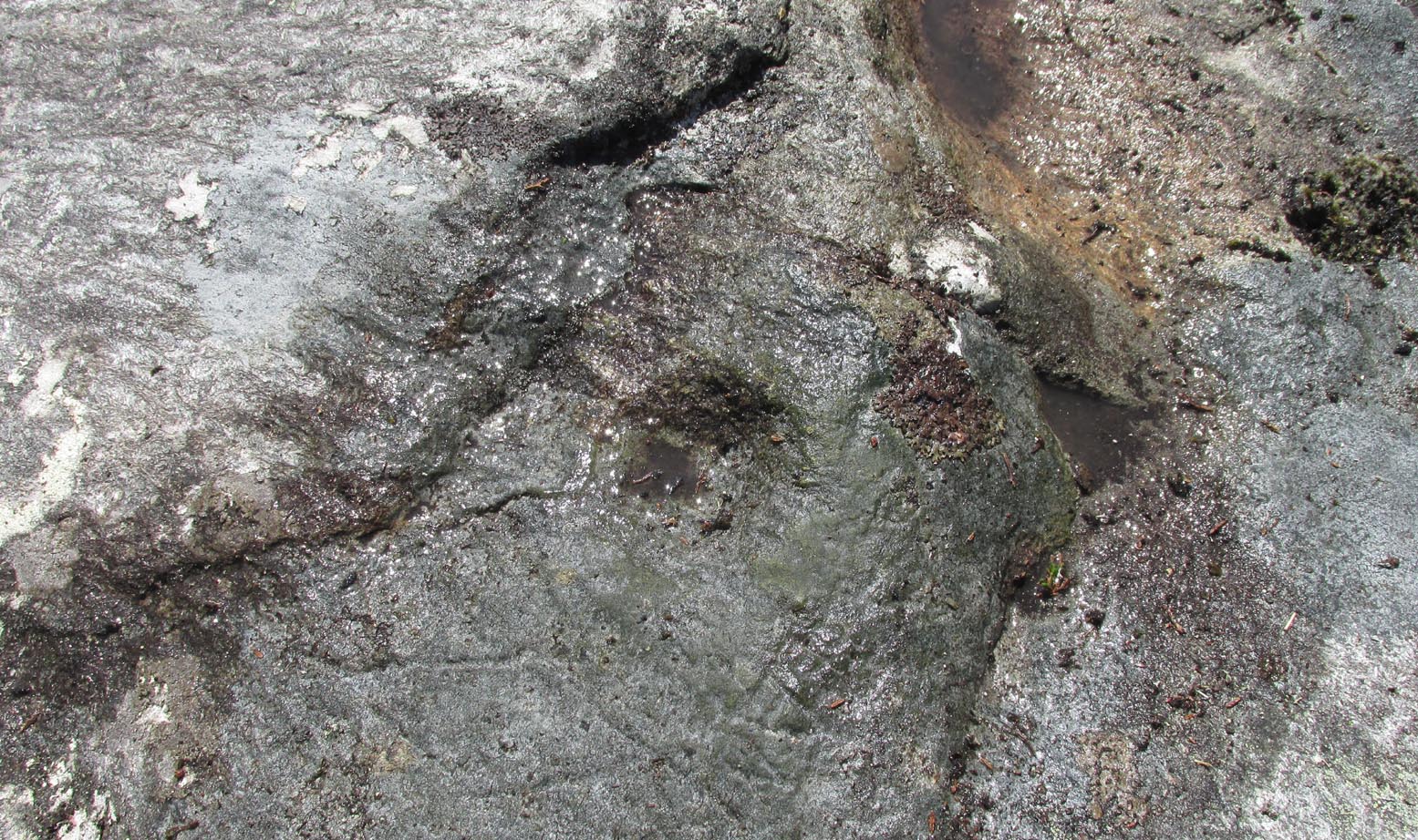
“The largest boulder, that situated furthest west, is about 8 feet high and 14 feet in length. On its south side, chiefly on the flat and less abrupt face of the stone, are groups of cup-marks of from 2in to 3in in diameter, the deepest being about 1in in depth, while a number are now almost obliterated. The extent of the markings is not very definite, but there appear to be two groups containing about twelve cup-marks each.”
Another chorus of cupsLichen-dappled cupmarks
But this only tells of half the stone’s symbolic story. For on the vertical northern face of the rock, from just above ground-level, we have a distinct almost straight line of many cup-marks, going up diagonally, at an angle of about 35º. I took a number of photos of this aspect of the stone, but the covering of lichens didn’t highlight them clearly at all. When you’re stood looking at them they stand out like a sore thumb!
I have to be honest and say that I bloody well love this site! You have to paint the entire environment in the right light, as it was when the stone was first carved, surrounded by the scattered woodland of birch, pines and rowan all across where now we have stunning barren moorlands. Tis a ritual place indeed – without any shadow of doubt!
References:
Mercer, R.J., Archaeological Field Survey in Northern Scotland 1976-1979, University of Edinburgh 1980.
Royal Commission on Ancient & Historical Monuments, Scotland, Second Report and Inventory of Monuments and Constructions in the County of Sutherland. HMSO: Edinburgh 1911.
Acknowledgements: Huge thanks to Sarah MacLean for her company and landscape knowledge in visiting this and other nearby antiquarian remains. And to Aisha Domleo, for getting me into this neck o’ the woods.
Souterrain (lost): OS Grid Reference – NC 6601 6315
Archaeology & History
In the middle of the 19th century the opening to a prehistoric souterrain used to be in evidence on the north-side of the single track road running past old Skerray Mains house. It was mentioned in Hew Morrison’s (1883) historical guide, albeit briefly and without ambiguity:
“Below the house of Skerra Mains is an artificial cave that enters from below the road and extends 40 or 50 yards in length. Two urns were found it when it was discovered but they soon crumbled away on being exposed to the air.”
More than thirty years later, the Royal Commission (1911) lads ventured to check it out, only to find that it had just recently been covered up:
“At the farm of Skerray Mains is an earth-house, the mouth or entrance to which was recently exposed by the farmer. It is situated about 15 feet distant from the northeast window of the dwelling-house, and is now entirely covered over again.”
Of the old locals I met here, only one of them remembers hearing of it, but the precise location of its entrance had been forgotten. Surely it aint gonna be toooo difficult to find it again?
References:
Morrison, Alex, “Souterrains in Sutherland,” in J.R. Baldwin’s Province of Strathnaver, SSNS: Edinburgh 2000.
Royal Commission on Ancient & Historical Monuments, Scotland, Second report and inventory of monuments and constructions in the county of Sutherland. HMSO: Edinburgh 1911.
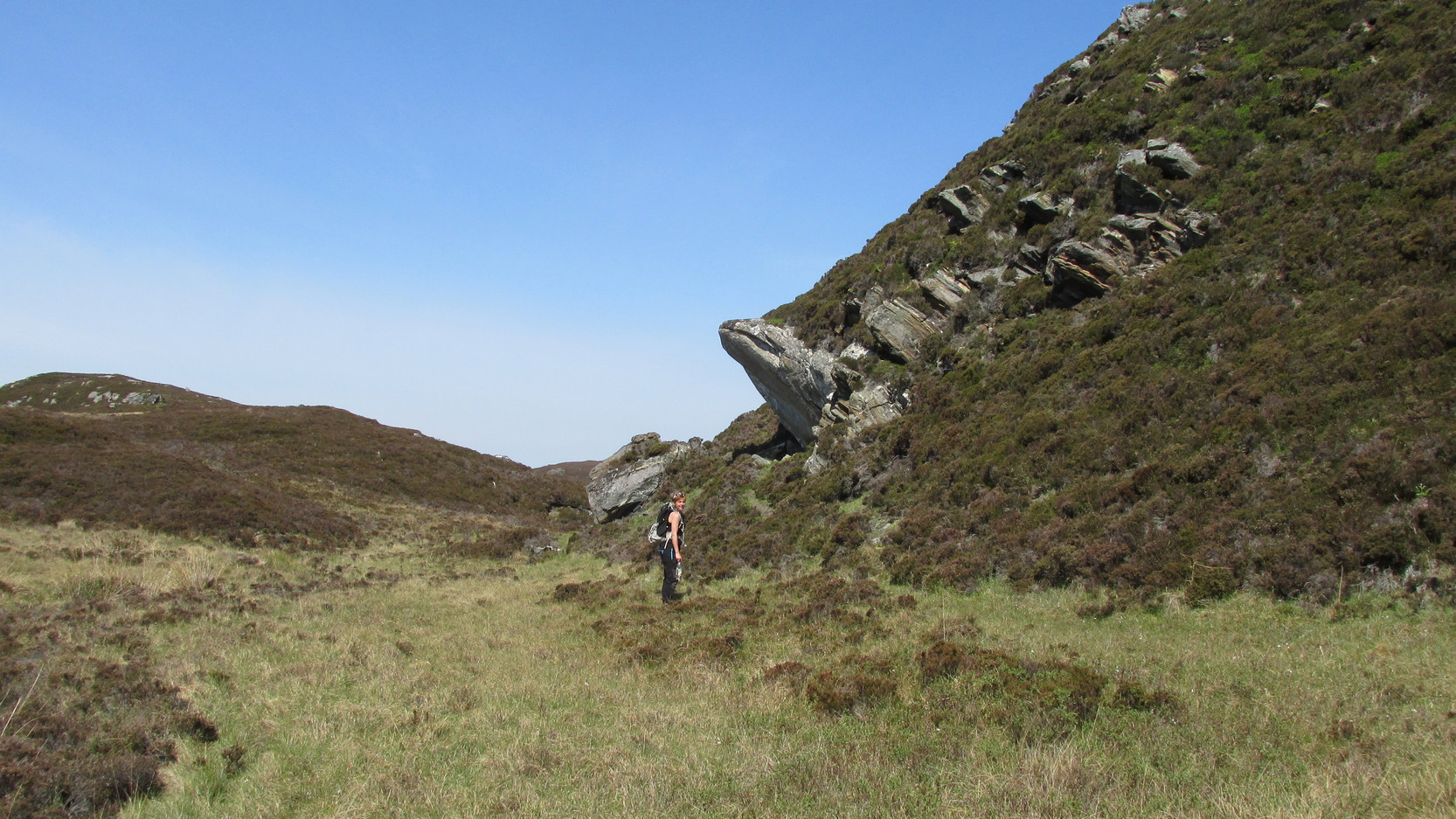
Difficult to reach, this large protruding rock on the west side of Thorrisdail Hill, was known as the Thorrisdail Stone in the old boundary records. It’s a bittova giveaway when you find it, as its name is inscribed on the lower face of the stone – etched a century or two ago by the look of it.
Thorrisdail Stone, with Sarah stood belowOne of the cupmarks highlighted, upper middle
It’s a difficult rock to climb upon if you aren’t used to such things – and you need to do this if you want to see the cupmarks; although they’re hardly worth seeing unless you’re a petroglyph freak! If you go to the trouble so see them, make sure to squat down carefully, being even more careful not to fall off (you’re screwed if y’ do). Once in position, you’ll see between three and five very faint shallow cups etched onto its flat surface. You can just make one of them out in the photo here. The more impressive thing to see here is the small standing stone that seems to artificially crown the top of the rounded hill to which the Thorrisdail Stone is attached.
Acknowledgements: Huge thanks to Sarah MacLean for her company and landscape knowledge in visiting this and other nearby antiquarian remains. And to Aisha Domleo, for getting me into this neck o’ the woods.
There’s no simple way to reach here – but the landscape alone makes the journey worthwhile. Roughly halfway along the A836 between Bettyhill and Tongue, take the minor road up to Borgie, past the recently revamped Borgie Hotel for half-a-mile (0.8 km) where, on your left, is Deepburn Cottage. On the other side of the road, on your left, go through the gate and follow the path uphill. It curves up and to the right where you hit some overgrown walling. Walk up and along this wall for nearly half-a-mile (it’ll feel like twice that!) and as you approach the crystal blue waters of Lochan a’ Chaorruin, veer right and start walking up the small Torrisdale Burn. Less than 200 yards along, you’ll see the large isolated rock on your left.
Archaeology & History
Cupmarks top & bottomSingle prominent cupmark
Previously unrecorded, this large boulder sitting above the edge of Torrisdale Burn was rediscovered by Sarah MacLean—hence its name—and has between five and nine cup-marks etched, primarily, on the topmost ridge of the rock. Its eastern steep-sloping face also has a cup-mark near the middle top-half of the stone. Apart from three of them (visible in the photos), the other cups aren’t very distinct and unless the lighting is right, you won’t see much here. This one is probably gonna be of little interest unless you’re a real hardcore petroglyph freak.
Further up this tiny winding glen we reach the faint cup-marked Thorrisdail Stone and a little further on is the impressive ritual site of Allt Thorrisdail.
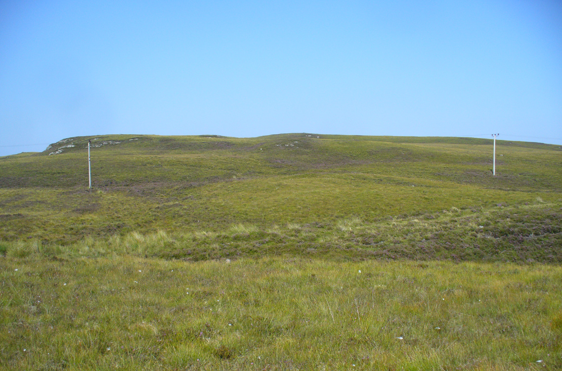
Take the A836 road between Bettyhill and Tongue and, roughly halfway between the two villages, a few hundred yards west of the turning to Borgie, park up at the roadside. Cross the road and through the gate, follow the waters of Allt Loch Tuirslighe for 100 yards and then walk uphill onto the moors. You’re damn close!
Archaeology & History
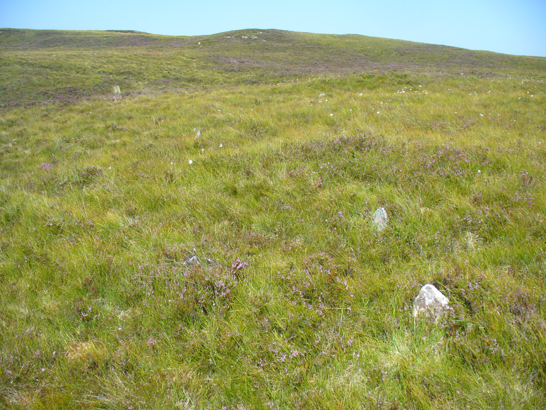
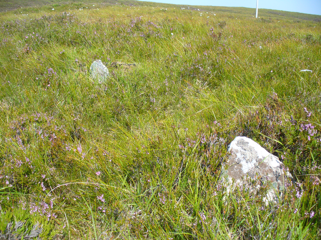
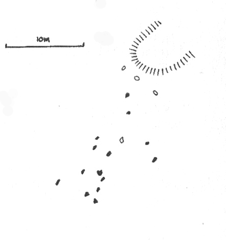
This megalithic stone row was uncovered in the late 1970s – which is no surprise to be honest. It is a very low parallel row of small upright stones, which Freer & Myatt (1982) initially found to consist of two rows of standing stones, twelve in all. When we visited the site a few days ago, I could find only ten of them that could appreciably be termed authentic – and that was stretching it a bit!
Several of the low stones
Close-up of the small stones
Of the two stone rows presently visible, the easterly one is easier to see and consists of seven small stones, running almost in a dead straight line NNE. A few yards west we find the second stone row, in which I could only discern three tangible contenders, also running NNE, but slightly fanning outwards and away further north. When standing in the middle of the two rows, they align to a small natural rocky outcrop on the near-horizon 100 yards away, upon which Paul Hornby recently discovered 3 or 4 faint cup-markings. If we turn 180 degrees and look in the opposite direction, the alignment of stones points to the highest peak in the far distance.
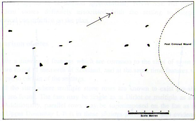
Myatt’s 1988 survey
Gourlay’s 1996 survey
All of the stones are small and difficult to see upon initial exploration. The highest of them stands no more than 1½ feet tall, with their average less than 1 foot. One of the stones in the eastern row is covered completely by vegetation. However, in earlier assessments of this site, quite a few other stones were visible. Its brief history and appearance was described in Leslie Myatt’s (1988) survey of such monuments in this remote region, where he told:
“This very ruinous setting of stone rows was fist recorded by the Archaeology Division of the Ordnance Survey… Peat cutting has taken place in the area and undoubtedly a number of stones have been removed from the site.
“(The illustration) shows the result of a survey carried out by the author showing a total of only 16 stones not more than 20cm above the surface. Because of the small number of stones remaining, it has not been possible to superimpose a geometric construction on the site. The ground slopes upwards to the north-northeast, at which end of the setting is a low peat-covered mound about 10m in diameter. It has no distinctive features, although it does not appear to be natural…”
The site is described in Alexander Thom’s (1990) major survey, but sadly he didn’t turn his direct attention here, so we still have no accurate geometric or astronomical assessment. A few years later Aubrey Burl (1993) gave us details of the larger initial size of the complex and told us that at
“Borgie, near Torrisdale Bay on the north coast of Sutherland, perhaps an early site, has three or four lines with the suspicion of a fifth. The rows narrow from their base 20ft (6.1m) across to 18ft 8in (5.7m) over a distance of 59ft (18m), a contraction as they worm uphill towards a peat-covered mound of hardly a quarter of an inch in a foot (0.6: 31cm).”
The small peat-covered mound which the stone rows lead up to was suggested by Robert Gourlay (1996) as “perhaps a small cairn.”
References:
Burl, Aubrey, From Carnac to Callanish, Yale University Press 1993.
Freer, R. & Myatt, L.J., “The Multiple Stone Rows of Caithness and Sutherland,” in Caithness Field Club Bulletin, 3:3, April 1982.
Gourley, Robert, Sutherland: An Archaeological Guide, Birlinn: Edinburgh 1996.
Myatt, Leslie, “The Stone Rows of Northern Scotland,” in Ruggles 1988.
Ruggles, Clive, Records in Stone: Papers in Memory of Alexander Thom, Cambridge University Press 1988.
Thom, A., Thom, A.S. & Burl, Aubrey, Stone Rows and Standing Stones – 2 volumes, BAR: Oxford 1990.
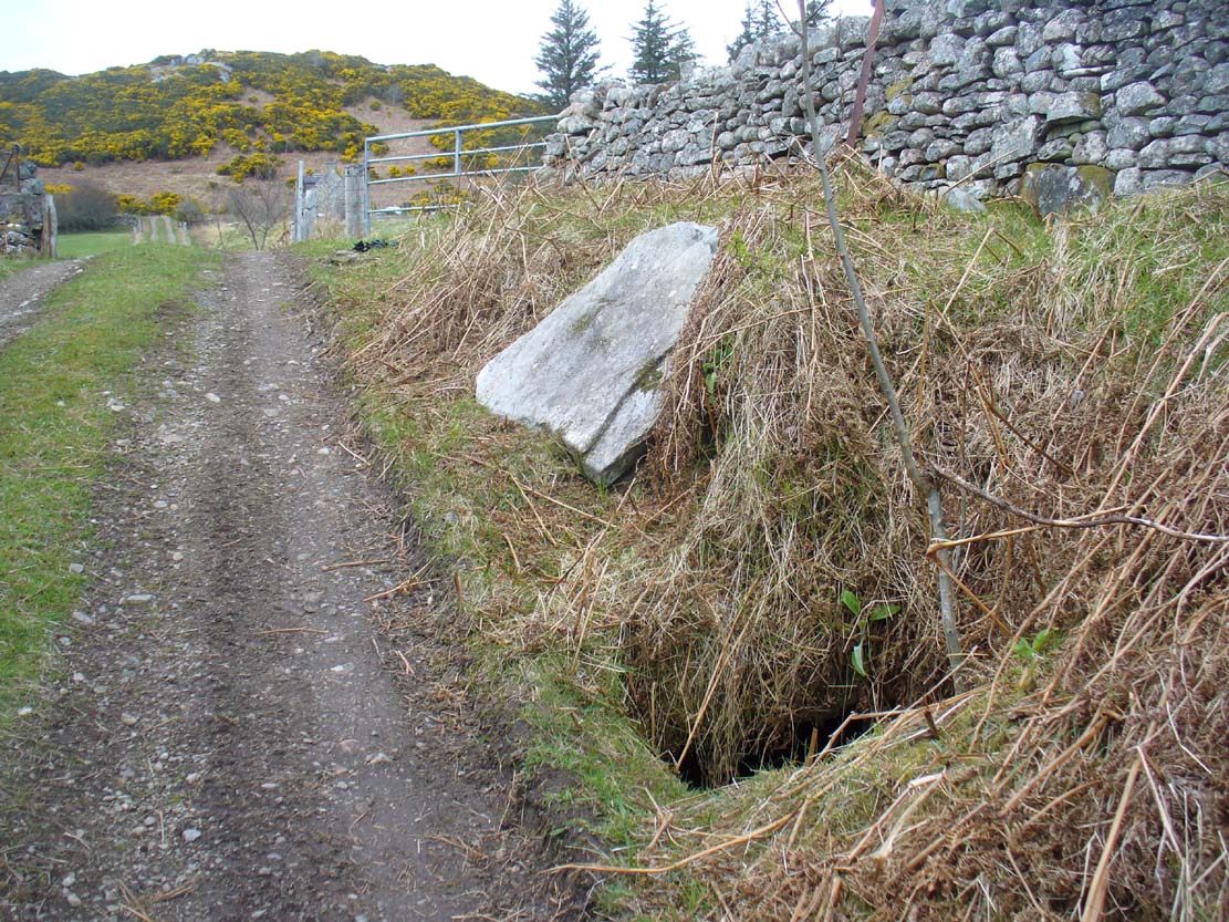
From Bettyhill village, take the A836 road west towards Tongue. Several miles along the road, keep your eyes peeled for Borgie and Skerray on your right. Go down here for half-a-mile or so until, a hundred yards or so before the Borgie Hotel, a dirt-track on your right takes you down into some trees. As you enter the edge of the woodland, right by the trackside on your left, a large stone lays in the grass. A few yards from this is the hole in the ground.
Archaeology & History
When I was first shown this place, I could find no previous description of it in any of the archaeological records. I was fortunate in being taken here by one of the land-owners hereby, who told me that it had been known about locally for some years – but informing the archaeologists (patronizing as they were to the people hereby, as can be the case sometimes) was the last thing on their minds….
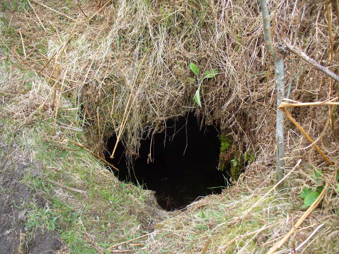
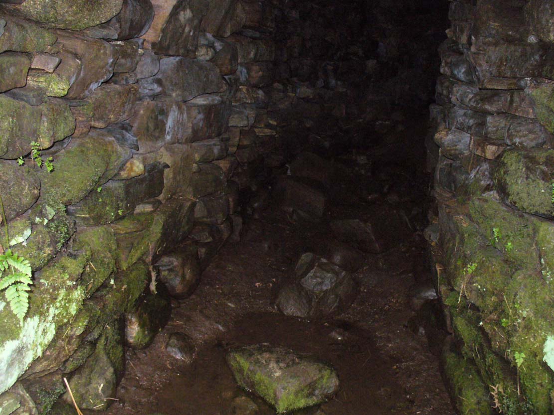
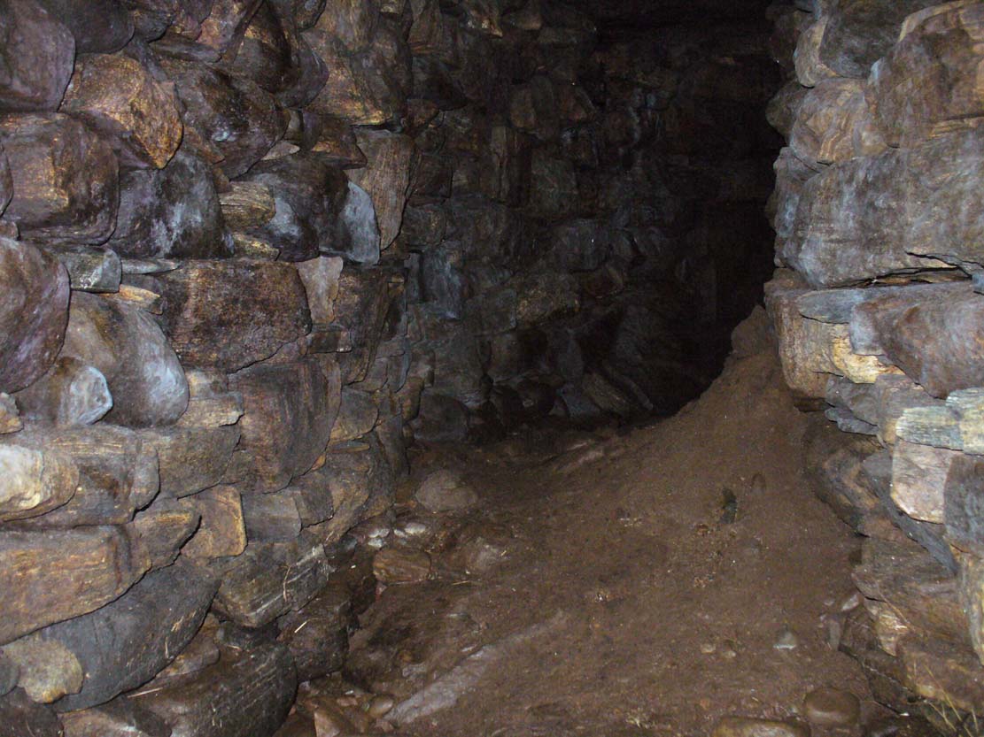
Entrance to an underworldLooking out from inside
Immediately beneath the ridge where the Borgie chambered cairn once stood, the site was uncovered quite by accident when a local man went to move a large stone on the grassy embankment, to make use of it in walling or something similar. But much to his surprise, the boulder covered the entrance to an underground chamber known as a souterrain – inside which, local lore tends to tell, the little people once stayed. It’s an impressive structure! When Donna Murray took me to see this a few months ago, she said it was only a few yards long – but once I’d got inside, found it to be much longer than this. After dropping perhaps six feet down into the hollow, the very well-preserved wide chamber beneath – some 6-8 feet across – curved around to the north-northeast and into pitch blackness. I walked perhaps ten yards into the chamber, completely upright, and as the chamber curved and went further into the Earth, the pitch black stopped me venturing more.
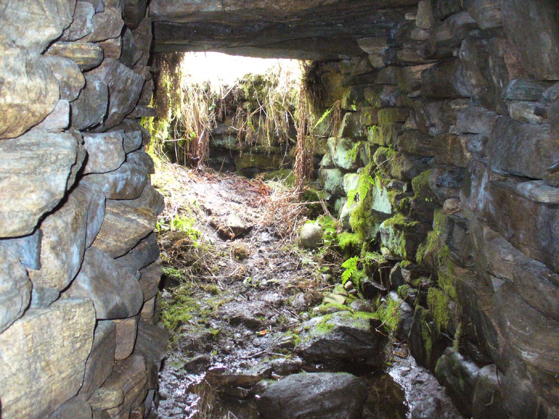
Looking into the darknessLine of roofing stones
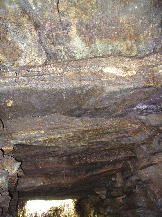
The walls of the souterrain were very well structured indeed and were made up of hundreds of good-sized stones, akin to those used to build old stone walling in our northern hills. The floor was, typically, muddy and apart from a scatter of a few stones I could see little by way of a ‘floor’ beneath my feet (but it was dark!). However, the roofing was made up of large flat stones measuring 6-8 feet across, as wide as the structure itself, running parallel all along the chamber. I did not walk to the end of the chamber – but would assume that this roofing continued to the end of the souterrain.
In a number of souterrains we find examples of cup-and-ring carvings (the one at Pitcur, Perthshire, being one of the very best), but I could discern no such petroglyphs inside this chamber. However, considering how dark it was, another investigation with torches is necessary before any definitive remarks regarding internal petroglyphs can be made.
Curving into the darkness
It’s in damn good condition indeed and is well worth looking at if you venture this far north. Other unrecorded prehistoric monuments are found all over this remote landscape – from cup-and-rings, to stone circles, to tombs, enclosures, cairns, you name it! If anyone knows of any permanent rental properties up here – please let me know and get in touch so that I can spend the rest of my life working here meandering, discovering and recording the prehistory of this truly archaic landscape! I’m serious!
Acknowledgements: Immense thanks to Donna from Borgie, for showing me this ancient monument and other sites.
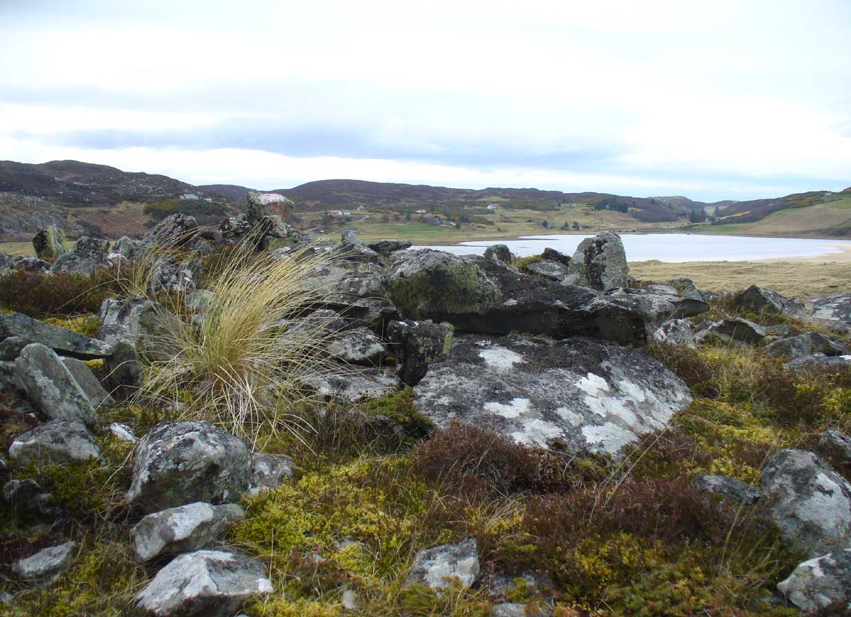
Along the A836 road between Bettyhill and Tongue, keep your eyes peeled for the turning down to Borgie and Skerray. Go along here for 1.8 miles (2.9km) until, just past a tiny road on your left, a small parking spot with a tourist board is by the roadside. Walk down hill and over the River Borgie below and follow the footpath round until your reach the edge of Torrisdale Beach. From here, walk right, uphill, across overgrown sand-dunes to the stone escarpment 400 yards or so to the east. A large scattered mass of rocks on top of one of the first rocky knolls is what you’re looking for. You can’t really miss it.
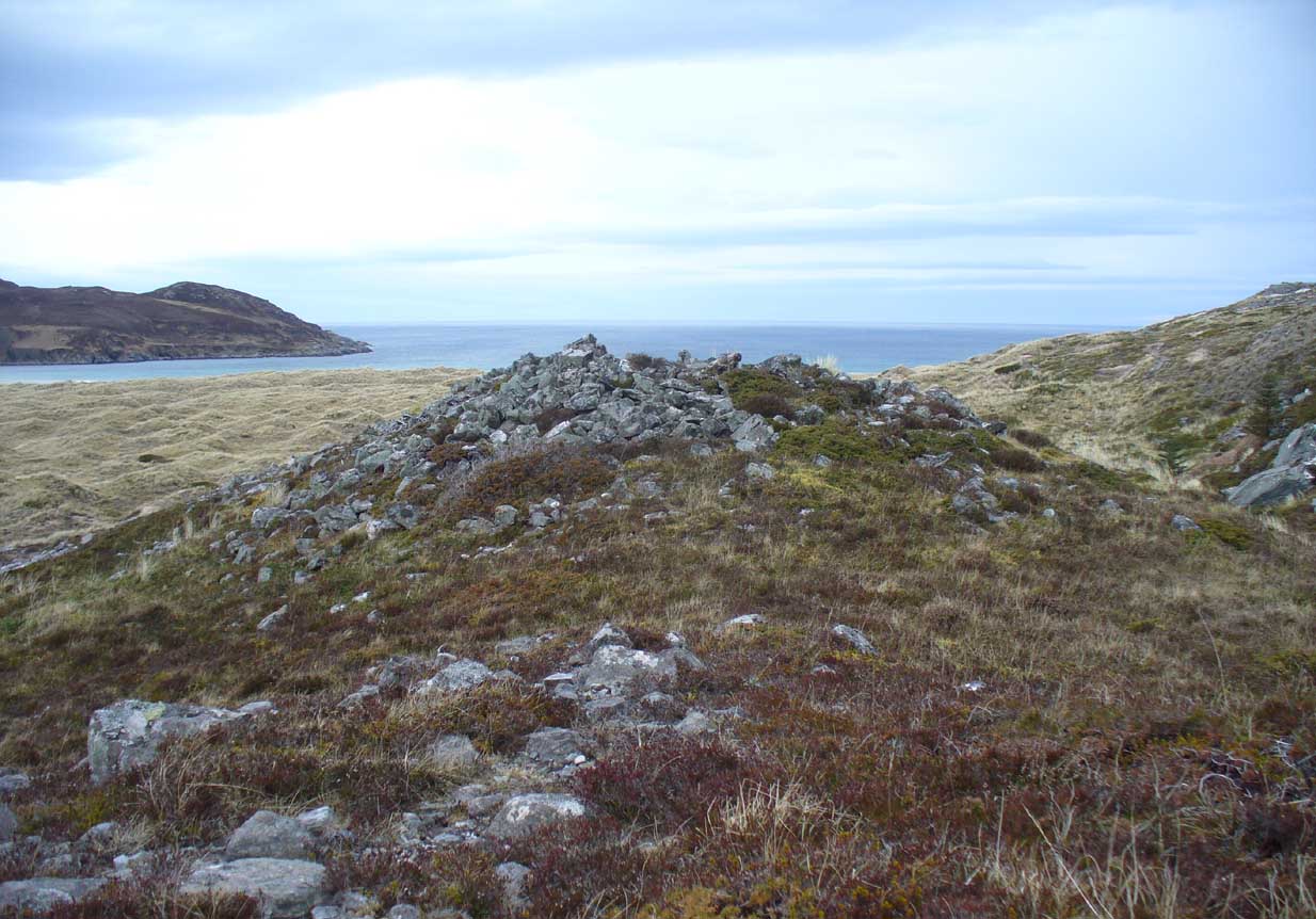
Archaeology & History
Dun Riaskidh, looking north
This is worth the journey for the scenery of Torrisdale Bay alone: one of the most beautiful places in all Scotland. …Not far from the legendary Ringstone and the carving above, this collapsed mass of scattered rocks was said, in local lore, to have been the remains of an old broch—or that’s what Hew Morrison told the Royal Commission (1911) lads about it when they surveyed the area more than a century back. Their description was short:
“About ½-mile E of the footbridge across the River Borgie, near Torrisdail, and on the W. side of Druim a’ Chleibh, are the remains of a broch. No outlines of walls are visible. The site is indicated by a structureless heap of stones.”
It seems at first to be in an unusual position for a chambered cairn: built onto solid rock instead of soil. Yet we find this geocentric structuralism echoed at the Borgie chambered tomb 1½ miles to the southeast. When you reach the place, a large mass of stones—hundreds of them piled-up several feet high—is strewn across the rocky surface and reaching onto more typical moorland ground. On top are a number of large stones, some laid down, some half-upright appearing, perhaps, to have played some part in an internal cist or chamber. On the eastern side the rocky mass falls down a natural steep slope, with many of the fallen stones covered by centuries of vegetation. As you walk around it, cairn-scatter seems to extend southwards towards another natural rocky knoll 20 yards to the south, giving the impression of a second cairn (much like the Fiscary 1 and 2 cairns 2.8 miles to the east), but this is improbable.
The first detailed archaeological account of the site was by Audrey Henshall (1972), who told us:
“…The cairn is about 4ft high, consisting of a mass of angular stones. On the S side the edge can be traced, and the indications are that the diameter was about 57ft. The edge on the N side is rather vague and may have been flattened in plan. On the E and W sides, where there are steep drops, the stones have evidently spread downhill, though on the E side parts of a roughly built edging can be seen.
“Many large slabs lie about the site, probably mainly displaced corbels and roofing stones. Much of the chamber structure probably exists, and a few visible orthostats are probably in situ. The entrance has probably been from the N or seaward side. A slab towards the S side, aligned E-W, projects 1ft 6in, and is likely to be the back-slab. The E side of the chamber is represented by a slab 4ft 6in to the N, aligned N-S, which is just visible. On the W side of the chamber there are a number of large slabs, one over the other wide their E edges aligned vertically, and laid declining to the W, which appear to be corbel stones only slightly displaced. To the N of them, a stone set transversely to the axis of the chamber, 10ft 3in N of the back-slab, might be a portal stone. Another upright stone seemingly firmly set but obstructing the probable position of the entry into the chamber, is presumably displaced.”
More than twenty years later however, Miss Henshall (1995) revisited Dun Riaskidh and altered her initial diagnosis of it as a chambered cairn, suggesting it to be something completely different, telling:
“The cairn-like structure…has an overall spread of about 17m including stone displaced downhill, and a height of 1.6m on the S side. On the summit a group of upright slabs protrudes up to 0.35m, and forms a rough oval 5.5m E to W, by 4.5m N to S. They seem to be on the inner side of a ring of stony material about 2.5m thick. In the interior is a disorganised mass of lintel slabs and three earthfast upright slabs. The structure appears to be a house with spaced uprights in the inner face of the wall, and with a series of uprights which helped to support a partly lintelled roof. A hollow on the N or seaward side probably indicates the position of the entrance.”
Top of the cairn, looking W
Now woe am I to go against the words of a giant like Miss Henshall, but having slept in numerous derelict houses and seen countless numbers of them in the hills, this structure does not seem to have such properties. The category that is continued by Canmore and Ordnance Survey re Dun Riaskidh is still a “chambered cairn”; but, perhaps, if Miss Henshall is correct in saying that it is not a cairn, then maybe the words of local tradition may have been right all along (again!) and this is a collapsed broch? Who knows for sure…?
Whatever its original nature and function, this vestige of antiquity is enveloped within another one of Nature’s incredible domains…
References:
Henshall, Audrey S., The Chambered Tombs of Scotland – volume 2, Edinburgh University Press 1972.
Henshall, Audrey S. & Ritchie, J.N.G., The Chambered Cairns of Sutherland, Edinburgh University Press 1995.
Mercer, R.J. & Howell, J.M., Archaeological Field Survey in Northern Scotland – volume 2, University of Edinburgh 1981.
Royal Commission on Ancient & Historical Monuments, Scotland, Inventory of Monuments and Constructions in the County of Sutherland. HMSO: Edinburgh 1911.
Acknowledgments: Huge thanks to Donna Murray, for putting me up in this part of Paradise. Cheers Donna.
A singular reference to this site appears in James Horsburgh’s (1870) early article on the prehistoric remains of Sutherland. It seems he was on an early road-trip (or dirt-track-trip as it would have been in those days, as there were no real ‘roads’) and as his journey took him along the remote tracks in the far North, visiting places that are still intact and mentioning those which, oral tradition told, had passed into memory, local folk told him about a couple of brochs that had recently met their demise. This was one of them. He wrote:
“Between Farr and Tongue, after crossing the Naver Ferry… some miles on, near Borgie-farm house, there was a Pictish tower, now demolished, and on the side of the old road to Tongue, another.”
In asking the lady who lives here if she knew anything about the broch, she told that although she didn’t, she’d ask some old locals to see if they knew of any folk remnants about the place. It would have stood a short distance above the little-known Borgie souterrain. If we receive any additional info, the site-profile will be updated. (the grid-reference for this broch is an approximation)
Very difficult to find under the herbage, but – along the A836 road between Tongue and Bettyhill, turn down at Borgie Bridge towards Skerray. A few hundred yards along, past the third house on y’ right, a path through the gate on the left takes you up the slope. Once you meet the deep-cut dike, follow it north-ish for 200 yards, over the fence; then walk 150 yards towards the eastern edges where the mass of gorse meets with the rocky escarpment. You’re damn close!
Archaeology & History
These days, much of the remains of this neolithic chambered cairn are inaccessible, as it is covered with the spindly-killer-bushes that are the yellow gorse (Ulex eurapæus). A pity. …Just like its fellow chambered tomb of Dun Riaskidh precisely 1½ miles NW, this was also built upon the edge of a natural rocky escarpment with some of the rocks making up the tomb falling to the edges (I nearly fell in and spined misself meandering around its edges!).
Little has been written about it in archaeo-tomes, despite it being first listed in 1947. Presumably neolithic in age, it was first classed as a ’round cairn’ and has subsequently been described by Canmore as,
“a severely robbed, chambered cairn. It is about 15.0m in diameter, with a maximum height of 0.6m in the centre; elsewhere the cairn is reduced to a stony rim and scattered stones. In the centre a chamber is indicated by two opposing earthfast boulders 1.1m apart and protruding up to 0.6m through the cairn material.”
References:
Gourley, Robert, Sutherland: An Archaeological Guide, Birlinn: Edinburgh 1996.
Acknowledgments: Huge thanks to Donna Murray, for putting me up in this part of Paradise. Cheers Donna.