Souterrain (lost): OS Grid Reference – NC 6601 6315
Archaeology & History
In the middle of the 19th century the opening to a prehistoric souterrain used to be in evidence on the north-side of the single track road running past old Skerray Mains house. It was mentioned in Hew Morrison’s (1883) historical guide, albeit briefly and without ambiguity:
“Below the house of Skerra Mains is an artificial cave that enters from below the road and extends 40 or 50 yards in length. Two urns were found it when it was discovered but they soon crumbled away on being exposed to the air.”
More than thirty years later, the Royal Commission (1911) lads ventured to check it out, only to find that it had just recently been covered up:
“At the farm of Skerray Mains is an earth-house, the mouth or entrance to which was recently exposed by the farmer. It is situated about 15 feet distant from the northeast window of the dwelling-house, and is now entirely covered over again.”
Of the old locals I met here, only one of them remembers hearing of it, but the precise location of its entrance had been forgotten. Surely it aint gonna be toooo difficult to find it again?
References:
Morrison, Alex, “Souterrains in Sutherland,” in J.R. Baldwin’s Province of Strathnaver, SSNS: Edinburgh 2000.
Royal Commission on Ancient & Historical Monuments, Scotland, Second report and inventory of monuments and constructions in the county of Sutherland. HMSO: Edinburgh 1911.
Nothing now remains of the prehistoric underground chamber, “eirde House” (as they were called) or souterrain, that was reported by the northern antiquarian James Horsburgh when he was exploring the sites here in the 1860s. Found near Deanside a couple of miles south of Tongue, alongside the edge of the Allt an Dionaite (Deanside Burn), even in his day there wasn’t much of it left. It was one of a number of souterrains in the region that he was shown, presumably by local people, telling us briefly that,
“Near Deanside, there were remains of the end of another (souterrain) on the bank of the burn, but it has since been washed away in a flood.”
In an exploration up the side of the burn today, I could find no remains whatsoever; although I didn’t walk too far up and have a feeling that its position would have been further up than where I got to. In a brief chat with some of the old people living in the neighbourhood, they told me they had no memory of the site.
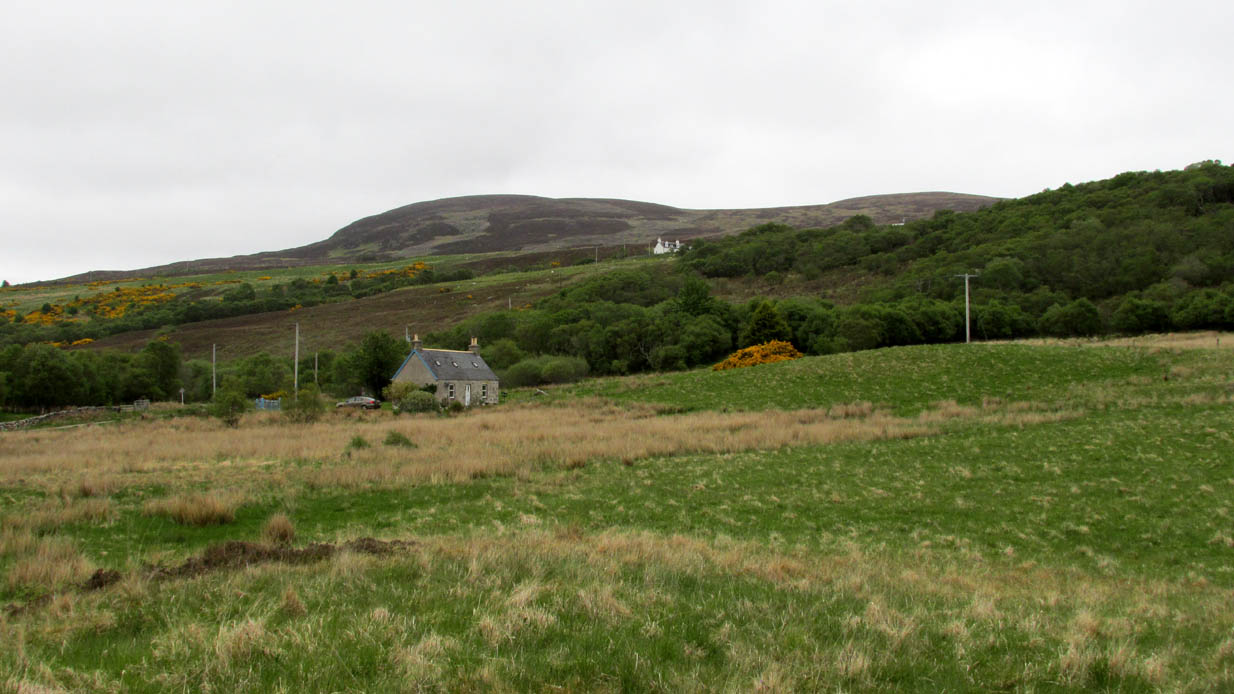
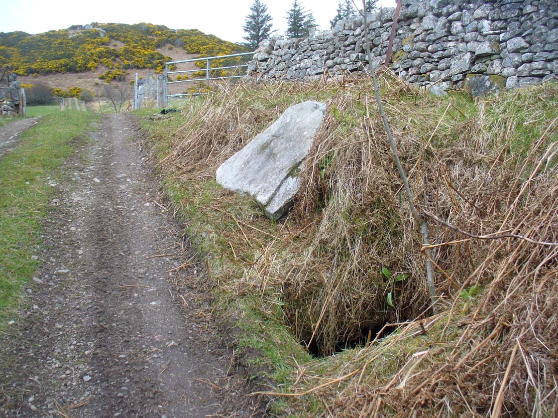
From Bettyhill village, take the A836 road west towards Tongue. Several miles along the road, keep your eyes peeled for Borgie and Skerray on your right. Go down here for half-a-mile or so until, a hundred yards or so before the Borgie Hotel, a dirt-track on your right takes you down into some trees. As you enter the edge of the woodland, right by the trackside on your left, a large stone lays in the grass. A few yards from this is the hole in the ground.
Archaeology & History
When I was first shown this place, I could find no previous description of it in any of the archaeological records. I was fortunate in being taken here by one of the land-owners hereby, who told me that it had been known about locally for some years – but informing the archaeologists (patronizing as they were to the people hereby, as can be the case sometimes) was the last thing on their minds….
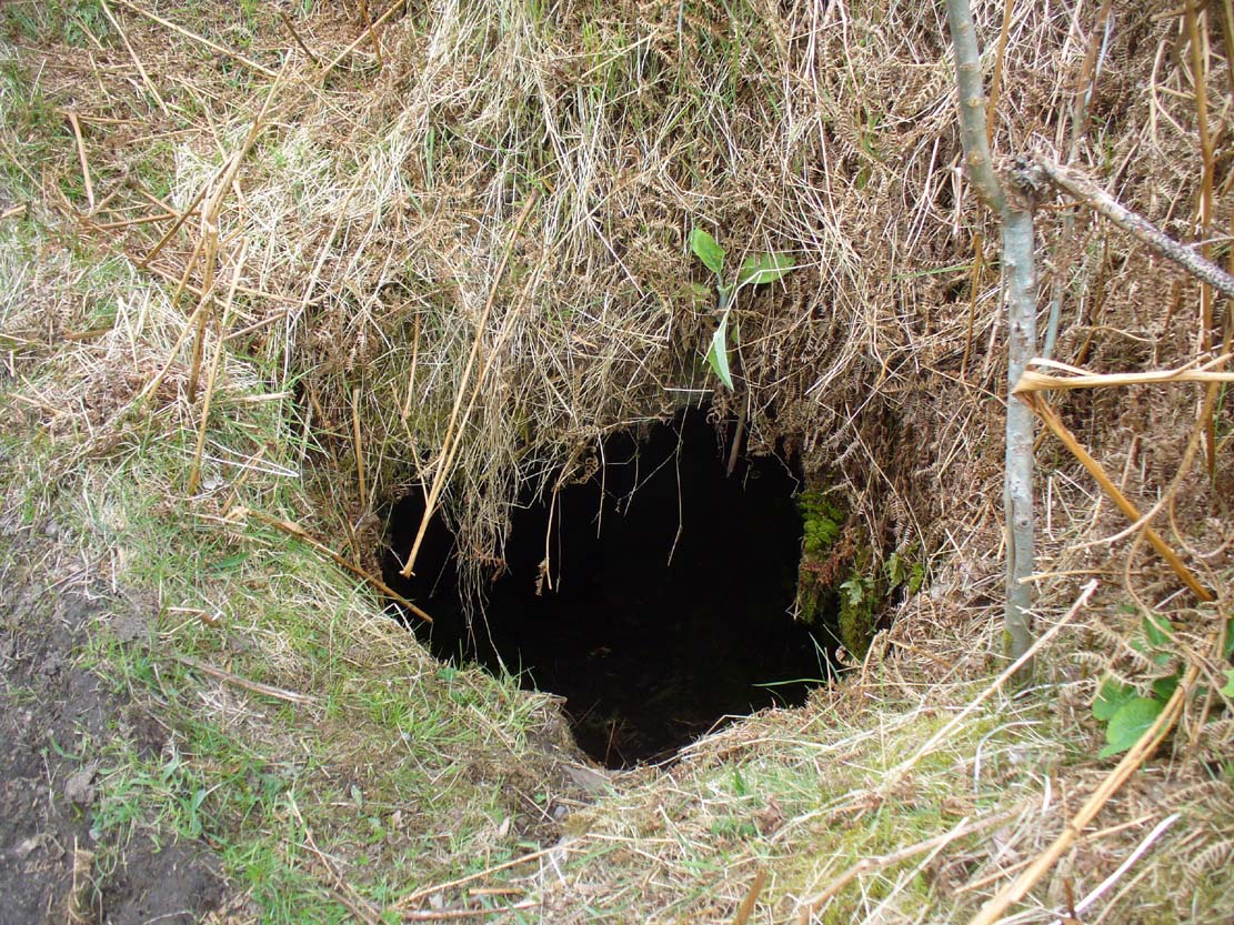
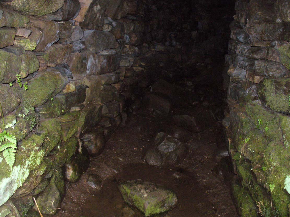
Entrance to an underworldLooking out from inside
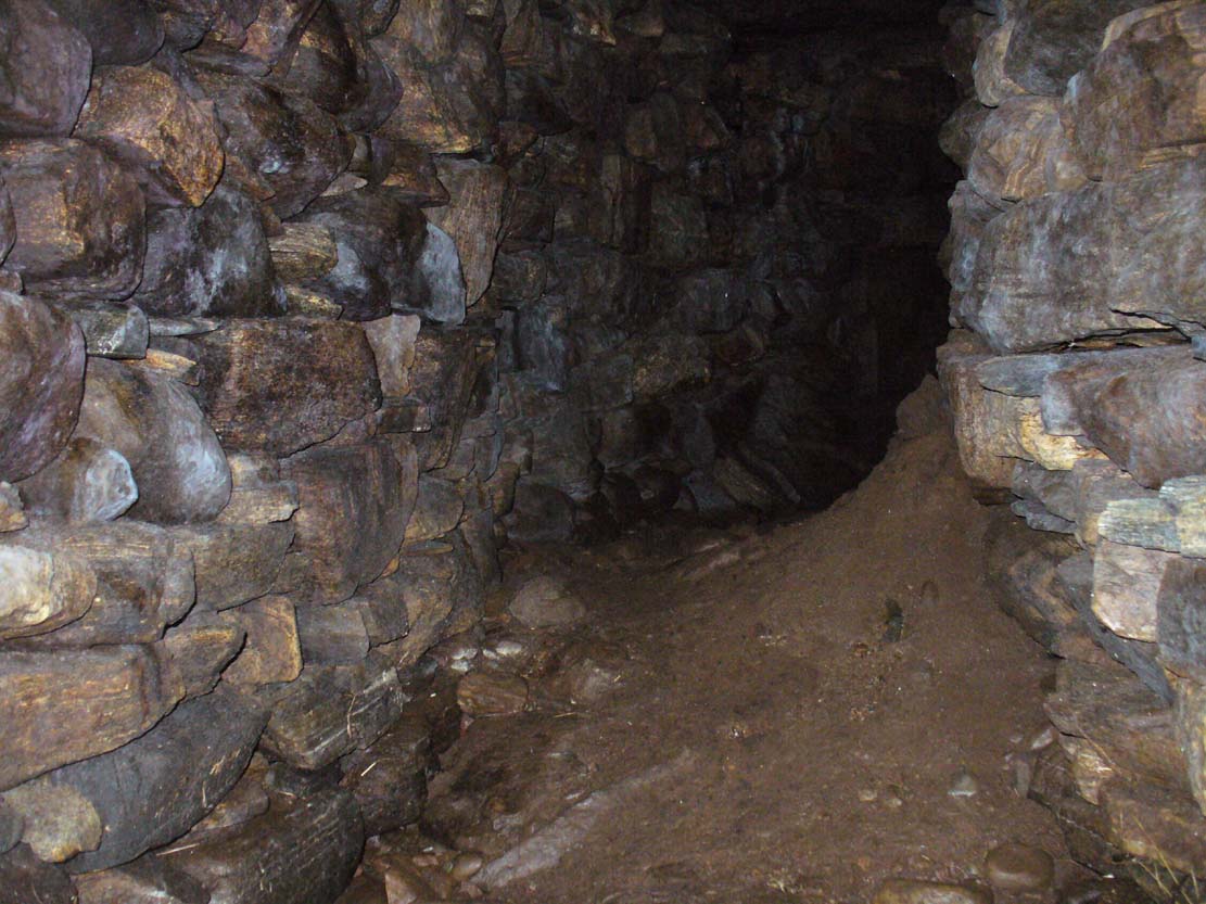
Immediately beneath the ridge where the Borgie chambered cairn once stood, the site was uncovered quite by accident when a local man went to move a large stone on the grassy embankment, to make use of it in walling or something similar. But much to his surprise, the boulder covered the entrance to an underground chamber known as a souterrain – inside which, local lore tends to tell, the little people once stayed. It’s an impressive structure! When Donna Murray took me to see this a few months ago, she said it was only a few yards long – but once I’d got inside, found it to be much longer than this. After dropping perhaps six feet down into the hollow, the very well-preserved wide chamber beneath – some 6-8 feet across – curved around to the north-northeast and into pitch blackness. I walked perhaps ten yards into the chamber, completely upright, and as the chamber curved and went further into the Earth, the pitch black stopped me venturing more.
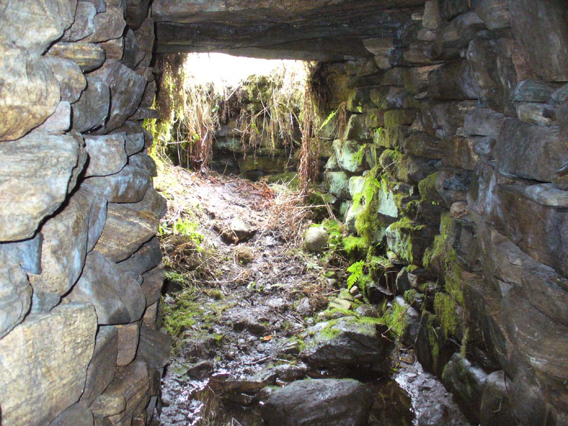
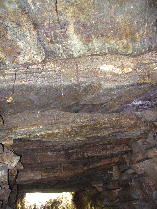
Looking into the darknessLine of roofing stones
The walls of the souterrain were very well structured indeed and were made up of hundreds of good-sized stones, akin to those used to build old stone walling in our northern hills. The floor was, typically, muddy and apart from a scatter of a few stones I could see little by way of a ‘floor’ beneath my feet (but it was dark!). However, the roofing was made up of large flat stones measuring 6-8 feet across, as wide as the structure itself, running parallel all along the chamber. I did not walk to the end of the chamber – but would assume that this roofing continued to the end of the souterrain.
In a number of souterrains we find examples of cup-and-ring carvings (the one at Pitcur, Perthshire, being one of the very best), but I could discern no such petroglyphs inside this chamber. However, considering how dark it was, another investigation with torches is necessary before any definitive remarks regarding internal petroglyphs can be made.
Curving into the darkness
It’s in damn good condition indeed and is well worth looking at if you venture this far north. Other unrecorded prehistoric monuments are found all over this remote landscape – from cup-and-rings, to stone circles, to tombs, enclosures, cairns, you name it! If anyone knows of any permanent rental properties up here – please let me know and get in touch so that I can spend the rest of my life working here meandering, discovering and recording the prehistory of this truly archaic landscape! I’m serious!
Acknowledgements: Immense thanks to Donna from Borgie, for showing me this ancient monument and other sites.