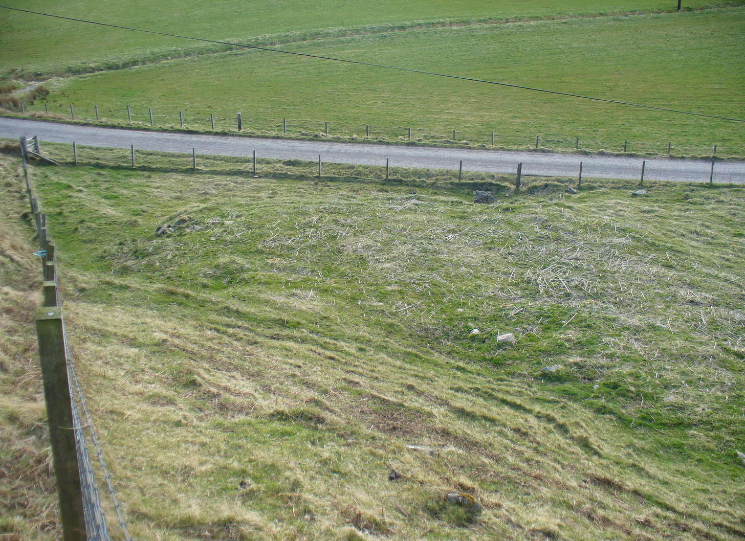
From Bettyhill village, take the A836 road east (as if you’re heading towards Thurso) for literally 1½ miles (2.4km) and take the left turn to Farr (signposted). Exactly a mile along, just past the gated house above the road on your right, in the sloping field below it, you’ll notice a seemingly innocuous scatter of stones doing nothing in particular in the grassland. That’s it!
Archaeology & History
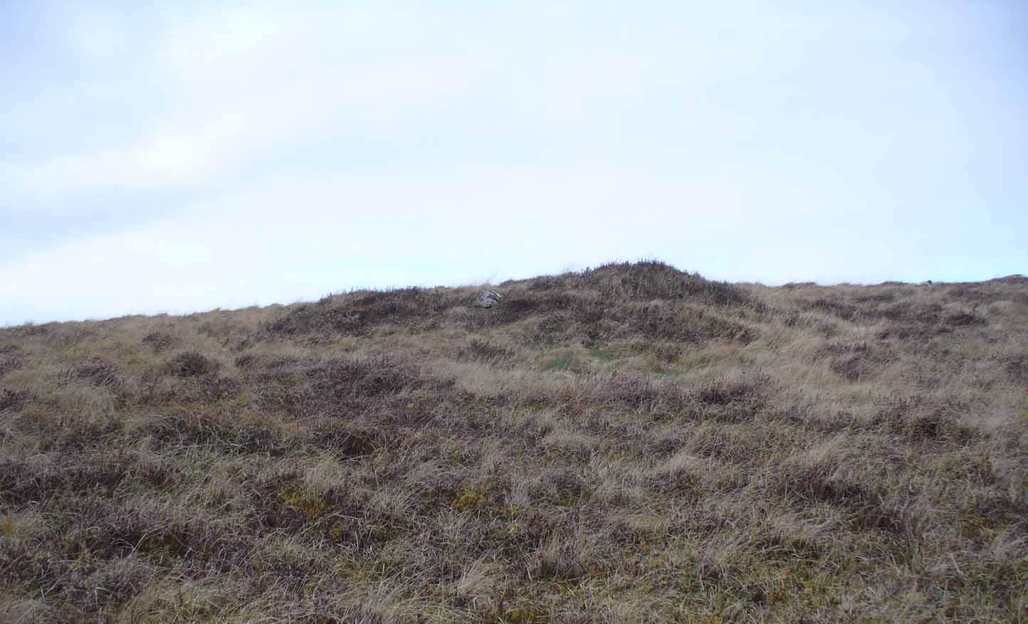
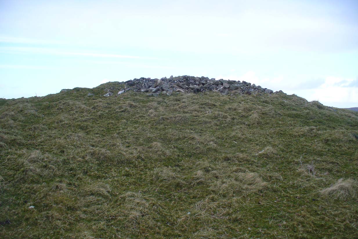
There’s not too much to look at here, apart from a very overgrown mass of loose stones seemingly piled up near the bottom of the sloping hillside. It was first noted when James Horsburgh (1870) explored the prehistoric sites of the region, but even then the site was mentioned with some brevity, telling simply:
“On the way from Farr to Borve Castle, there are the foundations of a Pictish tower at Clarkhill, the stones of which are larger than usual, being square blocks.”
Looking down on the ruins
His description regarding its precise whereabouts wasn’t very clear, but it was located some years later by the Royal Commission (1911) who subsequently added the site to their Inventory. They found that the broch was “at the extreme west end of a low rocky ridge on which are situated the buildings of a croft bearing the name of The Dun.” They reported, even then, that only a few large stones of the broch remained visible. `
The site was included in Euan Mackie’s (2007) magnum opus, where he described the only remains left of this “possible broch” to be “the basal course of the outer wall…forming an arc about 9.0m long.”
MacKie, E W., The Roundhouses, Brochs and Wheelhouses of Atlantic Scotland c.700 BC-AD 500 – volume 2, British Archaeological Report: Oxford 2007.
Royal Commission Ancient & Historical Monuments, Scotland, Second Report and Inventory of Monuments & Constructions in the County of Sutherland. HMSO: Edinburgh 1911.
Acknowledgements: With thanks to the old crew of Aisha and her little Lara for getting me up here, oh so many years ago now…..
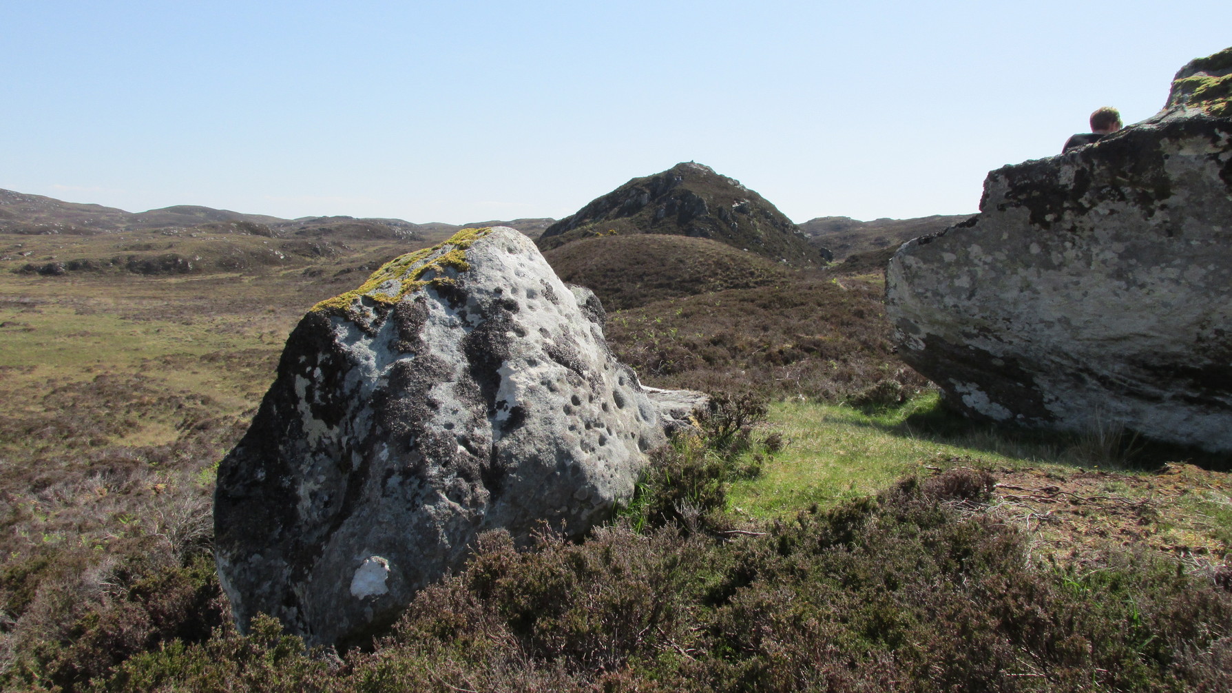
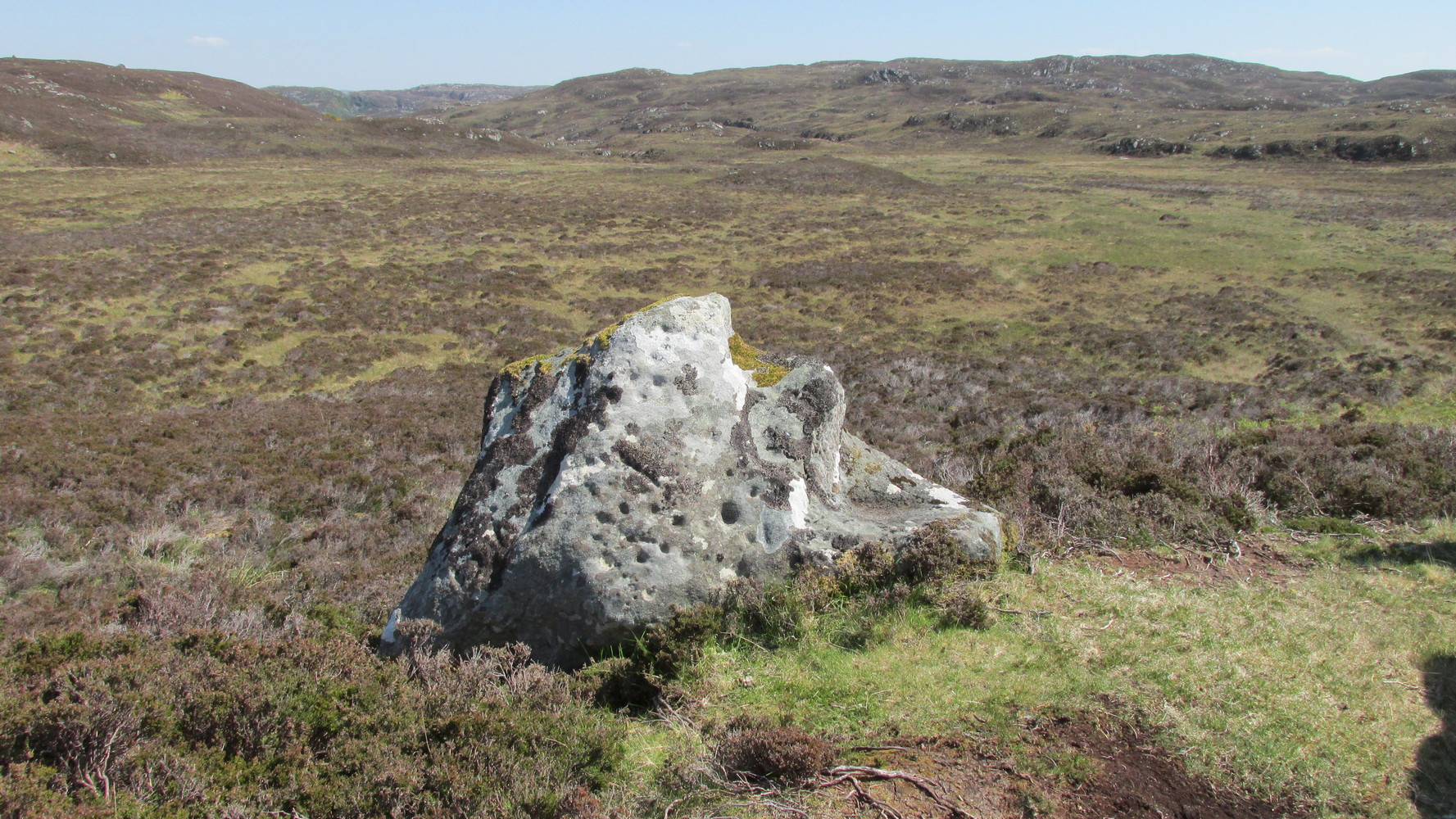
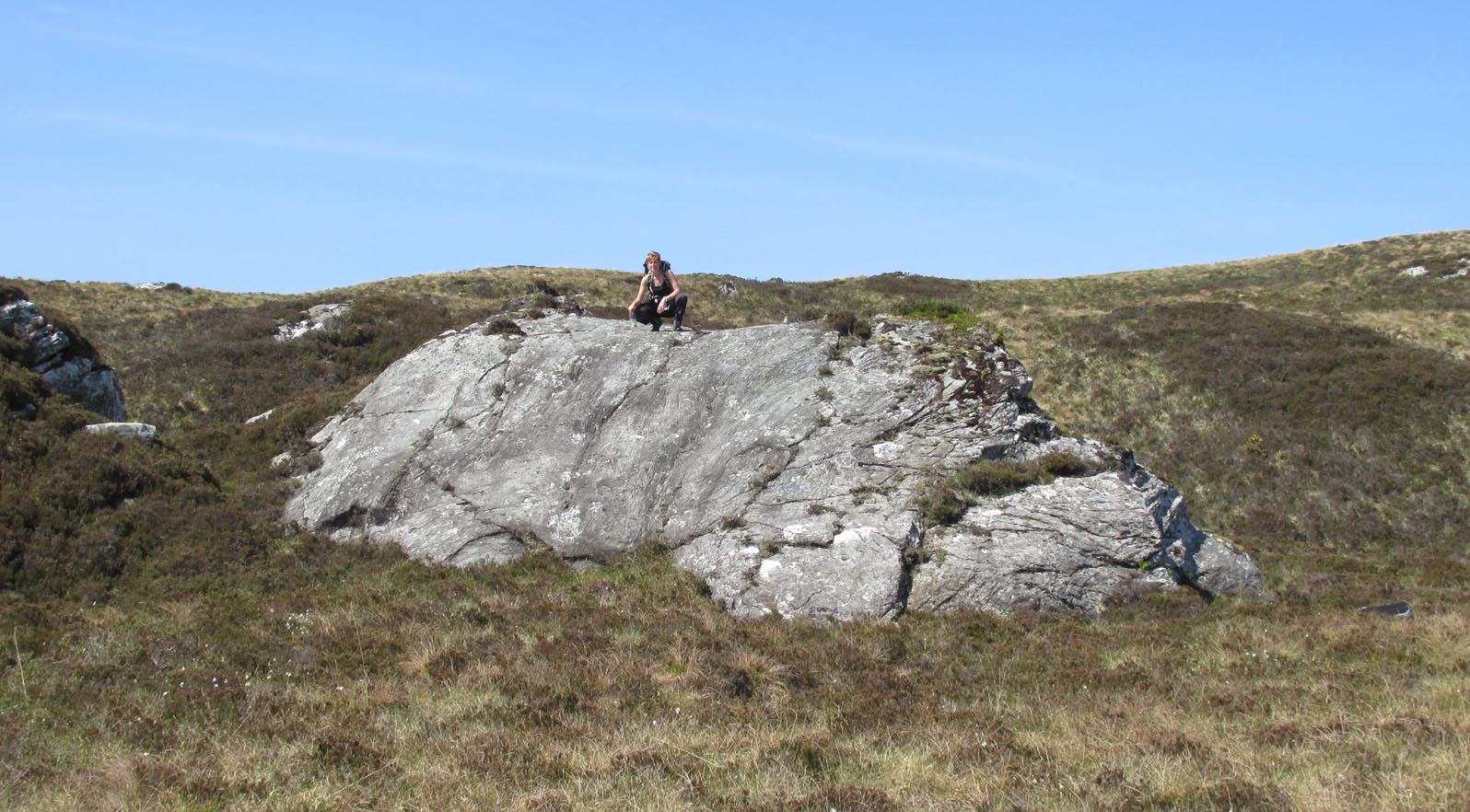
Simply follow the same directions as if you’re going to the Allt Thorrisdail (1) petroglyph, and the large, roughly oval-shaped boulder just a few yards away is the one you’re after. You can’t miss it!
Archaeology & History
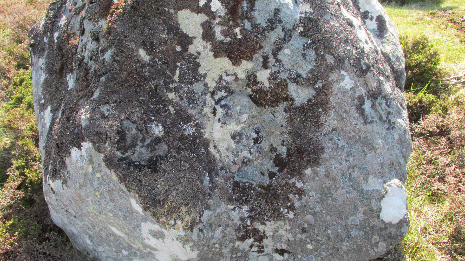
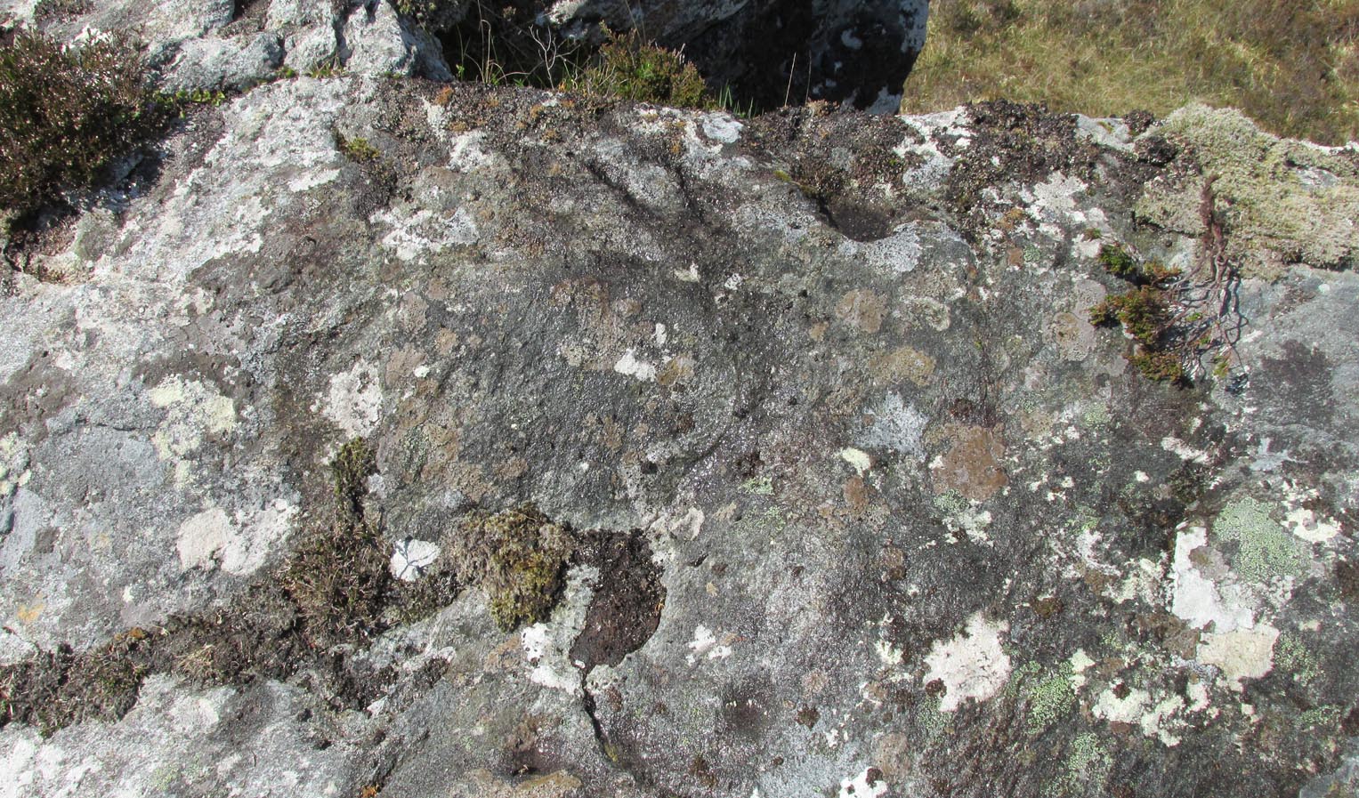
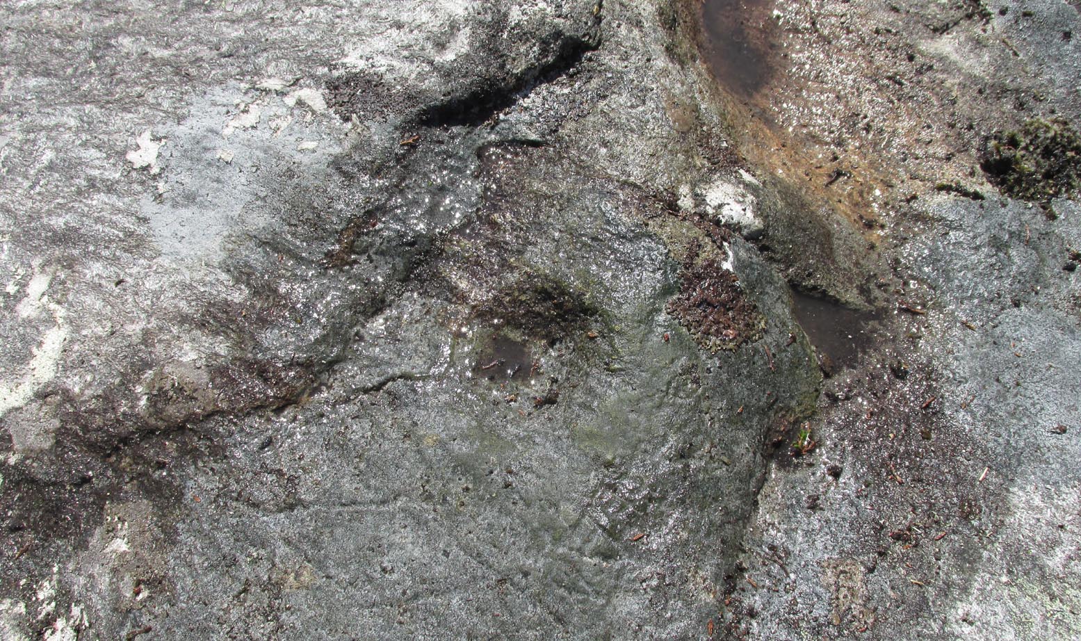
This large, earthfast, ovoid ball of rock has a series of cup-marks on three of its curvaceous faces, some of which seem to be natural, with a number of them “enhanced” by human hands at some time in the long long ago….
The main cluster of these cups can be found on its near-vertical western-face: an unusual feature in itself! There are several cups on its southern curve and, further round, low down on the east side of the rock we see a few more of them hiding away. These, too, seem to have been Nature’s handiwork, then enhanced by the hands of wo/men. The carving was described in Hew Morrison’s (1883) work as possessing two groups of cup-marks,
“similar to that on the neighbouring stone, one of eighteen small and one large cup, and another of eleven small marks. There is a solitary mark on the summit of this stone, and its southern face is marked by lines crossing each other, but without any apparent order or design.”
On its northern face we see a large oval hollow, an inch or so deep throughout, that has all the hallmarks of being a primitive face. There is a tradition of such a rock “face” carving somewhere close by, which seems to be lost—and this would seem to be culprit! If you visit the place, let us know what you think!
One feature that stands out at this site is the nearby pyramidal hill whch, I think, had some mythic relationship with the carvings. Impossible to prove, obviously, but the pyramid is such a dominant feature in this landscape that a relationship seems inevitable. I can only echo what I’ve said in the site profile for the adjacent carving here: tis a ritual place indeed – without any shadow of doubt. And I don’t say such things lightly. This place is truly superb!
References:
Mercer, R.J., Archaeological Field Survey in Northern Scotland 1976-1979, University of Edinburgh 1980.
Royal Commission on Ancient & Historical Monuments, Scotland, Second Report and Inventory of Monuments and Constructions in the County of Sutherland. HMSO: Edinburgh 1911.
Acknowledgements: Huge thanks to Sarah MacLean for her company and landscape knowledge in visiting this and other nearby antiquarian sites. And to Aisha Domleo, for getting me into this neck o’ the woods in the first place….where’er She may be….
Holy Well (lost): OS Grid Reference – NC 725 538 (approximation)
Archaeology & History
It would appear that there’s only one literary reference to this seemingly lost holy well, located halfway down megalithic Strathnaver, somewhere close to the legendary Loch ma Naire. James Horsburgh’s (1870) essay on the antiquities of this area mentioned it, almost in passing, in his description of the Dun Viden broch. He told that,
“Close to Dun Viden is Loch Manaar, where dozens of people come twice every year for the cure of diseases. They come before sunrise, bathe in the loch, walk round it, drink from a holy well (my emphasis), and throw some pieces of money into the loch. There is a legend about this loch, which I forget; but a woman was chased by a priest, and threw something in it, and called out that it was Loch Manaar—that is, the loch of my shame. “
The holy well is referred to in Historic Scotland’s Canmore entry, citing both the New Statistical Account and Name Books as referrals to the site, yet neither of them include this well in their surveys; it is only through Horbugh that we hear of this site—and we know not where it lived! In the event that it still exists, we’d expect it to be not more than 2-300 yards from the edge of Loch ma Naire; or perhaps it may be the source of the Loch ma Naire burn itself, nearly a mile to the east…. Seek and thee shalt find, as the old saying goes…
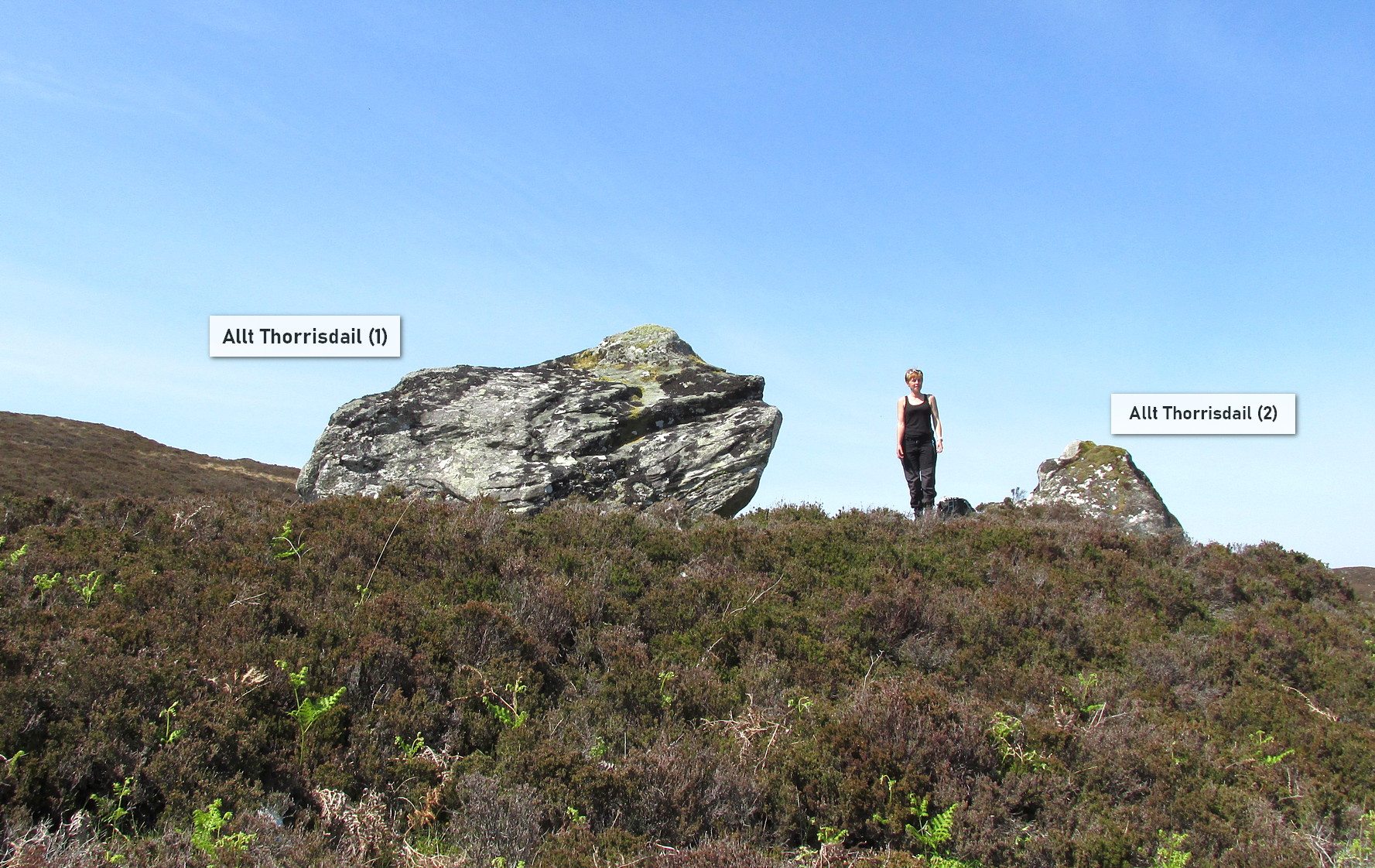
Roughly halfway between Bettyhill and Tongue on the A836 road, keep your eyes peeled for the sign to Skerray (4 miles) and travel down that road. About 1¾ mile on, take the tiny lane on your left up the slope for 0.6 miles (1km), and just before the sharp bend in the road (across a small bridge) there’s a gate on your left. Go thru here and follow the tiny path alongside the burn (stream) westwards for half-a-mile until where the waters become a bog within a wide oval bowl in the landscape. At the far-side you’ll see two large boulders sat above this watery bowl. That’s where you need to be!
Archaeology & History
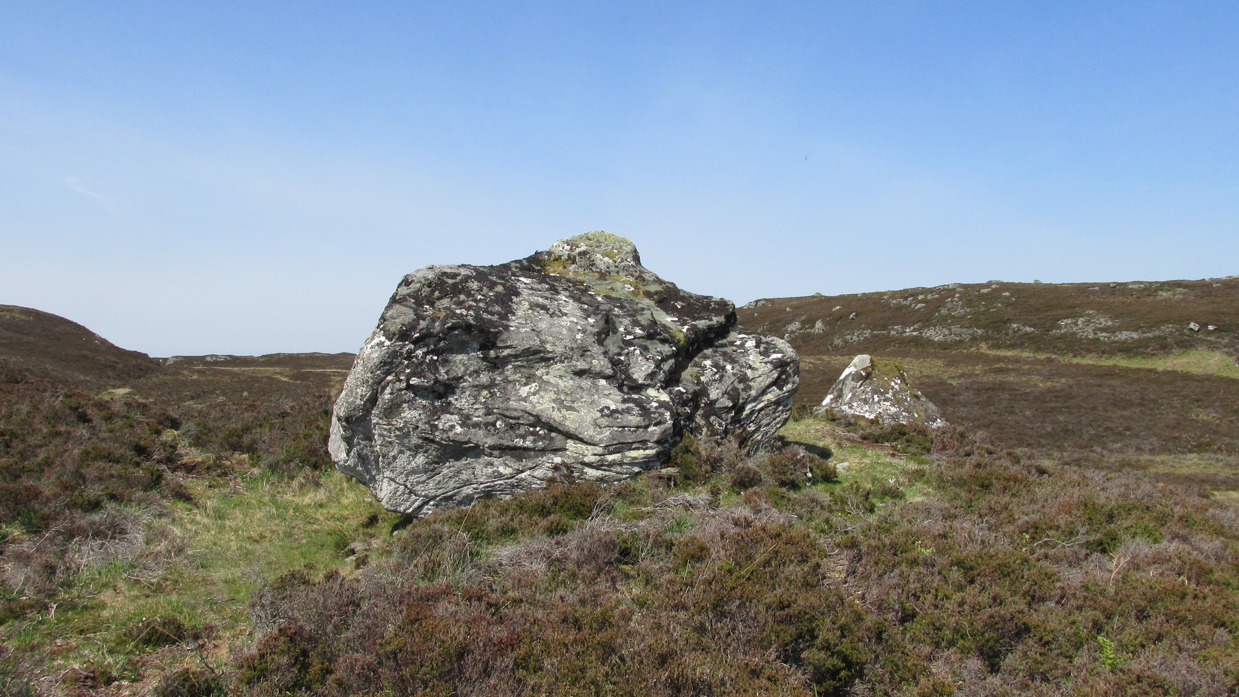
The big fella of the two
This is carving “number one” of two great incised boulders that are sat upon a natural ridge overlooking a dried-up lochan. An impressive spot that give a thoroughly distinct impression of altar stones above the sunken waters, from whence rites and proclamations were performed. It has that look and feel about it—and any animist would tell you the same. My hardcore dreams aside though…
This profile is for the larger of the two boulders that live here (Allt Thorrisdail 2 is here). It has very curious petroglyphic attributes—much like its compatriot—unlike many of those in these northern lands. The pair of them seem to have been described for the first time in Hew Morrison’s (1883) fine meanderings through the mythic history of the region. He told that,
“About a mile distant (from Torrisdale) two large cup marked boulders lie on the slope of a hill. The marks are disposed in groups of one large and nine smaller cups. On the larger boulder there are two of these groups and seven separate marks.”
There are slightly more than that, and this was pointed out when the Royal Commission (1911) lads came to see it:
“The largest boulder, that situated furthest west, is about 8 feet high and 14 feet in length. On its south side, chiefly on the flat and less abrupt face of the stone, are groups of cup-marks of from 2in to 3in in diameter, the deepest being about 1in in depth, while a number are now almost obliterated. The extent of the markings is not very definite, but there appear to be two groups containing about twelve cup-marks each.”
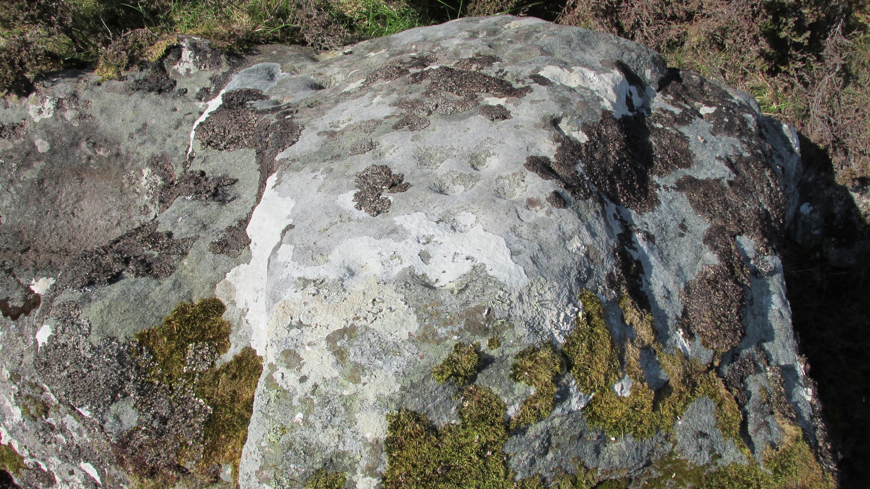
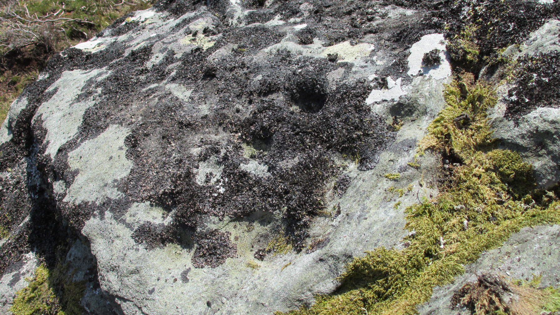
Another chorus of cupsLichen-dappled cupmarks
But this only tells of half the stone’s symbolic story. For on the vertical northern face of the rock, from just above ground-level, we have a distinct almost straight line of many cup-marks, going up diagonally, at an angle of about 35º. I took a number of photos of this aspect of the stone, but the covering of lichens didn’t highlight them clearly at all. When you’re stood looking at them they stand out like a sore thumb!
I have to be honest and say that I bloody well love this site! You have to paint the entire environment in the right light, as it was when the stone was first carved, surrounded by the scattered woodland of birch, pines and rowan all across where now we have stunning barren moorlands. Tis a ritual place indeed – without any shadow of doubt!
References:
Mercer, R.J., Archaeological Field Survey in Northern Scotland 1976-1979, University of Edinburgh 1980.
Royal Commission on Ancient & Historical Monuments, Scotland, Second Report and Inventory of Monuments and Constructions in the County of Sutherland. HMSO: Edinburgh 1911.
Acknowledgements: Huge thanks to Sarah MacLean for her company and landscape knowledge in visiting this and other nearby antiquarian remains. And to Aisha Domleo, for getting me into this neck o’ the woods.
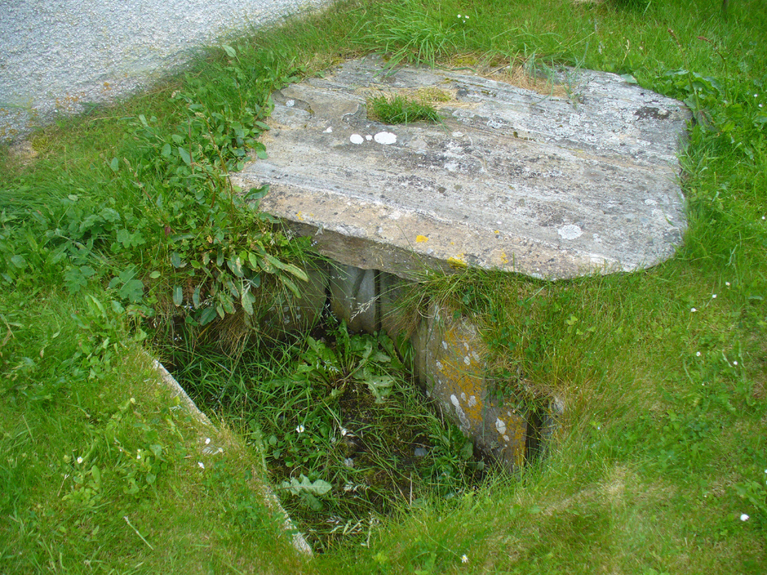
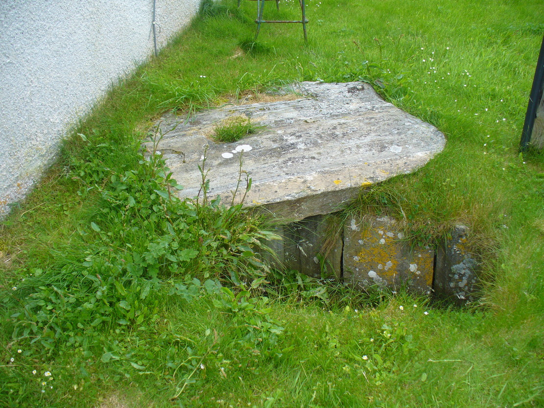
Dead easy. From the top of the hill at Bettyhill, take the road east out of the village along the A836 Thurso road. At the bottom of the hill, on your left, you’ll see the white building of Farr church Museum. Walk to it and instead of going in the door, walk past it and round the back, or north-side of the church where, up against the wall, you’ll see this small stone-lined hole in the ground. Y’ can’t really miss it.
Archaeology & History
Originally located 7½ miles (12.1km) to the south at Chealamy (NC 7240 5017), in the prehistoric paradise of Strathnaver, it was uncovered following road-building operations in 1981 and, to save it from complete destruction, was moved to its present position on the north-side of Farr church museum. It was fortunate in being saved, as it was covered by a large boulder which the road operators tried to smash with a large jack-hammer; but in breaking it up, they noticed a hole beneath it. Thankfully, old Eliot Rudie of Bettyhill—a well respected amateur historian and archaeologist in the area—was driving past just as it had been uncovered by the workmen. He recognised it as being a probable cist and so further operations were stopped until it was investigated more thoroughly.
The relocated cist
The cist—measuring some 4 feet long by 3 feet wide and about 1½ feet deep—contained the burial of what was thought to be a man in his mid- to late-twenties. The remains were obviously in very decayed state and it was thought by archaeologist Robert Gourlay (1996), that the body itself had been “deposited in the grave (when it was) in an advanced state of decomposition.” Also in the cist they found a well-preserved decorated beaker, within which Gourlay thought “probably contained some kind of semi-alcoholic gruel for the journey of the departed to the after-life.”
References:
Gourlay, Robert, Sutherland – An Archaeological Guide, Birlinn: Edinburgh 1996.
Gourlay, Robert B., “A Short Cist Beaker Inhumation from Chealamy, Strathnaver, Sutherland”, in Proceedings Society Antiquaries Scotland, volume 114, 1984.
Gourlay, Robert & Rudie, Eliot, “Chealamy, Strathnaver (Farr) Beaker Cist”, in Discovery Excavation Scotland, 1981.
Acknowledgments: To that inspiring creature Aisha Domleo, for her bounce, spirit and madness to get me up here; and for little Lara too, for meandering to the church museum where this cist can be seen; and to Eliot Rudie, who pointed it out to us.
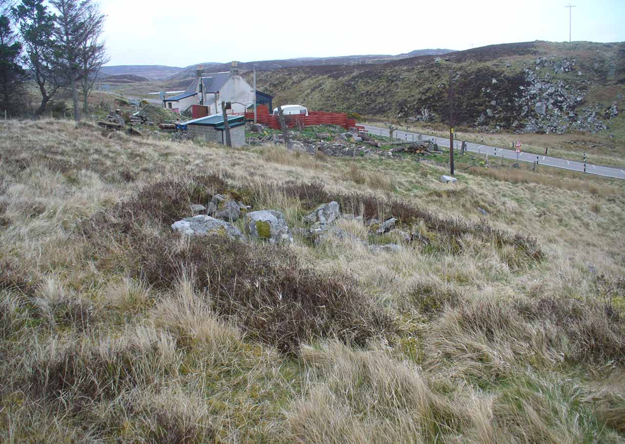
From Bettyhill, go out of the village along the A836 Thurso road for just over a mile. You go uphill for a few hundred yards and just as the road levels-out, there’s the small Farr Road on your left and the cattle-grid in front of you. Just before here is a small cottage on your left. In the scrubland on the sloping hillside just below the cottage, a number of small mounds and undulations can be seen. That’s it!
Archaeology & History
Although this place was highlighted on the first OS-map of the area in 1878, I can only find one modern reference describing this somewhat anomalous cluster of sites. It’s anomalous, inasmuch as it doesn’t have the general hallmark of being a standard cairnfield or cluster of tumuli. For one, it’s on a slightly steep slope; and another is that amidst what seems to be cairns there are other, more structured remains. As I wandered back and forth here with Aisha, I kept shaking my head as it seemed somewhat of a puzzling site. As it turns out, thankfully, I wasn’t the only one who thought this…
One of the ‘cairns’ from aboveProfile of a typical cairn
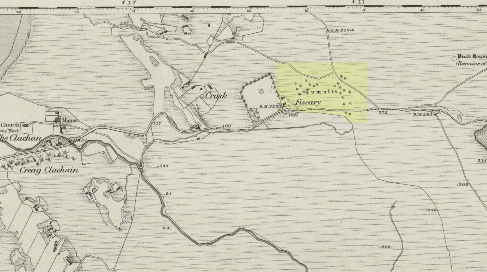
In R.J. Mercer’s (1981) huge work on the prehistory of the region, he described the site as a whole as a field system comprising “enclosures, structures, cairns and field walls” and is part of a continual archaeological landscape that exists immediately east, of which the impressive Fiscary cairns are attached. In all, this ‘cairnfield’ or field system is made up of at least 23 small man-made structures, with each one surviving “to a height of c.0.5m and are associated with 11 cairns from 2-6m is diameter.”
In truth, this site is probably of little interest visually unless you’re a hardcore archaeologist or explorer.
References:
Mercer, R.J., Archaeological Field Survey in Northern Scotland – volume 2: 1980-1981, University of Edinburgh 1981.
Acknowledgments: To the awesome Aisha Domleo, for her images, bounce, spirit and madness – as well as getting me up here to see this cluster of sites.
There’s no simple way to reach here – but the landscape alone makes the journey worthwhile. Roughly halfway along the A836 between Bettyhill and Tongue, take the minor road up to Borgie, past the recently revamped Borgie Hotel for half-a-mile (0.8 km) where, on your left, is Deepburn Cottage. On the other side of the road, on your left, go through the gate and follow the path uphill. It curves up and to the right where you hit some overgrown walling. Walk up and along this wall for nearly half-a-mile (it’ll feel like twice that!) and as you approach the crystal blue waters of Lochan a’ Chaorruin, veer right and start walking up the small Torrisdale Burn. Less than 200 yards along, you’ll see the large isolated rock on your left.
Archaeology & History
Cupmarks top & bottomSingle prominent cupmark
Previously unrecorded, this large boulder sitting above the edge of Torrisdale Burn was rediscovered by Sarah MacLean—hence its name—and has between five and nine cup-marks etched, primarily, on the topmost ridge of the rock. Its eastern steep-sloping face also has a cup-mark near the middle top-half of the stone. Apart from three of them (visible in the photos), the other cups aren’t very distinct and unless the lighting is right, you won’t see much here. This one is probably gonna be of little interest unless you’re a real hardcore petroglyph freak.
Further up this tiny winding glen we reach the faint cup-marked Thorrisdail Stone and a little further on is the impressive ritual site of Allt Thorrisdail.
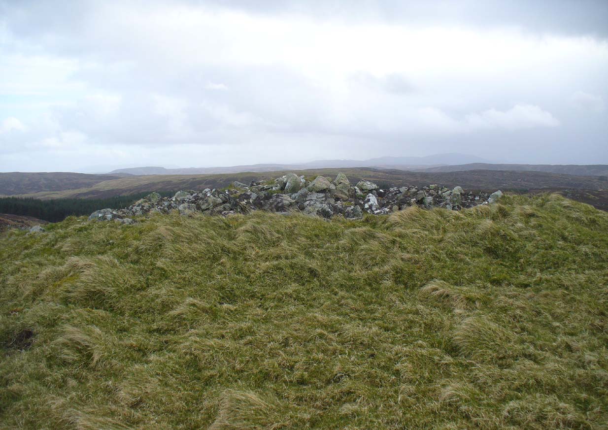
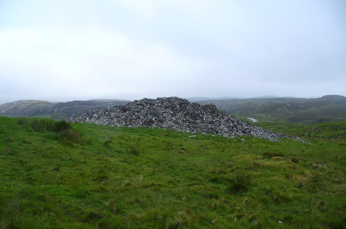
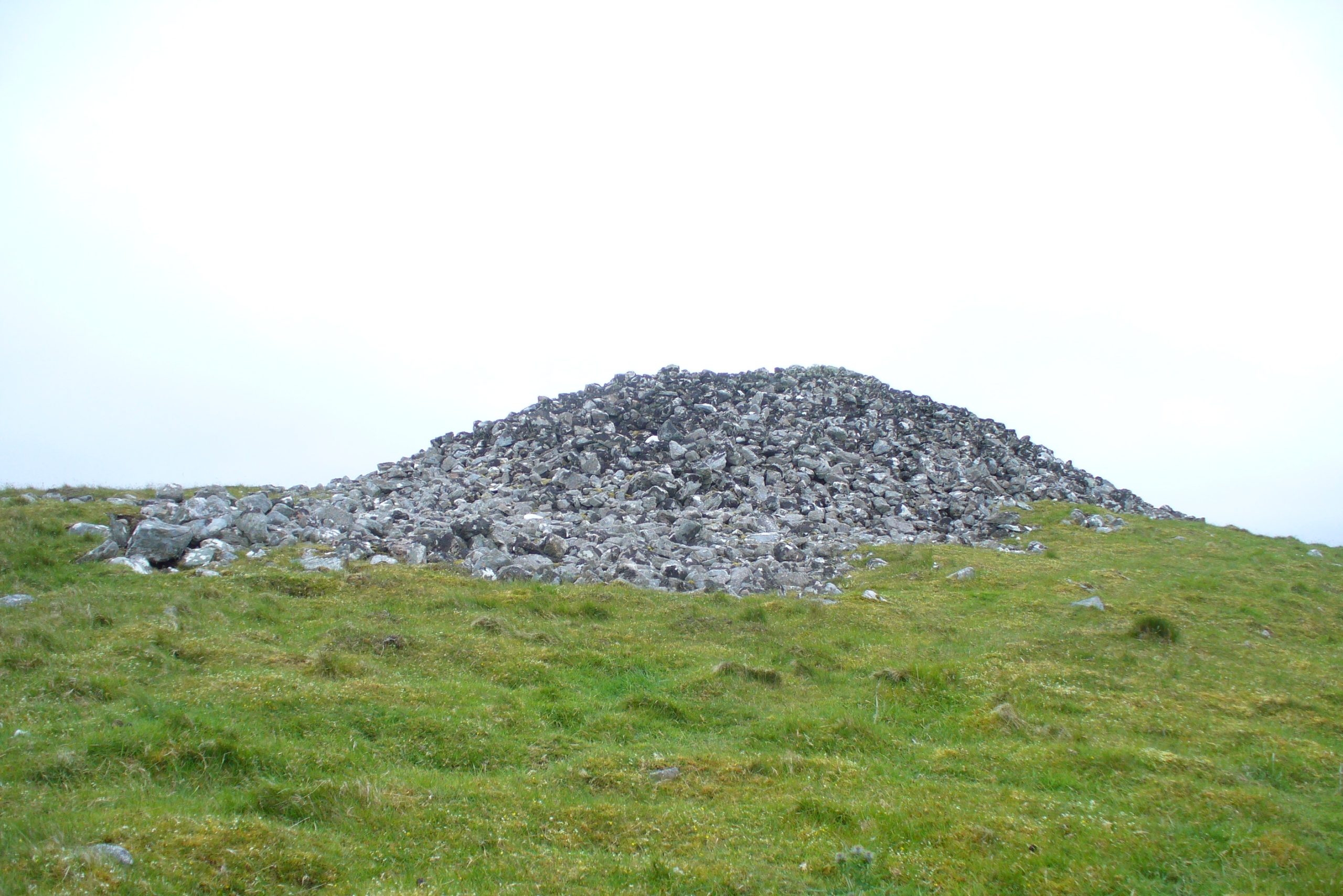
A mile east of Bettyhill on the A836 road, watch for the large piles of rocks up on the hill on your left (north). Turn left on the tiny road past the first house for 150 yards and then on the track past the sheep-fanks through the gate and up the small hill. The cairn is the smallest of the pile of rocks in front of you.
Archaeology & History
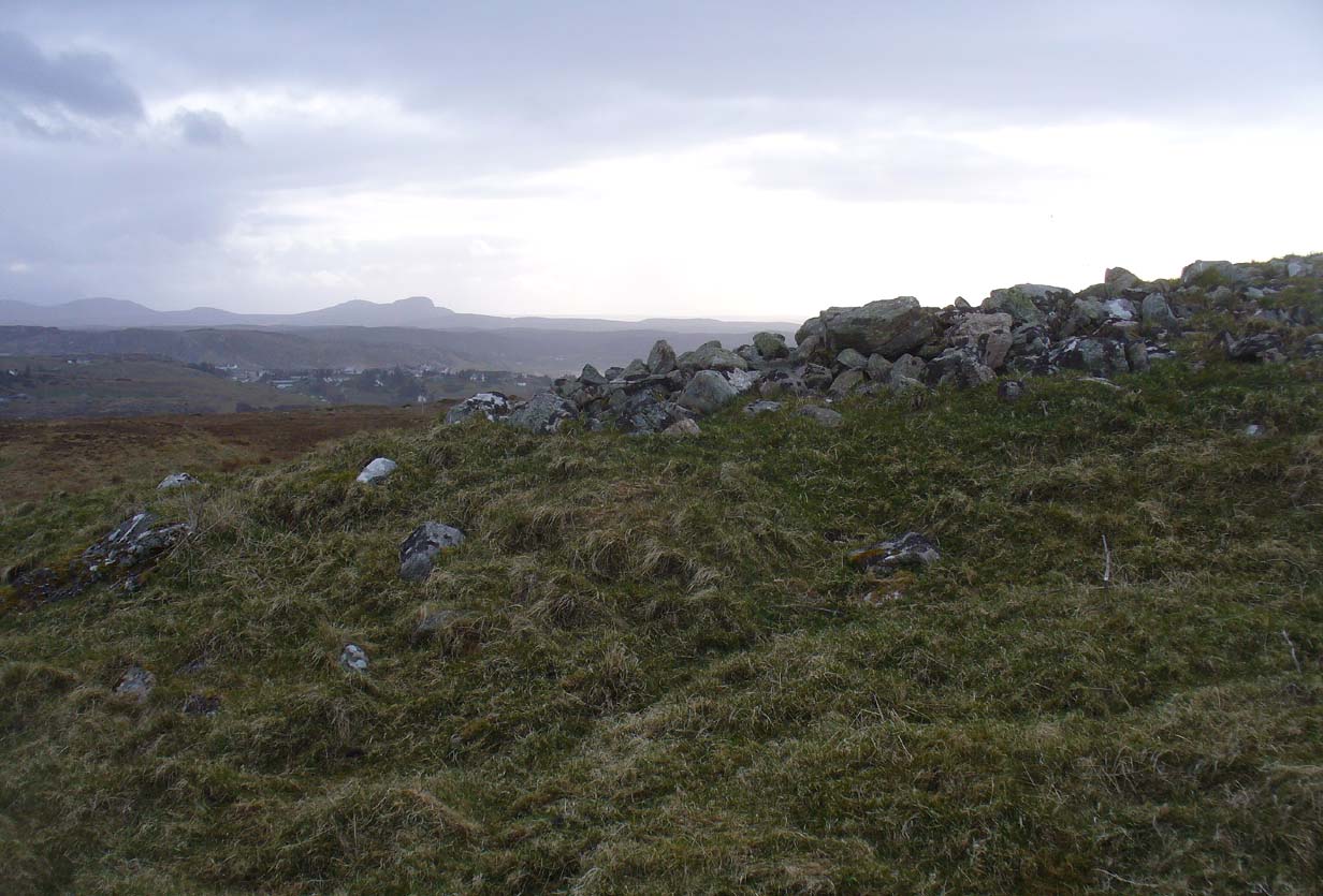
Of the four giant cairns clustered here at Fiscary, a mile east of Bettyhill, this one has received the least attention. It is found amidst a massive cluster of archaeological remains running from the 19th century all the way back into the neolithic period. Quite impressive!
Sitting on top of the cairn the view is impressive: looking 360º with the Orkney islands s to the northeast, Durness and the rising mountains west and southwest, and endless craggy moorlands peppered with lochans driving in all directions to the south countless miles away. This panorama of wilderness is something to behold…
Looking west out to sea
Looking southwest
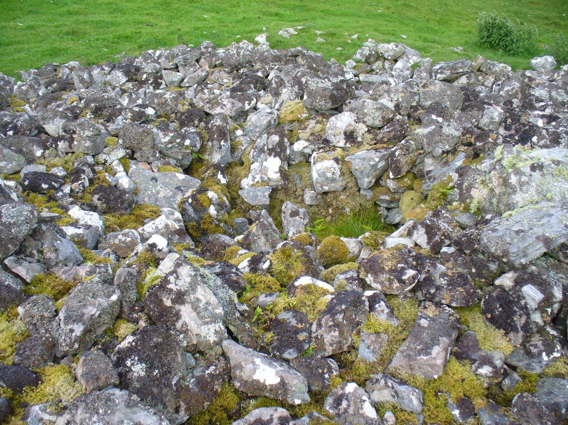
The tomb itself, with the acceptable scatter of fallen rocks to the edges, is nearly 50 yards in circumference, measuring more than 12 yards east-west and nearly 14 yards north-south, with the Earth covering the older rocks to the edges with more and more vegetation as the years pass. It stands about 5-6 feet high with the typical internal mass of thousands of stones making up the cairn. No known excavations have ever been made here.
In the otherwise superb Royal Commission (1911) survey of Sutherland, they only had scant information to say about this tomb, telling that,
“The fourth cairn…measures 28′ to 30′ in diameter and is about 6′ high. There are no signs of chambers visible and the cairn has been a good deal dilapidated.”
Even when R.J. Mercer (1981) came to give this area greater attention, he passed by the Fiscary 4 cairn with equal brevity, noting simply its dimensions, elevation above sea level and the fact that it is a “circular cairn on crest of hill.”
The tombs of Fiscary 1, 2 and 3 are very close by some beginning some 257 yards (235m) to the east. I cannot recommend this entire complex highly enough!
References:
Henshall, Audrey S., The Chambered Cairns of Sutherland, Edinburgh University Press 1995.
Mercer, R.J. & Howell, J.M., Archaeological Field Survey in Northern Scotland – volume 2, University of Edinburgh 1981.
o’ Reilly, Kevin & Crockford, Ashley, What to See Around Bettyhill, privately printed 2009.
Royal Commission on Ancient & Historical Monuments, Scotland, Second report and inventory of monuments and constructions in the county of Sutherland. HMSO: Edinburgh 1911.
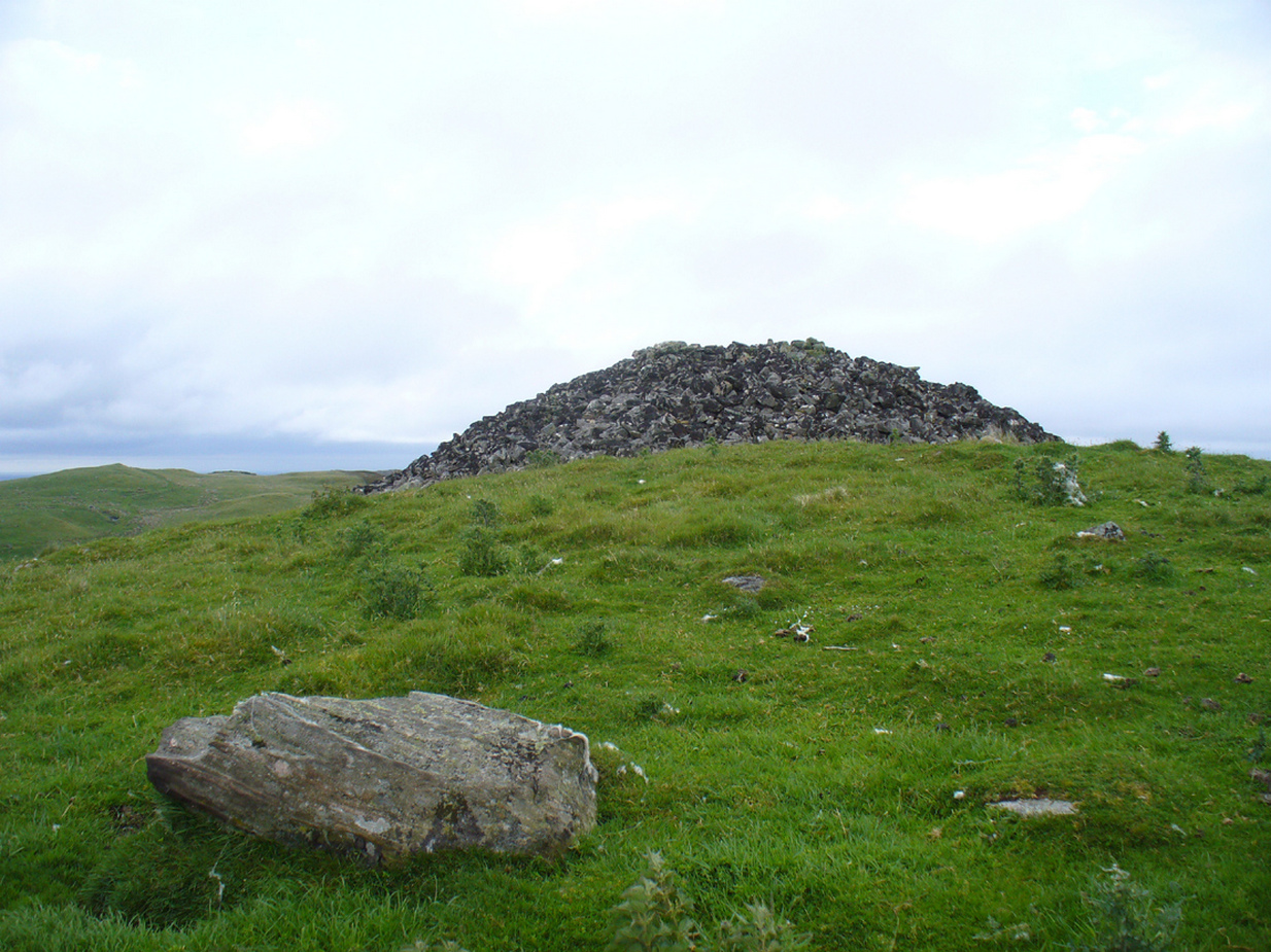
Along the A836 road from Bettyhill to Thurso, a mile east of the village keep your eyes peeled to your left (or to the right if you’re coming the other way!), looking north, and you’ll see some very large piles of stones a few hundred yards away. Go through the gate onto the rough grasslands and the first one you reach is the cairn in question. Y’ can’t miss it!
Archaeology & History
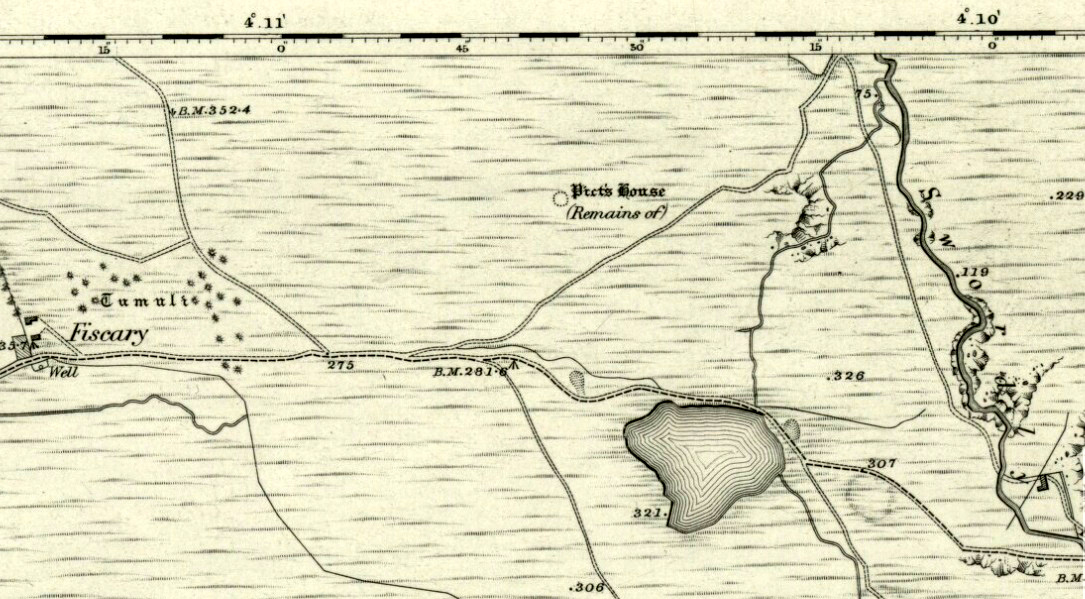
On 1878 OS-map as Picts House
Close to the Fiscary 1 and Fiscary 2 tombs, this is the third and southernmost of the three giant cairns on this moorland hillside and is the second largest of the trio. Curiously it was the only one highlighted by the Ordnance Survey lads in their cartographic analysis here in 1873—they somehow missed the others—when they told it to be a ‘Pictish House’, or broch. A few years later when the Royal Commission (1911) fellas got their noses up here, they said that this,
“which is the most easterly, is circular in form, is about 68ft in diameter, and 15ft 6in to the apex, on which a small pile of stones has recently been erected. The cairn does not appear to have been excavated, but the stones in several places have been pulled out, probably in attempts to discover the chambers or in pursuit of rabbits.”
Looking into its centre
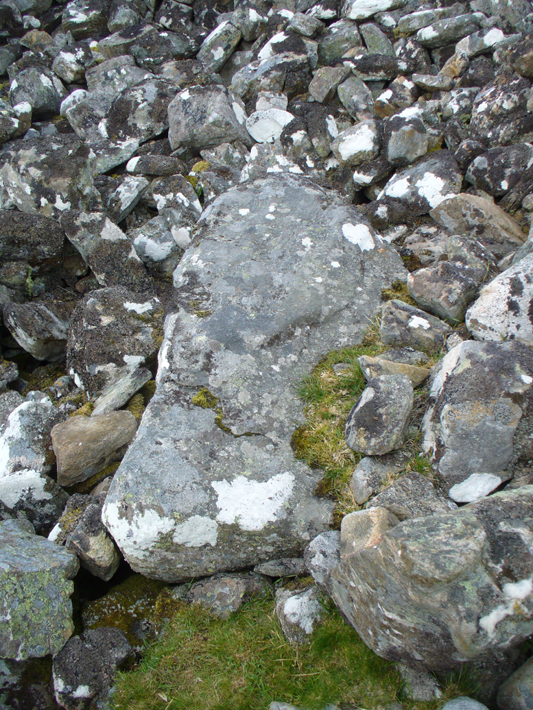
Long stone at southern edge
Considering the size of this giant cairn and its close association with is neighbours 150 yards northwest, I’m surprised at the lack of attention it’s been given. Within the collapse of stones on its southern-side we find an elongated stone which seems to have stood upright at some point in the past, either at the very edge of the cairn, or just inside it. It may even have been a covering stone to a collapsed entrance, but without an excavation we’re not gonna know for certain.
The fact that this cairn is on the slopes south of the crowning cairns of Fiscary 1 and Fiscary 2 implies that this was built some centuries later than them. Also notable here is that the view to the north is blocked and we are instead only looking across a panorama east, south and west.
Folklore
Looking across into the east
Local tradition told that this was a Pict’s house, or broch (it may well have been) and is shown as such on the first Ordnance Survey account of the region in 1878. Otta Swire (1963) told that this landscape was once peopled by giants who made the land and played a part in the creation of some of the giant tombs around here. One time local school-teacher at Bettyhill, Alan Temperley (1977) also told us how the fairy folk lived close to the giant tombs of Fiscary.
References:
Gourley, Robert, Sutherland: An Archaeological Guide, Birlinn: Edinburgh 1996.
Henshall, Audrey S., The Chambered Tombs of Scotland – volume 1, Edinburgh University Press 1963.
Henshall, Audrey S., “The Distant Past,” in The Sutherland Book (edited by Donald Omand), Northern Times: Golspie 1991.
Henshall, Audrey S., The Chambered Cairns of Sutherland, Edinburgh University Press 1995.
o’ Reilly, Kevin & Crockford, Ashley, What to See Around Bettyhill, privately printed 2009.
Royal Commission on Ancient & Historical Monuments, Scotland, Second report and inventory of monuments and constructions in the county of Sutherland. HMSO: Edinburgh 1911.
Sutherland, George, Folk-lore Gleanings and Character Sketches from the Far North, John o’ Groats Journal: Wick 1937.
Temperley, Alan, Tales of the North Coast, Research Publishing Company: London 1977.
Acknowledgments: HUGE thanks to Aisha Domleo and for getting me up here.
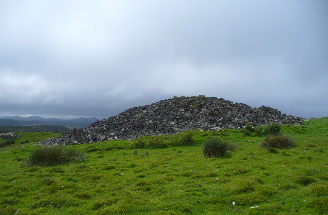
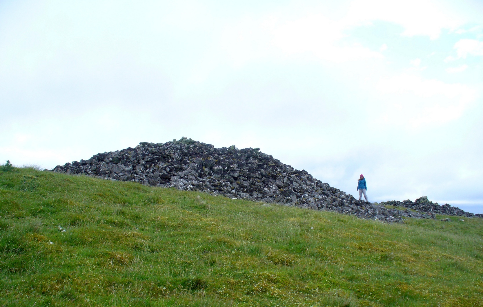
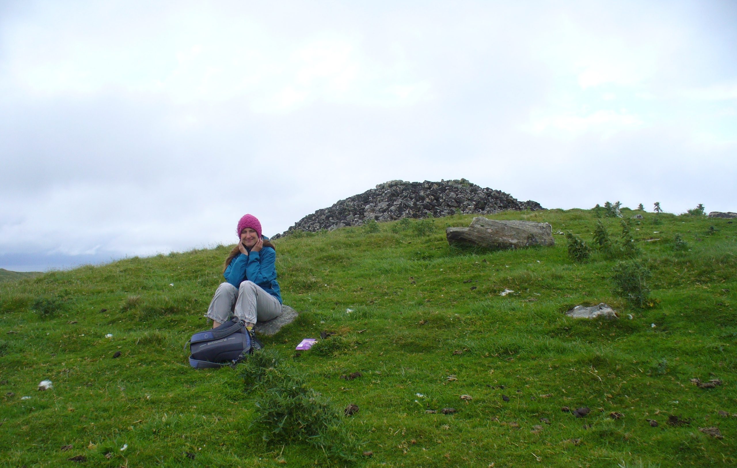
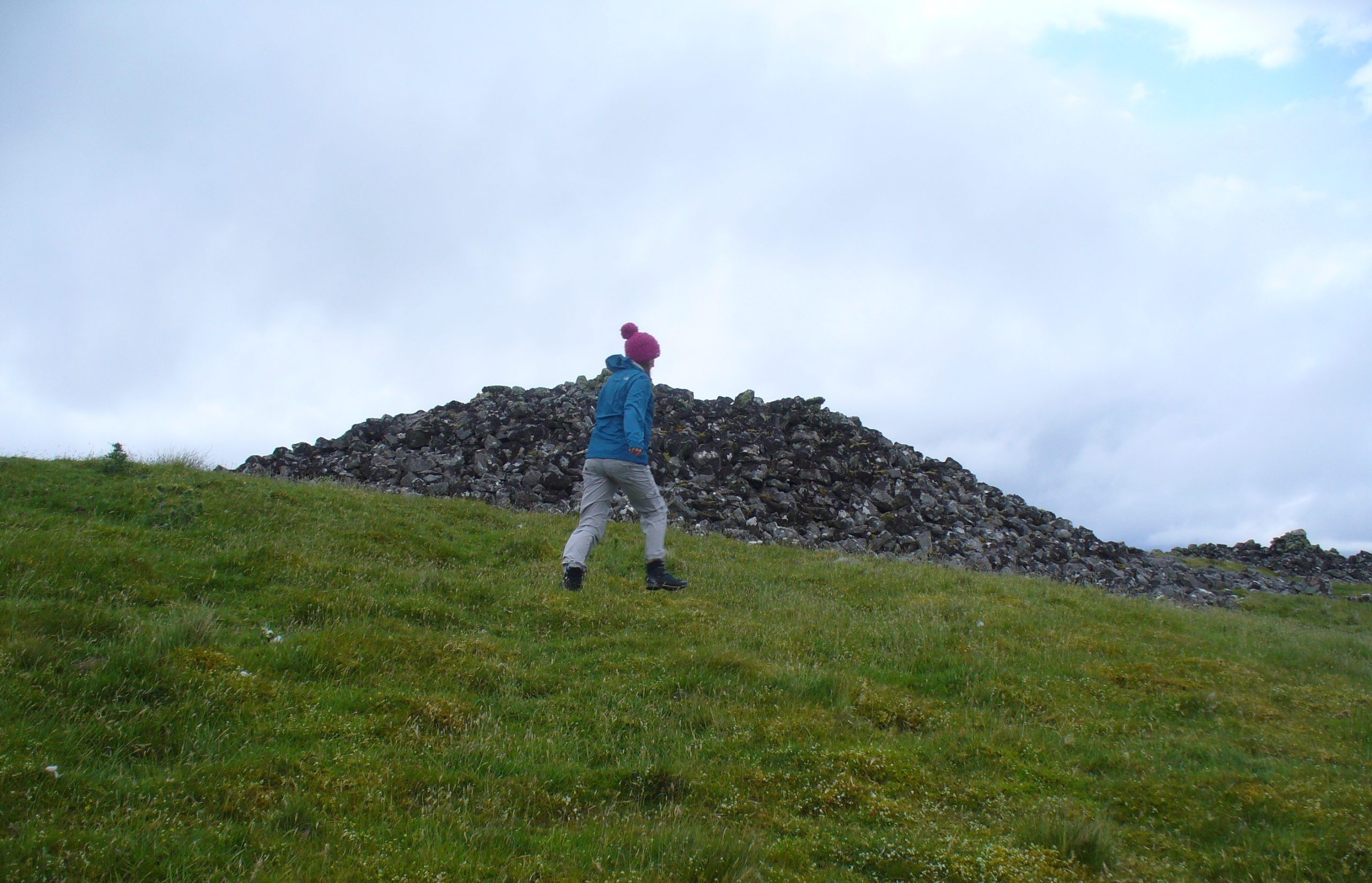
A mile east of Bettyhill along the A836 road, watch out for the large piles of rocks up on the hill on your left (north). Go through the gate, past the Fiscary 3 cairn and 150 yards northwest you’ll reach the crowning cairn on the hilltop itself – the Fiscary 2 cairn.
Archaeology & History
Fiscary 2 cairn, looking NW
The second of the three giant chambered cairns on this moorland hillside is the largest (only just!) of them all. Positioned right on top of the small hill, this great mass of rocks stands out from the roadside a quarter-mile to the south quite blatantly, yet it somehow evaded the eyes of the early Ordnance Survey lads in their visit here in 1873 (though the nearby Fiscary 3 cairn was plotted). Odd…
Aish by the side o’ the cairn
When I came here with Aisha and her clan a few weeks ago Nature was blasting us with full gales and so half her bunch returned after a short while, leaving us to get thrown about in the winds! Even just trying to stand upright on this and its associated tomb proved difficult. But despite this and the low grey clouds—typical of northern Scottish weather—it was obvious that the views from here would be superb, seeing far into the distance with a 360º view. I have little doubt that other important prehistoric sites would be speaking with this giant neolithic cairn, but there is nothing in the archaeology accounts to help us on such matters.
The giant tomb is almost linked to its companion—Fiscary 1—by a low scatter of rocks running between them, with only a yard or two separating their disturbed masses. Several archaeology students have posited that the two seemingly separate sites were, many thousands of years ago, perhaps one elongated chambered tomb, just like the ones found nearby at the Coille na borgie and Long Skelpick cairns; but it seems unlikely in this case…
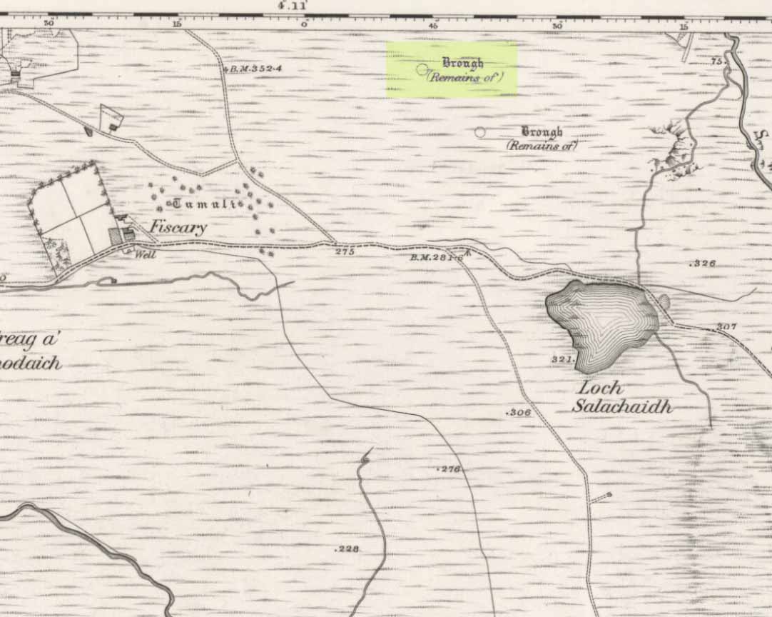
Fiscary (2) on 1908 mapFiscary (2), looking SE
Although Adam Gunn (1893) mentioned the “four large cairns” at Fiscally (the fourth and smallest is 262 yards to the west), the first real description I can find of the place comes from an article by a local man called Cathel Kerr (1892) who told us it was “about 220 feet in circumference, and 15 or 16 in height”; but most of his article dealt with his excavation into the adjacent Fiscary 1 tomb, which he noticed was connected by a stone platform that ran between the two sites. This was the first mention of such a connecting platform—and a curious feature it is indeed. When the Royal Commission lads came here in May 1909 they also noted this connecting platform. They found that the cairn itself,
“does not appear to have been excavated. It is circular with a diameter of about 52ft and is some 10ft high to the top of the modern pile of stones on its apex. It presents a peculiar feature. At the north end is clearly visible a broad platform of stones extending to a distance of 25ft from the base of the cairn and, though largely overgrown with turf, traceable by the outline of stones almost entirely around it. This platform has been described as a neck connecting the two cairns (Fiscary 1 and 2, PB), but in reality it stops 7ft distant from the adjacent cairn.”
In strong gales at Fiscary 2Henshall’s plan of Fiscary 1 & 2
Indeed, this “platform” seems to have been either deliberately constructed with the hilltop cairn positioned on top of it, or has been set around the tomb. It’s difficult to say with any certainty without further excavation.
The great Audrey Henshall (1963; 1995) wrote extensively about this ancient monument in her works, finalizing her site entry in The Chambered Cairns of Sutherland (1995). After describing in some detail the obvious archaeological association this site has with Fiscary 1, she gave us a detailed description on this one and wrote:
“The larger south cairn (Fiscary 2, PB) is bare, steep-sided, and has been little disturbed. The diameters are between 19.5 to 21.5m, and the height is 5.5m measured from the NW. The edge is clear for about half of the circuit. The surrounding platform is quite low and is partly covered with peat and deep heather which in places obscure the edge. The platform varies in width from 4.8 to 7.3m. On the SE side the cairn edge is clear and there is no sign of the platform. It appears on the NE side where it is largely free of heather, and the cairn material merges into its stones. This part of the platform is edged by a rough kerb which fades away westwards into the spread of stones which links the two cairns. In the area between the cairns the stones are mainly covered by peat on which grow turf and heather. The spread of stones appears to be thin, but on the NW side of the cairn, where there is evidently a drop in ground level, breaks in the peat cover show that here the stone spread has considerable depth. Round the W side the platform is heather-covered, and along the SW part, where the hill drops away steeply, there is a rough kerb at a lower level than elsewhere, within which the surface of the platform rises to the base of the cairn. The S end of the platform, which here is bare stones, seems to turn sharply towards the S edge of the cairn, though the actual edge of the platform is indefinite.”
The likelihood is that this cairn is the oldest of the cluster of three found here, most likely constructed in the neolithic period. Its position in the landscape would indicate that the site would have been built to commemorate the spirit of a local tribal elder, a King or Queen. It’s a superb site and I’ll be visiting it again very soon indeed!
Folklore
Bouncy elven sprite flies by
The folklorist Otta Swire (1963) told that this region was once peopled by giants who created the landscape itself around here (a common attribute of giants the world over), and they also played a part in the creation of this and other giant tombs in the area. The one time local school-teacher at Bettyhill, Alan Temperley (1977), also told us that the fairy folk lived close to the giant tombs of Fiscary.
References:
Gourley, Robert, Sutherland: An Archaeological Guide, Birlinn: Edinburgh 1996.
Gunn, Adam & Mackay, John, Sutherland and the Reay Country, John Mackay: Glasgow 1893.
Henshall, Audrey S., The Chambered Tombs of Scotland – volume 1, Edinburgh University Press 1963.
Henshall, Audrey S., “The Distant Past,” in The Sutherland Book (edited by Donald Omand), Northern Times: Golspie 1991.
Henshall, Audrey S., The Chambered Cairns of Sutherland, Edinburgh University Press 1995.
o’ Reilly, Kevin & Crockford, Ashley, What to See Around Bettyhill, privately printed 2009.
Sutherland, George, Folk-lore Gleanings and Character Sketches from the Far North, John o’ Groats Journal: Wick 1937.
Temperley, Alan, Tales of the North Coast, Research Publishing Company: London 1977.
Acknowledgments: To the beautiful Aisha Domleo, for her images, bounce, spirit and madness – as well as getting me up to see this cluster of sites. And a Huge thanks for use of the Ordnance Survey map in this site profile, reproduced with the kind permission of theNational Library of Scotland.