Fairy Well, Wragby, West Yorkshire

Sacred Well (destroyed):  OS Grid Reference – SE 3953 1570

Archaeology & History

The precise whereabouts of this site isn’t known with absolute certainty, but, following research by the respected folklorist and pagan historian Steve Jones of Wakefield, the grid-reference cited here has a high degree of probability about it.  I certainly agree with Steve about its location.

Pond in Fairy Wood, shown on the 1893 OS-map
Fairy Wood near Nostell, probable home of the Well

Known about in the 19th century, I was fortunate in coming across what seems to be the only reference to the place whilst perusing the scrapbook notes of local historian John Wilson (1903).  Were it not for him we would have lost all knowledge of its existence and the local tale told of it, albeit watered into a dying belief in these supernatural creatures, would have faded completely before its final physical demise.  Wilson was described as a “diligent a student of local history,” who possessed a great collection of rare booklets and pamphlets on Yorkshire history and was a “careful an observer and recorder of all pertaining to past times.”  Of this Fairy Well, Wilson scribed the following poem:

At Nostell is a Fairy Well,
Hard by the margin of a wood
Wherein once dwelt, as old men tell,
The little folks of fickle mood ;
Till smoke and steam denied the dell
And made them quit both wood and well.

Blythe Henry Carr, mine ancient friend,
— So bravely keeping on his feet ;
May death long spare him,
still to wend His way along the village street,
Within the cobbler’s shop to spend
A pleasant hour — mine ancient friend.

The woodman at the Priory
In old Sir Rowland’s halcyon days
Was Thomas Watson, gay and free,
Who roused with song the woodland ways
A friend of Henry Carr’s was he,
—The woodman at the Priory.

This Watson many a tale could tell
Of fairies red and fairies green,
That in the wood and by the well
On summer evenings he had seen:
Of elves that thereabouts did dwell
This Watson many a tale could tell.

Whoever heard of such a thing!
He said that persons, known to him,
At eve would flasks of liquor bring,
And leave them, lying near the brim
Of this — the wondrous Fairy Spring —
Whoever heard of such a thing !

Was ever such a tale yet told ?
He said, that, when the morning came,
Each flask lay empty, and, behold !
Near each a drunken elf. O, shame !
The vice of those of mortal mould :
— Was ever such a tale yet told ?

Then question I mine ancient friend:
“Did no one seize the tipsy sprites? ”
“Not they ! for sudden is his end
On whom the fairy vengeance lights.”
With solemn eyes that fear portend
Thus answers me mine ancient friend.

Steve Jones already knew of the Fairy Wood, which was highlighted on the 1841 and 1854 6-inch-to-the-mile OS-map of the area—but no “Well” is shown in the woods.  However, as Steve discovered, following a subsequent visit by the Ordnance Survey lads in 1891, they showed on their 25-inch-to-the-mile map of the woods a distinct small pond in the trees not far from the roadside.  This, he thought, was probably the Fairy Well referred to by Wilson. It would seem so.  Adjacent to the woods, the 1853 Tithe Award cite the existence of a field also dedicated to the fairy folk, known simply as Fairy Close.

References:

  1. Smith, A.H., The Place-Names of the West Riding of Yorkshire – volume 1, Cambridge University Press 1961
  2. Wilson, John, Verses and Notes, A. Hill: Corley 1903.

Acknowledgements:

Huge thanks to the research by Steve Jones of Wakefield, without whose work the location of the Fairy Well would have remained a mystery.  Also, thanks as always for use of the early edition OS-maps, Reproduced with the kind permission of the National Library of Scotland

© Paul BennettThe Northern Antiquarian

Fairy Well, Liversedge, West Yorkshire

Sacred Well:  OS Grid Reference – SE 1977 2309

Getting Here

Fairy Well’s boggy ground

Best approached from Heckmondwike/Liversedge and going up Roberttown Road where, just past the Spen Valley High School parking spot, an almost dead straight footpath takes you down (northwest) into the woods.  Walk down here for about 100 yards and then go left over the stile into the small copse of trees.  Once you come out the trees at the other side, walk up the slope in the field that you’re now in.  As you approach the line of trees at the top, you’ll notice the ground gets very boggy.  Look carefully under the trees and you’ll notice an embedded flat stone protruding out and a somewhat trivial trickle of water into the grass at the front.  That’s it!

Archaeology & History

Site on the 1854 OS-map

Highlighted on the 1854 Ordnance survey map of the area, this is a somewhat ruinous site which has seen better days.  Even after good downpours it’s not very obvious and, in truth, could do with being cleaned-up, cleared out, and brought back into the old life it once had.  If you look carefully beneath the roots of the covering tree, you’ll notice a  decent-sized flat worked stone sticking out at the bottom of the sycamore and below this, at the back, almost covered in earth, you can make out some brick walling at the rear.  It takes some finding!  This is evidently the remains of a small protective well-house, now in total ruin.

Old cover of the well

When we visited the place a few weeks ago, there seemed to be no water inside.  Instead, the water emerges into a small bog just below the tree-line a few yards away from the covering slab from whence it originally flowed.

Folklore

Obviously the abode of fairy folk in bygone days, all trace of the folklore and habits of them seems to have been lost long ago….

AcknowledgementsHuge thanks to mi old mate Gary Ferner for helping us uncover the source of the waters, which was almost completely covered in soil.

© Paul BennettThe Northern Antiquarian


Fairy Oak, Whitford, Flintshire

Sacred Tree:  OS Grid Reference – SJ 1577 7889

Folklore

Highlighted on the earliest Ordnance Survey map of the region in 1878 and described much earlier by Thomas Pennant (1796)—almost as legendary as the fairies themselves in some parts—this ancient tree was obviously a place of great repute in the mythic history of the people in previous centuries.  Animistic relationships with the landscape were still deeply embedded in the daily lives of our peasant communities all across the country when Pennant wrote about this place.  In his antiquarian history of the area he described the great mansion of Downing Hall and in its grounds the ruins of Molandina Abbey.  “Above this,” he wrote,

Fairy Oak on the 1878 map
Pennant’s 1796 drawing

“is a spreading oak of great antiquity, size, and extent of branches: it has got the name of the Fairy Oak.  In this very century a poor cottager, who lived near the spot, had a child who grew uncommonly peevish; the parents attributed this to the fairy, and imagined that it was a changeling.  They took the child, put it in a cradle, and left it all night beneath the tree, in hopes that the tylwydd têg, or fairy family, or the fairy folk, would restore their own before morning.  When morning came they found the child perfectly quiet, so went away with it, quite confirmed in their belief.”

Nearby, and in the same grounds of the mansion, Pennant told there to be an even older and greater oak tree that “has in it furrows so deep, and of aspect so uncommonly venerable, as to render its shade as worthy of the solemn rites of the Druids.”

References:

  1. Pennant, Thomas, The History of the Parishes of Whiteford and Holywell, B. & J. White: London 1796.

© Paul BennettThe Northern Antiquarian 

Fairy Oak, Killin, Perthshire

Legendary Tree:  OS Grid Reference – NN 57 33

  1. Coin Tree

Folklore

The Fairy Oak of Killin

Nothing has previously been written of this site.  Its existence came to light during one of umpteen enquiries I’d made with a well-known and very respected local lady, born and bred in Killin (sadly, a dying breed), who is known as a fount of knowledge regarding the history of the area.  We were talking about the ancient sites and folklore of the neighbourhood and, amidst being her usual helpful self she asked, “have you been to the Coin Tree?  The place where we leave offerings to the spirit of the place?”

I hadn’t.

“No, I’ve never heard of the place.”

“We keep it quiet, ” she said, “for obvious reasons.”

I knew what she meant.  The Fairy Tree at Aberfoyle is a case in point: littered with plastic pentagrams, children’s toys and so-called “offerings” of all kinds that have made it little more than a dumping ground for pseudo-pagans and new-age nuts that needs to be cleaned regularly by local folk.

Anyhow, our informant proceeded to give us directions to find the place, going out of the village, but asked that if we were to write about it, to keep its location quiet, “as the place is still used by us”—i.e., old locals.  After a slow trek along one of the roads out of the village we saw nothing that stood out.  Eventually we came across a fella relaxing in his garden and asked him if he knew anything about an old tree where offerings were made.  He gave us that look that olde locals do, to work out whether you’re a tourist or not and, after telling him what we’d been told and who had told us —that seemed to do the trick!

“You’d mean the Fairy Oak I s’ppose?  Aye,” he said, “gerrin the car and I’ll drive y’ down to it.”

So we did.  A short distance back along the road that we’d come down he stopped and walked along a to large oak tree beside the road.  We’d walked straight past it—but in truth it’s not a conspicuous tree and unless you were shown where it was, you’d miss it as easily as we did (and I’m usually damn good at finding such things!).  We thanked the fella for taking us to see it and he drove back home to leave us with out thoughts.

More coins as offerings
Coins for the little people

Embedded into the tree—some of them barely visible where the bark had grown over them—were clusters of old coins all around its trunk; some of them very old.  These had been inserted into the tree as offerings in the hope that the little people, or the genius loci would bring aid to that which was asked of it.

In a field across the road there’s a large “fairy-mound” hillock: one of Nature’s creations, but just the sort of place where many little people are said to live in many an old folk-tale.  Some such mounds are old tumuli, but this aint one of them.  It’s possible that it had some relationship with the tree where the fairy folk are said to reside but, if it did, our informants didn’t seem to know.

The important thing to recognise here is that in some of the small villages and hamlet in our mountains, practices and beliefs of a world long lost in suburbia are still alive here and there… But even these are dying out fast, as most incomers have no real attachment to the landscape that surrounds them.  Simply put: they see themselves as apart from the landscape as opposed to being a part of it.

© Paul BennettThe Northern Antiquarian 

Fairies’ Cradle, Cromarty, Ross & Cromarty

Legendary Rock (destroyed):  OS Grid Reference – NH 792 651

Archaeology & History

In the ruins St Bennet’s Chapel, along with his accompanying holy well (NH 7923 6502), could once be seen a curiously shaped rock which, according to tradition has been destroyed.  In Mr Innes’ (1855) major history work he mentioned this Fairies Cradle in passing.  Not far from here and close to the coast, is a curiously-shaped boulder with several natural cupmarks (at NH 9150 6497).

Folklore

In Hugh Miller’s (1878) definitive local history work, Scenes and Legends, we have our main description of this once important site.  It existed,

“near the chapel itself, which was perched like an eyry on a steep solitary ridge that overlooks the Moray Firth, there was a stone trough, famous, about eighty years before, for virtues derived also from the saint, like those of the well. For if a child was carried away by the fairies, and some mischievous unthriving imp left in its place, the parents had only to lay the changeling in this trough, and, by some invisible process, their child would be immediately restored to them. It was termed the fairies’ cradle; and was destroyed shortly before the rebellion of 1745, by Mr. Gordon, the minister of the parish, and two of his elders.”

The story of children here being carried away by littlepeople and then restored by an impish offering, is a play on the site being a healing stone.  There are numerous other “curing stones” found elsewhere in Scotland, but with their own respective traditions—like the Measles Stone at Fearnan, the Whooping Cough Stone near Killin, and many others.

If anyone knows anything more about this lost “curing stone”, please let us know.

References:

  1. Alston, David, “The Old Parish Church of Cromarty,” Cromarty, May 2005.
  2. Innies, Cosmo, Origines Parochiales – volume 2:2, W.H. Lizars: Edinburgh 1855.
  3. Miller, Hugh, Scenes and Legends of the North of Scotland; the Traditional History of Cromarty, William Nimmo: Edinburgh 1878.

© Paul BennettThe Northern Antiquarian

Breckon Howe, Sleights Moor, Sleights, North Yorkshire

Tumulus:  OS Grid Reference – NZ 85374 03406

Also Known as:

  1. Brakken Howe
Breckon Howe on 1853 map

Getting Here

Along the A169 road between Sleights and Pickering, some two miles south of Sleights at the highest point on the moors just above the west side of the road, you’ll see a large mound with what looks like a standing stone on top of it.  A minor road turns off the A169 at this point, heading southeast, and the large mound is 150 yards from the roadside. You can’t really miss it!

Archaeology & History

Shown on the first OS map of the area in 1853, this conspicuous prehistoric tomb surmounted by a relatively recent boundary stone, sits at the highest point on the moors in these parts.  Despite this (as with others on these moors), very little has been written about the place and it has received only minimal attention in archaeology tomes.  Even the renowned pen of Frank Elgee (1912; 1930) gave it only passing mention.  Perhaps it aint a bad thing to be honest.

Breckon Howe, from the south

As well as being conspicuous, it’s large.  Rising some six feet above the natural ground level, it measures 26 yards across its east-west axis, and 29 yards north-south, with a rough circumference of 88 yards.  The boundary stone that surmounts its crown sits in a hollow that looks like it was opened up a century or two ago by antiquarians (much like ourselves).  But its position of the tomb in the landscape that is most striking.  The view from here is considerable, having a clear 360º view for many miles around.  Other prehistoric tombs can be seen from here, but more importantly this tomb can be seen on the skyline from many others.  This was probably a deliberate feature intended by its builders–and it’s not uncommon, as many of our upland regions are crowned with ancient tombs like Breckon Howe.  In all likelihood this would have been the resting place of some important ancestral figure: a tribal elder or a shaman, whose spirit after death could view and travel across the landscape they inhabited in life.

Although the tomb presently sits amidst an endless sea of heather (Calluna vulgaris) typical of moorland across our northern lands, the name of the site ‘breckon’, according to George Young (1817) derives from the dialect word meaning ferns or bracken.  This is echoed in Francis Kildale’s (1855) local dialect study and subsequently in Joseph Wright’s (1898) unequalled magnum opus.

Folklore

In the early 19th century, one George Calvert who lived in the area, collected as much folklore as he could, as it was dying off with the coming of the Church.  One such piece told that there was once a hob who lived by this old tomb.  A hob is generally known as a supernatural creature, but in this area it can also be a medicine man.  Some hobs were good, others were malicious.  We know not what type of hob lived lived here, but Calvert simply told us there used to be “T’ Hob of Brackken Howe”.  Nowt more!  It would be good to find the story behind this old character, if it hasn’t been lost entirely…

References:

  1. Elgee, Frank, Early Man in Northeast Yorkshire, Frank Bellows: Gloucester 1930.
  2. Elgee, Frank, The Moorlands of North-Eastern Yorkshire, A. Brown: London 1912.
  3. Kildale, Francis, A Glossary of Yorkshire Words and Phrases Collected in Whitby and the Nieghbourhood, J.R. Smith: London 1855.
  4. Home, Gordon, The Evolution of an English Town, J.M. Dent: London 1905.
  5. Wright, Joseph, English Dialect Dictionary – volume 1, .Henry Frowde: London 1898.
  6. Young, George, A History of Whitby and Streoneshalh Abbey – volume 2, Clarke & Medd: Whitby 1817.

Acknowledgements:  A huge thanks to Lindsay Mitchell for getting us up to see this great tomb and its companion.

© Paul BennettThe Northern Antiquarian


Spittal of Glenshee, Kirkmichael, Perthshire

Standing Stone:  OS Grid Reference – NO 10865 70201

Also Known as:

  1. Canmore ID 29609

Getting Here

Spittal of Glenshee stone

Take to A93 road, north, between Blairgowrie and Braemar, keeping your eyes peeled many miles on, to turn left along the minor road as you approach the tiny Spittal of Glenshee hamlet. Just as you go over the ancient bridge, park up on your left, below the church.  Walk round the back of the church and you’ll see a large tree-covered mound.  Walk onto its top.

Archaeology & History

Stone marked on 1862 map

This quiet, almost hidden, six-foot tall standing stone on what initially seems to be a large fairy mound or tumulus at the back of the rude church, has been occluded from general view (in my opinion, deliberately) by the construction of the more debased christian edifice right in front of it.  But it detracts not from its gentle majesty once you reach its ancient body, atop of the old hill.

The stone is one in a cluster of prehistoric sites in and around this Glen of the Fairy Folk (as its name tells), where the rivers Shee and Beag converge.  If the church didn’t obstruct the view, some of the other sites would have been visible from here.

Folklore

The old stone, looking east

Folklore tells that when the christians came into the Glen to build a church—initially a half-mile or so to the east—the little people were much annoyed at the actions of the incomers, as it intruded on one of their sacred rings of stone close by.  By night they came out, and every stone that had been laid by the christians in the day was removed.  Each day the insensitive christians came and built their church without asking, and each night the little people removed it.  Eventually an agreement was made, and the fairies let them build the church next to this standing stone.  So goes the tale….

A veritable cluster of stories about Fingal, Ossian, Dermid and Grianne scatter this area, with many of them relating to ancient sites, but I’ve not found one directly relating to this stone.

References:

  1. Miller, T.D., Tales of a Highland Parish, Munro Press: Perth 1929.

© Paul BennettThe Northern Antiquarian


Pitcur Souterrain (3), Kettins, Perthshire

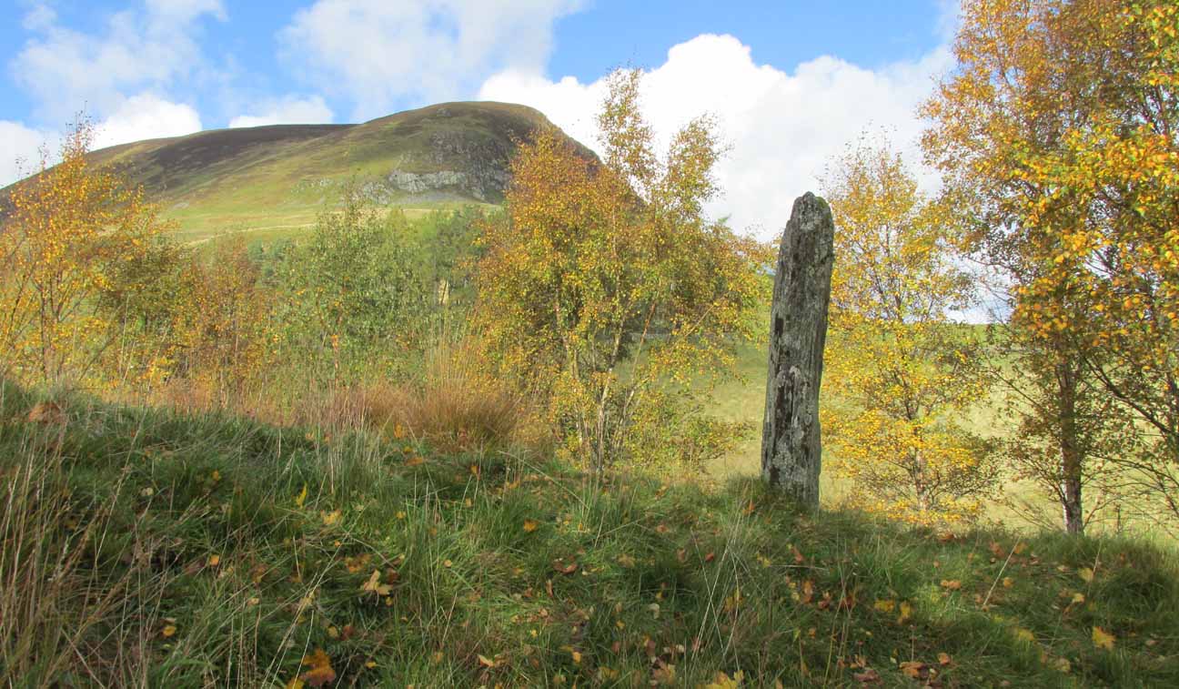
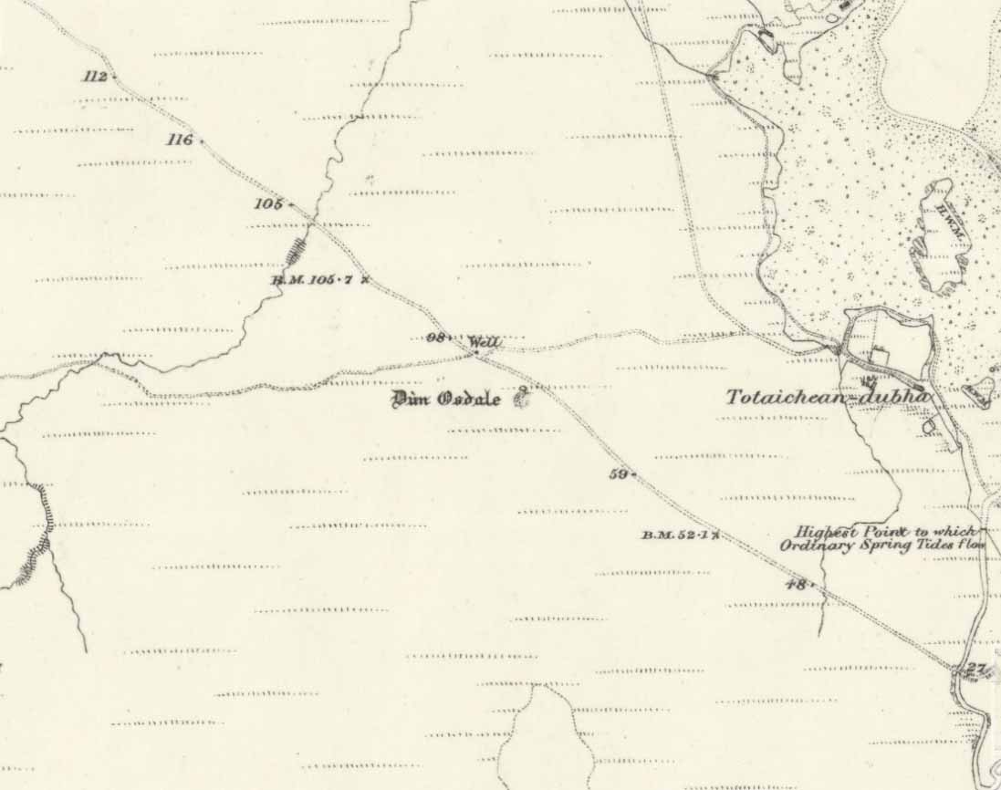
Souterrain:  OS Grid Reference – NO 2529 3738

Also Known as:

  1. Canmore ID 30539
  2. The Cave
  3. Pitcur II (Wainwright)

Getting Here

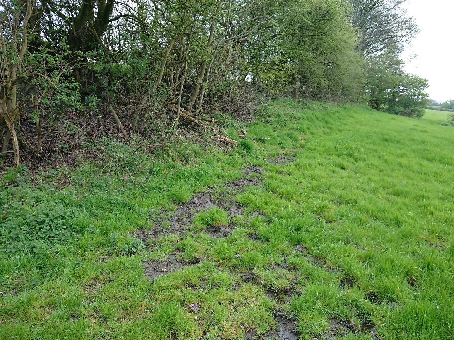
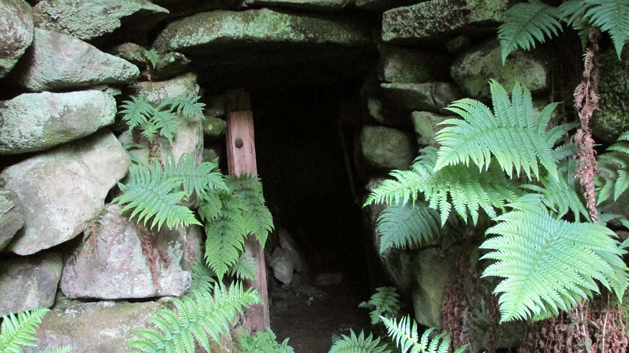
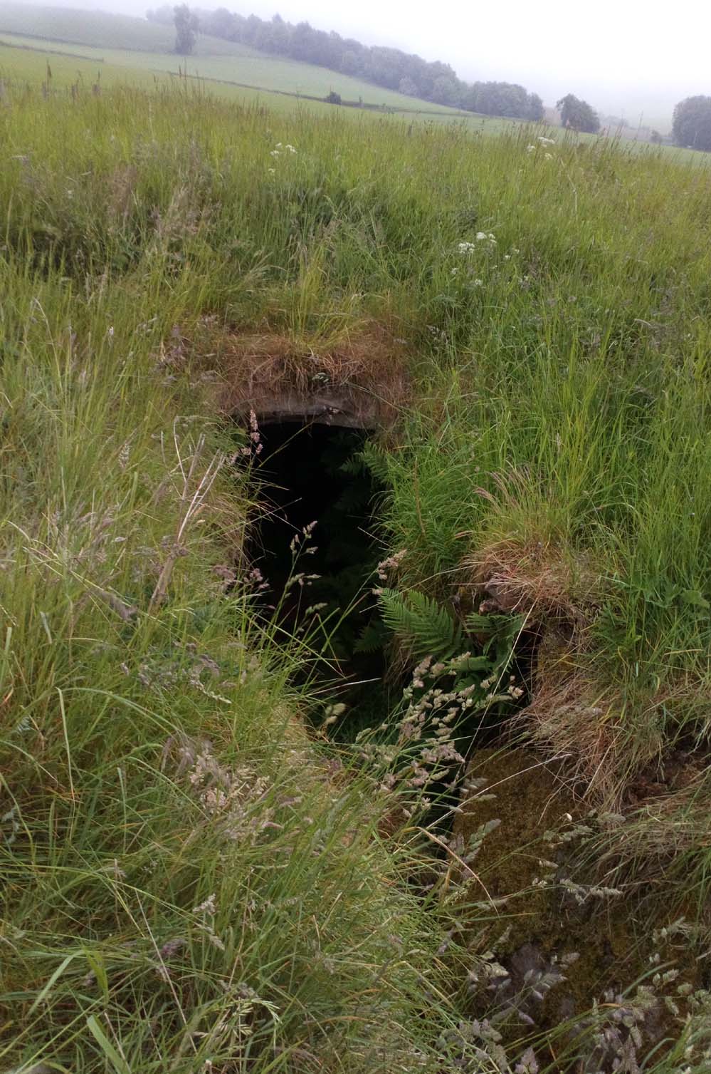
Pitcur souterrain entrance

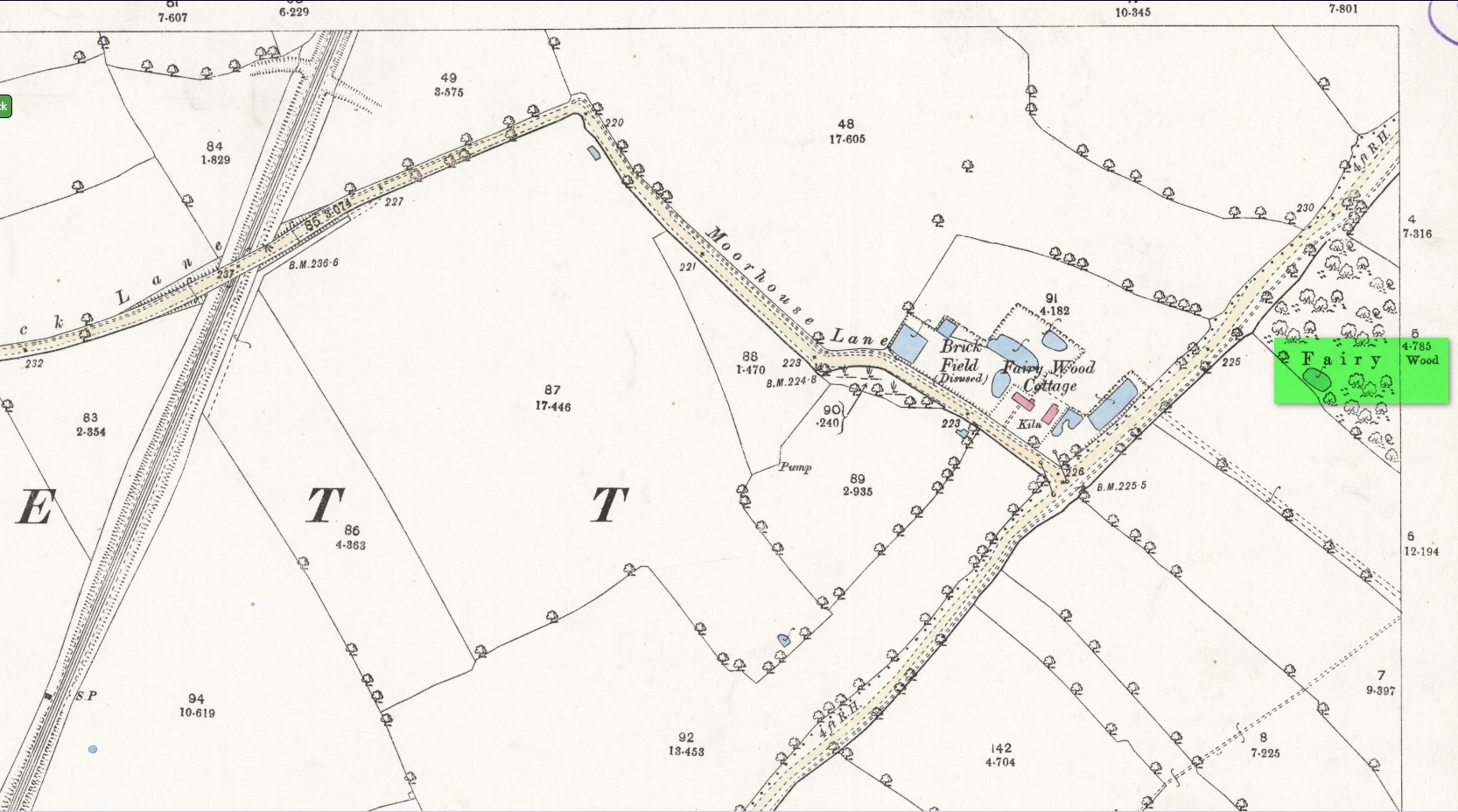
From Coupar Angus, take the A923 road southeast for nearly 2½ miles where you reach the crossroads.  Keeping walking along the A923 for just over 300 yards, then where you come to the second field on your left, follow the line of fencing the slope until you reach an overgrown fenced section.  It’s in there!

Archaeology & History

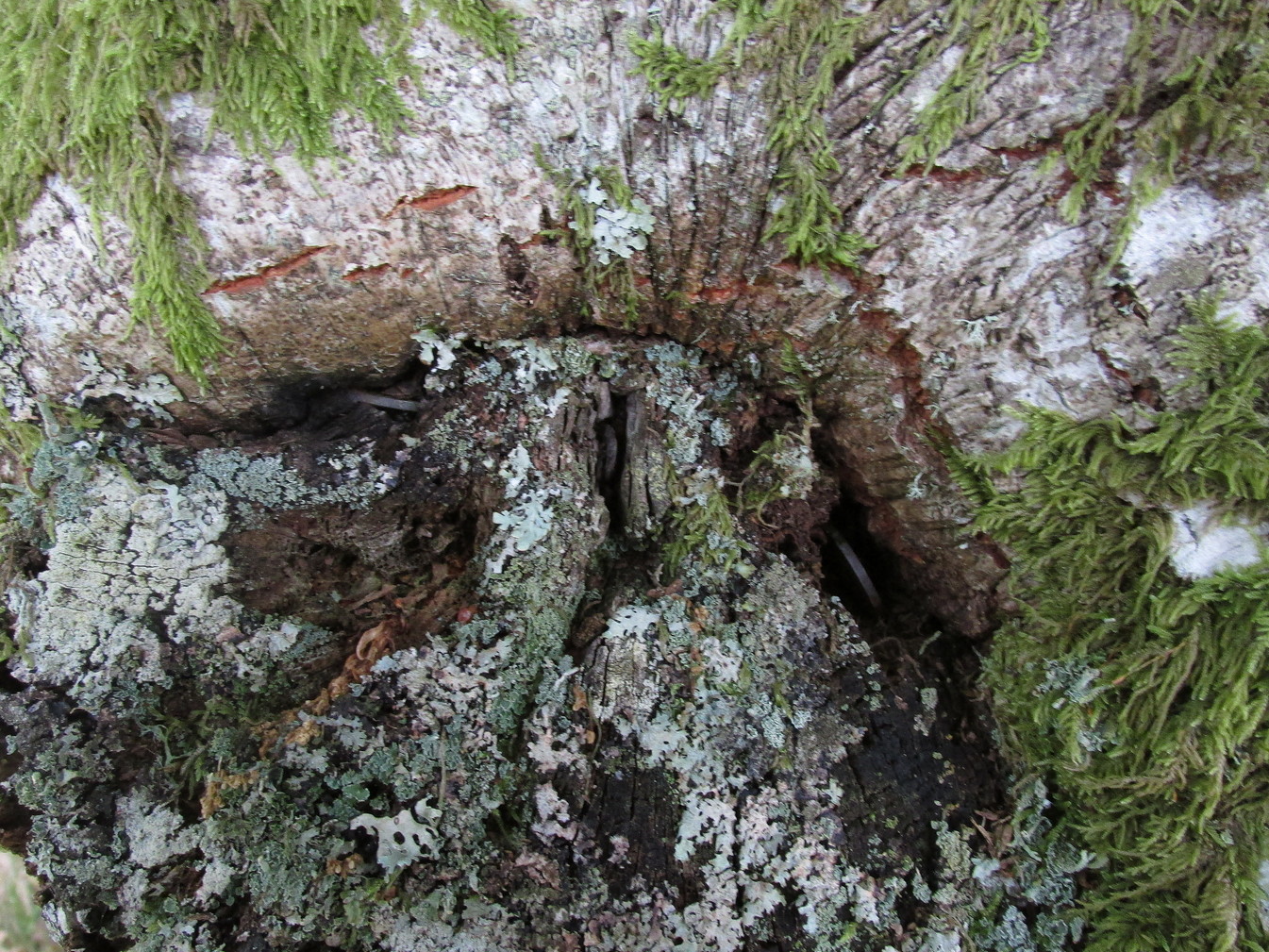
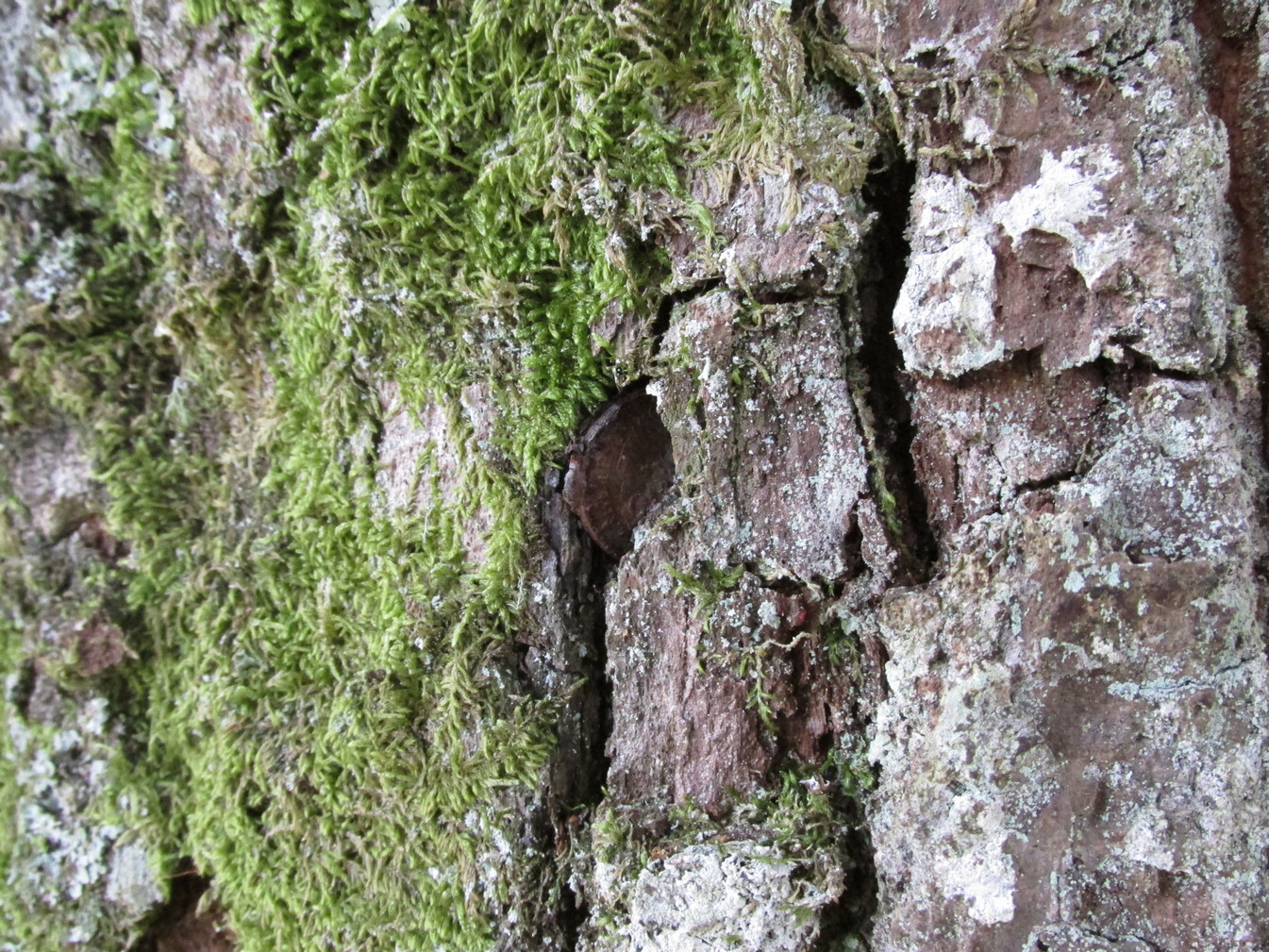
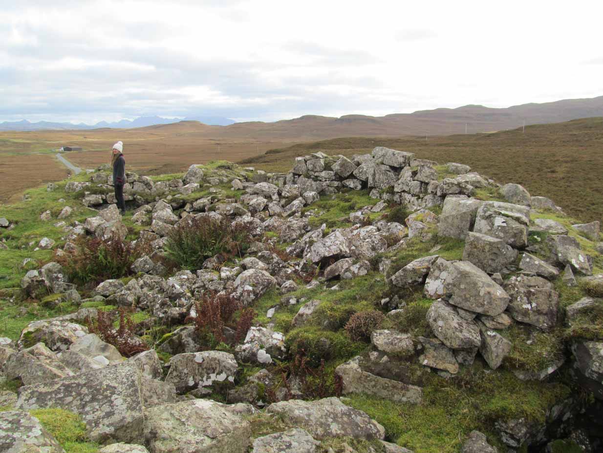
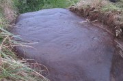
This is a mightily impressive site, which I’ve been looking forward to experience for many an age.  And—despite Nature covering it in deep grasses—it was even better than any of us anticipated.  Souterrains are ten-a-penny in this part of Scotland, but this one’s a beauty!  Here, dug 6-8 feet into the ground are at least two long curvaceous passageways, linked by another stone-roofed passageway—with the longest central passage leading at one end into a completely covered stone hallway, whose end is blocked by a massive fall of earth.  Outside this entrance, laid on the ground, is what looks like a possible old stone ‘door’ that may have once blocked the entrance, now fallen into disuse.  It is too small to have been a roofing stone.  In the walling just outside the entrance, on your left, you will see a faint cup-marked stone (Pitcur 3:5) and a larger cup-and-ring stone (Pitcur 3:6), both just above ground-level.

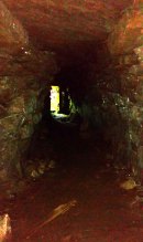
Inside looking out (photo by Frank Mercer)

Outside looking in (photo by Frank Mercer)

The site is evocative on so many levels: not least because we still don’t know what the hell it was used for.  The over-used idea that souterrains were cattle-pens makes no sense whatsoever here; the idea that they were food storage sites is, I suppose, a possibility; that they were possible shelters for people during inter-tribal raids is another; and equally as probable is that the deep dark enclosed construction was used by shamans, or neophytes enclosed for their rites of passage.  Iron Age archaeology specialist Ian Armit (1998) thought there may well be some as yet undiscovered “timber roundhouse” associated with this souterrain, awaiting excavation.  He may be right.  When we came here the other week we found previously unrecorded cup-and-ring carvings, at a site already renowned for decent petroglyphs.  A post-winter visit will hopefully bring us more finds.

The general history of this strange site is captured in Wainwright’s (1963) survey of souterrains, in which he wrote:

“Pitcur II was discovered in 1878 when a large stone, hit by a plough, was removed to reveal an underground passage.  Mr John Granger, tenant of Pitcur farm, excavated the souterrain himself, and twenty-two years later his son, Mr A. Granger Heiton, said that the only objects found by members of his family were ‘a small red clay bowl of Samian ware in pieces’ and ‘a Roman coin.’  The latter, according to David MacRitchie, ‘has been lost sight of’.  Mr Granger Heiton also told McRitchie that ‘one or two other coins were reported as having been found’, but were not seen by his father.

“As an excavation, Mr Granger’s effort seems to have been unsatisfactory by any standards, and it was followed by a ‘supplementary excavation’ conducted by Mr R. Stewart Menzies.  This was more successful as a relic-hunting operation, if not as an archaeological excavation, for between one hundred and two hundred finds are reported, including ‘a bronze pin’ and ‘a quantity of stones, beads, etc.’  But these too ‘seem to have been mislaid.’

Newly-found Pitcur 3:2 carving

Curiously Mr Wainwright made little mention of the impressive petroglyphs within this complex, save to say that “they were too heavy to be removed and ‘mislaid’.”  There are at least seven of them at Pitcur-3: four complex cup-and-ring designs and three basic cup-marked stones (described individually in separate site-profiles).  They have all been incorporated into the walls and roofing stones. At least one of these is so eroded (Pitcur 3:2) that there is little doubt it was re-used from a now-lost neolithic structure; the rest may have been from Bronze Age sites (also lost) and their respective lack of erosion shows they have been inside this Iron Age structure, away from Nature’s wind and weathering effects. It is likely that the re-use of these carvings in Pitcur-3 was of significance to the builders; although we cannot be sure as to what their function may have been within the souterrain.  It’s quite possible that some form of ‘continuity of tradition’ as posited by David MacRitchie (1890) was in evidence, over that huge time scale from the neolithic into the Iron Age, relating specifically to the animistic plinth implicit in all early agrarian cultures.

But the first real overview of the site was written at the end of the 19th century by David MacRitchie (1900), over twenty years after its rediscovery in 1878.  His account was a good one too:

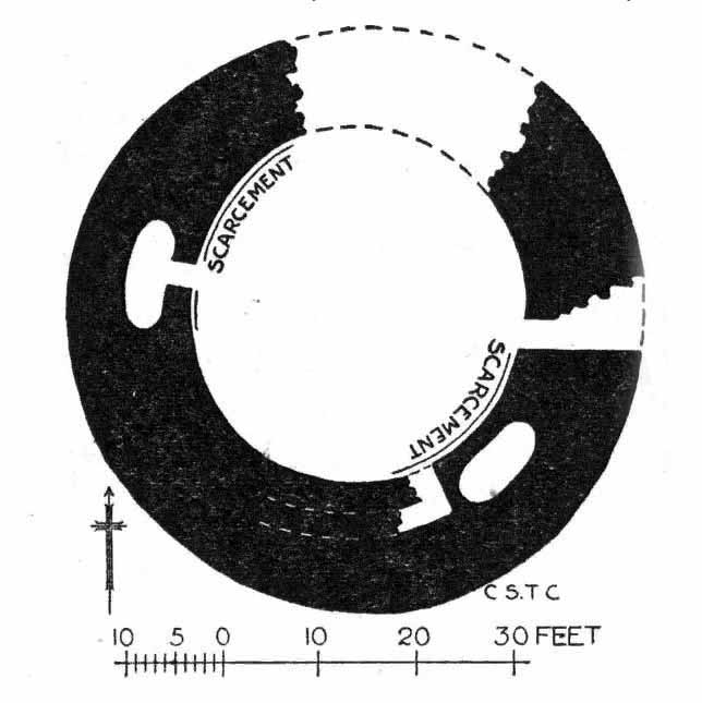
“The Pitcur house consists of one long subterranean gallery, slightly curved throughout most of its length, and bending abruptly in a hook shape at its western end. From this western end a short broad gallery or room goes off, curving round the outside of the ‘hook.’ The length of the main gallery, following the medial line, and measuring from the extreme of the entrance at either end, is almost 190 feet; while the subsidiary room is 60 feet long. For most of its length, this subsidiary room is 10 feet wide, measuring at the floor level. On account of this unusual width, it is reasonable to suppose that its roof was of timber; for although the walls slightly converge at the top, reducing the intervening space to 8 or 9 feet, the span is still so great that a flagged roof would scarcely have been practicable. To be sure, the walls might have been raised several courses higher, in the usual ‘ Cyclopean arch,’ and thus the interval to be bridged would become sufficiently narrowed at a height of say 12 feet. But there is no indication that the walls of any portion of this earth-house ever rose higher than the present level of their highest parts. Thus the inference is that this subsidiary room may have been roofed with timber.”

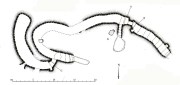
Modern groundplan (after RCAHMS, 1994)

MacRitchie’s 1900 groundplan

It may, but we have no remaining evidence to tell us for sure. MacRitchie cited possible evidences from elsewhere to add weight to this thought, but had the humility to leave the idea open, telling simply how “no vestige of a roof is visible at the present day, and the whole of this side room is open to the sky,” as with the majority of this entire souterrain.  In my opinion, more of it would have been roofed in stone slabs, but these would seem to have been robbed.  Certainly a well-preserved cup-marked stone (Pitcur 3:3) laying up against one of the walls appears to have slid from its topmost covering position into where it now rests in the passageway (near ‘b‘ in MacRitchie’s plan).

Continuing with Mr MacRitchie’s account, he (like most of us) found the underground section most impressive, telling:

“This covered section is unquestionably the most interesting and instructive of the whole building; for, as already stated, the other parts are more or less ruined and roofless. A few remaining flags lying in the unroofed part of the main gallery show, however, that it once possessed the usual stone roof throughout its entire length. This was rendered possible by the comparative narrowness of the main gallery, the width of which on the floor averages about 6 feet. The greater breadth of the subsidiary gallery will be realised by glancing at the cross section, a-b in the plan.

“The Pitcur earth-house had at least three separate entrances, namely, at the points hi, and j.  The subsidiary room appears also to have had an independent connection with the, outside world, at the point g, and perhaps also f, though the latter may only mark a fireplace or air-hole, for the condition of the ruin makes it difficult for one to speak with certainty. The entrance at i, which slopes rapidly downward, is roofed all the way to d; and consequently this short passage remains in its original state.

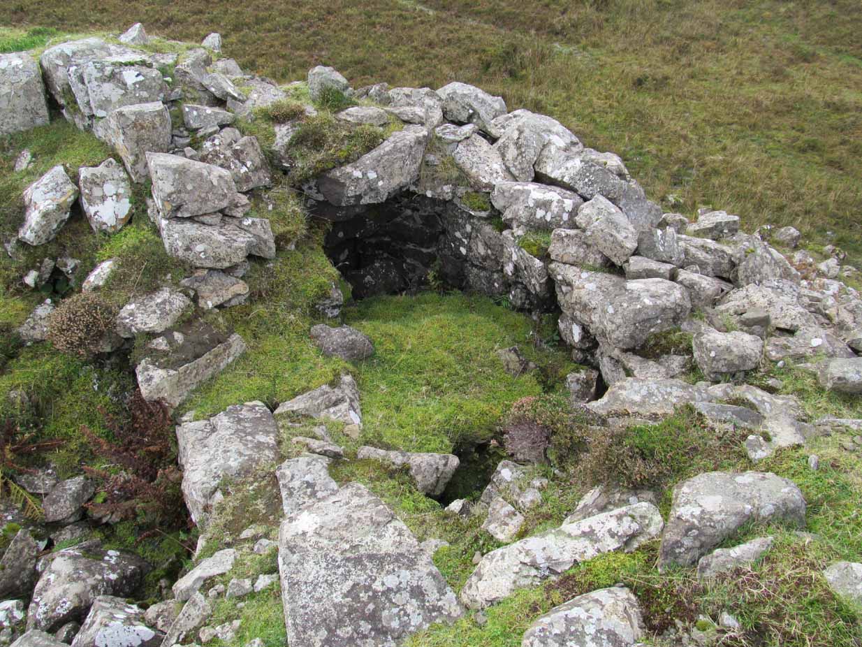
“Within the covered portion, and quite near its entrance, a well-built recess (e in the plan) seems clearly to have been used as a fireplace, although the orifice which presumably once connected it with the upper air is now covered over.  Another and a smaller recess in the covered portion (k in the plan) can hardly have been a fireplace, and it is difficult to know what it was used as.

“One other point of interest is the presence of two cup-marked stones (p and q on the plan). Of these, the former is lying isolated on the surface of the ground near the entrance i, while the latter forms one of the wall stones beside the doorway c.”

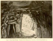
‘Fireplace’ near the entrance

The internal ‘cave’ section has that typical damp smell and feel to it, beloved of underground explorers.  As we can see in MacRitchie’s old photo of the site, the seeming ‘fireplace’ that he mentions is very obvious. Frank Mercer posited the same idea about this underground alcove when he first saw it, and it makes a lot of sense.  On the left-upright stone in the photo (right) you can just make out a single cup-marking (Pitcur 3:7) which we found when we visited; another one may be on the inside edge of the same fireplace.  If you climb up on top of the souterrain close to where the opening of the fireplace would have been, you’ll see the impressive Pitcur 3:5 petroglyph; whilst the Pitcur 3:1 carving is difficult to see (though Mr Mercer noticed it), just above ground-level, beneath the covering stone ‘m‘ in MacRitchie’s plan.  All in all, a bloody impressive place!

Folklore

In earlier centuries the site was known locally as The Cave, yet considering how impressive it is, folklore and oral tradition seem sparse.  Even David MacRitchie (1897) struggled to find anything here.  But in one short article he wrote for The Reliquary, he thought that stories of little-people may have related to Pitcur-3:

“A tradition which a family of that neighbourhood has preserved for the past two centuries, has, in the opinion of the present writer, a distinct bearing upon the “cave” and its builders.

“This is that, a long time ago, a community of “clever” little people, known as “the merry elfins,” inhabited a “tounie,” or village, close to the place. The present inheritors of the tradition assume that they lived above ground and do not connect them at all with this “cave,” of whose existence they were unaware until a comparatively recent date. But, in view of a mass of folk-lore ascribing to such “little people” an underground life, the presumption is that the “tounie” was nothing else than the “cave”. This theme cannot be enlarged upon here; but a study of the traditions relating to the inhabitants of those subterranean houses will make the identification clearer.

“It may be added that the term “Picts’ house” applied to the Pitcur souterrain, is in agreement with the inherited belief, so widespread in Scotland, that the Picts were a people of immense bodily strength, although of small stature.”

References:

  1. Armit, Ian, Scotland’s Hidden History, Tempus: Stroud 1998.
  2. Barclay, Gordon, “Newmill and the ‘Souterrains of Southern Pictland’”, in Proceedings Society of Antiquaries, Scotland, volume 110, 1980.
  3. Mackenna, F.S., “Recovery of an Earth House”, in The Kist, volume 4, 1972.
  4. Mackie, Euan, Scotland: An Archaeologial Guide, Faber: London 1975.
  5. MacRitchie, David, The Testimony of Tradition, Kegan Paul: London 1890.
  6. MacRitchie, David, “Pitcur and its Merry Elfins,” in The Reliquary, 1897.
  7. MacRitchie, David, “Description of an Earth-house at Pitcur, Forfarshire,” inProceedings Society of Antiquaries, Scotland, volume 34, 1900.
  8. Neighbour, T., “Pitcur Souterrain (Kettins parish)”, in Discovery & Excavation Scotland, 1995.
  9. Royal Commission on the Ancient & Historical Monuments of Scotland, South-East Perth: An Archaeological Landscape, HMSO: Edinburgh 1994.
  10. Wainwright, F T., The Souterrains of Southern Pictland, RKP: London 1963.
  11. Warden, Alex J., Angus or Forfarshire: The Land and People – Descriptive and Historical – 5 volumes, Charles Alexander: Dundee 1880-1885.
  12. Young, Alison, “Cup-and ring Markings on Craig Ruenshin, with some Comparative Notes“, in Proceedings Society of Antiquaries, Scotland, volume 72, 1938.

Acknowledgements:  This site profile would not have been made possible were it not for the huge help of Nina Harris, Frank Mercer & Paul Hornby.  Huge thanks to you all, both for the excursion and use of your photos in this site profile. 🙂

© Paul BennettThe Northern Antiquarian


Dun Osdale, Dunvegan, Skye

Broch:  OS Grid Reference – NG 24162 46424

Also Known as:

  1. Canmore ID 10832

Getting Here

Dun Osdale, by the roadside

From the A863 Dunvegan road, a mile south of the village turn onto the B884 road at Lonmore, making sure you veer right after a few hundred yards and head towards Glendale.  About a mile along, on the left-hand side of the road, note the small rocky crag that begins to grow just above the roadside.  At the end of this crag you’ll see a huge pile of rocks, seemingly tumbling down, just by a small T-junction to Uiginish.  You can’t really miss it.

Archaeology & History

Listed as one of the duns, or fortified prehistoric structures in Skye by the old writer J.A. MacCulloch (1905), the rediscovery of this broch was, said A.A. MacGregor (1930), one that “became historical only within living memory.”  I find that hard to believe!  The Gaelic speakers hereby merely kept their tongues still when asked, as was common in days of olde—and it was a faerie abode….

Looking at the SW walling

Looking at the SE walls

Once you go through the gate below the broch, the large boggy area you have to circumnavigate is the overflow from an ancient well, known as Tobar na Maor, where Anne Ross said, “tradition that the stewards of three adjacent properties met there.”  This well was covered by an ancient Pictish stone (now in Dunvegan Castle), which may originally have been associated with the broch just above it.  When I visited the site with Aisha and Her clan, we passed the overgrown well and walked straight up to the broch.

Despite being ruinous it is still most impressive.  The massive walling on its southwestern side is still intact in places; but you don’t get a real impression of the work that went into building these structures until you’re on top.  The walls themselves are so thick and well-built that you puzzle over the energy required to build so massive a monument.  And Scotland has masses of them!

Aisha in the broch

Small internal chamber

The site was surveyed briefly when the Ordnance Survey lads came here in 1877, subsequently highlighting it on the first OS-map of the area.  But it didn’t receive any archaeocentric assessment until the Royal Commission (1928) lads explored the area some fifty years later.  In their outstanding Inventory of the region they described Dun Osdale in considerable detail, although kept their description purely architectural in nature, betraying any real sense of meaning and history which local folk must have told them.  They wrote:

“The outer face of the wall of the broch for a great part is reduced to the lower courses, but on the west-southwest a section still maintains a height of about 7 feet; on the south-side, although hidden by fallen stones, it is about 4 to 5 feet high, and on the northeast there is a very short section 3 feet in height.  The stones are of considerable size and laid in regular courses.  In the interior a mass of tumbled stone obscures the most of the inner face of the wall, but on the south and northwest it stands about 8 feet above the debris.  The broch is circular with an internal diameter of 35 feet to 35 feet 6 inches, and the wall thickens from 10 feet on the north to 13 feet 7 inches on the south. The entrance, which is one the east, is badly broken down, but near the inside has a width of 3 feet 2 inches, and appears to have been 2 feet 10 inches on the outside; it has run straight through the wall without checks.  In the thickness of the wall to the south of the entrance is an oval chamber measuring 10 feet long by 4 feet 9 inches broad above the debris with which it is half-filled.  The roof has fallen in, but the internal corbelling of the walls is well displayed.  The fallen stones no doubt still cover the entrance, which has probably been from the interior.  Within the western arc of the wall, nearly opposite the main doorway, is another oval cell 12 feet in length and 4 feet 6 inches in breadth over debris, with a doorway 2 feet 9 inches wide; its outer and inner walls are 5 feet 9 inches, and 2 feet 6 inches respectively.  The roof od this chamber has also collapsed, but from the masonry which remains in position it must have been over 6 feet in height.  Immediately to the west of the cell near the entrance are exposed the left jamb of a door and a short length of a gallery 3 feet 6 inches wide in the thickness of the southern wall, which probably contained the stairs, as traces of a gallery at a higher level than the oval chambers are seen here, the inner wall being about 3 feet and the outer 8 feet thick. Parts of a scarcement 9 inches wide can be detected on the northwestern and southeastern arcs.”

Dun Osdale plan (RCAHMS 1928)

Dun Osdale on 1881 map

Measurements and architectural tedium aside, the broch is worthwhile for anyone interested in our ancient mythic past, not least because of its position in the landscape and its visual relationship with other sites of the same period nearby.  As well as that, there are unrecorded ancient sites still hiding in these olde moors…

Folklore

Tradition tells that Dun Osdale was used as a watch-tower by the tribal folk—which seems quite credible.  But the original inhabitants of Duirinish, the sith or fairy folk, were also said to live here.  It’s one of several places in Duirinish where the legendary Fairy Cup of Dunvegan was said to have come from.  Otta Swire (1961) told its tale:

“One midsummer night a MacLeod, searching for strayed cattle, stayed late on the moor.  In the moonlight he saw the door of Dun Osdale open and the little people come out, a long train of them, and began to dance on the green grass knoll nearby.  Fascinated, he watched, forgetting everything but the wonderful dance. Suddenly he sneezed.  The spell was broke.  The dance stopped.  MacLeod sprang up to fly, but the fairies were upon him and he was dragged, willy-nilly, into the dun.  Inside, as soon as his eyes grew accustomed to that strange green light associated with fairyland, he beheld a pleasing sight.  A great banquet was spread on a large table carved from a single tree: on it were vessels of gold and silver, many of them set with jewels or chased in strange designs.  His fairy ‘hosts’ led him to the table, poured wine into one of the beautiful cups and, giving it to him, invited him to toast their chief.  Now this man’s mother was a witch, so he knew well that if he ate or drank in the dun he was in the Daoine Sithe’s power for ever.  He lifted the cup and appeared to drink the required toast, but in fact skilfully let the wine run down inside his coat.  As soon as his neighbours saw the cup was half empty, they ceased to bother about him but went off on their own affairs or to attend the banquet.  Thereafter MacLeod watched for a chance of escape and, when one offered, slipped quietly through the door of the dun and away, carrying the cup with him.

“The fairies soon realised what had happened and started in pursuit, but he was already across the Osdale river and in safety.  He hurried home, told his mother the story, and showed her the cup.  Being a wise woman she realised the peril in which he undoubtedly stood and at once put her most powerful spell upon him to protect him from the arts of the Daoine Sithe, warning him seriously never to leave the house for a moment without getting the spell renewed.  But she forgot to put a protecting spell upon the cup also.  The fairies soon discovered the exact state of affairs and immediately laid their own spell upon the cup, a spell so powerful that all who saw the cup or even heard of it, were seized with an overmastering desire to possess it, even if such possession involved the murder of the holder.

“For a year, all went well and thanks to his mother’s care the young man went unharmed.  Then he grew careless and one day ventured out without the protecting spell.  A one-time friend, bewitched by the cup, had been awaiting just such a chance and immediately murdered him and went off with the prize.  The fairies, their revenge achieved, took no further interest in the matter, but MacLeod of MacLeod did.  The boy’s mother hurried to him with her story, and he at once gave orders that the murderer be found and brought to justice.  He was duly hanged and the trouble-making cup, now free of enchantment, passed into the possession of the chief and can still be seen in (Dunvegan) castle.”

References:

  1. Donaldson-Blyth, Ian, In Search of Prehistoric Skye, Thistle: Insch 1995.
  2. MacCulloch, J.A.,  The Misty Isle of Skye, Oliphant, Anderson & Ferrier: Edinburgh 1905.
  3. MacGregor, Alasdair Alpin, Over the Sea to Skye, Chambers: Edinburgh 1930.
  4. Royal Commission on Ancient & Historical Monuments of Scotland, Inventory of Monuments and Constructions in the Outer Hebrides, Skye and the Small Isles, HMSO: Edinburgh 1928.
  5. Swire, Otta F., Skye: The Island its Legends, Blackie & Sons: Glasgow 1961.

Acknowledgements:  Eternally grateful to the awesome Aisha Domleo and Her little clan for getting us to this ancient haven on Skye’s endless domain of natural beauty.  Without Her, this would not have been written.  Also, accreditation of early OS-map usage, reproduced with the permission of the National Library of Scotland.

© Paul BennettThe Northern Antiquarian


Fiscary (4), Farr, Sutherland

Cairn:  OS Grid Reference – NC 72858 62620

Also Known as:

  1. Canmore ID 6437

Getting Here

Approaching Fiscary 4, north

Approaching Fiscary 4, north

A mile east of Bettyhill on the A836 road, watch for the large piles of rocks up on the hill on your left (north).  Turn left on the tiny road past the first house for 150 yards and then on the track past the sheep-fanks through the gate and up the small hill.  The cairn is the smallest of the pile of rocks in front of you.

Archaeology & History

Of the four giant cairns clustered here at Fiscary, a mile east of Bettyhill, this one has received the least attention.  It is found amidst a massive cluster of archaeological remains running from the 19th century all the way back into the neolithic period. Quite impressive!

Sitting on top of the cairn the view is impressive: looking 360º with the Orkney islands s to the northeast, Durness and the rising mountains west and southwest, and endless craggy moorlands peppered with lochans driving in all directions to the south countless miles away.  This panorama of wilderness is something to behold…

Looking west out to sea

Looking west out to sea

Looking southwest

Looking southwest

The tomb itself, with the acceptable scatter of fallen rocks to the edges, is nearly 50 yards in circumference, measuring more than 12 yards east-west and nearly 14 yards north-south, with the Earth covering the older rocks to the edges with more and more vegetation as the years pass.  It stands about 5-6 feet high with the typical internal mass of thousands of stones making up the cairn.  No known excavations have ever been made here.

In the otherwise superb Royal Commission (1911) survey of Sutherland, they only had scant information to say about this tomb, telling that,

“The fourth cairn…measures 28′ to 30′ in diameter and is about 6′ high.  There are no signs of chambers visible and the cairn has been a good deal dilapidated.”

Even when R.J. Mercer (1981) came to give this area greater attention, he passed by the Fiscary 4 cairn with equal brevity, noting simply its dimensions, elevation above sea level and the fact that it is a “circular cairn on crest of hill.”

The tombs of Fiscary 12 and 3 are very close by some beginning some 257 yards (235m) to the east.  I cannot recommend this entire complex highly enough!

References:

  1. Henshall, Audrey S., The Chambered Cairns of Sutherland, Edinburgh University Press 1995.
  2. Mercer, R.J. & Howell, J.M., Archaeological Field Survey in Northern Scotland – volume 2, University of Edinburgh 1981.
  3. o’ Reilly, Kevin & Crockford, Ashley, What to See Around Bettyhill, privately printed 2009.
  4. Royal Commission on Ancient & Historical Monuments, Scotland, Second report and inventory of monuments and constructions in the county of Sutherland. HMSO: Edinburgh 1911.

© Paul Bennett,  The Northern Antiquarian 2016