Old Bess Stone, Oakworth Moor, West Yorkshire

Standing Stone:  OS Grid Reference – SD 978 389

Getting Here

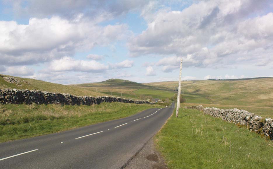
A bittova wander with not much to see, if truth be had.  Best way here’s from the top Oakworth Road heading to the Lancashire border, right on the moor-edge.  Go along the Hare Hill Edge road for a coupla miles till you hit the Pennine Way.  Walk along it up onto the moor, following the dead straight walling for several hundred yards.  Where the walling stops, all of a sudden, stop! (there’s a wooden post here)  Now walk left (west) across the heath for less than 100 yards.  You’ll find it…

Archaeology & History
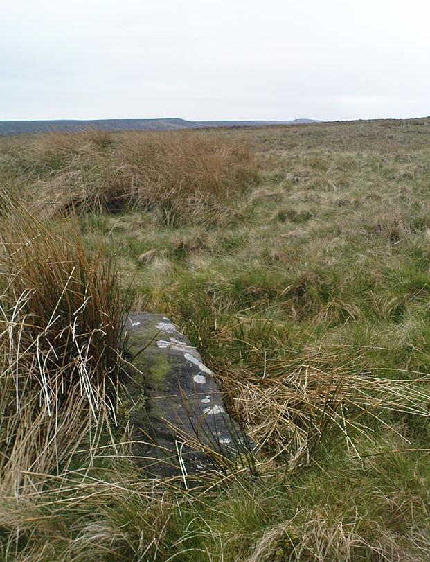
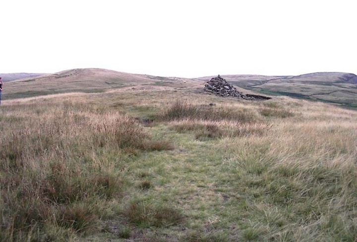
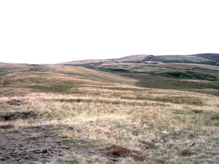
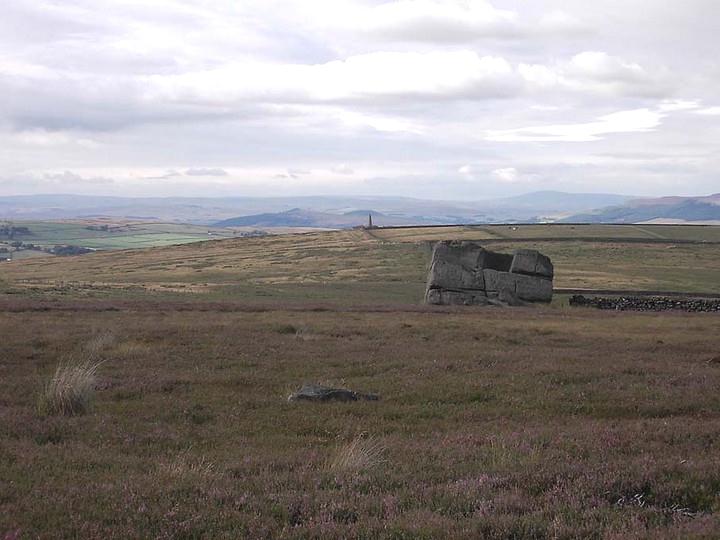
Old Bess Stone, with Crow Hill on the distant skyline

I’ve found nothing of this site in archaeology records – but that’s likely down to me not looking hard enough!  I’m not even sure that it’s prehistoric – but as there’s nowt written about it, and there are other sites which relate to this old stone, it’s certainly worthy of mention.

The stone lays in the grasses, some four-feet long, with a more recent 18th-19th century boundary stone laid a few feet away.  It seems most likely that Old Bess had stood here much longer though.  Old Bess seems to be the first in a row of at least 6 seemingly unrecognized boundary stones running northwest in a straight line up to the Wolf Stones, about half-a-mile from here.  Neither the early, nor modern OS-maps show any of these stones, several of which are accompanied by earlier, more worn stones – two of which have the letters ‘C.C.’ or ‘G.C.’ carved on them.

Old Bess 'hut circle'
Old Bess ‘hut circle’ (it’s there – honest!)

About 10 yards north of Old Bess are the remains of a very noticeable oval-shaped ‘hut circle’ – or something closely resembling such remains.  About five yards across at the most, with stone walling making up the edge of the ring beneath the moorland grasses, an excavation here wouldn’t go amiss!  Although it’s hard to see in this photo (it’s the roughly circular rise in the middle), when you’re on the moor it’s obvious.   It looks and feels as if the remains were something from medieval times, or perhaps even later – but it’d be good to know for sure!  The remains of an old delph 100 yards south may account for more of Old Bess and its accompanying hut circle than owt prehistoric.

From Old Bess, walk in a straight line towards the large rock outcrop of the Wolf Stones, northwest of here.  After a short distance you’ll come across another large stone, cut and shaped in bygone centuries (not prehistoric though) laying in the boggy tussock grass and looking similar to Old Bess.  Another 100 yards on from here, along the same straight line towards the Wolf Stones, you’ll find another cut stone of similar dimensions; and from here you’ll see another stone about the same distance again ahead of you.  These would appear to be the lost medieval boundary stones which led to a boundary dispute between the counties of Yorkshire and Lancashire a few centuries ago.  For those medieval historians amongst you, check ’em out: it would appear that these are the lost stones (pushed over, obviously) which led to the said dispute.  How on earth no-one’s found ’em previously beggars belief!

Folklore

A little-known site with a spirit ancestor giving rise to its name.  Surrounding it are tales of little people, for just above it is where the faerie lived at the Fairy Fold Dike.  While a couple of hundred yards west lived an old hob (another faerie creature) who used to drink from an old well named after him, the Hob Ing Spring.  Victorian lore tells of druidic folklore further up the moor by the old Wolf Stones, which is linked to Old Bess by virtue of the line of old boundary stones running from here.

© Paul Bennett, The Northern Antiquarian

Nursery Knot, Appletreewick Moor, North Yorkshire

Sacred Hill:  OS Grid Reference – SE 081 636

Also known as:

  1. Nursa Knott
  2. Nursery Hill

Getting Here

Dead easy.  Follow the Grassington-Pateley Bridge road (B6265) east and about 2 miles past Hebden village, the craggy hill rises to the left-hand side of the road, as you can see in the photo below.  Simple!

Archaeology & History

Nursery Knott hill
Nursery Knott hill

When fellow rock-art freaks Graeme Chappell, Richard Stroud and I were exploring the cup-and-ring stones in the area just south of here a few years back, this hill kept calling out with some repeated awe. “There’s summat about that place,” were the remarks we kept saying – but we could never put our finger on it. (still haven’t if truth be had!).  Between here and the awesome Simon’s Seat to the south, a whole panoply of neolithic and Bronze Age remains scatter the land — and if ritual landscape has any validity, this hill is undoubtedly enmeshed in the mythic framework of such a paradigm. But without any folklore I didn’t feel right to include it here…

At the northern or rear-end of this great outcrop (SE 082 640) is a scattering of many boulders, one of which in particular at Knot Head was explored by a Mr Gill in 1955 and found to have a number of Mesolithic worked flints all round it. Seems as if folk have been up to things round here for even longer than we first thought.  Microlith or flint-hunters would probably do well on the moors up here!

Folklore

It’s the old pen of our Yorkshire topographer Edmund Bogg which brings the lost folktale of this place back to life – and it’s typical of aboriginal creation myths from elsewhere in the world. In his Higher Wharfeland he had this to say of old ‘Nursa Knott’, as it was locally known:

“The old legend is that the devil, for some reason anxious to fill up Dibb Gill,* was carrying these ponderous crags in his apron when, stumbling over Nursa Knott, the strings broke and the crags fell. Legend also says, should the crags be removed they will be carried by some invisible power back to their original position.”

He then reminds us of links with old Wade, plus the settlement of old Grim, a short distance to the north.

Across the road down the track running south to Skyreholme, Jessica Lofthouse ( 1976) told the tale of a ghostly horseman, seen by her great-grandfather no less! Suggesting he may have been ‘market merry’ (i.e., pissed!), she told how he “struck out at a spectral white horse at the Skyreholme three-land ends near Appletreewick – and his stick passed through it!”

References:

  1. Bogg, E., Higher Wharfeland: The Dale of Romance, James Miles: Leeds 1904.
  2. Lofthouse, Jessica, North Country Folklore, Hale: London 1976.
  3. Walker, D., ‘A Site at Stump Cross, near Grassington, Yorkshire, and the Age of the Pennine Microlithic Industry,’ in Proceedings of the Prehistoric Society, 1956.

* Dibb Gill is nearly a mile due west of here – and Dibble’s Bridge which crosses the beck was also known as the Devil’s Bridge, with a few typical creation myths of its own attached.

© Paul Bennett, The Northern Antiquarian

Lower Apronful of Stones, Pendle Hill, Lancashire

‘Cairn’:  OS Grid Reference – SD 778 390

Getting Here

Park up at the Nick of Pendle and follow directions to the Devil’s Apronful of Stones, but about halfway along the path, bear to the right along a swerving footpath which eventually takes you to another guiding cairn. On the OS-maps there’s the Chartist’s Well 100 yards due west of this old overgrown tomb.

Archaeology & History

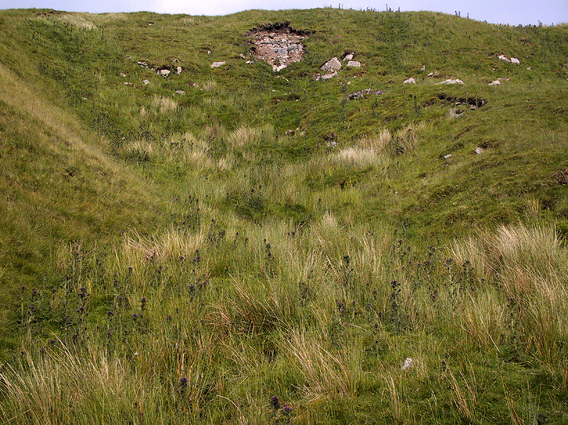
The much-overgrown Lower Apronful, with modern cairn on top
The much-overgrown Lower Apronful cairn

Seemingly excluded from all previous archaeological surveys, this is a very large structure indeed.  Crowned with a small modern cairn on its top marking a small footpath crossing the site, this very large cairn-like structure is about four feet tall at the highest.  I first came across it at the end of August, 2006, after going through some folklore records which then led to exploring the area in the hope that there might be some archaeological ruins in the region — and we weren’t to be disappointed!

Outline of extended monument

This giant cairn structure is larger than the denuded remains of the Devil’s Apronful cairn that can be seen a few hundred yards further uphill, but is almost entirely overgrown with grasses.  It measures at least 31 yards (east-west) by 29 yards (north-south) and is just like an overgrown Little Skirtful of Stones on Burley Moor. Parts of its eastern side have been dislodged and the main rock structure is plainly visible where the vegetation has come away.  A ringed embankment is also very clear, mainly on the north and eastern sides of this large structure (as one of the photos here shows), but on the whole it is overgrown and ruinous.  It’s a brilliant spot though and sorely needs some proper archaeological attention.  In the event that this site aint a prehistoric cairn, please lemme know so I can delete it from TNA.

© Paul Bennett, The Northern Antiquarian

Kelpie’s Stane, Corgarff, Aberdeenshire

Legendary Rock:  OS Grid Reference – NJ 264 087

Also known as:

  1. Kelpie Stone

Folklore

The old Scottish folklorist, A.A. MacGregor, described this legendary rock, “by the Bridge of Luib, on the River Don,” in his classic Peat Fire Flame. (1937)  One of the numerous ‘holed stones,’ it was one of countless rocks in our isles imbued with animistic spirit essence, akin to similar rocks found in all of the other cultures in the world.  MacGregor told how,

“It happened that a man summoned to the death-bed of a relative came to this crossing-place just after torrential floods had carried away the bridge. When he was on the point of abandoning all hope of reaching the opposite bank, a tall man appeared from nowhere and volunteered to carry him across. The distracted homecomer accepted the assistance proffered. But, when he and his carrier reached mid-river, the latter reverted to the form of the river kelpie and endeavoured to drag him down to the river’s bed. The victim managed to escape. As he scrambled to the bank, the infuriated kelpie hurled after him the huge boulder that to this day goes by the name of the Kelpie’s Stane.”

But the stone was also known to possess healing and magickal properties, as evidenced from MacPherson’s (1929) chronicle, which told:

“Somewhere near Dinnet was the Kelpie Stone. Childless women passed through its 18 inch (46cm) hole to concieve. A noble lady performed the task to no avail; only when she repeated it in the same direction as the river flow did the charm work.”

Close by are several other intriguing place-names which may at some time have had some archaeo-mythic relevance to this legendary rock. On the hill above is the old Carn Lian; the water course nearby is the Allt na Ciste; but most intriguingly we find the Bog of the Old Woman, or the Moine Cailleach a half-mile to the east.

References:

  1. MacGregor, Alisdair Alpin, The Peat-Fire Flame, Ettrick Press: Edinburgh 1937.
  2. McPherson, Joseph M., Primitive Beliefs in the North-East of Scotland, Longmans, Green & Co: London 1929.

© Paul Bennett, The Northern Antiquarian

Hitching Stone, Keighley Moor, West Yorkshire

Legendary Rock:  OS Grid Reference – SD 98665 41698

Getting Here

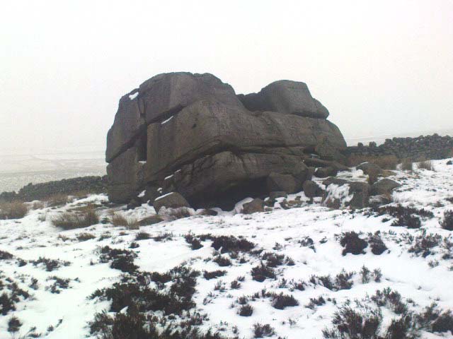
Hitching Stone through fog and snow
Hitching Stone through fog & snow

The easiest way to get here is via Cowling – though you can approach the place via moorland roads from Sutton-in-Craven, Oakworth and Keighley, but Cowling’s the closest place (so we’ll take it from there).  Turn east off the A6068 up Old Lane at the Ickornshaw side of town and go up the steep and winding road until you hit the moors.  Just as the road levels out with walling on either side of the road, there’s some rough ground to your left.  You can park here.  You’ll blatantly see our Hitching Stone on the moorland a few hundred yards above you on the other side of the road.  Walk up the usually boggy footpath straight to it!

Archaeology & History

For me, this is a superb place! Each time I come here the place becomes even more and more attractive — it’s like it’s calling me with greater strength with each visit.  But that aside…

Supposedly the largest single boulder in Yorkshire, it possesses several legends, aligns with the sacred Pendle Hill in Lancashire, is an omphalos (centre of the universe spot) and has other good points too! My first visit here was near the end of the Great Drought of 1995.  All of the streams and springs had dried up on the moors but, on the very top of this huge rock, measuring at least 8 feet by 4 feet across (and 3 feet deep) was a large pool of water, not unlike a bath, in which a couple of you could easily bathe (and do more besides, if the fancy takes you!).  It was surreal!  Water-boatmen and other insects were living in this curious pool on top of the rock.  Yet all other water supplies for miles around had long since dried-up.  It didn’t really seem to make sense.

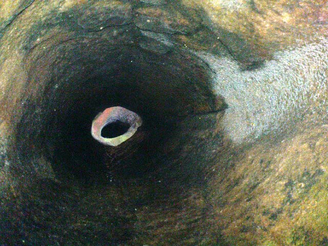
Crystalline tunnel in the Hitching Stone

On the west-facing side of the boulder, about 8 feet up, is a curious deep recess known as the Druid’s or Priest’s Chair, into which initiates were sat (facing Pendle Hill, down which it seems the equinox sun “rolls”) and is believed, said Harry Speight, “to have some connection with Druidical worship, to which tradition assigns a place on these moors.” If you climb up and inside the Priest’s Chair section you’ll notice a curious “tunnel” that runs down through the boulder, about 12 feet long, emerging near the northern base of the rock and out onto the moor itself.  This curious tunnel through the rock is due to the softer rock of a fossilised tree (Lepidodendron) crumbling away — and not, as Will Keighley (1858) believed, “the mould or matrix of a great fish.” When we visited the stone the other day in the snow, we noticed how the inner surface of this tunnel was shimmering throughout its length as if coated in a beautiful crystalline lattice (you can sort-of make this out in the image here, where the numerous bright spots on the photo are where the rock was lit up). Twas gorgeous!

The Hitching Stone, looking north

The boulder lies at the meeting of five boundaries, and was the starting point for horse-racing event until the end of the 19th century.  A short distance away “are two smaller stones, the one on the east called ‘Kidstone’, the other ‘Navaxstone’, which stands at the terminus of the race-course.” (Keighley 1858)  Lammas fairs were also held here, though were stopped in 1870.

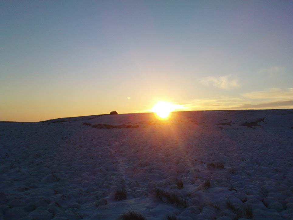
The cup-marked Winter Hill Stone a few hundred yards to the northeast, which I previously thought aligned with this site around winter solstice, but which happens to be a few degrees of arc off-line, would have indicated a very early mythic relationship, but this thought may now have to be put to bed.  I’ve not checked whether the winter solstice alignment shown in the photo below (with the Hitching Stone being shown on the near-horizon as the sun rose on winter solstice, 2010, from Winter Hill Stone) would have been closer in neolithic times or not.  Summat to check out sometime in the future maybe…

This aside, there is little doubt that this was an important sacred site to our ancestors.

Folklore

Winter Solstice sunrise, 2010 (from Winter Hill Stone)

Legend has it that the Hitching Stone used to sit on Ilkley Moor. But it was outside the rocky house of a great witch who, fed up by the constant intrusion the boulder made to her life, tried all sorts of ways to move it, but without success. So one day, using magick, she stuck her wand (or broomstick) into the very rock itself and threw it several miles from one side of the valley to the other until it landed where it still sits, on Keighley Moor.

A variation on the same tale tells that she pushed it up the hill from the Aire valley bottom. The “hole” running through the stone is supposed to be where our old witch shoved her broomstick!

References:

  1. Bennett, Paul, The Old Stones of Elmet, Capall Bann: Milverton 2001.
  2. Gray, Johnnie, Through Airedale form Goole to Malham, G.F. Sewell: Bradford 1891.
  3. Keighley, William, Keighley, Past and Present, R. Aked: Keighley 1858.
  4. Wood, Eric, Cowling: A Moorland Parish, Cowling Local History Society 1980.

© Paul Bennett, The Northern Antiquarian

Old Wife’s Spring, Snaizeholme, North Yorkshire

Sacred Well:  OS Grid Reference – SD 8344 8474

Getting Here

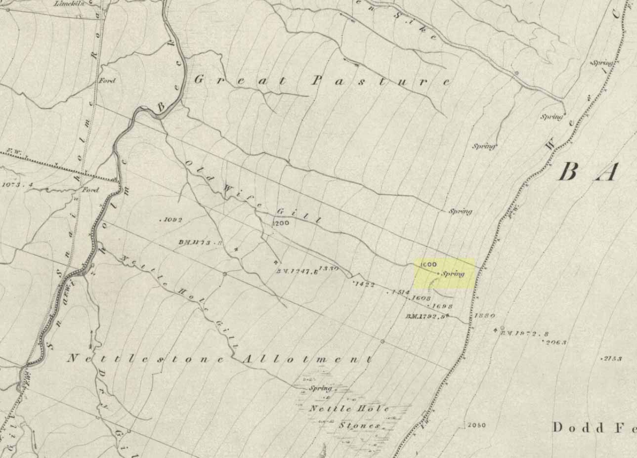
The ‘Spring’ atop of Old Wifes Gill, on 1853 OS-map

From Hawes, take the B6255 road west-ish to Ribblehead, but only for 1km, where there’s the Cam Road track on your left.  Walk on here, and keep going till you’re looking down the valley past the very last house (those of you who wanna take the Pennine Way from Hawes will end up in the same place).  It’s one of the springs down the steep slope on your right! (check the attached link to the OS-map to work out which one you’re heading for)

Archaeology & History

Apart from a singular mention in place-name records, I have found no historical information (yet!) about this old water supply.  It was one of the great sites of the cailleach in our Yorkshire hills: a truly ancient and heathen place, all but forgotten and lost in the mythic landscape of our past.  And it’s a bittova dodgy spot getting right up to her down the rather steep hilly slope — but it’s truly well worth the trek!

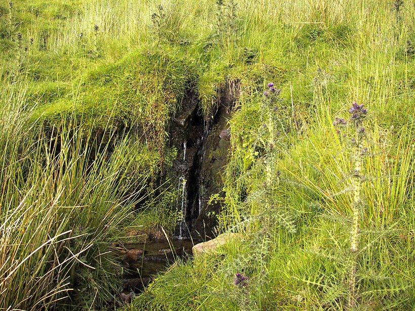
The Old Wife's Spring, Snaizeholme
The Old Wife’s Spring

When I first visited this place, we took off from Cam Fell’s western side and ambled up the tops until the land gave us the beauty of Snaizeholme valley, which had us stopping, dreaming and wanting more as we sought to find this forgotten well. Most of you would probably come from the easier side of Hawes and walk along the path on the southern-side of the valley, or p’raps even wander up Snaizeholme valley itself – but I’d recommend a walk along the tops. Tis much much better!

If you’ve got the 1:25,000-scale OS-map, you’ll see the ‘Old Wife’s Gill’ running down the hillside. Get over the wall by the track-side and stagger down the steep slope. You’ll pass a small spring about 70 yards down – but this aint the one (though I think originally the Old Wife came from much further up Dodd Fell itself). You’ve got another 75 yards to go down before you get to the main spring – but if you’re old and fragile, unfit or fat, you’ll struggle like hell here!

The waters emerge from this very steep slope, surrounded by plenty of thorns and thistles, on a part of the hill where the land itself is slowly coming away. After a long dry-spell no doubt, this might be a little more secure; but when we came here She’d been raining on-and-off like hell and the waters were a-plenty. It’s difficult to actually locate the exact spot where the water first appears – but like I said, it seems to have, long ago, come from much further up the hill. As the photos show, the water’s nice n’ clear, good-tasting, and then continues along its downward stream – known as the Old Wife’s Gill – until hitting the small river at the valley bottom.

The Old Wife's Spring from below...
The Old Wife’s Spring from below

The other site in this valley which assures us of the cailleach’s validity comes from the place-name a few hundred yards further up the valley, seemingly giving source to the valley river herself: a Lady Spring or well, whose form once emerged close to the gate of the Cold Well close by. The third part of the cailleach’s form – the maiden or virginal – has been lost as far as local myth and literary records go.  But I’ve gotta come here a few more times to get an idea as to where this ‘lost’ water-source originally appeared. A number of streams run off the hills here into the curiously-named Snaizeholme valley (which etymologists assign to nowt more than a “place where twigs are” – which seems nonsensical), and as there’s been very little by way of human habitation screwing the land up, there’s a damn good chance we’ll find and recover the mythic history of the landscape here after a few more treks and dreams…

Other sites of similar mythic relevance which need checking include Carlow Hill (SD 770 858)at Stonehouse, Dentdale; and the great valley of Carlin Gill on the North Yorkshire/Cumbria border (SD 634 993 – Gambles 1995:39).

© Paul Bennett, The Northern Antiquarian

Hawk Stone, Shipley, West Yorkshire

Cup-Marked Stone:  OS Grid Reference – SE 1792 4099

Getting Here

Take the road from Shipley to Guiseley, the A6038, past the turn-off to Esholt, until you get to the top of what’s locally known as Hollins Hill.  There’s a small farm-track to your leftand in the woodland here you’ll find the rocky outcrop.

Archaeology & History

Nothing has been written about this spot, but in this large wind-and-water worn rock outcrop, with its small cave, on the top part of the rock are several faint cup-markings.

Folklore

Legend tells that a man on horseback jumped from the top of here and landed safely at Low Hall, Yeadon, 2500 yards away to the east. (probably some sort of solar lore)

References:

  1. Gray, Johnnie, Through Airedale, from Goole to Malham, 1891.

© Paul BennettThe Northern Antiquarian


Gull Stones, Great Yarmouth, Norfolk

Stone Circle (destroyed):  OS Grid Reference – TG 524 035

Archaeology & History

Several local history records describe there being a circle of ten standing stones in a field called ‘Stone-field’ or ‘Stone-piece’ – now covered by a housing estate at Gorleston-on-Sea, south of Yarmouth.  In 1875, C. J. Palmer said that,

“there is a tradition that the Druids had a temple at Gorleston, some remains of which existed down to a comparatively recent period. It is supposed to have stood on a field next to the road to Lowestoft, upon what is called Great Stone Close; and it has been asserted that some huge stones remained standing until 1768, when they were destroyed by digging round their base and dragging them down by ropes. There are also two fields called Further Stone Close and Middle Stone Close, so that it is possible the Druidical circle, if it ever existed, may have had a wide extent”.

A painting of the site was reported to have been viewed by members of the Norfolk & Norwich Archaeological Society in 1888, but I’ve been unable to find out where this has gone.  Anyone out there got a copy?  Or know where it hangs?  An image of this lost stone circle would be hugely welcome!

References:

  1. Burgess, Michael W., The Standing Stones of Norfolk and Suffolk, ESNA 1: Lowestoft 1978.
  2. Palmer, C.J., The Perlustration of Great Yarmouth – volume 3, George Nall: Gt Yarmouth 1875.

Links:

  1. Hidden East Anglia: Ancient Sites & Legends

© Paul Bennett, The Northern Antiquarian

Invercharnan, Glen Etive, Argyll

Cairn:  OS Grid Reference – NN 1439 4761

Also Known as:

  1. Canmore ID 23689

Getting Here

As you enter the top eastern end of Glencoe, take the only tiny road to your left (south) into Glen Etive, past the great Buachaille Etive Mor (she kills four or five folk a year, so a local told me, as if to remind me who’s boss!), past Dalness for another couple of miles until you hit Invercarnan (watch you don’t miss it). Behind you are the great falls screaming down the mountain slopes on Buachaille’s south-side; but on the east-side of the road another 500 yards down (you’ll have to gerrout and walk down near the riverside – if you hit the tidgy bridge, you’ve missed it) on the far side of the trees behind the singular house, the little mound can be seen.

Archaeology & History

Down this awesome valley (perhaps mi favourite – it’s difficult to say) is very very little in terms of ancient remains – at least according to the record books. I find this hard to believe. Etive is scattered with various ancient legends of hero-figures and mythical creatures, and harbours geological features, waterfalls and magic unlike anywhere else in these great mountains.  The tomb here is only a small one, but it’s pretty well-preserved.  It’s about 30 feet across and three or four feet high. Described by the Royal Commission lads, thus:

“One of the best-preserved cairns in Lorn is situated in pasture on the west bank of the River Etive, some 700m south of Invercharnan.  Bowl-shaped in profile, it measures 8.25m in diameter by 1.6m in height, and has been constructed with a kerb of boulders on which a second retaining course of stones has been carefully set.”

…Tis an utterly gorgeous arena. The cairn is good – but it’s the land upon which it rests that truly holds you. I was just ambling here – and the rain didn’t stop for three solid days, but I could have stayed amidst its blessing for an eternity. On the walk back up to my tent, two mature stags came out from the trees and enacted a play-fight right in front of me, careless of me being there.  It was utterly superb to watch!  I was saturated, cold, hungry – but watching this stopped it all.  I bimbled back to mi tent in that dreamy state beloved of such places when the elements are alive.

Anyway – back to normality!  Just north of the old tomb – which I didn’t know at the time as I had no decent map – is found the ‘Crag of the Cailleach’ (a favourite creature of mine); and there are also a couple of old fairy place-names a few hundred yards to the southeast.  There’s got to be more ancient stuff around here tat are off the record-books.  Bimbling expeditions are a-calling…!

References:

  1. Barnett, T. Ratcliffe, The Land of Lorne and the Isles of Rest, W. & R. Chambers: Edinburgh 1933.
  2. Royal Commission on the Ancient & Historical Monuments of Scotland, Argyll – volume 2: Lorn, HMSO: Edinburgh 1974.

© Paul Bennett, The Northern Antiquarian

Giants’ Graves, Halton Gill, North Yorkshire

Cairns:  OS Grid Reference – SD 856 733

Also known as:

  • Giant’s Grave

Getting Here

Easy enough to get to – and a lovely place to behold for an amble!  From Settle, take the B6479 road up to Horton-in-Ribblesdale (ask a local if you’re too dumb to find it!), turning right at Stainforth and up the single-track road towards Pen-y-Ghent.  Keep yer eyes peeled for Rainscar – you’ve about a mile to go.  If you end up at Pen-y-Ghent House you’ve gone past ’em.  Turn back for 2-300 yards.  It’s on the right-hand side of the road as you’re coming up, about 100 yards up the footpath.

Archaeology & History

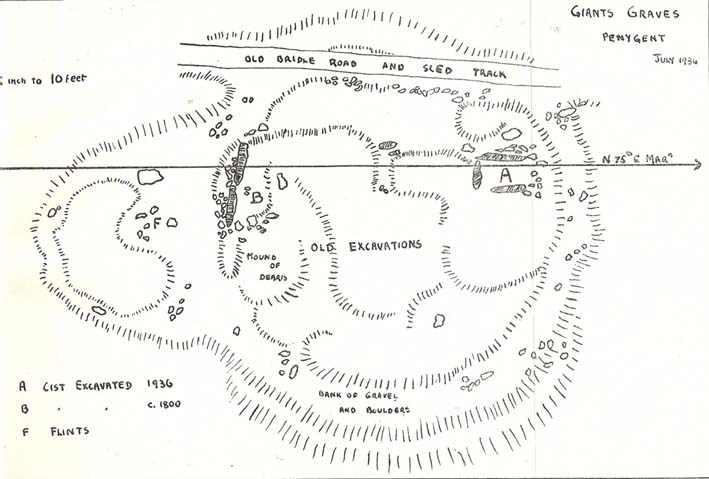
The Giants' Grave plan
The Giants’ Graves (after W. Bennett, YAJ 1937)

The earliest description I’ve found of this is in Terence Dunham Whitaker’s History and Antiquities of Craven (1878), where he reckoned the remains here to be of Danish origin.  The same thing was professed by the southerner, archdeacon W. Boyd, who said as such to the local people hereabouts more than 100 years ago, but they thought him a bit stupid and laughed at his notions! (though it does seem that Boyd wasn’t liked locally, tending to think himself better than the local people, who told him very little of local lore and legend)  Describing the remains, Whitaker said there were skeletons found in the tombs:

“The bodies have been inclosed in a sort of rude Kist vaen, consisting of limestone pitched on edge, within which they appear to have been artificially bedded in peat earth.”

But Harry Speight (1892) doubted this, saying that Whitaker never even visited the site!  When he went here he told us that,

“What is left at present are a few mounds of earth, the largest, which is divided into two, and lies north and south, measures about 28 feet by 25 feet. There is another apparent grave-mound on the east side of it, and again to the north is an oblong excavation or trench, 7 feet wide and nearly 30 feet long, in which several bodies or coffins may have been deposited. Several large oblong stones lay flay upon the ground beside the graves, but these were removed a few years ago and degraded to the service of gate-posts.”

The site was excavated in June 1936 by Arthur Raistrick and W. Bennett (1937) after they had been badly damaged and the stones robbed for walling and other profane building operations.  Herein were found two burial cists with fragments of human bones in each tomb.  In Bennett’s short account he told:

“The site consists of a nearly circular bank, about eight feet wide, and in parts two feet high, surrounding a much disturbed area.  Within the area are the remains of two cists and a number of hollows that certainly represent other similar structures.  The farmer tells of the removal of more than twenty large stones from these hollows, for use as gateposts, wall throughs and drain covers.*  The bank encloses an area fifty-four feet east to west…and fifty feet north to south.  At the west end there is a smaller bank, roughly in form of a circular apse, extending a further thirty feet.  Many large boulders and vast quantities of smaller stone are incorporated in the bank.

“Near the east end, with its axis bearing N75E, is a cist — three stones in position.  This was cleared to a depth of eighteen inches, and though no floor stone was present, among the sifted soil were found (i) broken bones, including parts of humourus, axis, vertebrae, ulna, ribs and cranium, all human; (ii) five teeth — two molars, one wisdom tooth, and two incisors, which appear to represent tow individuals.  Sir Arthur Keith reports that the bones submitted to his examination may represent more than one adult person, and there is also a fragment of a child’s tibia.  Most of the limb bones belong to a man of medium stature… He suggests from the condition of the bones a person of the Iron Age.  While this is possible with a secondary interment in the area, it is rather unlikely, as all the bones came from within the built cists, and not from the earthen part of the mound, where secondary burials would be expected.

“At the west end are two large stones, the side stones of cists or of a chamber.  The ground in front of them has been excavated many years ago…and partially refilled with boulders… Within the small extension on the west a trial excavation showed eighteen inches to two feet of random boulders, and beneath them, on the old sub-soil surface, two inches of fine grey sand, with two small flints — one of them a well-worked blade.  These probably pre-date the construction of the circle.

“The whole site is suggestive of a multiple cist burial mound, or even a “passage grave” type.  The obvious hollows, from which many of the larger stones have been lifted, are aligned in a parallel series, along an axis N75E, directed towards the two remaining large stones at the west, which may be part of a chamber wall and not part of a cist.”

Recent archaeological analysis has suggested these may be the remains of an old chambered cairn, although there is today far too much damage that’s been done to give us an accurate portrayal of what this originally looked like.  The Dawson Close prehistoric settlement is less than half-a-mile further up the ridge.

Folklore

The folklore here is simple: these are the graves of giants who lived in the valley of Littondale in ancient times.

References:

  1. Bennett, Walter, ‘Giants’ Graves, Penyghent,’ in Yorkshire Archaeological Journal, part 131, 1937.
  2. Boyd, W. & Shuffrey, W.A., Littondale Past and Present, Richard Jackson: Leeds 1893.
  3. Feather, Stuart & Manby, T.G., ‘Prehistoric Chambered Tombs of the Pennines,’ in YAJ 42, 1970.
  4. Speight, Harry, The Craven and North-West Yorkshire Highlands, Elliott Stock: London 1892.
  5. Whitaker, Thomas Dunham, History and Antiquities of the Deanery of Craven, Joseph Dodgson: Leeds 1878 (3rd edition).

* It might be worthwhile exploring the local gateposts and walls to see if any of these covering stones had cup-and-rings carved on them, as was traditional in many parts of Yorkshire and northern England.

© Paul Bennett, The Northern Antiquarian