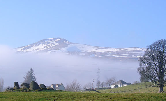
Garrywhin Fort, Ulbster, Caithness

Hillfort:  OS Grid Reference – ND 312 414

Getting Here

Going up the A99, just as your approaching Ulbster, take the left turn where the phone box is and go up the track for about a mile towards Watenan house.  A few hundred yards before here, three walls meet: follow the walling to the NW, past the nearby Cairn of Get and Garrywhin Stone Rows.  You’ll walk right into the fort!

Archaeology & History

This is a gigantic old hillfort, surrounded on all sides by a mass of prehistoric remains from the neolithic and Bronze Age periods.  But the fort itself is mainly Iron Age.  It occupies the summit of a broad ridge of land with 3, possibly 4 entrances and surrounded by bog-land.  It measures 590 feet north-to-south and up to 200 feet wide at its greatest diameter.  The stone walling averages some 8 feet wide around the fort and its entrances are lined with large slabs of stone.

Folklore

The local folklore writer George Sutherland (1937) told that the cliffs on the western edge of this large hillfort were haunted and under the protection of supernatural guardians.  One tale he narrated told of,

“a young man (who) happened to be at Garrywhin one day. He met a mysterious stranger there. The stranger asked him to look at the cliff and to tell him if he saw anything unusual. He looked and saw nothing unusual in the cliff. The stranger then gave him a pencil with a small glass in one end…and bade him look at the cliff through the glass. He did so, and to his horror he saw a large hairy beast slowly climbing up the perpendicular face of rock as a fly would walk up a pane of glass in a window. He got frightened and fled. To his dying day he believed that the strange man and the big hairy beast were creatures not of this world.”

There is also the curious folktale about powerful whisky attached to some characters by the Garrywhin Fort!

Many years after the fort had been constructed, a man and his son came to live on the southern end of the hill. They made a living selling their own brand of whisky, and a special kind of beer to local people. Local people were perplexed as to how the two could make such drinks, as they grew no barley or any other kind of grain, so the reputation soon gathered that they used supernatural means. The two men declared simply that their drinks were made from simple plants, but kept their methods secret. But the local folk wanted to know just how they made it so strong and so ended up threatening them for their secrets.

As George Sutherland wrote:

“It was known to everyone that dealt with them that they had a cave in the face of precipice in which they did their work unseen by any eyes but their own, and in which they stored their goods. Owing to some magical contrivance, no one – apart from the old man and his son – could find the entrance into the cave. Every device that ingenuity could suggest was tried on the old man and his son to induce them to reveal their secret, but in vain. At last they threatened them with death. The old man said to them, “If I should tell you, my son would kill me for doing so; kill my son and then I shall think over the matter.” They killed his son. The old man then said to them, “Now, kill me also; no on else knows our secret, and it will die with me.” They killed him, and so the secret remained a secret.

“Every inch of the face of the precipice, and of the adjacent ground, was scrutinised and tested over and over again, but no trace of the cave, or of the heather whisky and the heather ale stored in it, was ever found.”

References:

  1. Sutherland, George, Folklore Gleanings and Character Sketches from the Far North, John o’ Groats Journal: Wick 1937.

© Paul Bennett, The Northern Antiquarian

Frogden Circle, Linton, Roxburghshire

Stone Circle (destroyed):  OS Grid Reference – NT 774 292

Also known as:

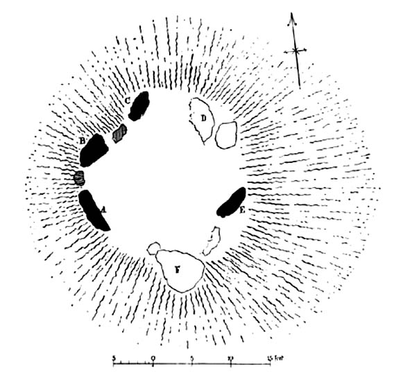
  1. Five Stones
  2. The Tryst

Archaeology & History

Less than a mile northwest of the hillfort on Linton Hill, modern OS-maps show the field-name of ‘Five Stone Field’ which is where, in bygone years, another important stone circle once stood.  Today unfortunately, not a single stone remains.  As the Scottish Royal Commission (1956) lads told:

“About a mile NE of Frogden, on the N side of the road between Frogden and Greenlees, there were formerly five or six upright stones forming a circle, ‘about the size of a cock-pit’ (1792 Statistical Account). This circle, which was adopted as a rendezvous by Border raiders in the Middle Ages and became known as The Tryst, has long since disappeared, but its approximate site is indicated on the OS map by the name Five…Stone Field.”

Folklore

One of many stone circles used as an old moot, or gathering spot.  This was described in one of the many footnotes to Sir Walter Scott’s (1802) Minstrelsy of the Scottish Border, in which he told:

“At Linton, in Roxburghshire, there is a circle of stones surrounding a smooth plot of turf, called the Tryst, or place of appointment, which tradition avers to have been the rendezvous of the neighbouring warriors. The name of the leader was cut in the turf, and the arrangement of the letters announced to his followers the course which he had taken.”

This tradition was echoed around the same period in Robert Forsyth’s (1805) massive work on the history of Scottish life and landscape, saying:

“In different parishes, such as Moorbattle, Linton, and others, are to be found what are called tryst stanes. These are great stones commonly situated on high grounds. They are placed perpendicularly in rows, not unfrequently in a circular direction. It is said, as also the name imports, that in times of hostility they marked the places of resort for the borderers when they were assembling for any expedition of importance.”

References:

  1. Burl, Aubrey, The Stone Circles of Britain, Ireland and Brittany, Yale University Press 2000.
  2. Forsyth, Robert, The Beauties of Scotland – volume 2, Thomas Bonar: Edinburgh 1805.
    Royal Commission on the Ancient & Historical Monuments of Scotland, Roxburghshire – volume 1, HMSO: Edinburgh 1956.
  3. Scott, Walter, Minstrelsy of the Scottish Border, James Ballantyne: Kelso 1802.

© Paul Bennett, The Northern Antiquarian

Fairy Stone, Cottingley, Bingley, West Yorkshire

Cup-and-Ring Stone:  OS Grid Reference – SE 09816 37862

Also Known as: 

  1. Black Hills Carving 01
  2. Cottingley Woods (01) carving

Getting Here

To get here, start from Bingley centre, go through Myrtle Park, across the river bridge and turn right at the dirt-track. Walk on & go over the old bridge/ford of Harden Beck, keeping with the track until the next set of buildings and be aware of a footpath left here. Take this and cross the golf-course, bearing SE until you reach the edge of Cottingley Woods. Take the distinct footpath into the trees & walk up the vivid moss-coloured path until you reach the level at the top where the woods become more deciduous. Here, turn left for 100 yards into the bit of woodland which has been fenced-off and walk about. You’ll find it!

Archaeology & History

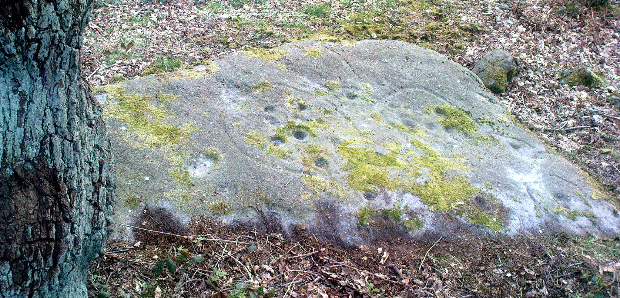
Cottingley Woods Fairy Stone

This is a truly superb cup-and-ring stone which anyone into the subject must take a look at!  It was first found by the old forester here, Ronald Bennett, in 1966 — ten years before the rock art student Keith Boughey (2005) mistakenly reported it to have been found “by Valerie Parkinson…in 1976.”  Everything about it’s excellent — but I think the setting in woodland is what really brings it out.

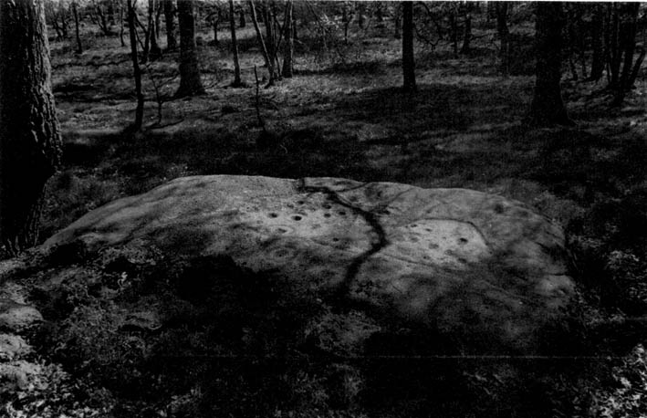
The first published account and photograph of this superb carved stone seems to have been in Joe Cooper’s (1982) precursory essay on the Cottingley Fairies in an article he wrote for The Unexplained magazine in the 1980s.  A few years later I included the stone in a short article on local folklore (Bennett 1988), then again much later in The Old Stones of Elmet (2001).  It was curiously omitted from Boughey & Vickerman’s (2003) survey, as were the other carvings that are found very close by.  Not sure why…  But of the small cluster here (I’ll add the others later), this carving stands out as the best of the bunch by far!  Its name has nothing to do with the Cottingley Fairy folk down town: it simply originates from my own teenage thoughts and the true ambience of the setting. Check it out!

Joe Cooper’s 1982 photo
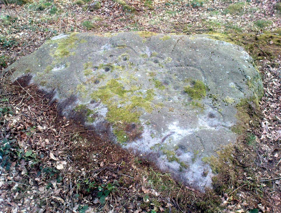
Fairy Stone carving

The rock is typical millstone grit and its carved upper surface measures roughly 3 yards east-west and 2 yards north-south, sloping gently into the ground.  As the photo shows, this is an elaborate design seemingly centred around two large and another smaller circular form, each enclosing a number of internal cups, ring and lines.  The next time we’re over there, we’ll try get some clearly images and make a detailed drawing of the old fella!  In the event that you visit here, check out the other three carvings close to this primary design — and try work out which one of the three was carved by the scouts in more modern times!  Another simple cup-marked stone was recently found in the undergrowth a short distant east of this group.

Sketch of the design in 1981

Recently the carving was given attention with what’s known as photogrammetry software: this enables a more complete image of the 3-dimensional nature of objects scrutinized.  In the resulting photos (which I’m unable to reproduce here due to copyright restrictions), a previously unseen long carved line was detected that runs across the middle of the larger of the two enclosing rings.  Hopefully in the coming months, those with the software (can’t remember whether it’s English Heritage or Pennine Prospects who won’t allow it) might allow us to reproduce one or two of their images to enable the rest of the world to see what their images have uncovered.  After all, considering that we peasants brought this carving to their attention, you’d at least hope they could repay the finds.  Some of these larger organizations, despite what they may say, simply don’t swing both ways!

Folklore

In an early edition of my old Fortean archaeology rag of the 1980s, I narrated the tale of one Anne Freeman, who was walking through the woods here.  When she reached the top of the woods, near some stones she heard a loud chattering and allegedly saw two tiny figures barely one-foot tall wearing red outfits and green hats in “medieval peasant dress”.  Andy Roberts (1992) later repeated the tale and illustrated the carving in his Yorkshire folklore work.

In the 1960s, the old ranger Ronnie Bennett (no relative of mine) who first found these carvings, also reported that he saw little people here: “not one, but three,” as he said.  Not fairies with wings, but more gnome-like.

References:

  1. Bennett, Paul, Of Cups and Rings and Things, unpublished: Shipley 1981.
  2. Bennett, Paul, ‘Tales of Yorkshire Faeries,’ in Earth 9, 1988.
  3. Bennett, Paul, The Old Stones of Elmet, Capall Bann: Milverton 2001.
  4. Boughey, Keith, “A Group of Four Cup-and-Ring-Marked Rocks at Black Hills, Cottingley Woods,” in Prehistory Research Section Bulletin, no.42, 2005.
  5. Cooper, Joe, ‘Cottingley: At Last the Truth,’ in The Unexplained 117, 1982
  6. Roberts, Andy, Ghosts and Legends of Yorkshire, Jarrold 1992.

© Paul Bennett, The Northern Antiquarian
Dun Mac Sniachan, Benderloch, Argyll

Hillfort:  OS Grid Reference – NM 9032 3822

Also Known as:

  1. Dun mac Uisneachan
  2. Dun Uisnach
  3. Beregonium

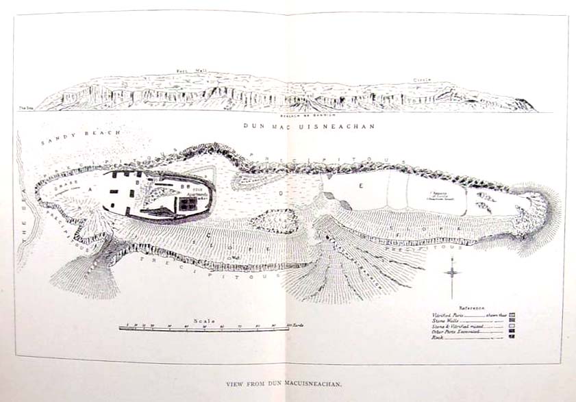
Early plan of the Fort, 1885

Archaeology & History

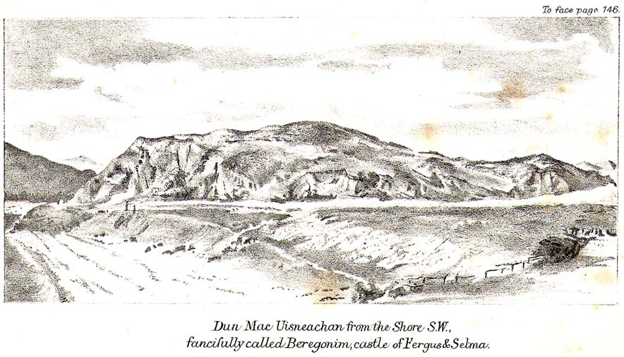
This is a fine-looking monument amidst a fine piece of landscape!  The site was constructed over various centuries, beginning in the Iron Age, with the earliest parts being the traces of walling on the outer edges.  This first section of the fort “measures about 245m in length by a maximum of 50m in width internally,” and much of it can still be traced all along the full length and breath of the geological ridge upon which it sits.  However, the timber-laced walls that stood all round the edges have, obviously, all but disintegrated.  This earlier part of the fort, wrote Richard Feacham (1977),

“was superceded by a small subrectangular, now vitrified fort, about 170 feet long by 60 feet wide, and by a circular and probably vitrified dun measuring about 60 feet in diameter.”

View of the Dun (Smith 1885)
Looking out from the dun

There was ample water supply for the people who may have lived on this ridged fortress, as there is still a fresh water spring on the southeast edge of the hill.  And it seems pretty obvious that this fort was occupied for some considerable time into the Common Era, as material remains found amidst excavation work here at the end of the 19th century, “including metalwork of Roman date…suggests an occupation in the early first millenium AD.” (Harding 1997)

Folklore

The folklore and legends of this site (aswell as the surrounding district) are considerable, and for now I must refrain from writing all there is (it’d take me ages!). Needless to say, R. Angus Smith’s (1885) fine old history and folklore work  is the source of much material.  Smith told us that,

“There are many stories about it.  It has been called the beginning of the kingdom of Scotland, the palace of a long race of kings; also the Halls of Selma, in which Fingal lived; the stately capital of of a Queen Hynde, having towers and halls and much civilization, with a christianity before Ireland; whilst it has also been considered to be that which the native name implies, simply the fort of the sons of Uisnach, who came from Ireland, and whose names are found all over the district, and who in the legend are reported to have come to a wild part of Alban.”

References:

  1. Feacham, Richard, Guide to Prehistoric Scotland, Batsford: London 1977.
  2. Harding, D.W., “Forts, Duns, Brochs and Crannogs,” in The Archaeology of Argyll (edited by Graham Ritchie[Edinburgh University Press 1997]).
  3. Royal Commission on the Ancient & Historical Monuments, Scotland, Argyll- volume 2, HMSO: 1974.
  4. Smith, R. Angus, Loch Etive and the Sons of Uisnach, Alexander Gardner: London & Paisley 1885.

Links:

  1. PSAS: Dun mac Sniachan & other Local Antiquities

© Paul Bennett, The Northern Antiquarian

Dun Gallain, Colonsay, Argyll

Hillfort:  OS Grid Reference – NR 3486 9314

Getting Here

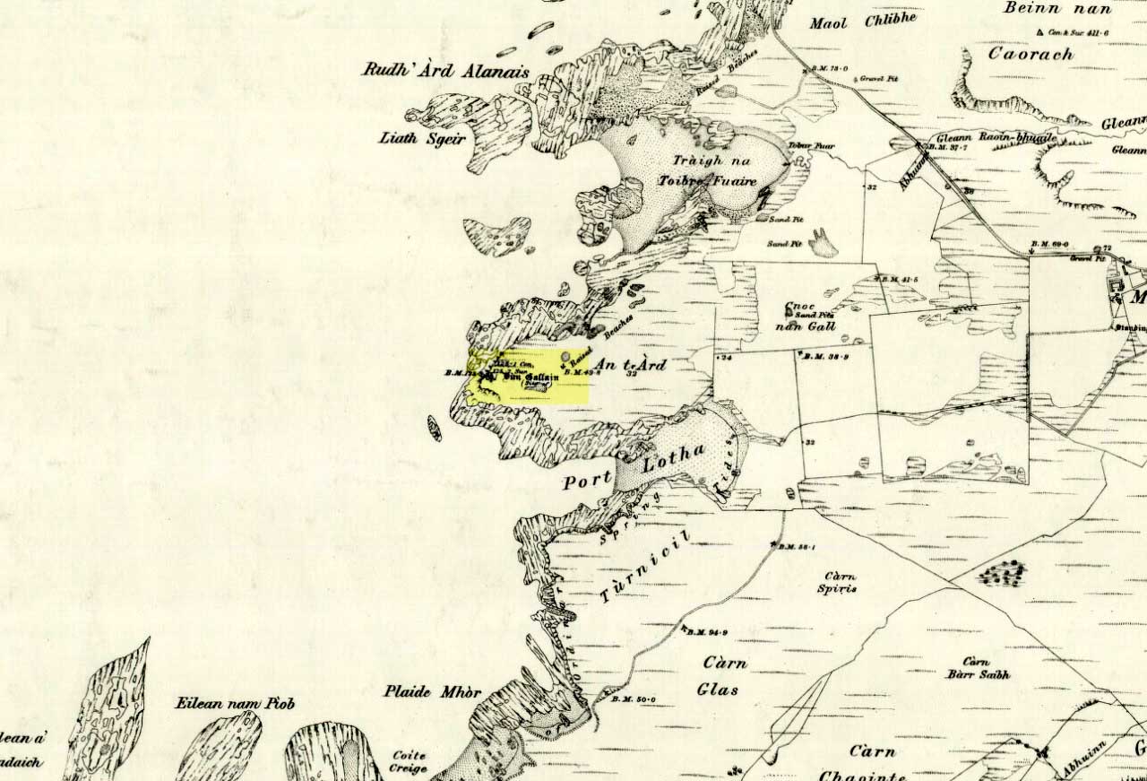
Dun Gallain on 1878 map

Bittova trek this one.  Once on Colonsay, head out onto the B8086 road west of Scalasaig until you, past Machrins, and onto the gold course. Take the footpath across it (south), until you hit the little airstrip where you need to veer right (west) right onto the spur of the coast about 800 yards away.  Your damn close!

Archaeology & History

Highlighted on the 1878 OS-map of the region, this site occupies a prominent position.  Its summit is surrounded by a line of oval walling enclosing an area of about 90 square yards.  There are also remains of of outer walling to the eastern and southern sides.  The ‘cairn’ on the highest spot in the middle of the hillfort is a modern construction.

Folklore

The great Scottish folklorist A.A. MacGregor (1947) narrated the tale behind this denuded fort on the western edge of the island. According to the islanders who told him the tale, they alleged it Norwegian in origin, though the fortress is much older than that. MacGregor told that, “in this fort there once lived an elderly and voluptuous tyrant named Grey Somerled, who is said to have been related to the first of the Lords of the Isles.

“Grey Somerled came to Colonsay, they say, in the capacity of factor. But he neglected his duties, imposed penalties and hardships on the innocent and defenceless tenants, and generally made himself so disagreeable that at last it was decided to take revenge upon him, previous warnings having been no deterrent.

“Like Rory Mor of Dunvegan, who slept best when he was within hearing of his ‘nurse’, the waterfall, Grey Somerled was wont to be lulled to sleep by the grinding noise of a quern placed near his head. When he retired for the night, one of the servants had to turn the quern-stone by his pillow, and keep on turning it, lest he woke.

“It was recognised that any attempt to surprise Grey Somerled during daylight was foredoomed to failure. So, a plot was laid to circumvent him during the night-time. His enemies entered into a conspiracy with one of the servants that she should allow them to invade Dun Gallain after he had fallen asleep. When they arrived, one of their number relieved the woman at the quern, and proceeded to turn the stone without intermission. But he was not too skillful at the turning; and his harsh and irregular grinding soon woke the sleeper. Ere Gey Somerled had had time to consider the matter of resistance, his foes were upon him. They carried him away from Dun Gallain; and tradition in the islands of Argyll has it that, in great privation, he spent the remainder of his days in a bee-hive house of stone, situated on the farmlands of Machrins.

“One night – so the story concludes – a huge boulder from the roof of the bee-hive fell in, killing its unhappy inmate. So as to identify the spot where this tragedy happened, the islanders raised on it the cairn now indicated on the Ordnance Survey Map as Carn Shomhairle Liath – that is to say, Grey Somerled’s Cairn.”

Interestingly, there is a long-cist burial at Machrins (plus small settlement) a few hundred yards east of the fort, and excavations here found them to date from the Viking period; though the Scottish Royal Commission thought that although the “small finds associated with the burial suggest that it is Viking, the plan-form of the houses is perhaps more likely to indicate a native tradition.”

References:

  1. MacGregor, Alasdair Alpin, The Peat-Fire Flame, Ettrick Press: Edinburgh 1947.
  2. Royal Commission of Ancient & Historical Monuments, Scotland, Argyll – volume 5, HMSO: Edinburgh 1984.

© Paul Bennett, The Northern Antiquarian


Dun Chonallaich, Ford, Argyll

Hillfort:  OS Grid Reference – NM 8544 0366

Getting Here

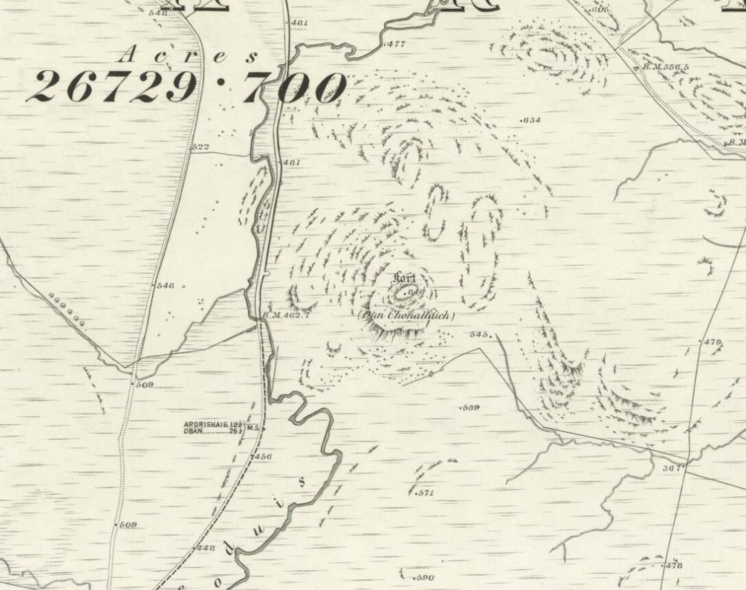
Dun Chonallaich on 1875 map

There’s two real ways to get up here: one from the Oban-Kilmartin roadside; the other from Ford village. I’d go for the latter as it avoids the traffic. Walk up the track to Salachary from the village centre, heading west. It’s a gradual uphill climb and after about half-a-mile (past six or seven cup-marked rocks) the great hill rises to your left.  Dun Dubh is to your right.  Climb over the fence and head for the hilltop.

Archaeology & History

It’s my opinion that this fort, above all others in the region apart from Dunadd, was of paramount importance to our prehistoric ancestors.  The reason being that it’s the great pyramidal hill to which the line of tombs in the Kilmartin Valley align, three miles to the south.  This prehistoric alignment was quite intentional (if you’ve got your doubts, gerrup there & have a look for y’self — you’ll soon change yer mind).

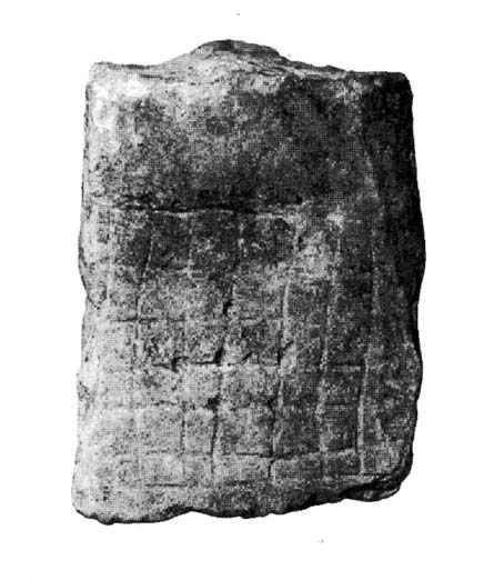
Curious carved stone found here

The main part of the structure is an irregularly-shaped construction with walling on all sides, measuring about 40 yards by 20 yards.  Much of it is pretty well defined – though has been vandalized by various doods in the past: one bunch being a film-crew who used the site in the early 1980s!  Inside the main walled fortress are several ruins.  The Royal Commission (1988) report told:

“Much of the interior is occupied by a rock spine which is surmounted by a modern cairn, but the NW half is relatively level and it contains, in addition to the modern round-house…and and an S-shaped structure associated with film-making, a number of ruined stone foundations.  On the north side there is a rectilinear building, and between the modern round-house and this rectilinear building, there is a further structure…an arc of walling, but its precise shape cannot now be determined without excavation.”

Dun Chonallaich means “the fort of King Connal’s people,” and although much denuded, is well worth the clamber for a short archaeological day out. A curious “gaming-board” was found here (see photo). A portable cup-marked stone in the fort’s southern wall is a modern artifact.

It’s a lovely view from up here too.  This is one of many places I’ve sat during a raging thunderstorm.  One helluva buzz, believe me!

References:

  1. Gillies, H. Cameron,The Place-Names of Argyll, David Nutt: London 1906.
  2. Royal Commission for Ancient & Historic Monuments, Scotland, Argyll – volume 6, HMSO 1988.

© Paul Bennett, The Northern Antiquarian
Druid’s Stone, Bungay, Suffolk

Legendary Rock:  OS Grid Reference – TM 337 898

Folklore

Described in 1926 by local antiquarian and early ley-hunter, W.A.  (1926), as “a fallen monolith” — this old stone is probably just a glacial erratic.  Found in the churchyard of St. Mary’s, tradition tells that in ages past young girls danced twelve times around this old stone, then placed their ears upon it to hear the answers to their questions and wishes. A similar legend tells how children danced around the stone seven times on a certain day of the year to conjure up the devil.  Mr Dutt thought the great rock may have been “a ley or direction stone.”

References:

  1. Dutt, W.A., The Ancient Mark-Stones of East Anglia, Flood & Sons: Lowestoft 1926.

© Paul Bennett, The Northern Antiquarian


Druid’s Altar, Bingley, West Yorkshire

Legendary Rocks: OS Grid Reference – SE 0924 3994

Getting There

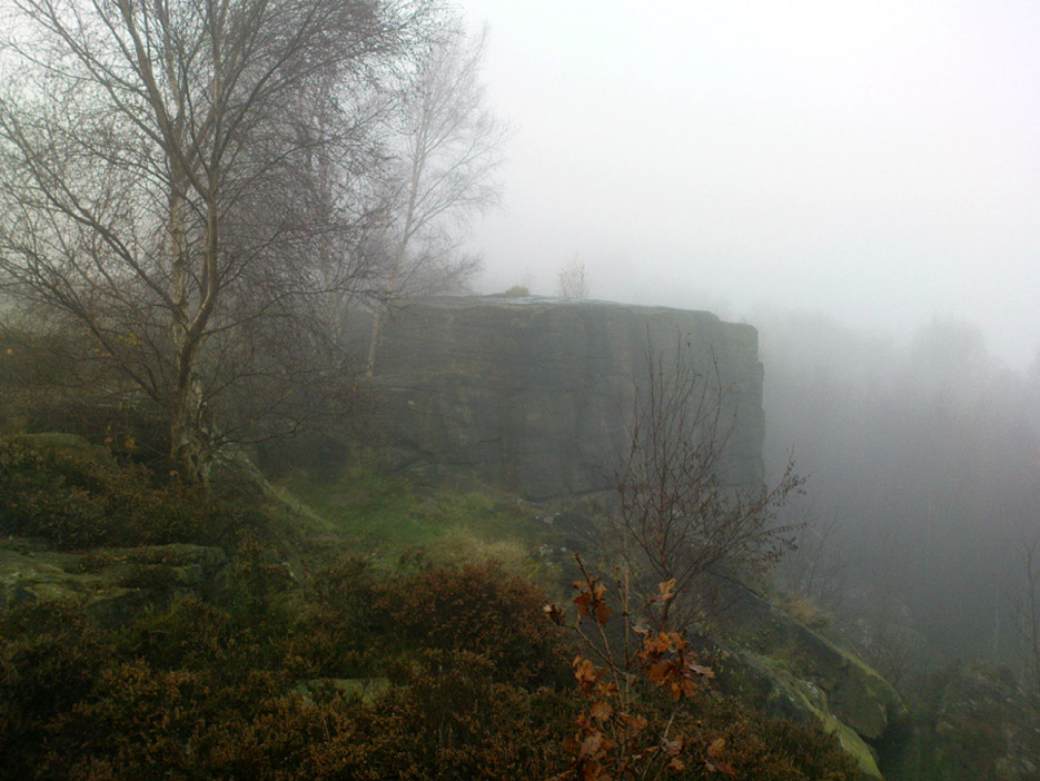
Druid’s Altar, sitting with mist

Pretty easy to get to. Best thing to do really, is ask a local and they’ll send you in the right direction. From Bingley, take the Harden road (B6429) across the river. As it bends sharply left, note there’s a track going up into the woods to the right. Walk up it! Keep going and, unless you take a detour, you’ll end up at the rock outcrop eventually (where the woods come to an end, Druid’s Altar appears before you with the track running along its top-side).

Archaeology & History

Mentioned in the Tithe Awards of 1849, this lovely outcrop of rocks looking down the Aire Valley on the southern edge of Bingley has “an immemorial tradition” of druidic worship, said Harry Speight in 1898 – though quite when it first acquired such repute is outside of any literary record.  In Sidney Greenbank’s (1929) rare book on this place, he could find little by way of archaeological data to affirm the old tradition, save the odd prehistoric find of flints here and there; though it is said that Beltane fires were burned upon the crags here in bygone centuries.

1894 photo of Druid's Altar (courtesy Clive Hardy)
1894 photo of Druid’s Altar (courtesy Clive Hardy)

There was a 19th century account from the Ilkley Scientific Club where a member described there being a cup-and-ring carving “near the so-called Druid’s Altar, at Bingley,” but I’m unaware of the whereabouts of this carving and Boughey & Vickerman’s (2003) said nothing about it in their survey; though a possible cup-marking can be seen on one rock less than 100 yards west, which might account for the report. (a bit dodgy though!)

Folklore

Harry Speight (1898) makes what sounds like a rare flight of fancy when he described faerie being seen atop of the many oaks beneath the Druid’s Altar.  In Clive Hardy’s (2002) work (from whence the old photo of the Altar is taken), he tells how “local antiquarians say that the cobbled way running from the Brown Cow Inn towards the site, is an old processional route walked by the druids.”

One, possibly two wells, each beneath the Altar rocks, are also reputed to have been associated with the old pagan priests, as their names tell: the Altar Well and the Druid’s Well – though the Altar Well has seemingly fallen back to Earth in recent years.

References:

  1. Greenbank, Sidney, The Druid’s Altar, Bingley, R.G. Preston: Bingley 1929.
  2. Hardy, Clive, Around Bradford, Frith Book Ltd: Salisbury 2002.
  3. Moores, Les, Ancient Monuments and Stone Circles, Francis Frith Collection: Salisbury 2005.
  4. Speight, Harry, Chronicles and Stories of Bingley and District, Elliott Stock: London 1898.
  5. Turner, J. Horsfall, Ancient Bingley, Thomas Harrison: Bingley 1897.

© Paul Bennett, The Northern Antiquarian


Machuim, Lawers, Loch Tay, Perthshire

Stone Circle:  OS Grid Reference – NN 68201 40156

Also Known as:

  • Lawer’s Mill

Getting Here

From the north-end of Loch Tay at Kenmore, follow the road (A827) round down the lochside, through the village of Fearnan and then another 4 miles down.  If you park up at the pub at Lawers, walk back up the road for ½-mile, keeping your eyes peeled up the slope on the left where you’ll see the circle visible from the road.

Archaeology & History

Much has been said of this fine old place – also known as Lawer’s Mill – which seems to have been first described by Thomas Pennant in his rambling Tour in Scotland (1772).  The local writer William A. Gillies (1938) told that after

“a recent examination of the ground around the circle…suggests that at one time there was an outer circle of stones concentric with the existing one. Most of the stones were removed in order to make more of the field available for cultivation, but there are still large stones buried within a few inches of the surface.”

Folklore

In J. McDiarmid’s Folklore of Breadalbane (1910) he tells of a man from Killin who, on passing by this old circle, heard haunting fairy music.  Being inquisitive, he walked up to see what was going on and walked into the circle where the little people were playing.  He was obviously lucky and the faerie-folk enjoyed his company, for when he left he was given the gift of a strong, fast, white steed.

Solar folklore may be…?

References:

  1. Gillies, William A., In Famed Breadalbane, Munro Press: Perth 1938.

© Paul Bennett, The Northern Antiquarian

Dove Stones, Widdop Moor, West Yorkshire

Legendary Rocks:  OS Grid Reference – SD 9333 3479

Also Known as:

  1. Dew Stones

Getting Here

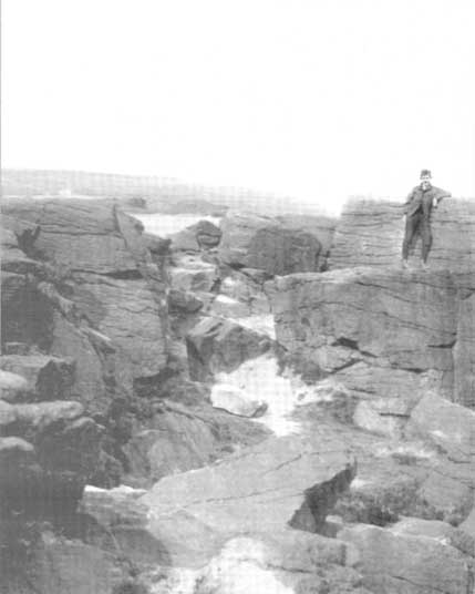
Dove Stones (after ‘QDanT’)

Get to Widdop reservoir in the hills west of Hebden Bridge and park up. The great rock faces to your right (north) is where you’re going. Clamber to the top until the moor levels out, making sure you head NNW for less than a mile. The moors you’re now on are supposed to be private – but folk like me pay no attention!  There are no footpaths to this great outcrop, only the heathlands and scattered stones – but keep walking for a half-mile north and you’ll get to them!

Archaeology & History

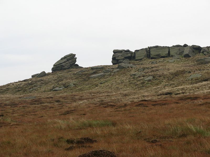
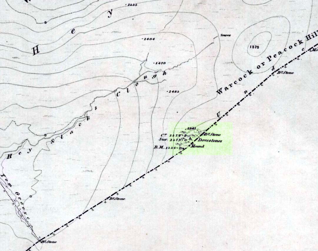
Erroneously ascribed by the place-name masters Eilert Ekwall and A.H. Smith (1961) as being ‘a place where doves gathered,’ this gigantic rock outcrop on the Yorkshire-Lancashire border — as shown on early maps — is actually the Dew or Black Stones (from the Gaelic, dubh).  It’s an awesome place!  Takes a bitta getting to, but it’s well worth the venture.

Dove Stones on 1848 map

This long geological ridge, rising higher as you walk along it to the north, has the occasional cup-mark on it, with the giant Dove Stone at the very end having a cup-and-half-ring on its crown (be careful not to fall off). From here, you look across a huge, desolate, U-shaped valley, the far side of which we rise to 1700 feet and the grand setting of the Lad Law.

Folklore

The folklorists Harland and Wilkinson (1882) included this in their survey of druidical sites, mentioning the several cup-markings, or druid basins as they called them. (though most of ’em on here are Nature’s handiwork)

For me, this is an incredible place – full of raw power and magick. It has a curious geomantic relationship with the Whinberry Stones, a couple of miles to the south, around which should be a ring of stones…though none can be found.

References:

  1. Bennett, Paul, The Old Stones of Elmet, Capall Bann: Chieveley 2001.
  2. Harland, John & Wilkinson, T.T., Lancashire Folk-lore, John Heywood: Manchester 1882.
  3. Smith, A.H., Place-Names of the West Riding of Yorkshire – volume 3, CUP 1961.

Links:

  1. More images of the Dove Stones

© Paul Bennett, The Northern Antiquarian