Gill Head, Blubberhouses Moor, North Yorkshire

Enclosures:  OS Grid Reference – SE 1338 5493
Getting Here

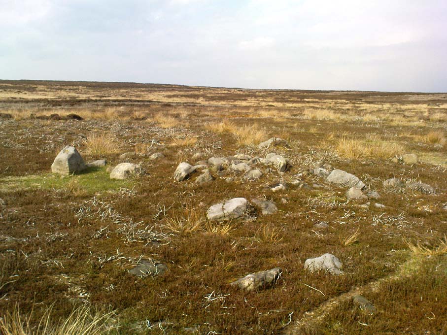
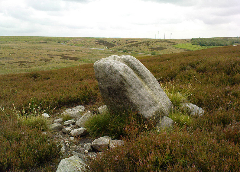
Upright stone in prehistoric walling

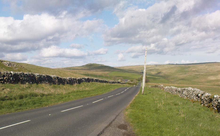
ON the A59 Harrogate to Skipton road, right on top where it crosses the barren moors, get to the parking spot right near where the road levels out at the highest point (2-300 yards past the turning to the derelict Dovestones Quarry). From here, go thru the gate onto the moor for about 100 yard. Then turn straight east (left) for another few hundred yards till y’ reach the spot marked as Gill Head Peat Moor on the OS-map. This small standing stone (right) is where you need to start – the other remains continue east of here.

Archaeology & History
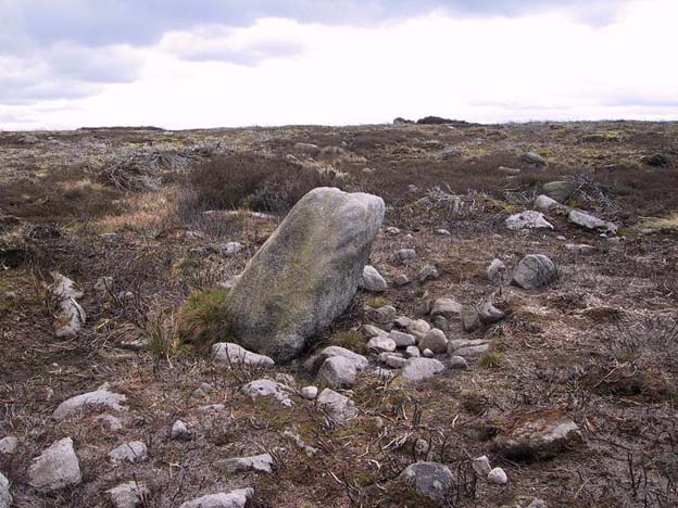
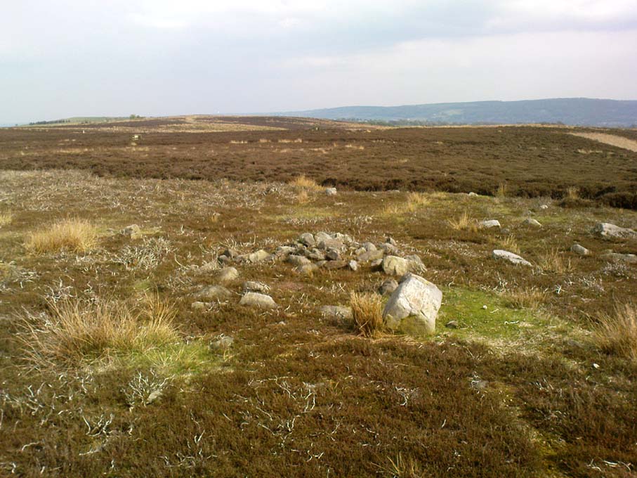
Richard’s original photo, with walling clearly visible

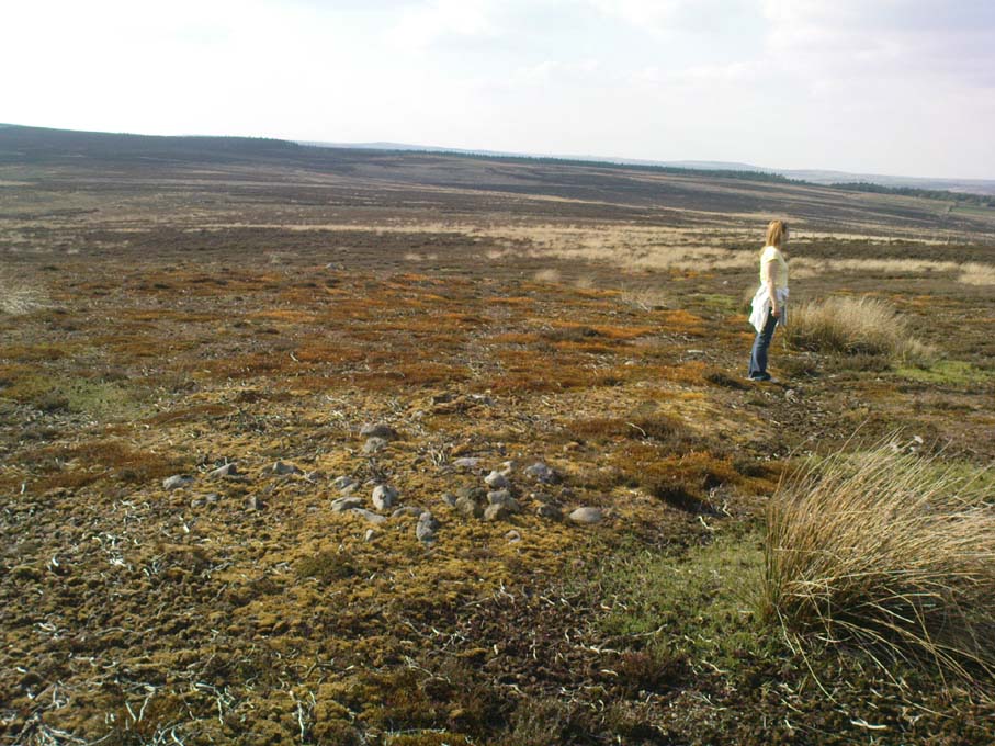
The discovery of this site began in April 2005, when rock art student Richard Stroud and I were exploring the moors here and he called our attention to what seemed like a singular upright standing stone, some 3 feet high, with a debatable cup-marking on top, standing amidst a scatter of smaller stones running north and south from here, implying that the stone may have been a part of some much denuded walling from our ancient past.  But we weren’t sure—and simply noted its location (at SE 13378 54924) and carried on our way.  But in revisiting this site after looking at some old archaeology papers, Paul Hornby and I chanced to find a lot more on the burnt heathland running east of here.

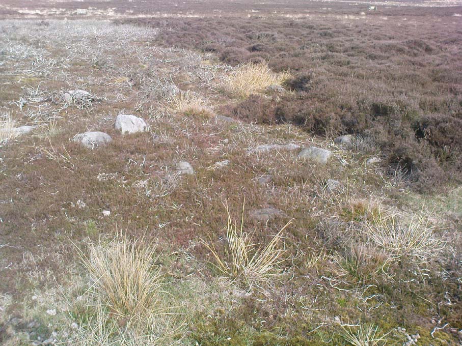
The upright stone found by Mr Stroud is certainly part of some ancient walling, but it is much denuded and falls back into the peat after only a short distance.  A short distance west of this stone is a small cairn which seems of more recent origin; but due east, along the flat plain on the moorland itself, the burnt heathland showed a scattering of extensive human remains, comprising mainly of walling, hut circles and possible cairns—lots of it!

One issue we have to contend with on this moorland is the evidence of considerable peat-cutting in places, which was being done on a large scale into the Victorian period.  Scatterings of medieval work are also found across this moor, in places directly interfering with little-known Bronze Age monuments in the middle of the remote uplands.  There is no doubt that some of these medieval and later workings have destroyed some of the uncatalogued prehistoric archaeological remains on this moor.  But thankfully, on the ridge running west to east along Gill Head to above the source of the Black Dike, scattered remains of human habitation and activity are still in evidence.  The only problem with what we’ve found, is the date…
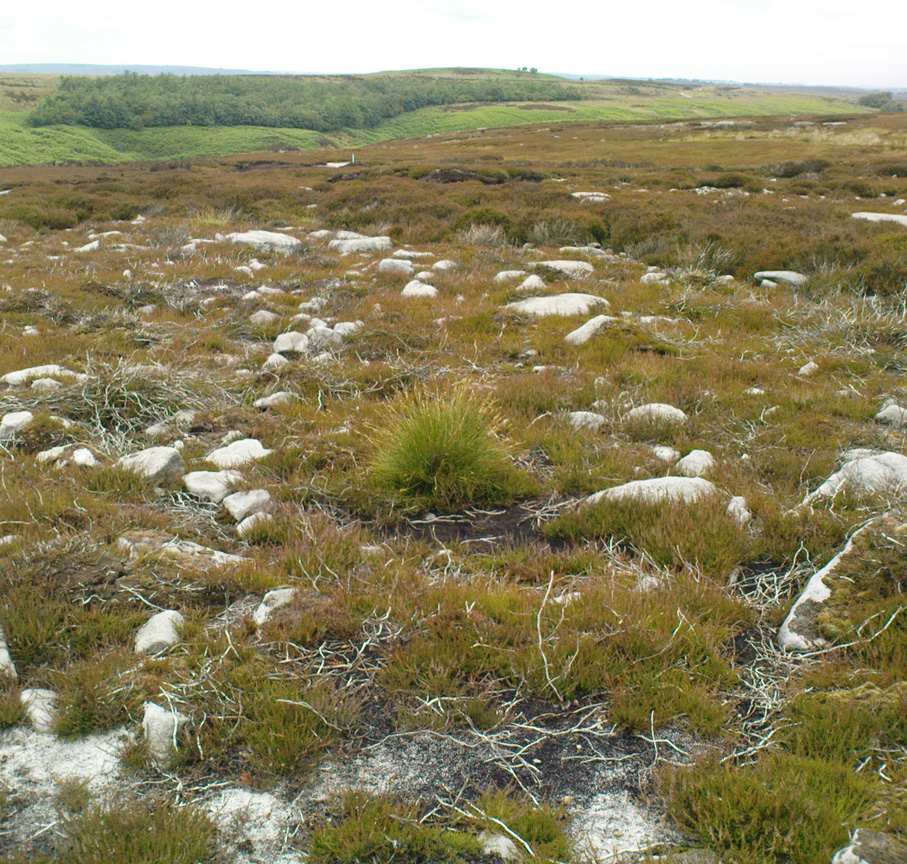
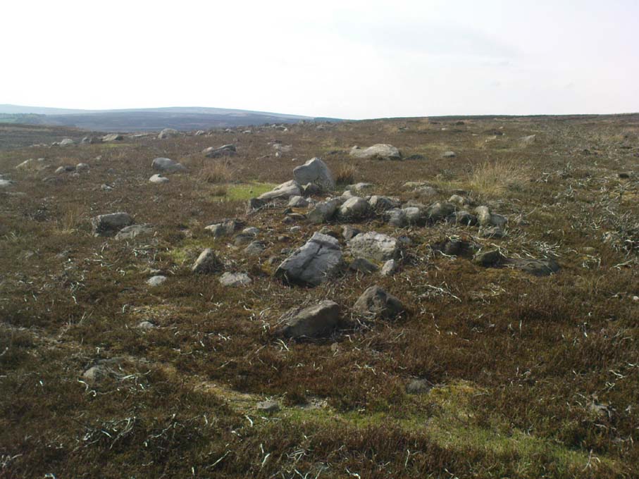
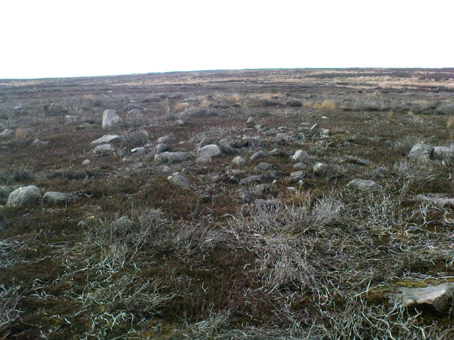
Two rows of straight walling, with stone scatter all round
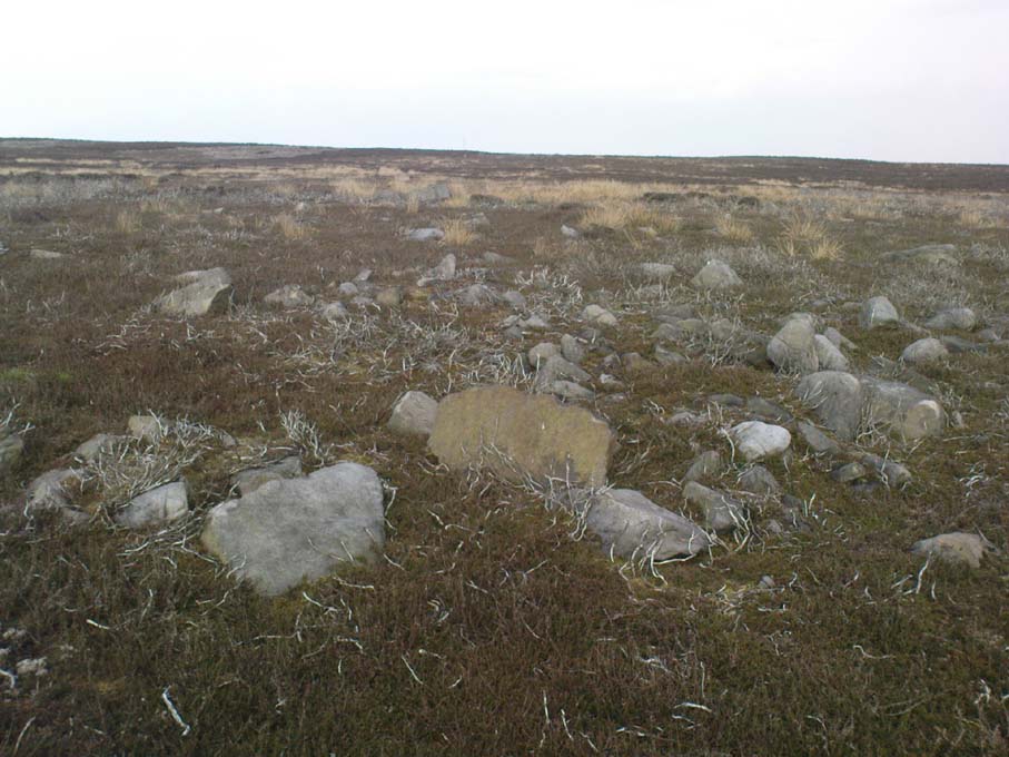
Another overgrown curve of walling

In 1960, Mr J. Davies first mentioned finding good evidence of flint-workings at a site close by; then described his discoveries in greater detail in the Yorkshire Archaeological Journal (1963) a few years later — but contended that the remains were of mesolithic origin.  A few years earlier, Mr D. Walker described a similar mesolithic “microlith site” a bit further north at Stump Cross.  Earlier still, Eric Cowling (1946) and others had made similar finds on these and adjacent moors.  Yet all of them missed this scatter of habitation sites, perched near the edge of the ridge running east-west atop of the ridge above the A59 road.  It’s quite extensive and, from the state of the walled remains, seems very early, probably neolithic in origin.

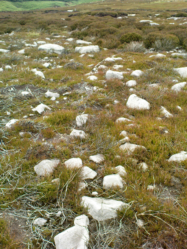
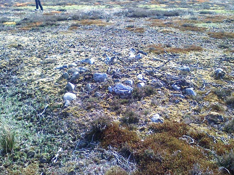
A number of small hut circles, 2-3 yards across, are scattered amidst the heather, with lines of walling—some straight, some not—broken here and there by people who came to gather their peat for fuel.  The walling and hut circle remains are very low to the ground, having themselves been robbed for stone it would seem.  The area initially appeared to be little more than a mass of stones scattered across the Earth (and much of it is), but amidst this are very clear lines of walls and circles, although they proved difficult to photograph because of the excessive growth of Calluna vulgaris.

Curious man-made structure in dried peat-bog

A couple of hundred yards south there are remains of one of the many dried black peat-bogs—with one large section that has been tampered with by humans at some point in the ancient past.  Over one section of it there has been built a small stone path, or possible fish-trap; plus elsewhere is a most curious rectangular walled structure (right) obviously made by people a long time ago.  Also amidst this dried peat-bog are the truly ancient remains of prehistoric tree-roots emerging from the Earth, a few thousand years old at least – and perhaps the last remnants of the ancient forests that once covered these moors.

How far back in time do all these walled remains take us?  Iron Age? Bronze Age?  Or much much further…?  Excavations anyone!?

References:

  1. Cowling, Eric T., Rombald’s Way, William Walker: Otley 1946.
  2. Davies, J., “A Mesolithic Workshop in Upper Wharfedale,” in Bradford’s Cartwright Hall Archaeology Group Bulletin, 5:1, 1960.
  3. Davies, J., “A Mesolithic Site on Blubberhouses Moor, Wharfedale,” in Yorkshire Archaeological Journal, part 161 (volume 41), 1963.
  4. Walker, D., “A Site at Stump Cross, near Grassington, Yorkshire, and the Age of the Pennine Microlith Industry,” in Proceedings of the Prehistoric Society, volume 22, 1956.

© Paul Bennett, The Northern Antiquarian 
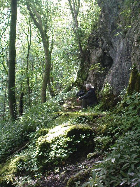

Fairy Holes, Whitewell, Lancashire

Legendary Cave:  OS Grid Reference – SD 6553 4677

Getting Here

Fairy Holes site

John Dixon took a bunch of us on a pleasant amble here via the Fair Oak Circle site.  From Fair Oak, go round the back of the farm and past the small cluster of hidden cottages, then bear right down the dirt-track and up the slope, then cross the field in front of you, going over the stile, following the footpath round the eastern edge of the slightly limestone New Laund Hill, and down again, thru the gate.  From here, head diagonally across the field 150 yards towards the fencing at the woodland edge.  Over the fence, into the trees, head halfway down the steep-ish slope and keep your eyes peeled for the rocky outcrop nearly halfway down.  Alternatively, an easier way here is apparently from the Inn at Whitewell.  Go across the river via the stepping stones (or wade!) and follow the footpath uphill towards a farm, where you’ll find a large steel gate on the left that leads into the woods.  Here there are 2 paths: follow the higher of the two until it starts bearing to the right.  Once here, look up the hill to the right you’ll see the rock outcrop.  The caves are there!

Archaeology & History

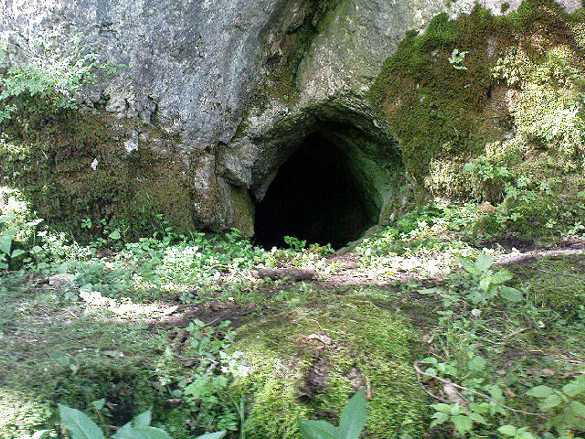
Smaller Fairy Hole

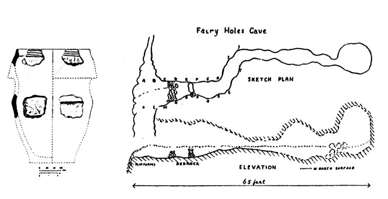
There are at least 3 caves here, close to each other along the edge of the small footpath a few yards apart.  The small rounded entrance of the northernmost one (photo, right) is reported by English Heritage to have had no human remains found therein, but further investigation is required here.  The main cave however is where intriguing prehistoric finds were located.  It appears that the entrance was deliberately built-up and blocked by stone walling a few yards inwards, giving the remains found therein a state of protection and sanctity.  Writer and historian John Dixon (2004) tells what was in the cave:

“In 1946, an excavation was carried out on the site by the archaeologist Reginald C. Musson.  In front of the larger cave is a flat platform on which evidence of Bronze Age daily life was found.  This included animal bones, a pebble pounder (used to extract marrow from bones) and shards of a food vessel.

“All that survived of this tripartite collared urn was a large rim-collar shard, two fragments displaying neck/shoulder/body elements and five smaller pieces, probably from the base of the body.  This is the only collared urn to have been found in a cave in Lancashire.  Its tripartite Pennine form assigns it to an early Bronze Age date.”

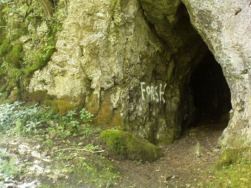
The main Fairy Hole
Plan of cave chamber (after J.Dixon 2004)

The artificial walled entrance may not merely have been an ingredient giving sanctity to the place, but this could well have been a site for ritual shamanic practices, including prolonged rites of passage and death rituals (authentic ones, not the modern pagan nonsense).  The ‘ritual death’ elements are highly probable here for, as John Michell (1975) told, caverns and crevasses are “most responsive to the necromancer’s invocation”.  It’s geomancy, spirit association and the archaeological finds therein are strongly suggestive of this usage. (Eliade 1989, 1995; Maringer 1960, etc)  Bearing this in mind, it is of some concern regarding the individual who thought it wise to spray-paint his name against the wall of the cave entrance (see photo); for many are those even in these days of shallow minds who fall prey to the car-crashes and creeping madness brought upon themselves by desecrating ancestral sites of ritual magick.  It would be intriguing to keep a prolonged eye on the ‘Forsh’ who painted his ego in this cave of dead spirits…

Folklore

Not surprisingly, the little people hold legend here.  Jessica Lofthouse (1946) found tales of these ancient peoples in several places close by, but at the Fairy Caves specifically,

“everyone knew that these little caves in the limestone at Whitewell were the homes of the little folk.”

…And in relation to the ingredient mentioned above, about ritual use of the cave in ancient times: are there any serious ritual magickians who’ve spent time working in this cave, overnight or longer, and who can let us know of their encounters here? (long shot, I know – but it’s worth asking, considering the probable use of the place)  Or perhaps spontaneous encounters of other people here…

References:

  1. Dixon, John, The Forest of Bowland, Aussteiger Publications: Clitheroe 2004.
  2. Eliade, Mircea, Shamanism, Arkana: London 1989.
  3. Eliade, Mircea, Rites and Symbols of Initiation, Spring Publications: Woodstock 1995.
  4. Lofthouse, Jessica, Three Rivers, Robert Hale: London 1946.
  5. Maringer, Johannes, The Gods of Prehistoric Man, Weidenfeld & Nicolson: London 1960.
  6. Michell, John, The Earth Spirit: Its Ways, Shrines and Mysteries, Thames & Hudson: London 1975.

© Paul Bennett & John Dixon, The Northern Antiquarian


High Low Ridge, Askwith Moor, North Yorkshire

Cairns:  OS Grid Reference – SE 166 512

Getting Here

Get here before the heather grows back!  From the Askwith Moor parking spot, walk up the road (north) and turn left on the moorland track, past the triangulation pillar, then the ranger’s hut on the edge of the hill, and head WNW along and down the gradual slope.  You’ll get to a row of grouse butts after a few hundred yards and, if you’re lucky to find it, an old OS trig-marked arrow carved on one of the low-lying stones.  This stone is about 10 yards away from the cairn!

Archaeology & History

There are no previous references to this site.  It was discovered by the hardworking Keighley volunteer, Michala Potts of Bracken Bank, on May 20, 2010, and was the most visible of at least three prehistoric cairns on the sloping edge of this hill. The main one illustrated here is about 3 yards in diameter and only a foot or two high.  Typical of the many Bronze Age cairns scattering the moors north and south of here, several others are in close attendance.  It seems as if some of the stone from this cairn has been robbed to build some of the grouse-butts that stretch across the moors hereby.

Single cairn on Askwith Moor
Same cairn, looking uphill

About 50 yards away from the main cairn shown in the photos are a couple of others of the same size and nature.  And if we walk over the other side of the nearby rounded hill immediately south, a couple of other cairns are in evidence.  However, we didn’t spend too much time here getting any images, as other sites on the moor were beckoning and we were running out of good daylight!

The name of this area seems a little odd: “High Low” — and our old place-name masters say little about it in the Yorkshire directories.  The name is shown in the earliest large-scale OS-maps, but the contradiction of a high low ridge probably derives from the word originally being lowe, or “hlaw”: which as A.H. Smith (1956) said,

“In (old english) the common meaning in literary contexts is ‘an artificial mound, a burial mound,'”

Cairn to centre, with 1 more on near horizon

which is exactly what we have found here — or several of them scattered about.  This tumulus derivation is echoed by modern place-name authorities like Margaret Gelling (1988), etc.  Gelling told how the word hlaw, or low, and its variants, “was used of burial mounds over a wide area, from the south coast to the West Riding.”  Much as we’ve found on this hill at Askwith Moor!  We’ve yet more exploring to do in and around this area in the coming weeks.  God knows what else we’ll find!

References:

  1. Cowling, Eric T., Rombald’s Way: A Prehistory of Mid-Wharfedale, William Walker: Otley 1946.
  2. Gelling, Margaret, Signposts to the Past, Phillimore: Chichester 1988.
  3. Smith, A.H., English Place-Name Elements – volume 1, Cambridge University Press 1956.

© Paul Bennett, The Northern Antiquarian

Askwith Moor Cairnfield, North Yorkshire

Cairns:  OS Grid Reference – SE 170 507– NEW DISCOVERY

Getting Here

From the large parking spot by the roadside along Askwith Moor Road, walk up (north) 250 yards until you reach the gate with the path leading onto Askwith Moor.  Follow this along, past the triangulation pillar until you reach the Warden’s Hut near the top of the ridge and overlooking the moors ahead.  Naathen — look due south onto the moor and walk straight down the slope till the land levels out.  If you’re lucky and the heather aint fully grown, you’ll see a cluster of stones about 500 yards away.  That’s where you’re heading.  If you end up reaching the Woman Stone carving, you’ve walked 100 yards past where you should be!

Archaeology & History

Discovered on the afternoon of May 13, 2010, amidst another exploratory ramble in the company of Dave Hazell.  We were out looking for the Woman Stone carving and a few others on Askwith Moor, and hoping we might be lucky and come across another carving or two in our meanderings.  We did find a previously unrecorded cup-marked stone (I’ll add that a bit later) — and a decent one at that! — but a new cairn-field was one helluva surprise.  And in very good nick!

Cairn A, looking northwest
Cairn A, looking east

There are several cairns sitting just above the brow of the hill, looking into the western moors.  Most of these are typical-looking single cairns, akin to those found on the moors above Ilkley, Bingley and Earby, being about 3 yards across and a couple of feet high amidst the peat and heather covering.  But two of them here are notably different in structure and size (and please forgive my lengthy description of them here).

We found these tombs after noticing a large section of deep heather had been burnt back, and a large mass of rocks were made visible as a result.  Past ventures onto these moors when seeking for cup-and-ring carvings hadn’t highlighted this cluster, so we thought it might be a good idea to check them out!  As I approached them from the south from the Woman Stone carving (where we’d sat for a drink and some food, admiring the moors and being shouted at by a large gathering of geese who did not want us here), it became obvious, the closer I got, that something decidedly man-made was in evidence here.

Cairn A, looking south

Walking roughly northwards out of the heather and onto the burnt ground, a cairn-like feature (hereafter known as “Cairn A”) was right in front of me; though this seemed to have a ring of small stones — some earthfast, others placed there by people — surrounding the stone heap.  And, as I walked around the edge of this large-ish cairn (about 9 yards in diameter and 2-3 feet tall), it was obvious that a couple of these outlying stones were stuck there by humans in bygone millenia.  The most notable feature was the outlying northernmost upright: a small standing stone, coloured white and distinctly brighter than the common millstone grit rock from which this monument is primarily comprised.  As I walked round it — adrenaline running and effing expletives emerging the more I saw — it became obvious that this outlying northern stone had long lines of thick quartz (or some crystalline vein) running across it, making it shine very brightly in the sunlight.  Other brighter stones were around the edge of the cairn.  It seemed obvious that this shining stone was of some importance to the folks who stuck it here.  And this was confirmed when I ambled into another prehistoric tomb about 50 yards north, at “Cairn B.”

Cairn B, looking north
Cairn B, looking east

Cairn B was 11 yards in diameter, north-south, and 10 yards east-west.  At its tallest height of only 2-3 feet, it was larger than cairn A.  This reasonably well-preserved tomb had a very distinct outlying “wall” running around the edges of the stone heap, along the edge of the hillside and around onto the flat moorland.  Here we found there were many more stones piled up in the centre of the tomb, but again, on its northern edge, was the tallest of the surrounding upright stones, white in colour (with perhaps a very worn cup-marking on top – but this is debatable…), erected here for some obviously important reason which remains, as yet, unknown to us.  Although looking through the centre of the cairn and onto the white upright stone, aligning northwest on the distant skyline behind it, just peeping through a dip, seems to be the great rocky outcrop of Simon’s Seat and its companion the Lord’s Seat: very important ritual sites in pre-christian days in this part of the world.  Near the centre of this cairn was another distinctly coloured rock, as you can see in the photo, almost yellow!  Intriguing…

The smaller “Cairn C”

Within a hundred yards or so scattered on the same moorland plain we found other tombs: Cairns C, D, E, F, G and H — but cairns A and B were distinctly the most impressive.  An outlying single cairn, C, typical of those found on Ilkley Moor, Bingley Moor, Bleara Moor, etc, was just five yards southwest of Cairn A, with a possible single cup-marked stone laying on the ground by its side.

Just to make sure that what we’d come across up here hadn’t already been catalogued, I contacted Gail Falkingham, Historic Environment team leader and North Yorkshire archaeological consultant, asking if they knew owt about these tombs.  Gail helpfully passed on information relating to a couple of “clearance cairns” (as they’re called) — monument numbers MNY22161 and MNY 22162 — which are scattered at the bottom of the slope below here.  We’d come across these on the same day and recognised them as 16th-19th century remains.  The cairnfield on top of the slope is of a completely different character and from a much earlier historical period.

We know that human beings have been on these moors since mesolithic times from the excess of flints, blades and scrapers found here.  Very near to these newly-discovered tombs, Mr Cowling (1946) told that:

“On the western slope of the highest part of Askwith Moor is a very interesting flaking site. For some time flints have been found in this area, but denudation revealed the working place about August, 1935.  There were found some twenty finished tools of widely different varieties of flint.  A large scraper of red flint is beautifully worked and has a fine glaze, as has a steep-edged side-blow scraper of brown flint.  A small round scraper of dull grey flint has the appearance of newly-worked flint, and has been protected by being embedded in the peat…One blade of grey flint has  been worked along both edges to for an oblong tool… The flint-worker on this site appears to have combed the neighbourhood to supplement the small supply of good flint.”

All around here we found extensive remains of other prehistoric remains: hut circles, walling, cup-and-ring stones, more cairns, even a probable prehistoric trackway.  More recently on another Northern Antiquarian outing, we discovered another previously unrecognised cairnfield on Blubberhouse Moor, two miles northwest of here.

References:

  1. Cowling, Eric T., Rombald’s Way: A Prehistory of Mid-Wharfedale, William Walker: Otley 1946.
  2. Jack, Jim, “Ancient Burial Ground and Bronze Age Finds on Moor,” in Wharfedale Observer, Thursday, May 27, 2010.

© Paul Bennett, The Northern Antiquarian

Smoo Cave, Durness, Sutherland

Cave:  OS Grid Reference – NC 419 672

Getting Here

From Durness take the road east for a couple of miles till you see the signpost which takes you on the left-hand side of the road, down to the coast.  You can’t miss it!

Archaeology & History

Findings here allege to take the history of the place into the mesolithic period, but we don’t know this for sure.  An excavation here by a Mr Donald Macdonald of Sangobeg in 1904 uncovered the presence of several small bone pins, which seem consistent with Mesolithic finds elsewhere.  When archaeo-excavations were done here in 1982, human remains going back to at least Iron Age were found in the simple deposit of many shells.  A further analysis by the Glasgow Archaeology Unit in 1996 was prevented of some excavation by (get this!) those screwy Health & Safety regulations.  Here’s a definite case for an independent group to undertake work here, as we could ignore such preventative measures (and if we drown it’s our fault!).  Smoo Cave’s primary function is pretty obvious: it would have been used for both shelter and ritual. 

Folklore

The folklore here tells of magick and occultism and possible remnants of rites of passage lore. For herein, many centuries ago, a powerful land-owner called Lord Reay — reputed as a master in the black arts — battled with the devil in the Smoo Cave.

The devil was keeping watch on Lord Reay following a previous dispute between the two of them, and espied him as he entered the cave. As Alexander Polson told it, the cave

“consists of three caverns, one within the other. Lord Reay had got as far as the second, and his dog, which had gone on in advance, returned howling and hairless. By this, Lord Reay knew that Satan was there before him, and bravely waited the attack, which was soon made, and his lordship fought lustily. Happily at the opportune moment a cock crew. This frightened the devil and his attendant witches, but Lord Reay stood between them and the exit. In their fright they blew holes through the roof of the cave, and this is the origin of the two openings through which the Smoo burns fall.”

Pitch black cave; protective spirit animal; encountering one’s psychological nemesis; unconscious battles with Underworld forces; rebirth of the sun at cock-crowing time; the conquering of the dark forces and renewal of Lord Reay.  These are typical hallmarks probably signifying folk-remnants of shamanism and rites of passage, for which this cave may once have been used.

References:

  1. Polson, Alexander, Scottish Witchcraft Lore, W. Alexander: Inverness 1932.

© Paul Bennett, The Northern Antiquarian 
Nursery Knot, Appletreewick Moor, North Yorkshire

Sacred Hill:  OS Grid Reference – SE 081 636

Also known as:

  1. Nursa Knott
  2. Nursery Hill

Getting Here

Dead easy.  Follow the Grassington-Pateley Bridge road (B6265) east and about 2 miles past Hebden village, the craggy hill rises to the left-hand side of the road, as you can see in the photo below.  Simple!

Archaeology & History

Nursery Knott hill
Nursery Knott hill

When fellow rock-art freaks Graeme Chappell, Richard Stroud and I were exploring the cup-and-ring stones in the area just south of here a few years back, this hill kept calling out with some repeated awe. “There’s summat about that place,” were the remarks we kept saying – but we could never put our finger on it. (still haven’t if truth be had!).  Between here and the awesome Simon’s Seat to the south, a whole panoply of neolithic and Bronze Age remains scatter the land — and if ritual landscape has any validity, this hill is undoubtedly enmeshed in the mythic framework of such a paradigm. But without any folklore I didn’t feel right to include it here…

At the northern or rear-end of this great outcrop (SE 082 640) is a scattering of many boulders, one of which in particular at Knot Head was explored by a Mr Gill in 1955 and found to have a number of Mesolithic worked flints all round it. Seems as if folk have been up to things round here for even longer than we first thought.  Microlith or flint-hunters would probably do well on the moors up here!

Folklore

It’s the old pen of our Yorkshire topographer Edmund Bogg which brings the lost folktale of this place back to life – and it’s typical of aboriginal creation myths from elsewhere in the world. In his Higher Wharfeland he had this to say of old ‘Nursa Knott’, as it was locally known:

“The old legend is that the devil, for some reason anxious to fill up Dibb Gill,* was carrying these ponderous crags in his apron when, stumbling over Nursa Knott, the strings broke and the crags fell. Legend also says, should the crags be removed they will be carried by some invisible power back to their original position.”

He then reminds us of links with old Wade, plus the settlement of old Grim, a short distance to the north.

Across the road down the track running south to Skyreholme, Jessica Lofthouse ( 1976) told the tale of a ghostly horseman, seen by her great-grandfather no less! Suggesting he may have been ‘market merry’ (i.e., pissed!), she told how he “struck out at a spectral white horse at the Skyreholme three-land ends near Appletreewick – and his stick passed through it!”

References:

  1. Bogg, E., Higher Wharfeland: The Dale of Romance, James Miles: Leeds 1904.
  2. Lofthouse, Jessica, North Country Folklore, Hale: London 1976.
  3. Walker, D., ‘A Site at Stump Cross, near Grassington, Yorkshire, and the Age of the Pennine Microlithic Industry,’ in Proceedings of the Prehistoric Society, 1956.

* Dibb Gill is nearly a mile due west of here – and Dibble’s Bridge which crosses the beck was also known as the Devil’s Bridge, with a few typical creation myths of its own attached.

© Paul Bennett, The Northern Antiquarian