Intake Farm, Hawksworth, West Yorkshire

Cup-Marked Stone:  OS Grid Reference – SE 15867 41244

Getting Here

Intake Farm carving

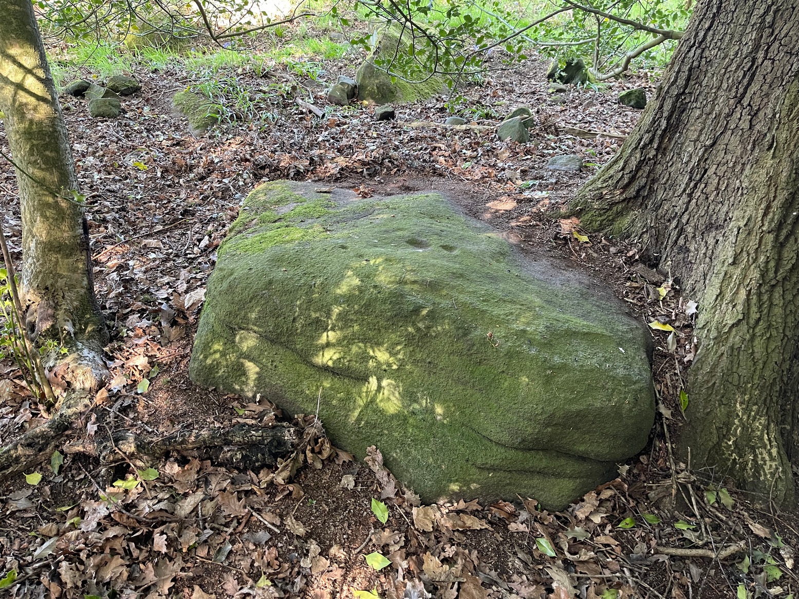
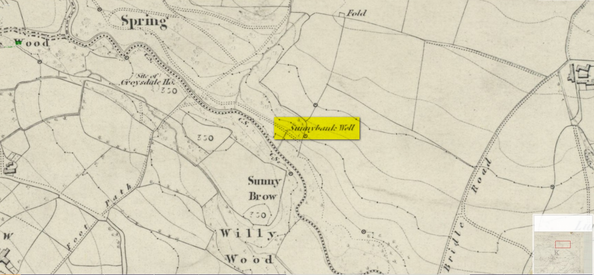
In Hawksworth village, less than 100 yards past the primary school, take the footpath on your left into the open fields.  200 yards down the fields, go over the stile on your right, into the next field and walk diagonally across it (SW) for 250 yards until you reach the wall; then walk alongside it, west, for another 150 yards where the walling goes due south and walk down here for 135 yards, going through the gate at the bottom into the next field and, at the bottom of this one go through the gate and bear right.  OK, now walk along the wall-side for 55 yards and you’re just about standing on it!  Alternatively you can reach it via the Hawksworth Spring (1) and (4) carvings, following the wall along for roughly 150 yards till you reach the gate. Go through here and walk diagonally NNW across the field for nearly 150 yards where you’ll see the stone stuck out in front of the wall.

Archaeology & History

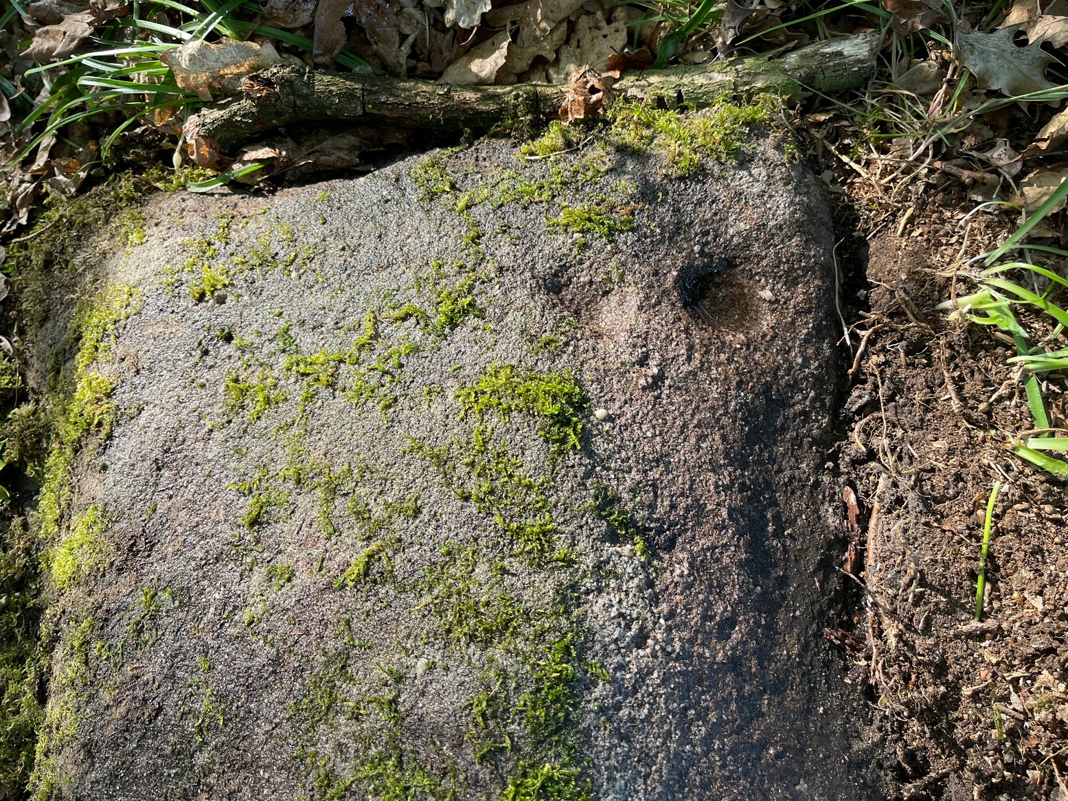
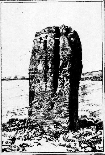
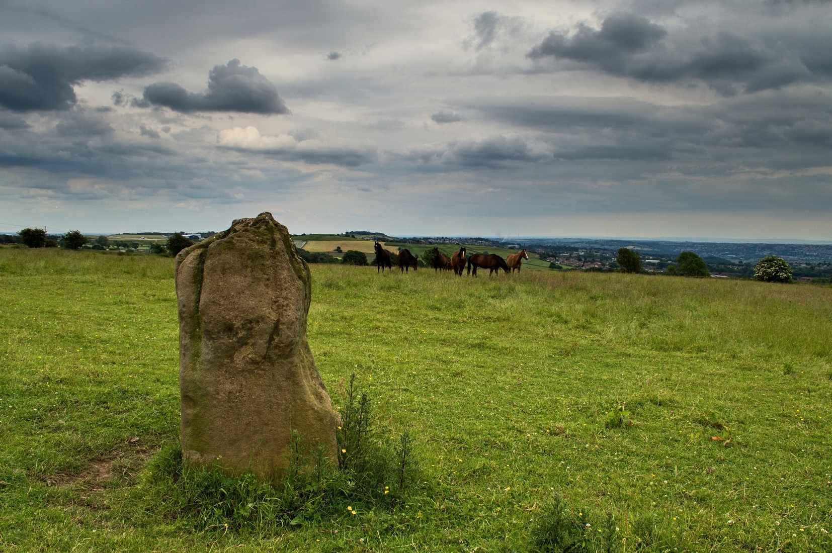
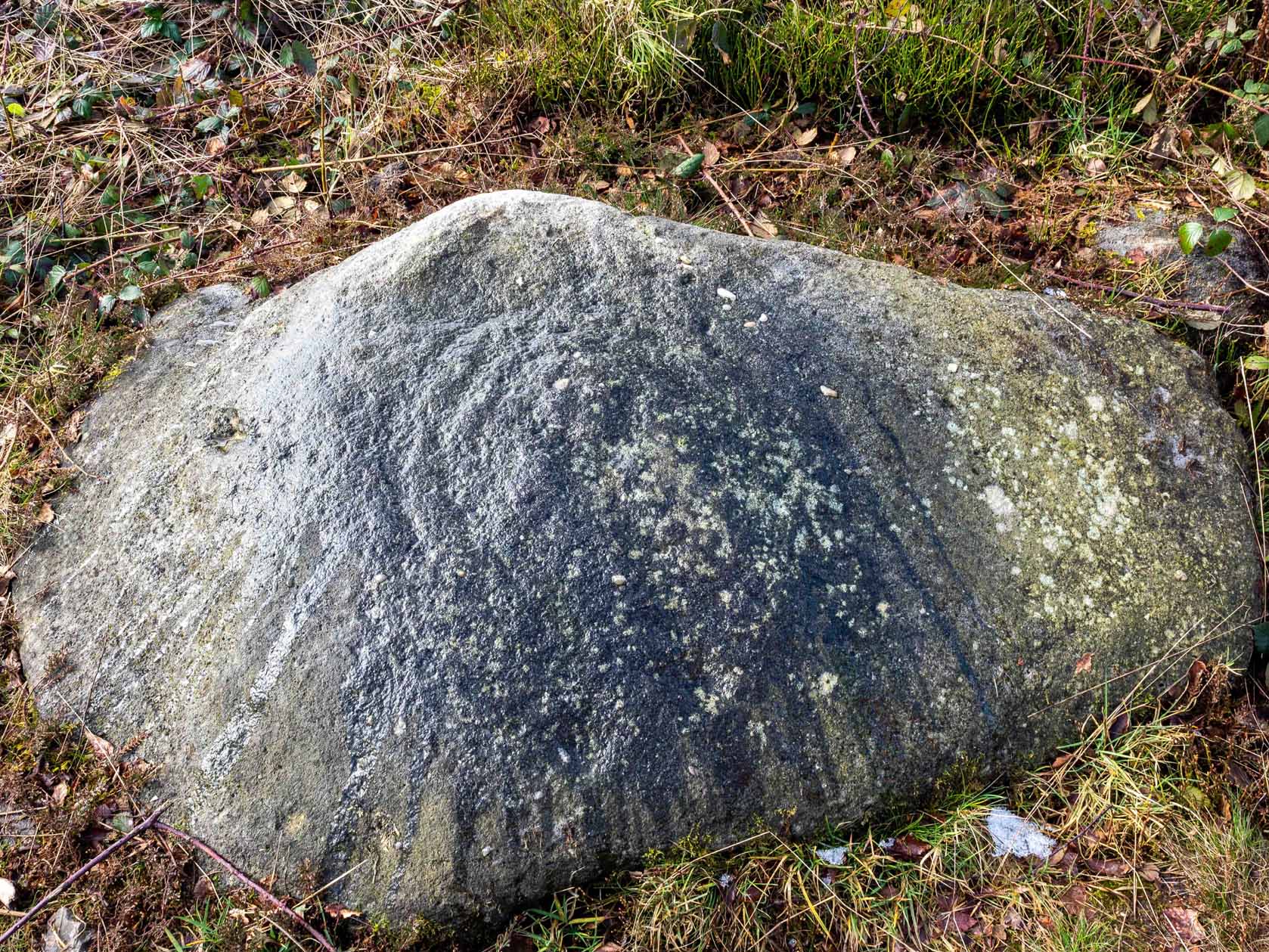
My first sight of this came about as I walked alongside the walling.  Approaching the stone, I noticed what looked like a recent cup-like marking with a curved line emerging from it on its eastern surface; but it didn’t look too old and was more like the scratch-marks you see sometimes when farmers have been dragging rocks along to be used in walling.  So I shrugged in slight disappointment—until the far-side, the western-side of the stone came into view.

Line of cups
Main scatter of cups

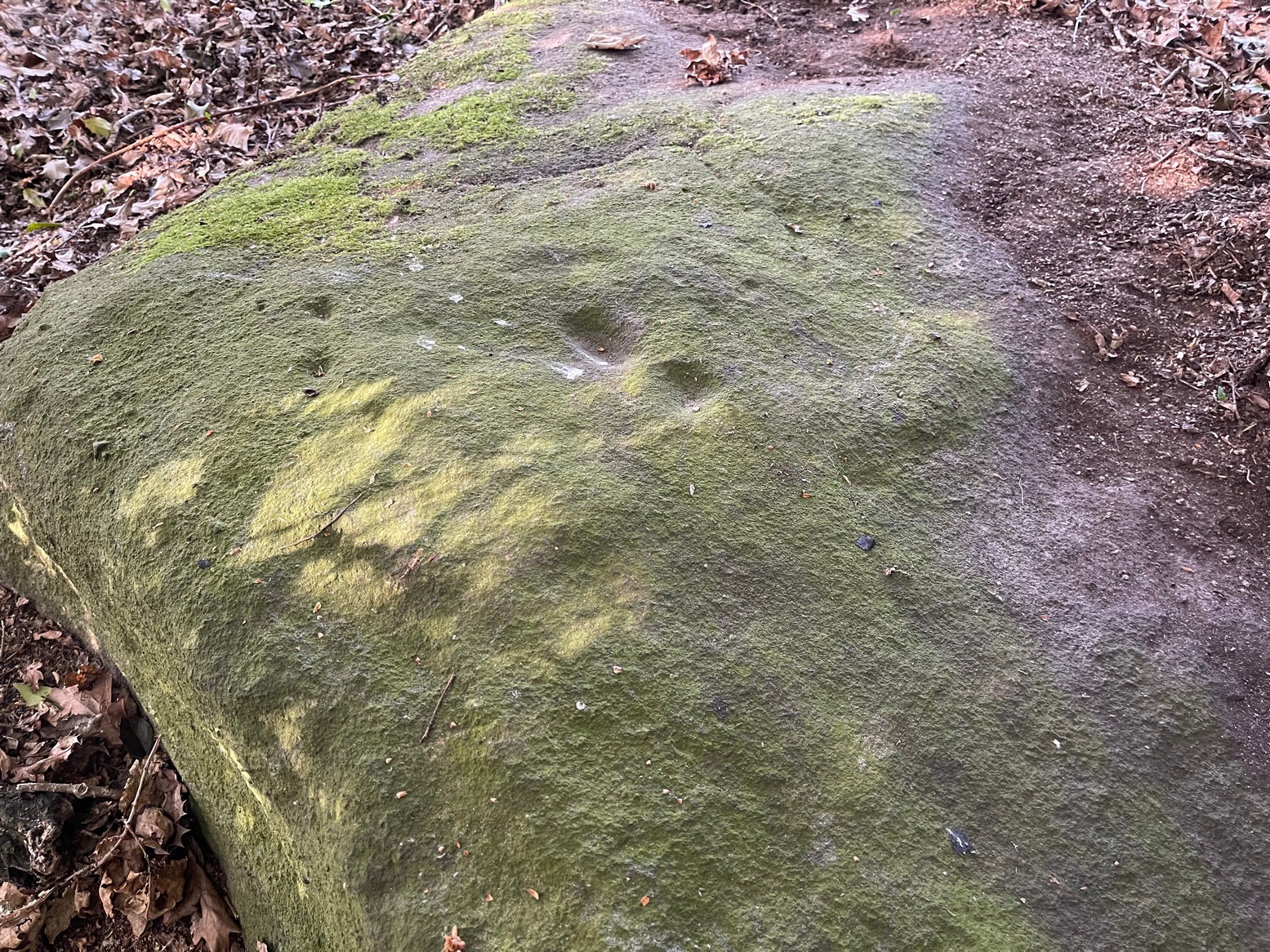
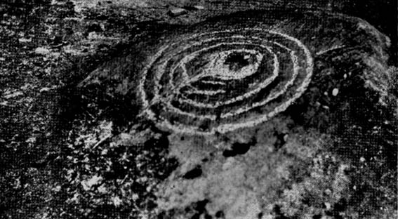
Sloping ever-so-slightly down into the ground, the surface of the stone had a cluster of quite worn, shallow, but distinct cup-markings between one and two inches across, four of which ran in a line from the top to the edge of the stone in a slight curve.  As I walked round it, looking from different angles, it became obvious that two or three other cups existed—mainly from the top to the western side of the rock.  One seemed to exist near the edge, whilst two other faint ones sat to the side of the line-of-four—almost creating a square formation.  From some angles it looked as if there may be faint lines running between some of the cups but (as usual) the sunlight didn’t really help highlight them and they could just be faded erosion lines.

Looking down at the cups
Water & sunlight & cups

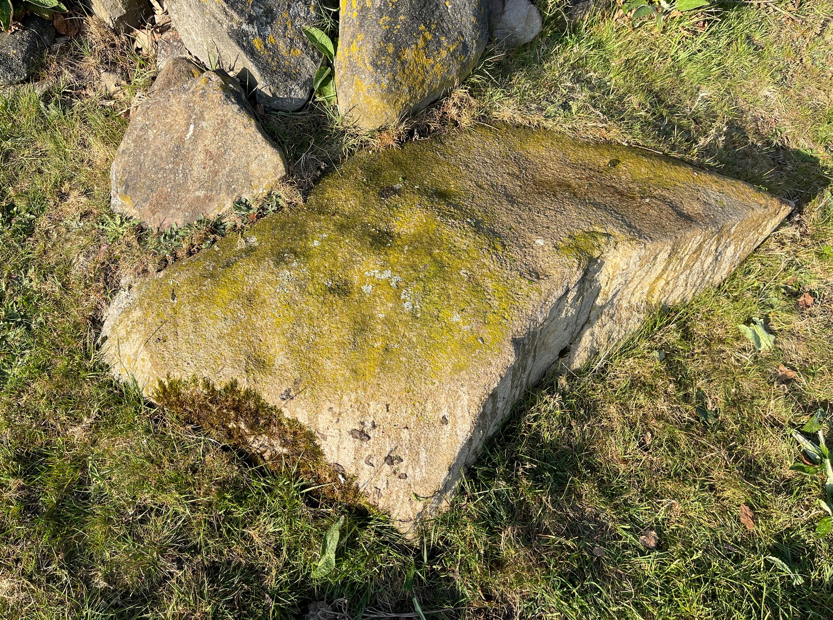
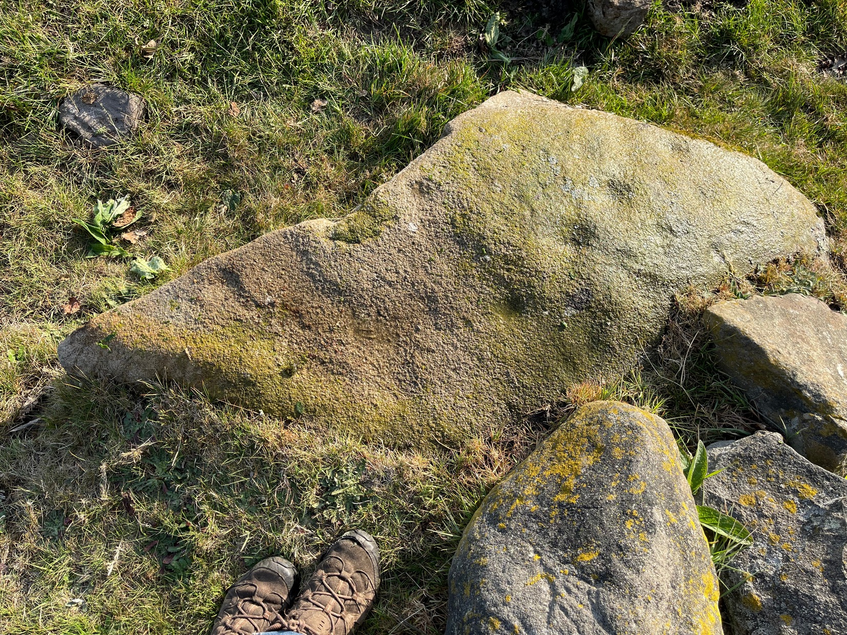
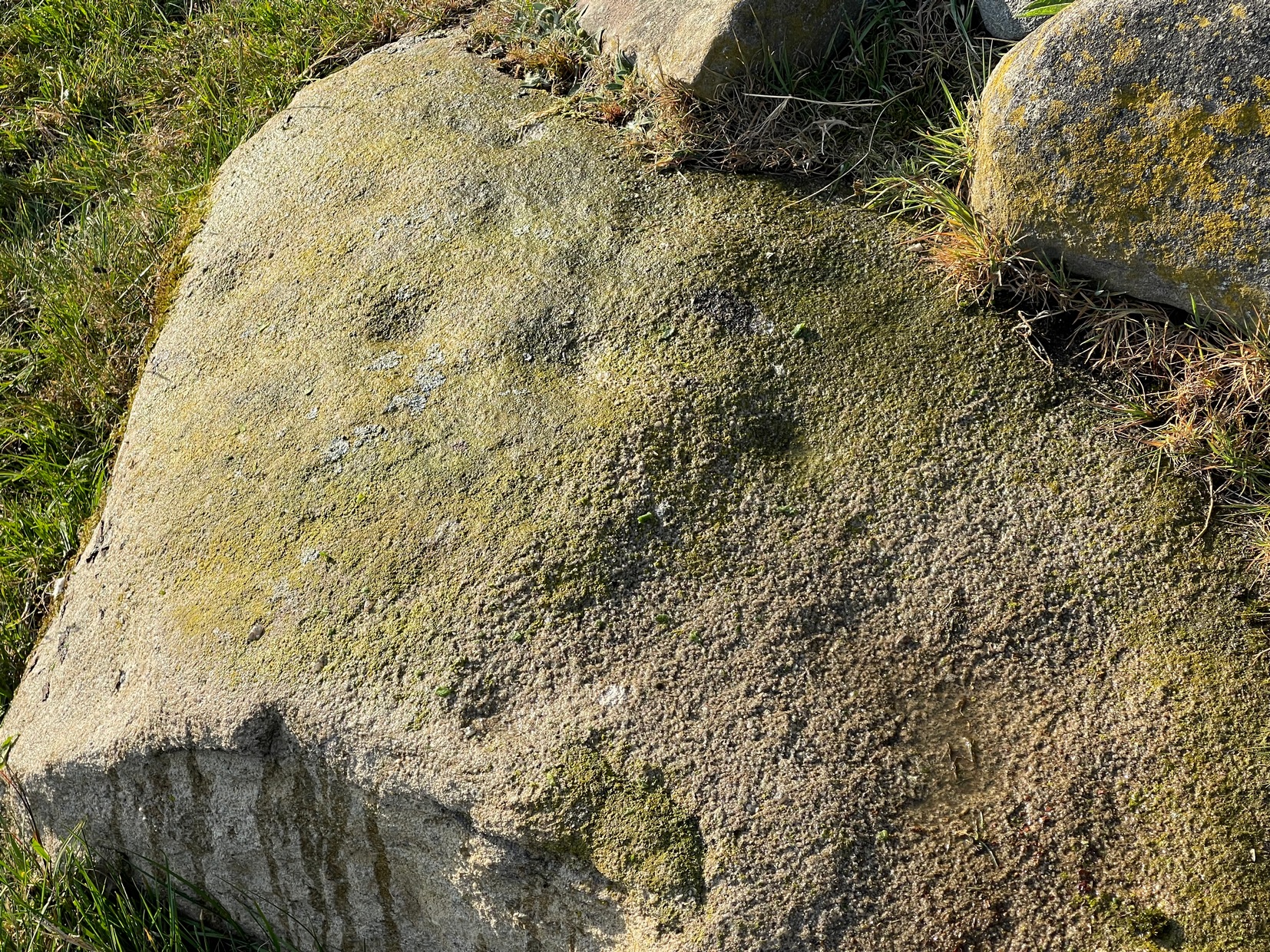
It was obvious that a section of the stone on its southern edge had been broken off in the not-too-distant past, raising the idea that the design may originally have been larger than its present form.  This thought returned when I walked another 60 yards west along the wall and came across a broken section of stone that had been placed into it, pretty recently, and on its vertical face noticed a single cup-mark in a good state of preservation, indicating that it had either been cut recently or instead been dug out of the ground not too long ago and shown intself to the world after a sleep of several millenia.  Look at it when you have a gander at the main carving here and make up your own mind….

© Paul BennettThe Northern Antiquarian

Hawksworth Spring (04), Hawksworth, West Yorkshire

Cup-Marked Stone:  OS Grid Reference – SE 15802 41206

Getting Here

Hawksworth Spring (04)

Take the same directions as if you’re going to visit the Hawksworth Spring (1) carving.  From here, the small footpath at its side keeps going uphill, curving to the right and following the line of walling.  After about 20 yards where the land begins to level out, keep your eyes peeled for a small elongated earthfast rock, less than three feet long, just to the left of the path and only three or four yards away from the wall.  If the leaves have covered the stone, get on your hands and knees and scrub around a bit.  You’ll find it!

Archaeology & History

Primary cup-marking

This was a frustrating find as there are several elements on the stone, only one of which I could be 100% certain about – and that’s the singular cup-marking on the top-left of the stone.  Just next to this is what looks to be another one, unfinished, cut into a natural fissure in the rock—but the daylight was frustrating, allowing only glimpses of visual clarity on the stone.  At the other end of the stone, as the photo shows, are what stand out as two or three more cup-marks, but these seem geophysical in nature—although examples such as these scatter the works of Boughey & Vickerman (2003; 2018) as authentic, which shows the problem we all have as rock art students. Anyhow, at least one of these cups is the real deal.  I’ll let the computer-tech lads sort the rest of it out for us…

© Paul BennettThe Northern Antiquarian

Hawksworth Spring (03), Hawksworth, West Yorkshire

Cup-Marked Stone:  OS Grid Reference – SE 15807 41196

Getting Here

Hawksworth Spring (3) CR

Once you’ve located the carvings of Hawksworth Spring (1) and (2), walk up the slope towards the topmost section of the walling where the land begins to level out.  Hereby you’ll see the Hawksworth Spring (4) carving (if it’s not covered in leaves) several yards below the wall. Turn around and look diagonally to your left, into the trees, where you need to walk into and beneath the overhanging holly branches.  Here you’ll reach the large earthfast rock whose edge rests up against the trunk of a larger tree.  You can’t miss it!

Archaeology & History

Notable curious “cups”

I’m not 100% convinced that this a prehistoric design, despite it being listed as such in Boughey & Vickerman’s (2003) survey—although, to be fair, they do suggest it as being “doubtful.”  The two most notable so-called “cups” have more of a recent hallmark to them and the other elements are troublesome to see with any certainty, but they may be geophysical in nature.  Their description of it told us this was a “fairly large fine-grained rock with some included pebbles.  Two pairs of cups, one pair connected by groove”.  Make of it what you will….

References:

  1. Boughey, Keith & Vickerman, E.A., Prehistoric Rock Art of the West Riding, WYAS: Wakefield 2003.

© Paul BennettThe Northern Antiquarian

Sunnybank Well, Hawksworth, West Yorkshire

Healing Well:  OS Grid Reference – SE 16228 40696

Getting Here

Sunnybank Well spring

My walk up to this place took me off the main A6038 Hollins Hill road, across from the petrol station and up the scruffy disused road to the hamlet of Tong Park, bending round the houses to the right when they appear.  Keep along this old track, then veer right, down the slope and along the footpath and into the trees under the railway arches, keeping on until you reach the lake on your left.  At the end of the lake, cross the bridge and follow the footpath as it bends to the left and into the trees.  You’ll go over a stile and then about 50 yards along, the stream that crosses the path emerges from a crack in the rocks on your right.  You’re here!

Archaeology & History

Site shown on 1852 map

All history and tradition of this site seems long gone. It was shown on the 1852 Ordnance Survey map of the region and doubtless receives its name from the location, as the spring of water emerges from beneath the sloping embankment which is a bit of a sun-trap in Spring and Summer.  It makes sense.  Although I can find no reference to any medicinal attributes, the waters of Sunnybank Well are cold, fresh and drinkable.

References:

  1. Shepherd, Val, Historic Wells in and Around Bradford, HOAP: Wymeswold 1994.

Acknowledgements:  Huge thanks for use of the Ordnance Survey map in this site profile, reproduced with the kind permission of the National Library of Scotland

© Paul BennettThe Northern Antiquarian

Bull Stone, Guiseley, West Yorkshire

Standing Stone/s:  OS Grid Reference – SE 20675 43469

Also Known as:

  1. Boon Stones
  2. Boul Stones
  3. Bull Stone of Otley Chevin

Getting Here

Bull Stone as ‘Pillar’, 1851 map

Worth checking this if you aint seen it before! Head up to the back (south-side) of Otley Chevin (where the cup-and-ring Knotties Stone lies sleeping), following the road there and park up near/at the Royalty pub.  Take the footpath behind the pub which crosses the fields and once into the second field, head diagonally down to the far-left corner.  From here, look over the wall — you can’t really miss it!

Archaeology & History

An intriguing site for various reasons.  All we have left to see of any value nowadays is this nigh-on 6-foot tall thick monolith, standing alone in the field halfway between West Carlton and Otley Chevin.  Completely missed in local archaeological surveys, the place was mentioned briefly by Slater (1880); though it appears to have been first described in detail by Eric Cowling (1946), who suspected the stone may have Roman origins (though didn’t seem too convinced!), saying that:

“near the ground the section is almost oblong, with sides three-feet six-inches by one-foot ten-inches; two feet from top, the section is almost circular.”

Sid Jackson’s 1956 sketch
Photo by James Elkington

The fact that the stone stands very close to the line of an all-but forgotten Roman road that runs right past it added weight to this thought (the road runs towards a Roman settlement a mile east of here near Yeadon).  But this standing stone is unlikely to be Roman.  More recent evidence seems to indicate a relationship with a now-lost giant cairn about 100 yards to the south.  The only remains we have of this place are scatterings of many small loose stones nearby.  And it seems a very distinct possibility that the extra standing stones that were once hereby, stood in a line.

The very first reference I’ve found about this site also indicates that there was more than one stone here in the past!  In 1720 this site was known as the ‘Boon Stones’; and the plural was still being used by the time the 1840 Tithe Awards called them the ‘Boul Stones.’  Initially it was thought that both words were plural for “bulls” — as A.H. Smith (1962) propounds in his otherwise superb survey — but this is questionable. (see Folklore)

Folklore

A piece of folklore that seems to have been described first by Philemon Slater (1880) relates to the pastime of bull-baiting here, that is –

“fastening bulls to it when they were baited by dogs, a custom…still known to the Carlton farmers” (North Yorkshire).

Cowling (1946) told that he heard the stone was said to be lucky as well as being a source of fertility.  This ‘fertility’ motif may relate to the meaning of the stone’s early name, the Boon Stones.  Both boon and boul are all-but obsolete northern dialect words.  ‘Boul’ is interesting in its association with a prominent folklore character, as it was used as a contemptuous term “for an old man.”  Now whether we can relate this boul to the notion of the ‘Old Man’ in British folklore, i.e., the devil, or satan — as with the lost standing stone of The Old Man of Snowden, north of Otley — is difficult to say.

More interestingly perhaps is the word ‘boon’, as it is an old dialect word for “a band of reapers, shearers, or turf-cutters.”  This band of reapers ordinarily consisted of five or six people and would collect the harvest at old harvest times.  And as the early description talks of Boon Stones, this plurality would make sense.  One curious, though not unsurprising folklore relic relating to these boons was described at another megalithic site (now gone) by John Brand (1908), where in the parish of Mousewald in Dumfries,

“The inhabitants can now laugh at the superstition and credulity of their ancestors, who, it is said, could swallow down the absurd nonsense of ‘a boon of shearers,’ i.e., reapers being turned into large grey stones on account of their kemping, i.e., striving.”

Standing stones with the folklore of them being men or women turned to stone is common all over the world.  If we accept the dialect word ‘boon’ as the first name of this old stone, there may once have been some harvest-time events occurred here long ago (and this is quite likely).  Equally however, we must also take on the possibility that this Bull Stone has always been a loner and that its name came from the now obsolete Yorkshire word, a bull-steann, meaning a stone used for sharpening tools, or a whetstone.

Take your pick!

References:

  1. Bennett, Paul, The Old Stones of Elmet, Capall Bann: Milverton 2001.
  2. Brand, John, Observations on the Popular Antiquities of Great Britain – volume 2, George Bell: London 1908.
  3. Cowling, Eric T., Rombald’s Way, William Walker: Otley 1946.
  4. Jackson, Sidney, ‘The Bull Stone,’ in Cartwright Hall Archaeology Group Bulletin, 2:5, 1956.
  5. Smith, A.H., English Place-Name Elements – 2 volumes, Cambridge University Press 1956.
  6. Smith, A.H., The Place-Names of the West Riding of Yorkshire – volume 7, Cambridge University Press 1962.
  7. Slater, Philemon, The History of the Ancient Parish of Guiseley, William Walker: Otley 1880.

© Paul Bennett, The Northern Antiquarian 


Knotties Stone, Otley Chevin, West Yorkshire

Cup-and-Ring Stone:  OS Grid Reference – SE 20772 44181

Also Known as:

  1. Carving no. 396 (Boughey & Vickerman)

Getting Here

Knotties stone (photo, James Elkington)

From The Royalty hotel, walk along the footpath onto the Chevin itself, turning left then walk about 350 yards east, past the small copse of trees.  Just north of the main path before the land slopes down you’ll find it.  It’s carved on an earthfast rock about 6 feet long.

Archaeology & History

This is an excellent carving if you’re into cup-and-rings!  Eric Cowling (1940) first described the stone* in an article for the Yorkshire Archaeology Society.  Although it’s somewhat faded, when the stone’s wet and the sun’s low on the horizon, you can make out more rings than just the three which Boughey & Vickerman (2003) described in their survey.

Folklore

Knotties Stone (E.T. Cowling)

Although the Chevin itself has a tradition of ‘supposed’ heathen goings-on in bygone days, the carving has nothing specific said about it.  Although one intriguing bit of info comes from the old Otley historian, Harold Walker (1974), who said that,

“blocks of stone were sent from (the) Chevin to form the foundations of the Houses of Parliament”!

Those lying deviants probably smashed up a few bits of extra rock art when they did this — not that those sorta people give a shit about anything unless it’s about money.

References:

  1. Boughey, Keith & Vickerman, E.A., Prehistoric Rock Art of the West Riding, WYAS 2003.
  2. Cowling, E.T., ‘A Classification of West Yorkshire “Cup-and-Ring” Stones,’ in Archaeology Journal, 97, 1940.
  3. Cowling, E.T., Rombald’s Way, William Walker: Otley 1946.
  4. Hotham, John Paul, Halos and Horizons, Hotham Publishing: Leeds 2021.
  5. Walker, Harold, This Little Town of Otley, Olicana: Otley 1974.

* Graeme Chappell tells me that this carving was named after Cowling’s nickname, Knotty!

© Paul Bennett, The Northern Antiquarian 


Hawk Stone, Shipley, West Yorkshire

Cup-Marked Stone:  OS Grid Reference – SE 1792 4099

Getting Here

Take the road from Shipley to Guiseley, the A6038, past the turn-off to Esholt, until you get to the top of what’s locally known as Hollins Hill.  There’s a small farm-track to your leftand in the woodland here you’ll find the rocky outcrop.

Archaeology & History

Nothing has been written about this spot, but in this large wind-and-water worn rock outcrop, with its small cave, on the top part of the rock are several faint cup-markings.

Folklore

Legend tells that a man on horseback jumped from the top of here and landed safely at Low Hall, Yeadon, 2500 yards away to the east. (probably some sort of solar lore)

References:

  1. Gray, Johnnie, Through Airedale, from Goole to Malham, 1891.

© Paul BennettThe Northern Antiquarian