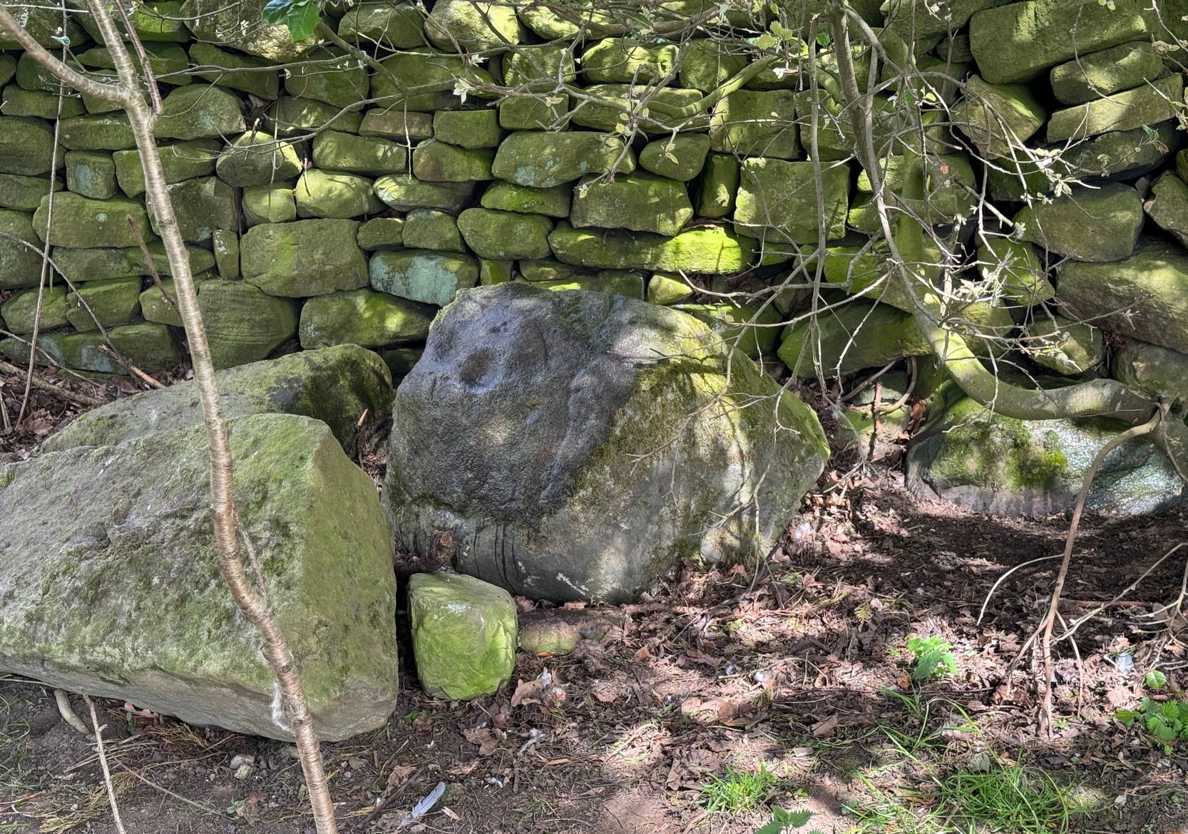
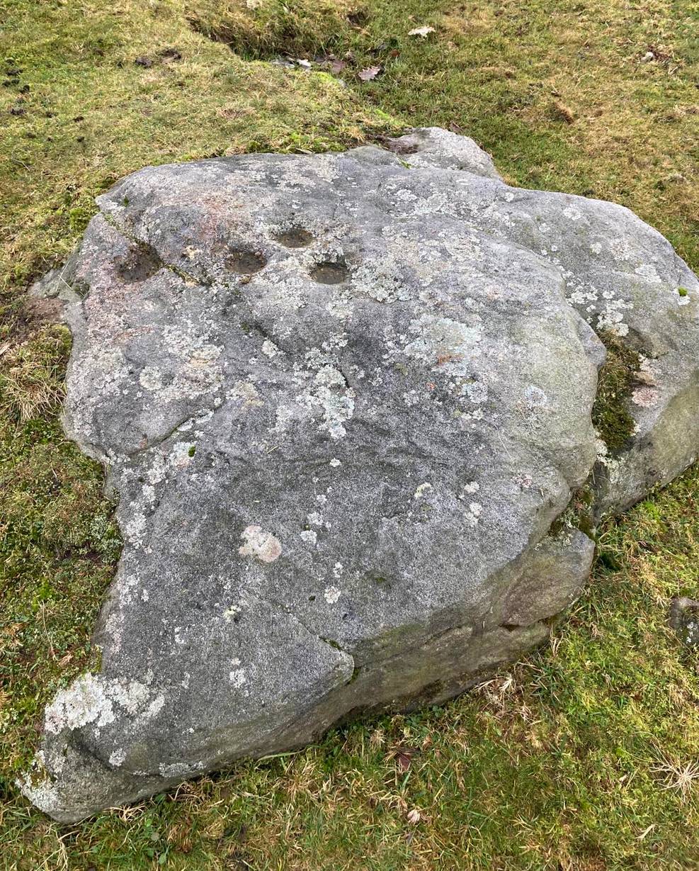
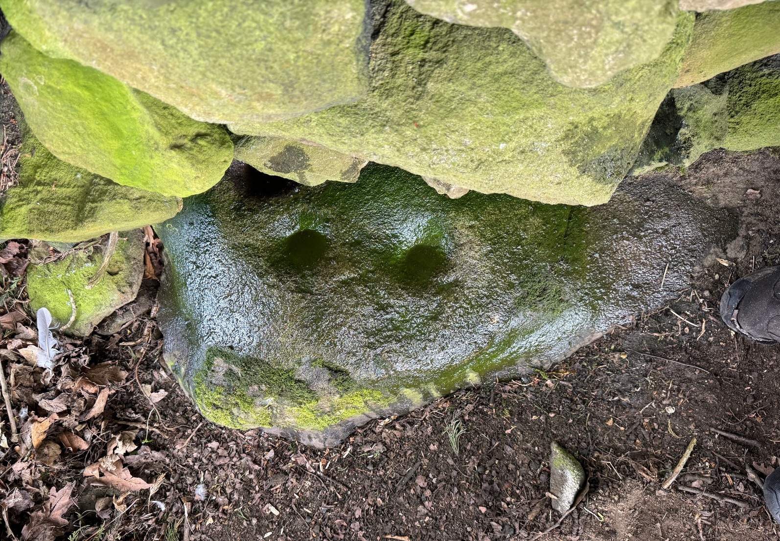
From Silsden, head up to Brunthwaite village and follow the same directions as if you’re going to see the Brunthwaite (1) cup-marked stone and, once there, look at the walling immediately behind it and you’ll see, at the base of the wall, peeking out is a small earthfast boulder. It’s about a yard away. You’ll find it.
Archaeology & History
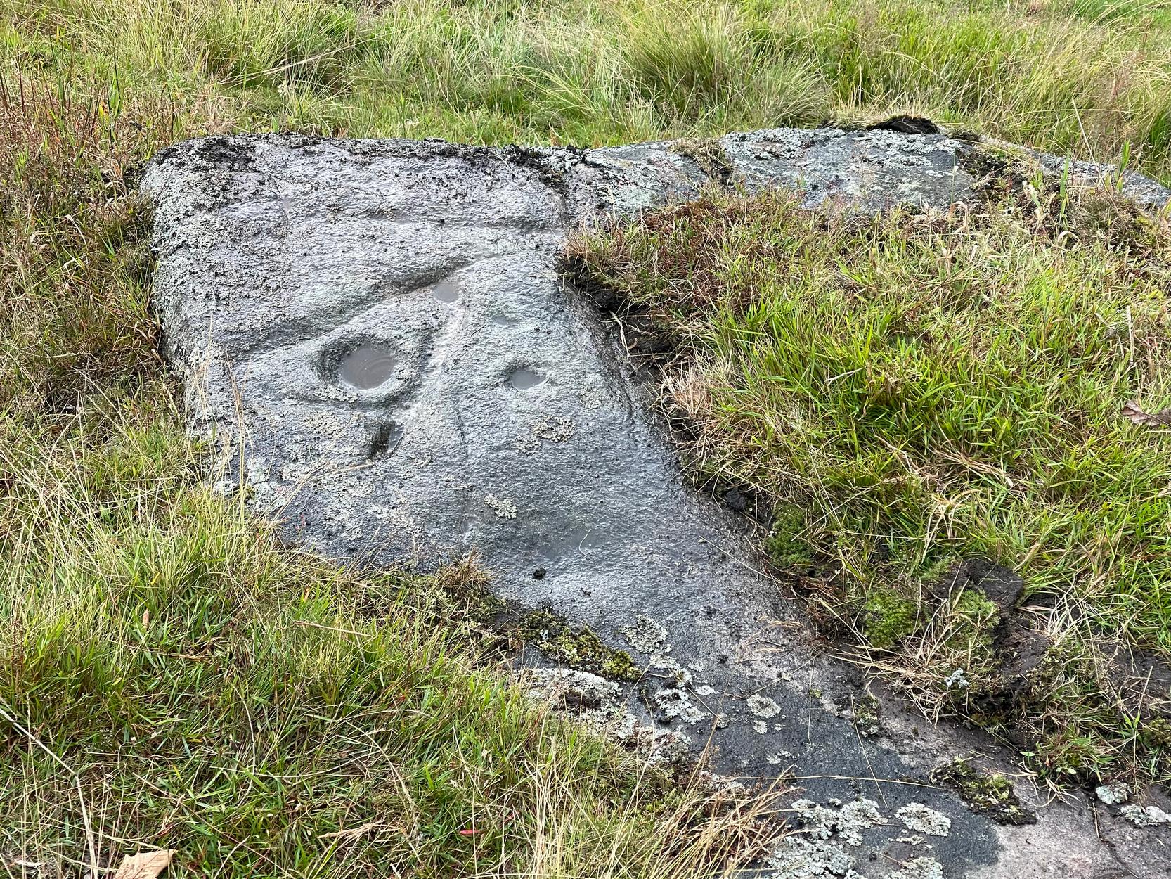
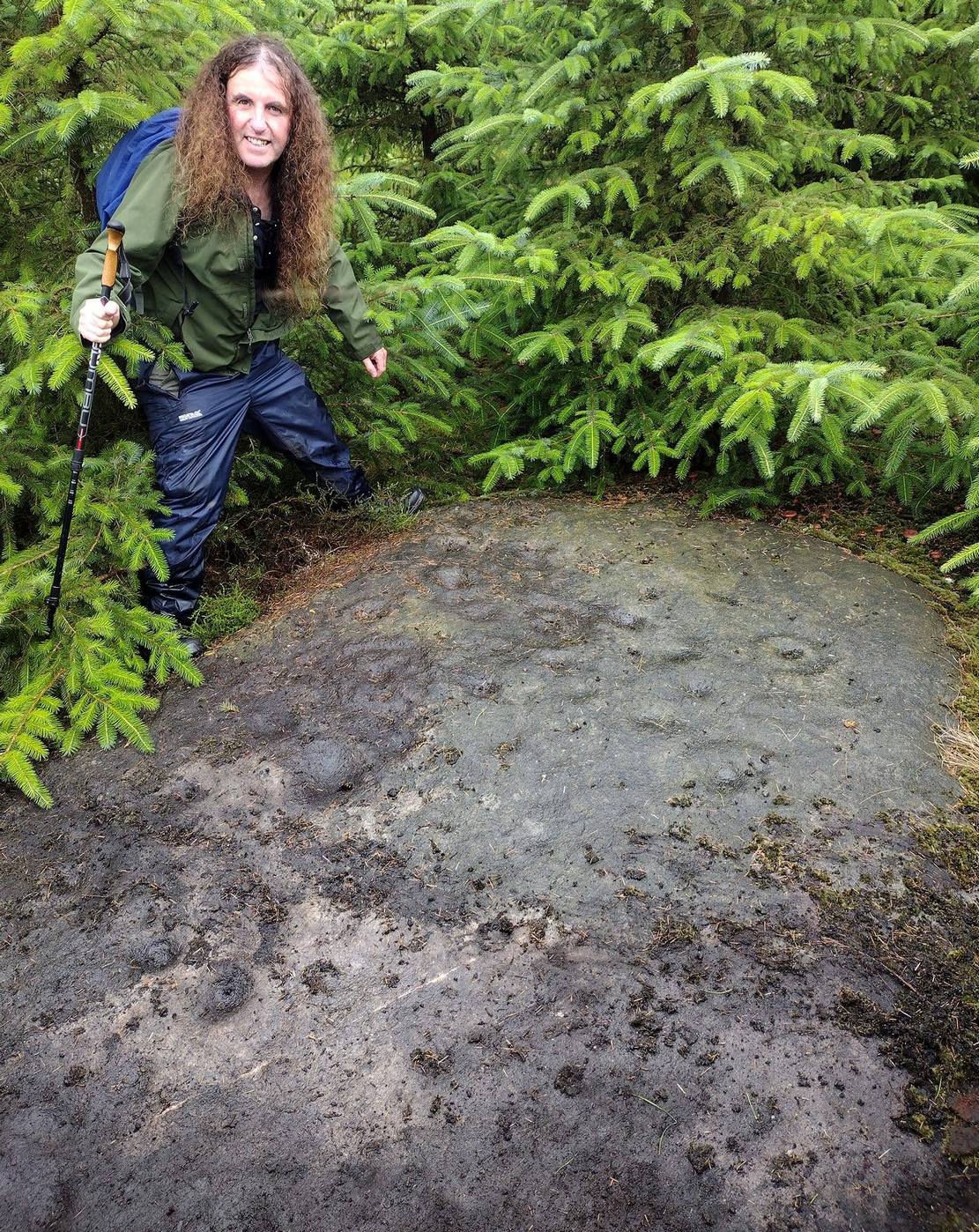
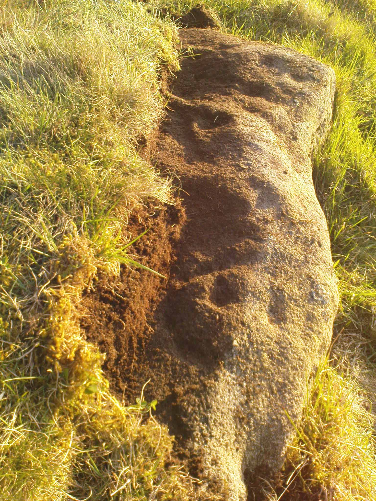
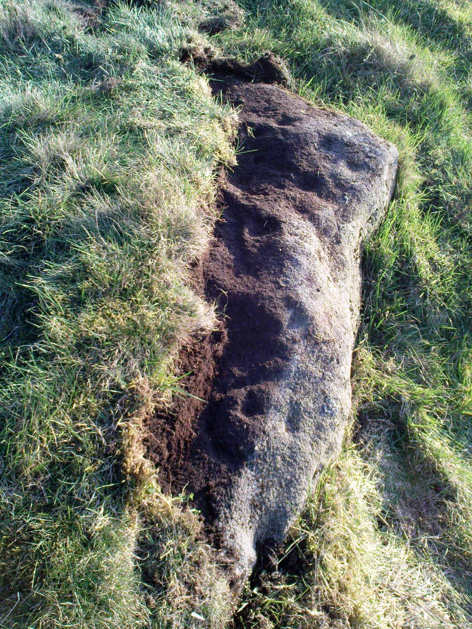
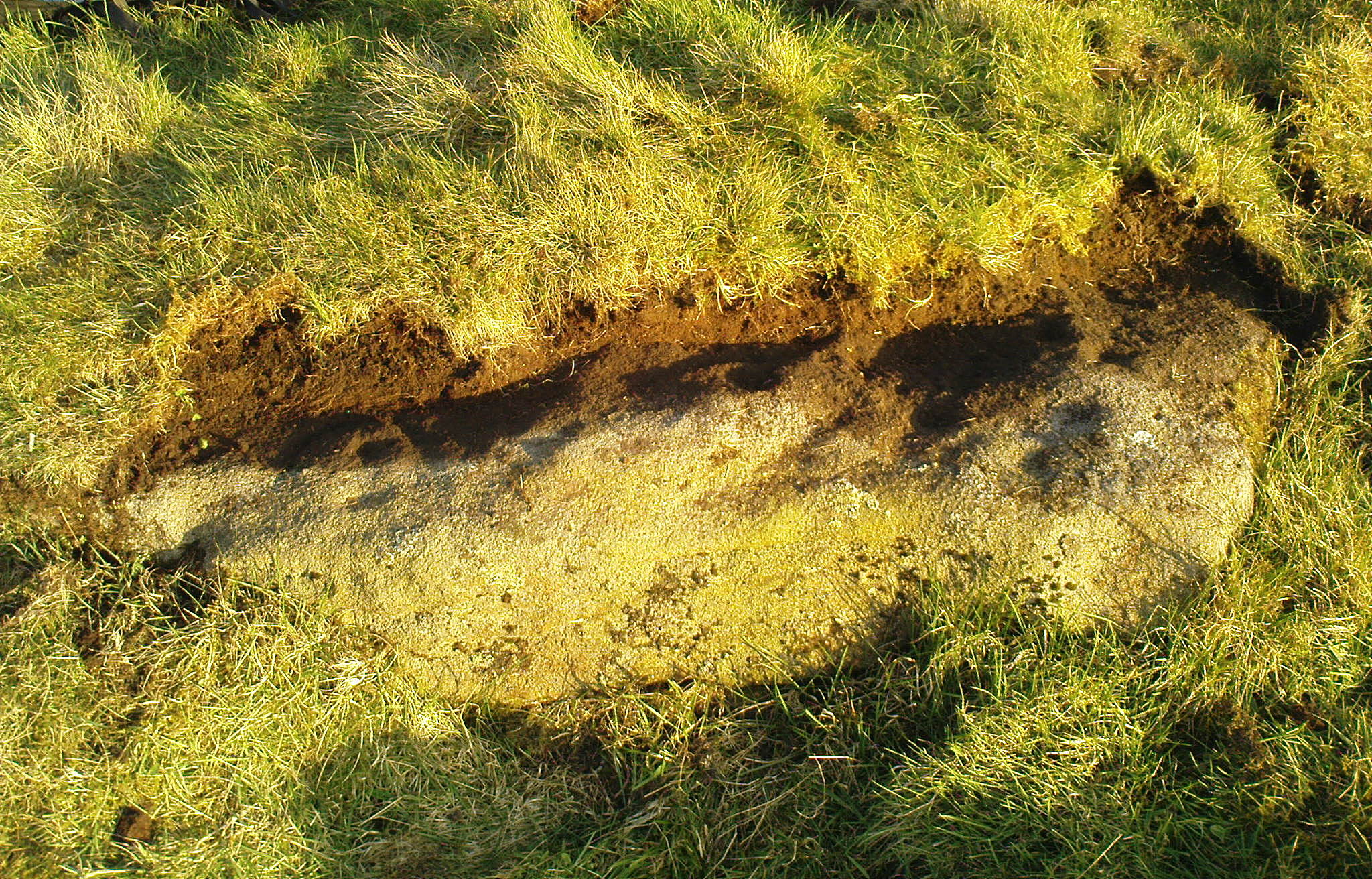
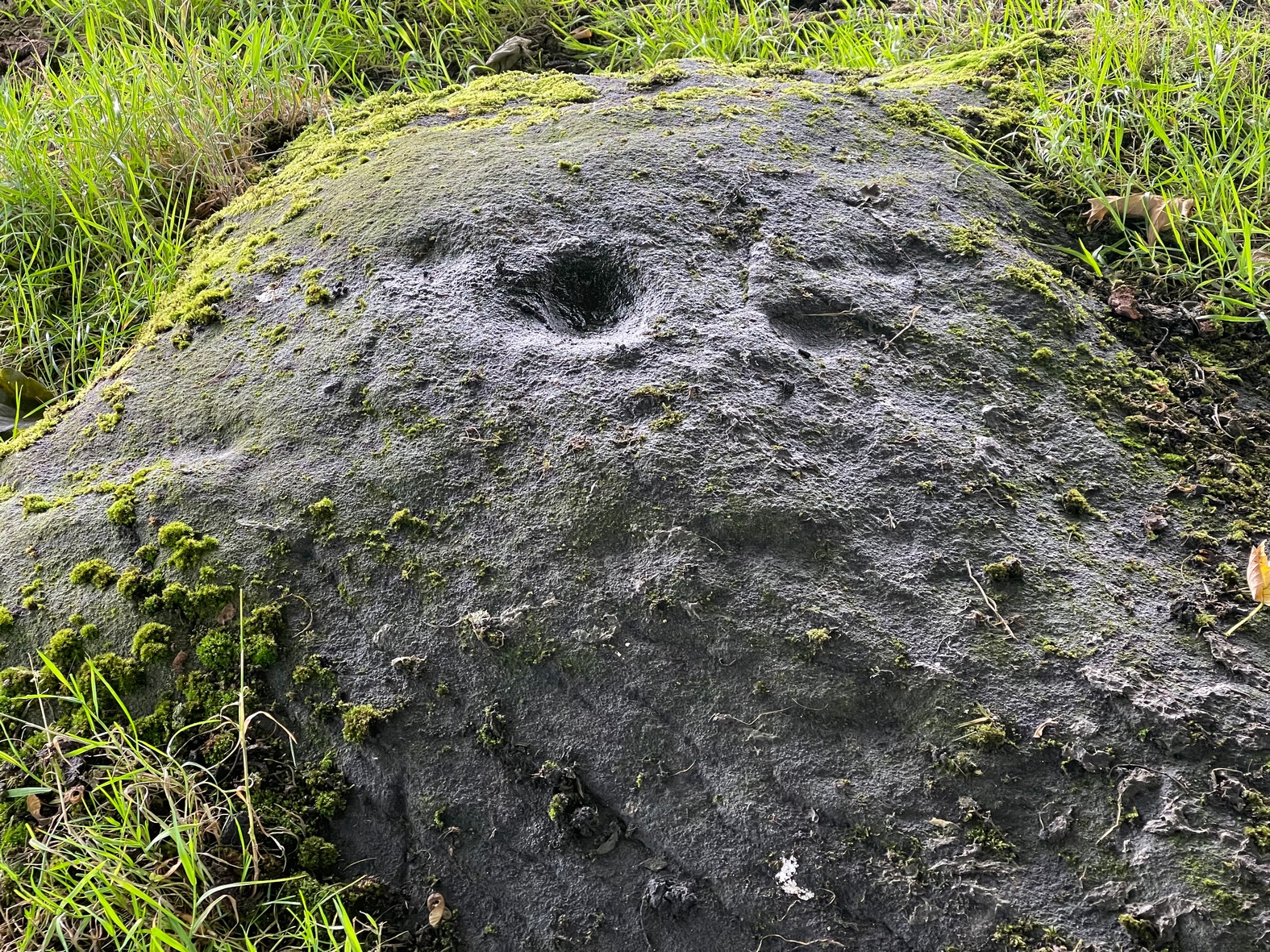
Sticking out from the edge of the walling at ground level is this low small cup-marked stone, rediscovered by rock art explorer Tom Cleland just a few weeks ago. It sits behind the cluster of rocks that were dumped here not too many years back. The carving comprises of at least three well-defined and quite deep cups, only two of which were initially visible until we cleared out a third one that had become filled with soil. It’s possible that there’s more of them on the stone, but we’d have to take the wall down to find that out!
The stone seems to be earthfast and may have remained in the same spot, untouched, since when it was first carved four or five thousand years ago—and certainly the depths of the cups suggest that its it’s been pretty much covered over for most of its life. The walling that’s been built on top of it is pretty recent by comparison; but it’s notable that its petroglyphic neighbour, the High Brunthwaite (3) carving, 175 yards to the east, is also an earthfast rock with the field-wall built on top of it.
Its somewhat minimalist appearance reminds me of several of the cup-marked petroglyphs at the top of Shipley Glen, six miles southeast of here, including the Baildon Moor (126) and (130) carvings…
Acknowledgements: Massive appreciation to Thomas Cleland for finding this carving and showing us it’s whereabouts.
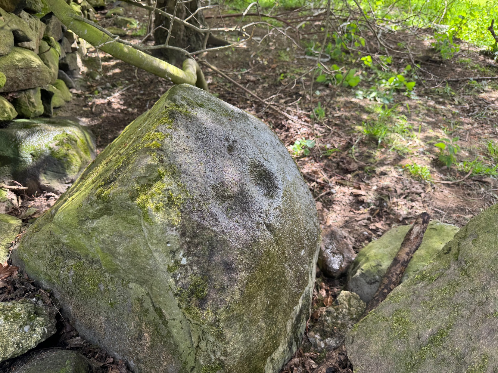
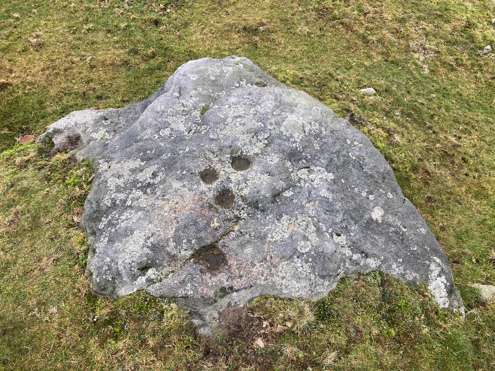
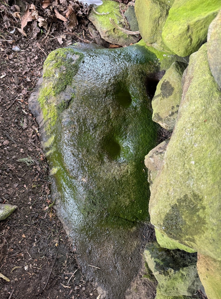
As you’re going into Silsden up the A6034 road, over the canal bridge, turn right (east) and go up Howden Road for half-a-mile, then go left up Hawber Lane and after 250 yards veer right along Brunthwaite Lane. After nearly another half-mile, through gorgeous High Brunthwaite hamlet and just as the road bends round past the last of the gardens and houses, go through the gate into the field on your right. You’re needing to look at the walling here, which runs alongside the road, but on the field-side, barely 10 yards up. A cluster of rocks has been piled-up against the wall. The largest rounded broken one is the one you’re looking for.
Archaeology & History
Looking across the cups
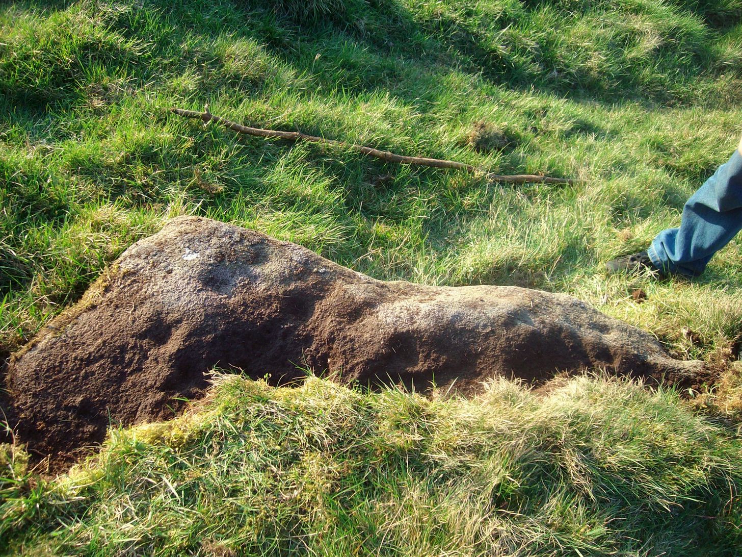
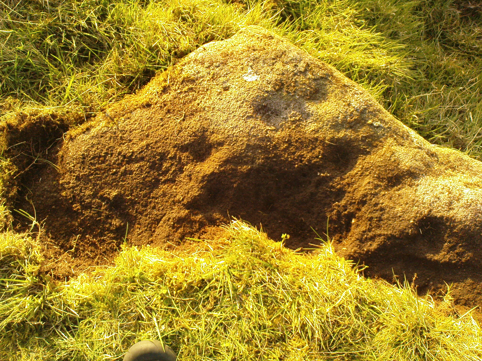
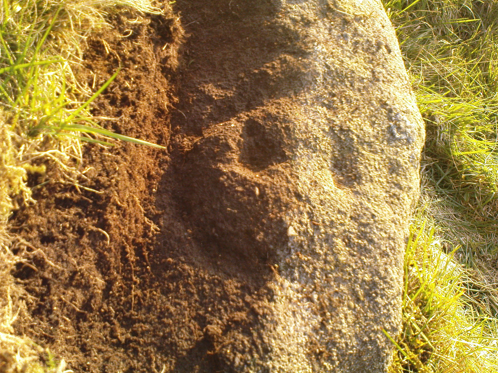
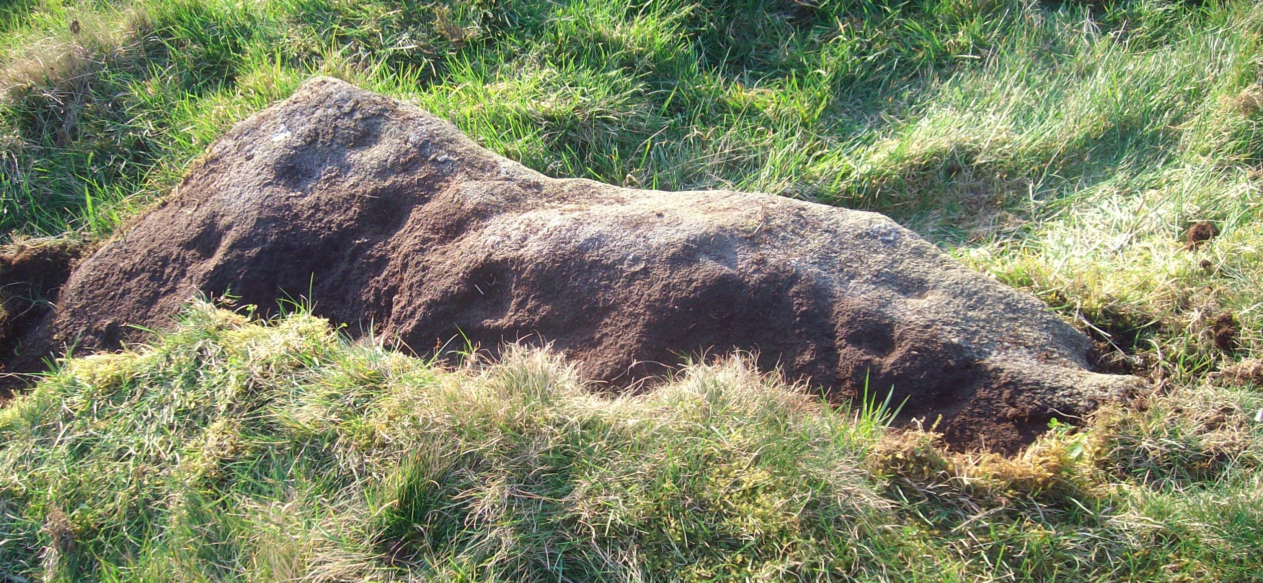
Discovered recently by the petroglyph explorer Thomas Cleland, this is one of two cup-marked stones in close attendance to each other. It’s nowt special to look at—unless you’re an ardent rock art buff!—as it consists of just two large well-formed cup-marks on its near-vertical face: the most distinct one being some two-inch across and a half-inch deep. The stone was obviously rolled here from very close by and just piled up against the wall and has been broken from a larger piece of rock, but we could see no other cup-marks on the others laid around it (although we couldn’t lift and turn the others over to see if there was anything on their undersides). The earthfast High Brunthwaite (2) cup-marked stone is just a yard away at the base of the wall.
Acknowledgements: Massive appreciation to Thomas Cleland for finding this carving and showing us it’s whereabouts.
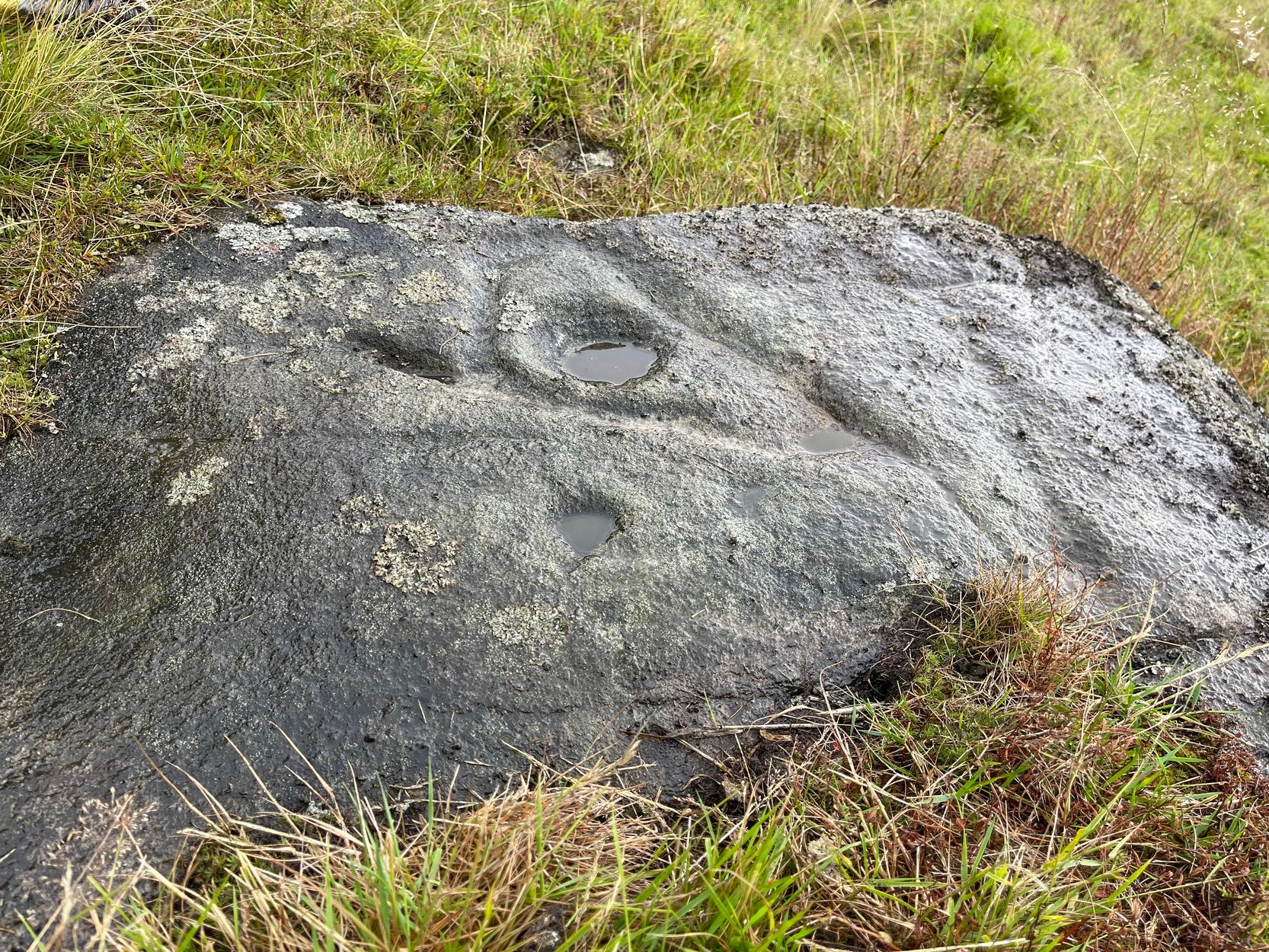
In Steeton, walk up the High Street and after a hundred yards or so, turn right to go up to Quarry House (opposite Falcon Cliffe), up past Quarry Cottages to the end where it turns into a track. Follow the track for 200 yards, where it bends left, then immediately right go into the field, following the wall along for 450 yards where you’ll go through a gate to another rocky steep hill-slope. Walk up by the side of the walling here, at the edge of the trees and, once at the top, bear right and a few yards along keep your eyes peeled. You’re virtually on top of it!
Archaeology & History
Not previously recorded, this is an unusual design: unusual in more ways than one. Firstly, it’s not entirely ‘ancient’; and secondly, the linearity in some of the carved lines around the cup-marks is unusual. It reminded me a little of the Hanging Stones above Ilkley, with its deeply cut lines, swerving around cup-marks, whose lack of ‘ancient’ guise is somewhat betrayed by the fact that Victorian quarry operations uncovered them—much like happened here…
It was first noticed in 2024 by Collette Walsh during a petroglyphic foray in the area. She noticed the distinct cup-marks on the rock surface, but then when she noticed a distinct quarrying mark, she dropped the idea that it was prehistoric. But this distinct quarry or stone-mason mark—executed sometime in the 19th century when the Industrialists were working here—shouldn’t take our attention away from the cup-marks; nor indeed all aspects of the other carved lines that swing round the edges of the deepest of the three cups, which is surrounded by a long curved triangle, some of which was carved into a natural crack, highlighting it more. The single outlying cup looked, from some angles when wet, that it may have had a partial ring around it—but we were unsure and it may have just been a trick of the light, along with our desire to see more than there actually is. Anyhow, it’s worth seeing. But we could do with a stonemason to check it out, enabling us a better assessment of which bits of this design are old and which are not-so-old.
Acknowledgements: To Collette Walsh for uncovering this design; and to Tom Cleland for showing me where it lives!
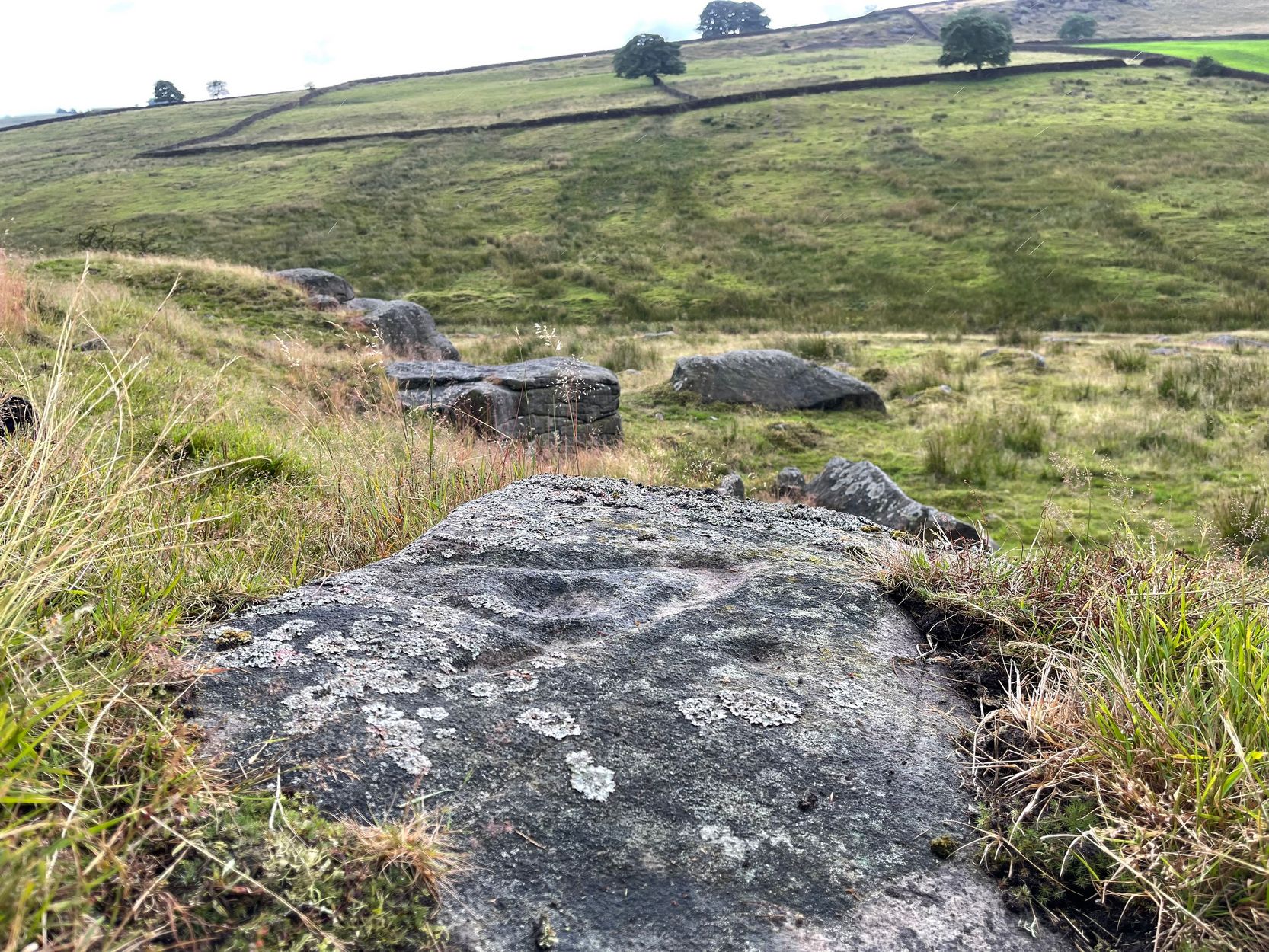
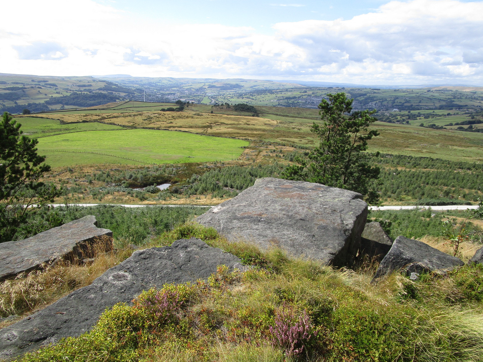
A real pain-in-the-arse to find this one, and even describing how to get there is troublesome—but I’ll try my best! I think the best starting point would be from the track that runs through Rivock plantation. Follow directions to reach the Ripple Stone carving, then walk 35-40 yards east to the ornate multiple-ringed stones of Rivock (067) and company. Now comes the tricky bit. From here walk, zigzag fashion (it’s the only way y’ can do it!) up the slope ever-so-slightly east of due south until you reach the top of the slope, where the land levels out. If you walked in a dead straight line from the triple-ringed Rivock (66) carving, it is almost bang on 100 yards. Anyhow, now you’re on top of the slope, zigzag about and look for the large flat oval-shaped stone. Take your time—you’re gonna need it!
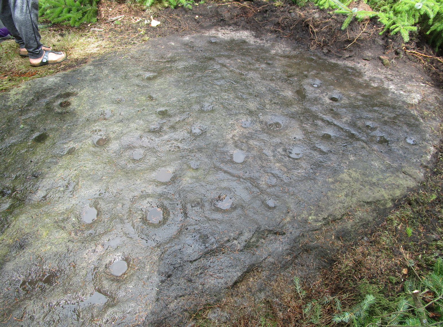
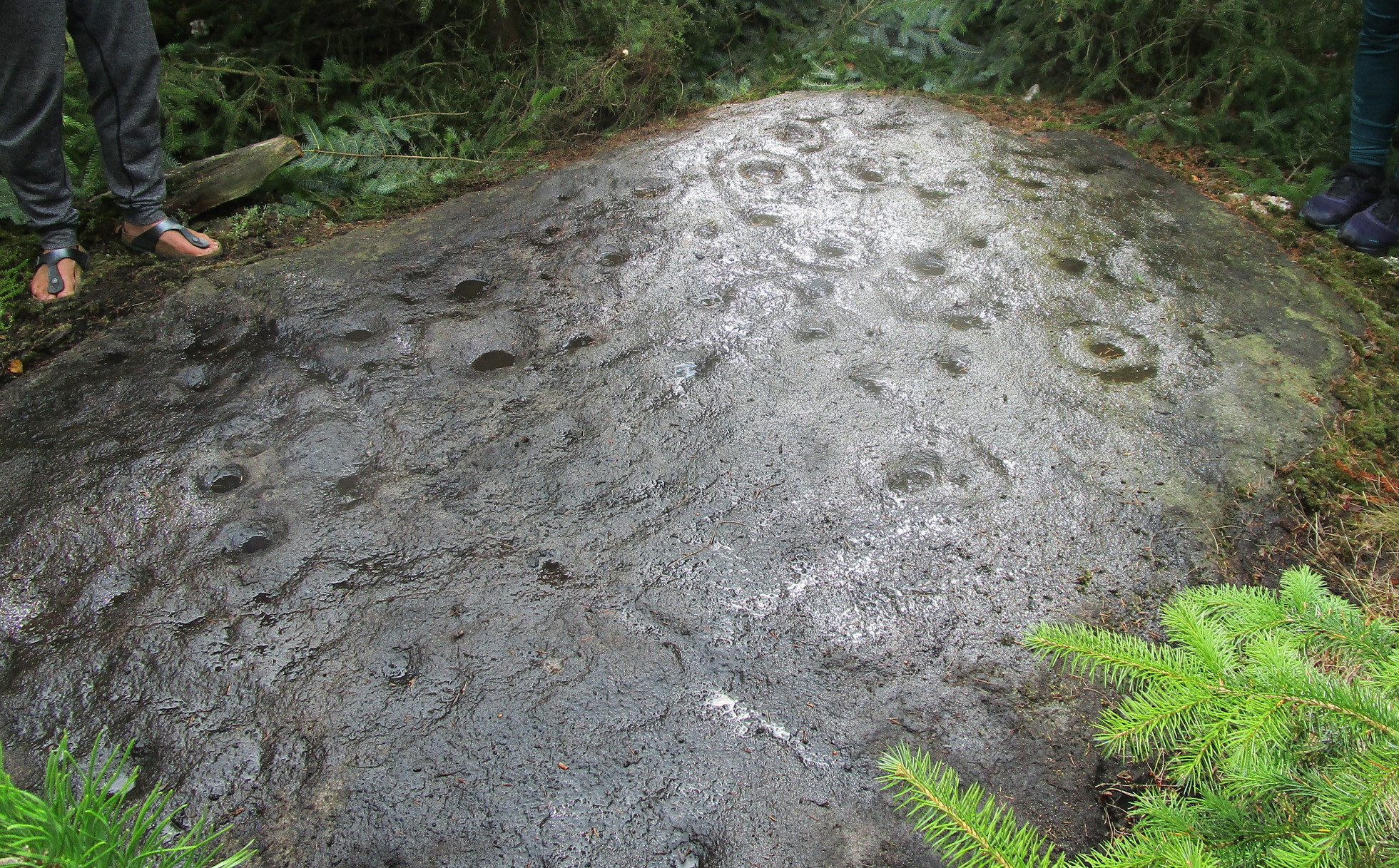
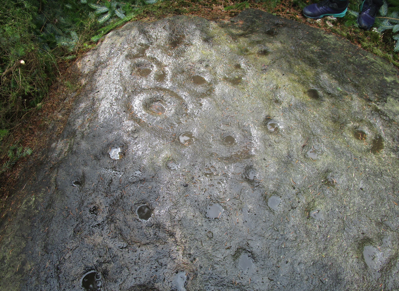
Archaeology & History
Section of carving
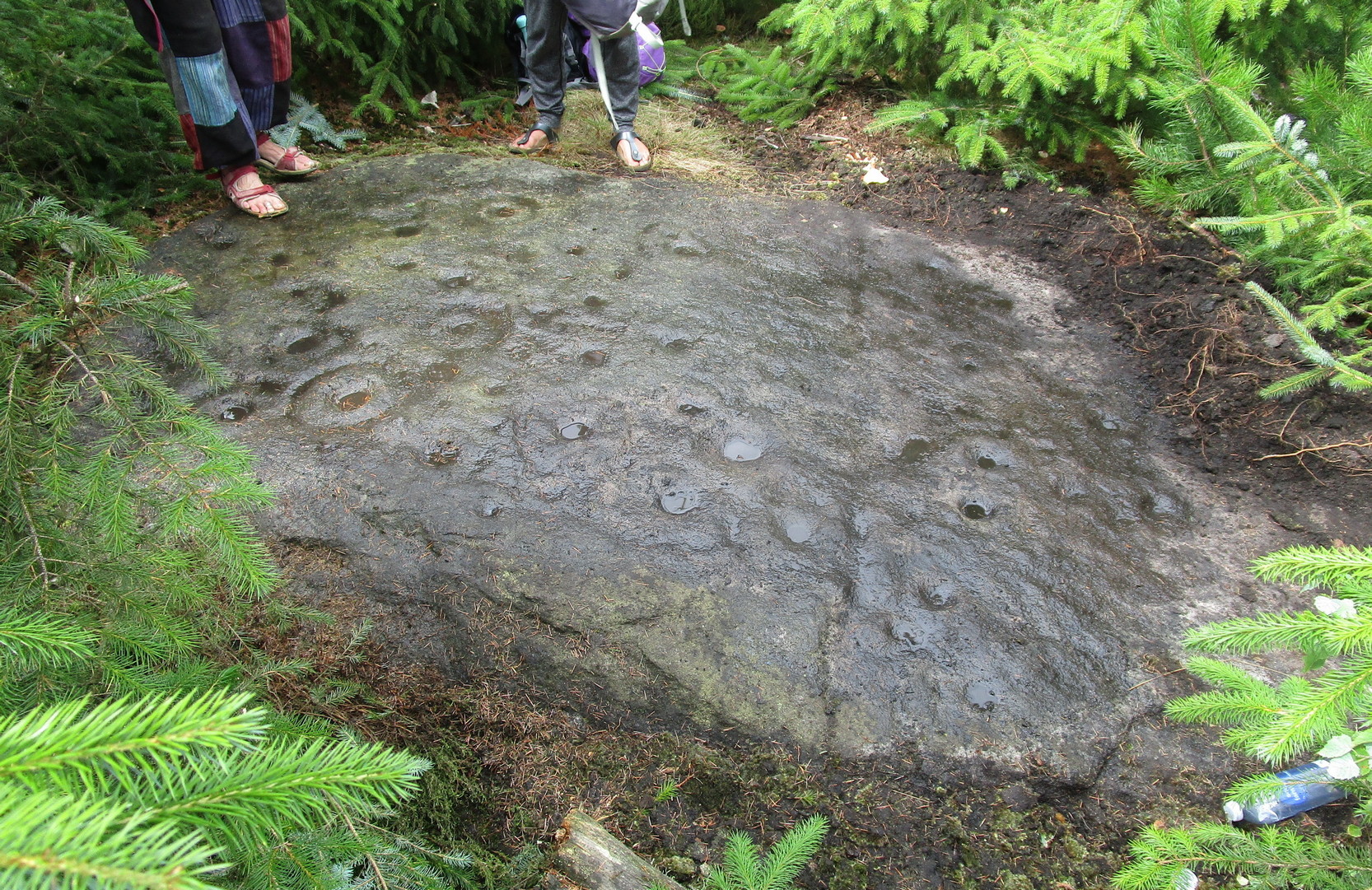
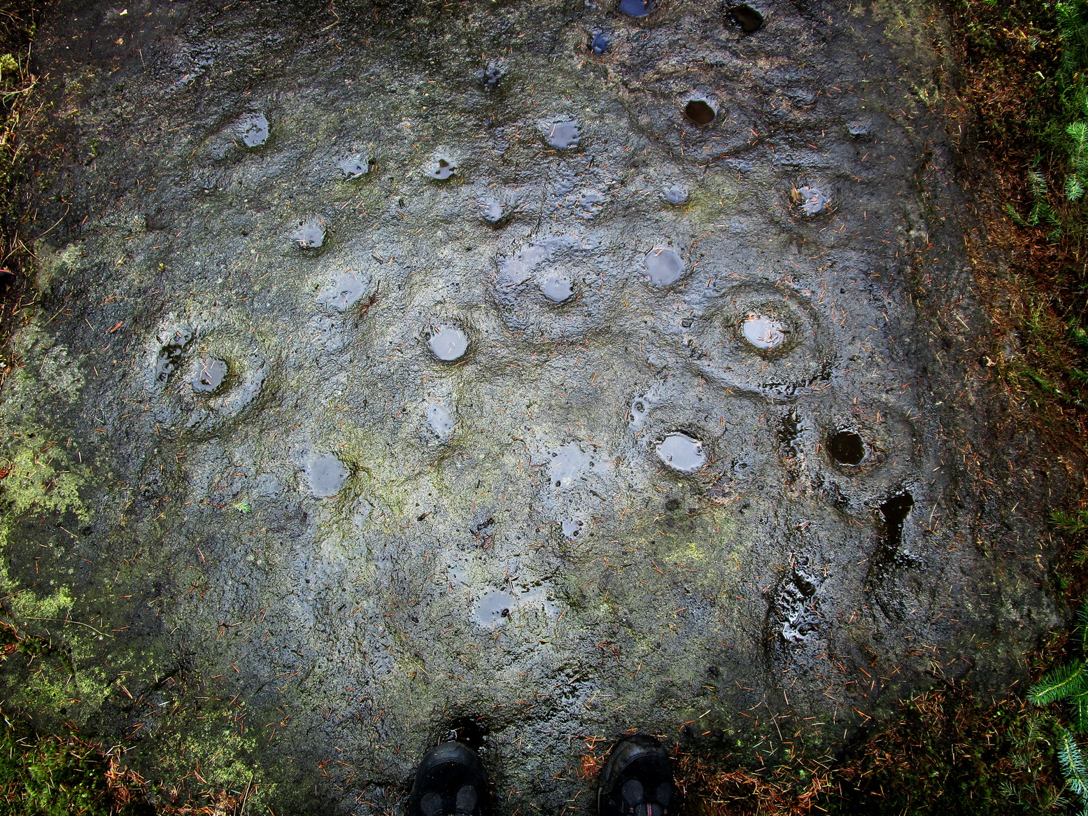
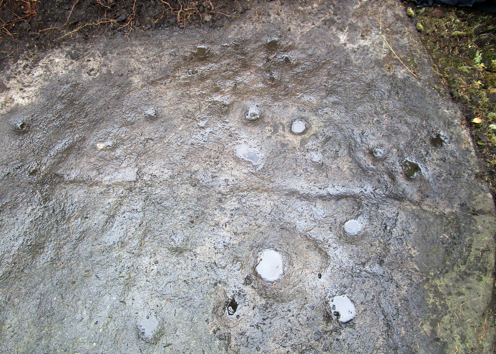
Laid amongst the dense mass of cheap crappy pine trees that plagues some of our upland countryside depriving the land of necessary nutrients for animals, flowers and other trees, this impressive multiple cup-and-ringed marked rock lies sleeping. It was rediscovered in 2017 by local hunter Chris Slinger during one of his many ventures through the undergrowth. I’m informed that one of his compatriots reckons that he already knew about it some forty years prior to Chris claiming it—but as yet we have no way of knowing that for sure, so the name of the carving goes to Mr Slinger. And it’s a beauty—one helluva beauty!
Main line & ring clusterScattered mass of rings
This large, flat, ovoid-shaped stone, roughly 10 feet by 7 feet across, is virtually covered from head to foot in large and not-so-large cup-and-rings at varying levels of erosion. The carving appears to have been partitioned, so to speak, into two sections that are clearly defined by a carved line that runs the breadth of the stone. On the top, larger section above this main line are about 30 cup-marks, with perhaps a dozen of them having rings around them—some complete, some incomplete—scattered about in the usual non-linear manner. One or two of the cup-and-rings may have double-rings, but due to dark conditions in here none of us could be sure. On one visit, a local lady (Liz of Fell Edge if I remember rightly) noticed that the largest cluster of cup-and-rings near one quarter of the stone seemed to be arranged in a similar form to the Swastika Stone, 1.9 miles northeast of here!
Main line, cups & ringsCluster of cup & rings
On the lower smaller section of the carving, beneath the main line if you like, there’s not quite as much going on. At least twelve cup-marks are apparent here, at least five of which have rings around them. The main little bunch of these are pushed right up against the long carved line, seemingly communicating with other rings on the top-side of it. In some photos it looks as if, in this section of the stone, carved lines link the cup-and-rings on each side of the main dividing line (if y’ get mi drift). There’s a lot going on here. It’s a pretty complex carving as you can see: one of the best in the Rivock cluster and one that I’d like to spend more time with, if only to get a complete picture of what the carving looks like in full as we’ve not yet got to the outer edges of the stone itself, meaning that there may be more of it beneath the vegetation.
Stone-fondler KootStone-fondler Sean
I was hoping to get some much better photos of this site and clear back more of the covering foliage, but as the carving is now all but covered in dense forestry, we may have seen the last of it for a few decades. Even worse, there’s the great possibility that the carving will be destroyed when the forestry lads come to cut down the trees—through no fault of their own—as they’ll have no idea that it’s directly beneath their machinery. It would be good if some local volunteers could perhaps completely clear and protect this stone to avert such a likely disaster a few decades from now. A small metal fence with a little notice-board would do the trick!
Acknowledgements: Firstly, to Chris Slinger for rediscovering the carving; then to the modern stone-fondlers Rod ‘Koot’ Chambers and Sean Dillon for beginning the cleaning process, and for their photographs in this site profile; and then to Sarah Walker, Sarah Jackson and Marianna, for helping to bring the entire stone into view.
Along the B6265 old road between Keighley and Bingley, at Riddlesden go up Granby Lane, bending left into Banks Lane. About a mile up you’ll reach the moorland road. Turn left at the junction and nearly half-a-mile along there’s a layby on y’ right. From here walk along the footpath on the edge of the ridge, half-mile along bending slightly above Rough Holden Farm until, a coupla hundred yards on, you hit the dirt-track. There’s a long straight stretch of walling on your left: follow this for a few hundred yards, go through the gate and here walk on the other (left) side of the wall (if you’ve reach a derelict farm, you’ve gone too far). Some 60 yards or so down here, keep your eyes peeled on the long earthfast stone right near the walling. An alternative is to start at the steep hairpin bend up Holden Lane and follow the footpath into the woods. Walk along here (parallel with the stream below) for about 600 yards until you hit the bridge crossing the stream. Don’t cross over: instead double-back up the field on your right, go diagonally across and through the gate into the next field, and walk up along the walling to your right. 160 yards up, go through the gate and walk about 30 yards along the side of the walling again. Tis there!
Archaeology & History
Unveiling the Sunset Stone
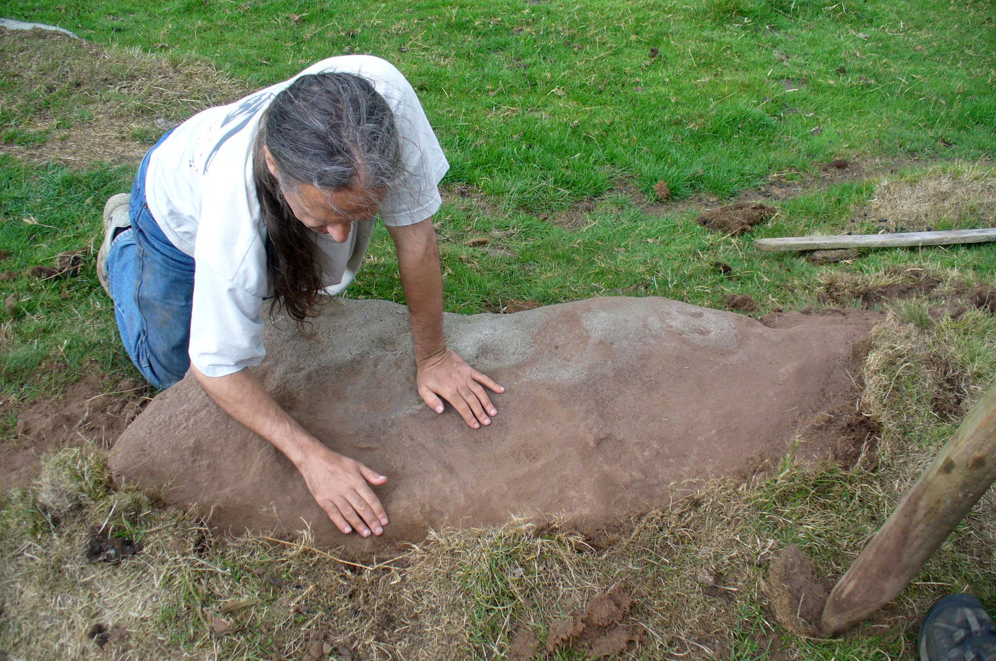
This is a fascinating carved stone on the western edge of Rombald’s Moor that I was fortunate to find in 2008. It’s found in association with two other cup-marked stones, north and south of it. I first noticed it when I was walking along the footpath by the side of the wall and saw that on a small exposed part of the rock a single cup-marking carved close to the vertical edge of the stone—and I’m glad that I stopped to give it more attention. The stone was very deeply embedded and the covering soil so tightly packed that I could only shift a small part of it—but the section that I managed to uncover and, importantly, the time of day when I did this, brought about an intriguing visage with subtle mythic overtones.
Carved arc on edgeEarly photo in low light
The carving was found near the end of the day just as the sun was setting and touching the far horizon. I noticed there was a cup-and-half-ring to the side of where I’d sat for a rest, near the northern edge of the stone, and the clear but soft light of the evening caught this element and almost brought it to life! As I gazed down at the half-ring, the sun highlighted it even more and I saw that some extended carved lines continued and dropped over the near vertical edge of the stone, becoming an unbroken elongated ‘ring’ that stretched twice the length of the half-ring on the flat surface. Not only that, but a faint cup-mark seemed to be inside this extended vertical ring and, as I saw this, a dreaming epiphany hit me that the symbolism behind this was a representation of the setting sun that I was watching at that very moment. It was quite beautiful and the carving seemed to come to life. The thought, nay feeling, that this part of the carving symbolized a setting sun not only slotted easily into a common animistic ingredient, but hit me as common sense too! However, as my ego and rational sense rose back to the fore (I had to get mi shit together and walk a few miles home before night fell), I saw that this impression may be a completely spurious one; but, as the rock-face inclines west, towards the setting sun, the name of Sunset Stone stuck. As I carefully fondled beneath the heavy overgrowth of vegetation covering the stone, I realised that I needed to come here again and uncover more of it, as additional cups and lines seemed to be reaching out from the mass of soil.
Cups near the S edgeClose-up of ring-edge
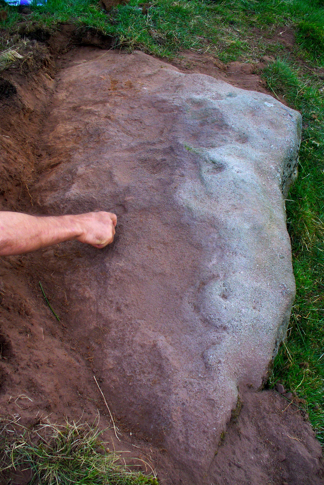
I returned to the stone a few times, but several years passed by before I revisited the site with the intention of uncovering more of the design in the company of Richard Hirst and Paul Hornby on August 4, 2013—and it took considerable effort to roll back the turf that covered the stone. But it was worth it! For it soon became obvious that much of the stone that was covered over had been unexposed for many centuries: as Richard pointed out, the edge of the rock was very smoothed by weathering, whilst the covered section of the stone that we were revealing was still quite rough and misshapen all across the surface, lacking weather and water erosion. Much of this design therefore, highlighted itself to us as it was when the mason first carved the stone. And it turned out to be a pretty curious design!
Faded photo of the carvingFaint proto-ring nr centre
Our first impression was that the design comprised of two cup-and-rings near the middle of the rock, with another cup-and-drooping-ring near the northern edge of the stone, and between ten and twelve typical cup-markings, many on the western exposed side. But curiously near the middle were also a couple of rings whose edges had been defined, but the hollowed-out ‘cup’ in the middle remained uncut or unfinished, being a proto-ring, so to speak. Also, lines leading from these unfinished ‘cups’ were also pecked and laid out, but they were also unfinished. Some sections of the unfinished lines ran onto the western edge of the stone and were very faint, but they were undeniably there. Unfinished cups is an unusual feature for carvings on Rombald’s Moor.
Mr Hirst’s clearanceCups & curves on edge
But the most interesting element in the fainter, seemingly unfinished carved lines, was what may be a small spiral that started above the two faint cup-and-rings. This then continued in a sharp arc which doubled-back on itself. In the other direction, the lines curve round and go down to the vertical face of the rock, before bending back up onto the level surface again, then disappearing. The topmost cup-and-half-ring is also a curious feature. When you visit here you’ll see how this aspect of the design looks for all the world like a simply cup-and-half-ring near the edge of the stone. But, as I’ve already mentioned, closer examination shows that this “half-ring” has a larger oval body beneath it on the vertical face of the stone, very worn due to its exposure to the elements and very much in the shape of a bell—and within this large cup-and-ring ‘bell’ is a much fainter complete cup-and-ring, just below the topmost cup-marking. I know that I’ve already mentioned this, but I’m giving it added emphasis as it’s a unique design element for carvings on these moors.
Early photo of the carvingEdge of the carving
The Sunset Stone really requires more attention, when the daylight conditions are just right, so that all of these intriguing aspects can be highlighted with greater lucidity. There is also the potential that more carved ingredients remains hidden beneath the compacted soil.
What seems to be a more trivial single cup-marked stone can be seen roughly 20 yards to the north.
Acknowledgements: Massive thanks to Richard Hirst of Hebden Bridge, and Prof. Paul Hornby, for their help in bringing this carving to light.
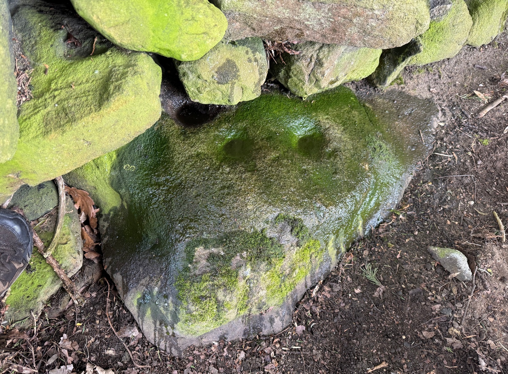
From Steeton village, go up Mill Lane, turning right and then bending up the steep Barrows Lane for a half-mile or so, where in turns into Redcar Lane. There’s a row of old cottages on your left with a green lane track running into the fields at the back of them. Four fields along you’ll reach a long straight line of walling running uphill. Up here, above and past the long geological stretch of quarried rocks, the land levels out and two trees sit next to each other by walling. The carving’s beneath them.
Archaeology & History
Close-up of carving
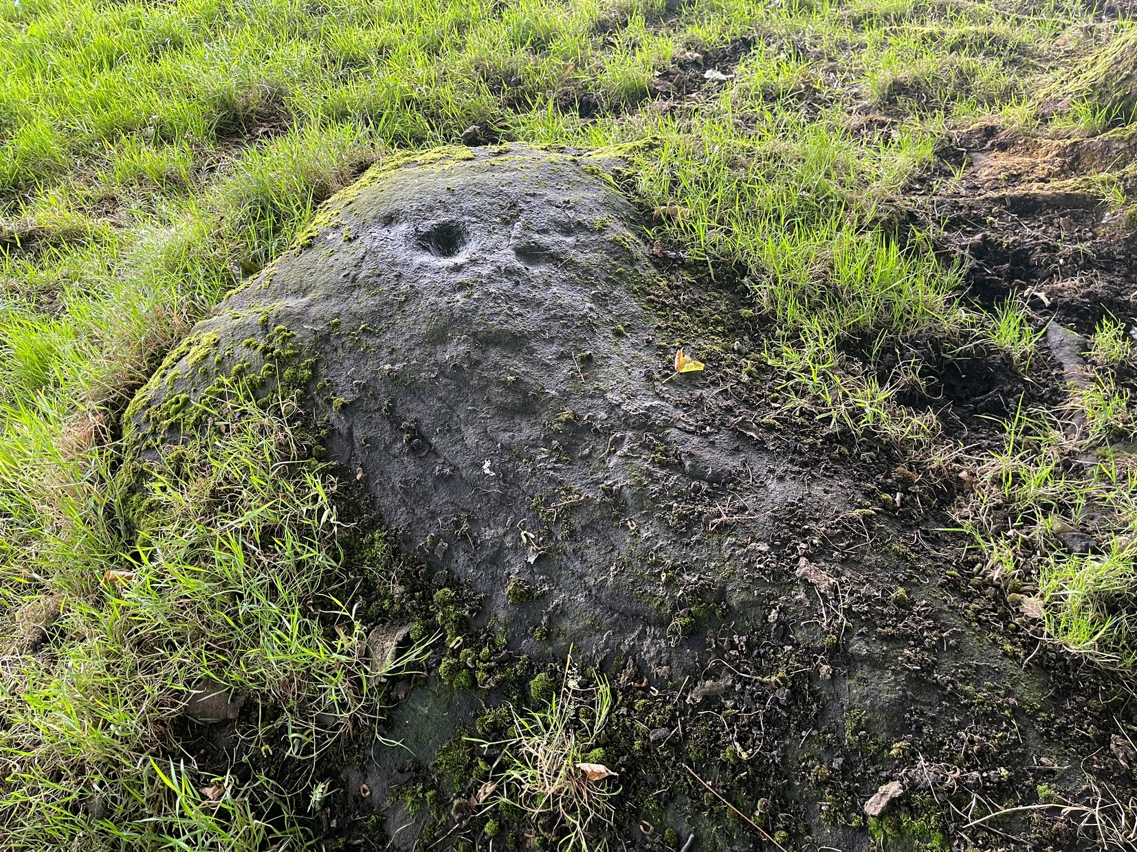
Rediscovered in the summer of 2024 by Thomas Cleland, a deeply worn cup-mark is the primary feature of this petroglyph on the topmost section of the stone, with the remains of a faint incomplete ring around one side of it. Three or four other smaller cup-marks can be seen close to the main one. There may be another cup-marked stone on an adjacent rock, with a lines running away from it, but we need to see that in better light or have one of the computer-tech doods to give it their attention to know for sure.
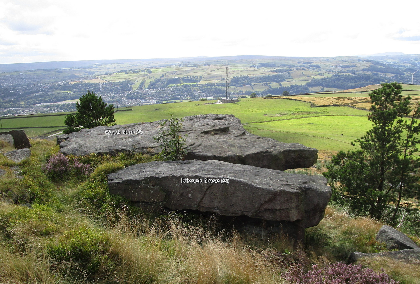
Follow the directions as if you’re visiting the fascinating Wondjina Stone and its companion. From here look at the large rocks on the edge of the drop a few yards away (west) and you’re looking for the flattest rectangular rock jutting out over the edge of the slope, about 15 yards from the walling. The carvings of Rivock (2) and (3) are on the adjacent rocks.
Archaeology & History
The southernmost of (at least) three cup-marked rocks on the edge of this outcrop, it isn’t a carving I’d necessarily include in my own surveys nowadays. It’s a dubious one to say the least. Nonetheless, earlier surveyors added it in their catalogues.
Lichen-covered “cups”
First mentioned in John Hedges’ (1986) survey, this large and roughly flat rectangular boulder possesses three or four questionable cups close to the edge of the stone. Boughey & Vickerman (2003) subsequently included it in their own work—copying Hedges’ notes—and told it to be a “large rock. About three cups on NW side.” Have a look at it when you visit the other more impressive Rivock carvings nearby and see what you think…
References:
Boughey, Keith & Vickerman, E.A., Prehistoric Rock Art of the West Riding, WYAS 2003.
Hedges, John (ed.), The Carved Rocks on Rombald’s Moor, WYMCC: Wakefield 1986.
Morris, Ronald W.B., “The Prehistoric Rock Art of Great Britain: A Survey of All Sites Bearing Motifs more Complex than Simple Cup-marks,” in Proceedings of the Prehistoric Society, volume 55, 1989.
Take the same directions as if you’re visiting the fascinating Wondjina Stone and its companion. From here, just a few yards to the west, are the large rocks overhanging the steep hill, several of which have cup-markings on them (including the carvings Rivock Nose [1] and [2]). This particular carving is the one closest to the wall. You can’t really miss it!
Archaeology & History
Line of 3 cups
A simplistic design that’ll only be of interest to the real geeks amongst you; but you might as well give it your attention when you’re looking at the adjacent Wondjina Stone. On its large surface, the most notable ingredients are the three large cups that run (roughly) in a straight line from the middle of the stone to its outer pointy edge. You can see them pretty clearly in the photo. Several other cup-marks can be seen on the more northwesterly side of the stone.
It was first described in John Hedges (1986) survey, whose notes were simply copied in the subsequent survey of Boughey & Vickerman (2003) where, in their traditional way, gave a very basic description, saying, “Large gritstone outcrop: 3m x 2m. Five cups towards NW edge.”
References:
Boughey, Keith & Vickerman, E.A., Prehistoric Rock Art of the West Riding, WYAS 2003.
Hedges, John (ed.), The Carved Rocks on Rombald’s Moor, WYMCC: Wakefield 1986.
Morris, Ronald W.B., “The Prehistoric Rock Art of Great Britain: A Survey of All Sites Bearing Motifs more Complex than Simple Cup-marks,” in Proceedings of the Prehistoric Society, volume 55, 1989.
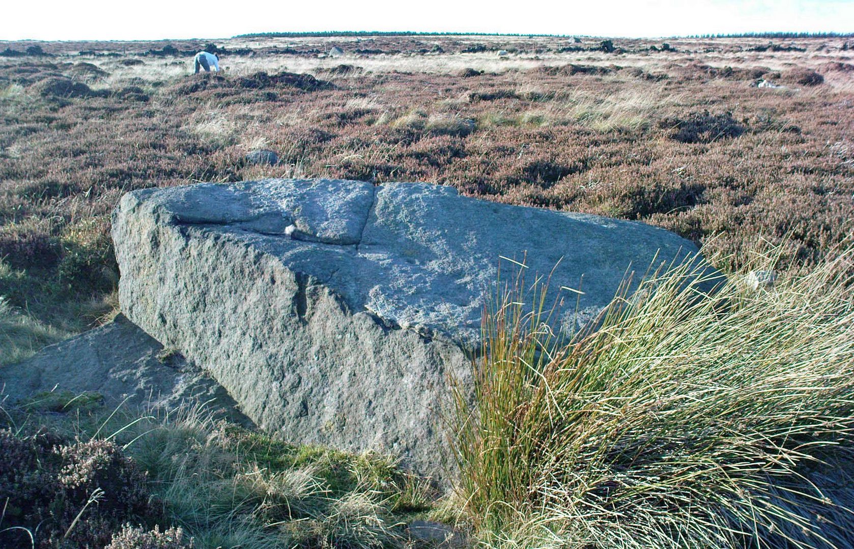
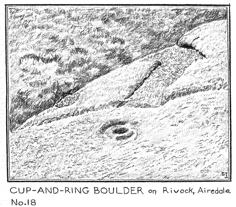
From East Morton, head up the winding Street Lane for just over a mile until, on your right-hand side, you hit the long straight Roman Road, or Ilkley Road as it’s known. Literally 690 yards (0.63km) up, on your left a footpath is signposted. Take the path alongside the wall, through the first gate (note the pile of stones at this gate, which are the remains of the destroyed Bradup stone circle) then keeping on for ⅓-mile till you reach another gate, then 200 yards to the next one where you reach the moorland proper. From here you need to walk through the heather, just over 300 yards southwest where you’ll reach this large rock. Y’ can’t miss it!
Archaeology & History
Looking down at the CnR
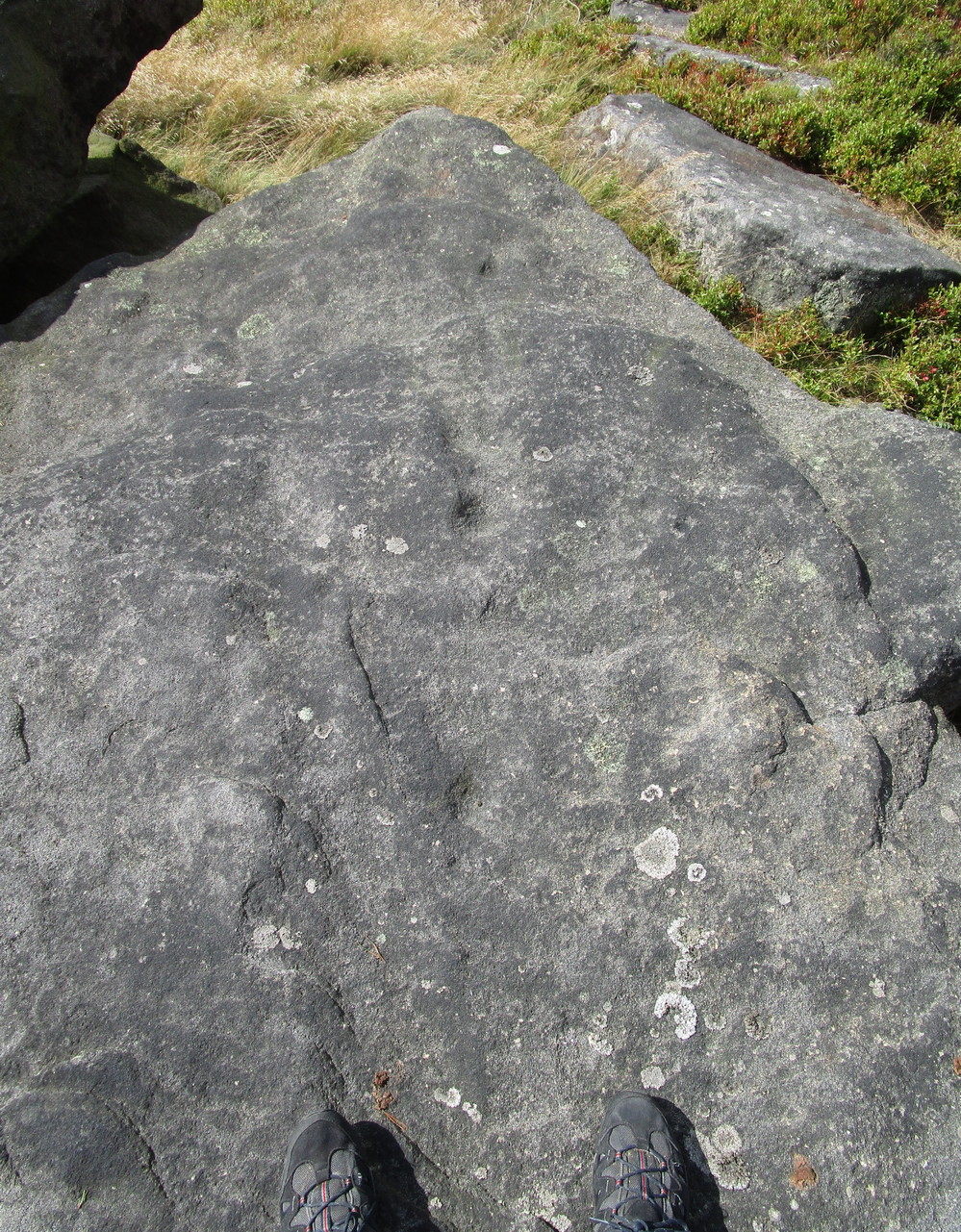
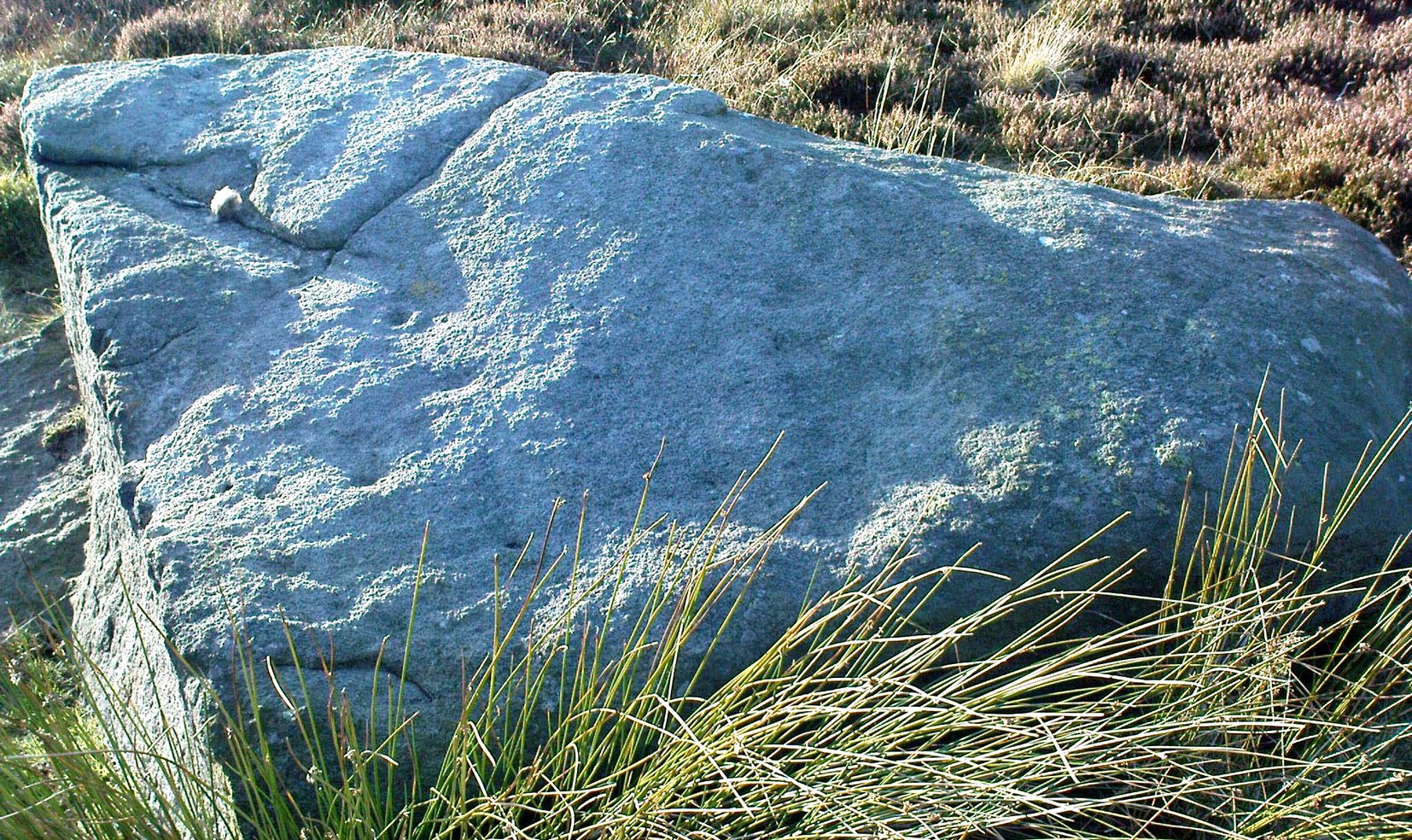
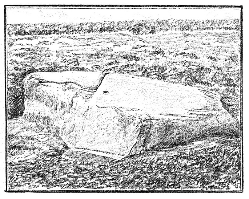
Considering the size of this stone, visitors might expect there to be more on it than there actually is; although a large section of it has been quarried off and there might have been more to it in earlier times. A basic cup-and-ring with one or two single cup-marks elsewhere on its surface, the carving was first described by Stuart Feather (1964) following one of his many rambles hereby, when he was checking out the Rivock carvings a short distance to the west (calling it the Rivock 18 stone). He wrote:
S. Feather’s 1964 sketch
“On the eastern edge of the Rivock plateau, about half-a-mile west of the stone circle at Bradup Bridge, is a cup-and-ring marked rock of a pronounced triangular shape. This at present measures 10ft by 8ft and is 3ft high at its western side… At some time in the past it has been quarried, probably to build part of the adjacent gritstone walls. The 8ft side of the rock has quite distinct drill marks visible…
Close-up of the CnR
The rock has…on its sloping surface a very fine cup-and-ring mark, the ring 6in in diameter around a cup 2in deep, all finely executed and well preserved. Running south from this cup-and-ring mark is a level area 3ft long and 5in wide, which ends alongside the ring at one end and at the quarried edge of the rock at the other. This is probably the former position of a fossil which has weathered out and its alignment onto the cup-and-ring may be due to the carving having been deliberately sited in juxtaposition to this very distinct natural feature. Only one other 2in deep cup remains on the surviving original portion of the rock; others may have been quarried away.”
References:
Boughey, Keith & Vickerman, E.A., Prehistoric Rock Art of the West Riding, WYAS: Wakefield 2003.
Feather, Stuart, “Mid-Wharfedale Cup-and-Ring Markings – no.18, Rivock”, in Bradford Cartwright Hall Archaeology Bulletin, 9:2, 1964.
Hedges, John (ed.), The Carved Rocks on Rombalds Moor, WYMCC: Wakefield 1986.
An intriguing find, made not too long ago by Jeff Wallbank of Silsden. Simplistic in design, it’s found on a small ridge of rocks adjacent to an old quarry (so there may have been other carvings here in times gone by), rising up immediately south of Haw Farm about 20 yards away, from where you can ask permission of the kind land-owner to have a look at the stone.
It’s pretty basic: consisting of a distinct triangle of three plain cup-marks on one side of a natural crack that runs across a section of the stone. Immediately adjacent and on the other side of this crack, is another singular cup. This appears to have a carved line running from it and possibly an elongated semi-circular element around the cup itself. It’s not too special when compared to the much more ornate petroglyphs further east, but is worth checking out if you’re walking in this gorgeous western edge of Rombalds Moor.
Acknowledgements: HUGE thanks to Sarah Walker, without whose help and permission to use her photos, this site profile could not have been written.
 The stone seems to be earthfast and may have remained in the same spot, untouched, since when it was first carved four or five thousand years ago—and certainly the depths of the cups suggest that its it’s been pretty much covered over for most of its life. The walling that’s been built on top of it is pretty recent by comparison; but it’s notable that its petroglyphic neighbour, the High Brunthwaite (3) carving, 175 yards to the east, is also an earthfast rock with the field-wall built on top of it.