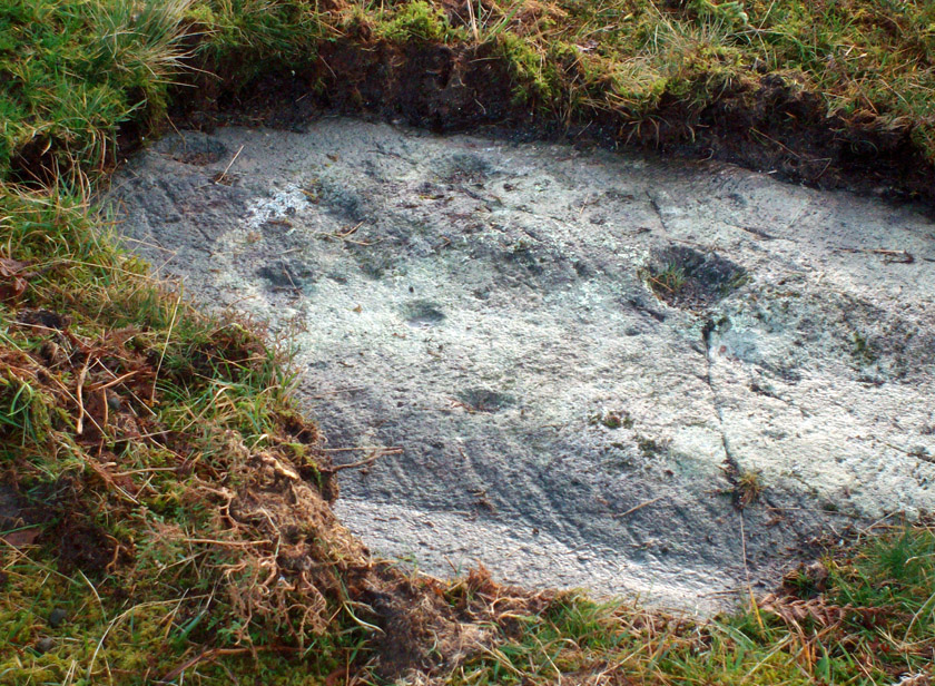
Follow the same directions to get to the Corrycharmaig 3 carving; and just a yard or two to the right of the far western edge of the rock, you’ll see another smaller slightly sloping rock, closer to the fencing, with faint cup-markings. That’s the one! (note that the 10-figure grid reference given here might need adjusting slightly)
Archaeology & History
This small slightly sloping piece of exposed rock is on the western extremity of the Corrycharmaig cluster of carvings, but is a distinctly separate piece of rock from the Corrycharmaig 3 stone (though part of the same outcrop). The stone itself has two sections to it, with a natural crack in the rock defining eastern and western section — both of which possess cup-marks.
The easternmost section of the stone has seven cup-marks, some of which were only recently uncovered. A large single cup-mark sits near the middle of this portion of the rock; this is probably what Mr Cormack (1952) was talking about when he told that, “further west (of the Corrycharmaig 3 carving, PB) is one isolated larger cup of 4-inch diameter.” On the western side of the stone, we find just two or three cup-marks, though one large cup-marking here would seem to be Nature’s handiwork.
It is highly likely that beneath the excessive vegetational growth around this carving and others along this ridge, other sections of prehistoric carvings remain to be found.
Morris, Ronald W.B., The Prehistoric Rock Art of Southern Scotland, BAR 86: Oxford 1981.
Royal Commission on the Ancient & Historical Monuments of Scotland, Archaeological Sites and Monuments of Stirling District, Central Region, Society of Antiquaries of Scotland 1979.
From Shieldaig, take the A896 road east to Torridon and Kinlochewe (a bloody superb part of Scotland – perhaps the best!) for a couple of miles, round the stunning bay of Ob Mheallaidh, till you reach the tiny hamlet of Balgie. From here, walk upstream following the small River Balgie until you hit Loch Damh. At the edge of the rugged and boggy flatland shortly before the loch itself, amble about in the rushes on your right (west). You’ll find it!
Archaeology & History
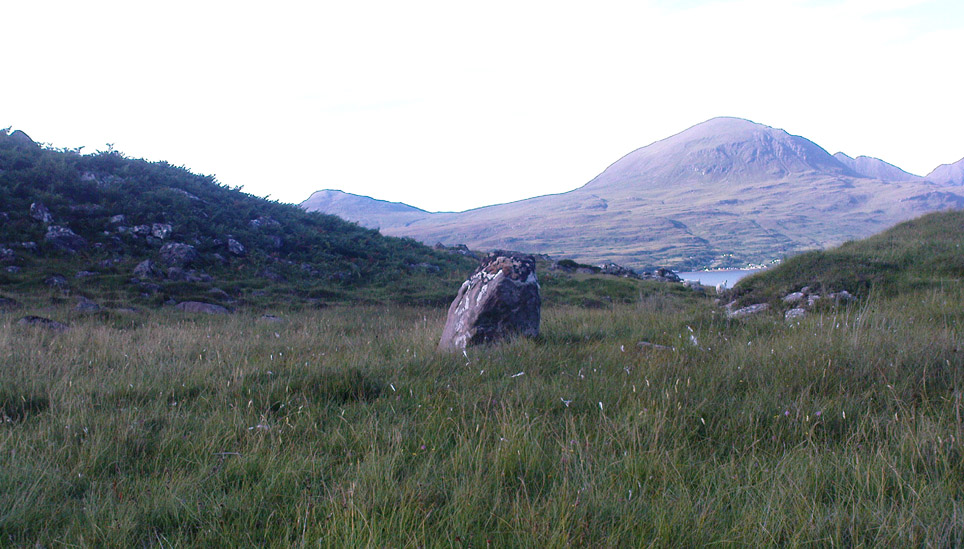
This is a small but chunky standing stone was rediscovered by Dr J. Havelock Fidler in the 1980s. Less than four-feet tall, it stands alone at the edge of the boggy landscape, with superb views all around (the hill in the background photo is An Ruadh-mheallan). There are other human remains scattered amidst the rocky landscape close by, including the remains of old buildings not far away, but this prehistoric monolith seems to be an isolated example. However, the landscape here is so vast that it’s highly likely that other standing stones remain hidden in these ancient mythic hills…
References:
Fidler, J. Havelock, Earth Energies, Aquarian: Wellingborough 1988.
On the A657 road, a half-mile past Greengates towards Calverley, just before the road starts going uphill, take the lower dirt-track of Eleanor Drive on your left into Calverley Woods (here known as West Woods). About 150 yards along the track, note the small footpath on the right which goes up diagonally further into the trees. Go along here until you reach the remains of a dried-up pond on your left. The carved stone is about 10 yards before the pond, just above the footpath.
Archaeology & History
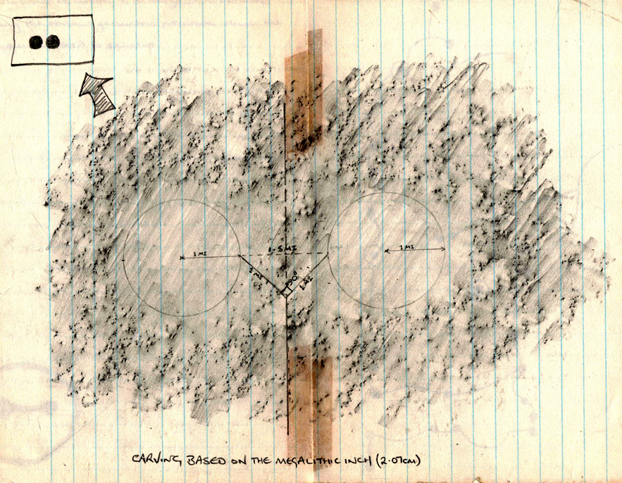
Rubbing of the 2 cupmarks
Another stone only for the puritans amongst you! This (and the West Woods 2 carving) was one we found in 1985 when we were exploring the woods looking for the Calverley Woods cup-marked stone reported by Sid Jackson in the 1950s. The stone is a small roughly oblong, earthfast rock, about 2ft by 1ft across, and has two distinct but faded cup-marks on its slightly sloping face. That’s it!
Soon after first finding this, we made a couple or rubbings of the stone, one of which I reproduce here and which shows the two cup-marks. You’ll note the measurement and note of the cups being 2 megalithic inches (MI) in diameter. The MI was a statistical unit of measure suggested by the late great Alexander Thom, who found regular integers of 2.07cm in many of the cup-and-rings he examined, and so surmised it as a deliberate numeric system. At the time when we found this cup-marked stone, I was exploring Thom’s idea and was very much taken up with it. However, after a few years doings numerous rubbings of the many cup-and-ring stones in West Yorkshire, and exploring the simple size of the human hand and how we execute cup-markings on rocks, I found Thom’s idea didn’t seem to be realistic. (though I still love Thom’s works: the man was an outstanding researcher, far exceeding all the archaeologists of his period in terms of his exploratory methods)
References:
Bennett, Paul, “The Undiscovered Old Stones of Calverley Woods,” in Earth 2, 1986.
Cup-Marked Stone (lost): OS Grid Reference – ST 260 870
Archaeology & History
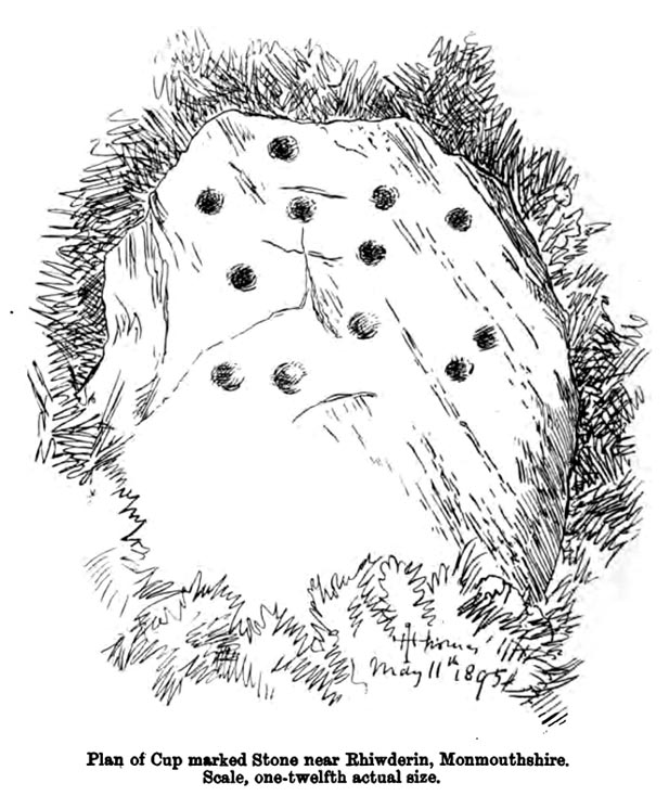
Rhiwderin cup-marks
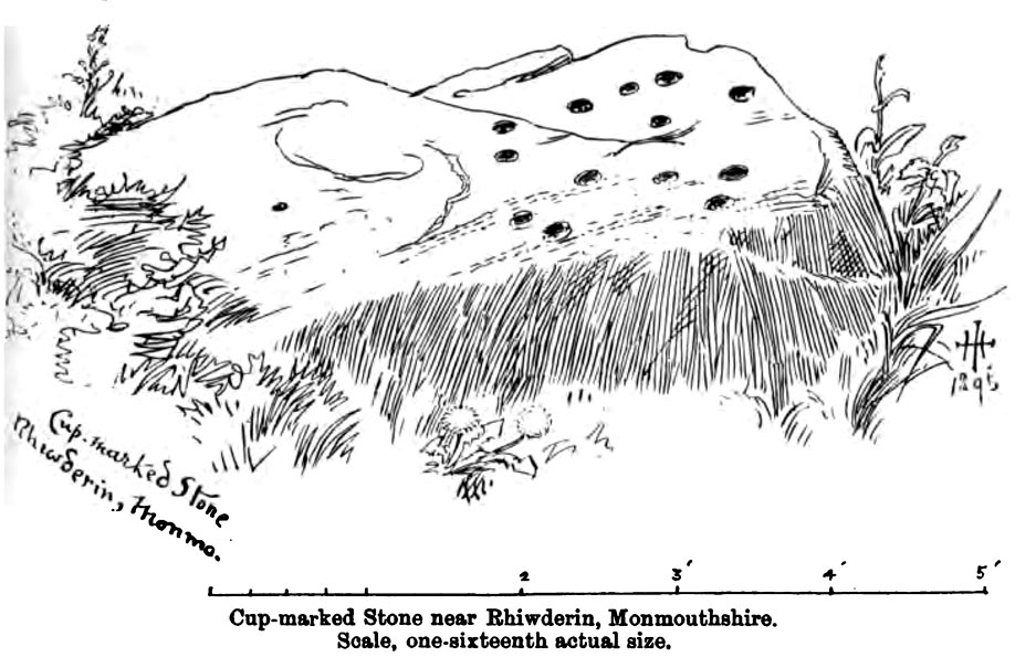
This fine-looking cup-marked stone was uncovered during a botanical outing in the last decade of the 19th century. Described as being around the township of Rhiwderin, the exact whereabouts of the carving is unknown and it’s not been seen since the first description of it in an early edition of Archaeologia Cambrensis by Mr T.H. Thomas. (1895) John Sharkey (2004) mentioned the site in his recent survey of Welsh rock art, saying simply “location unknown.”
The missing Rhiwderin stone
Although we know there are no hard and fast rules for working out the location of cup-and-ring markings, one may be fortuitous in exploring any nearby Bronze Age or neolithic tombs (cairns, tumuli, etc) in the Rhiwderin district, as they do tend to enjoy the company of such sites — but I must stress, this is by no means a dead cert!
Mr Thomas’s description of the carving was as follows:
“I enclose a sketch of what seems to be a cup-marked stone which I observed yesterday near Rhiwderin, Monmouth. Unless there be some operation which simulates such markings with which I am unacquainted, I take the specimen to add an instance of these mysterious prehistoric remains to the very short list given for Wales by Mr. Romilly Allen, and to be the first reported for South Wales.
“The stone displaying the cup-markings is a mass of millstone grit, earth-fast, the slanting surface appearing above the turf being about a yard wide, and 4 feet long. Upon the upper half of the surface is a group of twelve cups from 1½ to 2in diameter, and about 1in deep. On first noticing the cups they were taken for holes out of which quartz pebbles, abundant in the local millstone grit, had been weathered, but examination of the block showed that no pebbles of large size exist, or had existed in it, and the conclusion was arrived at that the cups are artificial.
“On turning back some of the turf covering the base of the slope of the stone, no other cups were discovered.
“The stone lies within an old enclosure, as shown by wild apple-trees and an abundance of daffodils, and still more clearly by ruins, which seem those of a cottage or small farm near by. This contiguity to a habitation which does not seem to have been abandoned more than a century, made me suspect some medieval or more recent origin for the markings. I cannot, however, account for them otherwise than by supposing them to be cup-markings in the technical archaeological sense.
“The stone was observed while in the company of Dr C.T. Vachell of Cardiff, searching for varieties of narcissus which occur at several points in the neighbourhood…”
If anyone comes across this lost carving, please let us know!
References:
Sharkey, John, The Meeting of the Tracks: Rock Art in Ancient Wales, Gwasg Carreg Gwalch: Llanrwst 2004.
Thomas, T.H., ‘Archaeological Notes and Queries,’ in Archaeologia Cambrensis, volume 12 (5th series), 1895.
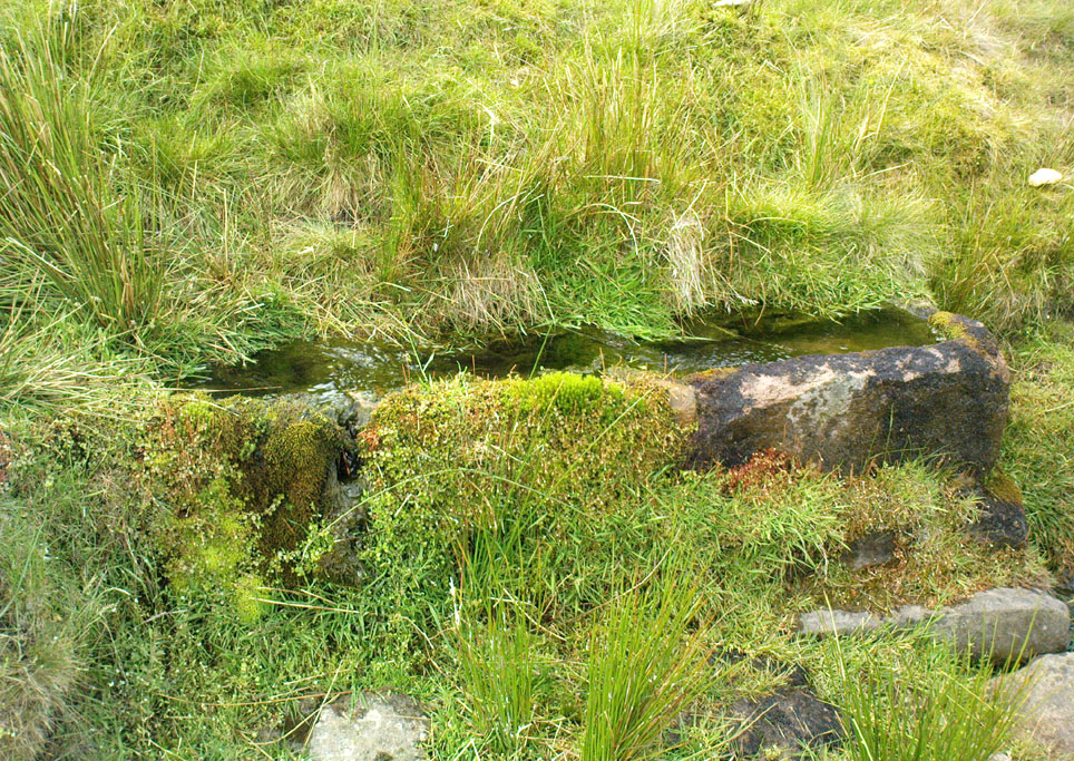
Take the Heptonstall road up from Hebden Bridge, going round the village (not into it) and head through Slack and onto Colden. Just as the road begins to go downhill to Colden, note the small single-track road on your right called Edge Road. Go on here for a good mile until it becomes a dirt-track and there, on your left, is the half-run-down old farmhouse called New Edge. Just yards past it, off to the right by the trackside, you’ll see this large copper-coloured stone basin oozing with the same-coloured liquid.
Archaeology & History
New Edge Chalybeate, above Colden
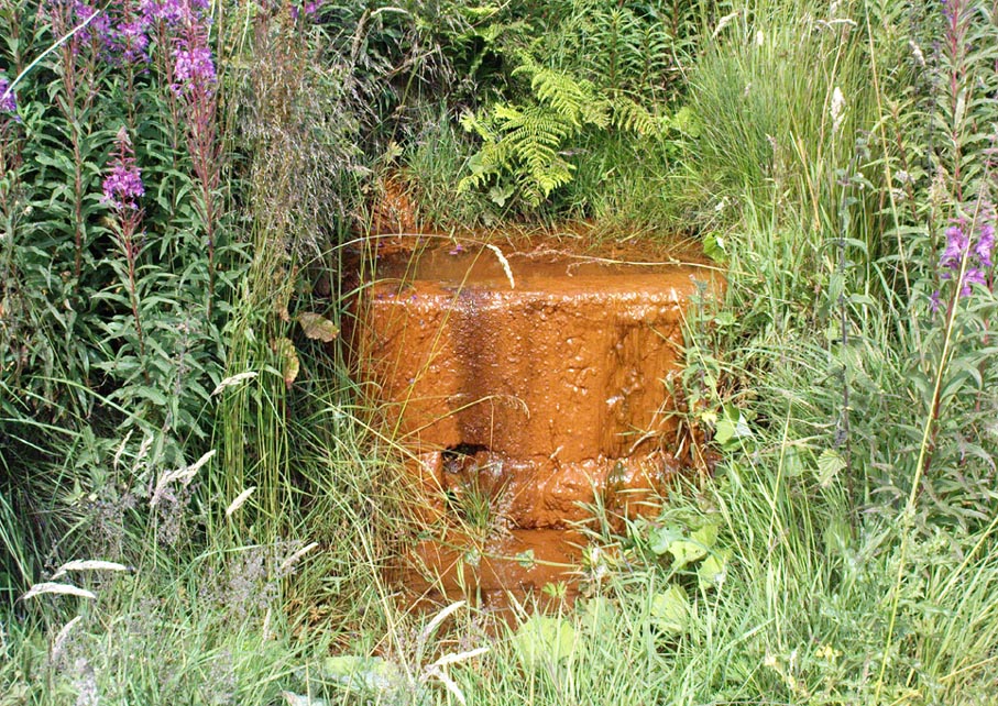
This is one of what Thomas Short (1724) called “the ten thousand chalybeats”, or iron-bearing springs, inhabiting the Yorkshire uplands — but he didn’t include this site in his huge survey. But it’s a beauty amongst chalybeates, as a visit here clearly shows! The well is one of two found on either side of the old building known as New Edge (as contrasted with Old Edge, a little further along the lane), and its waters trickle gently from the old stone trough.
The waters are undoubtedly enriched with large amounts of iron, as the photo here shows, giving the waters clear medicinal value. In tasting them, not only do the waters give you that copper-coloured hue, but you can clearly taste the minerals in the water. As with other iron-bearing springs, the water from the New Edge spring is good for the blood, good for anæmia, loss of energy and a low immune system.
References:
Short, Thomas, The Natural, Experimental and Medicinal History of the Mineral Waters of Derbyshire, Lincolnshire and Yorkshire, privately printed: London 1734.
Follow the directions to reach Churn Milk Joan, the head 100 yards east till reaching the crossing of footpaths, beneath Crow Hill. Take the northern (left) route and keep walking. Half a mile along you’ll see the tall upright stone to your left. You can’t really miss it!
Archaeology & History
The Greenwood Stone is an old boundary stone and is not prehistoric. It stands more than four feet tall. I first visited the site in 1988 in the company of several folklore and antiquarian writers, including Andy Roberts, Edna Whelan and Graeme Chappell. Twas a good day and coincided with a small collection of Psilocybes being gathered!
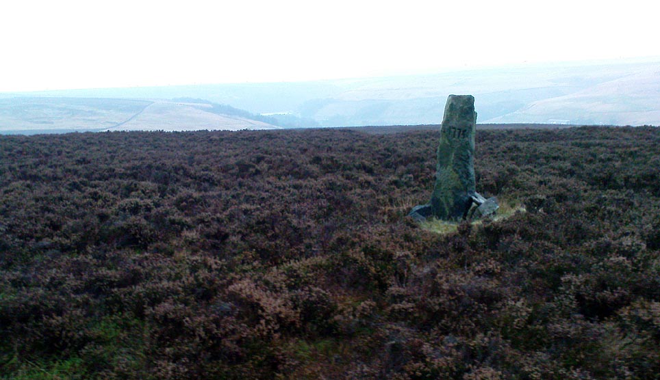
The tall upright is a boundary stone that was erected in 1775, as evidenced by the date carved on its southern face. I must emphasize however that this was not when the stone came to acquire its name: this was defined in 1594 as evidenced by a boundary perambulation written that year where it is described as being recumbent: “thence to one lying stone, newly named Greenwood Stone.” About 10-15 yards away is what may have been that very “lying stone,” the original Greenwood Stone, half-buried in the heather some six or seven feet long. It is possible this may have stood upright in the distant past.
Greenwood Stone, looking south
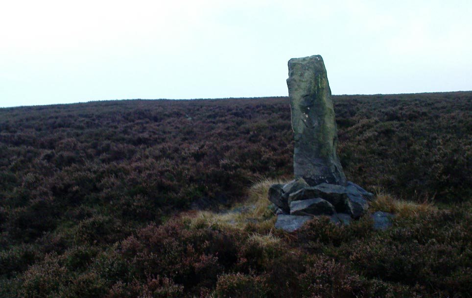
Moving about 75 yards south we come across another small standing stone at 1360 feet (412m) above sea level. This I’ve called the ‘Greenwood B stone’. It was marked on an old map as a boundary stone and is distinctly shaped to stand upright, marking a point separating the moors of Midgley and Wadsworth. When stood upright it is just visible on the horizon when looking from the Miller’s Grave prehistoric tomb several hundred yards east of here and is close to being an equinox indicator.
References:
Bennett, Paul, The Old Stones of Elmet, Capall Bann: Milverton 2001.
Take the B6478 road between Clitheroe and Newton, heading up north out of Clitheroe until you’re on the very top of the hill with fine views, mainly north and west. There’s a car-park about here, on the right-hand side of the road. From here, walk further along the road for about 200 yards, keeping your eyes peeled for the large stone trough at the left-hand side of the road. That’s it!
Archaeology & History
When we met up with John Dixon in the summer of this year, to wander on the nearby hills in search of old monuments, this was the first spot he showed us — and the waters were flowing nicely and tasted alright aswell! But its history is not widely know. Jessica Lofthouse (1976) described the place, saying:
“In the days of horse and pedestrian traffic none passed Walloper Well without stopping to ‘quaff the clear crystal.’ Long ago, hill men, hunters, forest wardens and farmers off to Clitheroe markets and fairs, pedlars, lead miners from the nearby workings, all met here. The name is thought-provoking. Why Walloper? From a word meaning a ‘fresh bubbling spring’, which this is, fresh from the moorside into stone troughs. Age, wartime army practice and vandalism of 1974 made renewal of the trough necessary, but the flow has been constant. One must drink, just as one throws pennies into the Roman fountain, to ensure one comes back again.
“The true derivation does not satisfy everyone. One can choose. A man and his wife climbed towards Walloper with raised voices, she nagging, he protesting. A pedlar watched them. “I’ll tell thee what I’d do if she were my wife. I’d wallop her, wallop her, wallop her well.” A song which every local singer was once compelled to have in his repertoire told the same story. The chorus sums up the reason for the name:
“…lovers of tell, each beau to his belle
The olden time story of Walloper Well.
The mason who built it in love with a maid
Who brought him his dinner one day, so tis said,
Was struggling to kiss her when over the Fell
A pedlar then passing cried, ‘Wallop her well’.”
References:
Byrne, Clifford H., Mineral Springs and Holy Wells of North-East Lancashire, unpublished manuscript, 1972.
Lofthouse, North Country Folklore, Robert Hale: London 1976.
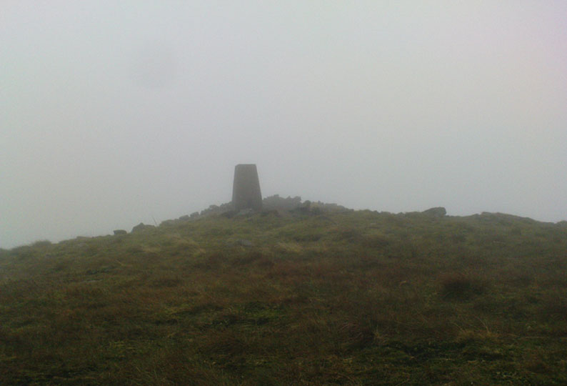
Triangulation & cairn atop of Rye Loaf Hill on a truly foggy eve
Best way is to take the Settle to Kirkby Malham road: a tiny little thing running steep from Settle up and around the hills, making sure you don’t miss the turn-off to Kirkby and head down to Airton instead. About 100 yards along from the road-junction to Kirkby, there’s a small copse of trees and a gate just before it. Walk up through that and head right to the top of the nice hill a mile or so ahead of you to the north. It can be boggy, slippy and well good! A decent Barmy Bennett expedition this way lies! Get to the top of the hill and you can’t miss the cairn!
Archaeology & History
First shown on the 1771 Greenwood map, this is another intriguing little-known antiquity in our Yorkshire hills. It’s intriguing as the precise age and nature of the site doesn’t appear to have been ascertained. On top of this lovely rounded hill is not only a stunning view for many miles in all directions (unless you climb it on a very cloudy foggy day, like we did!), but the rock-pile which someone in recent years has turned into a wind-break has been taken from a much larger, and much older rock-pile on the very summit.
The cairn stands about a yard tall at the highest and measures roughly 12 yards in diameter, but the edges of the site seem to disappear further beneath the peat and vegetation on the hilltop. A section in the middle of the cairn has obviously been dug into, probably to create the stone shelter on its southern side, but it also gives the impression of having been dug into by treasure-seekers in the past — similar to the trenches found in the Snowden Crags cairn circle, the Great Skirtful of Stones and other prehistoric tombs.
The site has been marked on Ordnance Survey maps as a simple marker cairn (non-antiquated writing on the maps), but I have strong suspicions after visiting this peak that the cairn in question is a lot older than has previously been assumed. So I contacted local archaeologist Robert White and asked if he knew of any archaeological data about the cairn, but he said there was nothing that he knew. However, an additional piece of information that adds potential to the antiquity of the cairn came from the awesome pen of Harry Speight (1895) who told that,
“The original name of this eminence is Inglehow, which suggests like Ingleborough and ancient look-out post or beacon hill.”
The suffix how or howe is well-known to place-name students in northern England and beyond as a burial mound or tumulus. We must be cautious however, for as Gelling (1988) says, the word “is frequently applied to a tumulus, but it can refer to a natural hill.” But Speight’s idea that the name may have had something to do with beacons was mentioned — albeit without reference to Rye Loaf Hill, whose history and features he ignored — in Thomas Whitaker’s (1878) huge survey, where he wrote:
“In this parish was an immemorial custom, continued within the memory of many persons yet alive, of kindling fires on the tops of the surrounding hills on St. Laurence’s Eve, the 9th of August. This night was called the Kennel or Kennelk night; and the tradition of the place is, that the fires were intended as a memorial of the beacons kindled by the Saxons to alarm their countrymen on the sudden approach of the Danes.”
The parish in question that Whitaker described was Giggleswick, which is right next door to Settle, in whose parish Rye Loaf Hill lives.
On the southern edge of Rye Loaf are a couple of other archaeological place-names that need looking at. We have a couple of ‘Stone Haws’, which are probably cairns, close to which we find extensive evidence of human activity at some time in the past. But close to one of these piles of stones is another, far more fabled rock whose history appears to have long since been neglected: the Dragon Stone of Scosthrop Moor. Never heard of it? That’s not surprising…
References:
Gelling, Margaret, Signposts to the Past, Phillimore: Chichester 1988.
Smith, A.H., English Place-Name Elements – volume 1, Cambridge University Press 1956.
Speight, Harry, Tramps and Drives in the Craven Highlands, Elliot Stock: London 1895.
Whitaker, Thomas Dunham, The History and Antiquities of the Deanery of Craven in the County of York, (3rd edition) Joseph Dodgson: Leeds 1878.
Follow the same directions to reach the recently discovered Slade-02 carving; and simply walk 30 yards southwest. The scattered ruins of numerous small stone piles, visible only when the heather’s been burnt back, is what you need to be looking for.
Archaeology & History
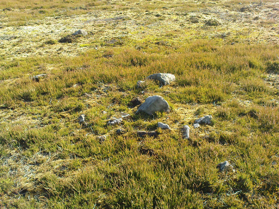
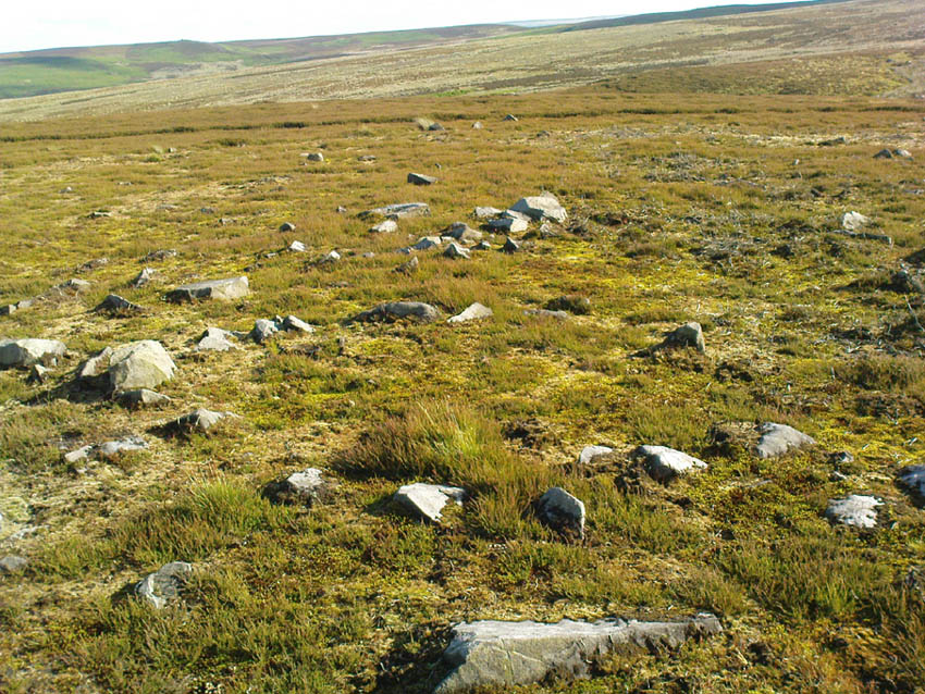
First discovered on a Northern Antiquarian outing in July 2011, it’s difficult to give an accurate appraisal of this site as much of the landscape all round here is very overgrown in deep heather. Added to this, there is evidence of more recent medieval and post-medieval industrial activity that’s intruded and/or affected the earlier prehistoric remains that are evident here. But these factors aside, we can say with certainty that here is a previously unrecognized prehistoric cairnfield — and it may be of some considerable size.
Ruined hut or cairn circle
We have so far located at least seven individual cairns and a cairn circle in relative proximity to each other, thanks to local rangers burning back the heather. It was the discovery of the cairns which then led to the discovery of the nearby cup-and-ring stones. Amidst the cairn-spoils there are also distinctive lines of stone, indicative of either walling or embankments of some form or another. Some of the stone making up this cairnfield appears to have been robbed. We also found that in walking through the deeper heather surrounding this ‘opening’ (where it had been burned away a few months previously), a number of other man-made piles of stone were evident that seemed to indicate more cairns. There is also evidence of further lines of prehistoric walling, whose precise nature is as yet unknown. But we do know that people have been on this moorland since Mesolithic times (structural and other remains of which are still evident less than a half-mile away).
The site requires greater attention the next time the heather’s been burnt back.
References:
Davies, J., “A Mesolithic Site on Blubberhouses Moor, Wharfedale,” in Yorkshire Archaeological Journal, part 161 (volume 41), 1963.
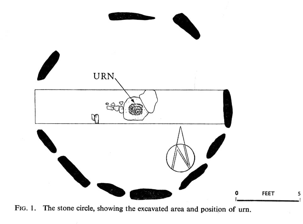
Although originally classed as a stone circle, this site should more accurately be described as a form of cairn circle, as burial remains were found in the middle. This is noted by both Aubrey Burl (2000) and John Barnatt (1989), who thought it to be a kerbed cairn. It’s only a small circle aswell, about 5 yards across and is found not far from other burial cairns in the neighbourhood.
First discovered around Easter in 1965 by the then owners of the farm, Mr & Mrs K. Jarman, parts of the circle were dug into by their children, who subsequently informed Sheffield City Museum of their finds. Subsequently, the circle was then described in a short article by J. Radley (1969) in ‘Notes on Archaeological Finds’ for the Yorkshire archaeology group. He wrote:
“The circle is 15ft in diameter and is made of ten stones which protrude a few inches above the turf cover. Inside the circle the ground is slightly concave. A two-feet wide trench was dug across the circle and a large stone was revealed at the centre. On the stone was a fragmented urn, remains of a cremation, and one fragment of flint. There are signs of burning on the stone, and also under the stone, but no other burial has been discovered. The whole burial was so shallow that it was in the root zone of the overlying grass. The survival of many pieces of bone in such a wet location suggests that the area must have been protected by a mound until quite recent times…
“The urn is too fragmentary to be restored. Of the hundreds of fragments, only a few retain both faces, and these are generally one centimetre thick. The urn appears to have been made of a fine clay with large grits and has a smooth brown surface marked in places with impressions of blades of grass. The urn may have been biconical in form with bands of horizontal grooves around the upper part, with vertical grooves below them.”
References:
Barnatt, John, The Stone Circles of Britain – volume 2, British Archaeological Reports: Oxford 1989.
Burl, Aubrey, The Stone Circles of Britain, Ireland and Brittany, Yale University Press 2000.
Radley, J., “A Stone Circle on Kirkmoor Beck Farm, Fylingdales,” in Yorkshire Archaeological Journal, part 167, volume 42, 1969.