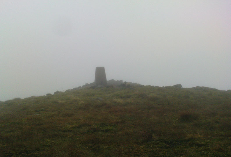
Cairn: OS Grid Reference – SD 86419 63309
Also Known as:
- Inglehow

Best way is to take the Settle to Kirkby Malham road: a tiny little thing running steep from Settle up and around the hills, making sure you don’t miss the turn-off to Kirkby and head down to Airton instead. About 100 yards along from the road-junction to Kirkby, there’s a small copse of trees and a gate just before it. Walk up through that and head right to the top of the nice hill a mile or so ahead of you to the north. It can be boggy, slippy and well good! A decent Barmy Bennett expedition this way lies! Get to the top of the hill and you can’t miss the cairn!
Archaeology & History
First shown on the 1771 Greenwood map, this is another intriguing little-known antiquity in our Yorkshire hills. It’s intriguing as the precise age and nature of the site doesn’t appear to have been ascertained. On top of this lovely rounded hill is not only a stunning view for many miles in all directions (unless you climb it on a very cloudy foggy day, like we did!), but the rock-pile which someone in recent years has turned into a wind-break has been taken from a much larger, and much older rock-pile on the very summit.
The cairn stands about a yard tall at the highest and measures roughly 12 yards in diameter, but the edges of the site seem to disappear further beneath the peat and vegetation on the hilltop. A section in the middle of the cairn has obviously been dug into, probably to create the stone shelter on its southern side, but it also gives the impression of having been dug into by treasure-seekers in the past — similar to the trenches found in the Snowden Crags cairn circle, the Great Skirtful of Stones and other prehistoric tombs.
The site has been marked on Ordnance Survey maps as a simple marker cairn (non-antiquated writing on the maps), but I have strong suspicions after visiting this peak that the cairn in question is a lot older than has previously been assumed. So I contacted local archaeologist Robert White and asked if he knew of any archaeological data about the cairn, but he said there was nothing that he knew. However, an additional piece of information that adds potential to the antiquity of the cairn came from the awesome pen of Harry Speight (1895) who told that,
“The original name of this eminence is Inglehow, which suggests like Ingleborough and ancient look-out post or beacon hill.”
The suffix how or howe is well-known to place-name students in northern England and beyond as a burial mound or tumulus. We must be cautious however, for as Gelling (1988) says, the word “is frequently applied to a tumulus, but it can refer to a natural hill.” But Speight’s idea that the name may have had something to do with beacons was mentioned — albeit without reference to Rye Loaf Hill, whose history and features he ignored — in Thomas Whitaker’s (1878) huge survey, where he wrote:
“In this parish was an immemorial custom, continued within the memory of many persons yet alive, of kindling fires on the tops of the surrounding hills on St. Laurence’s Eve, the 9th of August. This night was called the Kennel or Kennelk night; and the tradition of the place is, that the fires were intended as a memorial of the beacons kindled by the Saxons to alarm their countrymen on the sudden approach of the Danes.”
The parish in question that Whitaker described was Giggleswick, which is right next door to Settle, in whose parish Rye Loaf Hill lives.
On the southern edge of Rye Loaf are a couple of other archaeological place-names that need looking at. We have a couple of ‘Stone Haws’, which are probably cairns, close to which we find extensive evidence of human activity at some time in the past. But close to one of these piles of stones is another, far more fabled rock whose history appears to have long since been neglected: the Dragon Stone of Scosthrop Moor. Never heard of it? That’s not surprising…
References:
- Gelling, Margaret, Signposts to the Past, Phillimore: Chichester 1988.
- Smith, A.H., English Place-Name Elements – volume 1, Cambridge University Press 1956.
- Speight, Harry, Tramps and Drives in the Craven Highlands, Elliot Stock: London 1895.
- Whitaker, Thomas Dunham, The History and Antiquities of the Deanery of Craven in the County of York, (3rd edition) Joseph Dodgson: Leeds 1878.
© Paul Bennett, The Northern Antiquarian
This hill and cairn are possibbly the site and remains of a Roman signal station. The Roman route from Ilkley to Kendal which roughly aligns the present a65 would have had watch towers and signal stations alongst its length. A recent pamphlet called ‘The Roman A65’ suggests that rye loaf is one such contender. Sites alongst the route have been identified exept one on or near Ingleborough. Having travelled many sections of this route and climbing the suggested elevations, i can only agree with the logic of these suggestions. On a recent search i have identified a site above cowan bridge but i need to investigate further. I hope this is of interest.