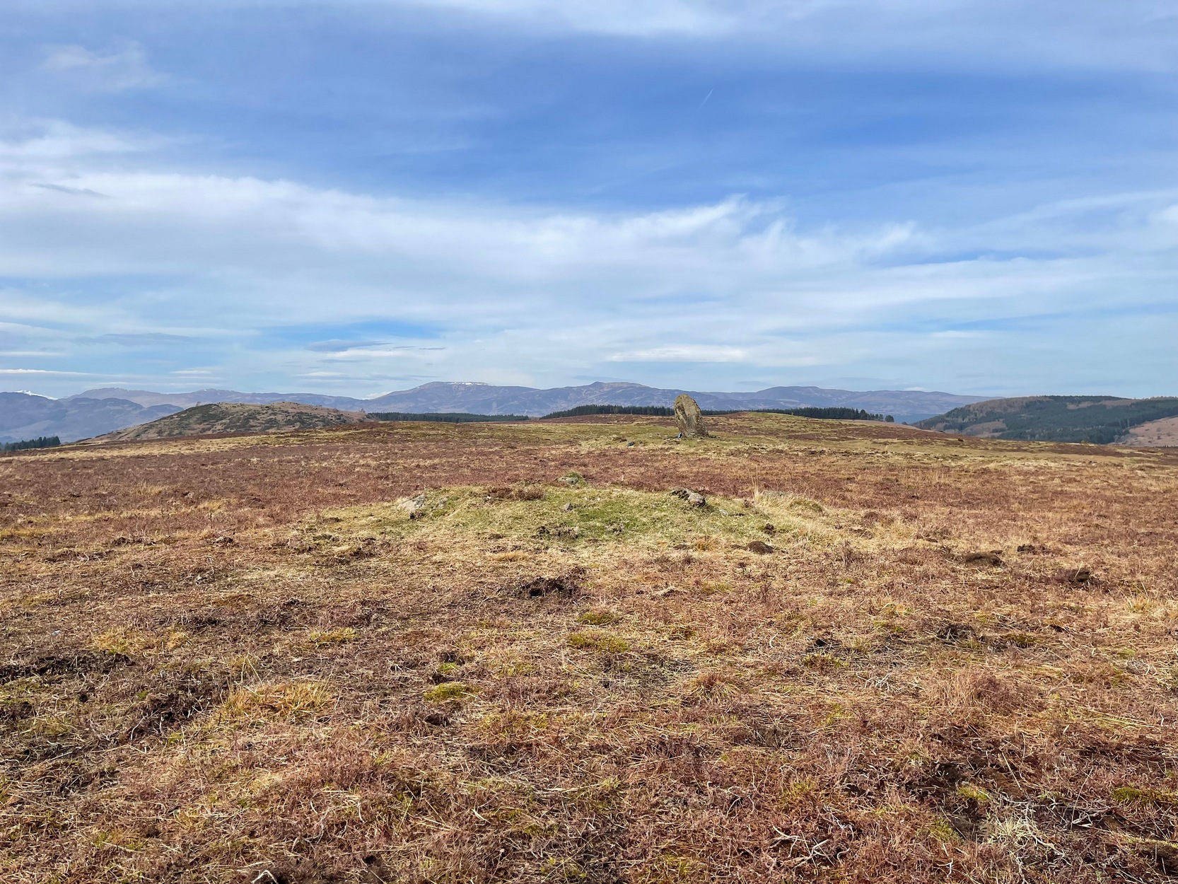
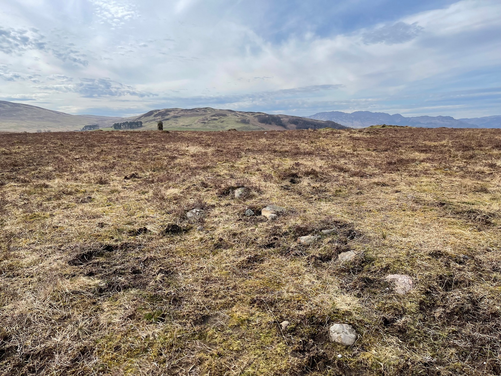
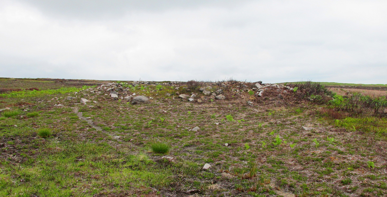
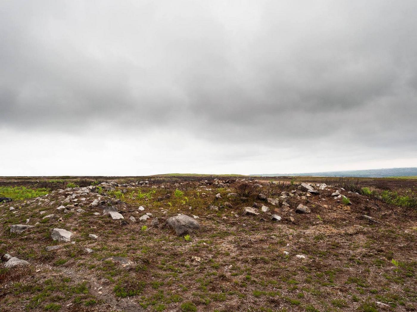
Simply follow the directions to reach the Dunruchan monoliths ‘D’ and ‘E’ and then zigzag through the heather to their immediate south—from just a few dozen yards away, to up to 300 yards west. Keep your eyes peeled for the stoney little rises in the heather as you walk back and forth and you’ll see at least some of these cairns.
Archaeology & History
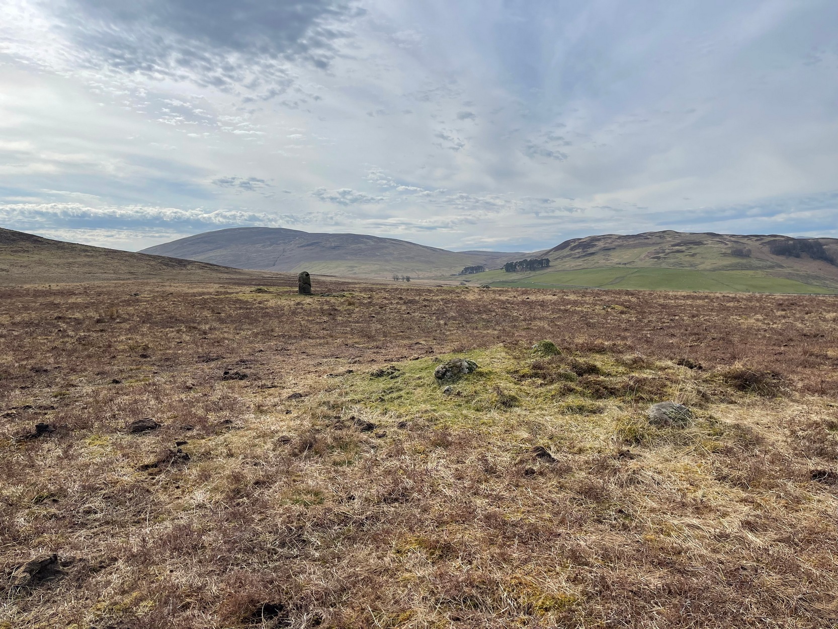
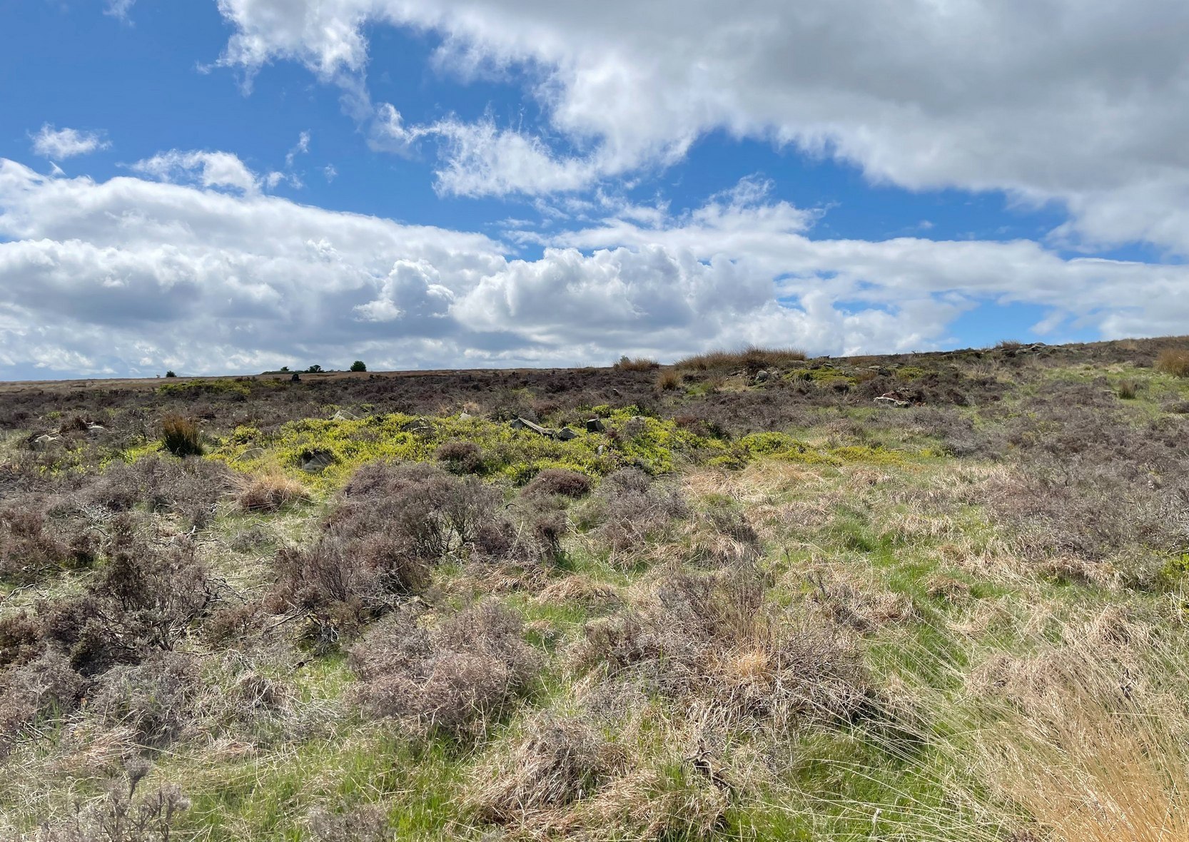
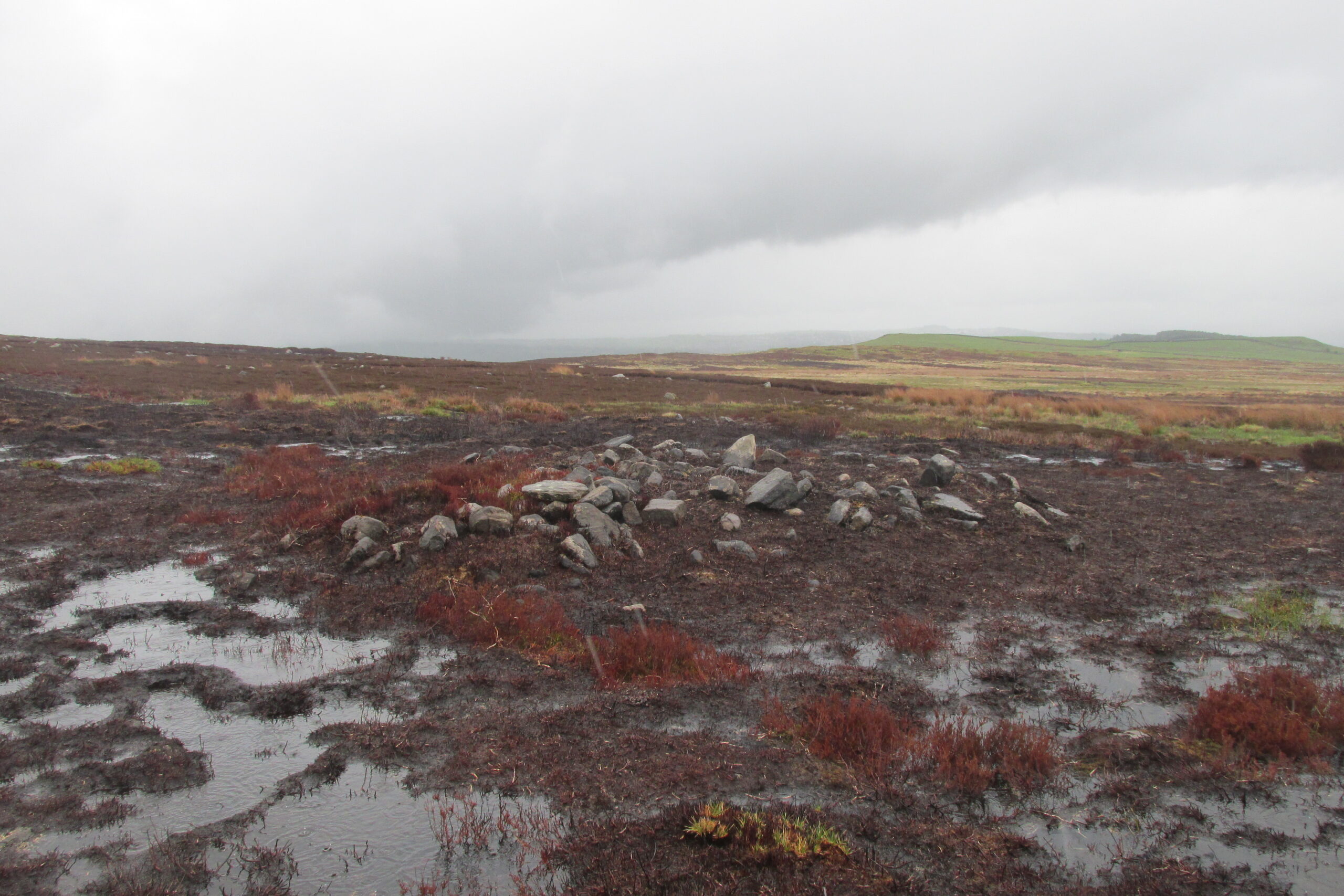
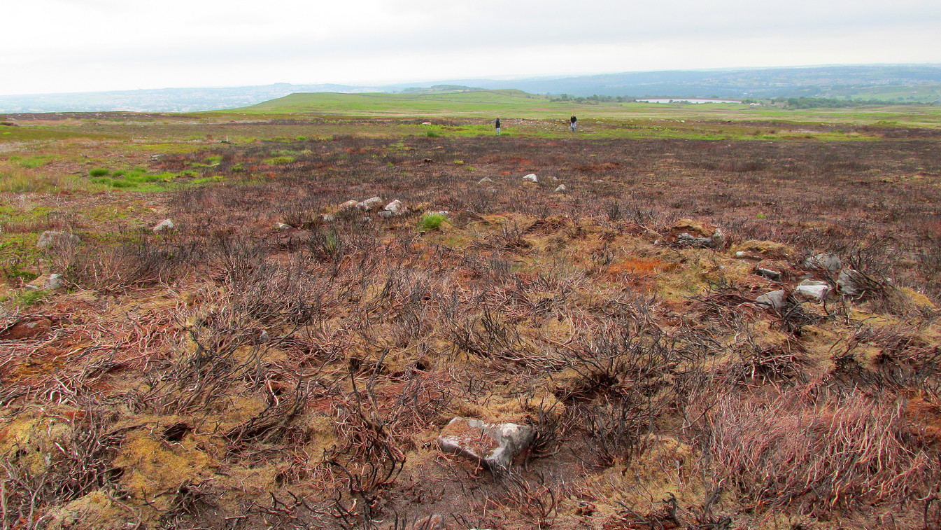
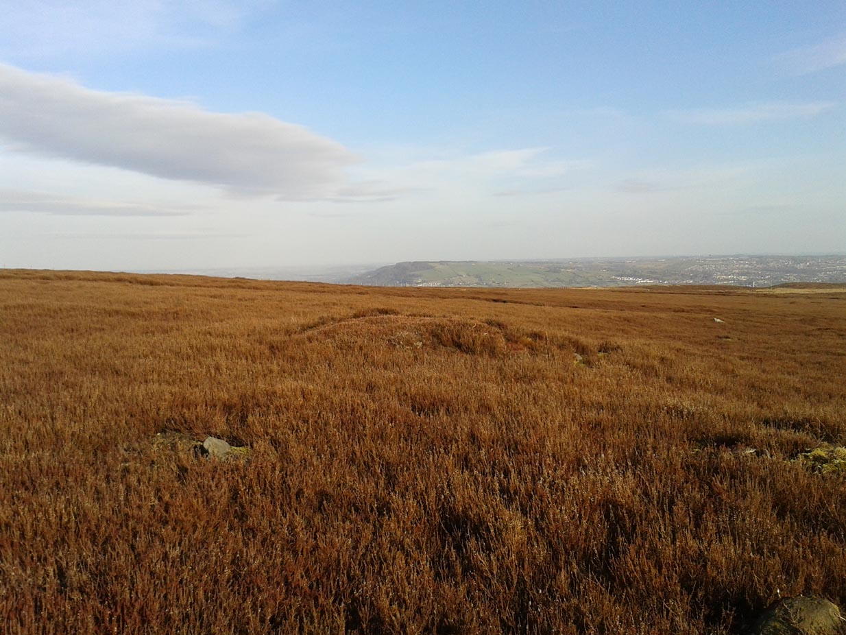
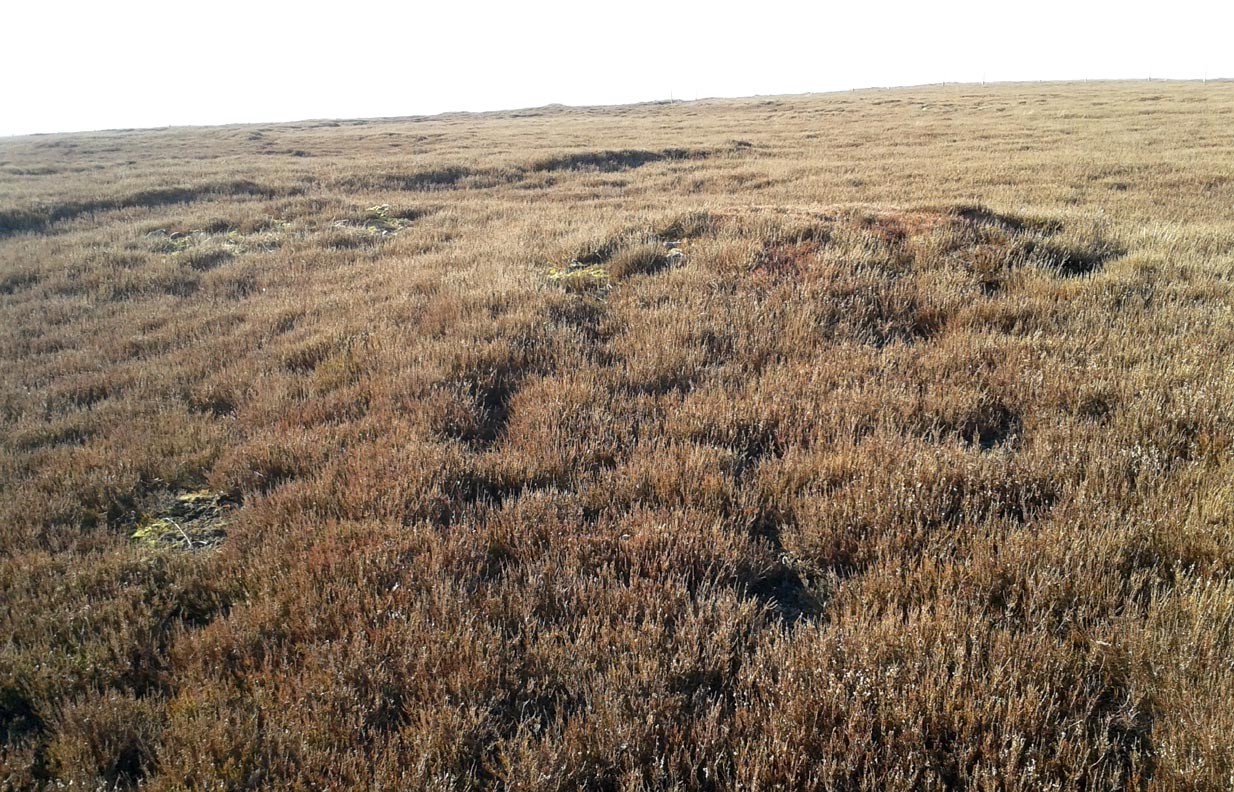
Not to be confused with the large cairn scatter on the grassy plain of Aodann Mhor a short distance north-west (whereon stands the magisterial Dunruchan A monolith), many of which which may be just field clearance cairns. This small group found a short distance east, south and west of Dunruchan stones ‘D’ and ‘E’ are more typical burial cairns. They each average between five and six yards across and none are more than three feet high. We first noticed them about ten years ago and on subsequent visits kept looking them over, but the deep heather ensured they were hard to see. But, after a recent heather-burning exercise on the moors, they are at thankfully visible—for a short time at least.
Cairn SE of Dunruchan ‘D’Cairn S of Dunruchan ‘D’
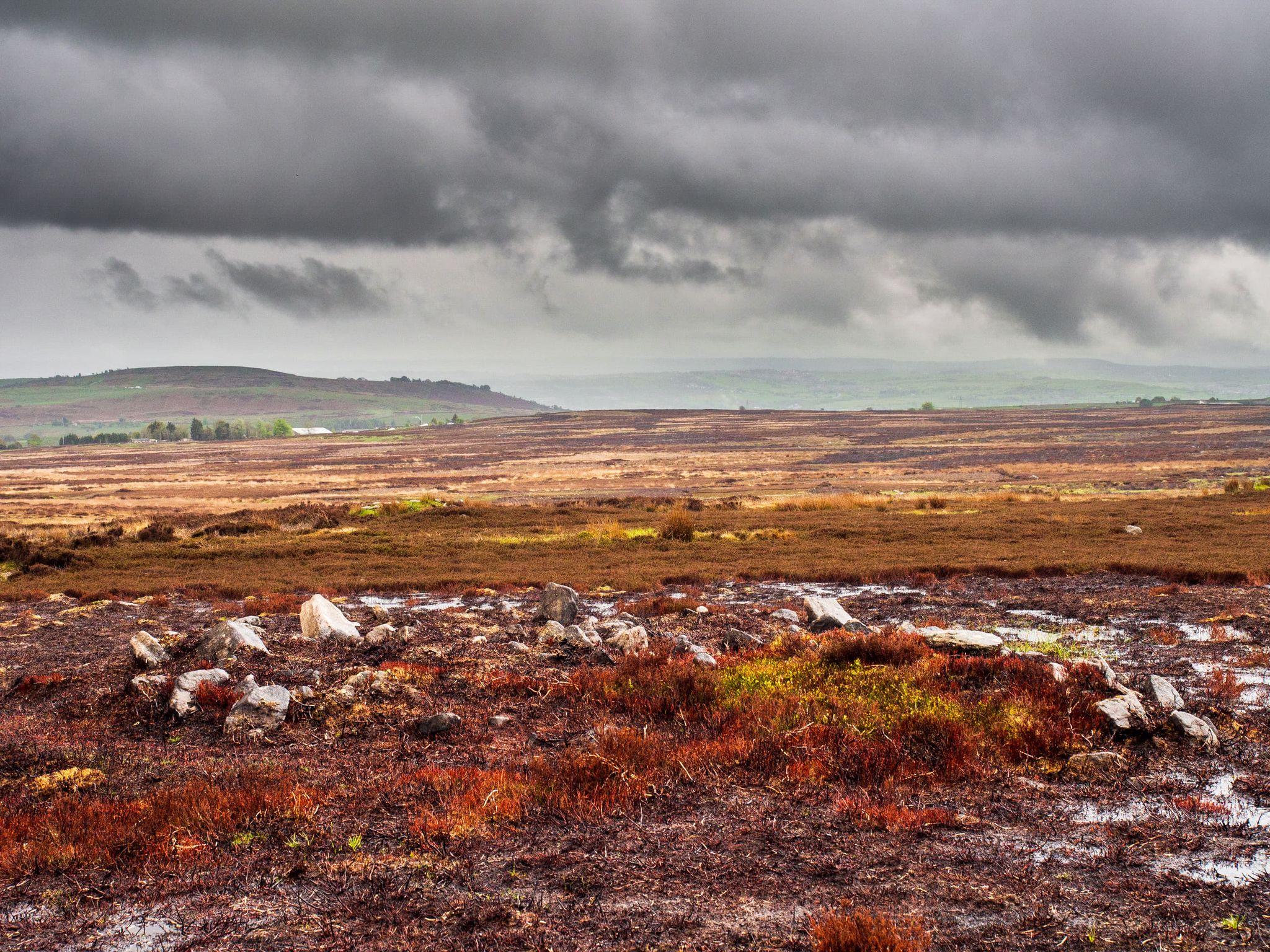
At the time of writing, probably the best one to see is found 40 yards south of Dunruchan D and 47 yards north-east of Dunruchan E and may have the astronomers amongst you running for the theodolites! It has that distinct look about it when you see it in context with the landscape and adjacent standing stones. The westernmost cairn that’s (presently) known here is 300 yards west of the Dunruchan E stone, just past the Dunruchan enclosure, at NN 7873 1676. It’s likely that there are other unrecorded prehistoric sites in this area.
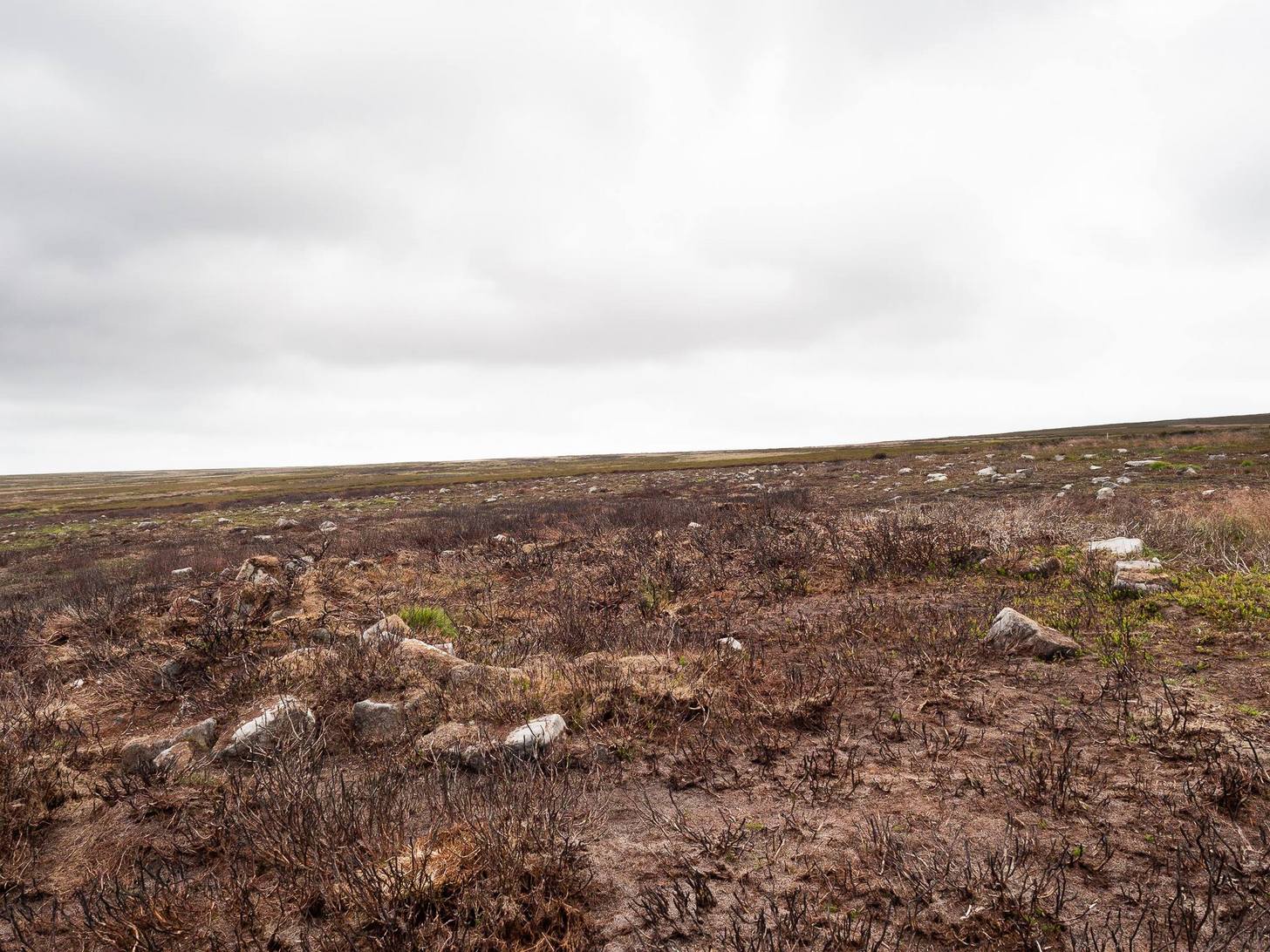
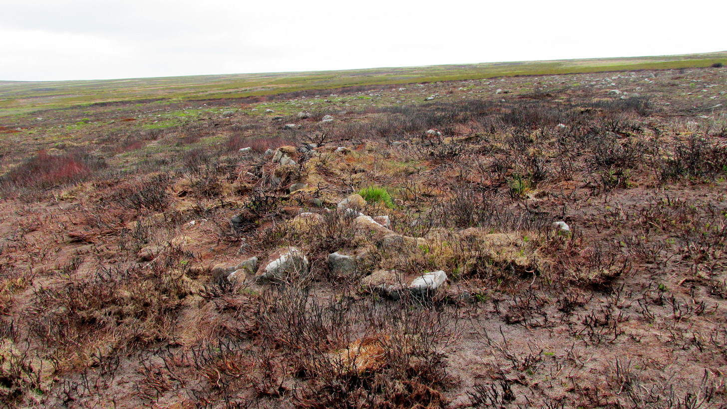
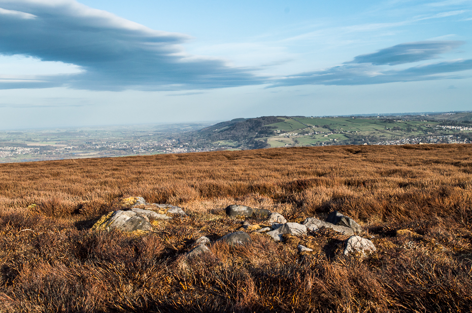
Low line of ancient walling
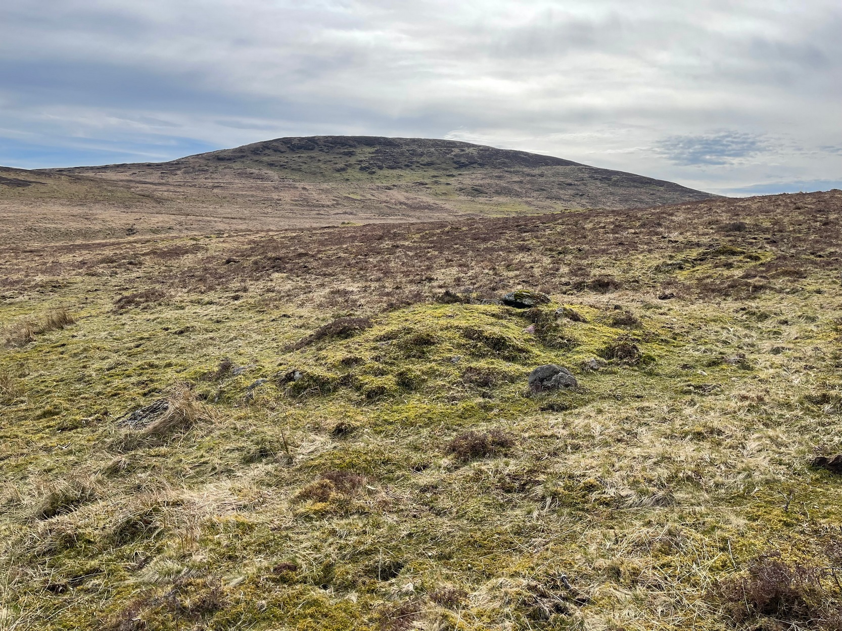
Amidst this section of the moors is a line of very low walling that runs a short distance east-to-west, towards the Dunruchan ‘E’ stone. A lot of old walling exists hereby, mainly visible in the fields to the east, but this particular line is much smaller and of a different age by the look of things, presumably older. It has the appearance of walling more usually associated with prehistoric hut circles, but in this case runs in a straight line towards the standing stone. Curious…
Folklore
The standing stones on this plain and the cairns here are said to be the graves of fallen Roman soldiers, slain by our tribal Scots two thousand years ago. In all honesty though, these are likely to be much older than any of those Roman savages.
Park up at the singular dusty car-park on the east-side of Askwith Moor Road. If you walk to the sloping eastern edge of the car-park and then go down and over the collapsed fence onto the moorland immediately east, walk in the direction of the Tree of Life Stone to the north-east (be aware that there’s no footpath here and it’s boggy as fuck in places) . Just over halfway towards the carving, nearly 400 yards from where you’ve parked, you’ll begin to see various ruinous piles and scatters of stone. You can’t really miss them!
Archaeology & History
Cairn, looking north
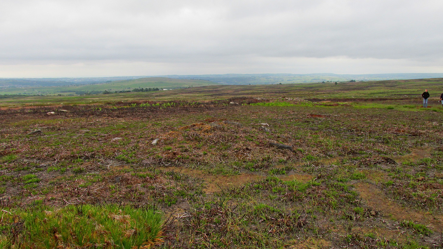
In a region teeming with prehistoric sites, the great Eric Cowling (1937) seems to have been the person who stumbled across this “barrow group”, as he called it, during one of his rock art forays in this neck o’ the woods. Little has been written of them since. Not to be confused with the Snowden Moor cairnfield more than 350 yards to the north, at this place we find at least a dozen quite distinct cairns scattered around the grid-reference cited, most of them much larger in size than the cairns to the north, ranging between five to twelve yards across and up to three feet high. They have all been opened and robbed, with considerable disturbance on the largest of the ‘barrows’. We know not who may have done this, but there’s been a history of quarrying close by and it may have been some of the workmen who did the damage, knowingly or otherwise.
Large scatter of cairn-spoilCairn covered in bilberries!
As far as I’m aware, no burial or funerary remains have been found here—but there’s been negligible archaeological attention given to any of the sites on this moorland, meaning that we can draw no real conclusions about the nature of the cairns. They seem to be far too large to be clearance cairns; and the proximity of large scale prehistoric settlements and rock art all round here would strongly suggest they possessed a funerary nature. Several impressive petroglyphs exist right at the edge of this group, literally yards away from them. Check them all out out the next time you see the Tree of Life stone…
References:
Cowling, Eric T., ‘Cup and Ring Markings to the North of Otley,’ in Yorkshire Archaeological Journal, volume 33 (part 131), 1937.
Cowling, Eric T., Rombald’s Way: A Prehistory of Mid-Wharfedale, William Walker: Otley 1946.
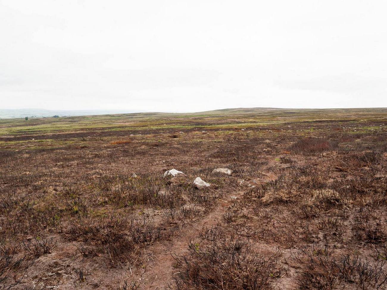
It’s a bittova pain-in-the-arse locating this site unless you’re into walking off-path, through excessive dense heather or burnt coarse ground. You can either follow the directions to the Black Beck tomb, or set off from Horncliffe Circle and walk up parallel to the fencing for nearly 300 yards (275m). From here, walk due east for nearly half a mile through the deep heather until you reach an overgrown track that keeps you eastwards towards a line of grouse butts abaat 275 yards (250m) on. Naathen, walk on the north-side of this path-track and for a few yards and you’ll begin to see either small piles of stones, or heather-covered mounds. Zig-zag about. You’re in the middle of the cemetery!
Archaeology & History
This cairnfield, or burial ground, or necropolis (choose whichever term you prefer) is a bittova beauty! Although some of the tombs here had been ‘officially’ noticed a few years back, the magnitude of it was understated to say the least. On a visit to the place a few months ago in the middle of one fuckova downpour, James Elkington and I found not only the large Black Beck tomb, but scattered clusters of many more cairns. But it wasn’t until a few weeks after that we got a longer time to check it over and, even then, I think the job was only half-done. So this site profile is merely an overview of some of what we found there. Along with the Black Beck tomb, we found more than thirty examples of prehistoric cairns—probably Bronze Age in nature—around the Hawksworth Shaw area near the middle of Hawksworth Moor, scattered around (seemingly) in no particular order.
…and another one…Round cairn in foreground
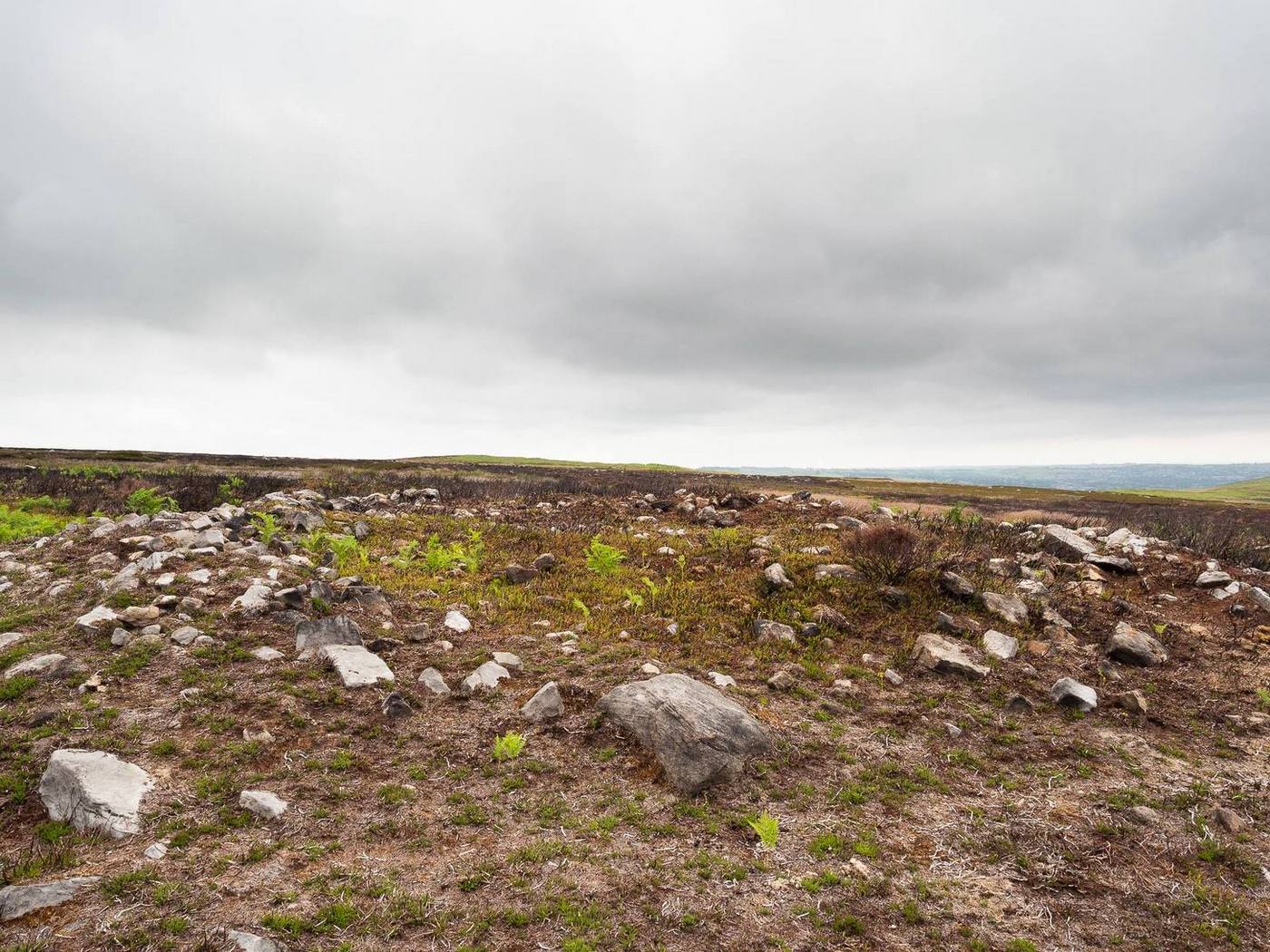
Three types of cairns were identified in this large cairnfield. The majority of them are of the standard circular form, averaging 3-4 yards across and rising to about two feet high. They are of the same architectural form as those found in the Hawksworth Moor cairnfield 4-500 yards northwest of here (there is the possibility that the two of them are part of the same necropolis, but unless we can locate an unbroken continuity between the two groups, it’s best to present them as separate clusters). When we looked at them a couple of weeks ago, most cairns of the ’round’ type were overgrown, albeit in low growth, as a couple of the photos here show. The main cluster of the round cairns are just a few yards off the aforementioned track, but there are others scattered here and there at other points on this part of the moorland. A number of these cairns seem to have have been damaged and robbed of stones to build a line of grouse butts close by.
One of the ‘long cairns’Another ‘long cairn’ during an utter downpour!
The second type of cairn in the necropolis—close to the main cluster of round cairns—are curious small, long cairns. Each one of them measures between 8-10 yards in length, are up to three yards across, and rise to a height of about one yard. They are built of the usual mass of small stones typical of the huge number of other cairns on Rombalds Moor, but have been constructed in an elongated form, in contrast to the more usual circular ones. Four of them are very close to each other with a fifth further away from this main group. A sixth one appears to be under the heather 50-60 yards away to the northeast. Unlike some of the nearby round cairns, this group looks as if it’s barely been touched by the hand of man, with only fallen scatters of stones around the outer edges of them. Tis an interesting group…
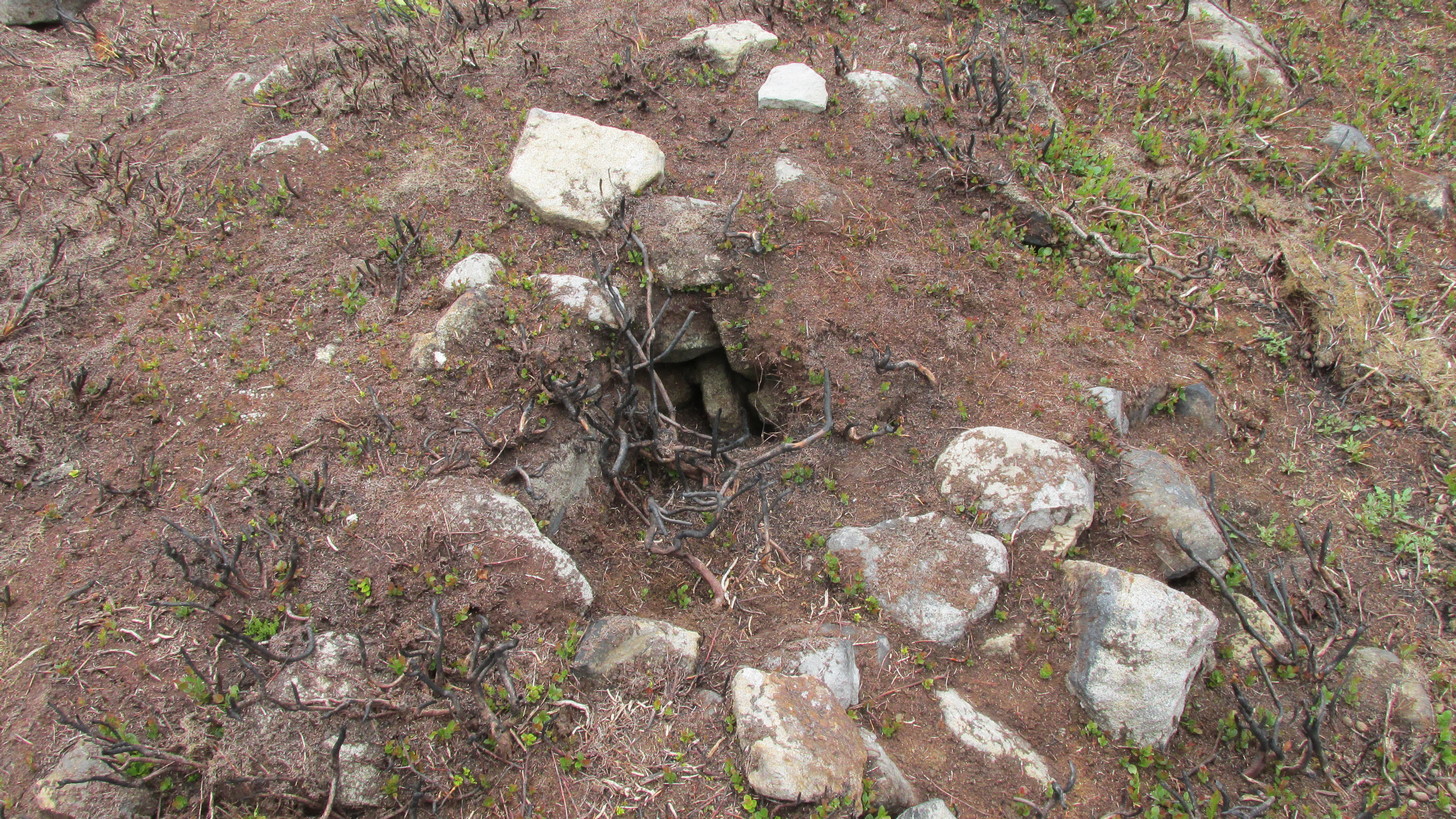
The third architectural cairn-types are scattered unevenly across the necropolis and are characterized as smaller, mini-versions of the round cairns, i.e, small piles of stones between 1-2 yards across and and just one or two feet high. Each of this type of cairn are more deeply embedded in the peat with more vegetational growth covering them due to their small size. This makes them much more difficult to see in comparison to their larger compatriots. One example (at SE 1423 4404) can be seen in the photo, above left, some 50-60 yards north of the Black Beck tomb; with another, above right, some 100 yards away to the southeast. There is the possibility they may be so-called ‘clearance cairns’, although I have some doubts about this and believe they are more likely to be individual graves…. but I could be wrong…
There’s little doubt that other tombs are hiding away in this area, waiting for fellow antiquarians to uncover them. Equally probable is the existence of hut circles or similar living-quarters lost beneath the heather. Two such sites have been found on recent ventures here: one a short distance west of the Black Beck tomb and another hiding away nearly 300 yards southwest, right beside the Black Beck. The main thing lacking up here are cup-and-ring stones. Apart from several uninspiring cup-marked rocks it seems few exist hereby; but there are, no doubt, some hiding away that have been hidden for millenia…
One final thing: the grid-reference given for this necropolis is based loosely on where some of the cairns can be found, but there are others whose positions lies slightly beyond that grid-ref, as you’ll find if you potter about.
Acknowledgements: With huge thanks, as always, for James Elkington for use of his photos. Also to the evolving megalith and landscape explorer Mackenzie Erichs; and to Linzi Mitchell, for additional input…
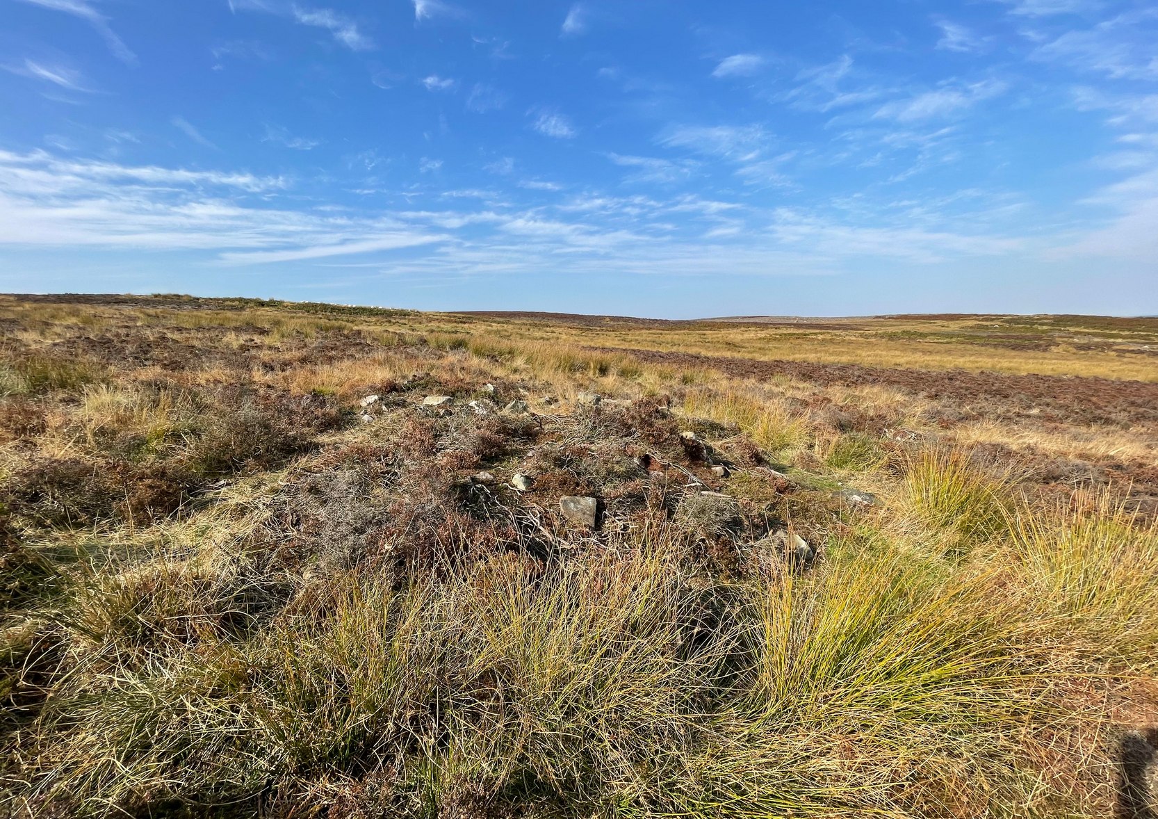
Probably the easiest way to find this is to use other sites as guides. From the Great Skirtful of Stones tomb, get over the fencing and follow it eastwards for exactly 500m (238 yards) where you’ll meet a small footpath on your right that goes southeast up the small slope of Craven Hall Hill and onto the moorland. Go along here for literally 0.2km (223 yards) and, just where the path bends slightly to the left, drop diagonally down the slope to where the moorland levels out close to the Craven Hall Hill (2) tumulus. From here walk WSW onto the flat moorland for literally ⅓-km (0.21 miles; 365 yards) where you’ll find either a large rounded mass of stones, or a large heather-covered mound—depending on whether there’s been a burning. Best o’ luck!
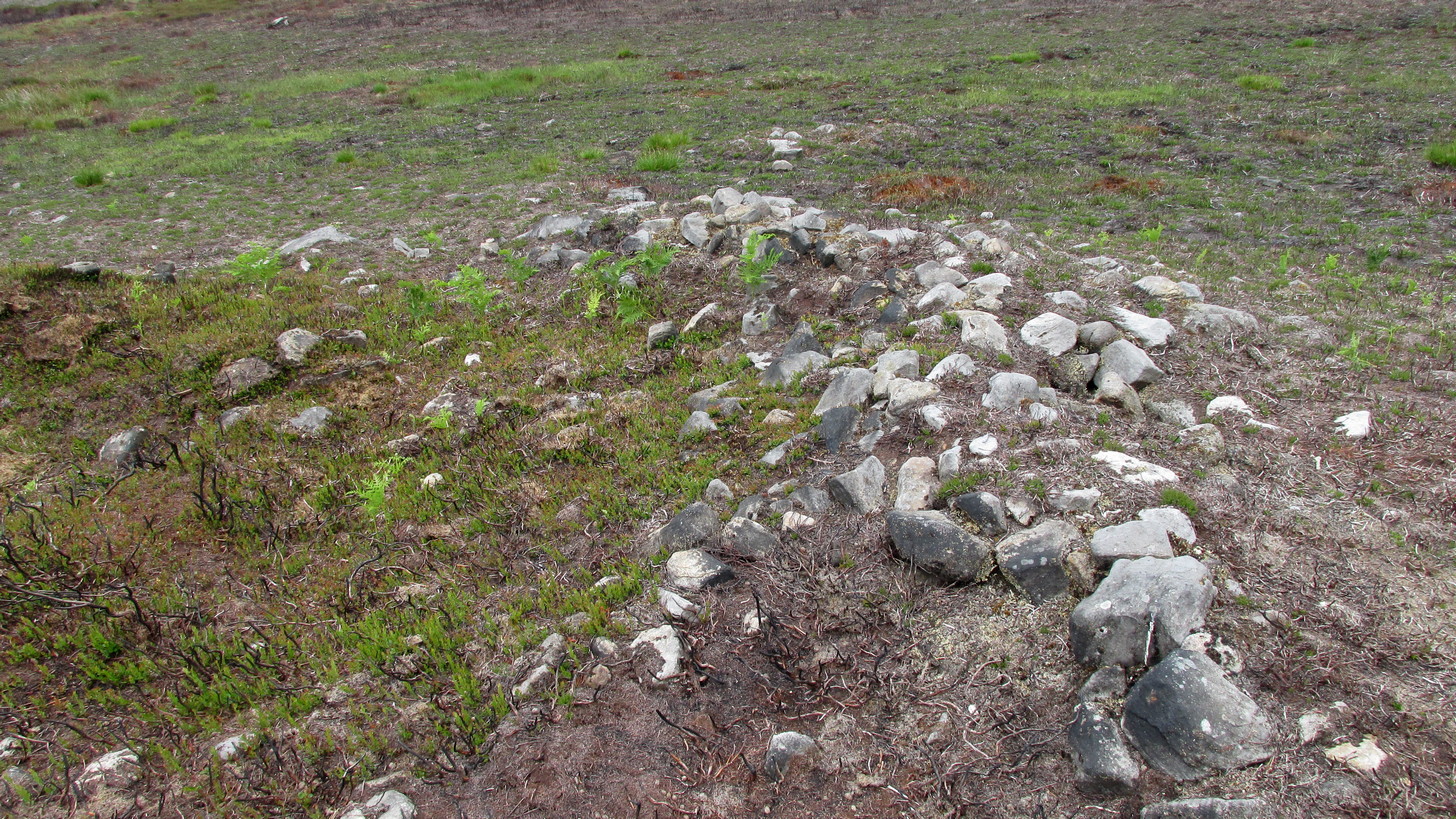
Very troublesome to locate when the heather’s fully grown, this large prehistoric tomb was uncovered very recently as a result of extensive moorland fires. It’s the largest such structure in a cluster of more than thirty cairns near the middle of Hawksworth Moor, many of which were rediscovered at the end of May, 2021. Due south of the Great Skirtful of Stones, this smaller skirtful of stones measures some 45 feet across and is more than three feet high in parts. Probably built in the Bronze Age, the tomb looks as if it’s been deliberately robbed at some time in the past, probably before the Victorians by the look of things—although only an excavation would tell us for sure. Primarily, the cairn has been robbed from its centre outwards mainly on its western side, where you’ll also see a small and rather dodgy cup-marked stone. Scattered into the surrounding peat are visible remains of where some of the loose stones have been cast.
Small hole in the middleNorthern edge of cairn
A possible alternative to this being simply a large cairn, is that it’s a much-disturbed ring cairn. Some sections on the north and western edges give the impression that the mass of stones may be collapsed rubble walling. There are also a couple of internal features beneath the overgrowth of peat and compressed vegetation: one being a small circular piece of stonework that has either fallen in on itself, been dug into, or is the home of an animal; and a yard or two from this is what looks like another internal U-shaped stone structure – again, deeply encased by centuries of encroaching peat. But I must emphasize that these features are far from certain and can only be proven one way or the other by an excavation.
The site is well worth seeing, not only for its own merit, but also because of its place in a much wider prehistoric cemetery in the middle of Hawksworth Moor. There are at least six small single cairns (which may be clearance cairns) scattering this area—the closest of which from here is some 20 yards to the north. A more curious group of at least five small long cairns exist about 100 yards to the south; and below these is the largest cluster of standard tombs in the form of small round cairns. A curious D-shaped hut circle structure can be found less than 100 yards to the northwest, and what seems to be remains of a larger deeply embedded enclosure exists beyond the long cairns. Check ’em out!
Acknowledgements: With huge thanks, as always, for James Elkington for use of his photos. Also to the evolving megalith and landscape explorer Mackenzie Erichs; and to Linzi Mitchell, for additional stimuli…
Take the same directions as if you’re going to visit the Black Beck cairn. From here, walk through the heather northwest for about 60 yards. If the heather’s been cleared, you’ll see it low down, otherwise you’re pretty much screwed when it comes to finding this one!
Archaeology & History
Seemingly in isolation, this low-walled, D-shaped hut circle is presently the only the structure of its kind known to exist on this part of Hawksworth Moor; although to be honest we should expect there to be such structures in the area when we consider the size and proximity of the associated cairnfields immediately north and southeast of here.
Southern arc of wallingNW section of walling; Black Beck tomb to rear
As with most hut circles, it’s nowt special to look at in all honesty. The south side of the structure is rubble walling typical of these structures, curving round as usual; but its more northern section straightens out, creating a D-shaped structure. This line of straight walling seems attached to another, outer parallel wall 3 feet away, creating its very outer edge. The rubble walls themselves average three feet across; whilst the hut circle measures 6-7 yards across. We assume that it was constructed during the same period as the adjacent prehistoric necropolis.
Acknowledgements: With huge thanks, as always, for James Elkington for use of his photos. Also to the evolving megalith and landscape explorer Mackenzie Erichs; and to Linzi Mitchell, for additional input…
2 cairns in line of 3, Manse Bridge (photo Sarah Maclean)
Along the A836 road between Durness and Tongue, take the minor road north to Melness and Talmine. 400 yards or so past Talmine Stores shop, walk left up the track onto the moor. Follow the track along as if you’re visiting the Talmine West settlement, but walk uphill onto the moor a hundred yards or so after the sheep-folds on your right. Before the top of the hill, keep your eyes peeled for the heather-covered rocky mounds in the moorland scattered about. You’ll find them!
Archaeology & History
A cluster of prehistoric cairns—or a cairnfield as it’s known— is found on the moorland scattering the south and eastern edges of the unnamed hill immediately west of Talmine. They can be pretty difficult to see when buried in heather, but they’re there! When Sarah Maclean took us up to see them, three in particular stood out: seemingly along a deliberate line, perhaps parallel with either an old trackway or old walling on the south slope of the hill.
Central cairn in line of 3 (photo by Sarah Maclean)
Central cairn hollowed out (photo by Sarah Maclean)
The main three that we visited were pretty easy to locate, with many loose stones comprising the respective piles, standing about 3 feet high and some 3-4 yards across. One of them (left) had been dug into, leaving a deep hollow in its centre, leaving it more exposed and visible than the others. There are other cairns on the slopes to the east, but none seemed to be as well-defined as the three here described.
In the same area are also a number of hut circles, much overgrown but still visible amongst the heather.
References:
Welsh, T.C., ‘Manse Bridge – Small Cairns, Hut Circles’, in Discovery & Excavation Scotland, 1973.
Acknowledgements: Huge thanks to Donna Murray of Borgie for putting me up (or should that be, putting up with me?!) and equally massive thanks to Sarah Maclean—also of Borgie—for guiding me up here and allowing us use of her photos to illustrate this site profile.
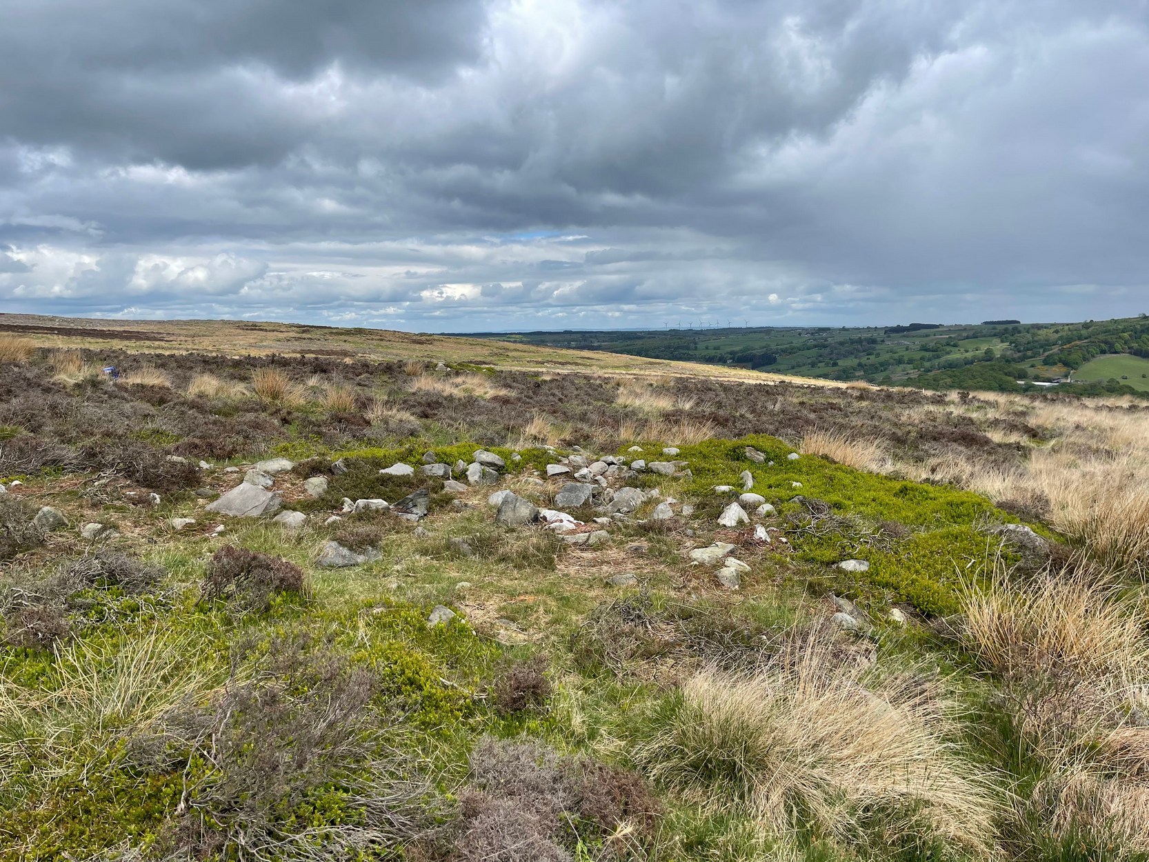
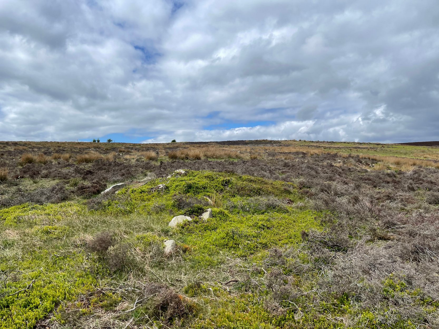
Take the same directions as if you’re visiting the Great Skirtful of Stones giant cairn on the boundary of Burley and Hawksworth. Cross the wire fence on its southern-side and, cross the (usually overgrown) prehistoric trackway 50-60 yards away. Keep in the same direction onto the pathless moor for about the same distance again, zigzagging back and forth, keeping your eyes peeled for some small overgrown rocky rises. You’ll find ’em.
Archaeology & History
Not to be confused with the much larger Bronze Age graveyard further south on the same moorland, this little-known prehistoric cemetery has had little of any worth written about it since the 19th century and—like many sites on these moors—has received no modern archaeological attention.
Close-up of one of the cairnsTwo of the cairns, looking NW
On my last visit to this site with James Elkington in 2015, only four of the heather-clad cairns were visible; but if you explore here after the heather has been burned away, a half-dozen such tombs are found in relatively close attendance to each other. They are each about the same size, being roughly circular and measuring between 3-4 yards across, 10-12 yards in circumference and a yard high at the most. As you can see in the attached images, they are quiet visible even when the heather has grown on them.
Another cairn in this group
This small cairnfield may stretch across and link up with the secondary cairnfield a half-mile to the southwest. More survey work is required up here.
As with the circle of Roms Law and the Great Skirtful of Stones, this relatively small cluster of cairns seems to have had a prehistoric trackway approaching it, running roughly east-west. A short distance west are the much-denuded waters of the Skirtful Spring.
References:
Bennett, Paul, The Old Stones of Elmet, Capall Bann: Milverton 2001.
Faull, M.L. & Moorhouse, S.A. (eds.), West Yorkshire: An Archaeological Guide to AD 1500 (4 volumes), WYMCC: Wakefield 1981.
Wardell, James, Historical Notes of Ilkley, Rombald’s Moor, Baildon Common, and other Matters of the British and Roman Periods, Joseph Dodgson: Leeds 1869. (2nd edition 1881).
Acknowledgements: Huge thanks to James Elkington for use of his photo in this site profile.
Follow the same directions to reach the recently discovered Slade-02 carving; and simply walk 30 yards southwest. The scattered ruins of numerous small stone piles, visible only when the heather’s been burnt back, is what you need to be looking for.
Archaeology & History
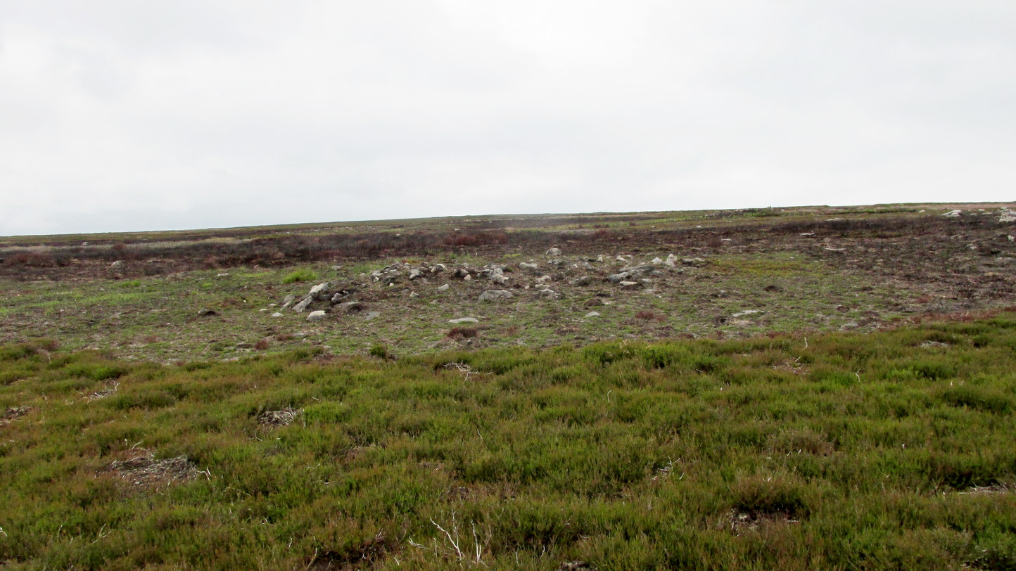
First discovered on a Northern Antiquarian outing in July 2011, it’s difficult to give an accurate appraisal of this site as much of the landscape all round here is very overgrown in deep heather. Added to this, there is evidence of more recent medieval and post-medieval industrial activity that’s intruded and/or affected the earlier prehistoric remains that are evident here. But these factors aside, we can say with certainty that here is a previously unrecognized prehistoric cairnfield — and it may be of some considerable size.
Ruined hut or cairn circle
We have so far located at least seven individual cairns and a cairn circle in relative proximity to each other, thanks to local rangers burning back the heather. It was the discovery of the cairns which then led to the discovery of the nearby cup-and-ring stones. Amidst the cairn-spoils there are also distinctive lines of stone, indicative of either walling or embankments of some form or another. Some of the stone making up this cairnfield appears to have been robbed. We also found that in walking through the deeper heather surrounding this ‘opening’ (where it had been burned away a few months previously), a number of other man-made piles of stone were evident that seemed to indicate more cairns. There is also evidence of further lines of prehistoric walling, whose precise nature is as yet unknown. But we do know that people have been on this moorland since Mesolithic times (structural and other remains of which are still evident less than a half-mile away).
The site requires greater attention the next time the heather’s been burnt back.
References:
Davies, J., “A Mesolithic Site on Blubberhouses Moor, Wharfedale,” in Yorkshire Archaeological Journal, part 161 (volume 41), 1963.
Follow the same directions to reach the Harden Moor circle. From here, walk down the footpath at its side down the slope for 100 yards and take the first little footpath on your left for 25 yards, then left again for 25 yards, watching for a small footpath on your right. Walk on here for another 100 yards or so, keeping your eyes peeled for the image in the photo just off-path on your left, almost overgrown with heather.
Archaeology & History
This is just one of several cairns in and around this area (I’ll probably add more and give ’em their own titles and profiles as time goes by), but it’s in a pretty good state of preservation. Nothing specific has previously been written about it, though it seems to have been recorded and given the National Monument number of 31489, with the comment “Cairn 330m north of Woodhead, Harden Moor.” (anyone able to confirm or correct this for me?)
It’s a good, seemingly undisturbed tomb, very overgrown on its north and eastern sides. Three pretty large upright stones, a couple of feet high, remain in position with an infill of smaller stones and overgrowth (apart from removing a little vegetation from the edges to see it clearer, we didn’t try disturbing it when we found it). It gives the impression of being a tomb for just one, perhaps two people and is more structured than the simple pile-of-stone cairns on the moors north of here above Ilkley and Bingley. Indeed, the upright stones initially gave the impression of it once being a small cromlech of sorts! Other cairns exist close by, but until we get heather-burning done up here, they’re difficult to find – or at least get any decent images of them!
Easy one this! Go up thru Baildon, on towards Baildon Moor over the cattle-grid. Take your first left and go up for several hundred yards past the reservoir until you reach the track on the left which takes you onto the Low Plain, Baildon Moor.
Archaeology & History
1845 plan of Cairns & Earthworks on Baildon Moor (after J.N.M. Colls)
In the year 1845, on the Low Plain on the western side of Baildon Hill, an intrepid archaeologist and historian, Mr. J.N.M. Colls, came across extensive earthworks and a number of prehistoric tombs in a very small area. Upon excavation, the ‘earthworks’ were found to be what sounds like neolithic walling running parallel to each other in a roughly north-south direction (north is the traditional direction for death). Scattered amidst these lines he found more than a dozen cairns and barrows, along with remains of “a circle, or ring.” Although the majority of what Colls wrote about has been destroyed, leaving only scanty remains of a once considerable archaeological arena, his lengthy description deserves being reprinted in full. He wrote:
“This level (the Low Plain) bears numerous traces of earthworks or other embankments running in many cases parallel with one another, at distances varying from 50 to 80 yards apart, and intersected by other works of similar construction. These earthworks can be remembered to have been from four to five feet in height; their bases nearly invariably appear to have been eight feet in diameter, composed of loose blocks of calliard, or close-grained sandstone, and earth. The greater part of the stone has been torn away to make and repair the roads of the neighbouring district; and the surface of the earth has been so nearly levelled that it is only by the scattered and disfigured remains, carefully delineated upon my plan, that any idea can be formed of their original character.
“In connection with these earthworks, and upon the north side of them, immediately above a steep fall to the next lower level (approx SE 1372 4020, Ed.), is a circle, or ring, formed originally of earthworks of precisely similar character, size and construction to those I have just described. The diameter of this ring is about fifty feet; its interior area is perfectly level; but the earthwork forming its circumference has been defaced and torn up for a considerable extent for the stone it contained. Circles of this nature have generally been termed druidical, from their presumed use as places of worship or sacrifice. I therefore opened its centre, in the hope of finding some trace of fire confirmatory of its character; and commenced clearing away a layer of peat earth, of from 10-11 inches in depth. I then found a layer of calliard boulders one-and-a-half feet in depth, the lower ones slightly burned, and resting upon a deposit of peat-ashes three inches in depth and from 2-3 feet in diameter (see Barrow No.8 in plan, Ed.). This I should have concluded to be the remains of a beacon fire, but, upon continuing the excavations, I found about three feet SSE of this deposit of ashes (at point b on the plan) a rude urn standing in an upright position, at a depth of two feet from the surface, a layer of calliard stones having been removed from above it, one of which appeared to have covered it. This urn was 12 inches in diameter and 9-10 inches in depth, of a circular or bowl shape, the upper stage of it being rudely ornamented by incised lines crossing each other at acute angles: it was filled with calcined bones (some remaining tolerably perfect), ashes and charcoal; and I selected some half-dozen of them as specimens, which Mr Keyworth, surgeon and lecturer on anatomy at York, has examined… He is of the opinion that they belonged to a very young subject, perhaps from 9-12 or 13 years of age; he thinks it possible however, that they may all have belonged to the same subject… The urn in which the were placed appears to have been rudely formed by the hand, without the assistance of a lathe; in substance about half-an-inch…it appears pretty evident that this urn has been formed of the black earth of the mountain and coal measures of which Baildon Hill is formed…
“A little to the west by south of the circle…are the almost obliterated remains of another circle (fig.9 on the plan), which I had not an opportunity of thoroughly examining; the slight traces remaining bear strong testimony of its character being similar to that of fig.8.
“Scattered over the surface of the Plain, and at irregular distances, cairns or heaps of stones, composed of bare sandstone and calliards (and not mixed with earth), frequently occur; they are generally about twenty feet in diameter and appear to have been originally 4 or 5 feet in height: these remains still require examination. In passing over them, I remarked that some of the stones of which they and the earthworks near them were constructed, had marks, or characters, but so rude that a doubt remains whether they may not have been caused by the action of the atmosphere on the softer portions of the stone.”
Urns found near Dobrudden
This final remark seems to be the very first written intimation of the cup-and-ring marked stones which can still be found amidst the grasses in the very area Mr Colls described. Sadly, much of the other remains shown in the drawing have been all but obliterated, or grown over. However, the decent concentration of cup-and-ring stones in this small area (see other Baildon Moor entries), highlights once again an associated prevalence of these carvings with our ancestor’s notions of death.
Sadly, year by year, the important neolithic and Bronze Age english heritage remains across this upland ridge are slowly being destroyed. The lack of attention and concern by regional archaeologists and local councillors, and the gradual encroachment of human erosion are the primary causative factors. Hopefully there are some sincere archaeologists in the West Yorkshire region who will have the strength to correctly address this issue. Under previous archaeological administrators, Bradford Council have allowed for the complete destruction of giant tombs, stone circles and other important prehistoric remains in their region—a habit that seems not to be curtailed as they maintain a program of footpath “improvements” on local moors without any hands-on assessment of the archaeology on the ground.
…to be continued…
References:
Baildon, W. Paley, Baildon and the Baildons – volume 1, St. Catherine Press: Adelphi 1913.
Barnes, Bernard, Man and the Changing Landscape, Eaton Press: Wallasey 1982.
Colls, J.N.M., ‘Letter upon some Early Remains Discovered in Yorkshire,’ in Archaeologia, volume 31, 1846.