The easiest way to see the site is to stop at the car park at Craighall on the B9099 south of Stanley, and follow the path to the river. The remains of the Brig will be seen on the other side of the Tay from the riverside walk.
Archaeology & History
The Thistle Brig was described in the nineteenth century Ordnance Survey Name Book as:-
‘A remarkable spot in the River Tay, when the breadth of the river becomes suddenly narrow by the protrusion of a bed of trap rock which crosses it at this place.’
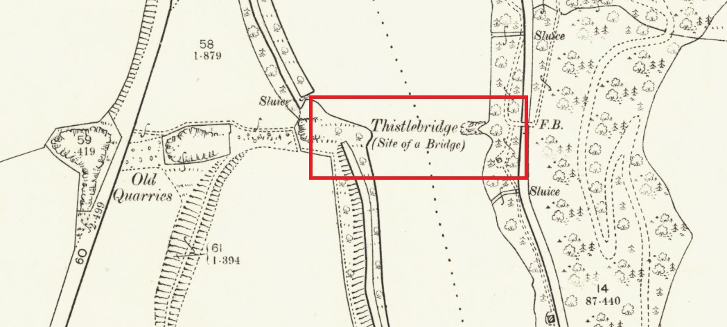
Thistle Brig & the quarries for its hard stone on the 1901 25 in OS-map
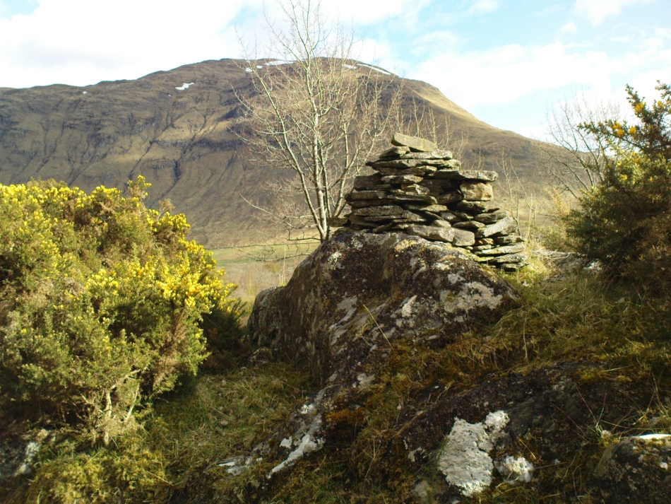
According to local historian Alexander Scott, the Thistle Brig formed a convenient place to ford the Tay until much of it was blasted away by explosives some time in the mid-nineteenth century in order to improve the flow of the river. Old maps imply that an actual bridge may have spanned the Tay hereabouts at some time in the past. The seemingly little known folklore of this site relates to an invasion by the Danes in the early mediaeval period. Elsewhere there are similar stories, so the truth or otherwise depends on where you are in Scotland, but this one may have more validity as the tale seems to give its name to the place!
The name ‘Thistle Bridge’ has been applied on old postcards to a stone footbridge over a side channel or lade between the road and the River Tay to the south of the Brig, and is not the subject of this profile.
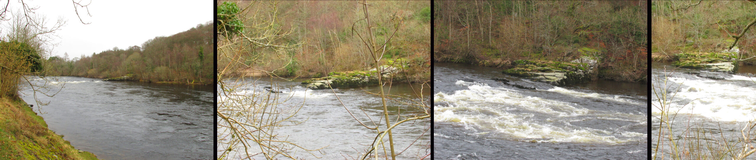
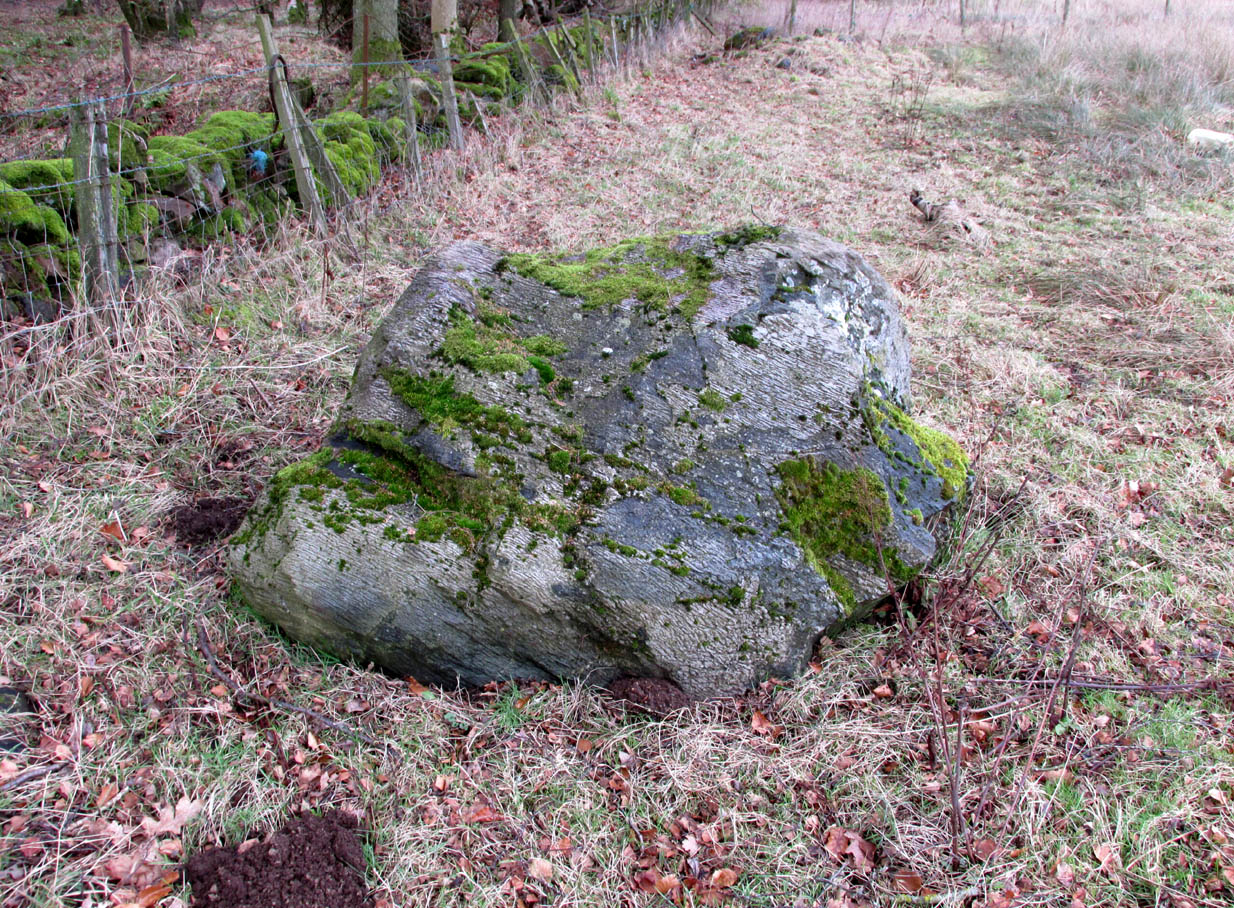
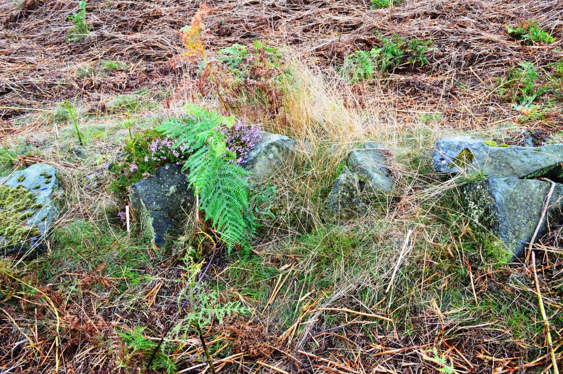
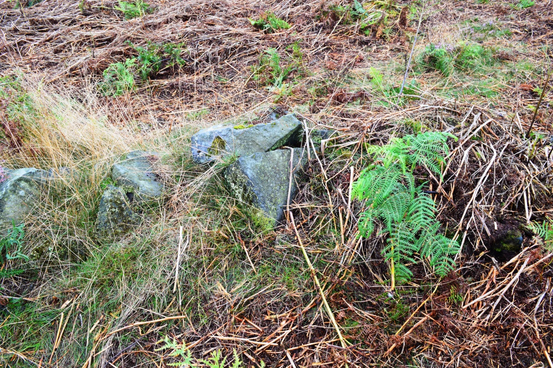
The remains of the Thistle Brig – a hard basalt dyke on the east bank of the River Tay
Folklore
Alexander Scott, writing of the Brig:-
“…tradition holds that here the thistle received the distinction of becoming the national emblem of Scotland. In one of the many invasions the country suffered from foreign armies, the Danes, on one occasion, having landed on the east coast sacked the town of Montrose and continued on their march across the country, burning and pillaging as they went. While crossing the Tay at this ford at night, the incident occurred of one of the leading soldiers arriving on the opposite side suddenly coming in contact with a thistle with his bare leg, which caused him to emit a shreik of pain.
“The noise was heard by the Scots, who had been encamped nearby, and the alarm thus given was the means of securing a victory over their enemies. The thistle was thereafter honoured as the national badge.”
Reference:
Scott, Alexander, St Martins and Cambusmichael, A Parochial Retrospect, Munro & Scott 1911.
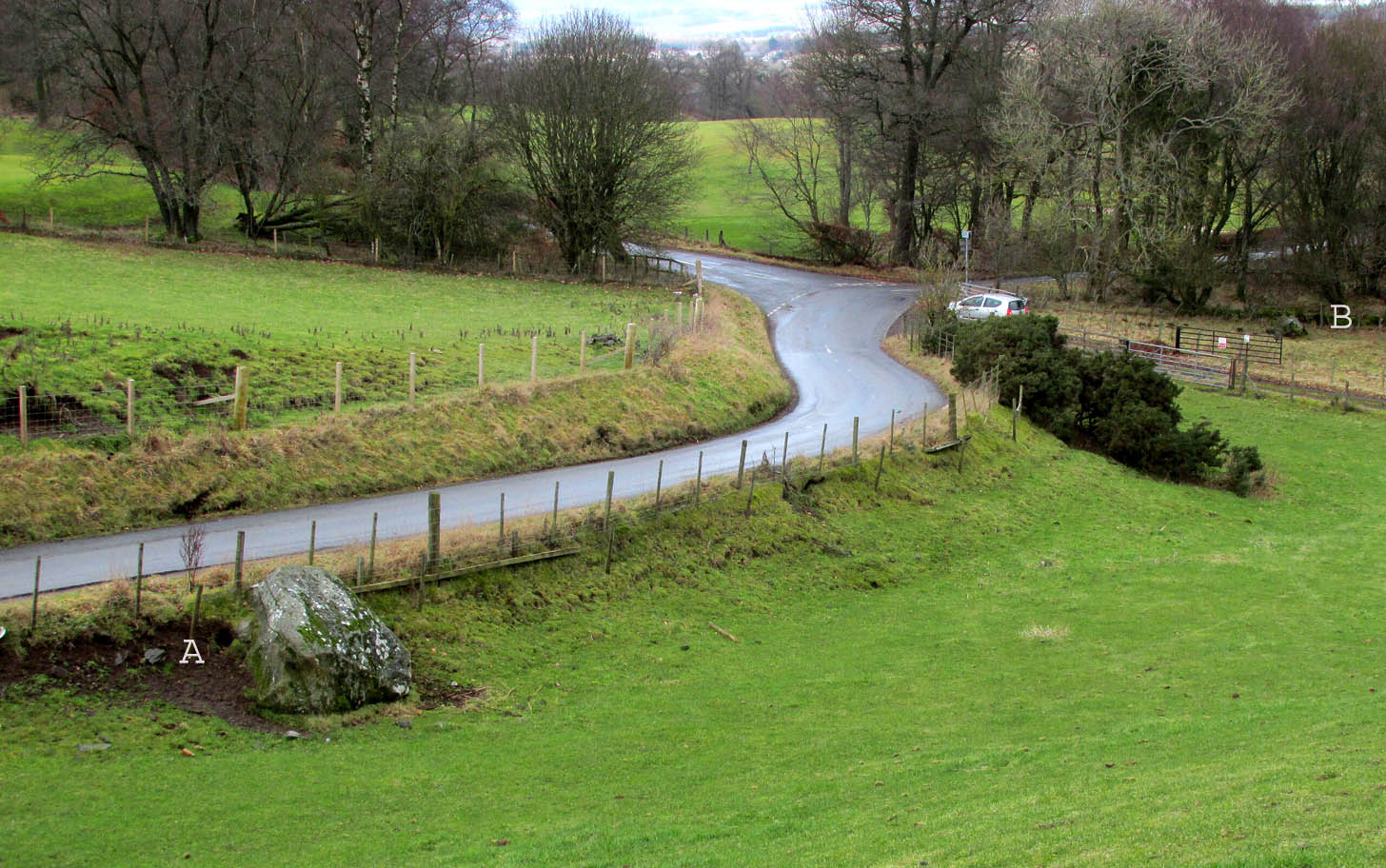
Travelling north from Perth on the A94, take the right turning for Murrayshall just before entering Scone, then take the first right and continue up to the road junction, and park up at the trackway opposite. You’ll see the big stone in the field to the right, up against the road embankment; and the small stone is in the paddock to the left of the trackway at the edge of the trees.
Archaeology & History
Two large glacial erratics which have acquired mythic status and picked up a Christian triumphalist message on the way.
Folklore
In Lawrence Melville’s (1939) excellent local history work, he thankfully put to pen an all-but-forgotten tale of oral tradition:
“Where the road from the Muir of Durdie leaves Kilspindie parish, a grass grown road leads north to Boglebee….. A few yards from the highway lie two large stones, said to have been flung from the Giant’s Hill in Collace parish – the flat topped eminence lying due north from the stones, about two or three miles away, better known as “Macbeth’s Hill”, or “Dunsinane Hill”.
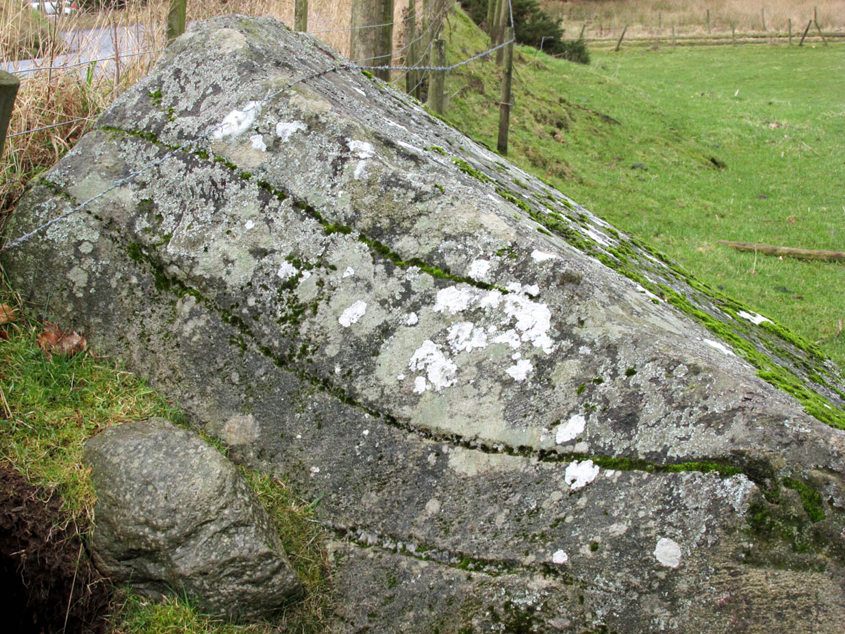
The ‘string’ marks of legendThe smaller stone with its ‘string’ marks
“When the church dedicated to St John in Perth was being built and its tower began to appear, a witch living in Collace was enraged to see this proof of the approach of Christianity and determined to destroy it. She had a son, a giant (after whom the hill receives one of its names), whom she sent to the top of the hill, giving him two huge stones with which to destroy the rising church.
“By her incantations she had supernatural power and knew that when Christianity came her power would be destroyed. She gave him her mutch from her head to be used as sling and in it the giant put the two huge stones. Whirling it around his head, he aimed them in a line with the tower, but, just as he let them fly, the string of his mother’s cap broke and the stones only went the length of Boglebee. The marks on the stones are said to be the marks of the witch’s mutch strings.”
Another view of the larger stone
A familiar folkloric message is remembered the length of Britain: a giant, a devil or other supernatural being throwing stones that either spill out of an apron or otherwise miss their mark. And in this case an unsubtle message to anyone trying to take on the might of the church. But what was the original story of these stones as told by the old time oral storytellers before Christian missionaries stalked the land?
If the string hadn’t broken and the stones had followed their original trajectory they would have fallen south of St John’s Kirk, but it was the thought that counted….
Reference:
Melville, Lawrence, The Fair Land of Gowrie, William Culross: Coupar Angus, 1939.
The site of the tree may be seen from the north side of the Kettins to Newtyle road, just before the Perthshire-Angus boundary sign. It stood on the south-west side of the dip at the far end of the field, next to the raised causeway.
Archaeology & History
Nothing now remains of the tree. The Ordnance Survey name book gives the following description, attested by Hugh Watson of Keillor, Thomas Mole of Denside and Charles Wood of High Keillor:
“[Situation] About 32 chains NE of Keillour. A large tree situated on the farm of Keillor. It is traditionally stated that Barons held their court under this tree, also that criminals were executed on it. Whence the name.”
Crown Tree stood left of the dip in front of the causeway
The tree was about 160 feet to the south-west of the boundary between the parishes of Kettins and Newtyle, on the Kettins side, both of which parishes were historically in the county of Angus, so it was likely also to have been an ancient boundary marker. Keillour, with the Parish of Kettins is now in Perthshire.
Based on the evidence of the 25″ OS maps, it seems the tree was felled sometime between 1900 and 1921.
Reference:
Ordnance Survey Name Book, Forfar (Angus) Volume 52, 1857-61
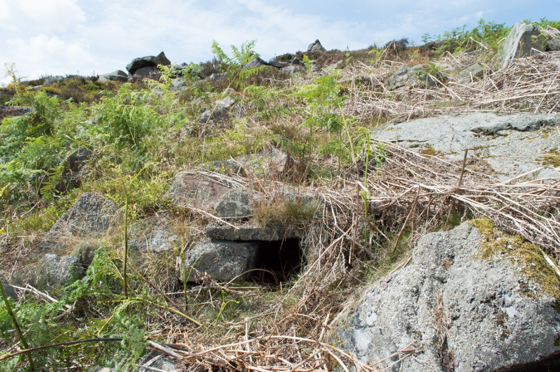
Fairy Mine, Bingley Moor (photo by James Elkington)
This is a strange one. A really strange one….. The site would not have even been written about had it not been for James Elkington pushing me to make its existence visible to a wide audience. As with many sites that I’ve rediscovered, this is one of many that I never seem to write about, for various reasons…although I did do a short piece on it (Bennett 2001) many years back in a little earth mysteries mag, but kept the location quiet. But now, James has got me to change my mind about it. If anyone can throw any light onto what they think this site might be, feel free to let us know. With the exception of its early history, this is its story…
Close-up of the entrance (photo by James Elkington)
One weekend in the early Spring of 1977, Jon Tilleard and I made our weekly wander onto the southern edges of Rombalds Moor, doing little as usual apart from maybe seeking out the curious cup-and-ring stones and other ancient remains, along with walking through the obligatory bogs and wetlands, getting filthy and wet through as healthy kids do at that age. After making our way to Horncliffe Well (generally our first point of call most weeks), we decided to head straight west, off-path as always, and eventually sat ourselves down for something to eat near Wicking Crags on Bingley Moor.
As we packed up again, readying ourselves to walk further onto the moor, John stood upright. In doing so, he dislodged a stone by his feet—right where I was still sitting on the ground!
“Watch out!” he exclaimed loudly—and I quickly rolled forward to get out of the way of the impending stone. Thankfully it wasn’t too big. But then as I turned round to see what had happened, I saw John stood on the small rocky rise he’d been sitting upon—and right beneath his feet, the stone that he’d dislodged had been hiding a very curious secret indeed…
As the photos show, a small opening led into the Earth right underneath where Jon had been sitting. The stone he’d accidentally kicked away had covered and sealed a previously unrecorded entrance. Now, after however many centuries it had been closed and secret, he’d uncovered it again. For us two fourteen-year-old lads gazing into this passageway, our imaginations started running riot!
“What the hell izzit!?”—we must have exclaimed a dozen times or more to each other! To this day, we still don’t know.
I’m not sure how long we stayed here after we’d first found it, but before we left we made sure that the covering stone which had sealed the entrance was propped back upright, securely, so that no one else could find it. The site was quite a way off-path, at the head of a very large boggy area where—to this day—people very rarely walk (in all my years of walking these moors, I’ve yet to see another human walking in this area).
In looking into the tunnel for the very first time, the ground on the outside was of course covered by the usual moorland vegetation; but an inch behind where the stone had sealed this tunnel, the floor was grey dust, all the way in. There were no animal tracks, neither mice nor others, no droppings, no nothing (which we thought was rather unusual). No plants of any form were evident. This ‘door’ had been closed for a very long time it seemed. …Today if you visit the site, ferns and other small plants have encroached several feet into the tunnel.
The entrance itself is about 14 inches across, and from the ground to the top covering stone the entrance is less than 12 inches high, showing quite clearly that no humans can walk in or out of it. Which added to the puzzle: what the hell is it? And why was it sealed with a covering stone? But the more we looked (it became our regular port of call each time we were on the moors) the more obvious it became that a huge amount of work had gone into creating this antiquarian oddity.
As Winter came and cleared all the vegetation surrounding the site, we got an increasingly clear picture of it. But this wasn’t before we tried to get inside! Jon and I failed, but our torches showed that it went in for perhaps 10 feet or so and then appeared to be stop, blocked by another stone. Thankfully I had a younger brother, Phil, who was seven-year old at the time—so we took him up to have a look at the place. We figured that only a small person could get inside the tunnel, but we didn’t tell him this (nor my parents!) until we arrived.
With torch in hand, Phil slithered into the entrance and, eventually, his little feet disappeared into the ground. He didn’t seem too happy about it as I remember—but I was his big brother! (cruel – cruel – cruel!) Shouting back down to us as he slithered further and further in, when he reached the blocking stone in the tunnel he exclaimed—”You can go round it!”
“What!? Really!?”
We were excited.
“Keep going Phil,” we urged. But he wouldn’t.
“I’m scared Paul,” he said. “I won’t be able to get back out”—or something along those lines. And he was probably right.
But he managed to get his young tiny body slightly round the blocking stone that he’d reached and shone the torch-light down the extended tunnel. He told that the it just kept going into the hill still further, keeping the same size and dimensions and straightness for about the same distance again—but then it started to curve very slightly, bending to the left (northwest) until it disappeared underneath the entire hillside, stretching out of sight. It seemed from his description, subsequently, that the tunnel went on for another 50 feet at least.
Once he was safely back out, he reiterated how far in it seemed to go. We walked up the hill under which it had been built and Phil bimbled to roughly where he thought the tunnel was as he saw it with the torchlight. Standing on the hilltop, this was obviously an extraordinary feat as there are thousands of tons of rock and earth covering it! Curiously, years later, a dowser who visited the place walked the same route that Phil had described when he went inside it (we told the dowser nothing of Phil’s venture until afterwards).
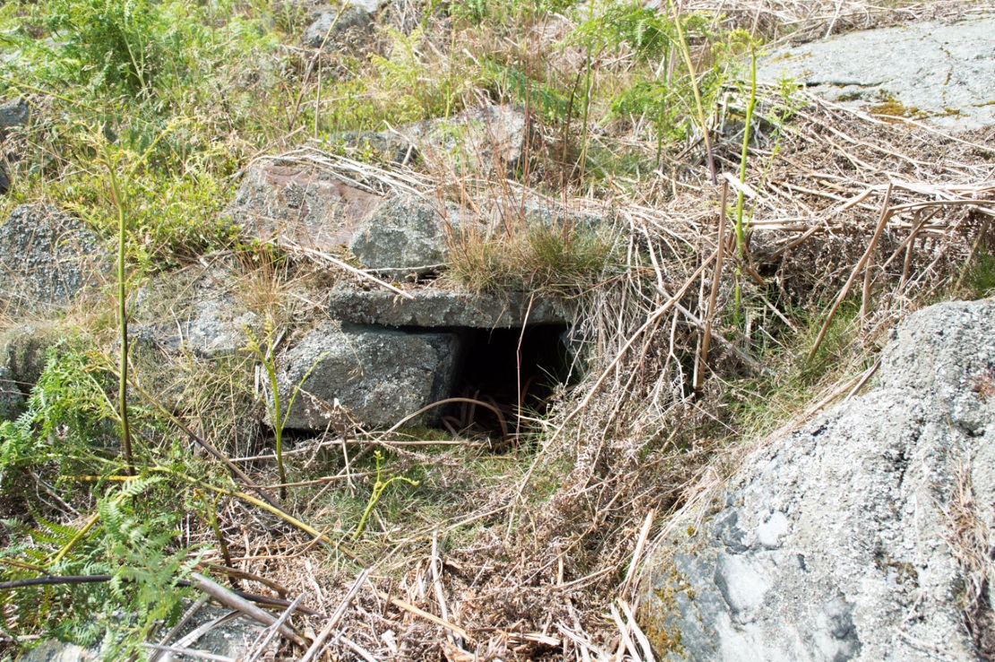
Denuded walling leading to entrance (photo by James Elkington)Low walling leading to the ‘Mine’ (photo by James Elkington)
When all the moorland vegetation has died back, you can clearly see how the tunnel has been built upon by a large mass of earth and rocks, some of them loose. All round it is an extended collapse of what seems to be quarried stone tumbling down the hillside. At the top of the hill are the remains of old walling and at least two walled structures—although they appear to be post-medieval in nature, not prehistoric. At the entrance itself is evidence of continued walling of some form. It seems as if a wider man-made chamber of some sort may once have stood here, right in front of the present-day entrance. Even if this proves not to be the case, there is very clear evidence that the tunnel which goes into the hillside was once longer, as low walling continues outside away from the entrance, bending away some 50 yards to the southeast, before ending with no indication of additional structural remains. This walled structure swerving out from the entrance is equally perplexing.
The closest prehistoric feature is an unrecorded cairn and petroglyph a few hundred yards away. As far as I’m concerned, this tiny little entrance into the ground isn’t prehistoric. But I’m nonetheless still very intrigued by it, not least because of a few very strange things that subsequently occurred here after we’d discovered it.
Whoever did this, went to a helluva lot of trouble and immense effort to build it. And for what? …Since being opened nearly 40 years ago, very few people have been to see this curious entrance into the Earth. I’ve kept its location hidden. But amongst the visitors has been an archaeologist, a historian, antiquarian authors, occultists and friends. None have been able to say what this site might be. From souterrains to mine-shafts, probably the best suggestion so far was by Mr Paul Hornby who suggested it might have been some sort of kiln, as there seems evidence of fire against one of the stones. But there are anomalies with the site that don’t quite fit the glove of a normal kiln. The extended collapsed ‘tunnel’ which reaches way out, past the entrance which Jon broke in the 1970s, doesn’t make sense; nor the fact that the tunnel goes way into the natural hillside. Indeed, many things here don’t make sense, simply—I presume—because we haven’t asked the right question yet.
But one thing seems obvious: there may be something at the end of this tunnel, deep inside the hill, which someone many centuries ago, for some odd reason, wanted to keep hidden for a long long time. What’s at the end of this tunnel? And if it’s valuable treasure deep in there—it is NOT going to some museum which then, in later years, will be sold off cheaply to some wealthy dood when the museum runs out of money. It should be kept within the safe holdings of The Northern Antiquarian. If this becomes an issue, whatever lies at the end will simply be re-buried elsewhere.
Fortean History
On that fine Spring morning when we first discovered this “mine shaft for little people” as we called it, before we went on our way, we placed the stone that Jon had dislodged that had covered the entrance back into position so that no one could see the opening leading into the ground and under the hill. It was firm and secure when we left—we made sure of it.
The following Sunday morning we made our way back up past Horncliffe Well again and onto this little mine-shaft to sit and have summat to eat. The rocky arena here made it difficult to locate, even though we knew where it was. But when we eventually did find it again, the covering-stone was missing. In fact it had been rolled a good 5 yards away from the entrance. This was odd, we thought—considering that no one even knew of its existence. We wondered if an animal had taken up residence inside, but there were no tracks or remains consistent with this initial idea. We puzzled about it, ate our food, and said our au revoirs. Before we left, we repositioned the covering stone again to block the entrance. This time we made it a little more secure than previously.
The following Sunday morning we visited the site again—and the covering stone had been removed, again! So we replaced it, securely, and visited the place a week later—and the same thing had happened again. This occurred time after time, month after month, year after year. Every single time we covered the entrance, something came and removed it. Yet no one ever comes on this section of the moorland—and even if they did, the site is very difficult to locate. Until now, the site has never been added to any archaeology or history records anywhere—so no one knew of its existence (in asking two of the moorland rangers who’ve worked here over the decades, neither of them knew what we were talking about).
When Andrew Hammond and I left school at 18 (in 1981), we decided as a ritual to bring our school books onto the moor and burn them as the sun was setting in the northwest. We sat near the little mine-shaft and sang our songs of joys at being out of school at last—and as the darkness began to fall over the moor, we replaced the entrance-stone again. Within 30 minutes Nature had cast pitch black across the moor and we fell asleep.
Awaking at sunrise the following day, we wandered down the slope to the little mine-shaft where we’d repositioned the stone only hours previously. It had been moved again, several yards away from the entrance. No animal could have moved it. Whatever it was, it kept doing it every time we repositioned the covering stone. No animal tracks, droppings, or any evidence whatsoever of Nature’s creatures being responsible for the constant removal of the covering stone has ever been found. The constant removal of the covering stone remains a complete mystery.
When a dowser came and tried tracing the underground route of the tunnel in the early 1990s, his rods took him to the top of the rocky hill above, then led him in a small curve to the northwest for more than 100 yards before stopping.
Note:
In the event that archaeologists ever get round to excavating or assessing this site, I would appreciate being contacted before anything is done and would love to be involved in any work performed at the site. I’ll be a good boy! Other remains nearby (usually covered by heather) need appraising to enable a more complete analysis, otherwise all subsequent reports would lack wider archaeocentric contextualization. Thanks, in advance. 🙂
References:
Bennett, Paul., ‘Into a Mythic Domain – a Passage into the Ilkley Underworld,’ in Northern Earth, 87, Autumn 2001.
Acknowledgements: Huge thanks to James Elkington for use of his photos to illustrate this site profile.
Take the B846 road out of Aberfeldy over the bridge towards Dull and Weem. As you go through Weem, watch closely for the signpost directing you into the trees of Weem Rock and Woods on the right. Follow this tiny road up until you reach the parking circle in the edge of the trees. Follow the directed footpath up into the woods & keep to the winding track, keeping your eyes peeled for the first large rocky crag above you, with a huge tree growing out of the edge. Once you get to the top of the steps and onto these crags, look right in front of you!
Archaeology & History
The nearest ‘officially recognised’ cup and ring carvings to the one we’re gonna see here, are those described by Kaledon Naddair (1990) in his brief descriptions of the Glassie Farm carvings a short distance northeast in the same woods. Other than that, I can find no account of the carvings I’m about to describe – other than a couple of short local history walking guides, which tell that one of the carvings here is “modern.” And that much is plainly evident.
Close-up of one section of the main design
There are at least seven carved stones here – all very close to each other on the top of an impressive crag with a large old tree growing out of the edge of the cliff. But the carvings are located on the flat ground above the cliffs and, it would seem, may well be modern. But I thought that since there are no accounts of the site on-line and no remarks in the Canmore registers, they should be mentioned as future students may mistake them as ancient. There is the possibility (unless someone can show us otherwise) that one or two of them are prehistoric, but I think it’s best we surmise that they are all recent additions in the landscape for the time being. And damn good designs they are too!
The triangular rock designs
The first and most notable of the group of seven (at least), is on the large earthfast triangular flat rock, pointing out to the cliff’s edge and the hills across the valley. This is where the greatest cluster of multiple cup-and-rings can be seen. Double- and triple rings surround several of the central cup-markings, with the traditional lines running out from the central cup. There are a great number of single cups scattering the surface; and we also find a typical ‘rosette’ element, comprised of a central cup surrounded by eight singular cups, which some students have interpreted as solar and lunar symbols (amongst other things) when found on other carvings (there is a prehistoric Rosette Stone is known on Ilkley Moor; but similar examples are known in Ireland, Northumberland and elsewhere).
Below this triangular rock (perhaps attached beneath the) is another long piece of earthfast stone, with more carvings on. But when Lindsey Campbell and I came here yesterday, it was obvious that some elements along this section of stone were carved in recent years. Two double-cup-and-rings are at the bottom-left of this section of rock, with a scattering of other cup-marks reaching across its surface. Several of these are obviously quite new.
Another multiple cup-and-ring
The third notable example is to the top-right of the triangular rock. This stone is mainly of quartzite rock, apart from near the top-end, where another multiple cup-and-ring (four, with a possible fifth broken ring fading away) stand out very blatantly. This carving also seems to be not that olde…
From this third quartz carving, look 10 yards (if that!) back towards the trees and there’s a large boulder. On the surface of this is another multiple cup-and-ring that was very obviously new, and several other cup-markings, also quite new. I presume that the other sections carved onto this stone have also been etched by the same modern artists.
Another boulder with new carvings
As I looked back to the main triangular carved stone, I noticed other small pieces of stone peeking up from the ground and, upon closer inspection, found one small rounded triangular piece with another multiple cup-and-ring that just fit onto the rock. And close by this was another long piece of stone which, when I rolled the turf gently back, found three simple cup-markings along the surface.
A seventh carving was found on one of the rocks that is falling slightly down the slope, close to the fourth ‘new’ carving that I described. This was heavily covered in moss and autumn’s fallen leaves, and I wasn’t about to take the moss away just for the sake of my curiosity. But it was obvious that other cup-markings were on the sloping face of this large stone.
We’ll have to venture back here soon and get some better photos and, with any luck, find some old locals who can tell us when the carvings first appeared. It’s quite a superb spot for a bimble, with the healing waters of St. David’s Well and his cave close by—and the woods were, so local legends tell, inhabited by dragons and good heathen creatures in centuries past. But the proximity of the Druid school—formed by the Ionian druids no less—around the 6-7th century, may have thankfully preserved these old tales and relate to some of the many other monuments found in this area. Although some of these carvings (possibly all) are of recent years, this is a gorgeous spot well worth exploring… And if anyone knows precisely when they were done – please let us know!
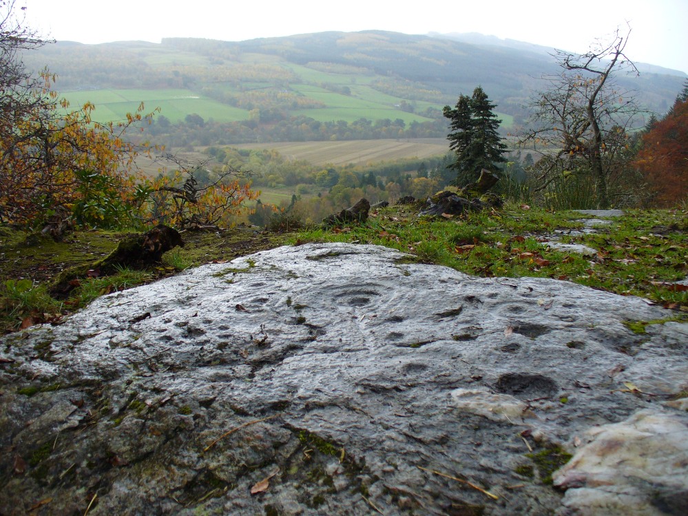
From Fortingall, get to the standing stone of Adamnan’s Cross a few miles down the stunning Glen Lyon. Barely 100 yards before you reach the stone, notice the overgrown gorse-covered rocky rise across the road, just past Craigianie Farm. As you climb to the top of this small rocky rise, you’ll see a cairn of stones on its top. Just below it, into the solid rock, you’ll see a footprint-shaped hollow etched into the stone. If it seems hidden, just keep looking – you’ll find it…
Archaeology & History
St. Palladius Stone, Glen Lyon
When Ratcliffe Barnatt (1944) visited Glen Lyon in the 1940s, this legendary rock was one of his stopping points. “When we have passed by Ruskich and Slatich,” he wrote, “we come to that sacred spot, Craig Dianaidh, the Rock of Safety, where, until about 1480, solemn and judicial meetings were held.” The old rock was known through recent ages, “as a preaching hill, a motehill and a justiciary court,” said Hilary Wheater (1981), and upon its top is the curious ‘footprint’ which Nature’s blood would fill on all but the hottest of summers. It is this geological feature that gave the stone is name, long ago.
Of known historical events here, Wheater further told:
“It was on this rock…that the Baron Courts of Glenlyon were held. Law and order was kept by regular courts held by the Chief or Landowner. The Baron-Bailiary of each area was appointed by Royal Charter. Fifteen men were chosen as a jury and the laird or his baile presided. To this court were brought all the problems and grievances of the people. Here the miller accused several men of refusing to take part in the compulsory ‘hamganging’ of a new millstone; here a man was fined for brewing ale without a license; here a neighbour was accused of putting the ‘evil eye’ on the cow of the croft next door so it produced no milk; and here a man was prosecuted for ‘taking of ane sore horse of his to Rannoch in the summer of 1629 and putting on him ane great burder of timber, and letting him go through the wood where he stuck between two trees all night and the timber on his back.’ However, he was acquitted when he was able to prove that the horse was fit enough after this for another man to be able to take it to Edinburgh soon after.”
St Palladius Footprint
As well as being a moot site, it is more than probable that this footprint, like the one near the top of Dunadd in Argyll—and others scattering the Highlands and beyond—was an initiation stone, perhaps for local tribal elders or ancient kings. Janet Bord (2004) writes about them as places of ritual inauguration in her survey of such places.
Folklore
The legendary site, looking south
This legendary rock would probably have had earlier mythic association than the one ascribing it to St. Palladius—but as yet I have found no written lore telling the nature of such a spirit, so would only perhaps discern the original genius loci by lengthy encounters with the rock in question, through mist and storm and wintry months, alone. It is known in local folklore that Palladius was in fact an urisk: a solitary spirit of steep streams that few humans encounter due to their lonely habits amidst hidden abodes in dark and ancient gorges. Such urisks dwelt in numbers amongst many of the steep falls in this landscape — and still do, if the words of old locals are to be believed. Here,
“St Palladius was a goblin saint, an urisk that dwelt in a mountain burn and was sanctified by the people.”
…and some rocks by the stream up the mountain immediately above this “footprint” was one of the places the urisk was known to dwell.
…to be continued…
References:
Barnatt, T. Ratcliffe, The Road to Rannoch and the Summer Isles, John Grant: Edinburgh 1944.
Bord, Janet, Footprints in Stone, Heart of Albion Press 2004.
Fraser, Duncan, Highland Perthshire, Standard Press: Montrose 1969.
Wheater, Hilary, Aberfeldy to Glenlyon, Appin Publications: Aberfeldy 1981.
Dead easy! Just about in the middle of the village, by the side of the road where a seat allows the weary walker a chance to sit and rest, the Tarry Stone stands before it, with a plaque on the wall above the seat. The old postcard here shows its situation clear enough!
Archaeology & History
The history of this large rock near the middle of Cookham village is important in the history of the old village, though there is no direct evidence to give it a prehistoric pedigree. It was known to be an ancient boundary stone and is included in perambulation records of the area, where local people would annually walk and redefine the landscape of Cookham: a pastime known across the land, but which fell into disuse in Victorian times. Such perambulations are thought to trace way back into the mythic lands of prehistory — so the Tarry Stone here may well have an archaic provenance.
The known history of the stone was gathered and described in Stephen Darby’s (1899) rare work on the place-name history of Cookham. He wrote:
“A stone 3½ ft high, by 4 ft long, and 2½ ft thick. This formerly stood in Cookham village, about two feet from Dodson’s fence, where the roads parted to the church and the ferry. It is now in the Mill Garden at Cookham, where it was removed by the late George Venables when he was church-warden. This stone was formerly known as Cookham Stone.
“A.D. 1506: The tithing man presents that the Warrener ought to hold sports at Cookham Stone on the day of Assumption; and he has not done so (Cookham Manor Court Rolls).
“The stone was originally a boundary stone to the property of the Abbot of Cirencester, whose house was close by, as is shown in the will of John Luffenham, A.D. 1423.”
An old plaque that was once attached to the rock told, “The Tarry Stone at which sports were held before 1507 AD, stood formerly 50 yards NNE and was replaced here AD 1909 by order of the parish council.” The position described “50 yards away” was next to an old pub with the fascinating legendary name of ‘Bel and the Old Dragon’!
Folklore
Dennis Curran’s 1976 drawing
One of the main reasons this site has been included here is the legendary attachments. When the stone was moved from its original position in 1839 by a certain George Venables, to nearby Mill House Gardens, local people told how the Venable family thereafter were cursed. It was thereafter moved back to its earlier site!
The stone has been suggested as a meteorite — a theme that was echoed in Peter Ackroyd’s Thames (2007), but the Tarry Stone is a regional sarsen rock, albeit peppered with erosion holes, giving a more ‘foreign’ look to it!
Cookham was also the village where the spirit of the god Herne “winds his horn and the music of his hounds can be heard from across the common.” (Yarrow 1974) The stone was also the focal point of village games in earlier centuries.
References:
Ackroyd, Peter, The Thames: Sacred River, Chatto & Windus: London 2007.
Darby, Stephen, Place and Field-Names of Cookham, Berkshire, privately printed: London 1899.
Hallam, Elizabeth, Domesday Heritage, Arrow: London 1986.
Follow the directions to reach Churn Milk Joan, the head 100 yards east till reaching the crossing of footpaths, beneath Crow Hill. Take the northern (left) route and keep walking. Half a mile along you’ll see the tall upright stone to your left. You can’t really miss it!
Archaeology & History
The Greenwood Stone is an old boundary stone and is not prehistoric. It stands more than four feet tall. I first visited the site in 1988 in the company of several folklore and antiquarian writers, including Andy Roberts, Edna Whelan and Graeme Chappell. Twas a good day and coincided with a small collection of Psilocybes being gathered!
The tall upright is a boundary stone that was erected in 1775, as evidenced by the date carved on its southern face. I must emphasize however that this was not when the stone came to acquire its name: this was defined in 1594 as evidenced by a boundary perambulation written that year where it is described as being recumbent: “thence to one lying stone, newly named Greenwood Stone.” About 10-15 yards away is what may have been that very “lying stone,” the original Greenwood Stone, half-buried in the heather some six or seven feet long. It is possible this may have stood upright in the distant past.
Greenwood Stone, looking south
Moving about 75 yards south we come across another small standing stone at 1360 feet (412m) above sea level. This I’ve called the ‘Greenwood B stone’. It was marked on an old map as a boundary stone and is distinctly shaped to stand upright, marking a point separating the moors of Midgley and Wadsworth. When stood upright it is just visible on the horizon when looking from the Miller’s Grave prehistoric tomb several hundred yards east of here and is close to being an equinox indicator.
References:
Bennett, Paul, The Old Stones of Elmet, Capall Bann: Milverton 2001.
Until we’ve isolated this site, it’s difficult to suggest an age for it. It’s an all-but forgotten grave of some sort, last mentioned by John Clough (1886) in his rare work on Steeton township. Although the folklore indicates some medieval date here, the site may have been a prehistoric tomb, as it was located in the same valley a mile east of another little-known prehistoric burial at Crosshills. Mr Clough wrote the following of the site:
“Until AD 1790 the road to Kildwick would be down Pot Lane and past ‘The Lion’. Near a field, now called Nanny Grave Hill; there were four land ends; there are three lane ends yet; there was what i’s called Devil’s Lane, the lanes towards Eastburn and Steeton, and Wood Street… The junction of these four lane ends is the scene of one of Steeton’s tragedies. At this place is buried a suicide called Nanny, with “a stake in her inside.” Some people point out the mound under which she’s buried. When the suicide took place isn’t known, but it would certainly not occur later than the 17th century.”
But there are no records telling of the said ‘nanny’ and her death, nor archaeological accounts of any excavations hereby. The epithet nanny is sometimes used in northern counties to mean a witch, and although we have no remaining lore telling of such a character, the old name Devil’s Lane certainly infers some pre-christian or supernatural history hereby, common to many ancient burial mounds throughout Britain and across the world. Also a burial at an old crossroads is another heathen indicator; and the legend of the body having “a stake in her inside” is highly suggestive of further archaic death rituals, fixing the spirit of the dead at the site to prevent transmigration of any form, effectively ending the lineage of shaman or other heathen priestess. Any further information about this site would be most welcome.
References:
Clough, John, History of Steeton, S. Billows: Keighley 1886.
An intriguing and little-known carved stone whose existence has been brought to our attention by historian and author John Dixon. Its precise history and nature seems unknown; but aspects of the carving possess symbols that are found on early christian remains, as well as some cup-and-ring designs. John wrote:
Artist’s impressionFoulscales Stone
“This enigmatic stone (27 inches height, 12 inches wide, 6 inch thickness), anciently known as the Yolstone and later as the Bonstone, once stood behind Foulscales Farm, near Gibbs. For some reason the stone was removed from this site and taken into the cellars of Knowlmere Manor under the authority of the Peel Estate.
The stone displays possible early native chi-rho symbols that may have a 6/7th century provenance. The lettering ‘HT’ look to be of 16/17th century origin and may refer to the Towneley family who held lands in Bowland.”
Was it a boundary stone? A gravestone? Was it an early christian stone? A Romano-British stone? The carved circles with ‘crosses’ inside them are typical Romano-British period designs, covered extensively in the early works of J. Romilly Allen and found to be widespread across Britain. Any further information on this stone would be greatly appreciated.