River Balgy, Shieldaig, Ross & Cromarty

Standing Stone:  OS Grid Reference – NG 849 533
Getting Here

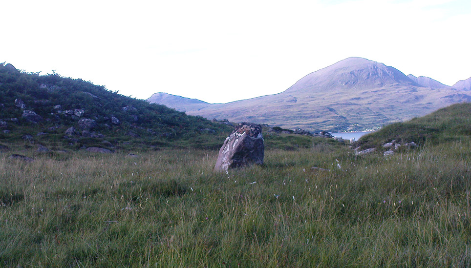
Standing Stone near Shieldaig

From Shieldaig, take the A896 road east to Torridon and Kinlochewe (a bloody superb part of Scotland – perhaps the best!) for a couple of miles, round the stunning bay of Ob Mheallaidh, till you reach the tiny hamlet of Balgie.  From here, walk upstream following the small River Balgie until you hit Loch Damh.  At the edge of the rugged and boggy flatland shortly before the loch itself, amble about in the rushes on your right (west).  You’ll find it!

Archaeology & History

This is a small but chunky standing stone was rediscovered by Dr J. Havelock Fidler in the 1980s.  Less than four-feet tall, it stands alone at the edge of the boggy landscape, with superb views all around (the hill in the background photo is An Ruadh-mheallan). There are other human remains scattered amidst the rocky landscape close by, including the remains of old buildings not far away, but this prehistoric monolith seems to be an isolated example.  However, the landscape here is so vast that it’s highly likely that other standing stones remain hidden in these ancient mythic hills…

References:

  1. Fidler, J. Havelock, Earth Energies, Aquarian: Wellingborough 1988.

© Paul Bennett, The Northern Antiquarian


Torr Mor, Applecross, Ross & Cromarty

Settlement: OS Grid Reference – NG 709 431

Getting Here

Pretty easy to get to.  Go south through the village for a half-mile until you reach the hall by the fire station, sat back on the left-hadn side of the road a few hundred yards past Loch a’ Mhuillinn.  Stop here and walk up the slope behind the hall for a hundred yards or so.  Walk about!

Archaeology & History

The OS-coordinate here is a loose one. It centres on the notable hillock of Torr Mor, around which are a number of hut circles (at NG 7097 4293; NG 7139 4303; NG 7087 4309; NG 7088 4310 and NG 7090 4320) which are each in a relatively good condition and are thought to date from at least the Iron Age. When I visited them, the bracken had encroached on all but one of them (the last in the list above), which was about 30 feet across.

North of here are several curious-looking heaps of stones which need closer examination when the vegetation has died away. At first glance they would seem to be cairns, i.e. tombs. No such prehistoric graveyard has been found anywhere on the peninsula as yet – but considering the existence of the settlements in the area at Sand, you’d think there’d be one somewhere!

© Paul Bennett, The Northern Antiquarian


Toscaig, Applecross, Ross & Cromarty

Standing Stones: OS Grid Reference – NG 715 384

Archaeology & History

The Cambridge biologist J. Havelock Fidler described finding three standing stones in the gorgeous little remote hamlet of Toscaig in his book Ley Lines (1983), which neither the Applecross Local History Society, myself, nor anyone else has been able to locate (the OS grid reference cited above is simply an approximation of their locality). In an updated version of his work, Mr Fidler seems to indicate they can be found a short distance south-east of the village, at the end of an alignment which is supposed to start at Fearnmore (NG 724 605), at the northern edge of the peninsula. If they exist, could anyone perhaps enlighten us as to their whereabouts…?

References:

  1. Fidler, J. Havelock, Ley Lines – Their Nature and Property, Aquarian: Wellingborough 1983.

© Paul Bennett, The Northern Antiquarian