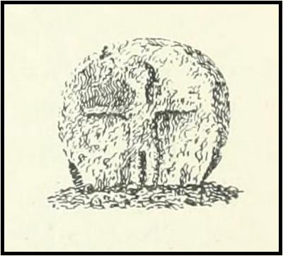
Cup-Marked Stone (lost): OS Grid Reference – SD 950 488
Archaeology & History
When the archaeology assistant Stuart Feather ventured over to look at the prehistoric enclosure on the northwest slope of Raygate Hill, a mile or so south-west of Carleton, like any good petroglyph explorer he looked out for any rock art and—like y’ do sometimes—came across a cup-marked stone that hadn’t been recorded before. He wrote down his finds at home and, following his death, those records were thankfully sent to the Manor House Museum in Ilkley, from where these brief notes are taken. There was at the time of his visit, he said, a
“Rock outcrop with two cup-marks, on August 6th 1960 this outcrop was intact. On a second visit the top layer of the rock had become detached and split into two. The pieces were then removed for preservation.”
By “removed for preservation”, he meant that he took it home to Fernbank Avenue in Keighley (he did this with a few of our old cup-and-rings). However, this one has not been found since and it may simply have been buried in his garden. Does anyone know more about it?
He described another less likely contender of a carving a little closer to the enclosure, telling briefly: “Cup-marked rock, cups only possibly man-made. In close proximity, 75 yards, to (the) earthwork marked on the 6” O.S. map.”
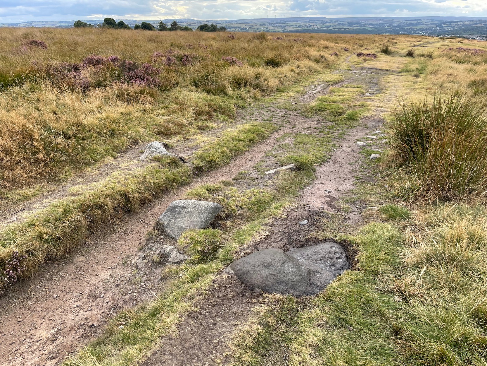
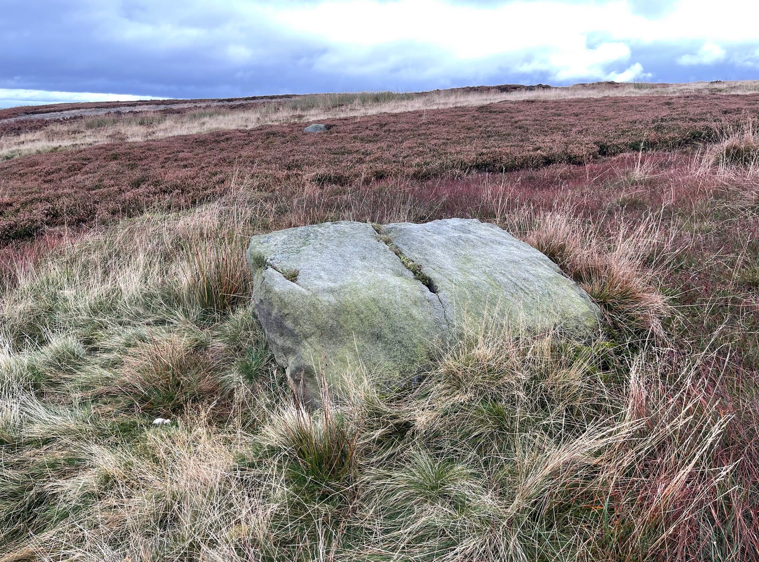
Probably best if you start from the car-parking spot at Acrehowe, by taking the road up through Baildon village, across at the roundabout up Northgate and up onto the moor, then after a few hundred yards turn left on the Bingley Road. The Acrehowe parking spot is a half-mile up on your right. From here, cross the road and bear right to take the footpath that follows the contour at the edge of the hillside, walking past the Baildon Moor (184) carving on the way. About 250 yards past this carving, on the right-side of the track as you’re heading to Dobrudden, is this low-lying almost innocuous stone. Keep your eyes peeled and you’ll see it.
Archaeology & History
The carving looking WCup-marks clearly visible
This cup-marked stone was first unearthed by fellow rock art explorers Mike Short and Dave Spencer in 2012 after they’d been looking at some of the other carvings hereby. In peeling back the turf on the stone, otherwise hidden cups—perhaps nine in all—were uncovered that had been hidden for centuries. Most of them are quite distinct, but it seems that a couple of the cups may have been left unfinished, as their size isn’t consistent with the others on this and other carvings close by.
The carved stone—located on the northern edge of the Low Plain prehistoric cemetery—is one in a line of several low earthfast rocks that crosses the track hereby and it’s possible that it was part of some prehistoric walling. Linear remains of walls and ditches were reported here in the 19th century and some of them can still be seen in some places on this part of the hill, but much of it has been destroyed.
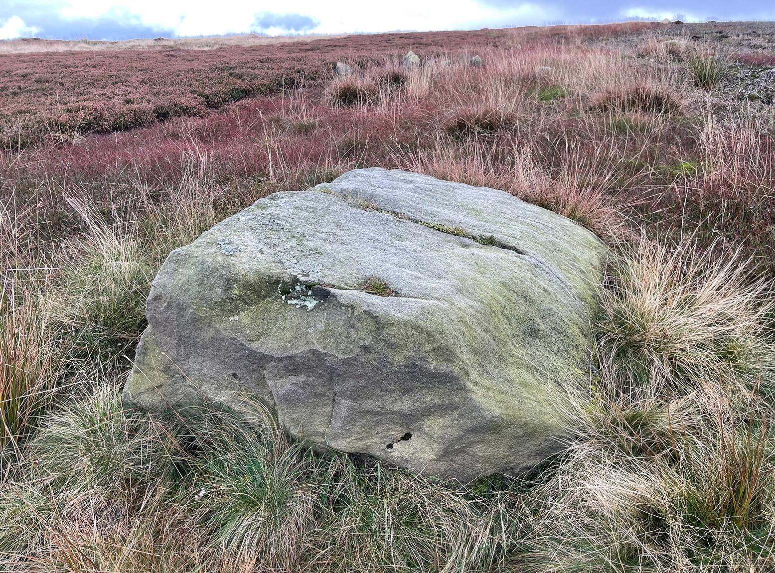
You can walk up from Menston, up Moor Lane north-west towards the moor, then turning left when you hit the moorland road of Hillings Lane. Nearly 350 yards along, turn right up the track known as Occupation lane onto the moor. More than half-a-mile up, past the gate at the Bee Stone, where the track splits, keep to the left and head further uphill, roughly parallel with the fence on your left. Literally ¼-mile (0.4 km) up from the split, you’re looking almost straight down at the reservoir; but to your left, walk towards the fence. Zigzag about! You can also approach it from the Grubstones and Great Skirtful area, by following the Occupation Lane track eastwards down the slope until you’re roughly level with the same reservoir.
Archaeology & History
On this somewhat isolated stone on the northern sloping edge of Craven Hall Hill we find a small cluster of shallow cup-marks, first noted in the 1980s and eventually mentioned in a survey by Boughey & Vickerman (2003) where they described it as a,
“Low, medium striated rock lying in slope of hill. SE end carries possibly up to eleven cups, possibly two sets grouped in arcs running into natural striations of rock, one of which may have been artificially enhanced by pecking.”
Shallow cup-marks
The view from here is quite something: gazing east to the heathen hilltop of Otley Chevin (Beltane rites and rock art — albeit not much), north-east to the far uplands of the White Horse of Kilburn, then across the northern panoramas of Askwith and Denton Moors, and beyond. Some archaeologists have started to believe that such vistas may have had relevance with such carvings, sometimes. They’ve caught up at last! 🙂 Anyhow, the carving itself is pretty simplistic and probably only of interest to the real petroglyph nuts amongst you – although it’s mebbe worth checking out if you’re visiting the Great Skirtful giant cairn and its very impressive hengi-form neighbour.
References:
Boughey, Keith & Vickerman, E.A., Prehistoric Rock Art of the West Riding, WYAS: Wakefield 2003.
Boughey, Keith & Vickerman, E.A., Prehistoric Rock Art of the West Riding – Supplement, YAS 2018.
Acknowledgements: With thanks to Tom Cleland for help in relocating the site on a recent visit.
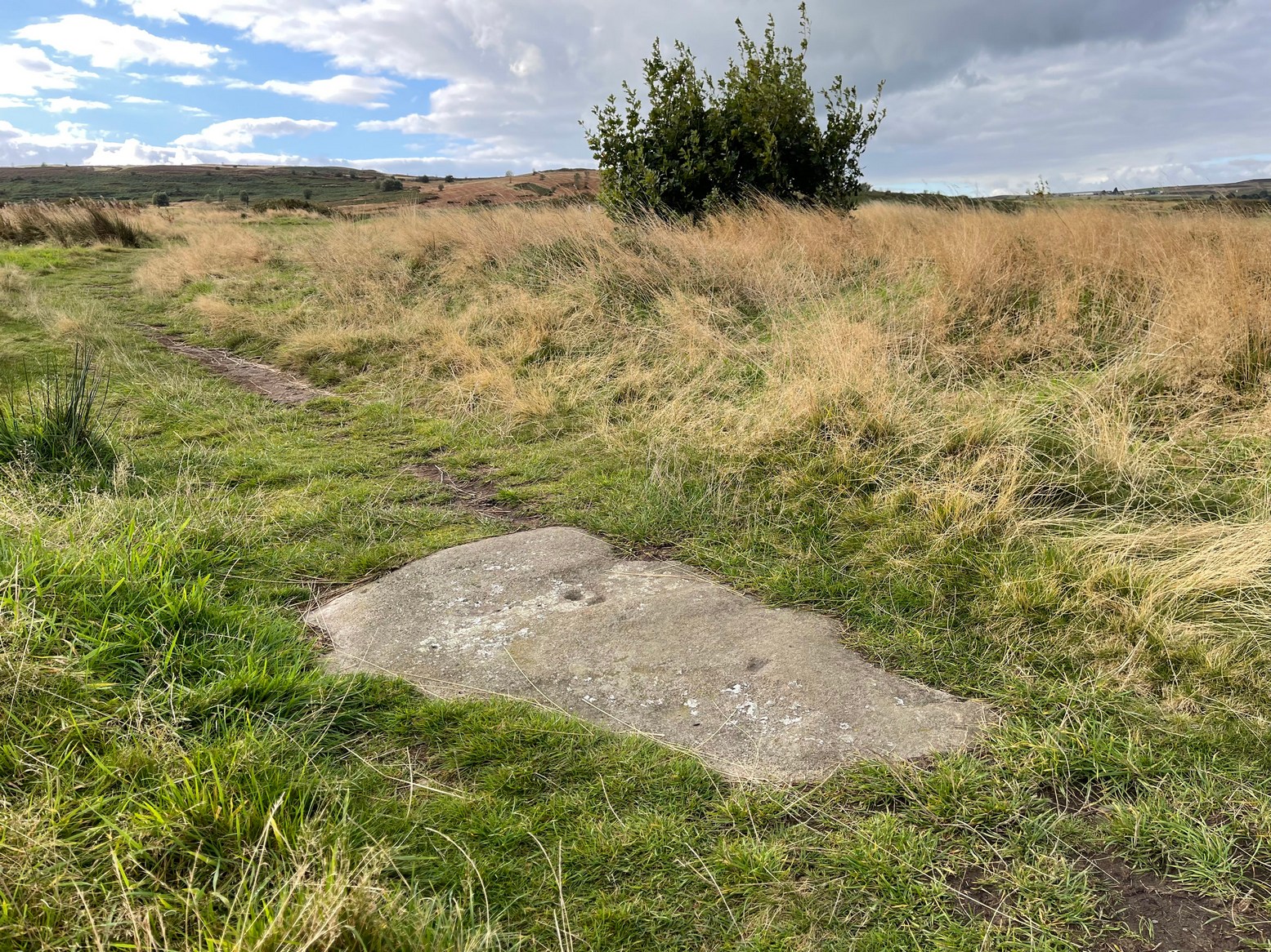
Numerous ways to get here: probably the easiest (direction wise) is if you’re coming from Dick Hudson’s public house on the southern road surrounding Rombalds Moor. From the pub, head left (east) along Otley Road (passing Weecher reservoir) for 1.9 miles (3.1km) until you reach Reva reservoir where a track leads you to the waters. A small parking spot is on the left-side of the road. From here, go through the gate and along the footpath across the field for nearly 300 yards to the next gate. Go through here and immediately follow the walling down to your left for about 135 yards to the edge of the rushes. It’s there!
Archaeology & History
Single cupmark nr the top
On a recent visit to the Fraggle Rock carving, Tom Cleland foraged about at the edge of what was, in centuries gone by, a good flowing stream below the west slope of Reva Hill. An old pathway cut across one section of it near where the walling now runs, covered these days in the mass of Juncus reeds, typical of mashy grounds. And here, just where folk would cross the waters, Tom found a good sized stone with a single deep cup-mark on its crown, calling through a feast of lichens to be seen once more. There may be a second cup-mark by its side, but the light wasn’t good when we were here, so that’ll be worked out some other day. Anyhow, this one’s probably only for the crazy petroglyph hunters out there. It’s the Fraggle Rock and its companios that you’re gonna be looking for, nearby….
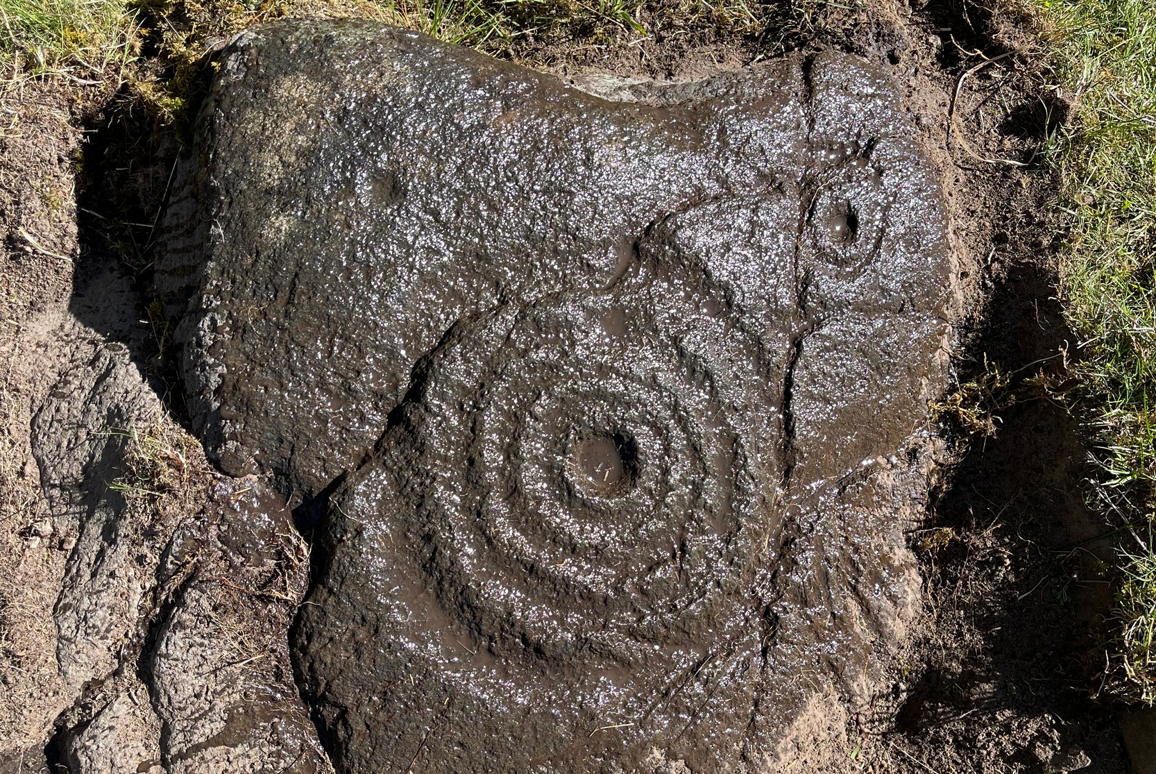
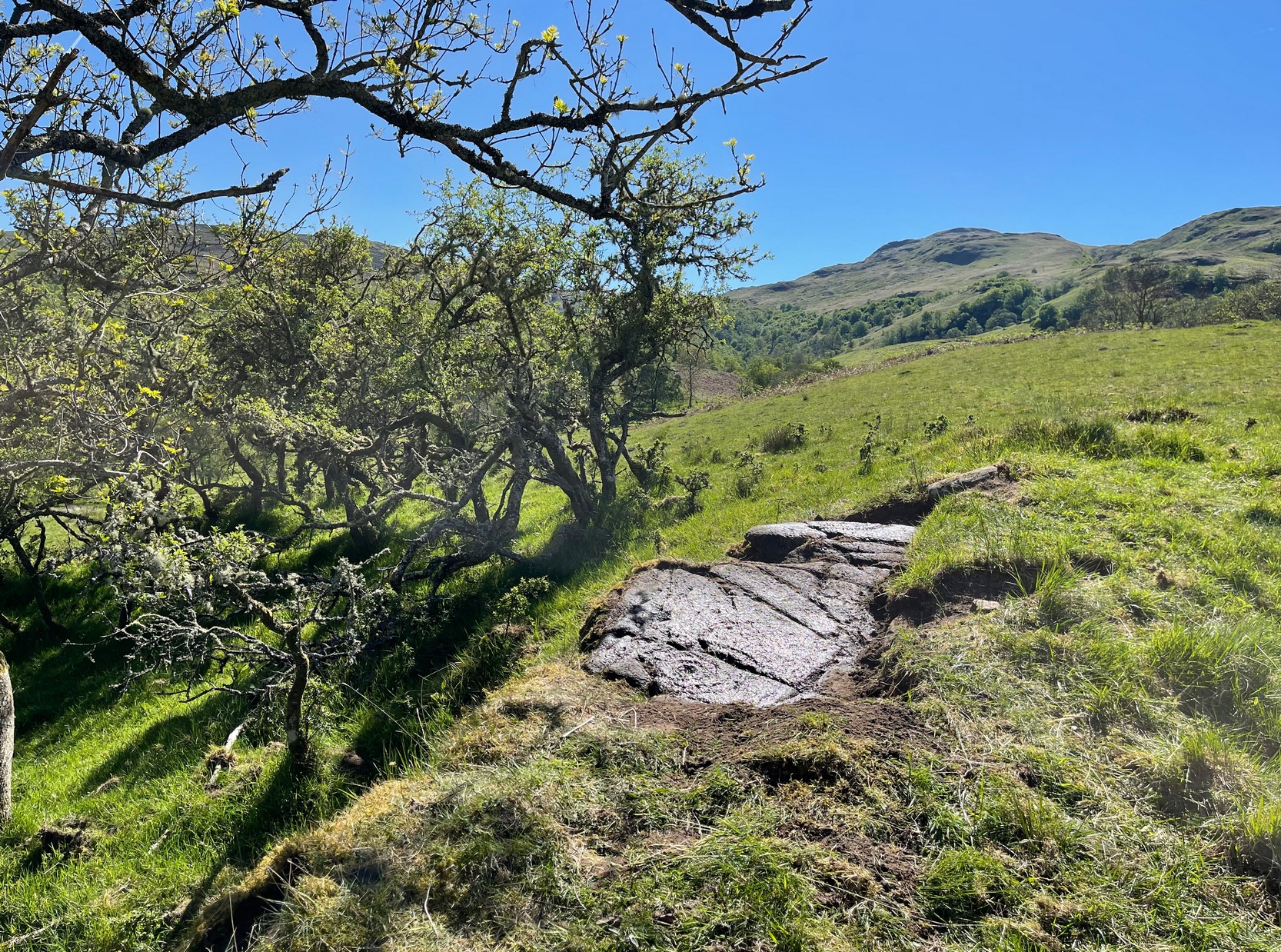
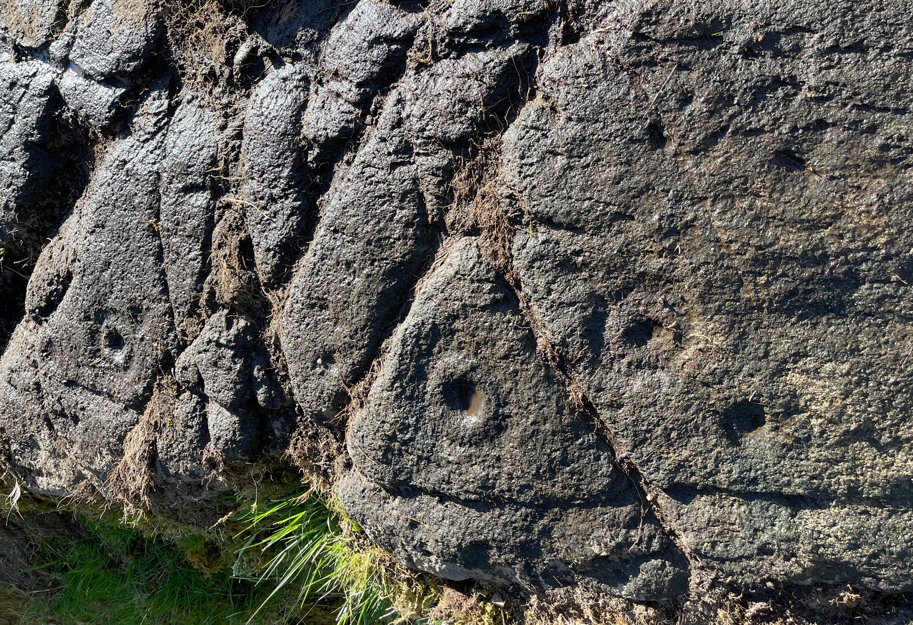
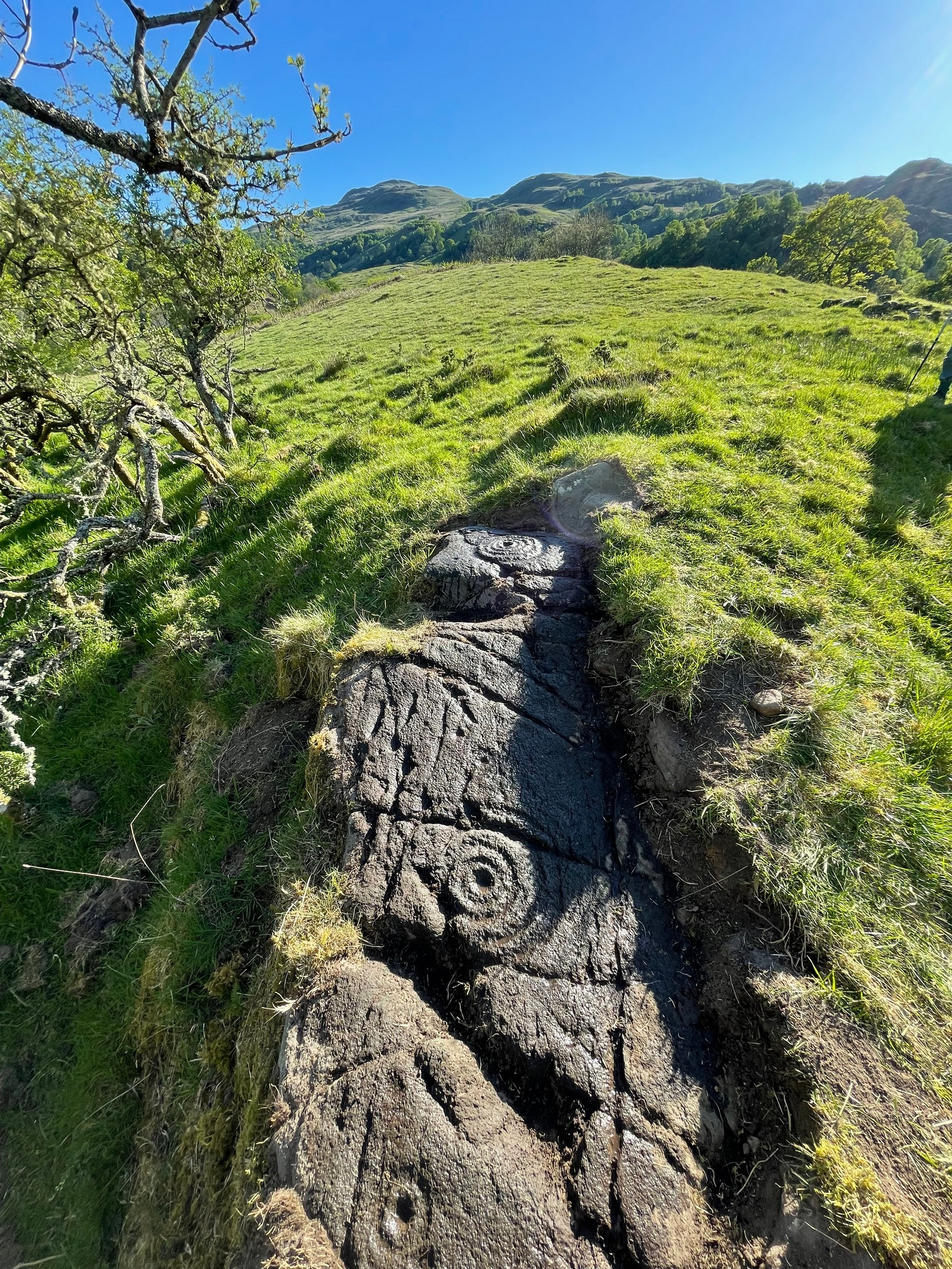
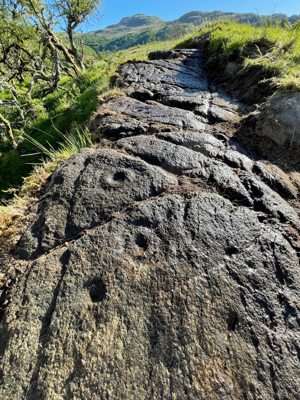
This is a relatively new find that was uncovered in 2019 by members of the Association of Certified Field Archaeologists, on the western edge of a small bowl of blackthorn trees, just past one of the Corrycharmaig East carvings — and it’s a bit of a beauty!
Topmost part of carvingCorrycharmaig (9) stone
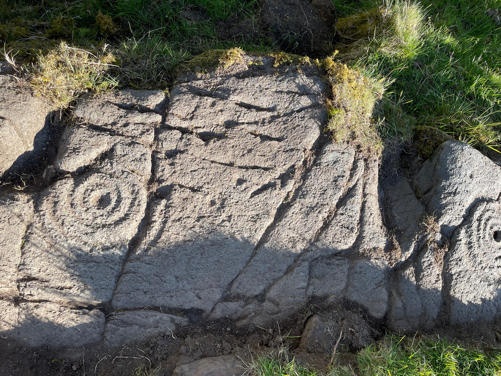
Described, albeit briefly, in the superb survey by Gardiner, King & MacInnes (2024), the carving here has been cut into a sloping straight line of rock along the ridge of a very tiny cliff and consists of cups, single rings and multiple rings. At its crown, so to speak, where the rock surface levels out and is flat, a very well-preserved multiple cup-and-ring greets our senses: a cup-and-four rings to be precise. The outermost edge of the rings cuts into a natural crack that runs to the edge of the stone; and close to where this crack reaches the edge, another standard cup-and-ring rests against it. On this same section you’ll see a single cup which, by the look of it, was intended to have a much wider ring surrounding it—but for some reason it was never executed.
Second multiple-ringerSecond multiple-ring
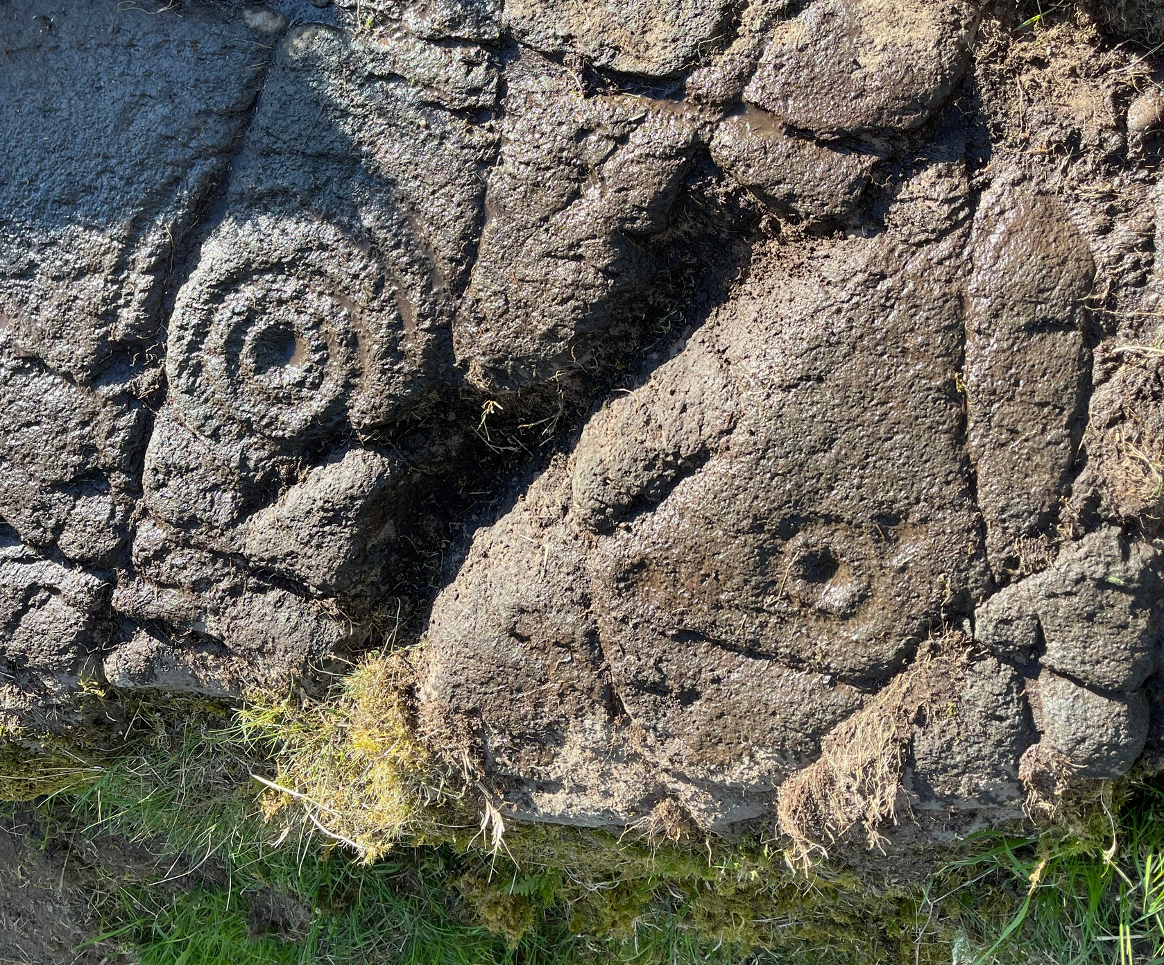
From the topmost section, the rock then slopes gradually downward and the design is broken by several natural splits in the stone before we reach a single unfinished cup-and-ring and a solitary cup-mark. These occur shortly before we reach a near-duplicate of the multiple-ringer that we’ve just seen on the flat top of the stone. The outer ring of this is broken and the edges of it are intruded (again) by natural cracks in the stone (a not uncommon feature). The erosion level of this and its fellow four-ringed compatriot at the top are much the same, suggesting that the two were executed at around the same time.
Lower-half with cup&ringsClose-up of cup&rings
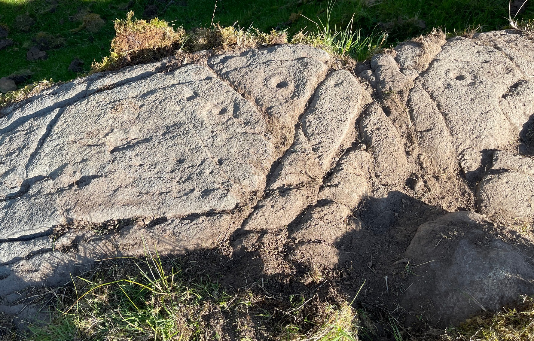
As we move down the slope of the rock with its veritable scattering of geological splits, the rest of the design consists of several single cup-and-rings—at least three of them—over its lower-half, almost in a gentle arc over the surface. The one closest to the four-rings has a single cup-mark attached to its outer edge and another single one just a few inches away from it. The others don’t seem to have any additional carved features attached to them; although one or two other singular cup-marks can be seen on this, the lowest section of the carving.
Looking to the hillsFrom the bottom up
An interesting feature noted here is the direction that this line of rock points to: a dip between two distinct rocky peaks on the horizon and which is close to the winter solstice sunset. I should point out however, that the relationship between open air petroglyphs and astronomical alignments (in Britain at least) is very debatable. Even alignments from one carving to another are pretty meaningless, despite the attempts of some modern archaeologist to show otherwise. In my younger days when I raced into rock art studies, I threw everything I had to show astronomical and other alignments were involved in these carvings—but it turned out not to be…. Instead, it turns out that some of these seeming ‘alignments’ (and only a few) relate to pathways and ancient routes: pointers, if you like, to the way ahead. Makes sense…
References:
Gardiner, M., King, L. & MacInnes, Dugald, In the Glen of the Dark Goddess, Bell & Bain: Glasgow 2024.
Acknowledgements:Huge thanks for use of the Ordnance Survey map in this site profile, reproduced with the kind permission of the National Library of Scotland.
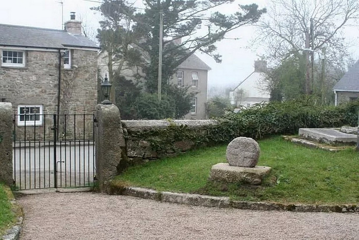
Nice ‘n easy: get into the village and walk through the church gates and there, on your left on the grass verge, a plinth and the cross-head sits before thee!
Archaeology & History
When the great Arthur Langdon (1896) wrote about Crowan’s cross-head, he was puzzled. At the time it was in the garden of a local surveyor in the nearby village of Praze-an-Beeble, but its origins seemed mysterious. The surveyor in question, a Mr William Carah, wrote to Langdon and said,
“It seems a mystery where the cross we have originally came from. A friend of mine, living abroad at present, saw it, I think, at a farm-place, being used as a bottom for a beehive. He asked the people for it, intending to fix it somewhere. At any rate, when he left England he had not done so, and at my request they gave the cross to me.”
The condition of the cross-head wasn’t too good and Langdon suggested it had “received some very rough treatment” – no doubt when it was hacked from its shaft. With his usual precision he gave the dimensions of the cross-head as follows:
“Height, 1 ft. 6 in.; width, 1 ft. 8 in.; thickness: at the bottom 6½ in., at the top 5½ in.
Front. — Part of a small conventional figure of Christ, extending to the knees, at which point the fracture occurred which separated the head from the shaft.
Back. — The remains of a mutilated Latin cross in relief.”
The stone shaft or menhir that once supported this carved head has, it would seem, long since been destroyed.
References:
Blight, J.T., Ancient Crosses and other Antiquities in the West of Cornwall, Simpkin Marshall: London 1858.
Courtney, R.A., The Evolution of the Wheel Cross, Beare & Sons: Penzance 1914.
Doble, Gilbert H., A History of the Parish of Crowan, King Stone Press: Shipston-on-Stour 1939.
Langdon, Andrew, Stone Crosses in West Cornwall, Federation of Old Cornwall Societies 1999.
Langdon, Arthur G., Old Cornish Crosses, Joseph Pollard: Truro 1896.
Cup-and-Ring Stone (lost): OS Grid Reference – NU 013 264
Also Known as:
Cairnfold Field
Archaeology & History
In James Hardy’s (1889) essay describing new archaeological finds from the Lilburn area, he told of seeing a triple-ringed petroglyph that seems to have been cast up from one of the cairns in the adjacent field. I can find no other reference to this. He wrote:
“On a wall top, near a gate not far from the Cairn-fauld’s field, lies a detached stone, supposed to have come from a cairn, with three circles and a hollow central cup incised on it, which no one seems to care for.”
Does anyone know what has become of it? Mr Hardy also described a series of other carvings a few fields away to the east, some with quite ornate cup-and-ring designs. These have never subsequently been seen and remain hidden.
References:
Hardy, James, “Further Discoveries of Pre-Historic Graves, Urns and other Antiquities, on Lilburn Hill Farm,” in Archaeoogia Aeliana, volume 13, 1889.
Acknowledgements:Huge thanks for use of the Ordnance Survey map in this site profile, reproduced with the kind permission of the National Library of Scotland.
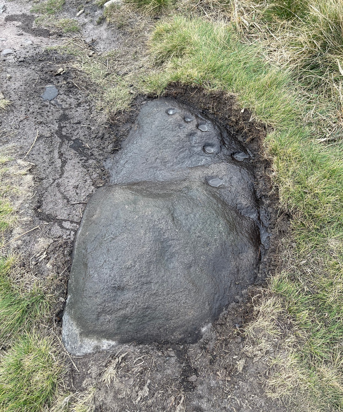
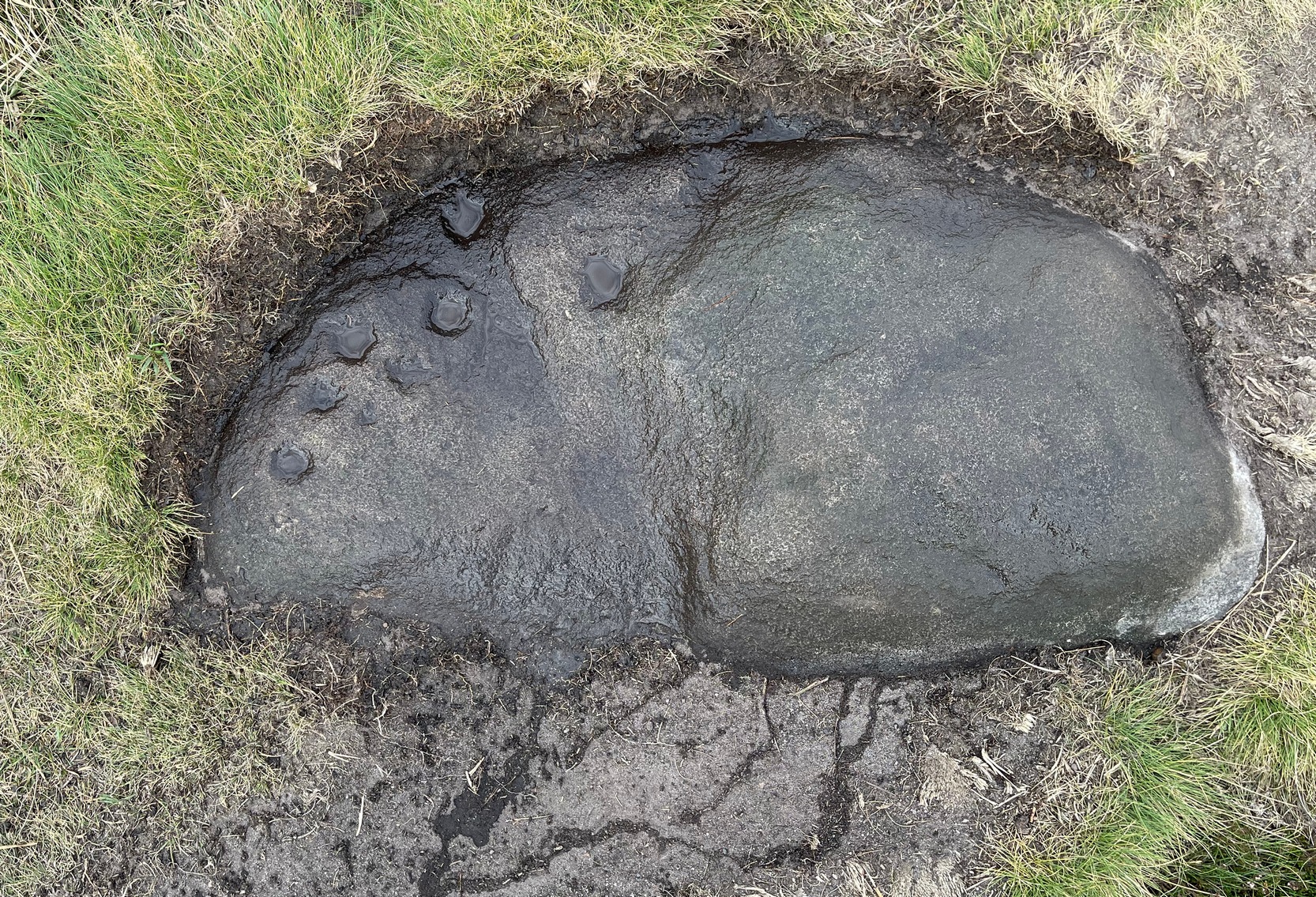
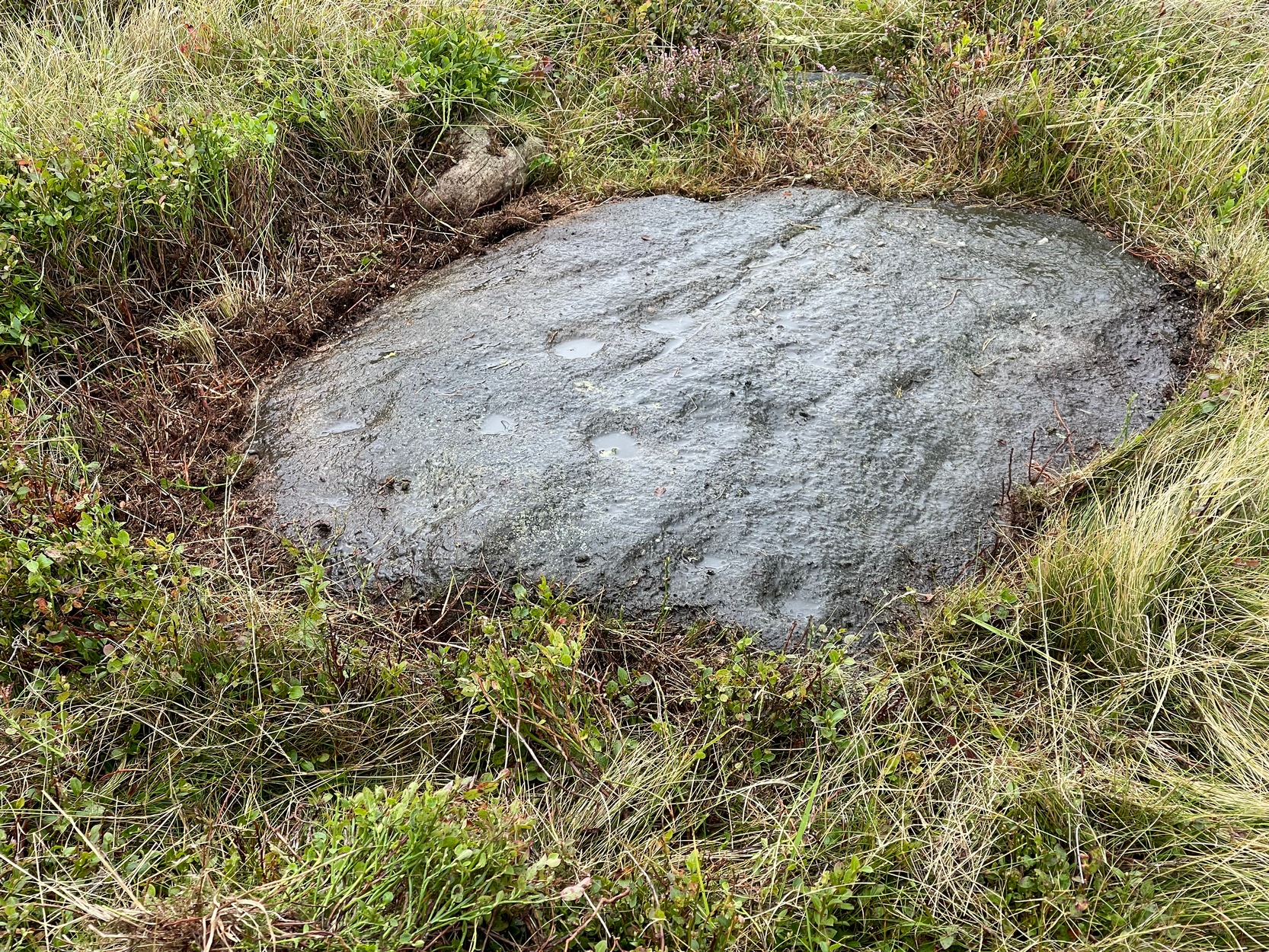
Naathen… I’d give you the directions of how to find this stone, but I’m not sure of its precise location. Just get to the top of Reva Hill, on its more westerly side, and it’s somewhere on its upper slopes. I was up here again recently and hoped to find it, but the grasses might have grown back over it. If one of you petroglyph fans manages to locate it, please can you send me its exact grid-reference, so I can update the site profile.
Carving when wetFaint Reva Hill carvingCarving when wet
Archaeology & History
This was one in a cluster of carvings that were rediscovered in 2011 and which I’ve not managed to re-locate (bad boy). It’s very plain and simple, as you can see. Indeed, I was lucky to even notice it, as the central photograph above shows how faint and eroded the cup-marks are in normal light. Thankfully with a bit of water, what I initially thought may have been two cup-marks, turned into three or four of them. So the next time you’re having a look at the Fraggle Rock carving and its companions, remember that this little fella is hiding somewhere close by…
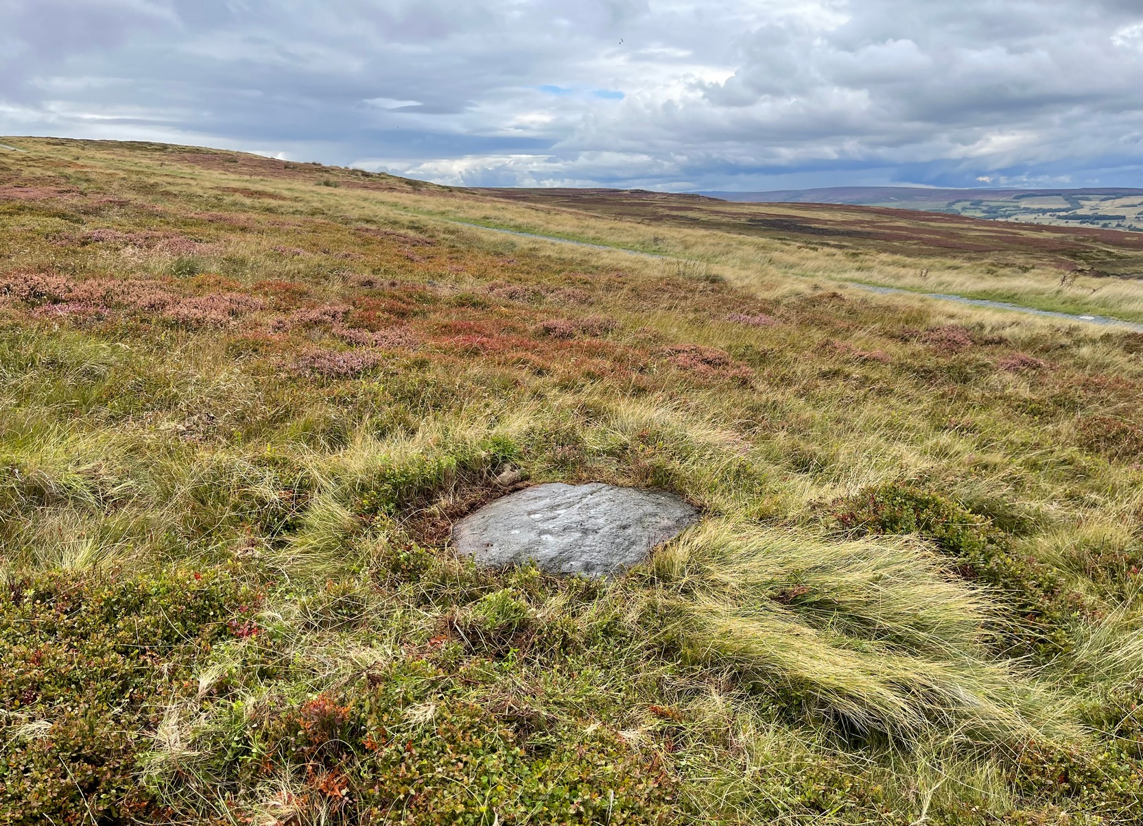
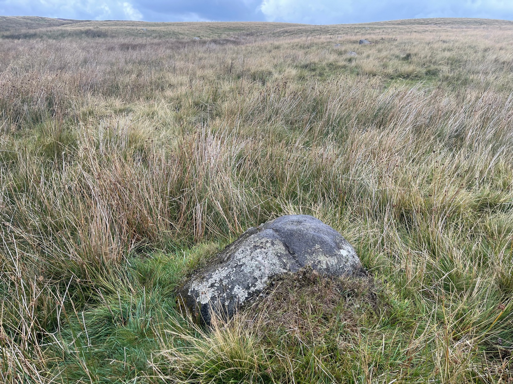
From Cow & Calf Rocks, walk up the steep footpath and turn left (southeast) when it levels out on the edge of the moor. Walk 250 yards along and, where the main path veers down to the road, just keep walking along in the same direction along the footpath that runs gradually uphill until, after 650 yards (595m) you’ll eventually meet up with the footpath that runs along the moorland proper. Where these two paths meet-up, then head upwards (south) into the heather for 55 yards (50m) until you see a good-size sloping block of stone with a crack roughly down the middle. If you hit the Little Haystack Rock (a big conspicuous stone) you’ve gon too far!
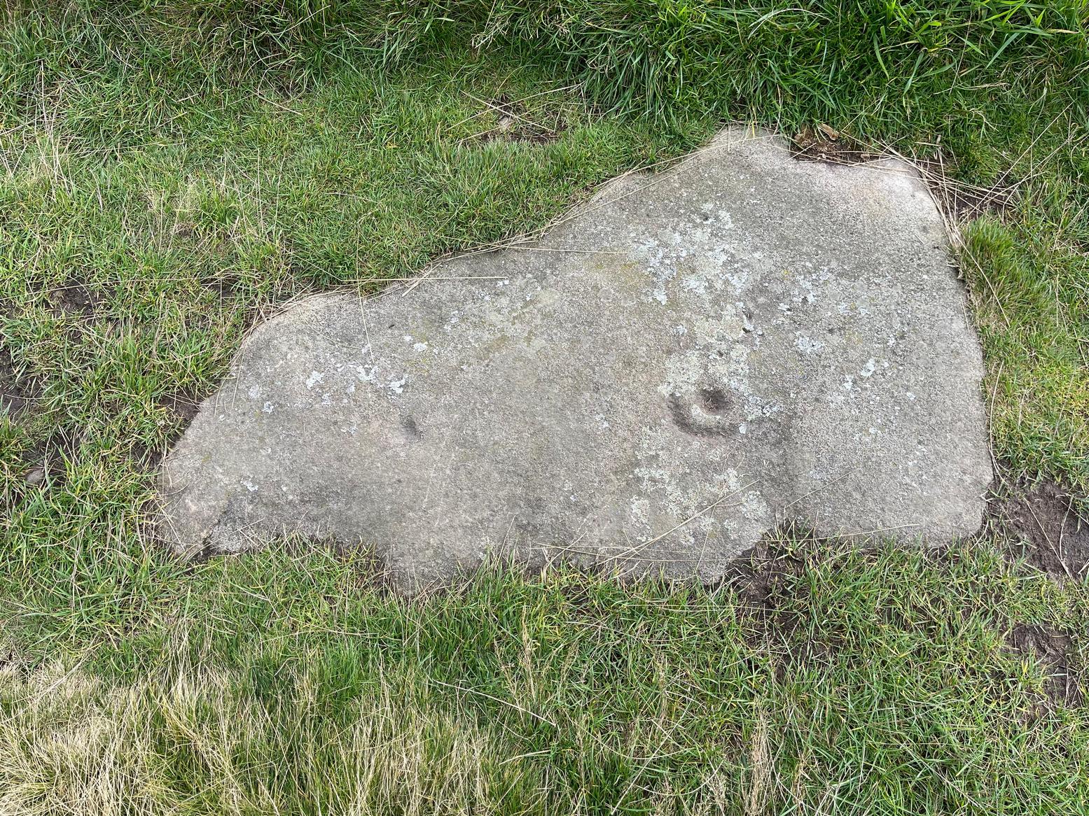
Archaeology & History
Shallow cupmarks visible
This is one of the many basic cup-marked stones you’ll find scattered all over these moors possessing (as it does) only two distinct cup-marks on its more northern half, although a possible faint third one needs looking at in better light. When we were kids exploring this and other areas, single and double cup-marked stones like this seemed ten-a-penny and we’d flippantly pass them by after quick perusal, looking for more impressive designs.
The carving here seems to have been missed in the surveys of Hedges (1986) and Boughey & Vickerman (2003), despite the rock standing out quite distinctly. I can only assume that they checked it out when the skies were grey and dull, making the cup-marks difficult to see. A number of other prehistoric remains can be found close to this carving, including cairns and sections of enclosure walling.
Folklore
Tradition tells that the indigenous Britons had a battle with the Romans on the plain where this carving is found.
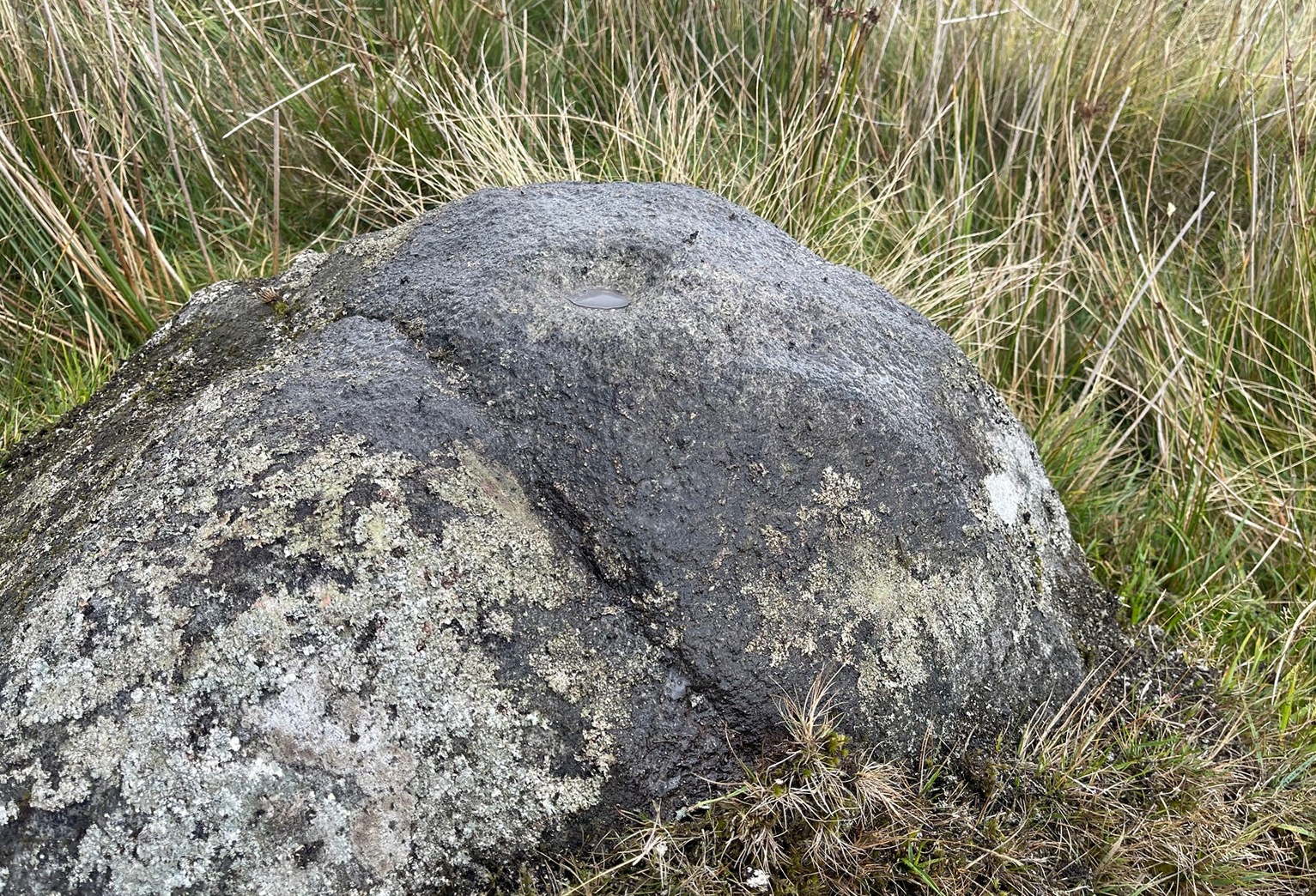
Take the road up through Baildon village, across at the roundabout up Northgate and up onto the moor, then after a few hundred yards turn left on the Bingley Road. About five hundred yards along, keep your eyes peeled for where the ruined reservoirs are to the left-side of the road. Straight across the road from here (north) you’ll see the small cliffs of Eaves Crag. Walk along the footpath that runs above the cliffs and, about 80 yards past them, keep your eyes peeled on the ground right in the middle of the path. You can’t really miss it!
Archaeology & History
Basic cup-and half-ring
First mentioned in passing in the magnum opus of W. Paley Baildon (1913) and subsequently in one of Sidney Jackson’s (1955) series of profiles on the Baildon Moor carvings, this all but insignificant carving comprises of a simple cup-and-half-ring and another singular cup-mark a little further along the stone. John Hedges (1986) described this carving as being a “well marked cup surrounded by horseshoe groove – also well marked. Possible small cup and incomplete ring.” Whilst the minimalists Boughey & Vickerman (2003) told it to be simply, “two cups, one with incomplete ring.” A peculiarity with this design is that it might have been cut by a metal implement, perhaps in the Bronze Age, perhaps even in the Iron Age. We might never know…
References:
Baildon, W. Paley, Baildon and the Baildons – volume 1, St. Catherines: Adelphi 1913.
Boughey, Keith & Vickerman, E.A., Prehistoric Rock Art of the West Riding, WYAS: Wakefield 2003.
Hedges, John (ed.), The Carved Rocks of Rombald’s Moor, WYMCC: Wakefield 1986.
Jackson, Sidney, ‘Cup and Ring Boulders of Baildon Moor,’ in Bradford’s Cartwright Hall Archaeology Group Bulletin, 1:10, 1955.
Acknowledgements:Huge thanks for use of the Ordnance Survey map in this site profile, reproduced with the kind permission of the National Library of Scotland.