Slade Cairnfield, Blubberhouses Moor, North Yorkshire

Cairnfield:  OS Grid Reference – SE 141 543
Getting Here

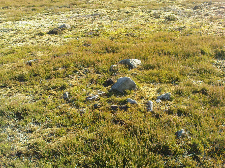
One of several recently discovered small cairns

Follow the same directions to reach the recently discovered Slade-02 carving; and simply walk 30 yards southwest.  The scattered ruins of numerous small stone piles, visible only when the heather’s been burnt back, is what you need to be looking for.

Archaeology & History

First discovered on a Northern Antiquarian outing in July 2011, it’s difficult to give an accurate appraisal of this site as much of the landscape all round here is very overgrown in deep heather.   Added to this, there is evidence of more recent medieval and post-medieval industrial activity that’s intruded and/or affected the earlier prehistoric remains that are evident here.  But these factors aside, we can say with certainty that here is a previously unrecognized prehistoric cairnfield — and it may be of some considerable size.
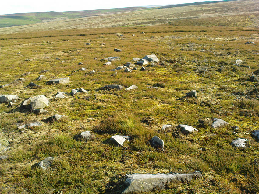
Ruined hut or cairn circle

We have so far located at least seven individual cairns and a cairn circle in relative proximity to each other, thanks to local rangers burning back the heather.  It was the discovery of the cairns which then led to the discovery of the nearby cup-and-ring stones.  Amidst the cairn-spoils there are also distinctive lines of stone, indicative of either walling or embankments of some form or another.  Some of the stone making up this cairnfield appears to have been robbed. We also found that in walking through the deeper heather surrounding this ‘opening’ (where it had been burned away a few months previously), a number of other man-made piles of stone were evident that seemed to indicate more cairns.  There is also evidence of further lines of prehistoric walling, whose precise nature is as yet unknown. But we do know that people have been on this moorland since Mesolithic times (structural and other remains of which are still evident less than a half-mile away).

The site requires greater attention the next time the heather’s been burnt back.

References:

  1. Davies, J., “A Mesolithic Site on Blubberhouses Moor, Wharfedale,” in Yorkshire Archaeological Journal, part 161 (volume 41), 1963.

© Paul Bennett, The Northern Antiquarian

Eller Edge (429), Pock Stones Moor, Thruscross, North Yorkshire

Cup-Marked Stone:  OS Grid Reference – SE 0902 6150

Also Known as:

  1. Carving no.429 (Boughey & Vickerman)
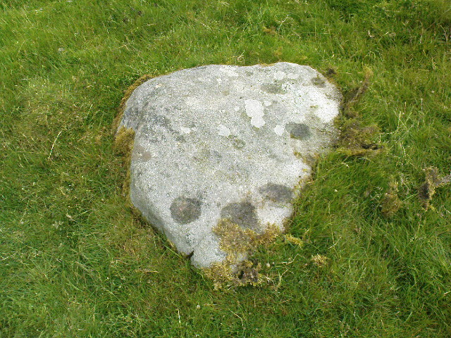
Eller Edge stone 429

Getting Here

A slight walk to get here.  Follow the same directions as if you’re going to the Eller Edge 431 carving.  Once here, walk west as if you’re going into the middle of the field, keeping your eyes peeled about 20 yards along for a small-ish rounded stone with nice colours of lichen amidst the grasses.  If you’re patient, you’ll find it soon enough!

Archaeology & History

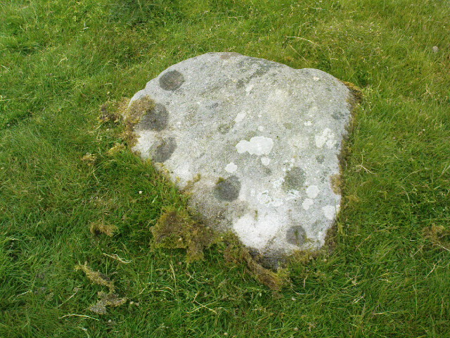
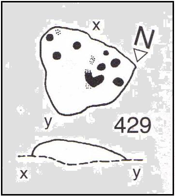
This is another simple cup-marked stone on the grassland ridge overlooking higher Wharfedale.  The carving here is a little clearer and more well-defined than that of its close neighbours, with a number of simple cups visible on its rounded surface.  We counted seven such cups on our cloudy-day visit, but Boughey & Vickerman (2003) thought there might be a little more, describing the stone simply:

from another angle
B & V’s drawing

“Small lichen-covered rough grit rock.  About eight cups and two depressions.”

A rubbing of this small stone (as practiced by English Heritage and rock art students alike) would prove useful in bringing out any other ingredients in the ancient design.  And whilst you’re in this field, have a look at the curious Spiral Stone and some of the other cup-markings close by.

References:

  1. Boughey, Keith & Vickerman, E.A., Prehistoric Rock Art of the West Riding, WYAS: Wakefield 2003.

Links:

  1. Eller Edge Rock Art – more notes & images

© Paul Bennett, The Northern Antiquarian

Eller Edge (424), Pock Stones Moor, Thruscross, North Yorkshire

Cup-Marked Stone:  OS Grid Reference – SE 08973 61487

Also Known as:

  1. Carving no.424 (Boughey & Vickerman)
Eller Edge carving 424

Archaeology & History

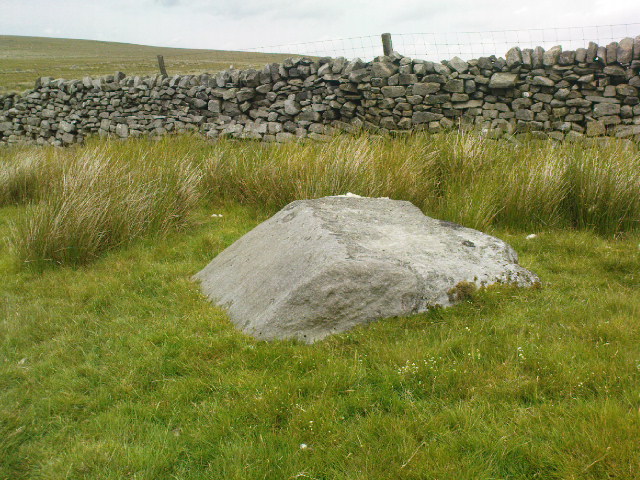
A slight walk to get here, but well worth it once you arrive!  Follow the same directions as if you’re going to the Eller Edge 426 carving.  Once you reach this stone, notice the larger rounded rock about 20 yards to your west, a bit further down the field.  You can’t really miss it!

Archaeology & History

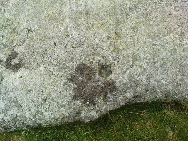
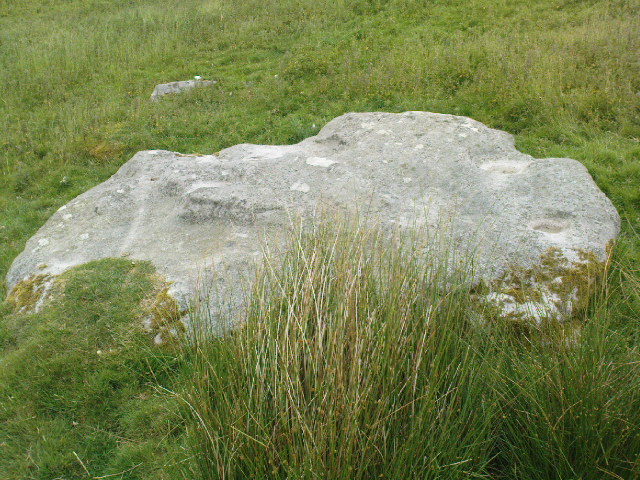
A large rounded stone just on the meadows before it begins to slope more steeply downhill, there are several of those large natural ‘bowls’ that we see on a lot of cup-marked and not-so-cup-marked stones in our northern hills.  These basins or bowls may, at times, may have had significance for our ancestors, but it’s the cluster of cup-markings on this stone which are of importance to us here.  There are perhaps as many as a dozen cup-marks here, all very well worn, and mostly to be seen on the eastern sides of the rock.  When I came here with Paul Hornby and QDanT a few months back, the cloud cover stayed with us all day, so I didn’t get any decent images of the carving.  Ne’er mind…

Close-up of faint cups

The stone was described by Boughey & Vickerman (2003) simply as:

“Very large, uneven, rough grit rock with face with scooped-out areas sloping down to grass.  Eleven possible cups and six basins.”

A plain carving, perhaps only of interest to the fanatics amongst you.  But if you do visit here, check out carving 432, 431, and others in the same field.

References:

  1. Boughey, Keith & Vickerman, E.A., Prehistoric Rock Art of the West Riding, WYAS: Wakefield 2003.

Links:

  1. Eller Edge Rock Art – more notes & images

© Paul Bennett, The Northern Antiquarian

Eller Edge (432), Pock Stones Moor, Thruscross, North Yorkshire

Cup-and-Ring Stone:  OS Grid Reference – SE 09078 61479

Also Known as:

  1. Carving no.432 (Boughey & Vickerman)
Carving 432, close to the wall

Getting Here

A slight walk to get here.  Follow the same directions as if you’re going to the Eller Edge 426 carving, but as you reach the field edge, walk up the slope (in the field itself) along the side of the wall.  You’ll pass rudimentary Carving 431 and about 30 yards further uphill this little fella will catch your eye!  You can’t really miss it.

Archaeology & History

Another basic cup-marked stone that’s probably only gonna be of interest to the purists amongst you.  A single cup-marking sits on the edge of a small patch of old dark lichen, although the rock art students Boughey & Vickerman (2003) reckon there could be another two on here—but I aint so sure misself.  The stone was described by them simply as:

“Medium-sized rectanguar rock of medium gritstone, with vertical edges except for finely striated sloping W side.  One cup near possibly quarried edge and perhaps two more.”

Single faint cup-mark

Another single cup-marked stone of the same size, type and quality as this one can be found on another stone not far from this stone, which aint in the Boughey & Vickerman survey.  There’s also evidence of ancient lines of walling close by, but with little surface clues as to its age.

References:

  1. Boughey, Keith & Vickerman, E.A., Prehistoric Rock Art of the West Riding, WYAS: Wakefield 2003.

Links:

  1. Eller Edge Rock Art – more notes & images

© Paul Bennett, The Northern Antiquarian

Slade Carving (02), Blubberhouses Moor, North Yorkshire

Cup-Marked Stone:  OS Grid Reference – SE 1411 5431

Also Known as:

  1. Owl Stone
  2. Sunset Stone

Getting Here

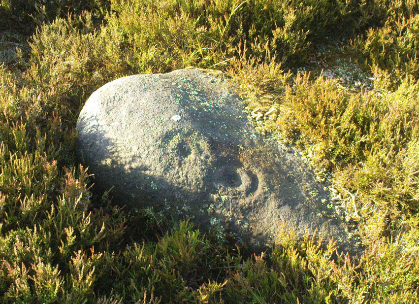
Cup-and-rings, looking NE

Same directions as the Slade 01 carving.  But once you reach the upstanding stone cairn on the rocky hill, walk 220 yards (less than 200m) WSW and look around.  You’re damn close!  If you find the large cup-marked Slade 03 carving,  walk back east about 10-20 yards and you can’t really miss it!

Archaeology & History

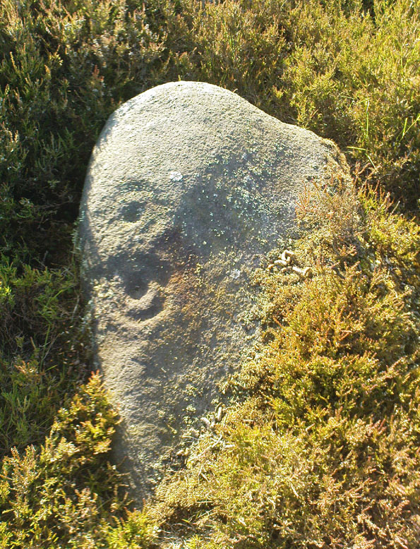
This is just one of at least seven previously undiscovered carvings on this section of moorland – and it’s worth looking for!  The two other names we gave it — ‘owl’ and ‘sunset’ — come from the very notable design: owl thanks to it having the appearance of large owl-like eyes, and sunset as the two cup-and-rings are etched on the western edge of the rock and, when we found it yesterday, the sun was setting (albeit to the NW) and the image prompted talks of setting suns, the land of the Dead and other such worldwide indigenous religious myths (Harvey 2000) — for without recourse to such ingredients, these carvings are vacuous archaeocentric museum pieces and nothing more.  And this carving at least deserves much more than mere cataloguing!  The internationally renowned archaeologist, O.G.S. Crawford (1957) would have entered this carving into his ‘eye’ and ‘owl’ motif, representative of goddesses or spirit-forms, as would Gimbutas. (1989)

…and from above

But this carving is archetypal, as we can see, though would appear to have no other etched features on the stone’s surface.  It is very close (if not within) the prehistoric graveyard that is plainly evident 30-40 yards south in the burnt heather and would very likely have had some mythic relationship with the dead (a symbiosis we have found in many cup-and-rings).  We plan further ventures here in the coming weeks in the hope that we can unearth other prehistoric remains.

References:

  1. Crawford, O.G.S., The Eye Goddess, Phoenix House: London 1957.
  2. Gimbutas, Marija, The Language of the Goddess, Harper Collins: New York 1989.
  3. Harvey, Graham (ed.), Indigenous Religions, Cassell: London 2000.

© Paul Bennett, The Northern Antiquarian
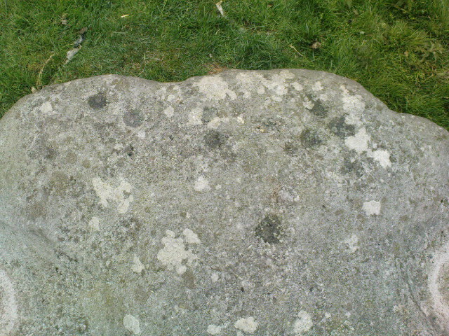

Eller Edge (426), Pock Stones Moor, Thruscross, North Yorkshire

Cup-and-Ring Stone:  OS Grid Reference – SE 08991 61486

Also Known as:

  1. Spiral Stone
Spiral Stone with cluster of cups (image © QDanT)

Getting Here

A slight walk to get here, but well worth it once you arrive!  From Appletreewick, take the road east through Skyreholme and up Skyreholme Bank track, bearing right at the fork in the tracks along the ancient Forest Road.  Keep going and after a couple of zigzags, you’ll cross the Larnshaw Beck.  Keep walking along the track until it runs wallside — and here, go straight down the field for 75 yards (best climbing over the rickety wooden bridge by the stream 50 yards back and walking up).  Although there are a number of other stones hereby, you can’t really miss this.

Archaeology & History

This carved stone and its close associates rest upon the green slopes overlooking the Blands Valley and further across upper Wharfedale and the lands beyond.  The majestic Simon’s Seat rises on the nearby western slope and there in the greater distance, once more reaches the sacred hill of Pendle, with whom so many other ancient sites commune within our northern lands.  It’s hard to say for sure that the Witch’s Hill was of little relevance to this and other stones, but only a fool would ignore the geomancer’s notes about this constant.

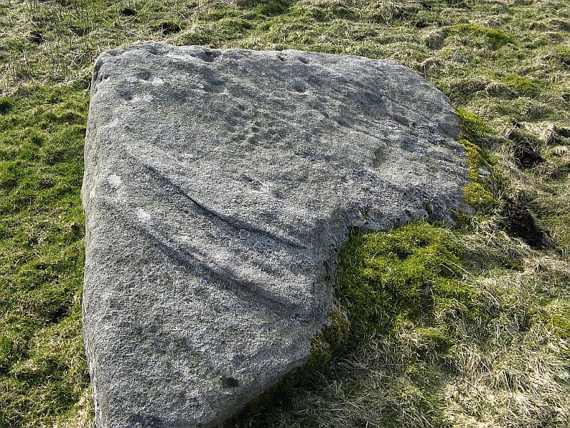
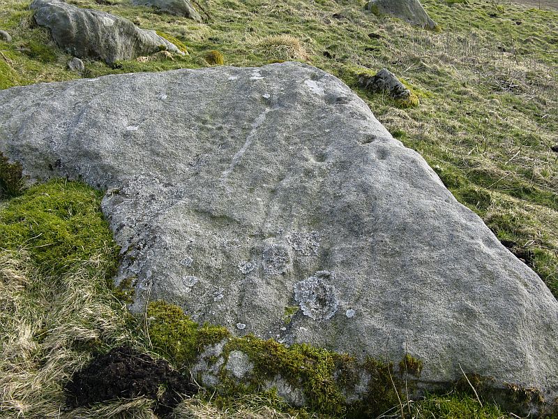
Eller Edge carving, looking south (image © QDanT)
Boughey & Vickerman’s drawing

The carving here doesn’t give much clues in any direct sense either.  We have an almost arrowhead-shaped rock with a dozen decent cup-marks or so cut along and near its western side; but the notable curiosity here is the small circular cluster of smaller cup-marks dotted in a near circular mass near the middle of the stone.

When Danny, Paul and I came here the other week, the initial impression of this cluster was one of a primitive solar symbol etched onto the rock; but the more we looked, the more it seemed that these small cups appeared to have been arranged in a very rough spiral lay-out.  Now I know that spirals are damn rare items in rock art (especially in this part of the world), but the more we looked and then subsequently checked Boughey & Vickerman’s (2003) illustration, the more evident it became.  Of course the ‘spiral’ could be merely fortuitous, but I’m not so sure misself.  In discussing this with our field archaeologist later, he suggested getting a rubbing of this part of the stone on his next visit.

The stone was first described by the petroglyph explorer Stuart Feather (1964) and later described by the rock art students Boughey & Vickerman (2004), simply as:

“Large, rough grit rock with face sloping SE down into grass at N.  About twenty cups to W, with three grooves at N corner and group of about twenty small cups at NE.”

A very intriguing carving.  And if you visit here, make sure you check out carving 424 and others in the same field.

References:

  1. Boughey, Keith & Vickerman, E.A., Prehistoric Rock Art of the West Riding, WYAS: Wakefield 2003.
  2. Feather, Stuart, “Appletreewick, WR,” in ‘Archaeological Register, 1963’, Yorkshire Archaeological Journal, volume 41, 1964.

Links:

  1. Eller Edge Rock Art – more notes & images

© Paul Bennett, The Northern Antiquarian