Maypole (destroyed): OS Grid reference – SD 5161 9212
Archaeology & History
Long since gone, it’s existence was recorded by, amongst others, the Kendal historian Cornelius Nicholson. (1861) He described it in relation to one of the town crosses, that was removed due to it being “an obstruction in the street.” The maypole too, he said,
“was another incumbrance, but indispensable, according to the custom of our forefathers. It stood in Kirkland, opposite the house of the late Thomas Reveley, Esq., and was suffered to remain till within eighty years ago. In the time of our good Queen Katherine, who may fairly be supposed to have partaken of the amusements, countenanced by her royal consort, the original festivity of maying and morris-dancing would be here celebrated, by the annual ceremony of “maying” when, immediately after sunrise, on the 1st of May, processions, entering the town at various inlets, streamed through the streets, with music of horns and flutes; boys with their May-gads (willow-wands twined with cowslips), and girls with their “brats” full of flowers — young and old alike joining in merry laughter, and song, and the customary chorus, “We have brought the summer home.” When the above-named ceremonies became less fashionable, the May Pole was made the rendezvous of all the milkmaids in the neighbourhood, who came and paraded round it on Easter Mondays. On other occasions of rejoicing, afterwards, such for instance, as terminating an apprenticeship, and the like, it became customary for young men to go and dance around it.”
The author then told that this annual village ceremony was still being performed at the beginning of the 19th century, “in the assemblage of young people in the Vicar’s Fields, on Easter Tuesday. After spending the afternoon there, they returned in procession through the streets, threading grandy needles.”
References:
Nicholson, Cornelius, The Annals of Kendal, Whitaker & Co.: London 1861.
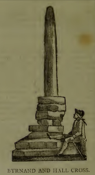
This long lost Cross could once be seen close to the Tudor era Byrnand Hall, which stood on the north side of the High Street. The Hall was demolished around 1780, and replaced by the present building, which is now a political club. The Cross was taken down around the same time, so we’re very fortunate to have a contemporary sketch.
Harry Speight (1906), the Great Yorkshire antiquarian, described the Cross when he was writing of the ‘big houses’ of Knaresborough, saying:
“Another notable old mansion was Byrnand Hall, which stood at the top of the High Street facing Gracious Street, and was rebuilt about a century ago. It was the property and seat for many generations of one of the leading families of Knaresborough, named Byrnand, one of its members being recorder of York in 1573. Opposite the house stood a very ancient stone cross, consisting of a plain upright column, without date or inscription, supported by several rudely-formed stones placed on three tiers or steps. It appears that one Richard Byrnand paid a fine and was permitted to enclose a cross standing on a piece of waste land then lately belonging to Robert Nessfield. The cross may be conjectured to have been either a memorial or boundary-stone. In those days ” it was not enough,” says the old antiquary, Hearne, ” to have the figure of the cross both on and in churches, chapels, and oratories, but it was put also in church-yards, and in every house, nay, many towns and villages were built in shape of it, and it was very common to fix it in the very streets and highways.
“This ancient relic, the site of which is now marked by a brass cross sunk in the causeway, was in after times called the Byrnand Hall Cross, from its proximity to the house of the same name. It stands on the road equidistant between York and Leeds, being eighteen miles from either place.”
At the end of the eighteenth century, E. Hargrove wrote:
“The (Byrnand) family mansion was situated at the end of the High-street, leading towards York. Near it formerly stood an ancient Cross, which being placed on the outside of the Rampart, and opposite to the entrance into the borough, seems to have been similar in situation, and probably may have been used for the same purpose, as that mentioned by Mr. Pennant, in his History of London, which stood without the city, opposite to Chester Inn; and here, according to the simplicity of the age, in the year 1294, and at other times, the magistrates sat to administer justice. Byrnand-Hall hath been lately rebuilt, by Mr. William Manby, who took down the remains of the old Cross, and left a cruciform stone in the pavement, which will mark the place to future times.”
Abbot J.I. Cummins, writing in the 1920s about the Catholic history of Knaresborough, told:
“Of the Byrnand Cross beyond the old town ditch the site is now marked in York Place by a brass cross let into the pavement for Christians to trample on.”
The Cross occupied an important position in the Knaresborough of old, at one of the highest points of the town by the junction of the modern High Street and Gracious Street, this latter being the road down the hill to the riverside and the troglodytic shrines of St Robert of Knaresborough and Our Lady.
Assuming the eighteenth century drawing is an accurate representation of the Cross, it does give the impression of considerable antiquity, and looks to have been 15-16 feet (4.75m.) high. From its appearance it looks like either a prehistoric monolith or an Anglo-Saxon ‘stapol‘ or column, and if it was the latter, it may have been erected to replace an earlier heathen wooden column or sacred tree following the replacement of the old beliefs by Christianity. If so, there may be no reason to deny Hargrove’s speculation that Byrnand Hall Cross once had a similar juridical function to the Chester Inn Cross in London.
References:
Bintley, Michael D.J., Trees in the Religions of Early Medieval England, Woodbridge, Suffolk, Boydell Press 2015.
Cummins, J.I., “Knaresborough,” in The Ampleforth Journal, Vol XXIV, No II, Spring 1929.
Hargrove, E., The History of the Castle, Town and Forest of Knaresborough, 5th Edition, Knaresborough 1790.
Speight, H., Nidderdale, from Nun Monkton to Whernside, London, Elliot Stock, 1906.
Standing Stone (lost): OS Grid Reference – SU 161 432
Archaeology & History
In William Stukeley’s Stonehenge, he described a number of monoliths outlying Salisbury Plain that also possessed a prehistoric pedigree. Most of them have been recorded, but this one seems to have been forgotten about — perhaps by virtue of it having fallen into the River Avon! Edgar Barclay (1895) described it in his fine survey, saying:
“In the bend of the river below the village, is a large submerged stone; only during drought is any portion of it visible above water; it can, however, in ordinary times, be dimly seen from the bank, which is of chalk, here very steep and overgrown. The country people assert that a metal ring, “turning always,” is let into its upper end. Legend relates that when the Devil brought the rocks of Stonehenge from Ireland, tied together with withes, this stone escaped from the bundle and fell into the river. Its position forbids the belief that it got fixed in the bed of the stream when its passage to Stonehenge was being attempted, for it lies immediately beneath the crest of a very steep bank, and at its most inaccessible point; as the stream sweeps against this, the water must always have been deep at this spot, the open valley would everywhere offer more favourable points for such an operation, especially would this be the case before the Avon was dyked. A boundary stone would have been placed on the brow of the hill; if the stone be a grey-wether, as report says, and as is probable, it may originally have stood on the bank, and “once upon a time”, a ring having been fixed in it, it may have been dragged into the stream to moor a ferry-boat. It lies closely midway between the stone on Bulford Down and that in Durrington fields.”
One wonders if any local people might know more about this…
References:
Barclay, Edgar, Stonehenge and its Earth-works, D. Nutt: London 1895.
Cross (destroyed): OS Grid reference – TA 0424 2064
Archaeology & History
This long lost wayside cross was described in various local records from 1621 upwards. In the definitive place-name survey of this area, Kenneth Cameron (1991) told us that this was,
“A medieval cross dedicated to St James, situated at the point where the Thornton and Burnham roads meet… Mr R. Newton comments, “said to have replaced a wayside shrine. The foundations of the shrine were exposed when the Home Guard dug a defensive trench there at the beginning of the last war. Foundations destroyed by a bomb.””
References:
Cameron, Kenneth, The Place-Names of Lincolnshire – volume 2, EPNS: Nottingham 1991.
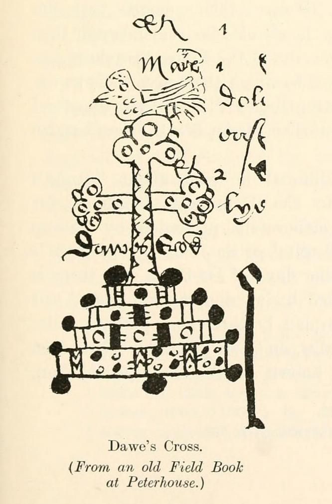
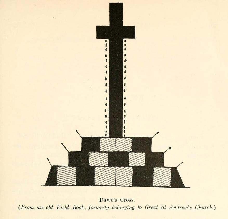
This is one of several medieval stone crosses in Cambridge that were destroyed several centuries ago. This particular one was erected on a three-stepped stone base at the old crossroads where, today, the modern A1307 of Regent Street meets the A603 Lensfield Road. It was described in an old Field Book of 1575 as standing being beside an old poplar tree, long gone. Mr H.P. Stokes (1915) gave us a short account of the site, telling:
“In describing the lane called “Deepway” between the London Road and the Hadstock Way and known as “King’s Lane” from the latter road to Hinton Way, mention was made of a Cross (called Dawe’s Cross) which stood at what is now known as Hyde Park Corner. Dawe’s Cross is often mentioned in ancient deeds, and in an old Field Book, which formerly belonged to the vestry of the Church of St Andrew the Great, there was a most interesting representation of it. This is here reproduced…from a copy in the celebrated Bowtell MSS.”
The cross stood along one of Alfred Watkins’ (1932) “archaic tracks”, or leys, in this area—although he wasn’t aware of its existence.
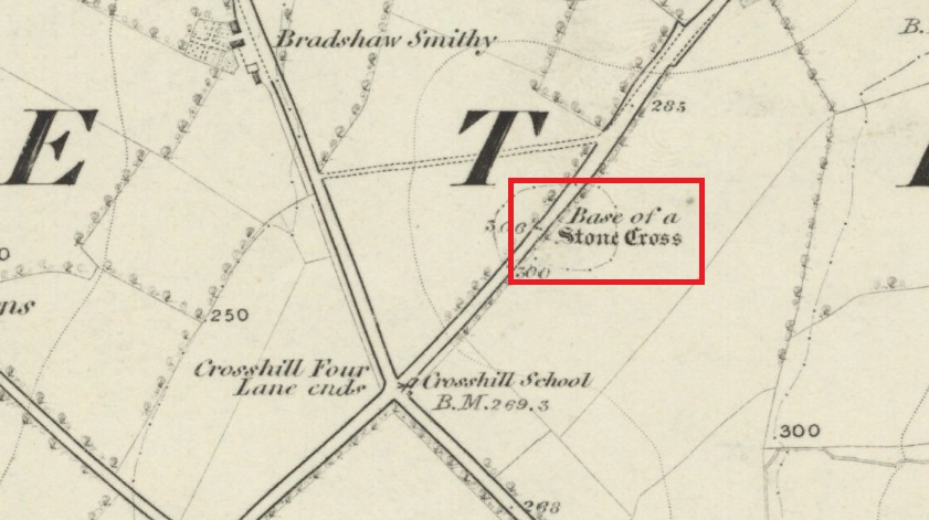
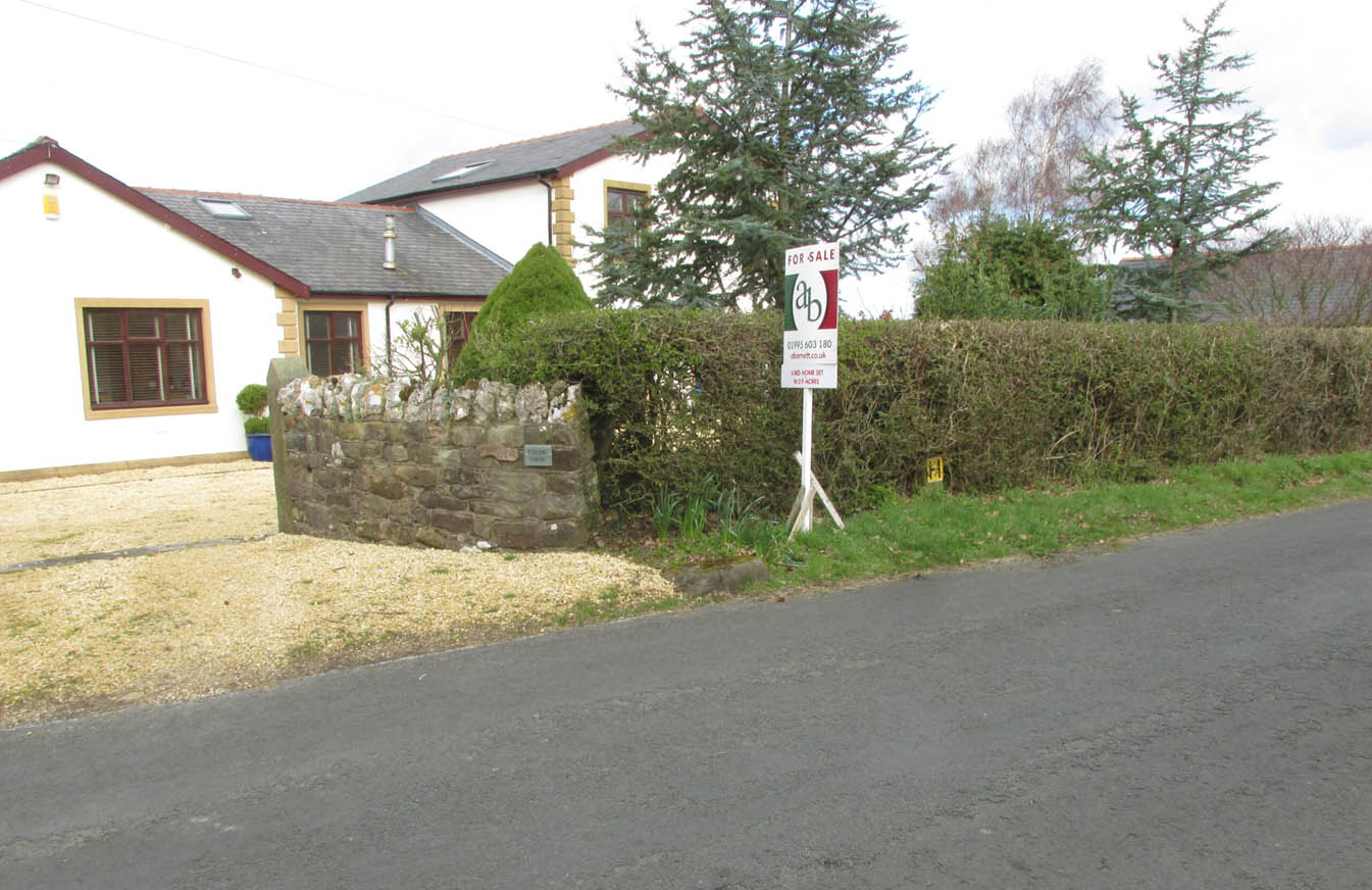
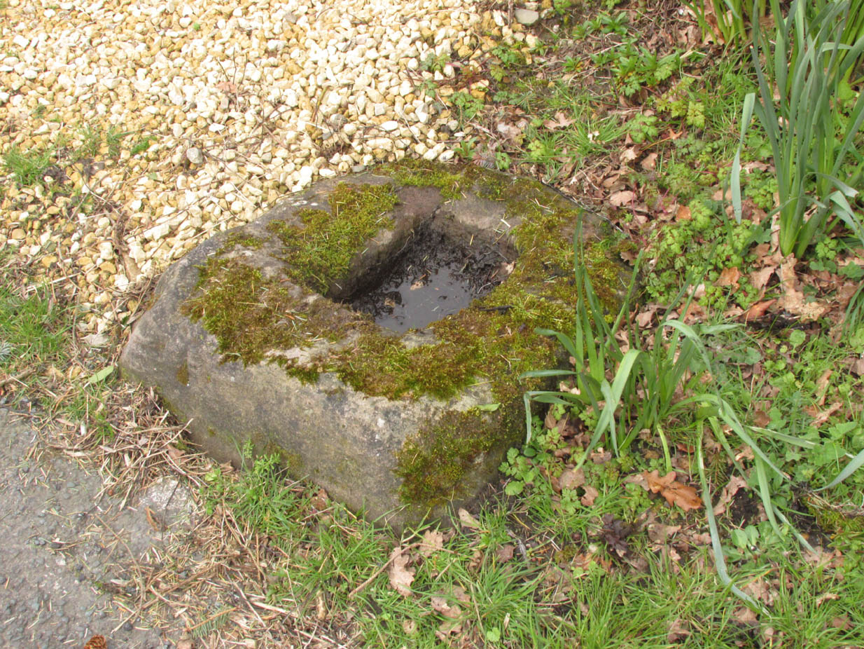
Follow Long Lane northwards from Scorton, over the crossroads at Crosshill Four Lane Ends, and the cross base will be found at the road edge immediately to the right of the driveway of ‘Sandalwood’ on the left hand side of the road.
Archaeology & History
Described in the Historic Buildings listing citation as:
“Cross base, probably mediaeval. A sandstone boulder, roughly rectangular, with rectangular socket.”
Cross base at the roadside‘A sandstone boulder, roughly rectangular’
The base of one of the numerous mediaeval wayside crosses that once adorned this part of Lancashire. So what happened to the cross? It’s possible that it was wilfully destroyed in the early nineteenth century as we have a likely culprit in the person of the Reverend Richard ‘Cross Smasher’ Wilkinson (c.1791 – 1823), Curate of Whitechapel, who took it upon himself to destroy the symbol of his religion wheresoever he could find it.
Immediately to the north west of the Cross is Cross Hill. The cross itself was probably a waymarker on the road over Harrisend Fell from Oakenclough, and Bradshaw may be the name of the locality, there being a Bradshaw Bridge just outside Street to the north west, while the 1846 6-inch OS map records a ‘Bradshaw Smithy’ on the same road.
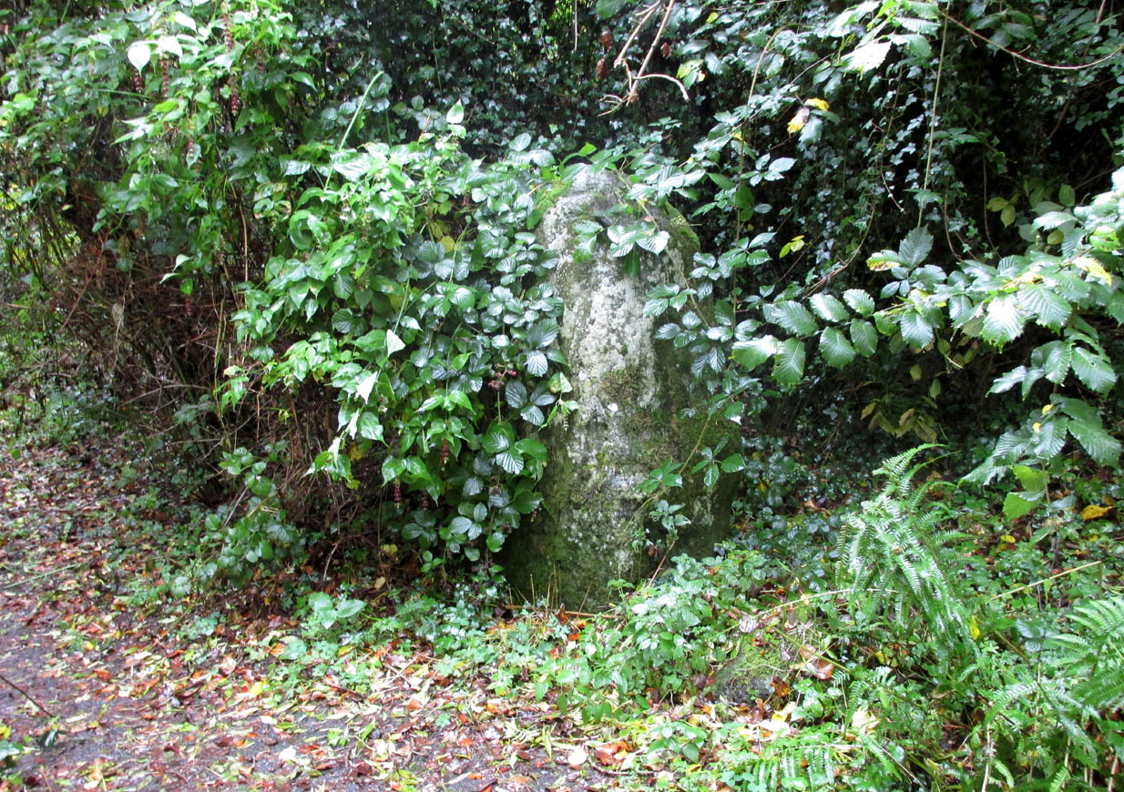
Along the main A913 Perth Road that runs round the northern edge of Abernethy village, as you approach the village from the western side, go right at the mini-roundabout up the Main Street into the village. However, just where this roundabout is, there’s a footpath into the trees known as the Castlelaw. Walk up here, keeping to the left-side of the burn (don’t cross over onto the right-hand side!) and after about 200 yards or so, keep your eyes peeled for a large upright stone, almost overgrown in dark vegetation on your left.
Archaeology & History
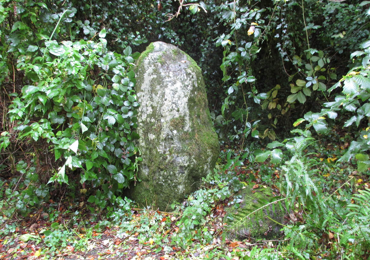
An intriguing standing stone in a most unusual position: a small wooded glen with a steep slope on its immediate eastern side, very enclosed. It’s quite a big thing too, standing some six-feet high with the usual worn rounded crown, typical of olde stones.
The olde stone, unmasked
In the very brief account of this site by Hallyburton & Brown (2000) they describe this “previously unrecorded /lost standing stone and possible ruinous stone circle.” This is also echoed in Canmore’s description. A standing stone we certainly have, but in several visits here there was no evidence of any stone circle either side of the burn. It was suggested that the “circle” may once have been atop of the slope immediately above this stone, but again there is no evidence at all to suggest this and old maps show nothing. I’m extremely doubtful of any megalithic ring here (I’d love to be wrong though).
References:
Hallyburton, I. & Brown, R., “Abernethy Den (Abernethy Parish),” in Discovery & Excavation Scotland, New Series – volume 1, 2000.
To find this stone take the A91 to Gateside and turn into Station Road. Follow to the end, then turn right. 200 yards on there is a parking spot for the Bunnet Stane, and a track to follow. As you go up this track towards the Bunnet, approximately 280 yards on is this beauty.
Archaeology & History
At over 6ft high, this previously unrecorded standing stone has quite a presence on this slight incline. It’s hard to tell the true height as he is set in a grassy bank with a drystane wall behind. It has obviously been used as a gatepost at some time in the past, but there’s no hint of being moved for that purpose. There are many ancient relics in this area and there used to be a stone circle across the road and behind Nether Urquhart Farm, along with several burial cairns. I reckon there is a lot more to be found, and we fully intend to go back there.
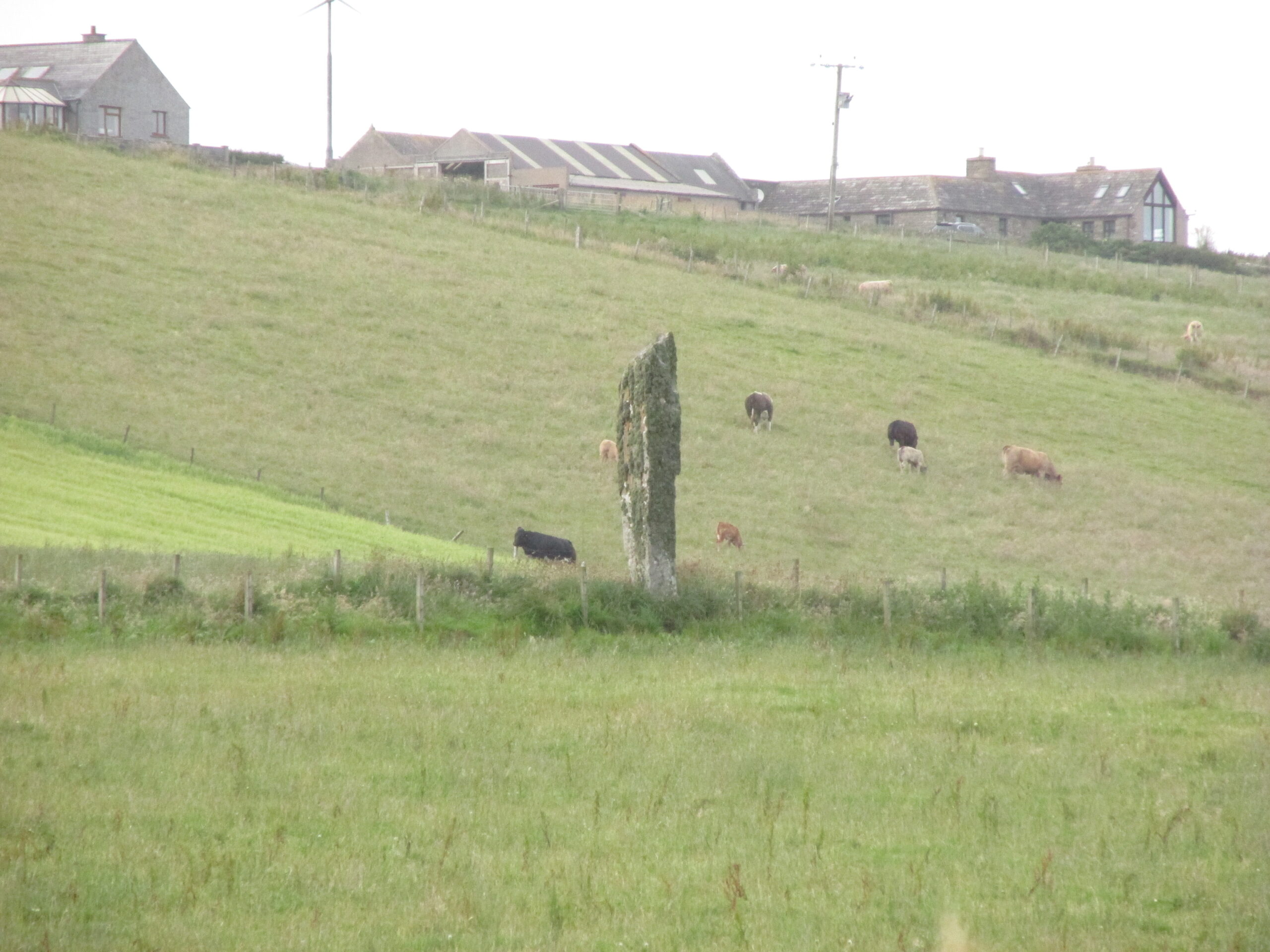
Travelling south on the A961, take the first road left past St Margaret’s Hope, and follow it over the cross roads, and down the hill towards the sea, and it’s visible on the left hand side. You can’t miss it! It’s accessed by a narrow pathway which has been partly ditched – be careful!
Archaeology & History
View from the SEView from the track – SW
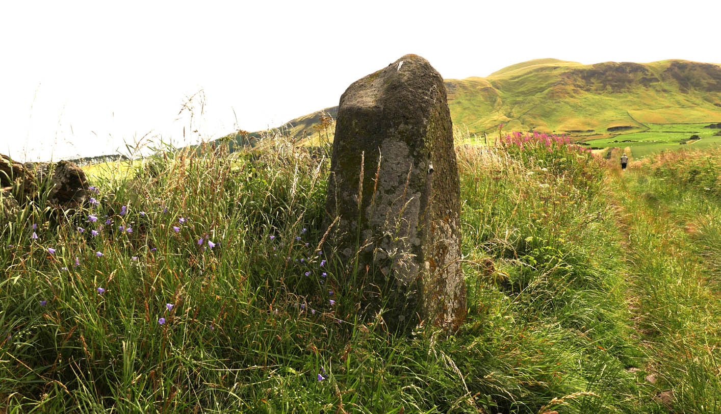
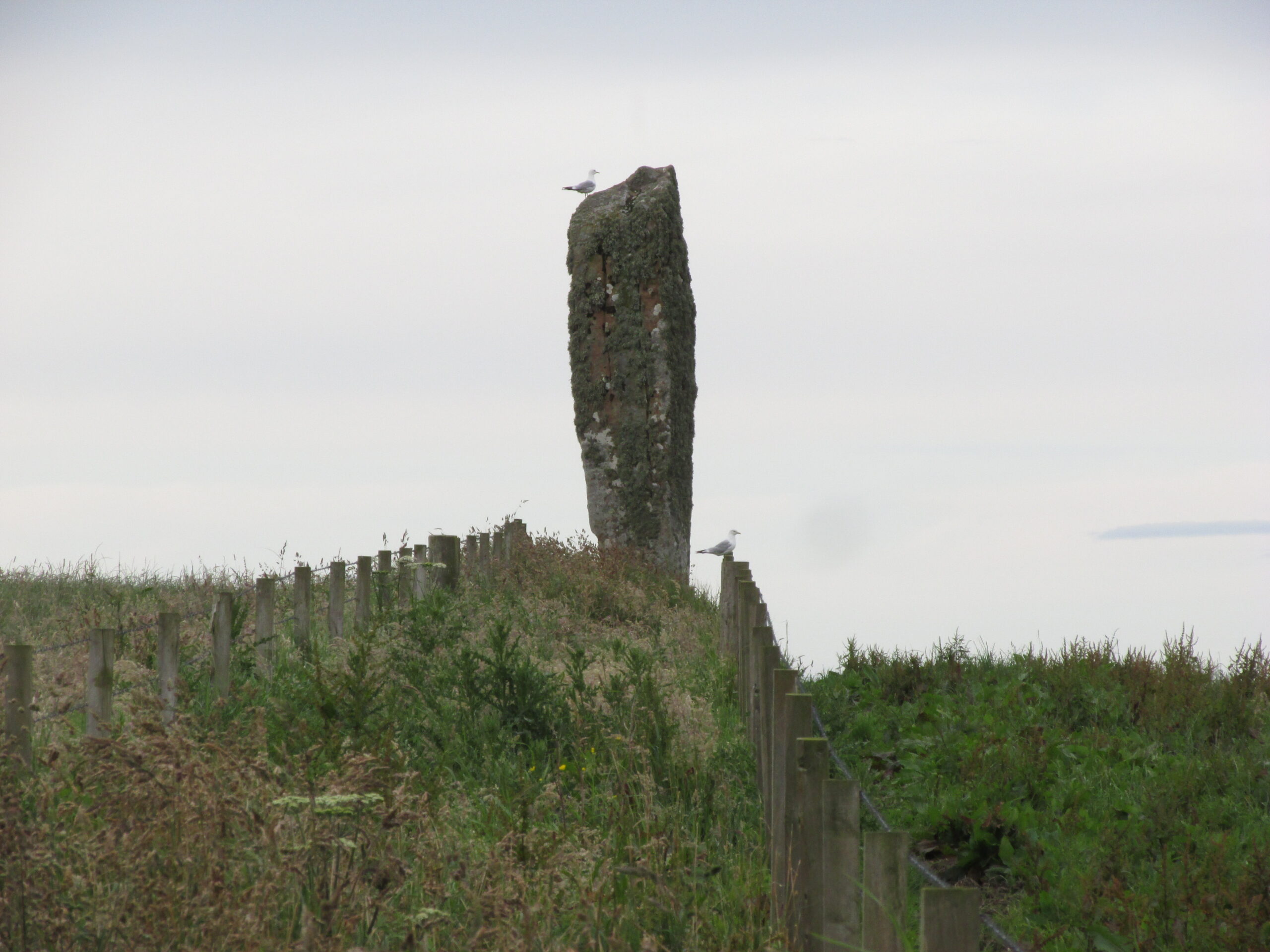
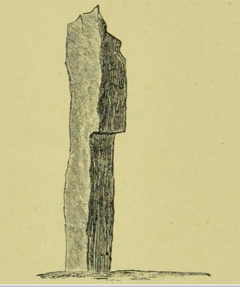
One of the less well known but most impressive of the Orkney standing stones, and seemingly one of the least visited. On my visit in July 2019, it was clear no one had walked the path for several months. The Royal Commission Inventory describes it as being, “14′ – 14′ 6″ high with some packing at the base. At 3′ above ground level, it is 2′ 6″ wide and 18″ thick, thickening to 21-22″ as it rises.”
It has a distinctly top-heavy look, and although invisible from the west above the brow of the hill, it can be clearly seen from the sea.
George Low visited the stone on May 11th 1774, saying:
‘In this beautiful hollow, in a cornfield, saw a large erected stone about 16 feet above ground, probably monumental, tho’ tradition is silent about it, and by digging nothing was found that could certainly prove this’.
Described by local historian George Barry (1748 – 1805):
George Low’s 1774 drawing
‘To the north (of South Ronaldsay), – at no great distance, is a most beautiful vale, with the ocean on one side, and gently declining hills on the other; which, for the production of every sort of beneficial crop, is far superior to any other part of the island. In the middle of this pleasant spot, on the brow of a hill, is a monumental stone, sixteen feet high, which, like many others through the country, bears no marks of human art, in carving, figures, or inscription. The whole delightful dale is known by the name of Paplay’ .
If you’re in the islands, this impressive stone is certainly worth a detour!
References:
Barry, Dr George, History of the Orkney Islands, Longman,Hurst,Bell & Orme: London 1808.
Low, George, A Tour Through the Islands of Orkney and Schetland…collected in 1774, William Peace & Son: Kirkwall 1874.
Royal Commission Ancient & Historical Monuments, Scotland, Inventory of the Ancient Monuments of Orkney and Shetland, HMSO 1946.
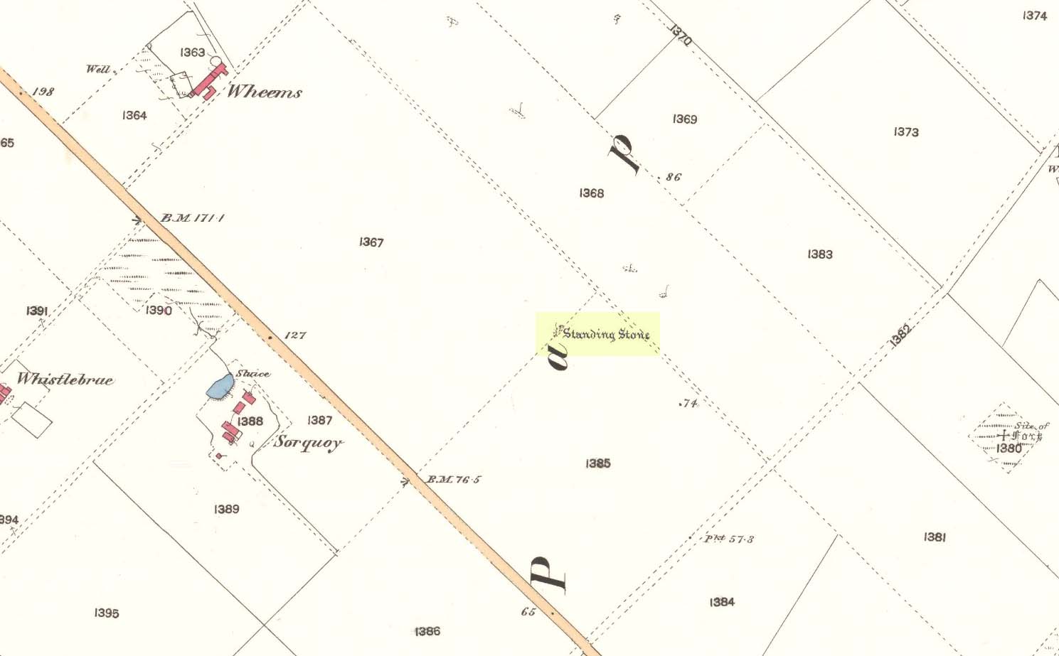
Acknowledgements: Big thanks for use of the 1st edition OS-map for this site profile, Reproduced with the kind permission of the National Library of Scotland.
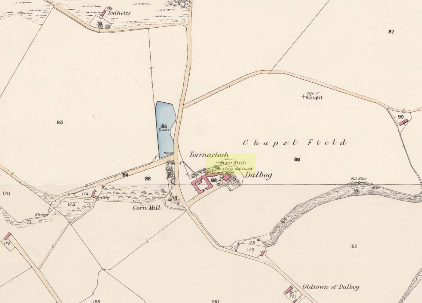
When the Ordnance Survey lads visited this area in 1860, they stood upon this small knoll that was known as Torrnacloch – or the Knoll of the Stone. They were informed that a ring of stones had stood here, but had been destroyed about 1840, apparently by a local farmer. The stones were described as being about 3 feet high. They subsequently added it on the earliest OS-map of the area, but also made note that a cist was found within the site. The circle was included and classed as a stone circle in Aubrey Burl’s (2000) magnum opus, but had previously been classed as a cairn with “a kerb of large boulders” by the Royal Commission doods. (1983) They based their assessment on the appearance of some of the stones found on a gravel mound behind the farm which had apparently been removed from the circle when it was destroyed. Andrew Jervise (1853) gave us the following account:
“The Chapelry of Dalbog was on the east side of the parish, due west of Neudos. The time of its suppression is unknown; and though no vestige of any house remains, the site of the place of worship is still called the “chapel kirk shed” by old people, and, in the memory of an aged informant, a fine well and hamlet of houses graced the spot. This field adjoins the hillock of Turnacloch, or “the knoll of stones,” which was probably so named, from being topped in old times by a so-called Druidical circle, the last of the boulders of which were only removed in 1840. Some of them decorate a gravel mound behind the farm house; and, on levelling the knoll on which they stood, a small sepulchral chamber was discovered, about four feet below the surface. The sides, ends, and bottom, were built of round ordinary sized whinstones, cemented with clay, and the top composed of large rude flags. It was situate on the sunny side of the knoll, within the range of the circle; but was so filled with gravel, that although carefully searched, no relics were found.”
The emphasis on this place being where a stone circle stood is highlighted in the place-name Torrnacloch, or the hillock of stones/boulders. Both Dorwood (2001) and Will (1963), each telling it to be where a stone circle stood; with Will adding that parts of the circle “may yet be seen in rear of the steading of Dalbog.” If this had been where a cairn existed, some variant on the word carn would have been here.
References:
Burl, Aubrey, The Stone Circles of Britain, Ireland and Brittany, Yale University Press 2000.
Dorwood, David, The Glens of Angus, Pinkfoot: Balgavies 2001.
Jervise, Anrew, The History and Traditions of the Land of the Lindsays in Angus and Mearns, Sutherland & Knox: Edinburgh 1853.
MacLaren, A. et al, The Archaeological Sites and Monuments of Central Angus, RCAHMS: Edinburgh 1983.
Will, C.P., Place Names of Northeast Angus, Herald: Arbroath 1963.
Acknowledgements: Big thanks for use of the 1st edition OS-map in this site profile, Reproduced with the kind permission of the National Library of Scotland.