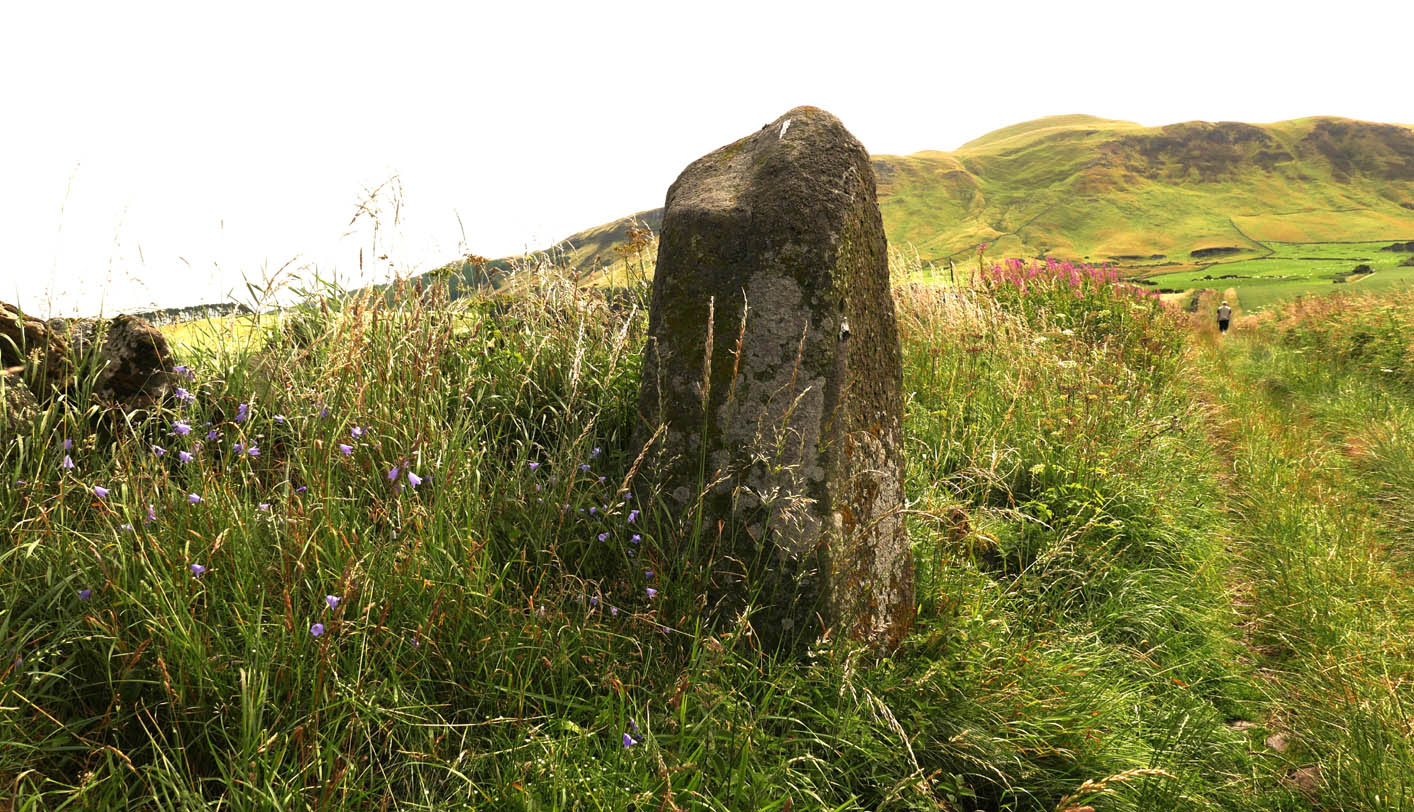
To find this stone take the A91 to Gateside and turn into Station Road. Follow to the end, then turn right. 200 yards on there is a parking spot for the Bunnet Stane, and a track to follow. As you go up this track towards the Bunnet, approximately 280 yards on is this beauty.
Archaeology & History
At over 6ft high, this previously unrecorded standing stone has quite a presence on this slight incline. It’s hard to tell the true height as he is set in a grassy bank with a drystane wall behind. It has obviously been used as a gatepost at some time in the past, but there’s no hint of being moved for that purpose. There are many ancient relics in this area and there used to be a stone circle across the road and behind Nether Urquhart Farm, along with several burial cairns. I reckon there is a lot more to be found, and we fully intend to go back there.
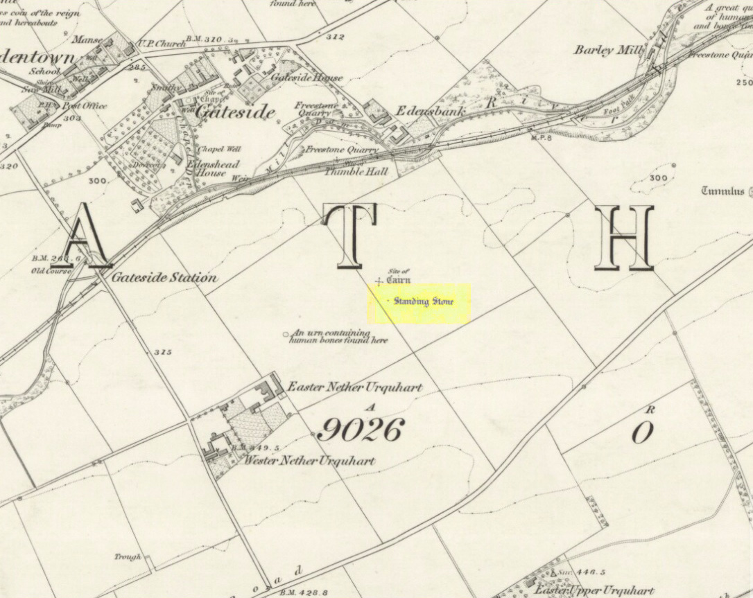
Turn off the A91 road at Gateside and go down Station Road, crossing the old railway line at the bottom. From here, cross the fields to your left and the site of the circle will be found in the field to the north east of Easter Nether Urquhart Farm.
Archaeology & History
Marked on the 1856 6″ Ordnance Survey map as a “standing stone,” earlier references record this as being the survivor of a stone circle. Not listed in Aubrey Burl’s (2000) magnum opus, this circle was on the edge of the site of a major battle between the Romans and the native defenders, and large amounts of human remains have been found in the vicinity. Referring to an adjacent cairn, Lieutenant-Colonel Miller wrote in 1829:
“A very fine Druid’s Temple stood on the south side of it, consisting of seven very large stones. All these were blasted with powder and removed, except half the one of them, which still marks the spot.”
Of the same cairn, the Reverend Andrew Small wrote in 1823:
“This cairn stood a little north of an ancient Druids’ temple, only one stone now remaining, out of ten of which it formerly consisted.”
The Ordnance Survey Name Book for 1853-55 imparts the following:
“This standing Stone is about 13 chains on the South side of the River Eden opposite Edensbank but whether it is the remains of a druid’s temple or set up to mark something relative to the battle contested between the Romans and Caledonians according to Messrs. Miller & Small, it is difficult to determine. It stands about 4 feet 10 inches high and its sides are about 2 feet broad…many of the inhabitants consider it to have been a druid’s temple…”
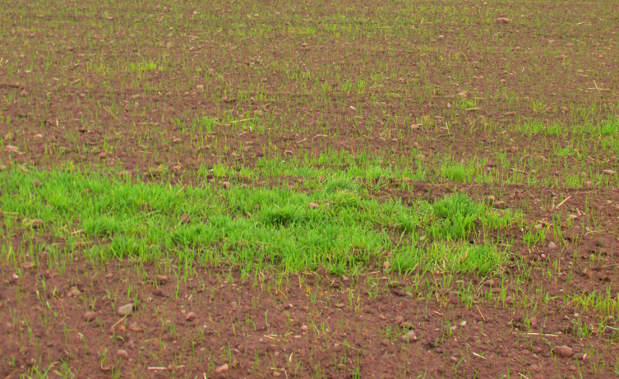
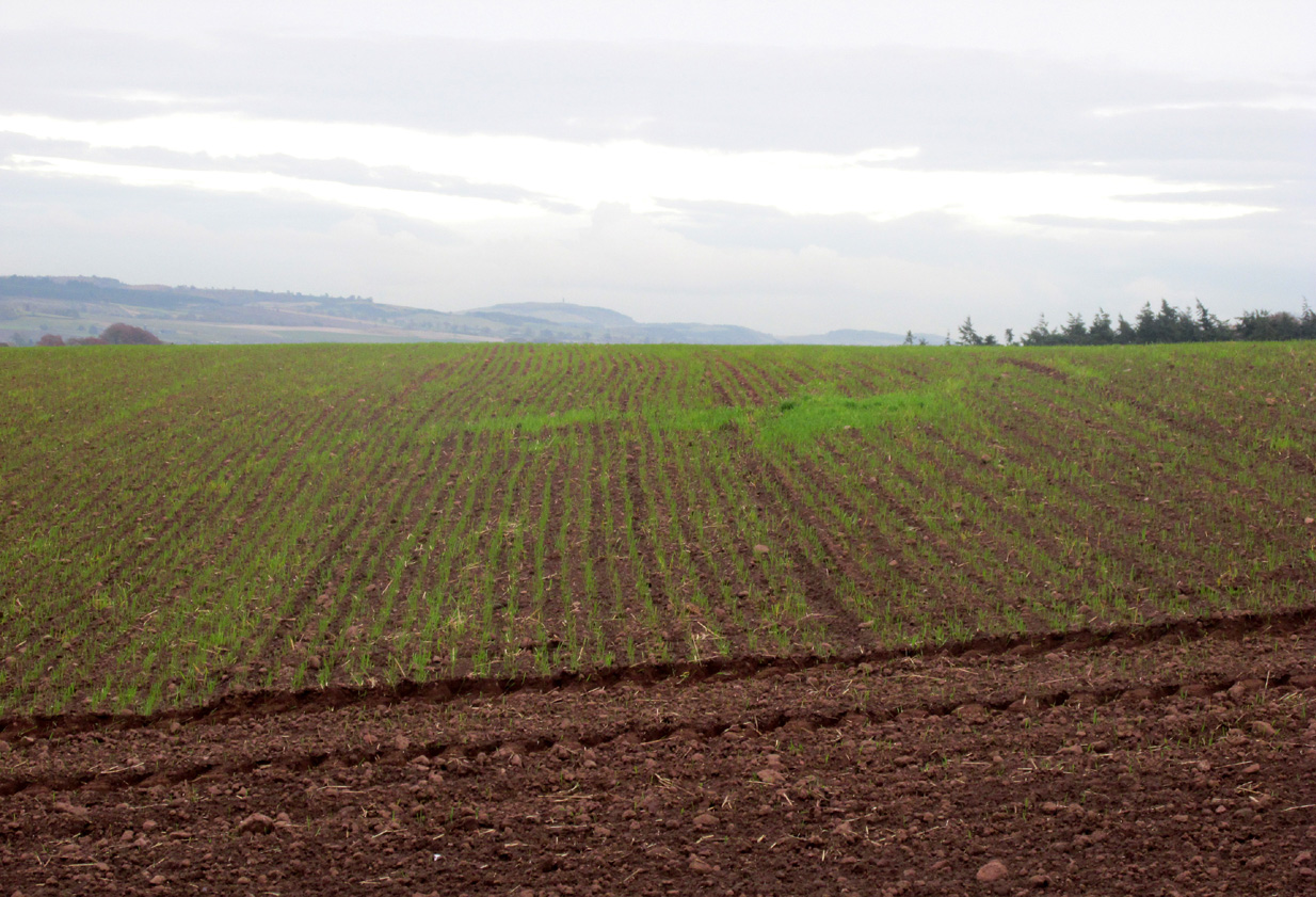
A close-up of the sitePosition of the circle, evident in crop-growth
J.S. Baird of Nether Urquhart informed an Ordnance Survey officer in 1956 that the remaining stone was broken up and removed around 1952, and measured 5 feet high with a girth of 9 feet at the base. Near the top of the stone, on the south-side were two slight cracks weathered to suggest a simple incised cross.
On the day of my November field-visit the winter barley was sprouting and it was interesting to see how much better it was growing at the place where the remaining stone had stood.
Burl, Aubrey, The Stone Circles of Britain, Ireland and Brittany, Yale University Press 2000.
Miller, Lieutenant-Colonel, “An Inquiry respecting the site of the battle of Mons Grampius (Read 27th April 1829 and 25th January 1830),” in Proceedings of the Society of Antiquaries of Scotland, Volume IV, 1857.
Small, Reverend Andrew, Interesting Roman Antiquities Recently Discovered in Fife Ascertaining the site of the Great Battle fought betwixt Agricola and Galgacus, John Anderson & Co: Edinburgh 1823.
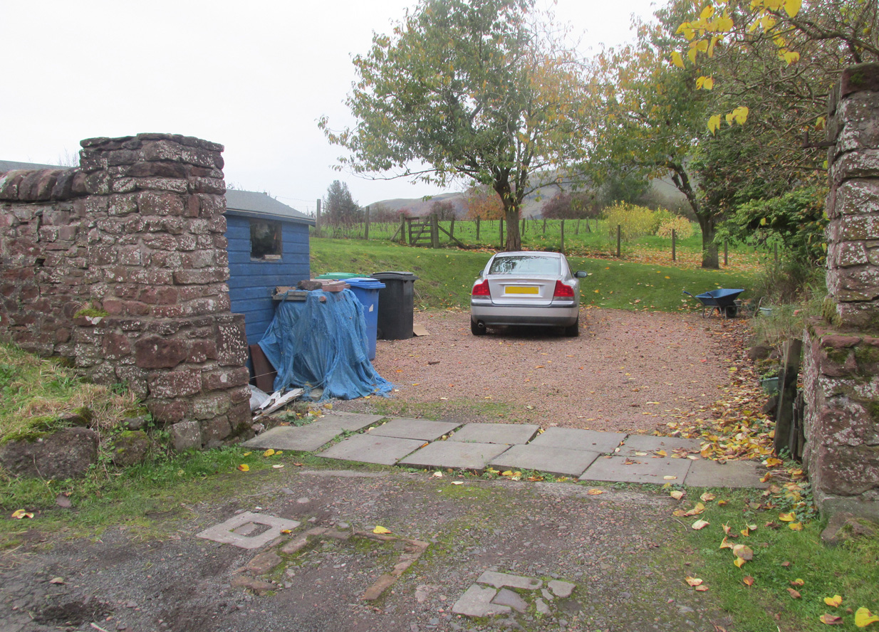
Travelling from Milnathort on the A91, in Gateside village, turn right down Old Town, and after the left bend in the road, park up. Access to the field where the Well is situated is through the gate on land next to the easternmost house on the south side of Old Town. Ask at the house first. Walk down the field towards the Chapel Den burn, and the ruins of the Well will be seen next to the burn just before the line of bushes that cross the field.
Archaeology and History
In his brief description of Strathmiglo parish, Hew Scott (1925) wrote:
“At Gateside…there was a chapel of St Mary, with Our Lady’s Well beside it.”
It was described in the nineteenth century Ordnance Survey Name Books by an informant:
“A small spring well on the north side of the Mill Dam. Supposed to have been used in the days of Popery as holy water and for other purposes when the building supposed to have been St Mary’s Chapel was in existence.”
Another informant wrote:
“…a Romish chapel is supposed to have been erected in this village and is borne out in a great measure by names of objects adjoining, namely Chapel Den, Chapel Well.”
And further:
“According to Doctor Small…it is stated, ‘The ancient name of this village called in old papers the Chapelton of the Virgin, changing its name at the Reformation.'”
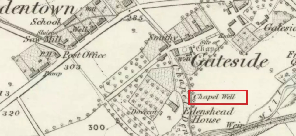
Shown as Chapel Well in 1856
This latter statement would seem to imply that the part of modern-day Gateside south of the main road (the north side was known as ‘Edentown’) was a pilgrimage centre of the Cult of the Virgin. The chapel was erected by the monks of Balmerino to whom it was known as ‘Sanct Mary’s of Dungaitsyde’. It was highlighted as the Chapel Well on the 1856 OS-map.
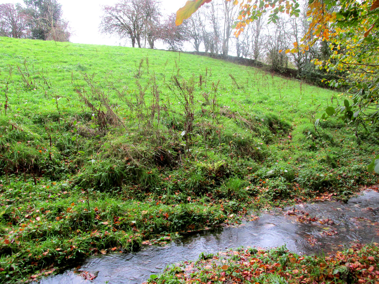
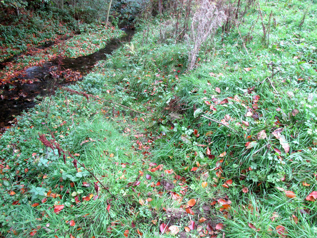
The ruined Well from across the burnNature takes back the ruined masonry at this magickal spot
While no trace of the chapel remains, the Well is evidenced by some low ruins of what had once been a red sandstone structure, and it was just possible to make out in the field the line of the pilgrim’s path to the well. But what a lovely serene place next to the burn! An ideal spot to meditate or daydream… The spring no longer flows, and a manhole in the field probably indicates the water supply has been diverted, perhaps to serve the long since closed Gateside Distillery?
References:
Scott, Hew, Fasti Ecclesiae Scoticanae – Volume V, Oliver & Boyd: Edinburgh 1925.