Wayside cross: OS Reference – SD 52474 51414
Also Known as :
- Historic England Grade II Listed Building No. 1163927
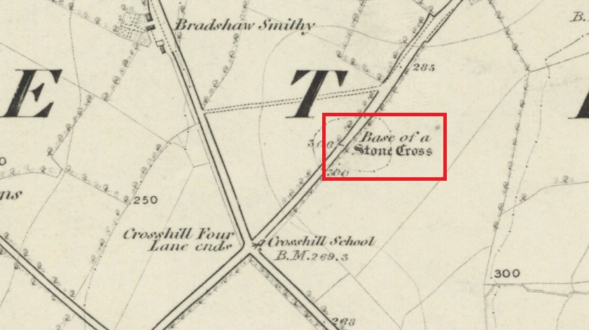
Follow Long Lane northwards from Scorton, over the crossroads at Crosshill Four Lane Ends, and the cross base will be found at the road edge immediately to the right of the driveway of ‘Sandalwood’ on the left hand side of the road.
Archaeology & History
Described in the Historic Buildings listing citation as:
“Cross base, probably mediaeval. A sandstone boulder, roughly rectangular, with rectangular socket.”

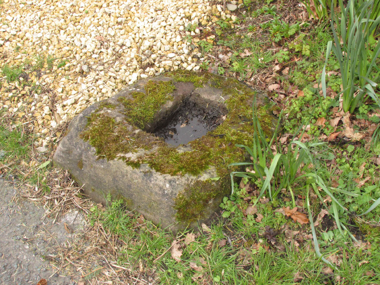
The base of one of the numerous mediaeval wayside crosses that once adorned this part of Lancashire. So what happened to the cross? It’s possible that it was wilfully destroyed in the early nineteenth century as we have a likely culprit in the person of the Reverend Richard ‘Cross Smasher’ Wilkinson (c.1791 – 1823), Curate of Whitechapel, who took it upon himself to destroy the symbol of his religion wheresoever he could find it.
Immediately to the north west of the Cross is Cross Hill. The cross itself was probably a waymarker on the road over Harrisend Fell from Oakenclough, and Bradshaw may be the name of the locality, there being a Bradshaw Bridge just outside Street to the north west, while the 1846 6-inch OS map records a ‘Bradshaw Smithy’ on the same road.
Note: More has been recorded about Wilkinson in the profile of Stump Cross, near Goosnargh.
Reference:
- Taylor, Henry, The Ancient Crosses and Holy Wells of Lancashire, Sherratt and Hughes, Manchester, 1906
© Paul T Hornby, The Northern Antiquarian, 2020