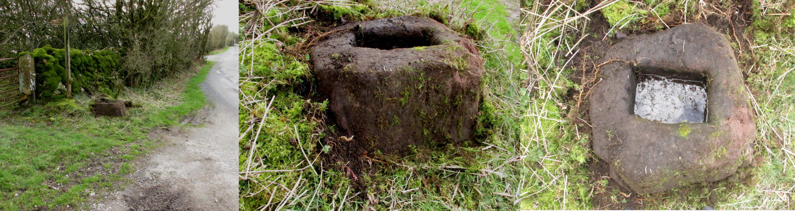
Take the Town End Road out of Slaidburn, and turn right along Wood House Lane at the Gold Hill junction, continue past the entrance to Myttons Farm on the right, and the cross base will be seen on the right next to the gateway just before the sharp left hand bend.
Archaeology & History
Only the socketed red sandstone base of this mediaeval wayside cross survives. It is unusual in that it has carved decorative fluted corners. It has an OS bench mark carved on its north face and has suffered recent damage to one of the corners, probably from a grass cutter. It is beside the old salt road over Salter Fell from Bowland into Lancashire and the Lune Valley.
There is one surviving complete cross and a cross base at the other end of the salt road, south of Hornby. Wood House Lane was known as Cross Lane when the 1850 6″ OS map was printed. It is a Grade II listed building and is described in the citation as:
“Base of cross, probably medieval, sandstone. Of irregular shape with a rectangular socket in the top.”
Three views of the Cross base
Folklore
The farmer of the adjoining land told me that a local elder had told him that the smashed remains of the Cross had been built into an adjoining dry stone wall, which, if this is correct, may indicate
destruction of the Cross at a comparatively late date.
Note: the monument is in the historic county of the West Riding of Yorkshire.
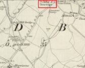
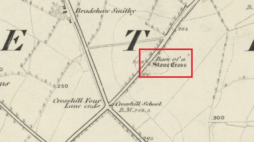
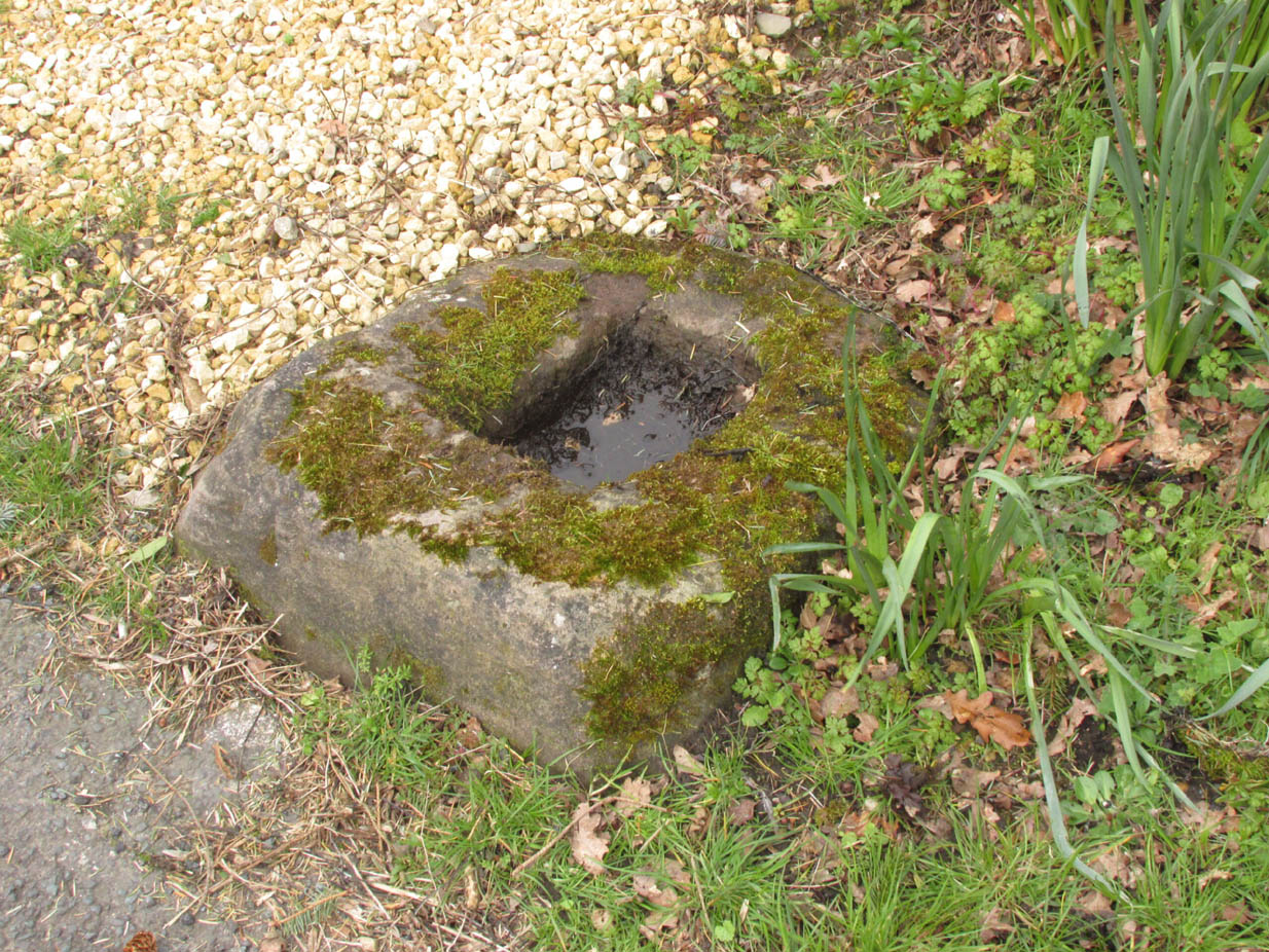
Follow Long Lane northwards from Scorton, over the crossroads at Crosshill Four Lane Ends, and the cross base will be found at the road edge immediately to the right of the driveway of ‘Sandalwood’ on the left hand side of the road.
Archaeology & History
Described in the Historic Buildings listing citation as:
“Cross base, probably mediaeval. A sandstone boulder, roughly rectangular, with rectangular socket.”
Cross base at the roadside‘A sandstone boulder, roughly rectangular’
The base of one of the numerous mediaeval wayside crosses that once adorned this part of Lancashire. So what happened to the cross? It’s possible that it was wilfully destroyed in the early nineteenth century as we have a likely culprit in the person of the Reverend Richard ‘Cross Smasher’ Wilkinson (c.1791 – 1823), Curate of Whitechapel, who took it upon himself to destroy the symbol of his religion wheresoever he could find it.
Immediately to the north west of the Cross is Cross Hill. The cross itself was probably a waymarker on the road over Harrisend Fell from Oakenclough, and Bradshaw may be the name of the locality, there being a Bradshaw Bridge just outside Street to the north west, while the 1846 6-inch OS map records a ‘Bradshaw Smithy’ on the same road.
John Dixon took a bunch of us on a pleasant amble here via the Fair Oak Circle site. From Fair Oak, go round the back of the farm and past the small cluster of hidden cottages, then bear right down the dirt-track and up the slope, then cross the field in front of you, going over the stile, following the footpath round the eastern edge of the slightly limestone New Laund Hill, and down again, thru the gate. From here, head diagonally across the field 150 yards towards the fencing at the woodland edge. Over the fence, into the trees, head halfway down the steep-ish slope and keep your eyes peeled for the rocky outcrop nearly halfway down. Alternatively, an easier way here is apparently from the Inn at Whitewell. Go across the river via the stepping stones (or wade!) and follow the footpath uphill towards a farm, where you’ll find a large steel gate on the left that leads into the woods. Here there are 2 paths: follow the higher of the two until it starts bearing to the right. Once here, look up the hill to the right you’ll see the rock outcrop. The caves are there!
Archaeology & History
Smaller Fairy Hole
There are at least 3 caves here, close to each other along the edge of the small footpath a few yards apart. The small rounded entrance of the northernmost one (photo, right) is reported by English Heritage to have had no human remains found therein, but further investigation is required here. The main cave however is where intriguing prehistoric finds were located. It appears that the entrance was deliberately built-up and blocked by stone walling a few yards inwards, giving the remains found therein a state of protection and sanctity. Writer and historian John Dixon (2004) tells what was in the cave:
“In 1946, an excavation was carried out on the site by the archaeologist Reginald C. Musson. In front of the larger cave is a flat platform on which evidence of Bronze Age daily life was found. This included animal bones, a pebble pounder (used to extract marrow from bones) and shards of a food vessel.
“All that survived of this tripartite collared urn was a large rim-collar shard, two fragments displaying neck/shoulder/body elements and five smaller pieces, probably from the base of the body. This is the only collared urn to have been found in a cave in Lancashire. Its tripartite Pennine form assigns it to an early Bronze Age date.”
The main Fairy HolePlan of cave chamber (after J.Dixon 2004)
The artificial walled entrance may not merely have been an ingredient giving sanctity to the place, but this could well have been a site for ritual shamanic practices, including prolonged rites of passage and death rituals (authentic ones, not the modern pagan nonsense). The ‘ritual death’ elements are highly probable here for, as John Michell (1975) told, caverns and crevasses are “most responsive to the necromancer’s invocation”. It’s geomancy, spirit association and the archaeological finds therein are strongly suggestive of this usage. (Eliade 1989, 1995; Maringer 1960, etc) Bearing this in mind, it is of some concern regarding the individual who thought it wise to spray-paint his name against the wall of the cave entrance (see photo); for many are those even in these days of shallow minds who fall prey to the car-crashes and creeping madness brought upon themselves by desecrating ancestral sites of ritual magick. It would be intriguing to keep a prolonged eye on the ‘Forsh’ who painted his ego in this cave of dead spirits…
Folklore
Not surprisingly, the little people hold legend here. Jessica Lofthouse (1946) found tales of these ancient peoples in several places close by, but at the Fairy Caves specifically,
“everyone knew that these little caves in the limestone at Whitewell were the homes of the little folk.”
…And in relation to the ingredient mentioned above, about ritual use of the cave in ancient times: are there any serious ritual magickians who’ve spent time working in this cave, overnight or longer, and who can let us know of their encounters here? (long shot, I know – but it’s worth asking, considering the probable use of the place) Or perhaps spontaneous encounters of other people here…
From the village of Chipping, go along Talbot Street until it meets Green Lane and there, on the left, there runs a country lane roughly northwards. Go along this and after about 1½ mile, watch out for the track of Quiet Lane on your left. Go all the way up this track for nearly 1½ mile, till you reach its end. Diagonally across to your right, note the stile into the field. Go over this and, some 50 yards across the field, look to your south where the field rises to its small peak. This is the site.
Archaeology & History
Fair Oak enclosure
Although little can be seen of this site at ground level, aerial photography in the 1980s identified a large circular earthwork at Fair Oak Farm. The circle has a surrounding ditch and bank enclosing a raised circular mound of approximately 100m in diameter. It is thought that the feature may represent Bronze/Iron Age settlement in the area, and may possibly be a village site. The site requires further survey.
Aerial photography has identified a number of possible settlement sites in the area between Dinkling Green and the River Hodder at Whitewell and in the area around Whitmore below Totridge Fell. The largest being that at Fair Oak.
Folklore
Jessica Lofthouse (1946) told of a number of places close by that were said by local people to be inhabited by faerie folk — Fair Oak itself being no exception. Hinting of earlier heathen gatherings, she wrote:
“As for the farm of Fair Oak, where we take the path to Dinkling Green, nearby was the fairy oak, the scene of so much midsummer revelry.”
Stone Circle (destroyed): OS Grid Reference – SD 822 387
Also Known as:
Pendle Stone Circle
Archaeology & History
A destroyed site mentioned by several local historians. It was positioned at the valley bottom just below Faughs, a hundred yards west of Lower Moss End, where today it is simply overgrown meadows with the typical excess of Juncus reeds. As local investigator John Dixon said, there are “five stones shown on (the 1848) map just west of Spen Brook Mill.”
In the 1970s, one writer described there being several uprights still in place, but a visit here a few weeks back (though I – unusually! – didn’t walk all through the boggy grounds and explore as extensively as I normally would) found nothing.
Its geomancy, however, was striking. The unnamed hill immediately to the north of its position (at the southern end of the legendary Pendle Hill, a coupla hundred yards west of St. Mary’s church) rises up like a great singular ‘pap’ which, to our old ancestors, was animated with female spirit. I sat here in the pouring rain looking up at this hill and its presence in front of the circle was striking.
…And so I walked onto the top of the said hill. Thereupon I found a small gathering of rocks, not unlike a cairn-spoil. When I enquired with a few local people about the age or nature of this rock-pile, I found no-one seemed aware of its existence. Weird. But from the hill itself, the view is excellent – and the small valley amidst which the old circle once stood teems with legends and myth: of cailleachs, ghosts, wells, witches and more. An excellent spot!
The local writer, historian and walker, John Dixon, sent us the following notes of his exploration here:
“Clifford Byrne, the late Nelson antiquarian, mentions in his book ‘Newchurch in Pendle’ the site of a former stone circle that stood just below Faughs, a hundred yards west of Lower Moss End. Today no large stones of any kind can be located anywhere near this spot, the stones having been removed or broken up some time in the past. However, the 1848 6” OS map records the number and position of these stones as being in two parallel lines about a hundred yards apart lined up west to east. The northerly line (SD 823 389) consists of 3 stones, the southerly (SD 823 387) of 4 stones, all being some 3 yards apart.
“It appears that we have an avenue of stones, not a circle. But why their position in the landscape at the headwaters of two valley streams? The Sabden Brook starts its journey westward to meet with the Calder from the stones, while Dimpenley Clough rises from the stones running east to join Pendle Water – could this be of any significance?”
References:
Byrne, Clifford, Newchurch-in-Pendle: Folklore, Fact, Fancy, Legends and Traditions, Marsden Antiquarians: Nelson 1982.