If you’re coming south out of Dunfermline, or north towards Dunfermline, make sure you go along the A823 Queensferry Road. About a mile short of the town centre you need to turn east along the B916 Aberdour Road. Nearly 1 mile along here, shortly past the Tesco supermarket, turn left along Tweeddale Drive. About 50 yards down here, turn left again along Walls Place. About 120 yards along you’ll find a small ginnel/path that runs between two rows of flats on the council estate. Walk down here for a short distance and the stone will magically appear on your right.
Archaeology & History
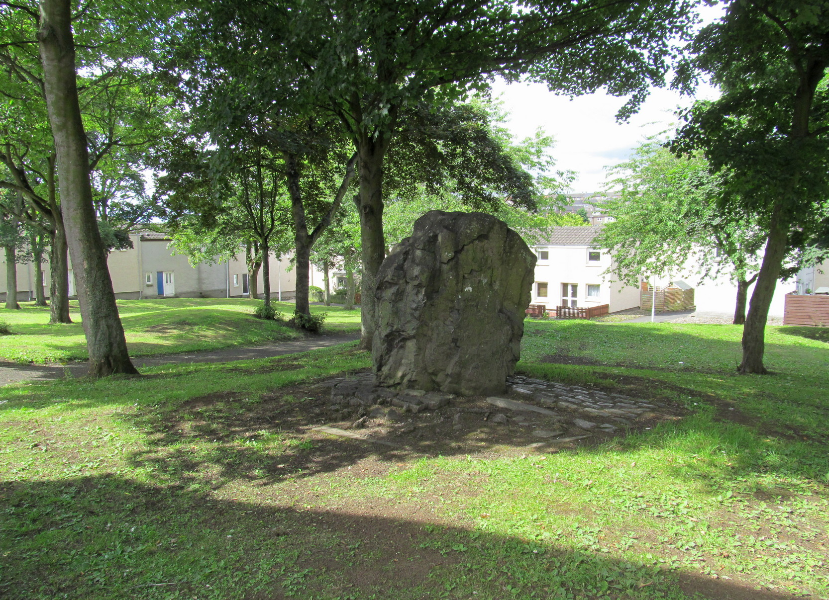
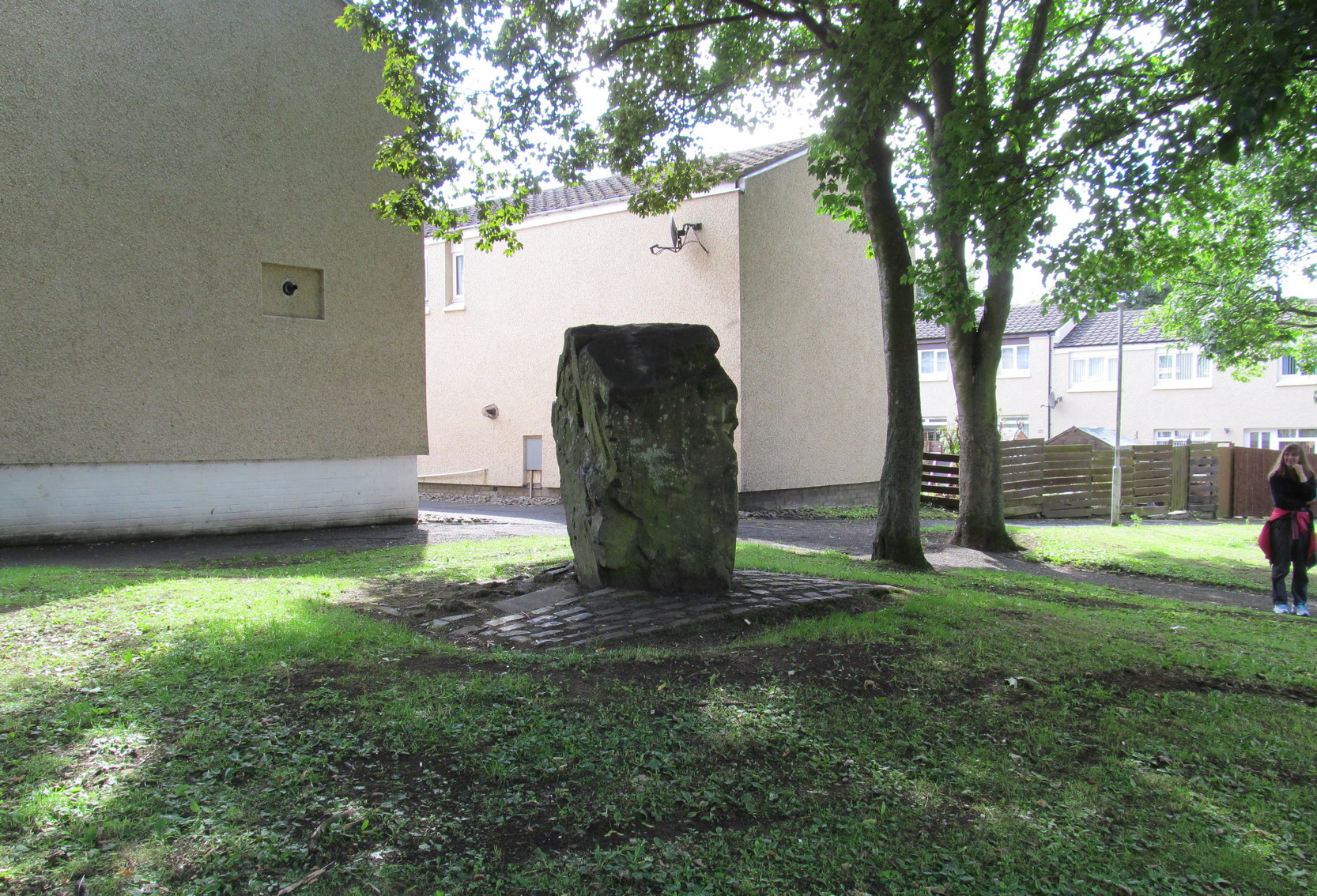
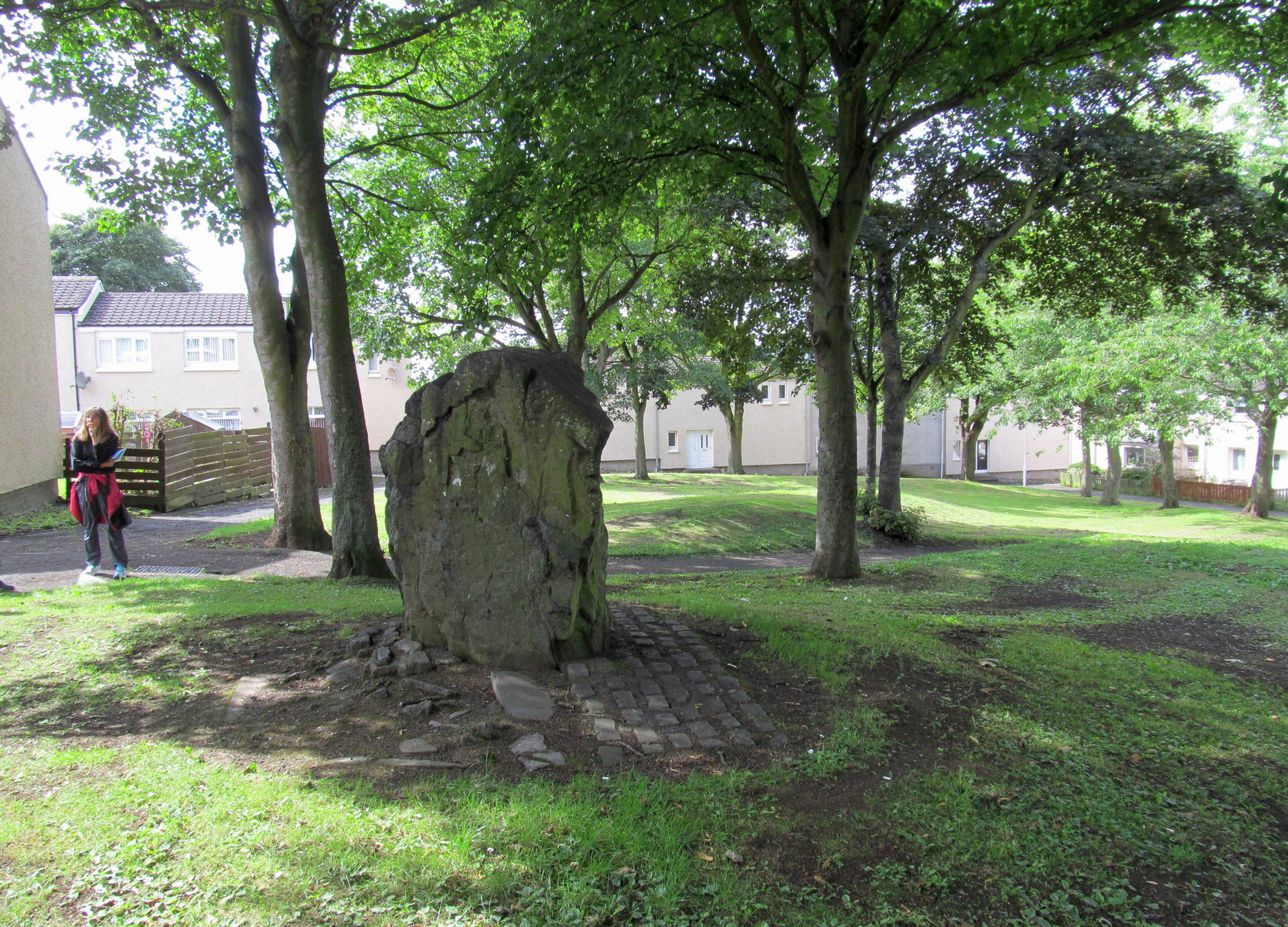
This is a bit of an odd one! Early accounts of the monolith are scarce and, on my first visit here, I was somewhat sceptical of its prehistoric provenance. To be honest, I still am. The erosion levels on the stone give the impression that it’s a much more recent erection (calm down… 😉 ), almost as if it was only quarried a century or two ago. Anyhow, that aside. It’s a nice bulky standing stone, nearly six feet tall and erected where the rising land levels out in the middle of the modern housing estate. It was included in the Royal Commission (1933) survey, who said of it:
Pitcorthie, looking SWPitcorthie, looking West
“About 200 yards north of the farm of Easter Pitcorthie, in a field adjoining the north side of the roadway from Dunfermline to Burntisland, stands a roughly rectangular block of sandstone, which presents the appearance of having been subjected to fire or heat. It is set with its main axis due north and south on the crest of slightly rising ground… There are some indications that it has been packed at the base, but what appears to be packing may be no more than a collection of loose stones which have accumulated round it during the years in which the surrounding area has been cultivated. It rises to a height of 5 feet 10 inches above the ground level, but shows no traces of any sculpturings. At 3 feet from the ground its girth if 11 feet 10 inches.”
It would be good if there were other prehistoric remains close by that could erode my slight scepticism about its age, but I think the nearest other Bronze Age monument is the cairn more than half-a-mile to the south-east.
References:
Royal Commission on the Ancient & Historical Monuments, Scotland, Inventory of Monuments and Constructions in the Counties of Fife, Kinross and Clackmannan, HMSO: Edinburgh 1933.
Swarbrick, Olaf, A Gazetteer of Prehistoric Standing Stones in Great Britain, BAR: Oxford 2012.
This little-known iron-bearing spring takes some finding! It’s all but lost beneath a mass of invasive rhododendrons that cover the slopes here (it needs to be severely cut back) and will only be found by the truly adventurous amongst you. In notes of this site by Ordnance Survey in 1854, they told that “there was formerly a fountain to protect the Spring, but the fountain has been allowed to go to ruin” and I could see no remnants here on my visit.
In a detailed and lengthy analysis of the spring water that was done by W. Robertson in 1829, the principal minerals in it were found to be iron, magnesia and lime, but the spring was said to have no medicinal renown locally.
Acknowledgements:Huge thanks for use of the Ordnance Survey map in this site profile, reproduced with the kind permission of the National Library of Scotland.
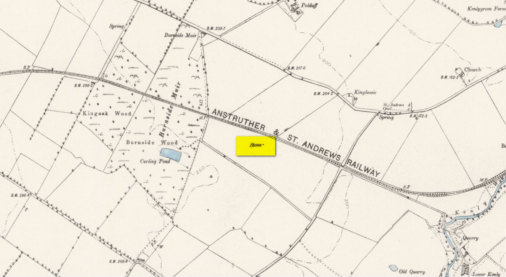
Take the A917 road southeast out of St Andrews, heading towards the hamlet of Boarhills about 4 miles away. However, about a half-mile before you get to Boarhills, keep your eyes peeled for a small minor road on your right, signposted to Dunino, 3 miles. Go along here for about 350 yards where you’ll reach a track cutting across the road. Walk up the gently sloping field here on your right and you’ll see, 400 yards from the road whence you’ve parked, a tall thin upright stone standing alone…
Archaeology & History
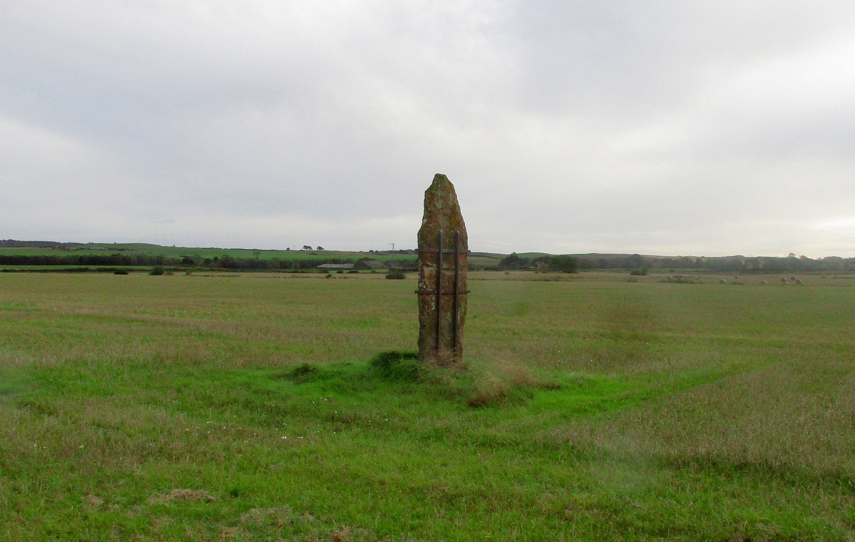
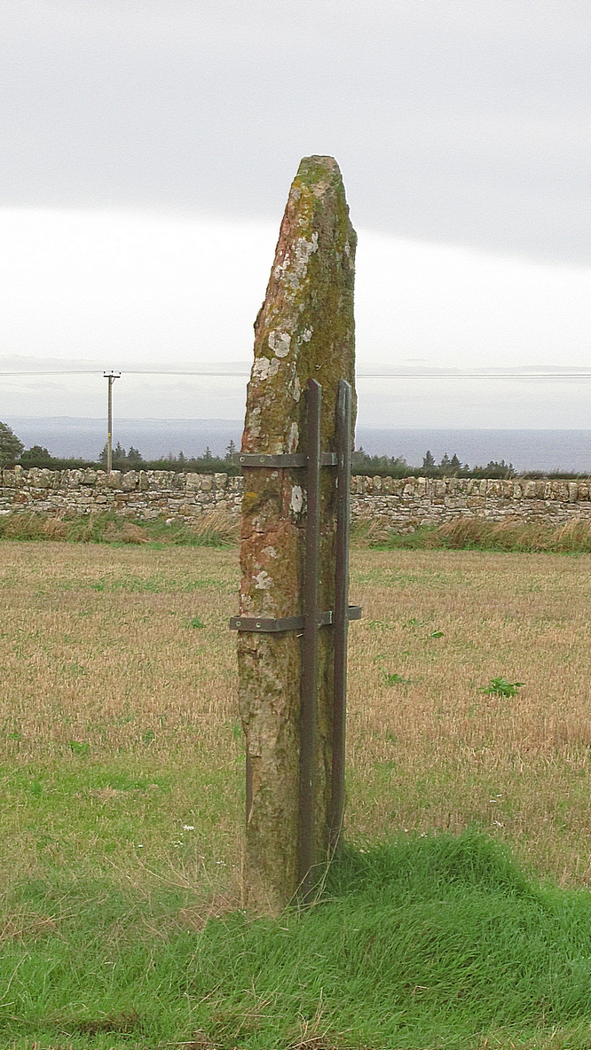
Highlighted on the 1893 and 1896 OS-maps (as merely a “Stone”), this tall and incredibly skinny standing stone has seen better days. After many-a-millenia, the god of storms cut the stone to the ground not too many years ago, leaving it broken in the middle o’ the field where once it stood. Thankfully however, local folk ensured that it was eventually resurrected and fixed into position once more, albeit in a somewhat ugly cage—or corset as Mr Hornby called it!
The Royal Commission (1933) lads checked the stone out for inclusion in one of their damn good surveys, they told us the following:
“About midway between the farms of Polduff and Peekie, and on the south side of the Anstruther and St Andrews Railway, 200 feet above sea level, there is a fine block of red sandstone, which rises to a height of just over 9 above ground. It averages 4¼ inches in thickness and measures 2 feet 4 inches wide across the broad faces. The stone has been set up with the major axis north-east and south-west and has been well packed round the base with smaller stones.”
Interestingly—to me anyhow—when the monolith was recently stood back in its upright position, the archaeo’s found a spring of water beneath it. Many dowsers (and I don’t mean the ones who fallaciously reckon they’re finding ‘energy lines’ all over the place) have found the crossing of underwater streams and water sources to be a common feature beneath megalithic sites.
Folklore
In Richard Batchelor’s (1997) short work on the ancient sites of this area, he calls attention to what a Mr N. Dow thought was a ley-line passing from the cairn on top of Kellie Hill 4¾ miles (7.64km) away, northeast to the Peekie Stone, and which Mr Batchelor points out is close to the major lunar standstill.
References:
Batchelor, Richard A., Origin of St Andrews, Shieling: St Andrews 1997.
Royal Commission on the Ancient & Historical Monuments, Scotland, Inventory of Monuments and Constructions in the Counties of Fife, Kinross and Clackmannan, HMSO: Edinburgh 1933.
Acknowledgements: Huge thanks to Paul Hornby for use of his photos.
This little-known tree, said to have been planted in memory of Sir William Wallace’s mother, is long gone. The only notice I can find of it, is in the writings of Pete Chalmers (1844), who told us:
“There is a tradition that the mother of Sir William Wallace was buried in the old church-yard, on the spot where the present thorn-tree is growing, but how she came to die here history seems to be silent. It is added that her son wished afterwards to erect a monument to her memory, but being in pursuit of, or flight from, his enemies, had not time to do so, and, as a substitute, planted a thorn-tree.”
Much of what constitutes “the old church-yard” has long been covered by the new cathedral and so the precise location of this old thorn tree will never be known, which is a pity, for as Chalmers told,
“This tree had reached an immense size, and was seemingly of great age about 60 years ago (c.1784), when it was blown down by a storm and replaced by a stem from the old tree, now advanced to a considerable height and magnitude—the only living and remaining memorial of the filial affection of the Scottish Patriot.”
Due to a lack of writings from the viewpoint of Wallace and the Scottish people, we are only left with fragments regarding the why’s and wherefores of Wallace and his mum being in Dunfermline. Chalmers thought,
“Possibly the occasion of their being here is referred to in the following lines of the poet, an account of a pretended pilgrimage of Wallace and his mother to St Margaret’s shrine.”
He then cites a more assured account of Sir William being in the area, saying:
“It is recorded of this renowned person, that, on one occasion, in 1808, when he was surrounded by his enemies, he came from the fastnesses where he had taken refuge, to the Forest of Dunfermline, and by the mediation of his friends, proposed, on certain conditions, yiz., the assurance of safety in life, limbs, sad estate, to surrender himself. These conditions were indignantly refused by the haughty and infuriated Edward (the Tosser), who cursed him, by the fiend, for a traitor, and even set a price on his head. On hearing this, the Patriot ” betook himself again to the wilds and mountains, and subsisted on plunder.”
In Pete Chalmers (1844) historical brief about the long lost chapel and hospital of St. Leonard (and its associated holy well), mention is made of this long forgotten relic. Its memory was preserved in an old place-name, and was to be found less than half-a-mile southeast of St. Leonard’s sites on,
“the high part of the road, about a quarter of a mile to the south, the Spital-Crosshead, (named) from a pillar which, according to tradition, was erected there, decorated on the top by a St Andrew’s Cross, and removed probably towards the close of the 16th or 17th century.”
The cross is believed to have been erected in the 15th century.
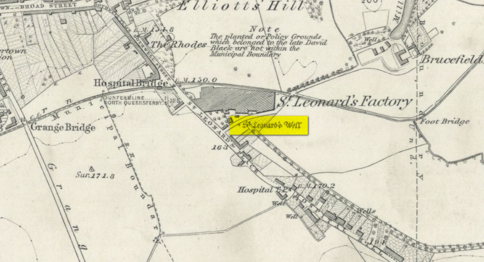
Holy Well (destroyed): OS Grid Reference – NT 0976 8666
Archaeology & History
Site shown on 1856 map
There seems to be very little information available about this holy well, lost long ago and now hidden beneath the foundations of a food superstore! It was found in close association with both a chapel and a hospital in St. Leonard’s name—both of which have also been destroyed. The water from here may have been used by the monks for patients in the hospital, but that’s purely speculative. St. Leonard was known to be connected with lepers, which may be something that the waters here were used to treat. But again, I’m speculating…
When the Ordnance Survey lads came here in 1853, the waters were still running and they subsequently added it to their map a few years later. The site was still visible when Erskine Beveridge (1917) came here, telling us briefly that,
“St. Leonard’s Well still remains a little to the south-east, and, though now built up, is recognisable.”
But a few years later it had been destroyed and its position was shown on the updated OS-map of 1926 as “Site of.” The old well had gone…
Simpkins, John Ewart, Examples of Printed Folk-lore Concerning Fife, with some Notes on Clackmannan and Kinross-shires, Sidgwick & Jackson: London 1914.
Walker, J. Russel, “‘Holy Wells’ in Scotland,” in Proceedings of the Society of Antiquaries of Scotland, vol.17 (New Series, volume 5), 1883.
Acknowledgements: Big thanks for use of the 1st edition OS-map in this site profile, Reproduced with the kind permission of the National Library of Scotland.
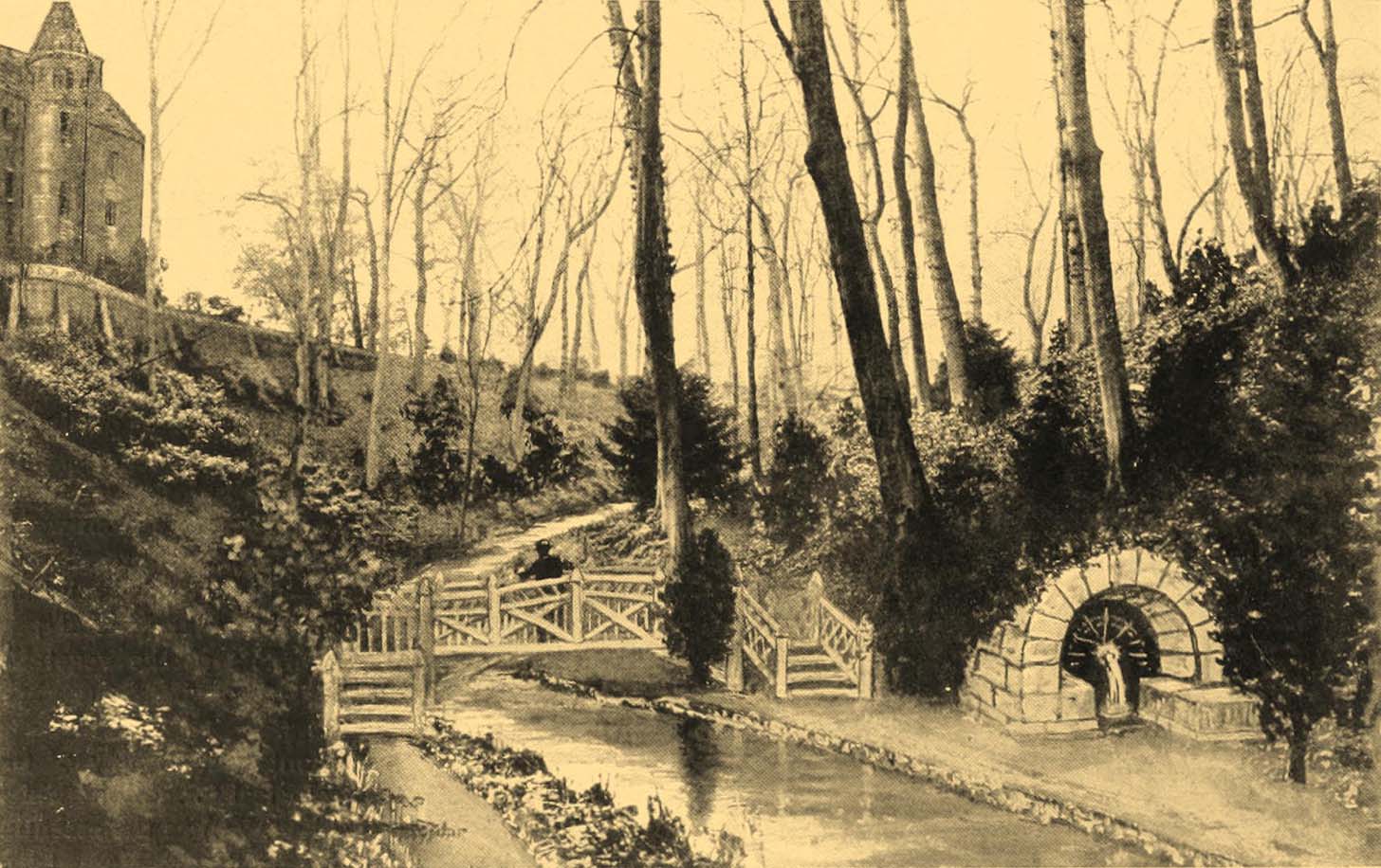
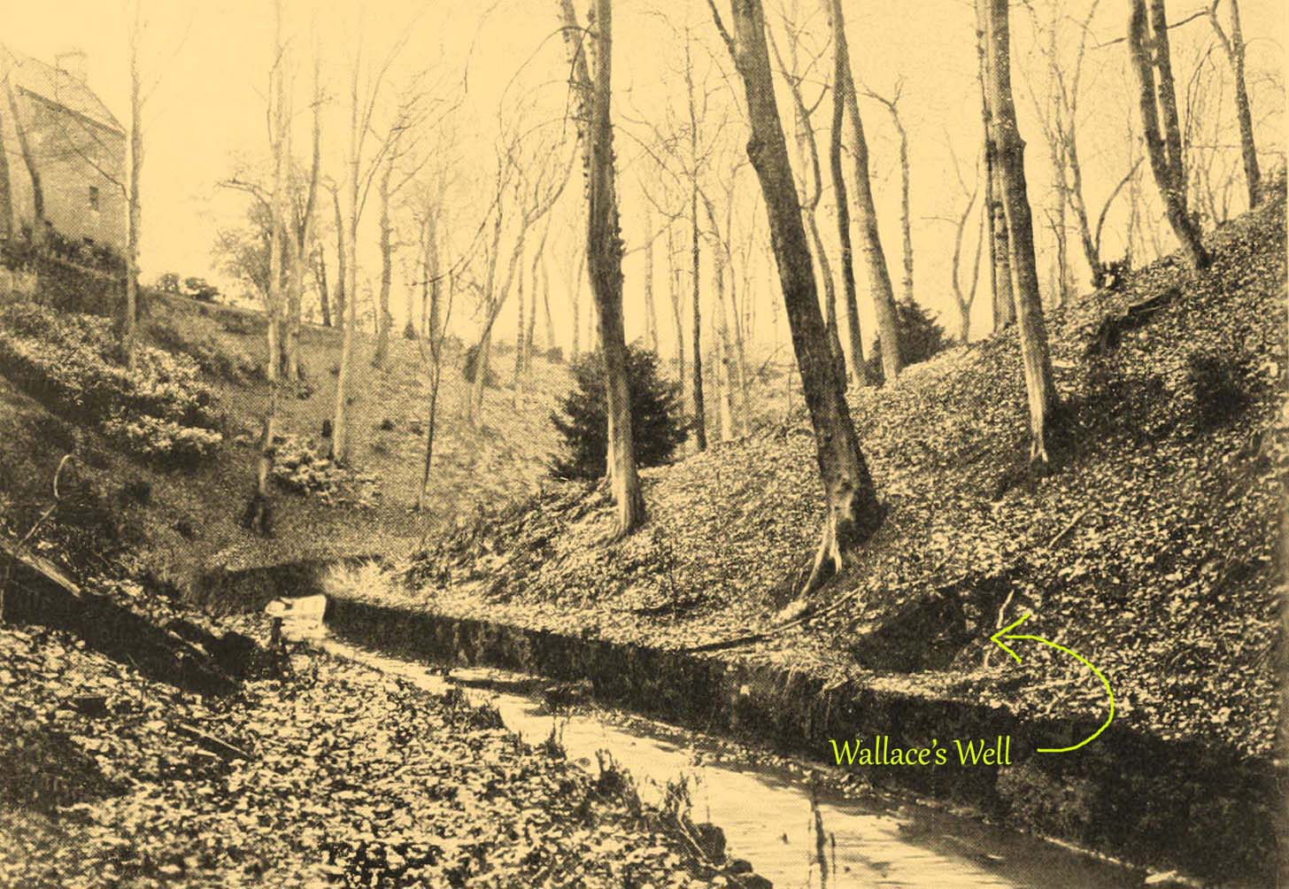
The ruins of this little-known site, dedicated to the legendary Sir William Wallace, can still be seen in the form of an overgrown stone ruin just off the footpath that runs through the Pittencrieff Glen out of the town centre. In earlier times the waters were evidently of some repute, as a Council meeting in May 1773 reported with some disdain the closure of the waters by a Mr Chalmers:
“This Day the Council considering that the entry from the Town to the Well of Spaw is now shut up by Mr. Chalmers, which was a particular privilege to ye Inhabitants of the Burgh, Do hereby appoint the Provost to intimate to Mr. Chalmers that the Town will not give up that privilege, and to require him to oppen an entry thereto as formerly.”
We don’t know whether the miserable Mr Chalmers gave access to the well, as there seem to be no Council meeting notes telling us the outcome. My guess would be that the local people got their way, hopefully at Chalmers expense! More than 70 years later, another Mr Chalmers (1844) wrote about the well in a more respectful light:
“On the north edge of the rivulet, a little below this bridge, at the foot of the Tower Hill, there is a famous well, named the Wallace Spa, or well of Spa, which was formerly much resorted to by the inhabitants of the town for its excellent water, but which has been long since disused. It is noticed here simply on account of the traditionary antiquity of its name, Sir William Wallace, it is said, having once, in the haste of a flight, drank a little of it, out of the palm of his hand.”
In spite of there being local folklore of William Wallace, the local historian Ebeneezer Henderson (1879), in his giant work on Dunfermline, thought there was a more prosaic origin to the well’s name. He told,
“This well is still in existence, about fifty yards south of the ruins of Malcolm Canmore’s Tower — Tower Hill. The water is reported as being “very cold at all times.” The water should be analysed. The well during the period of its being used was known as the “Spaw Well,” and the ” Well of Spaw,” and, by and by an easy, natural transition, ” Wallace Spa;” and thus the name of the well has sometime been connected with that of the great Scottish hero.”
The Well after 1900pre-1900 image
By the end of the 19th century, the well had become almost buried by earth and foliage, but was subsequently brought back to life following architectural improvements of the glen around the turn of the 20th century. In Patrick Geddes’ (1904) work he gives us “before and after” portraits (attached here) showing how it had been restored. He also mentioned “its tradition of medicinal value”, but could give no further information regardings the ailments it was reputed to cure…
References:
Chalmers, Peter, Historical and Statistical Account of Dunfermline, William Blackwood: Edinburgh 1844.
Take the B936 out of Auchtermuchty, and park at the small car park for Auchtermuchty Common on your right just before Lumquhat Mill. Follow the path through the Common southwards and along the narrow strip until the Common opens out past the boundary stone. Head for the sign board on the right and when you get there turn left and march straight up the hillock and the stone is ahead of you in front of a gorse bush.
Archaeology & History
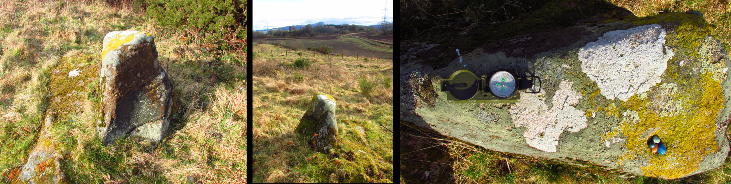
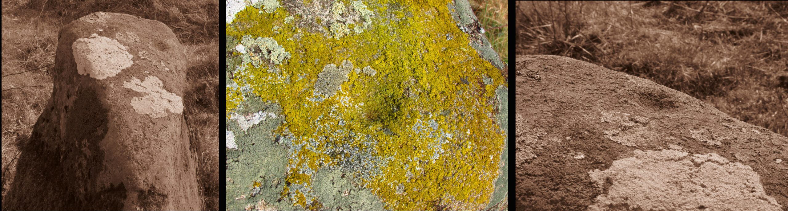
A curious little stone that I found quite by chance. It is wedge shaped in plan, bearing one large cup mark on its top surface. The cup is approximately 2″ in diameter and about ¾” deep. The raised part of the stone is about 3′ high, it is 3′ long and about 13″ wide at the blunt south end, although at ground level it is nearly 3′ wide at this end.
The stone is orientated due N-S, the south end aligning with the peak of East Lomond (a mythic hill of which at least one legend survives), while the north end points to the river port of Newburgh. It gives the impression of having been carved as a direction marker from what was a much larger stone, which, if this is the case may have originally borne more cups.
Left to Right 1.Facing North – the stone looks to have been cut down from a larger boulder. 2. The summit of East Lomond due South. 3. Aligned North – South.The cup mark.
Folklore
The first time I visited, there were three small polished coloured stones at the foot of the rock, while the second time there were four stones within the cup. A long term resident out walking his dog told me he knew of no folklore relating to the stone, but that over the last thirty years he had kept seeing offerings of stones in the cup, so the rock clearly still has some ritual significance for local heathens/pagans…
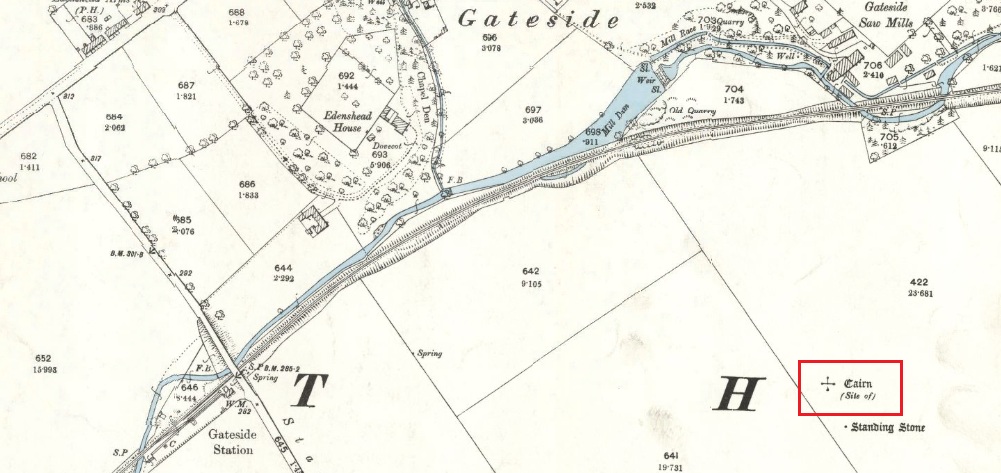
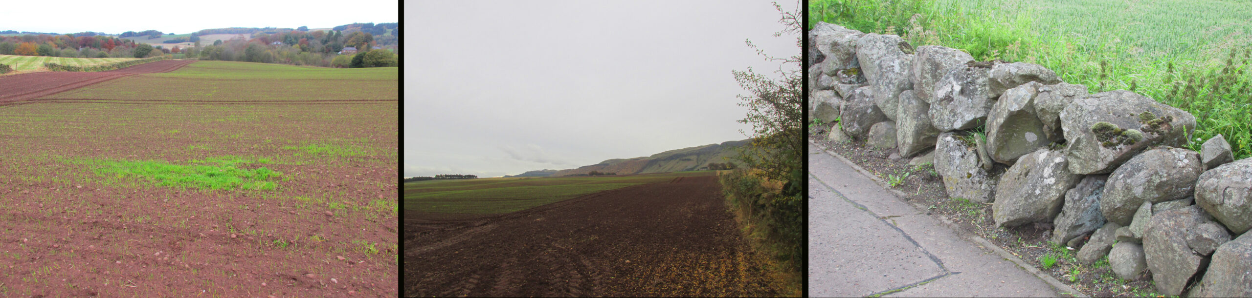
The easiest way is to turn south off the A91 at Gateside onto Station Road, and the site of the cairn is in the third field to the left over the railway bridge. I accessed the site walking along the old railway line and climbing up the embankment.
Archaeology & History
The site of the Cairn on the 1894 25 in. OS map.
In the shadow of the Lomond Hills of Fife, what was once a very large pre-historic cairn, officially described as of ‘unassigned’ period, was quarried to destruction around two hundred and twenty years ago, presumably to provide stones for dykes (stone walls), at that time of enclosures of common land and what the landowners liked to call ‘agricultural improvements’.
In the early nineteenth century, this part of the Eden Valley between Gateside and the Lomond Hills was what would now be called a ritual landscape. There were, according to Miller:
‘nearly in a line between the two Laws ( Lomond Hills) noless than eight “druidical temples” (Stone circles) close together‘
and a number of impressive burial cairns, of which Easter Nether Urquhart seems to have been the largest. There were in addition large numbers of graves containing masses of cremated of human bones. Nearly all this archaeology has been subsequently destroyed by the farmers.
Two local antiquarian writers proposed that all these human remains had been buried there following the battle of Mons Graupius between the Roman Invaders under Agricola, and the Caledonians, and went on to argue that the Eden Valley was the site of this historic defeat for the ancient Caledonians defending their homeland. Whatever and whenever the origins of the cairns and human remains, subsequent researchers disagree with these nineteenth century arguments in favour of the Eden Valley, and tend to favour a more northerly location for Mons Graupius. Nevertheless we have these two historians to thank for leaving us descriptions of the cairn.
One of the antiquarians, Rev. Andrew Small wrote in 1823:
‘The Slaughter here seems to have been so dreadful, that even after the lapse of 17 Centuries the Common tradition of the Country bears, and seems to be as fresh in the Mouths of both old and young as though the battle had been fought only a hundred years ago, – that after this battle the River Eden ran red with blood for two days…’
It seems more likely that the event remembered was part of the campaign by Roman Emperor Septimus Severus and his son Caracalla to subdue the Caledonians around 209-210 CE. Modern writer, Simon Elliott:
‘Archaeological data is now emerging to show ….. a major depopulation event, indicating something close to a genocide was committed by the Romans in the central and upper Midland Valley.’
Andrew Small describing the cairn and some of the cremation remains in 1823:
‘There was also a very large cairn laid upon these ; and the proprietor lately told me that when removing the stones, besides the ashes already mentioned, there was also a pit of pure fine sand by itself, about as fine as is usually put into sand-glasses, which he thinks had been used for regulating the fire in burning of the dead. This cairn stood a little north of an ancient Druids temple, only one stone now remaining, out of ten of which it formerly consisted ‘.
Lieutenant – Colonel, Miller writing in 1829:
‘Farther west ….a very large cairn stood, containing upwards of two thousand cart-loads of stones. Upon removing it about thirty years ago, a pit six feet long, two broad, and of the same depth, was found, quite full of burnt bones; and near it another, two feet square and two deep, full of the finest sand. An urn was also found, near the surface of the cairn, full of bones. A very fine Druid’s temple stood on the south side of it, consisting of seven very large stones…’
As the builders of the cairn didn’t have access to carts, and that the stones all had to be moved by hand, it gives an indication of the manpower needed to build the cairn, and the status of the individuals whose remains were buried there. And we have to question why a special chamber been built into the base of the cairn to hold fine sand, and what was the purpose of this sand?
Left – View of Cairn site looking north, centre of the field beyond the tractor tracks. Centre – View looking south. Right – The cairn recycled? Walling on the south side of A91 at Gateside
Folklore
While not writing specifically of the cairn, Revd. Small recounts these tales of the surrounding land, relating it to his belief that it was the site of Mons Graupius:
‘I cannot forbear to mention here, also, a singular circumstance I had from the landlord and landlady, both yet alive, — viz. that before parking or inclosing took place, they were accustomed to have folds built of feal or turf for the cattle lying in at night ; but that, when the folds happened to be in this place where the dead had been burnt, the cattle would never lie in them, but always broke through or leaped over the dyke ; that they were obliged to give a man a boll of barley extra to watch them, when they lay in this spot, which was obliged to be repeated every four or five years in rotation ; but that sometimes the man was not able to keep them in by all his endeavours, the cattle looking wild and terrified in appearance ; and sometimes it required the united efforts of all the hands that could be had to keep them in, oftentimes springing over the fold dykes close beside them, and frequently crouching and trembling as if they would have fallen down with terror, although nothing appeared visible to the visual organs either of the man or those that occasionally assisted him. However, after the discovery of so many ashes and fragments of human bones, the man declared that, had he known of these being so near, he would not have been so fond of watching.’
‘The late farmer of Upper Orquart, a most respectable man, with whom I was well acquainted, and upon whose farm the principal part of the battle was fought, told me also that always when the folds happened to be both at where the Caledonians were burnt as well as the Romans — but particularly he specified the spot where the Romans had been burnt, or the Witch Know or Knoll — the cattle would never lie in the fold, but were always breaking ” the fauld,” as he called it, except when they were particularly watched ; and even that was not always effectual for keeping them from doing it either. This would insinuate as if the spirits of these departed heroes of antiquity sometimes visited and hovered about the places where their ashes had been deposited ; though invisible to the more refined visual organs of the human eye, yet obviously visible in some shape or other to the more gross visual organs of the irrational or bestial tribe, else how can these forementioned occurrences be accounted for? This hypothesis seems to be borne out by Balaam’s Ass perceiving the Angel twice, when he himself could not do so till his eyes were supernaturally opened.’
Afterword
Although the cairn no longer exists, its stones were probably reused for local walling, and it’s likely, but not provable, that the wall on the south side of the A91 past the Station Road turning is built from stones removed from the cairn.
References:
Elliott, Simon, Septimus Severus in Scotland, Greenhill Books, 2018.
Miller, Lt. Col., “An Inquiry Respecting the Site of theBattle of Mons Grampius“, 1829, published in Archaeologica Scotica vol. IV, 1857.
Small, Andrew, Interesting Roman Antiquities Recently Discovered in Fife, John Anderson, Edinburgh, 1823
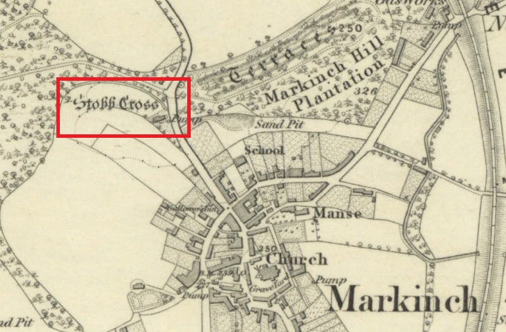
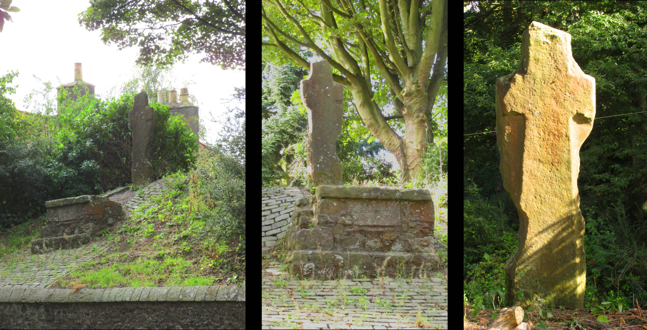
The cross is located on a bluff of land overlooking the west side of Stob Cross Road on the northern edge of Markinch.
Archaeology & History
In 1933, following a visit in 1925, the county archaeological inventory described it thus:-
Close beside the East Lodge of Balbirnie House, on a knoll 200 feet above sea-level, stands a stone known, from the nature of its sculpturings, as the “Stob Cross.” It is a somewhat mutilated rectangular slab, 7 feet 5 ½ inches in height, 2 feet broad at the base and 6 inches thick, having a plain cross carved in relief on the east and on the west face. The cross on the east is now very much damaged but sufficient remains to indicate that the arms have been 1 foot wide and that the shaft has measured 1 foot 5 inches across at the intersection. On the west face the design stands out in relief from 1 to 1 ¼ inches. The arms of the cross measure 11 ½ inches in width, and the upper limb, which tapers slightly to its extremity, is 12 ½ inches across at the point of intersection. The shaft measures 1 foot 2 inches across below the arms and widens gradually downwards to 1 foot 8 inches at the base. In 1790, when the cross was in danger of falling, the Earl of Leven had the position faced up with masonry, and the monument now stands, with its major axis north and south, on a two-stepped base of modern construction.
Roadside views l. & centre – Rear view r.
It’s certainly had a hard life, and its official designation as ‘early medieval’ leads us to suspect that it may have been a decorated Pictish cross that has had its ornamentation obliterated by Reformation iconoclasts. Those same iconoclasts may have concocted the ‘history’ recounted by Rev John Thomson (1794) in the Old Statistical Account of 1794 of what he describes as a ‘very coarse piece of work’:-
‘Vulgar tradition says, that it was erected to the memory of a gentleman, who fell on this spot, in a mortal encounter with one of his neighbours.’
Writing of Markinch, nineteenth century historian Aeneas Mackay (1896) has this to say:-
‘A cell of the Culdees was established there by one of the last Celtic bishops, and the ancient cross near Balgonie [sic] may mark its site.’
Modern place-name research ascribes Markinch as a place where horses were grazed while their owners were attending the early mediaeval courts and assemblies at Dalginch a quarter of a mile to the east, so the cross may at that time have been a waymarker. A roadside plaque describes the Cross as possibly marking the limit of an ancient sanctuary enclosure related to the church of St Drostan (known locally as St. Modrustus) in the centre of Markinch. Additionally, it was on the ancient (and recently revived) Fife Pilgrim Way from Culross to St Andrews, so would have been a wayside station for the pilgrims. which if it was a Pictish cross would have made it a target for desecration by iconoclasts. We are lucky that it has survived at all, and with the revival of the Pilgrim Way as a long distance path it will attract many new admirers.