Take the third left road off the A961 past St Mary’s Hope, travelling south, taking the right fork at Lythes, and continue down to the end of the metalled road. From there, walk up the slope to your right (south) and follow the fence on your left into the next field and the stone will be seen in a fenced enclosure.
Archaeology & History
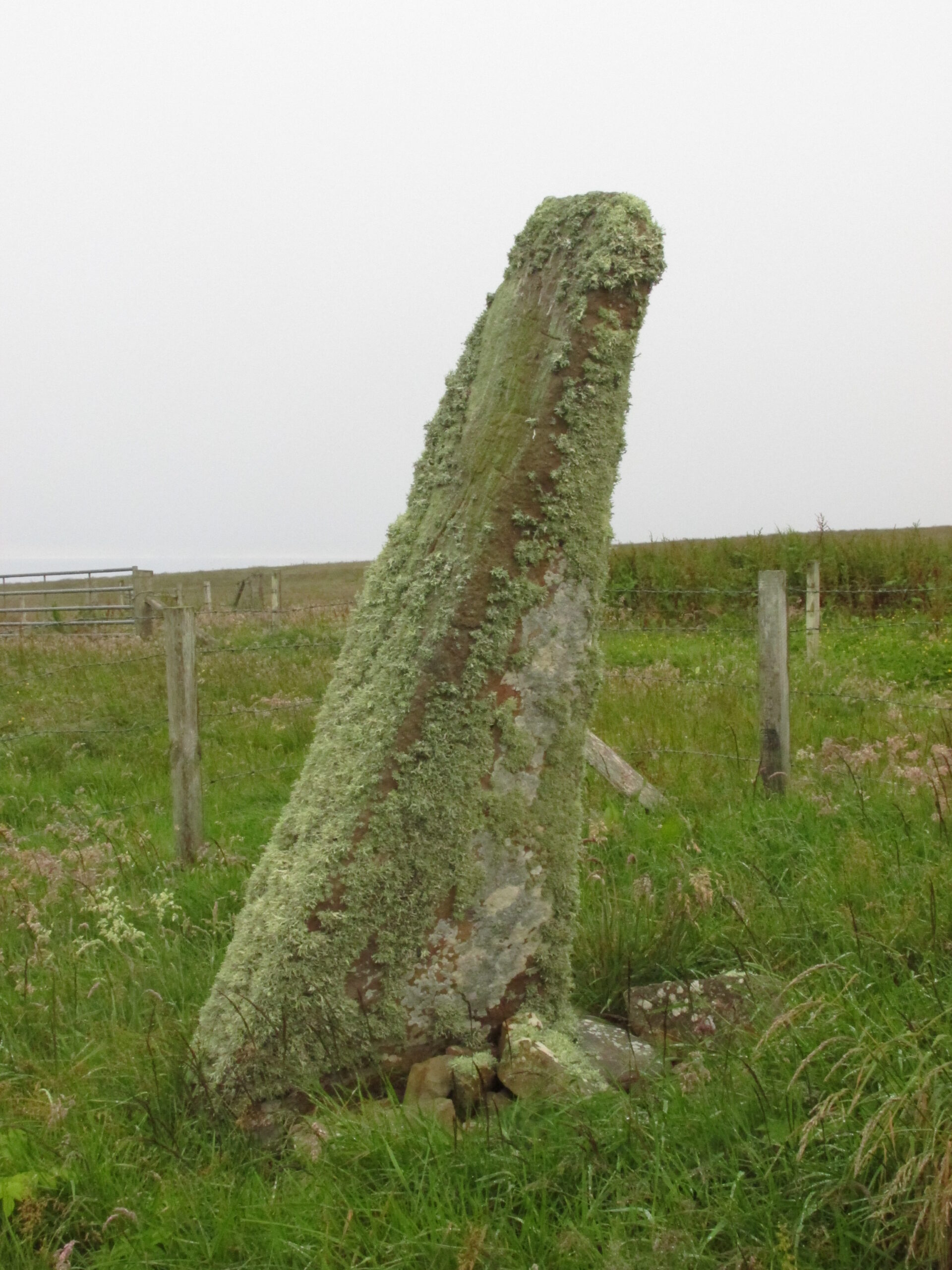
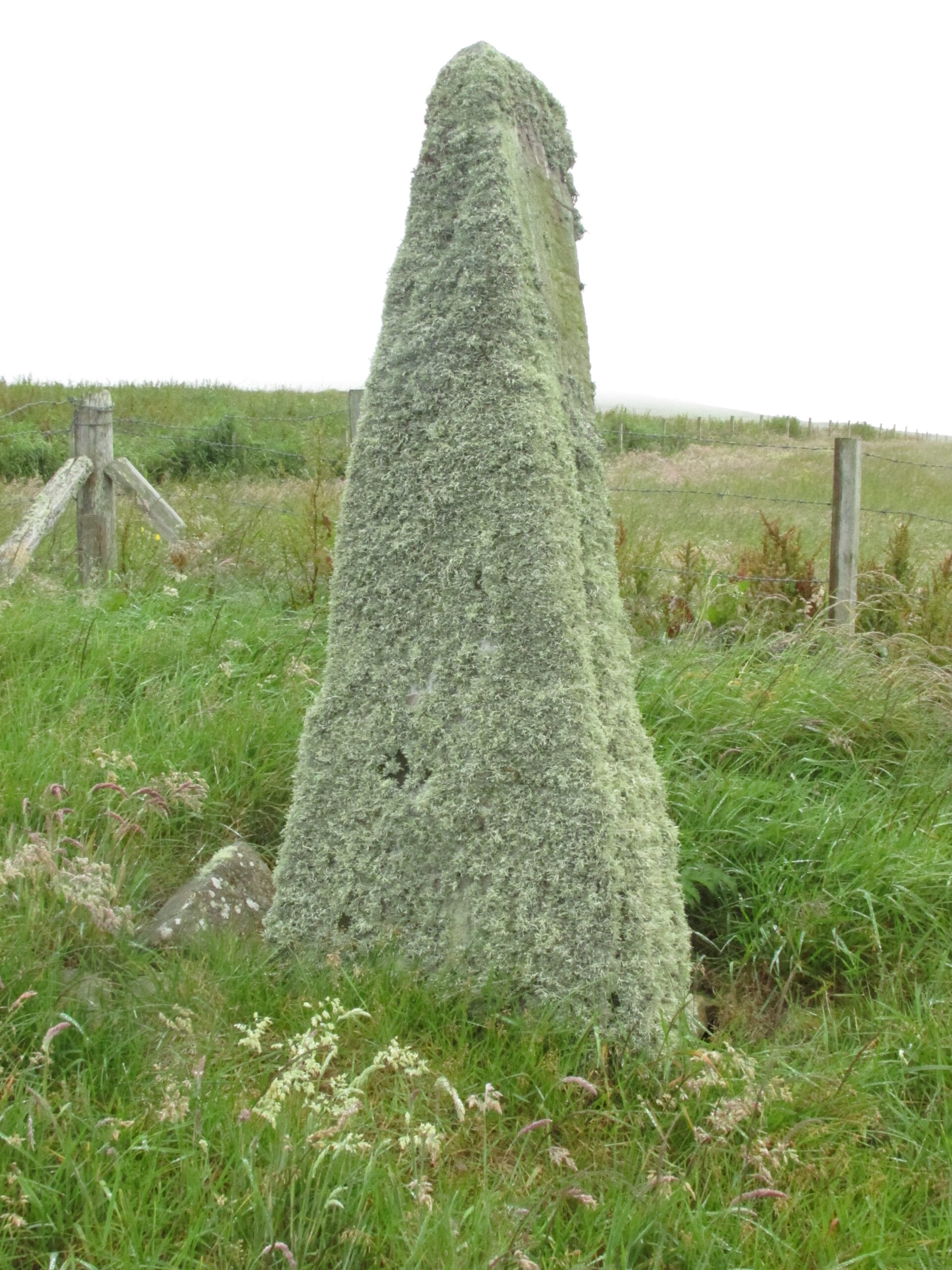
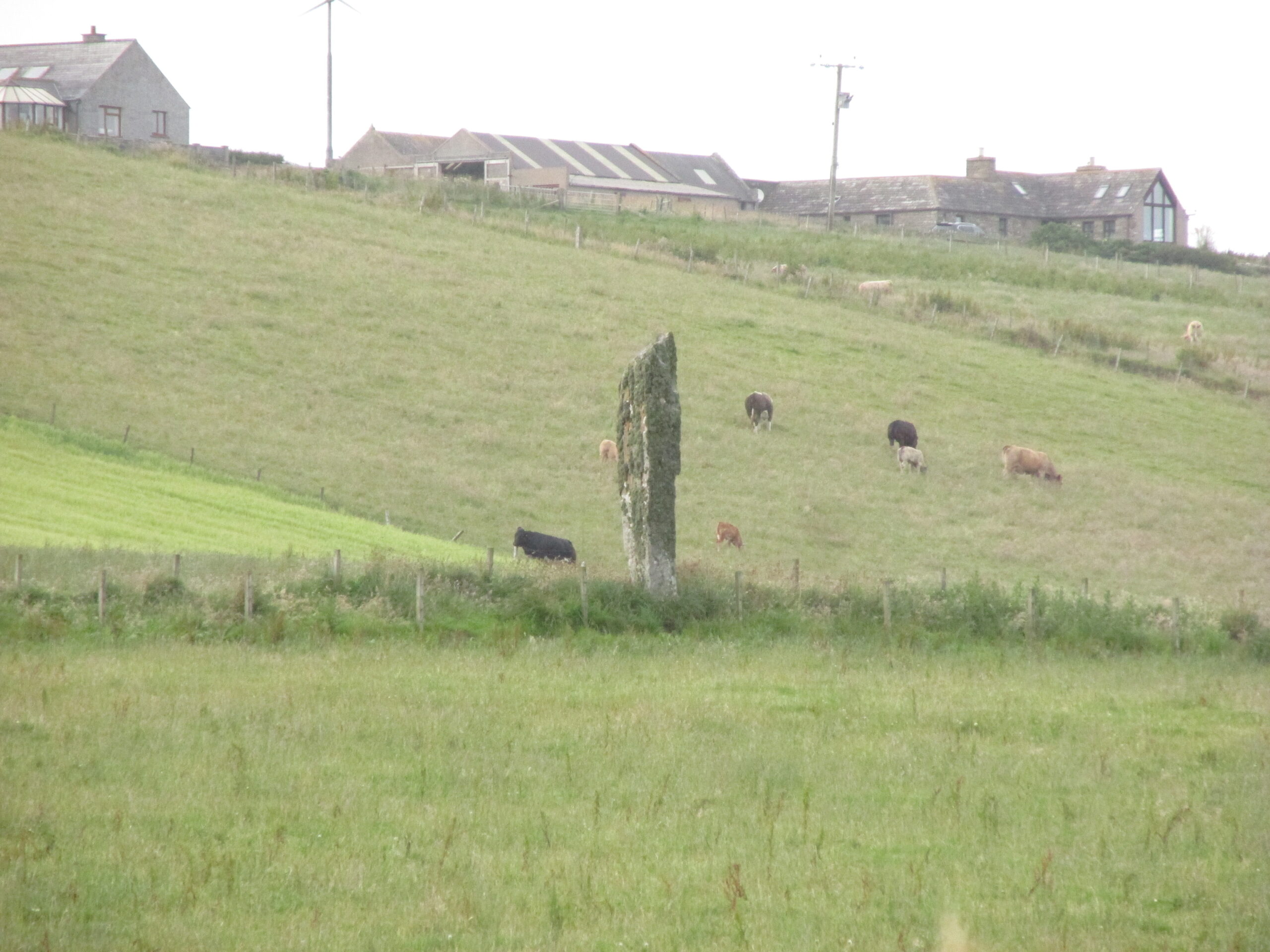
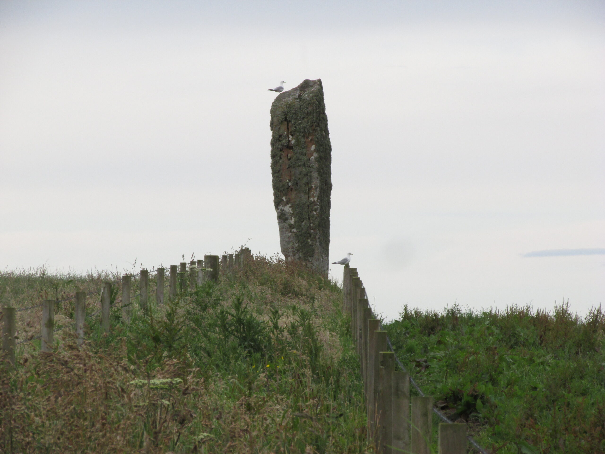
Two things strike you when you first see this stone, the triangular shape of the east facing side, and the lichen which covers this face and much of the rest of the stone giving it the distinct illusion of having a green velvet coat! From another angle it has a distinct lean and there are quite a few packing stones around its base. The Royal Commission inventory (1946) describes it thus:
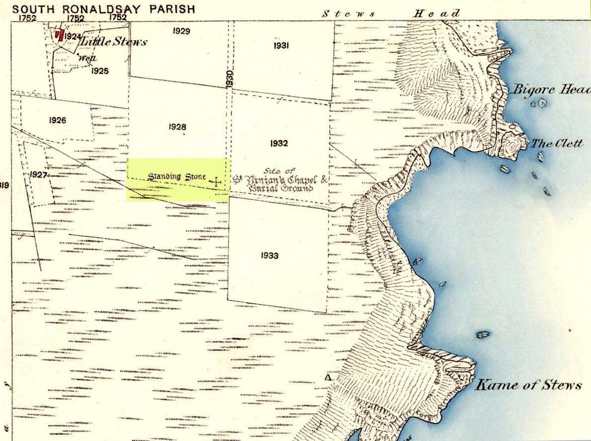
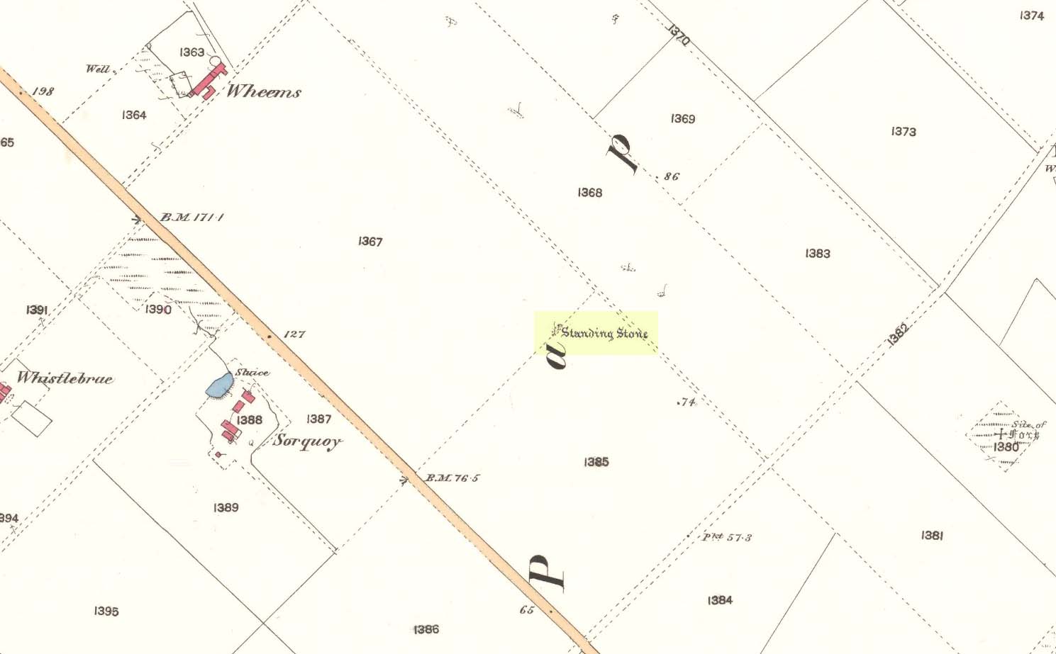
Stone on 1881 map
“On a ridge barely a quarter of a mile S of the farmhouse of Stews is a triangular block of red sandstone nearly 6 ft high, set with a packing of small stones at the base and with its axis N-S. At the bottom where it is widest it measures 2 ft. 6 in. across and is from 12-13 in. thick. As it rises it tapers gradually to a pointed top, which is slightly inclined towards the W.”
George Low on his 1774 tour wrote:
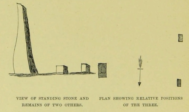
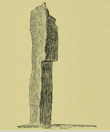
“Left this spot, and May 12th, proceeded southward by Stowse head; observed on the hill the remains of a tri-angular monument, but very much defaced, and two of the stones broke to the stumps. Tradition is there none as to the reason &c. of its erection. The figure with a plan follows…”
George Low’s 1774 sketchA coat of lichen
There is now no trace on the surface of the other two stones of this group so we are fortunate to have Mr Low on the spot sketch to record them. The stones would have been visible to the seafarers of times past who may have used them as navigation landmarks in pre-literate times, this being one of a number of surviving coastal stones on the Orkneys but whether they were erected for this purpose cannot be known. If you’ve been to see the Sorquoy stone up the coast, the surviving Stews stone is worth the journey if only for its ‘velvet’ coat.
References:
RCAHMS, Twelfth report with an inventory of the ancient monuments of Orkney and Shetland, 3v. Edinburgh. 1946
Low, George, A Tour Through the Islands of Orkney and Schetland…collected in 1774, William Peace & Son: Kirkwall 1879.
Acknowledgements: Big thanks for use of the 1st edition OS-map for this site profile, Reproduced with the kind permission of the National Library of Scotland.
Travelling south on the A961, take the first road left past St Margaret’s Hope, and follow it over the cross roads, and down the hill towards the sea, and it’s visible on the left hand side. You can’t miss it! It’s accessed by a narrow pathway which has been partly ditched – be careful!
Archaeology & History
View from the SEView from the track – SW
One of the less well known but most impressive of the Orkney standing stones, and seemingly one of the least visited. On my visit in July 2019, it was clear no one had walked the path for several months. The Royal Commission Inventory describes it as being, “14′ – 14′ 6″ high with some packing at the base. At 3′ above ground level, it is 2′ 6″ wide and 18″ thick, thickening to 21-22″ as it rises.”
It has a distinctly top-heavy look, and although invisible from the west above the brow of the hill, it can be clearly seen from the sea.
George Low visited the stone on May 11th 1774, saying:
‘In this beautiful hollow, in a cornfield, saw a large erected stone about 16 feet above ground, probably monumental, tho’ tradition is silent about it, and by digging nothing was found that could certainly prove this’.
Described by local historian George Barry (1748 – 1805):
George Low’s 1774 drawing
‘To the north (of South Ronaldsay), – at no great distance, is a most beautiful vale, with the ocean on one side, and gently declining hills on the other; which, for the production of every sort of beneficial crop, is far superior to any other part of the island. In the middle of this pleasant spot, on the brow of a hill, is a monumental stone, sixteen feet high, which, like many others through the country, bears no marks of human art, in carving, figures, or inscription. The whole delightful dale is known by the name of Paplay’ .
If you’re in the islands, this impressive stone is certainly worth a detour!
References:
Barry, Dr George, History of the Orkney Islands, Longman,Hurst,Bell & Orme: London 1808.
Low, George, A Tour Through the Islands of Orkney and Schetland…collected in 1774, William Peace & Son: Kirkwall 1874.
Royal Commission Ancient & Historical Monuments, Scotland, Inventory of the Ancient Monuments of Orkney and Shetland, HMSO 1946.
Acknowledgements: Big thanks for use of the 1st edition OS-map for this site profile, Reproduced with the kind permission of the National Library of Scotland.