Standing Stone (lost): OS Grid Reference – NN 795 168
Archaeology & History
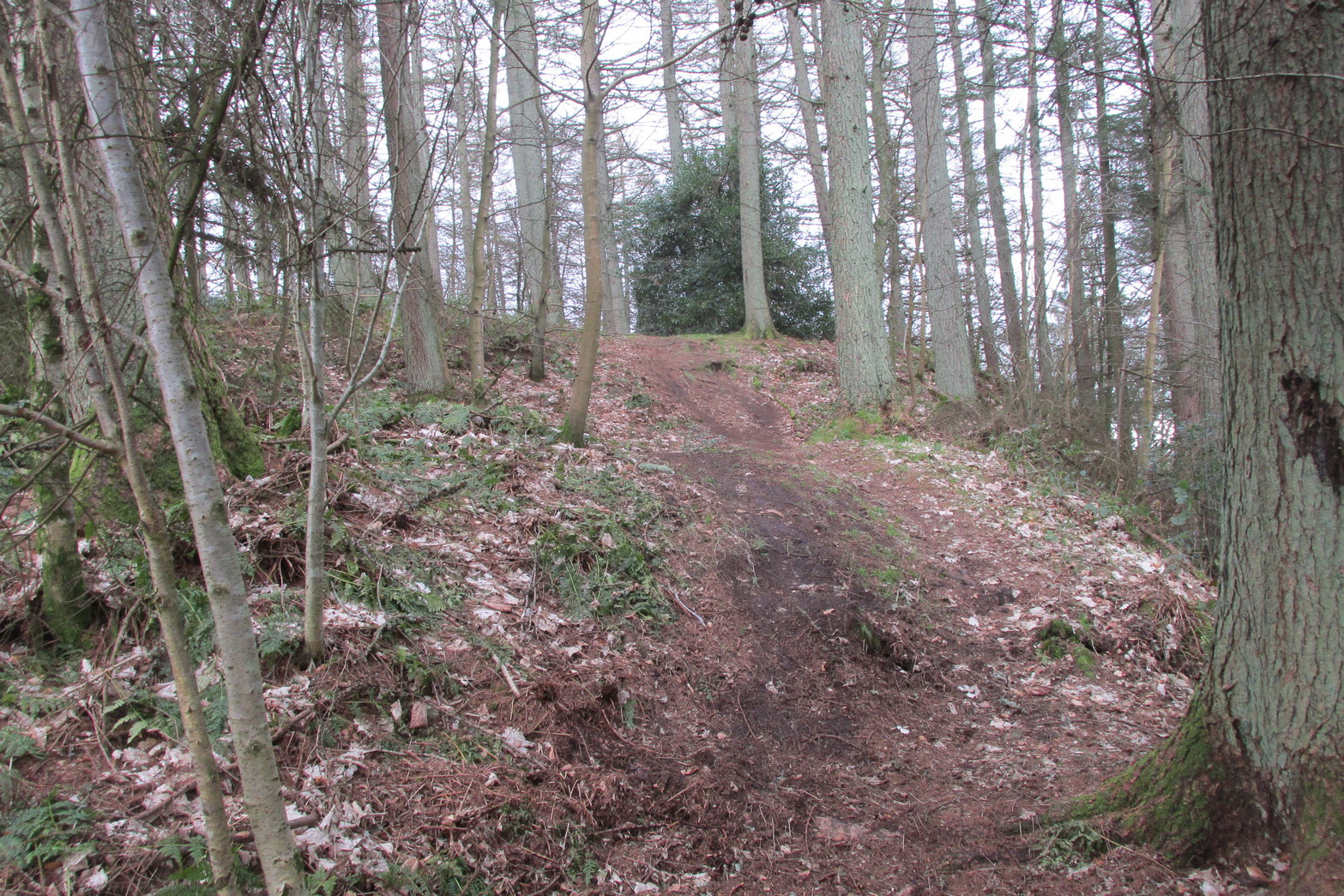
When Fred Coles (1911) visited the giant impressive Dunruchan standing stones, he told that “some distance to the east” of the Dunruchan E stone, “near the unnamed stream…my friend Mr James Simpson has seen another great Stone, but lying prostrate.” When he visited the area the weather beat him back (easily done up here!) and prevented him “from wandering far over the moor, and therefore this Stone was not observed.” It remains lost. (the grid-reference given for this site is an approximation)
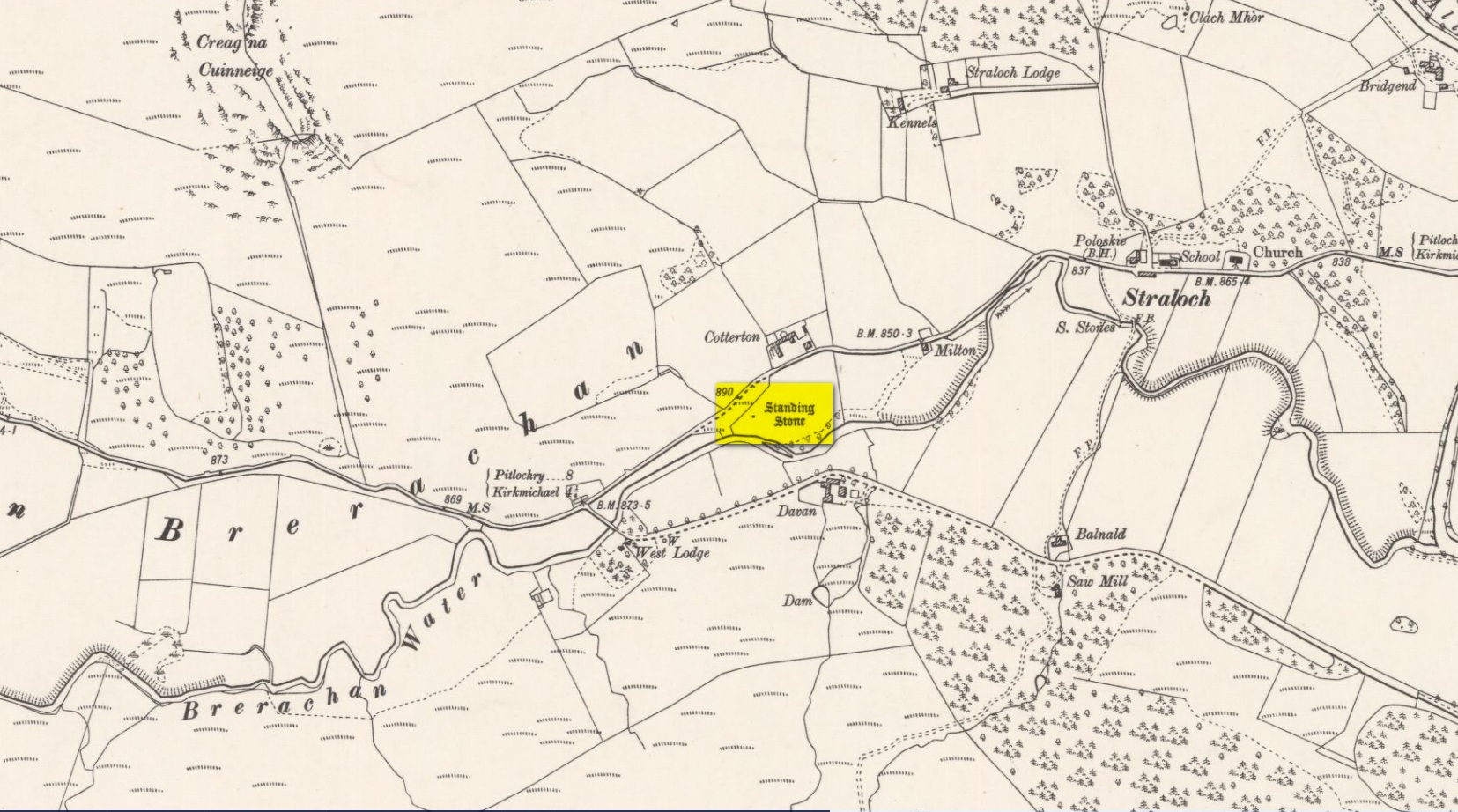
Along the A924 road, just over 4 miles (6.6km) NW from Kirkmichael, or about 8 miles (13km) NE from Pitlochry, you’ll hit the large farmhouse of Straloch. You’ve really gotta keep your eyes peeled! A few hundred yards west of Straloch itself, a small parking spot is on the south-side of the road, above the river. From this parking spot, walk a few yards to the fence that overlooks the river and look into the field below you, where you’ll see the stone. If y’ walk down the slope, you’ll see a gate on the right that leads you into the field.
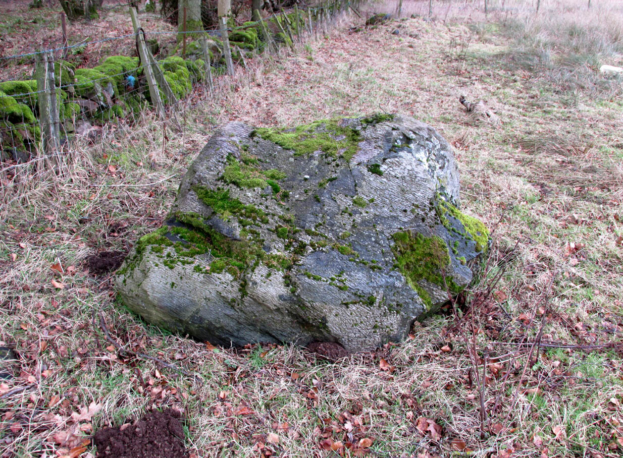
Archaeology & History
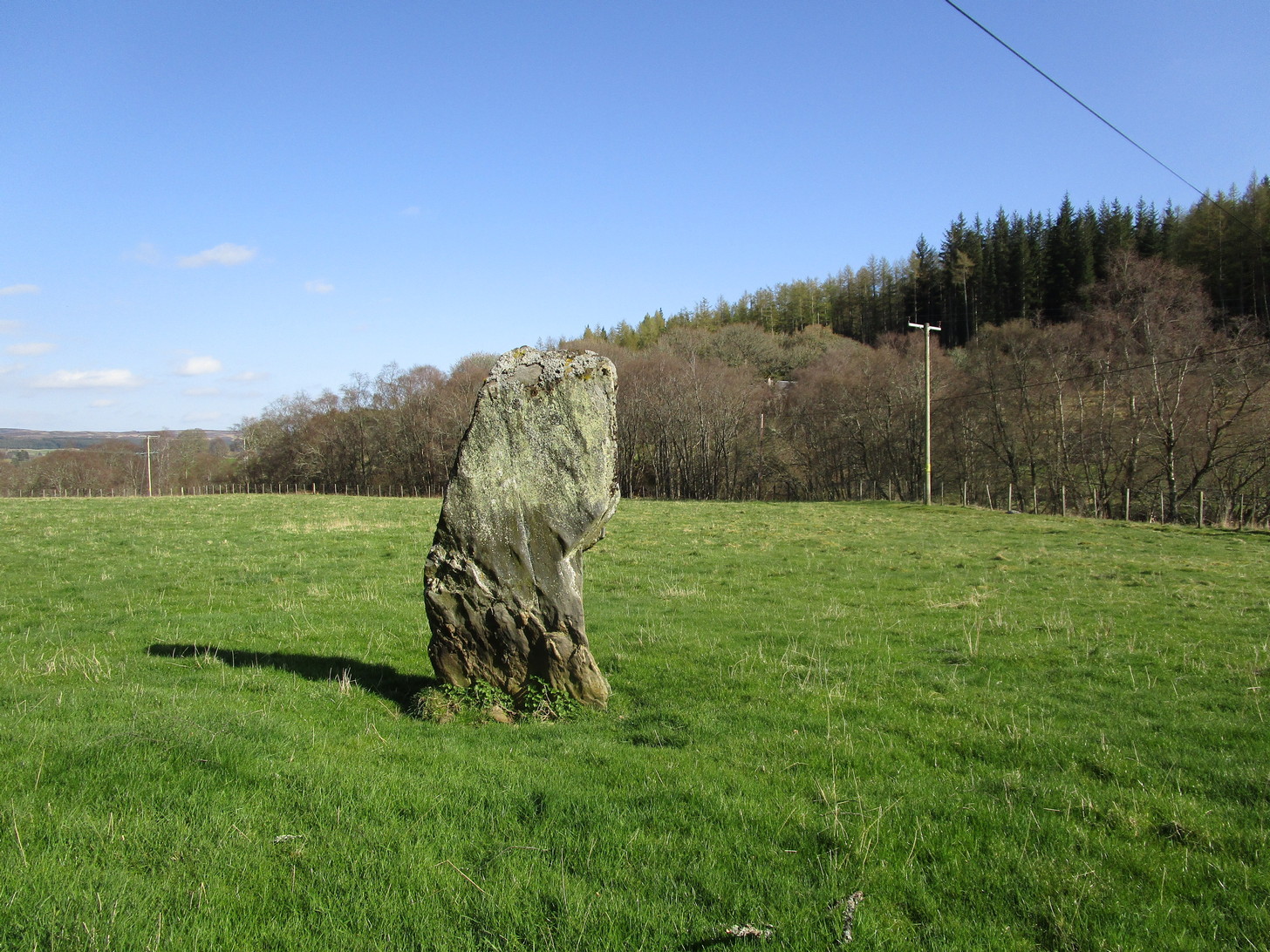
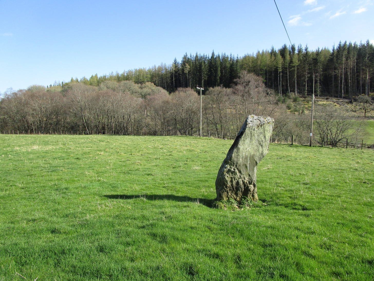
First shown on the 1900 OS-map of the area, this petrified hunchbacked witch-of-a-stone stands on the flat grassland plain (previously scattered woodland when first raised) forty yards from the River Brerachan: a proximity characteristic found at many of the stones along Strathardle.
Cotterton stone 1900 mapFred Coles’ sketch
Descriptions of the site prior to 1900 seem non-existent (does anyone know otherwise?). It was the brilliant antiquarian Fred Coles (1908) who, it seems, was the first to mention the old stone — whose very crooked appearance had an unusual effect on him, saying how “such a decided leaning over towards the north…almost make one uneasy when standing beside it”! It didn’t have that effect on me, but I was mightily impressed by both its appearance and curious hunched gait. Twas one of those monoliths that had a distinct ‘feel’ about it, which many people report at such places up and down the country. Whether it was its position by the river, or the color of the landscape, or the silence, or the shape of the stone, or combinations of them all—which ever it was, there was almost a sense of genius loci residing here…
But in that other world of pragmatic measurements, as Mr Coles told us:
“The Stone is at the base an oblong in shape, measuring 14 inches on its east end, 2 feet 7 inches along its south side, 17 inches at the west, and 3 feet 6 inches on its north side—a girth, therefore, of 8 feet 8 inches. At the middle its dimensions are the same, but the top is rather less. At its N.E. apex the Stone is 7 feet 8 inches clear of the ground, and at the west edge 7 feet. In the illustration…I have shown the monolith from the south, with the craggy profile of Menachban in the background.”
The stone was mentioned in passing in Hugh Mitchell’s (1923) local survey. A few years later in John Dixon’s (1925) account he repeated the dimensions of the stone that Coles had cited; and although he found there to be no known traditions of the place, he conjectured how it may have been connected with the numerous battles “that in former days occurred along this entrance to the Highlands.”
It’s a damn good site is this. All you megalith hunters will love it!
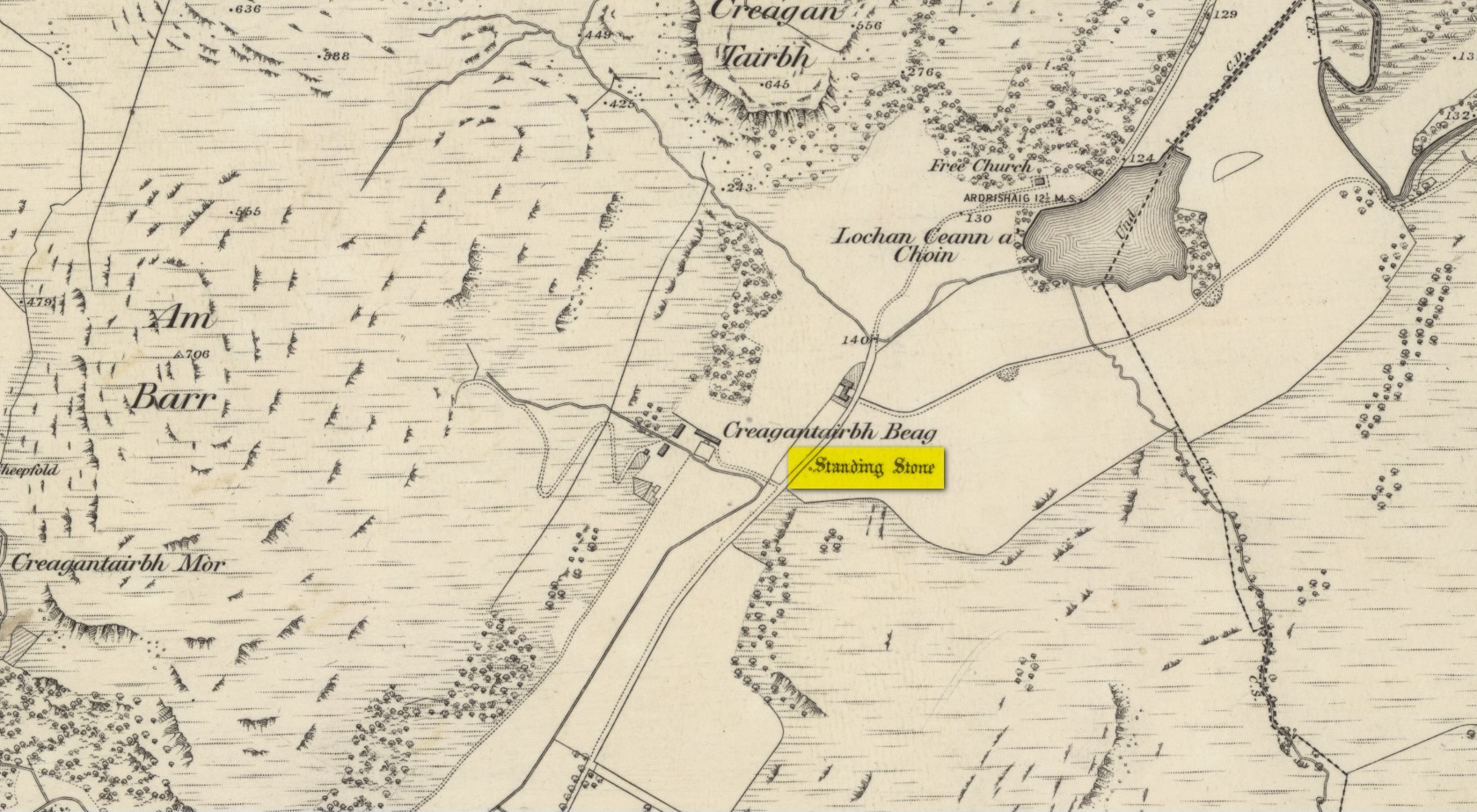
From Kilmartin go north on the A816 Oban road, and after 1½ miles watch out for the small B840 road on your right, to Ford and Loch Awe. Less than a mile along the winding road, just after the track to the farmhouse on your left, keep your eyes peeled for the standing stone on your right, whose top is peeking over the old walling. If you’re not careful you’ll miss it!
Archaeology & History
From the roadside this looks like just a reasonably small standing stone, but closer inspection shows it’s been snapped halfway up—apparently in a great storm in December 1879. If you look over the wall, just a couple of yards behind the upright you’ll see the larger section of stone that was attached to the 6-foot upright before its calamitous fall. Originally it was said to have been 16 feet tall!
Broken bit laid flatFrom the roadside
The first description of the stone is thought to be by the great J. Romilly Allen (1880) in his brief visit to Ford, saying simply that the stone “is close to the road on the east side, 1 mile from Ford. It is 14 feet high and 3 feet by 4 feet at the base. The material is slate. It inclines considerably from the perpendicular”—meaning, that he saw it before the stone had been broken. Lucky bugger!
More than twenty years later David Christison (1904) visited the site and wrote his of his finds in an essay for the Society of Antiquaries, although in truth he said little more than anyone before and after has been able to say:
“A mile and a quarter south-south-west of Ford Church, 130 yards east by south of Creagantairbh Beag farmhouse, close to the west side of the highway, stands the base of an obelisk, at the foot of which the shaft lies prostrate. The base is 5 feet 6 inches high,’and has an oblique ledge, half way up on to which the shaft would accurately fit. If restored, the height of the stone would be 16 feet 2 inches above ground, and it must have had a very handsome appearance, tapering in width as it gradually does from 2 feet 6 inches to 2 feet. It is 18 inches thick at the base and 10 inches to 12 inches at the top.”
Christison’s 1904 sketch
The name Creagantairbh derives from the Crag of the Bull, which is the sharp hill immediately in front of you to the north; and its geological consort, the Creag a’ Chapuill (or Crag of the Horse) rises to its immediate northwest. A few hundred yards further along the road towards Ford is the large Auchinellan standing stone.
Folklore
When I lived in Ford many years ago, the olde folk told me how, in bygone centuries, bulls were sacrificed on the Creagantairbh above.
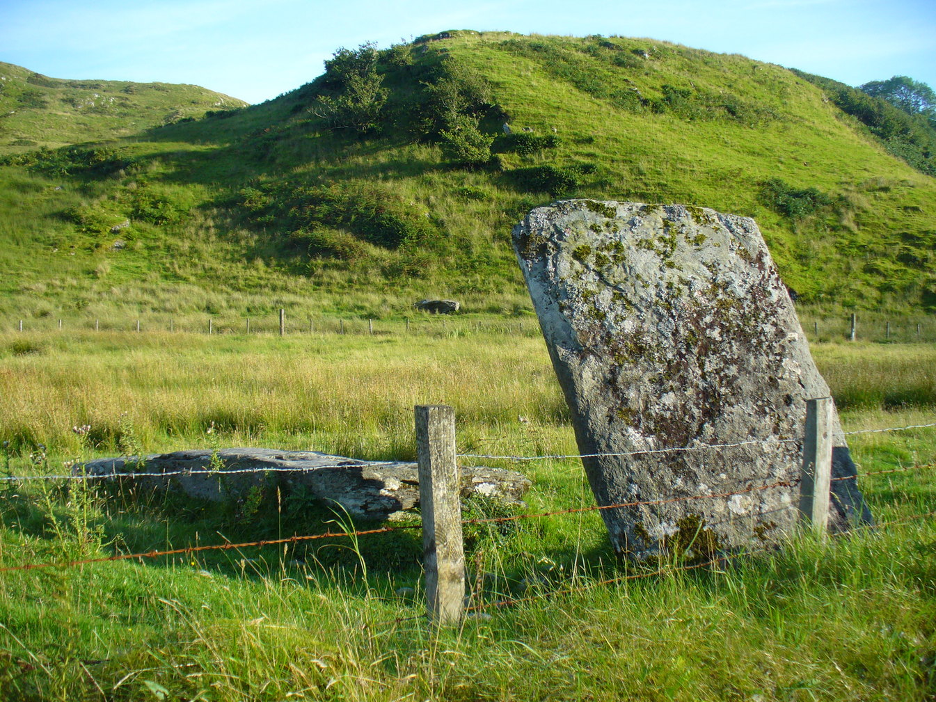
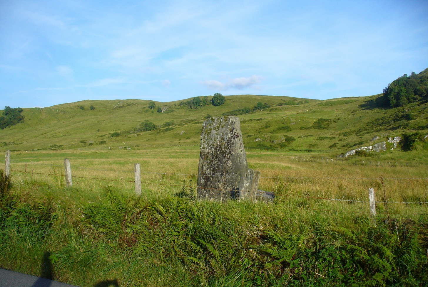
If you’re coming by car, Braco’s an easy place to park. Once here, walk up the main road, past the terrace houses until, on your left, you reach the B8033 Feddal Road. About 500 yards on, where the houses end and you reach the small river bridge, you’ll notice a footpath immediately on your left with a small table where you can have a cuppa. Walk past this, into the trees and along the riverside for barely 100 yards, and walk up the hillside on your left. On your way up are a couple of large humps, a bit like a small roller-coaster. You’re here!
Archaeology & History
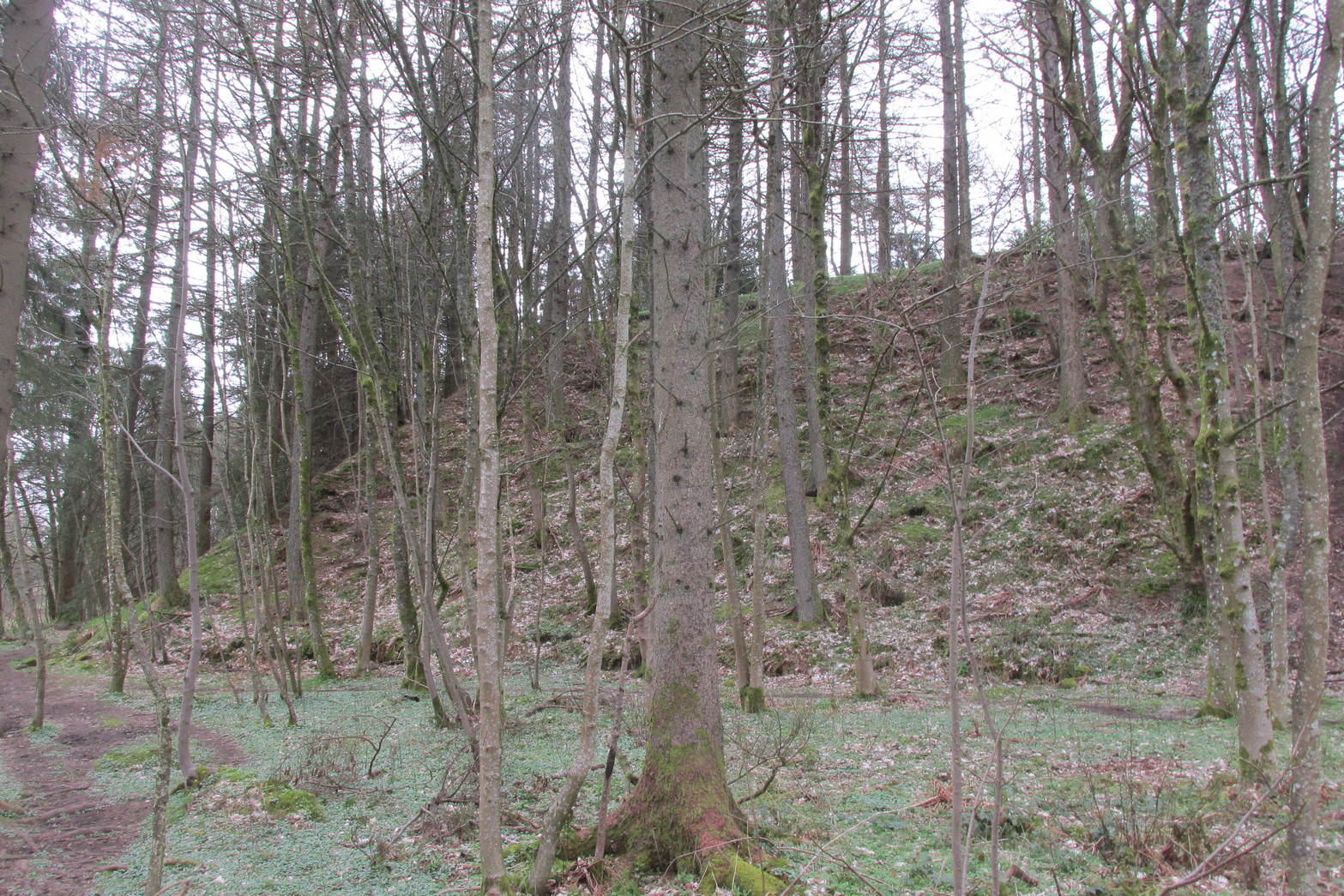
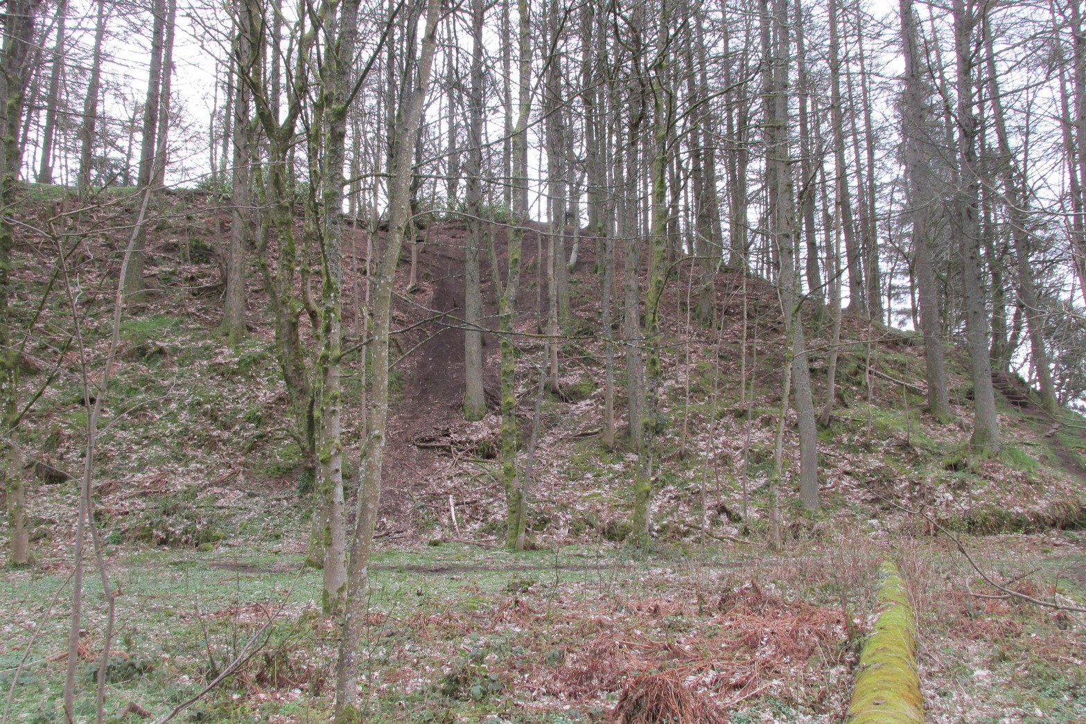
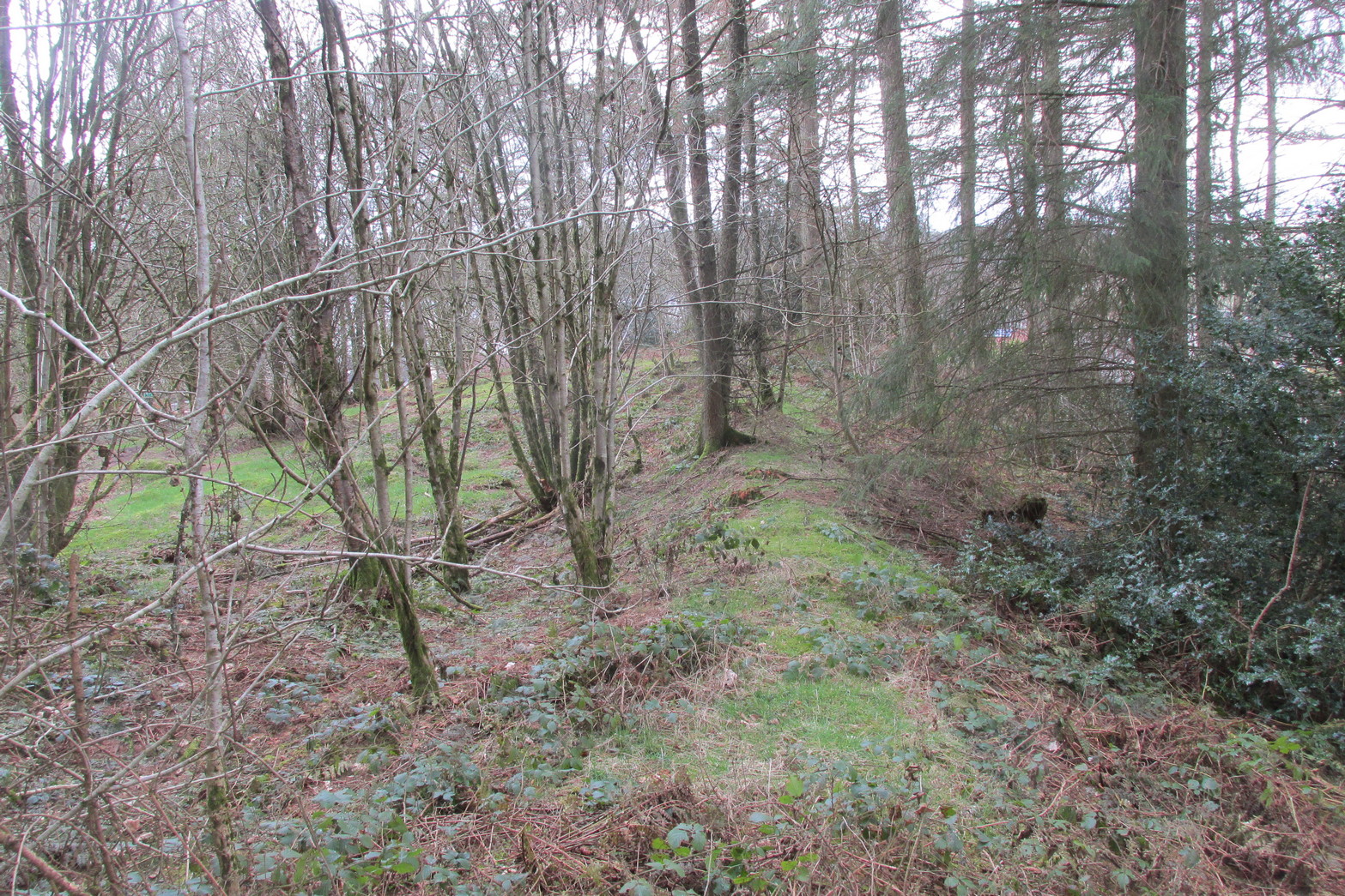
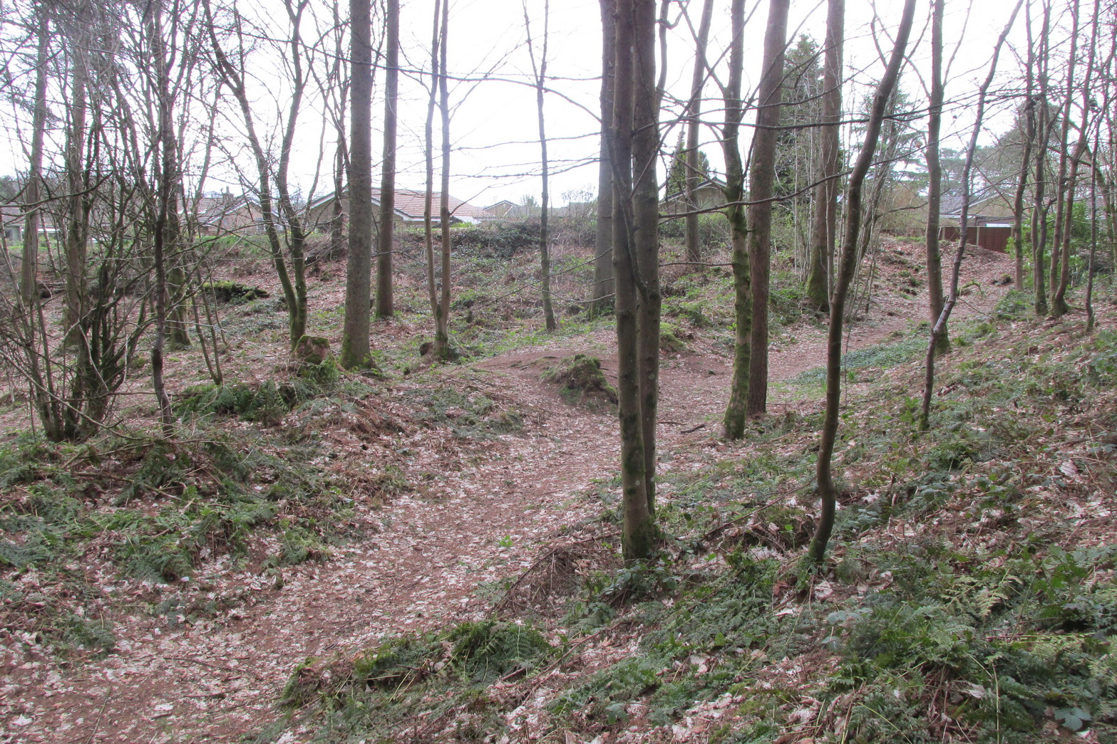
Antiquarians amongst you are gonna love this. It’s huge! Hiding away and all but forgotten in the little village of Braco, overgrown with trees and brambles, this steep wooded defensive structure has a series of large ramparts—three in all—that you’ll walk up and down before hitting a slightly undulating summit.
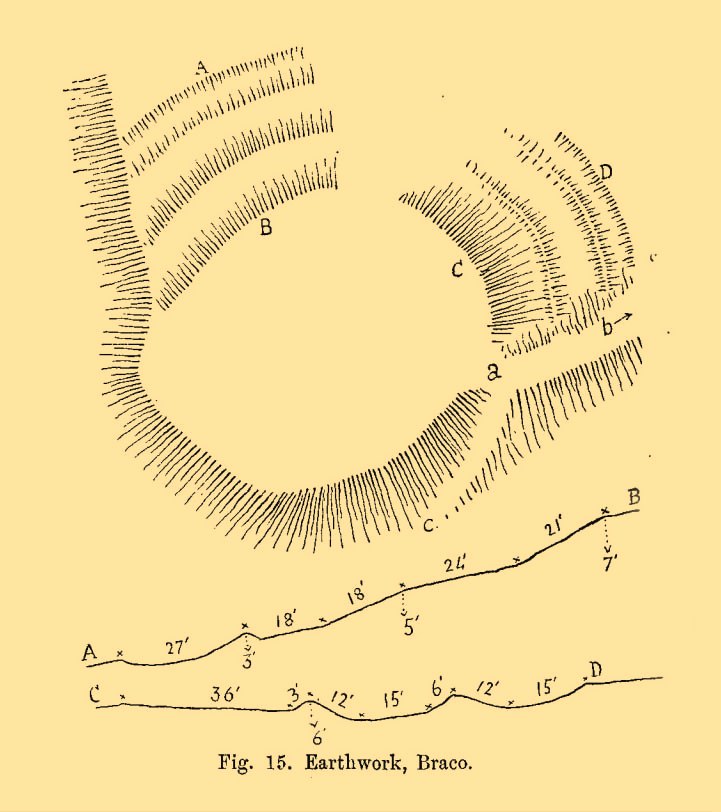
William Roy’s 1793 planChristison’s 1900 plan
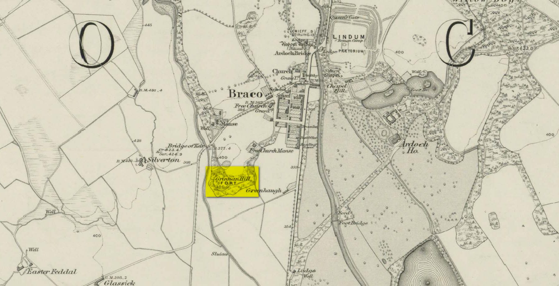
The site was shown as an unnamed triple-ringed hill on William Roy’s 1747-52 survey of Scotland, with the lines representing the ramparts of this ‘fortress’. Some years later, Roy (1793) briefly mentioned the site when he was comparing indigenous fortifications with those of the Roman invaders, saying that “the small camp at Ardoch” probably “contained more than a Roman legion, with their auxiliaries.” His sketch and layout of the hillfort (right) is interesting in that it shows the more compete fortified ramparts on the north-eastern sides, which have today been covered by the modern houses. The ramparts in this part of the hillfort were still visible when the brilliant Miss Christian MacLagan (1875) came here; and in a subsequent visit by Mr Christison (1900) they could still be seen, as we can see in in his sketch (left). When we visited recently, it looked as if the lads who’d landscaped the large gardens most probably, unknowingly, used the soil of the ramparts to create them!
Apart from the missing northeastern ramparts, the site today is little different from when our antiquarians wrote of it more than a hundred years back. Read Miss MacLagan for example, who said:
“Near the parish church is an eminence called Grianan Hill, on which are still to be traced the remains of a British fort. The hill is a beautifully wooded knoll to the west of the village of Braco. It appears to be about 100 feet in height above the level of the surrounding land; on three of its sides the ground is perfectly flat, and we could suppose that in the amply days of the fort above, it had been environed on three sides by a lake, which would of course contribute to its strength. The fourth side of the hill, having but little natural strength, has been strongly fortified by three great walls. This is the side which connects the knoll with the neighbouring rising ground which is nearly as high as itself.
“The area enclosed by the innermost circular wall has a diameter of 130 feet. The space between this wall and the second is 37 feet, and the space between the second and third walls 47 feet. Almost every stone of this fort has been removed, but the lines and trenches which mark their former presence are still very distinct.”
Christison (1900) subsequently gave us much the same, with just some additional points here and there:
Looking up at SW sideLooking up at S side
“The site is less than ½-mile SW of Ardoch camp, 420 ft above the sea, on the edge of a steep descent, 40 to 50 ft high, to Keir Burn, but only slightly elevated above the field towards Braco village. It has apparently been an earthwork with a semi-oval triple line of defence…partly ramparted and trenched, partly terraced, the broad oval being rudely completed by the unfortified edge of the steep bank. The entrance, a, is along the narrow crest of a ridge, i, from the E, and it is likewise approached by a rude roadway, c, from the burnside below. Roy’s plan makes the work nearly complete, but the middle half of the lines no longer exists. He says that it may have been a work of the natives before the arrival of the Romans, but calls it a (Roman?) ‘post.’ There can be no doubt that it belongs to a common type of native fortresses. Its extreme length is about 320 ft, and the interior may have been about 200 by 170.”
Southern line of wallingFootpath along rampart
What he failed to point out—and contrary to Canmore’s comment that “the interior is featureless”—is the length of internal walling running nearly halfway through the top of the hillfort, cutting it in half so to speak, roughly southeast to northwest: the eastern area slightly larger than the west, which is a little higher. A ‘gate’ or passage between these two sides seems apparent halfway along this line of walling. This wall, like the long one running along its southern edge, is a couple of feet high and more than a yard across. In the western section a small pit has been dug, about eight feet across and a yard or so deep. Local lore tells that this was an old Roman fire-pit!
Around the very bottom mainly on the west-side of the hill, remains of old walling can be seen for a couple of hundred feet beneath the vegetation, but I’m unsure about the date of this structure. It may well be a 19th century construction, but without an excavation—and none has ever been done here—we will never know for sure.
Undulating ramparts
One final thought on this place is how is may have related with the large Roman forts that are just a few hundred yards away to the northeast. When the invaders came here, local tribal folk no doubt watched them with caution. One wonders whether or not some sort of ‘agreement’ was made between our local folk and the aggressive incomers, with them coming to some sort of nervous truce between them which allowed the Romans to build their camp to the east, as long as they kept their distance from the folk in this hillfort. Just a thought…..
References:
Christison, D., “The Forts, Camps and other Field-Works of Perth, Forfar and Kincardine,” in Proceedings Society Antiquaries, Scotland, volume 34, 1900.
Hogg, A.H.A., British Hill-Forts: An Index, BAR: Oxford 1979.
MacLagan, Christian, The Hill Forts, Stone Circles and other Structural Remains of Ancient Scotland, Edmonston & Douglas: Edinburgh 1875.
Roy, William, Military Antiquities of the Romans in North Britain, W. Bulmer: London 1793.
Acknowledgements: Huge thanks for use of the 1st edition OS-map in this site profile, Reproduced with the kind permission of the National Library of Scotland.
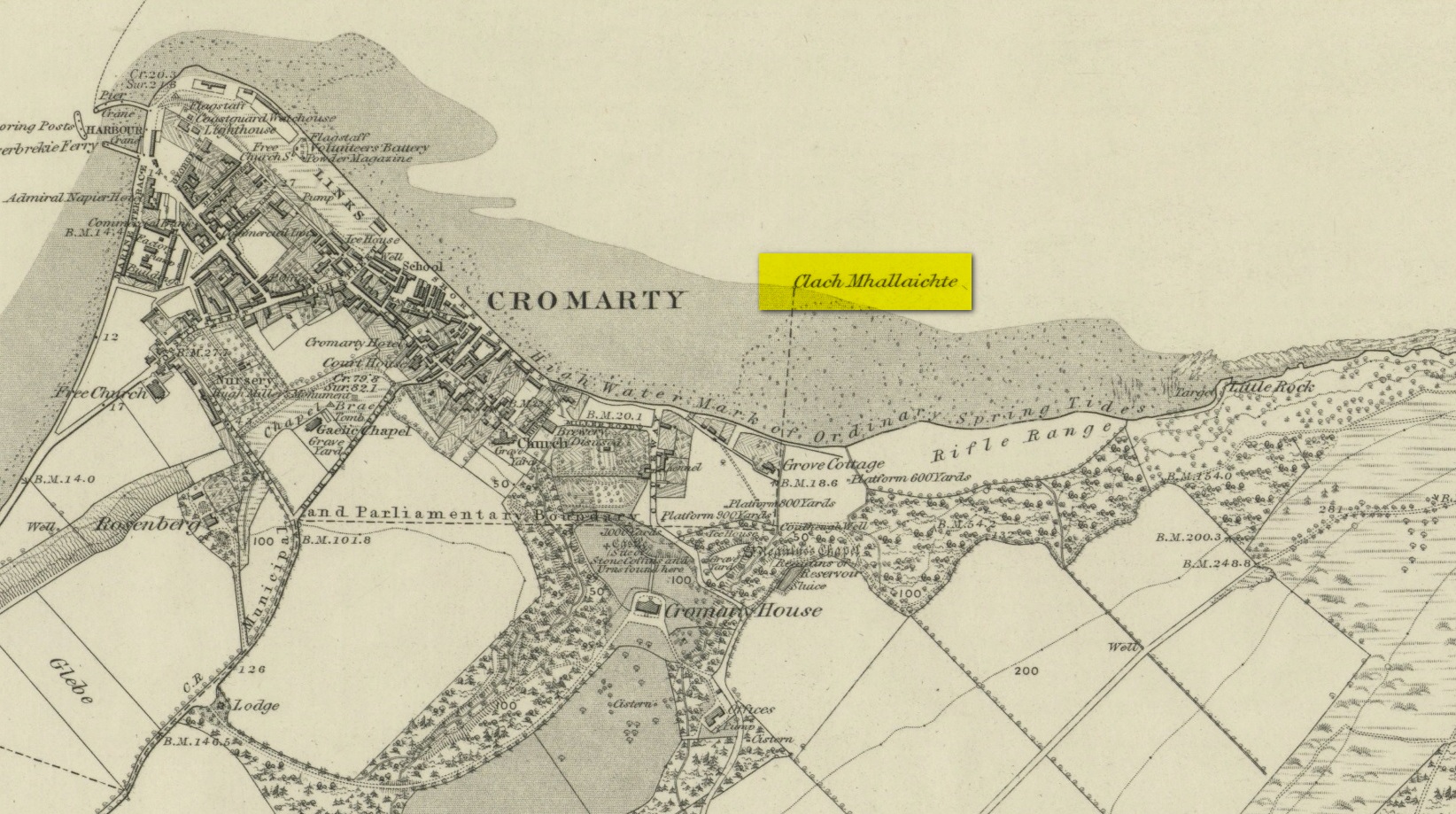
This large boulder found off the Cromarty coast, was highlighted on the 1880 OS-map of the region. It is one of the ancient boundary stones of the township.
Folklore
We know from the vast array on the folklore of stones that many were imbued with magickal abilities, some of which were witnesses to vows and others to make curses from. This large boulder off the coast of Cromarty was, according to Donald MacKenzie (1935), a place where the latter used to be done. He told us:
“At Cromarty there is a big boulder known as the Clach na Mallachd (‘Stone of Cursing’). Curses were delivered when an individual stood or knelt bare-kneed upon it.”
In an earlier account by the Ordnance Survey lads in one of their Name Books, they gave the following tale that had been narrated to them:
“A large stone Situate at the Low Water, and forming one of the boundary Stones of the burgh, the reason of its having this name is, that a young lad while Sitting on it was overwhelmed by the advancing tide and drowned, his mother when told of it, cursed the stone, hence the name Clach Mallach (Accursed Stone)”
References:
MacKenzie, Donald A., Scottish Folk-lore and Folk Life, Blackie: Glasgow 1935.
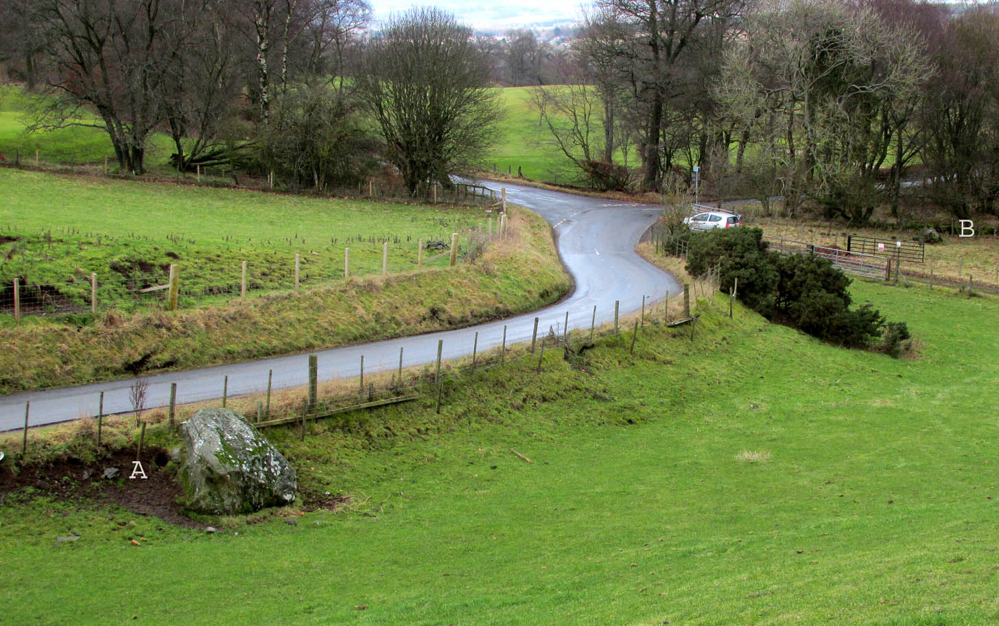
Travelling north from Perth on the A94, take the right turning for Murrayshall just before entering Scone, then take the first right and continue up to the road junction, and park up at the trackway opposite. You’ll see the big stone in the field to the right, up against the road embankment; and the small stone is in the paddock to the left of the trackway at the edge of the trees.
Archaeology & History
Two large glacial erratics which have acquired mythic status and picked up a Christian triumphalist message on the way.
Folklore
In Lawrence Melville’s (1939) excellent local history work, he thankfully put to pen an all-but-forgotten tale of oral tradition:
“Where the road from the Muir of Durdie leaves Kilspindie parish, a grass grown road leads north to Boglebee….. A few yards from the highway lie two large stones, said to have been flung from the Giant’s Hill in Collace parish – the flat topped eminence lying due north from the stones, about two or three miles away, better known as “Macbeth’s Hill”, or “Dunsinane Hill”.
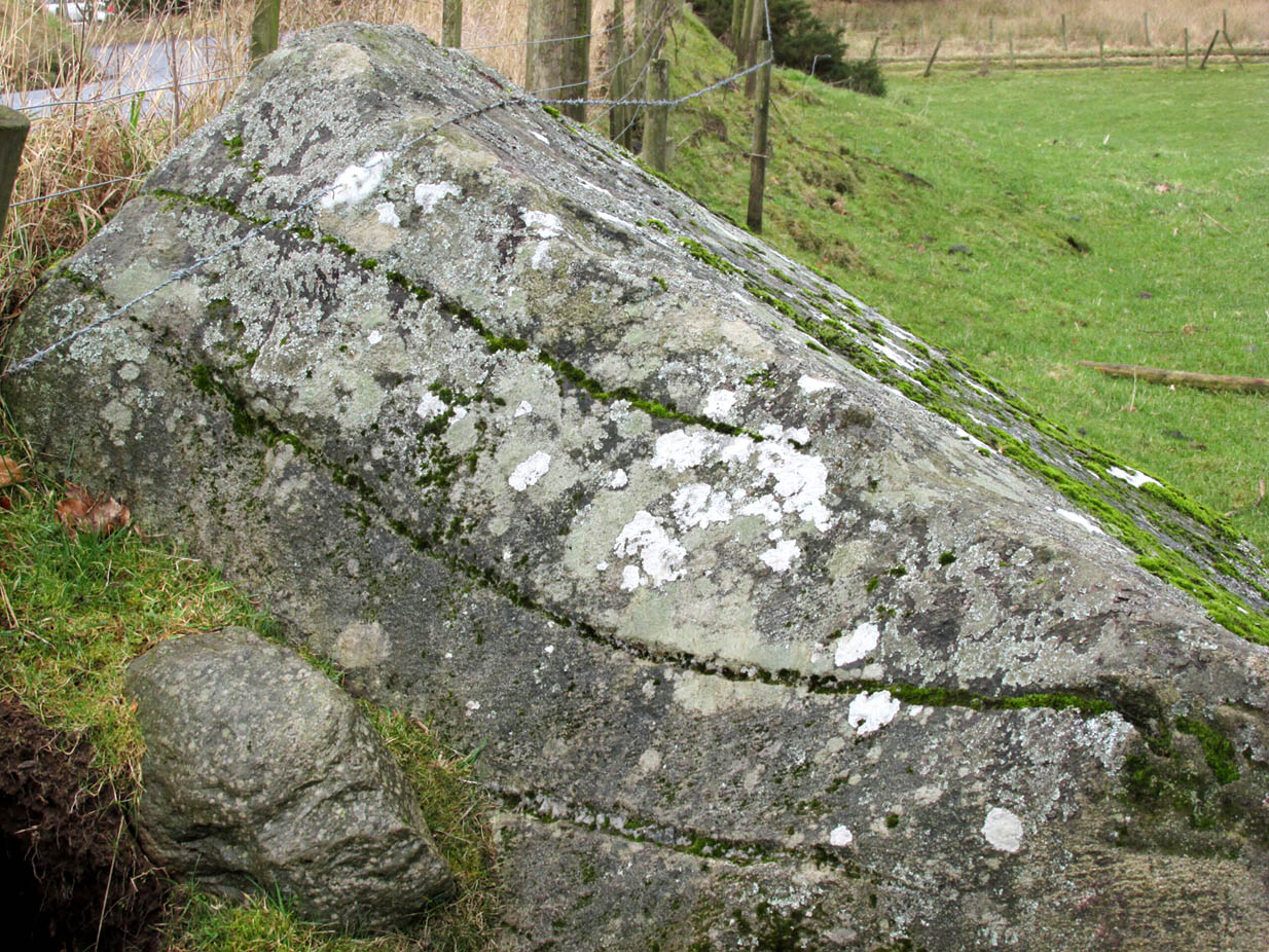
The ‘string’ marks of legendThe smaller stone with its ‘string’ marks
“When the church dedicated to St John in Perth was being built and its tower began to appear, a witch living in Collace was enraged to see this proof of the approach of Christianity and determined to destroy it. She had a son, a giant (after whom the hill receives one of its names), whom she sent to the top of the hill, giving him two huge stones with which to destroy the rising church.
“By her incantations she had supernatural power and knew that when Christianity came her power would be destroyed. She gave him her mutch from her head to be used as sling and in it the giant put the two huge stones. Whirling it around his head, he aimed them in a line with the tower, but, just as he let them fly, the string of his mother’s cap broke and the stones only went the length of Boglebee. The marks on the stones are said to be the marks of the witch’s mutch strings.”
Another view of the larger stone
A familiar folkloric message is remembered the length of Britain: a giant, a devil or other supernatural being throwing stones that either spill out of an apron or otherwise miss their mark. And in this case an unsubtle message to anyone trying to take on the might of the church. But what was the original story of these stones as told by the old time oral storytellers before Christian missionaries stalked the land?
If the string hadn’t broken and the stones had followed their original trajectory they would have fallen south of St John’s Kirk, but it was the thought that counted….
Reference:
Melville, Lawrence, The Fair Land of Gowrie, William Culross: Coupar Angus, 1939.
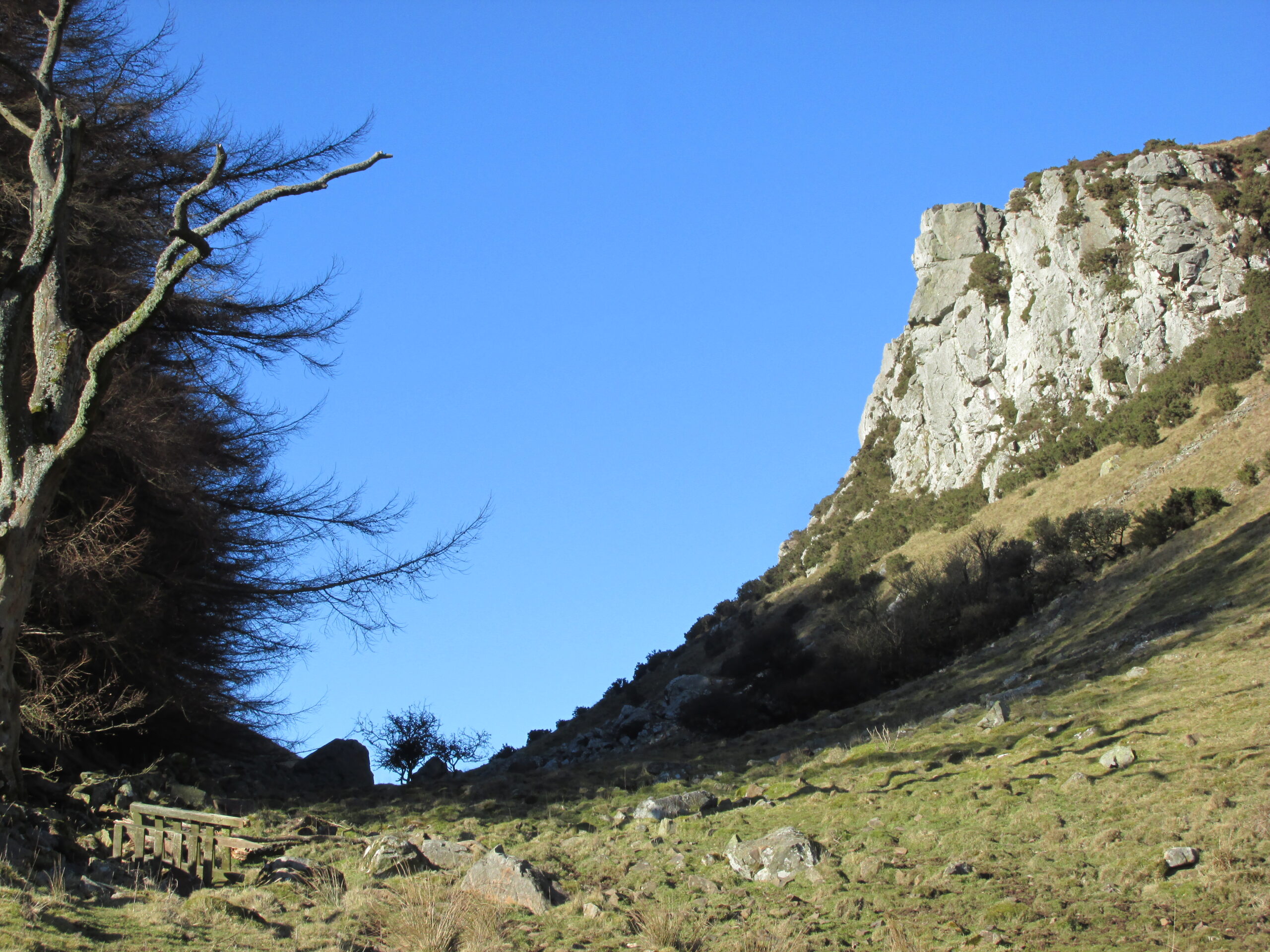
The Rock and Leap may be seen from the B953 Bandirran to Abernyte road. Approach across the fields.
Archaeology & History
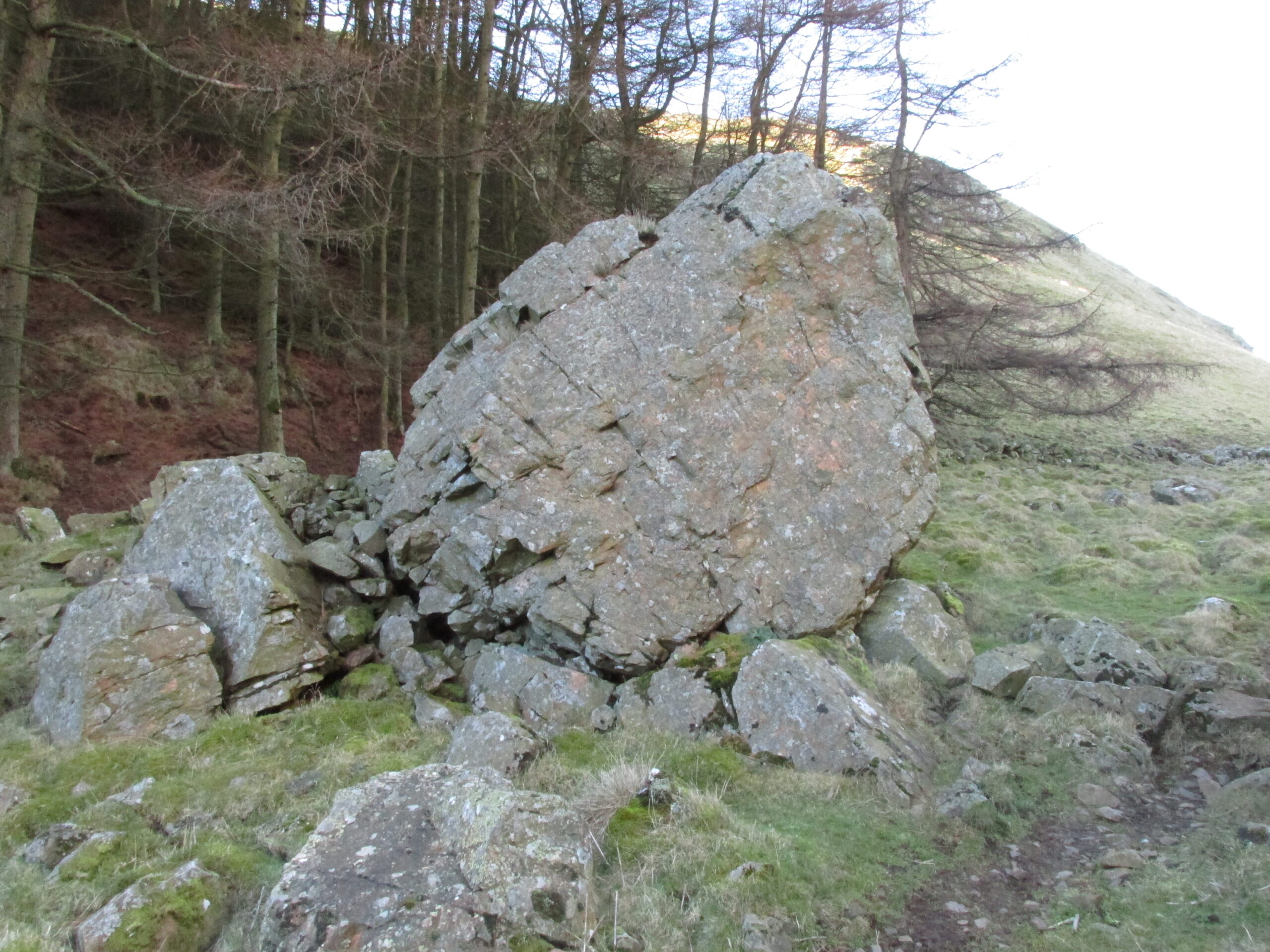
A large boulder perhaps 40 tons in weight lies in a ravine between Dunsinane and Black Hill. The ‘Leap’ is a flat topped ledge jutting out from the west side of Black Hill facing Dunsinane.
Folklore
Melville (1939) in his The Fair Land of Gowrie writes of the simple pleasures of the giant:
“From the farther side of the ravine [between Dunsinane and Black Hill], a precipitous rock juts out, which is called the “Giant’s Leap”. According to the lore of the Sidlaws, a giant, who once lived in these parts, leaped from this rock right on to the top of Dunsinane Hill. The giant also amused himself by tossing about a huge boulder which can be seen lying at the bottom of the ravine.”
And adds:
The Big Fellow’s toyGiant’s Leap from the north
“Fairies haunted the hills here and on summer nights they descended to the meadows, where they danced at a spot called “Fairygreen”. The Black Hill gets its name from the dark heath which covers it. Weird and bleak looking for most of the year, the lower slopes are brightened by glowing patches of purple flowers in late summer.”
Fairygreen Farm lies a mile almost due north of Dunsinane.
Reference:
Melville, Lawrence, The Fair Land of Gowrie, William Culross & Son, Coupar Angus, 1939.
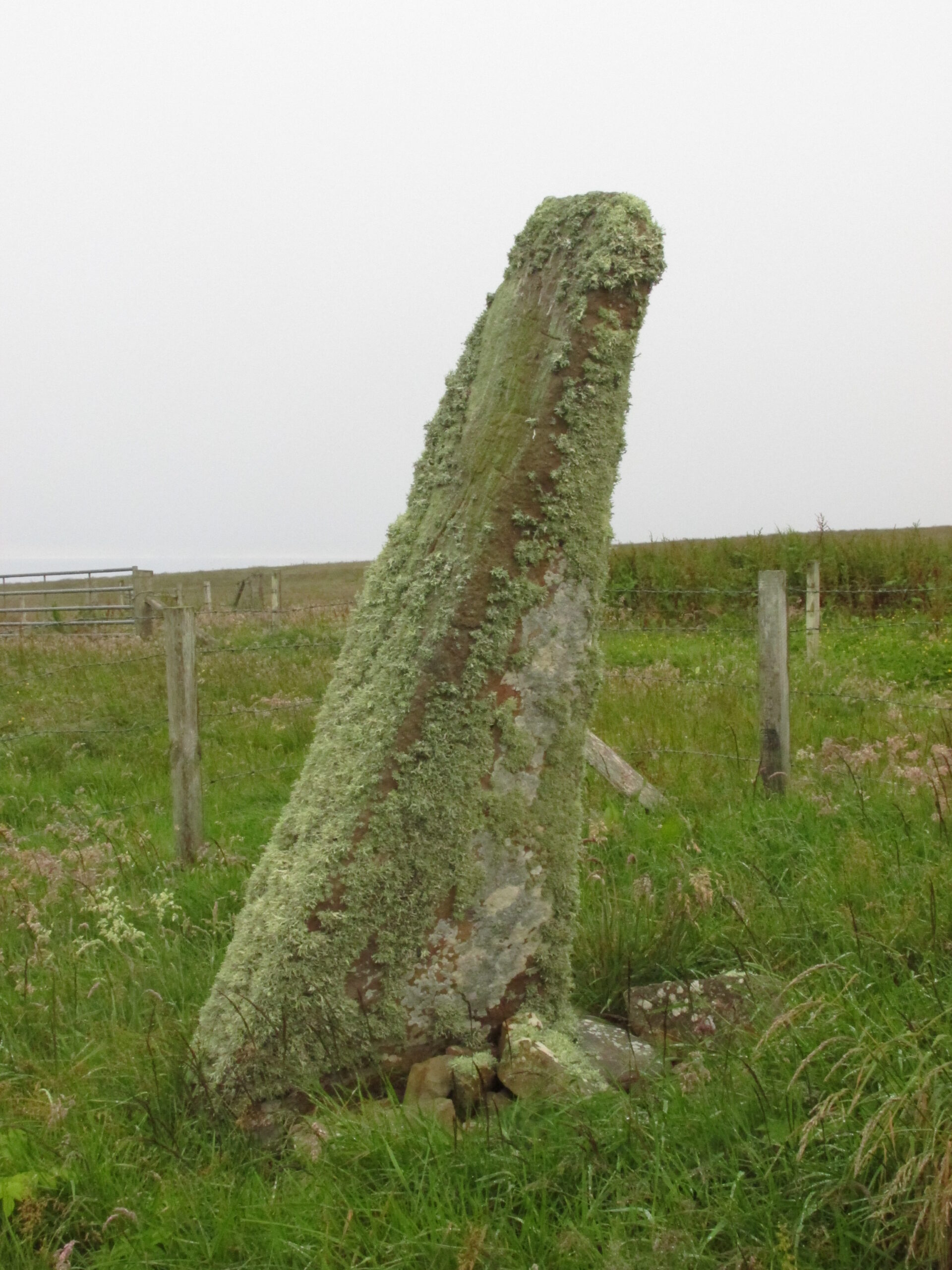
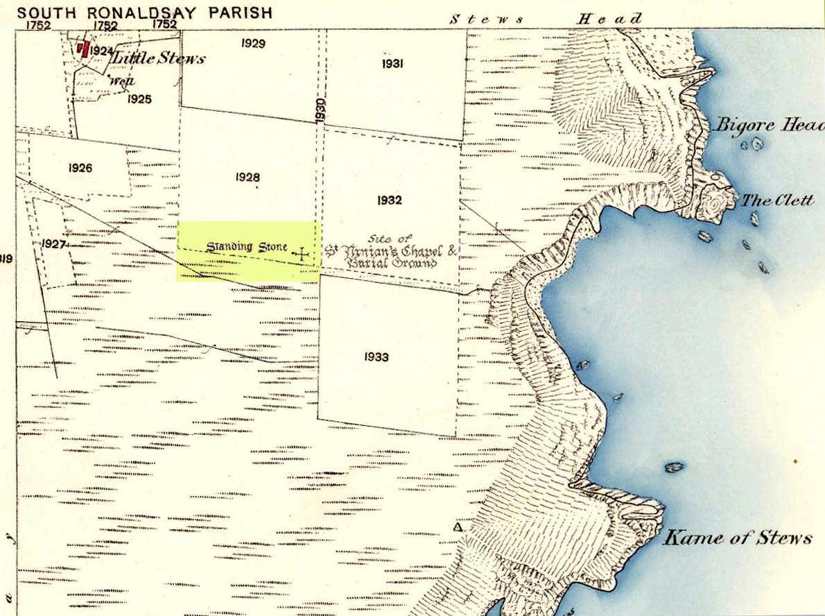
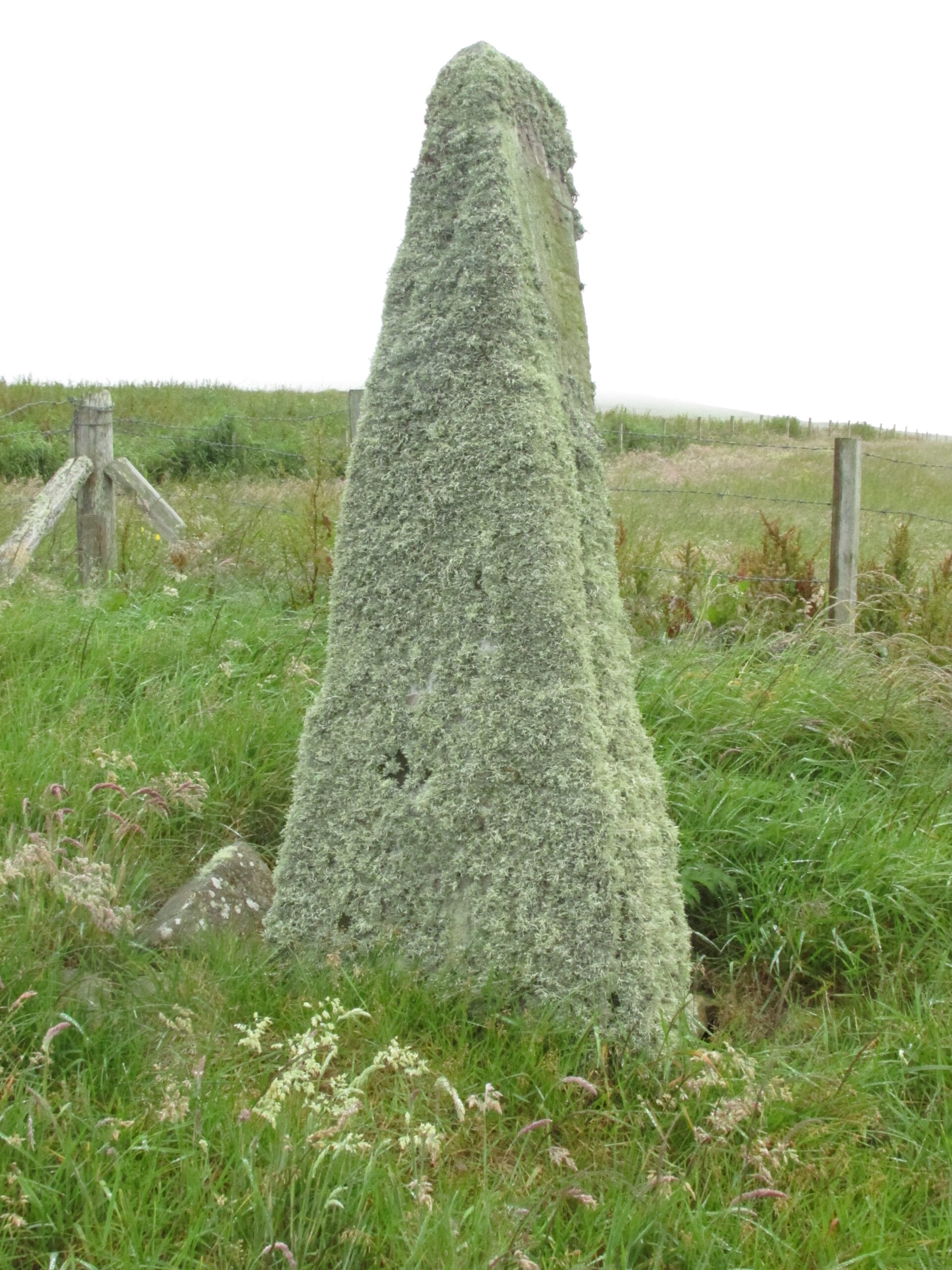
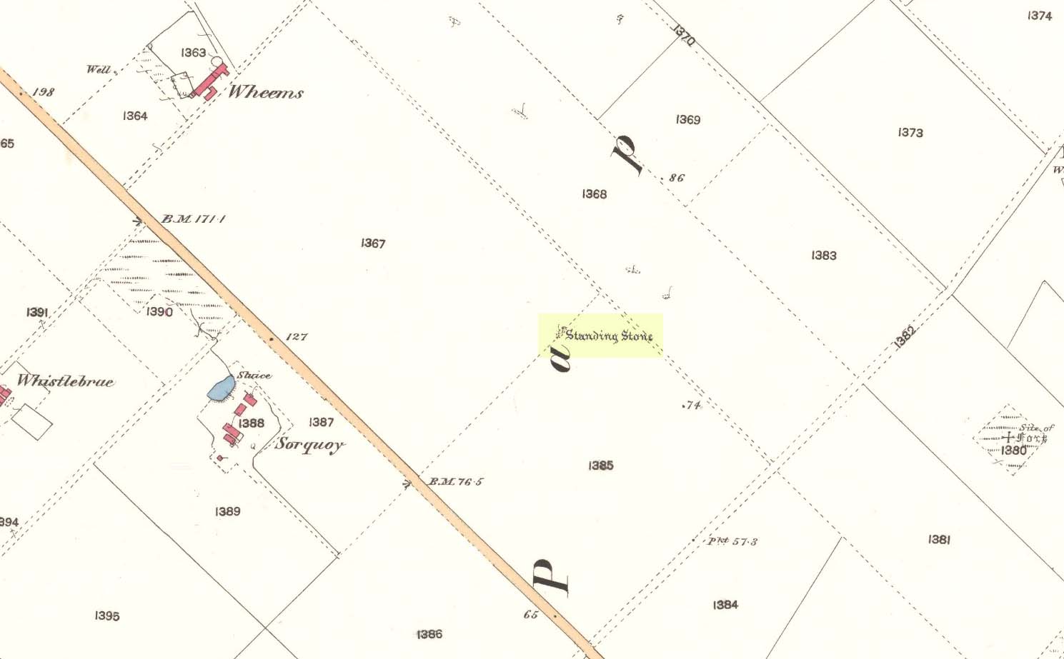
Take the third left road off the A961 past St Mary’s Hope, travelling south, taking the right fork at Lythes, and continue down to the end of the metalled road. From there, walk up the slope to your right (south) and follow the fence on your left into the next field and the stone will be seen in a fenced enclosure.
Archaeology & History
Two things strike you when you first see this stone, the triangular shape of the east facing side, and the lichen which covers this face and much of the rest of the stone giving it the distinct illusion of having a green velvet coat! From another angle it has a distinct lean and there are quite a few packing stones around its base. The Royal Commission inventory (1946) describes it thus:
Stone on 1881 map
“On a ridge barely a quarter of a mile S of the farmhouse of Stews is a triangular block of red sandstone nearly 6 ft high, set with a packing of small stones at the base and with its axis N-S. At the bottom where it is widest it measures 2 ft. 6 in. across and is from 12-13 in. thick. As it rises it tapers gradually to a pointed top, which is slightly inclined towards the W.”
George Low on his 1774 tour wrote:
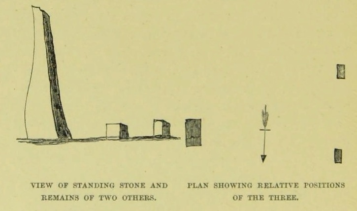
“Left this spot, and May 12th, proceeded southward by Stowse head; observed on the hill the remains of a tri-angular monument, but very much defaced, and two of the stones broke to the stumps. Tradition is there none as to the reason &c. of its erection. The figure with a plan follows…”
George Low’s 1774 sketchA coat of lichen
There is now no trace on the surface of the other two stones of this group so we are fortunate to have Mr Low on the spot sketch to record them. The stones would have been visible to the seafarers of times past who may have used them as navigation landmarks in pre-literate times, this being one of a number of surviving coastal stones on the Orkneys but whether they were erected for this purpose cannot be known. If you’ve been to see the Sorquoy stone up the coast, the surviving Stews stone is worth the journey if only for its ‘velvet’ coat.
References:
RCAHMS, Twelfth report with an inventory of the ancient monuments of Orkney and Shetland, 3v. Edinburgh. 1946
Low, George, A Tour Through the Islands of Orkney and Schetland…collected in 1774, William Peace & Son: Kirkwall 1879.
Acknowledgements: Big thanks for use of the 1st edition OS-map for this site profile, Reproduced with the kind permission of the National Library of Scotland.
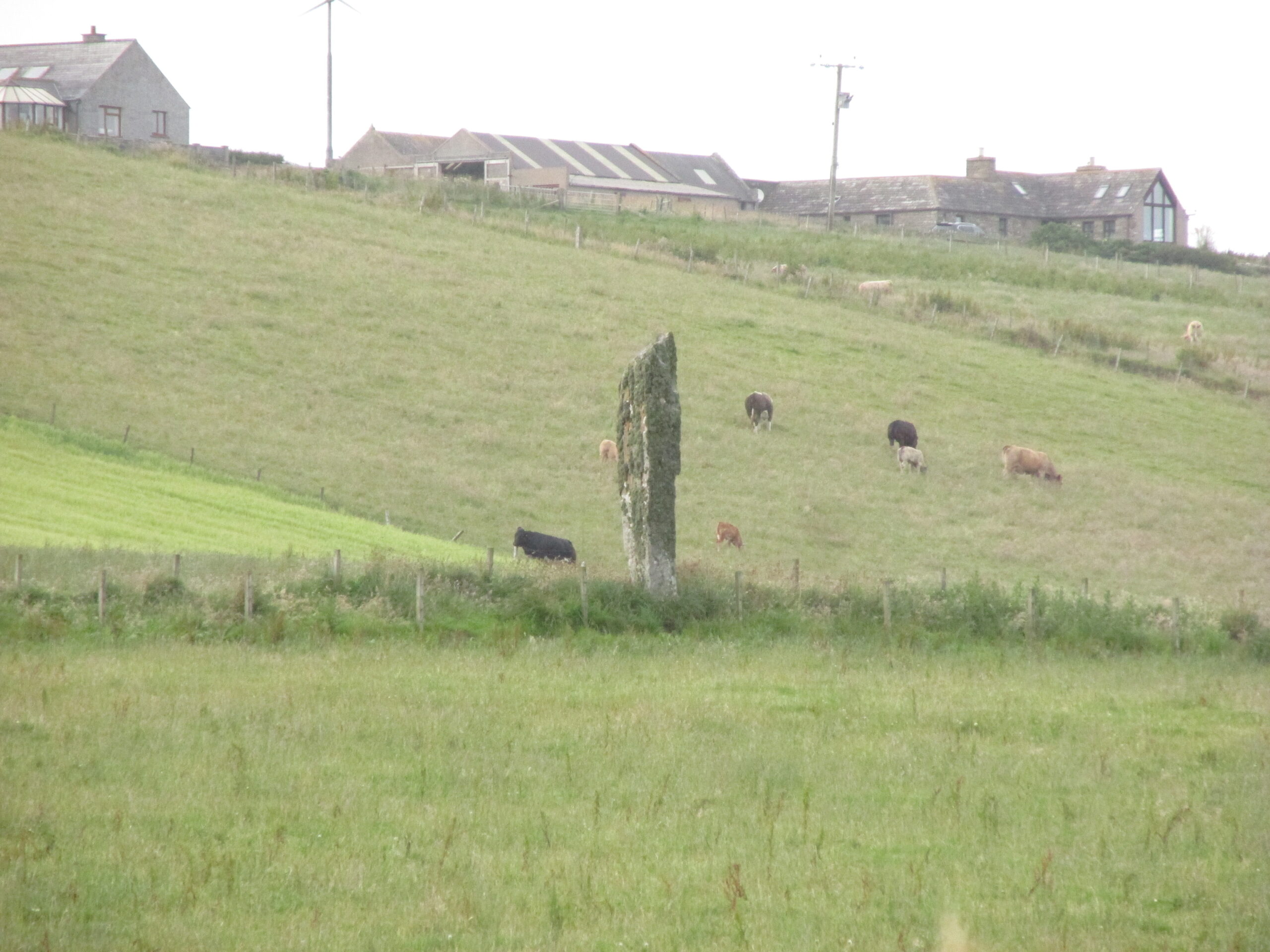
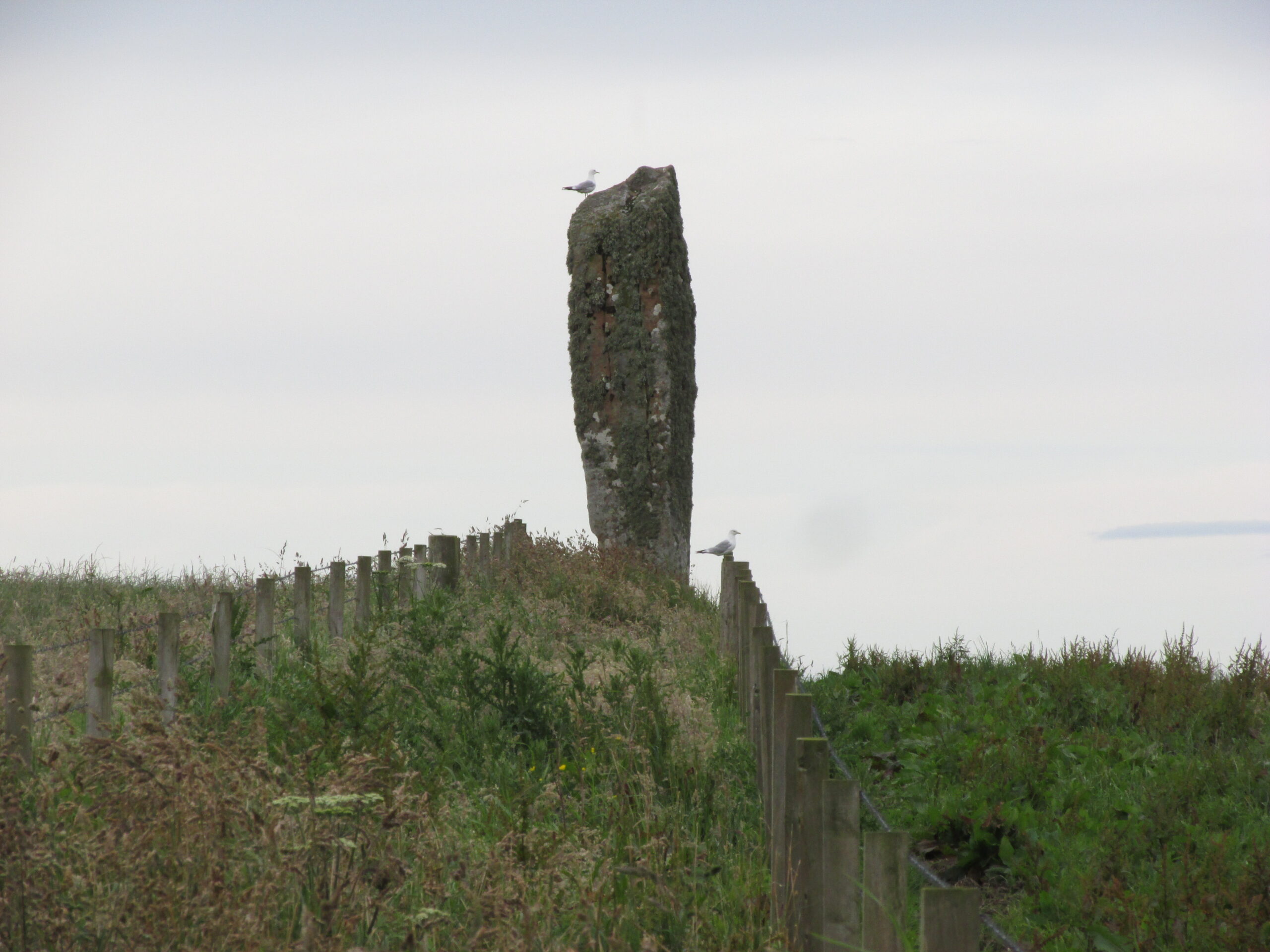
Travelling south on the A961, take the first road left past St Margaret’s Hope, and follow it over the cross roads, and down the hill towards the sea, and it’s visible on the left hand side. You can’t miss it! It’s accessed by a narrow pathway which has been partly ditched – be careful!
Archaeology & History
View from the SEView from the track – SW
One of the less well known but most impressive of the Orkney standing stones, and seemingly one of the least visited. On my visit in July 2019, it was clear no one had walked the path for several months. The Royal Commission Inventory describes it as being, “14′ – 14′ 6″ high with some packing at the base. At 3′ above ground level, it is 2′ 6″ wide and 18″ thick, thickening to 21-22″ as it rises.”
It has a distinctly top-heavy look, and although invisible from the west above the brow of the hill, it can be clearly seen from the sea.
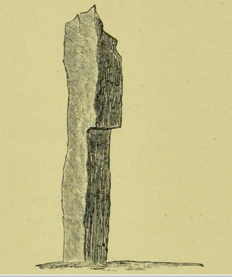
George Low visited the stone on May 11th 1774, saying:
‘In this beautiful hollow, in a cornfield, saw a large erected stone about 16 feet above ground, probably monumental, tho’ tradition is silent about it, and by digging nothing was found that could certainly prove this’.
Described by local historian George Barry (1748 – 1805):
George Low’s 1774 drawing
‘To the north (of South Ronaldsay), – at no great distance, is a most beautiful vale, with the ocean on one side, and gently declining hills on the other; which, for the production of every sort of beneficial crop, is far superior to any other part of the island. In the middle of this pleasant spot, on the brow of a hill, is a monumental stone, sixteen feet high, which, like many others through the country, bears no marks of human art, in carving, figures, or inscription. The whole delightful dale is known by the name of Paplay’ .
If you’re in the islands, this impressive stone is certainly worth a detour!
References:
Barry, Dr George, History of the Orkney Islands, Longman,Hurst,Bell & Orme: London 1808.
Low, George, A Tour Through the Islands of Orkney and Schetland…collected in 1774, William Peace & Son: Kirkwall 1874.
Royal Commission Ancient & Historical Monuments, Scotland, Inventory of the Ancient Monuments of Orkney and Shetland, HMSO 1946.
Acknowledgements: Big thanks for use of the 1st edition OS-map for this site profile, Reproduced with the kind permission of the National Library of Scotland.
Holy Well (lost): OS Grid Reference – SW 6602 2053
Archaeology & History
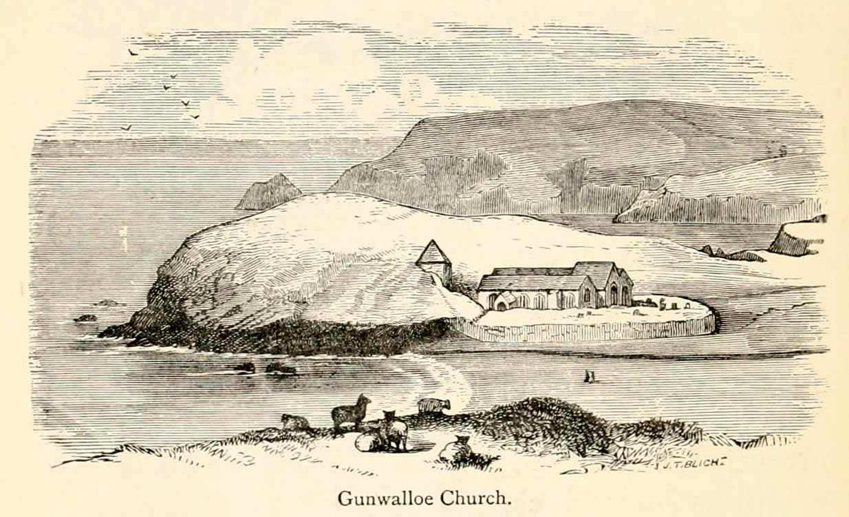
The old church at this headland just above the sea was, said Padel (1988), dedicated to Saint Gunwalloe or Winwalloe in 1332 and is thought to have been the character (a hermit by all accounts) who deemed this well to be ‘holy’. In Alfred Cummings (1875) history of Gunwalloe parish, he devotes a short but singular chapter to this holy well which, according to most accounts, has fallen back to Earth. It was found, said Cummings, “close to the church porch, only a few feet over the precipitous rock…and (was) doubtless the resort in former days of many a lad and maiden.”
Yet even in his day, he lamented its loss, telling that.
“The spring that once bubbled up in its rocky basin is no longer there; sand and stones fill up the well at each high tide, and though occasionally cleaned out for the satisfaction of the wayfarer’s curiosity is yet only an imperfect semblance of its former self.”
Yet remnants of practices and traditions of the well were thankfully remembered:
Gunwalloe church in 1885
“That Gunwalloe was considered by the country folk a well of some importance there can be little doubt, for one day in the year, which was called Gunwalloe Day, was set apart for cleaning out this holy well — it was quite at a different time of year to this parish feast — and now only remembered by two old men out of the whole population of the place.
“They fix the time in their memories as the period of tilling barley, for they recollect that on this Gunwalloe Day it was the custom for the men to mend all the cliff roads (doubtless these were useful in days of smuggling when a successful run was a desirable thing), and so strictly was it kept that, if any were found labouring in the fields, a party would go and take them by force, and press them into the service of the holiday makers, who, having mended the roads and cleared the holy well at Gunwalloe, wound up the day with merriment and revelry.”
Such practices are long since gone of course and, so most modern accounts would tell us, the holy well with it. But when J. Meyrick (1982) came looking for the site on the summer solstice of 1980, he seemed a little more fortunate than his predecessors. Located just a few yards from the detached church tower, he spoke with a
“Mrs Wilson, a churchwarden (who) told me that in heavy rain the tower continues to be flooded so the spring is still somewhere about, and curiously enough by the stile to the beach is a small granite trough with rainwater put there by someone no doubt in lieu of the Well and who is to say that the water is not holy! The stream across the dune still meanders a few feet beneath the tower and into this the water from the well would have run, but there seems now no sign of an originating spring in the rocks around.”
Folklore
The church itself possesses a folktale found up and down the land. “It is said,” wrote Blight (1885),
“that the builders intended to erect the church on higher ground, nearer the centre of the parish, at Hingey; but as fast as materials were brought to the place they were, by some mysterious agency, removed during the night to the present site. And here the church was built, it being found useless to contend with a supernatural power.”
The supernatural agencies that are nearly always responsible for such actions tend to be the devil, fairies or other types of little-people.
References:
Blight, J.T., Churches of West Cornwall, Parker: London 1885.