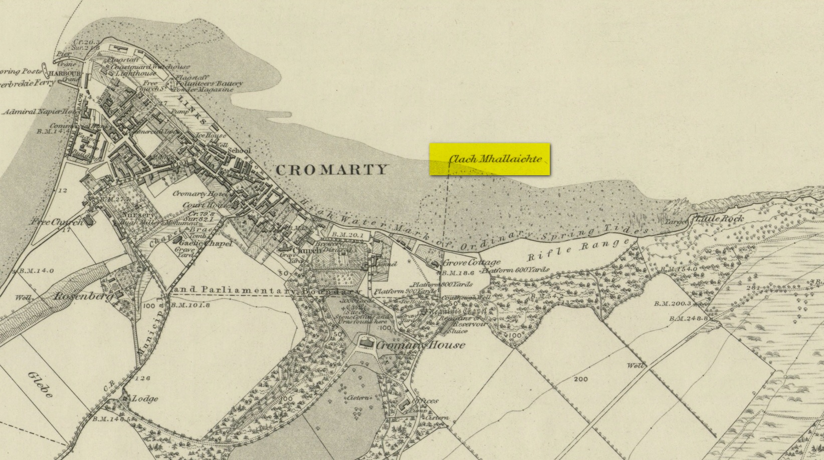
This large boulder found off the Cromarty coast, was highlighted on the 1880 OS-map of the region. It is one of the ancient boundary stones of the township.
Folklore
We know from the vast array on the folklore of stones that many were imbued with magickal abilities, some of which were witnesses to vows and others to make curses from. This large boulder off the coast of Cromarty was, according to Donald MacKenzie (1935), a place where the latter used to be done. He told us:
“At Cromarty there is a big boulder known as the Clach na Mallachd (‘Stone of Cursing’). Curses were delivered when an individual stood or knelt bare-kneed upon it.”
In an earlier account by the Ordnance Survey lads in one of their Name Books, they gave the following tale that had been narrated to them:
“A large stone Situate at the Low Water, and forming one of the boundary Stones of the burgh, the reason of its having this name is, that a young lad while Sitting on it was overwhelmed by the advancing tide and drowned, his mother when told of it, cursed the stone, hence the name Clach Mallach (Accursed Stone)”
References:
MacKenzie, Donald A., Scottish Folk-lore and Folk Life, Blackie: Glasgow 1935.
As with traditions found all over the world, rivers and lakes had spirits, gods and rituals attached to them. Despite us believing that no such things ever occurred in Britain and the rest of the so-called ‘civilized’ world, such things were once common. One of the annual rites performed at the Hebridean river at Barbhas (Barvas)—and described by Alexander Fraser (1878)—is just one such example:
“The natives of Barvas had a peculiar custom on the first day of May, of sending a man across the river at (the) dawn of day to prevent any females from crossing it first, as that would hinder the salmon from ascending the river all the year through.” (Fraser 1878)
The importance of the salmon, both as an important food source and equally as a ‘sacred animal’, is known in myths and legends throughout the British Isles. To the legendary hero-figure Finn, it played a part of him gaining supernatural wisdom, and this quality is integral to the fish itself who ate the hazelnuts of knowledge and gained such power. In this same short piece of folklore, the time of year when the ritual should be enacted on the River Barvas is Beltane, which is renowned as the prime period in the annual cycle/calendar relating to fertility. This element relates to maintaining the fecundity of the river and the salmon where, in this case, men crossing the waters symbolically fertilizes them to ensure the annual return of the fish. It would be interesting to know when this custom finally died out.
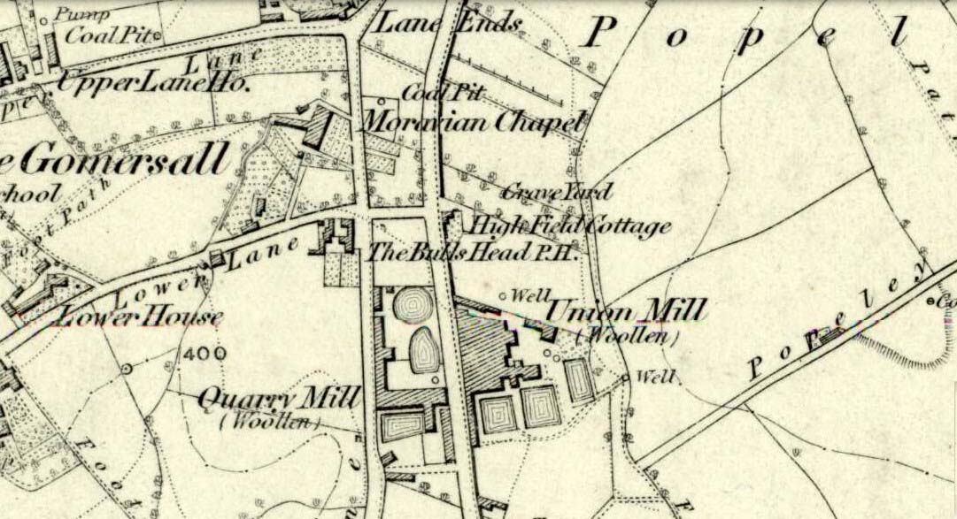
Originally called the ‘Manor Lea Well’ because it could be found on the far west of the land belonging to the Manor House, the name later became corrupted to ‘Mannerly’ by local folk. It was one of the four prime water supplies for this part of the old village, but it had other important social and festive rites attached that undoubtedly went back centuries. H.A. Cadman (1930) told that:
“On Palm Sundays it was the custom for boys to take bottles containing Spanish juice, treacle, and any other sweet thing they could, for the purpose of having them filled with the water from the well. The boys then exchanged bottles with each other and each sampled the others. It was said that no better water existed for this purpose.”
This particular ritual was integral to virtually every Spa Well from Wakefield through to the source of the River Calder.
A Mr G.W. Parker said that the well was to be found at the “extreme Western side” of Manor Lea and was “still in existence” when Cadman wrote about it in 1930, “behind Company Mill” not far from the Moravian Burial Ground. Do any local historians know if the well is still there, or has it since been destroyed?
References:
Cadman, H. Ashwell, Gomersal, Past and Present, Hunters Armley: Leeds 1930.
The 6″ OS map of 1913 has a ‘Fairy Well’ marked on the northern edge of Preesall Hill. Travelling north through the village on the B5377, the Hill is to your right. Immediately past it is a stile, cross over this and go straight on with the hill to your right. The approximate site of the fairy well is now marked by a boggy area at the foot of the hill.
Archaeology & History
Almost a footnote in Reverend William Thornber’s 1852 paper on the Britons, Saxons and Danes in the Foreland of the Fylde, here is how this site is described by him in the quaint (to our eyes) language of the mid-nineteenth century:
“…the hill of Presal, (the ‘Pressonde’ of Domesday), with its well all but deified; and although the votaries, like those in the pool of Laconia, may not have cast into it cakes of bread-corn to Juno,* yet a bush was named ‘Beggar’s bush,’ from the circumstances of the offerings of rags and clouts being affixed to it, over which a prayer was said; for Bishop Hale ridicules a superstitious prayer for the blessing of clouts for the cure of diseases.”
In addition, the following reference was found on-line:
“…If the travellers had lingered, however, they would observe the inhabitants placing half eggshells on the edge of the Fairy Well at the foot of Preesall Hill; a practice of the local school children even at the beginning of the 20th century. Recording some of the traditions of the country areas of 19th century Wales, Sir John Rhys in his “Celtic Folklore”, mentioned how half eggshells were left out for the fairy folk to use as cooking pots in which to prepare food and brew beer for the reapers at harvest time.”
Close-up of the boggy waters
The Beggar’s Bush is long gone, but the red colour of the deposits in the adjoining ditches would indicate a chalybeate (iron-bearing) spring rather than a well, and the northern slope of the hill seems to have become an unofficial children’s play area. Curiously, at the top of the hill, next to the playground of the Fleetwood’s Charity School, there is a modern ‘beggar’s bush’, festooned with white and yellow plastic strips, in a small nature trail area…
* quoted from Borlase, in his Natural History of Cornwall (1758): “…In Laconia they cast into a pool, sacred to Juno, cakes of bread-corn; if they sunk, good was portended; if they swam, something dreadful was to ensue.”
¶ http://www.lancastrians4ever.homecall.co.uk/lancastrians4ever/precha1.htm – Believed to be an online digest of out of print Preesall history publications by Stan Jones
References:
Thornber, William, ‘Traces of the Britons, Saxons and Danes in the Foreland of the Fylde,’ in Proceedings and Papers of the Historic Society of Lancashire and Cheshire, Liverpool 1852.
Acknowledgements: – My thanks to the staff of the Local Studies Department, Borough of Blackpool Library Services for their assistance
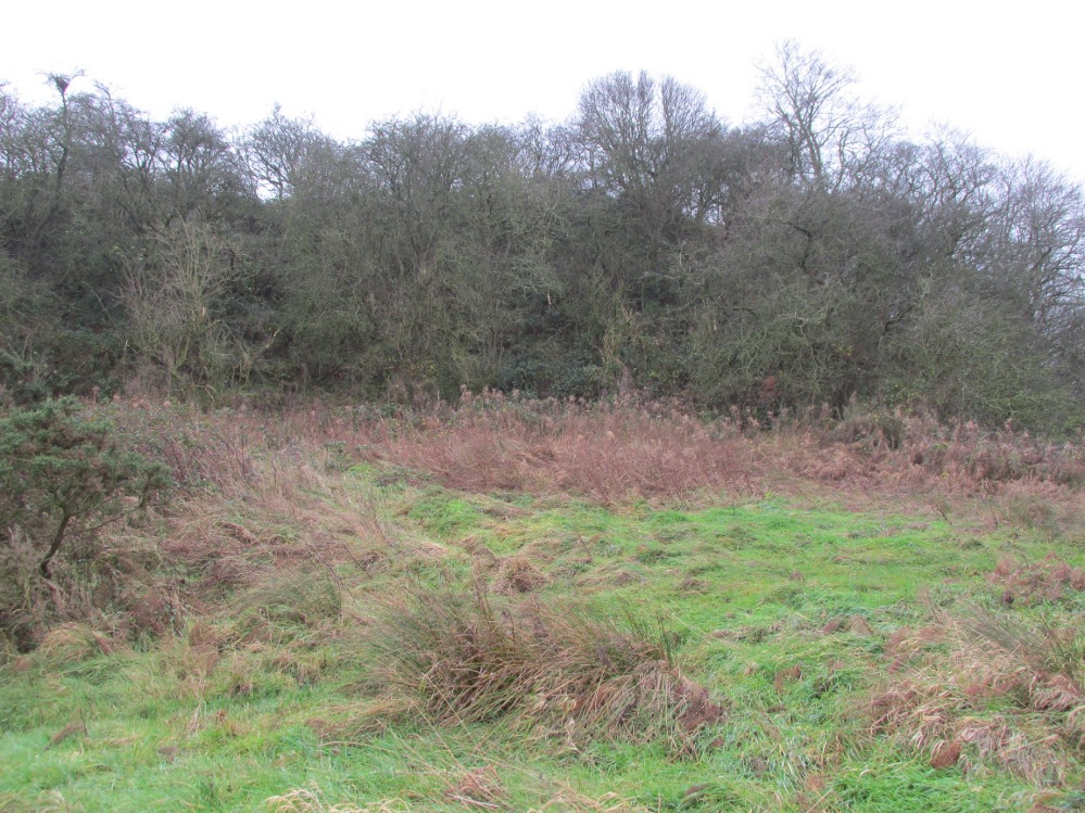
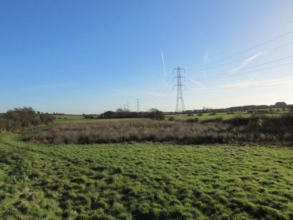
The boggy ground of the Bull Spring – from the site of possible cairn
To get here, leave Staining village along Mill Lane, turning right at the windmill along Smithy Lane. Walk along Smithy Lane, then 2-300 yards past a derelict piggery on the left go into the gated trackway on the right, and Bull Meadow is to the south-east, a boggy area at the western end of OS parcel 356. Be prepared to cross barbed wire fences.
Archaeology & History
Like the Staining Wrangdomwell or Fairy Spring recorded elsewhere, knowledge of this site owes its historical survival to the writings of Blackpool cleric, Rev. William Thornber (1803 – 1885), who wrote in 1851 about the now forgotton ‘Teanla’ or Hallowe’en bonfire cairns of Hardhorn:
“…but here adjoining the cairns are attached two wells, the one celebrated as Fairy or Wrangdomwell, and the other, issuing from a huge oblong mound of stones, as Bel spring or vulgarly Bull spring, in the Bull meadows, evidently bearing the same name as Beltain Meadow in Blackpool. Here on this Hardhorn oblong cairn, ceremonies were observed for the purpose of obtaining health to the herds of the farmers of the township – to free the wheat-land from tares, weed &c. – to bring good luck to the votaries, and to enquire into the secrets of futurity.
The ceremony was thus:- first, large fires were lighted, two or three families joining at a circular cairn, the ashes of which were carefully collected. Then the white stones, which at first, had circled the fire were thrown into the ashes, and being left all night, were sought with anxious care at sunrise, when the person who could not distinguish his own particular boulder was considered fey, i.e. some misfortune would happen to him, during the course of the ensuing year¹.
As a finale, the stones recognised were thrown, as an offering, on the oblong cairn to the god or saint who presided over it, and the well, and thus, such collections were made in a succession of years, as to astonish the curious. The water of the wells also had a sovereign virtue for healing the disease of men and cattle….”
The healing procedure at the wells is transcribed in the description of the nearby Fairy Well. Mr Thornber continues:
“The site of the large circular cairn (at Bull Meadow) is not now easily to be distinguished, since Mr. Fisher, the proprietor of the field, has carted away upwards of twenty loads of the refuse that composed it, but the soil around it is burnt red and black. This farce was carried on in its pristine glory long after the reformation; for rational Christianity (sic), which had been almost lost previously, progressed but slowly in the district of the Fylde. Even the waters of Marton Mere (SW of Bull Meadow),…were held sacred.”
Perusal was made of the Schedule to the 1839 Tithe map which revealed a ‘Bull Meadow’, owned and occupied by William Fisher, and from this, its location was able to be identified on the OS map.
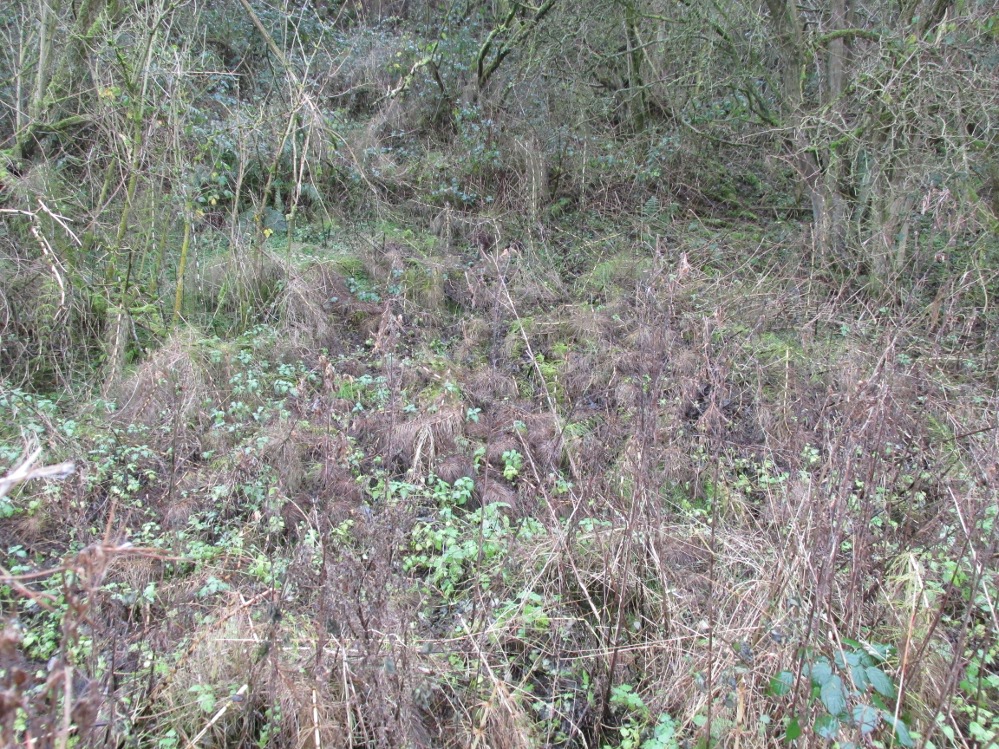
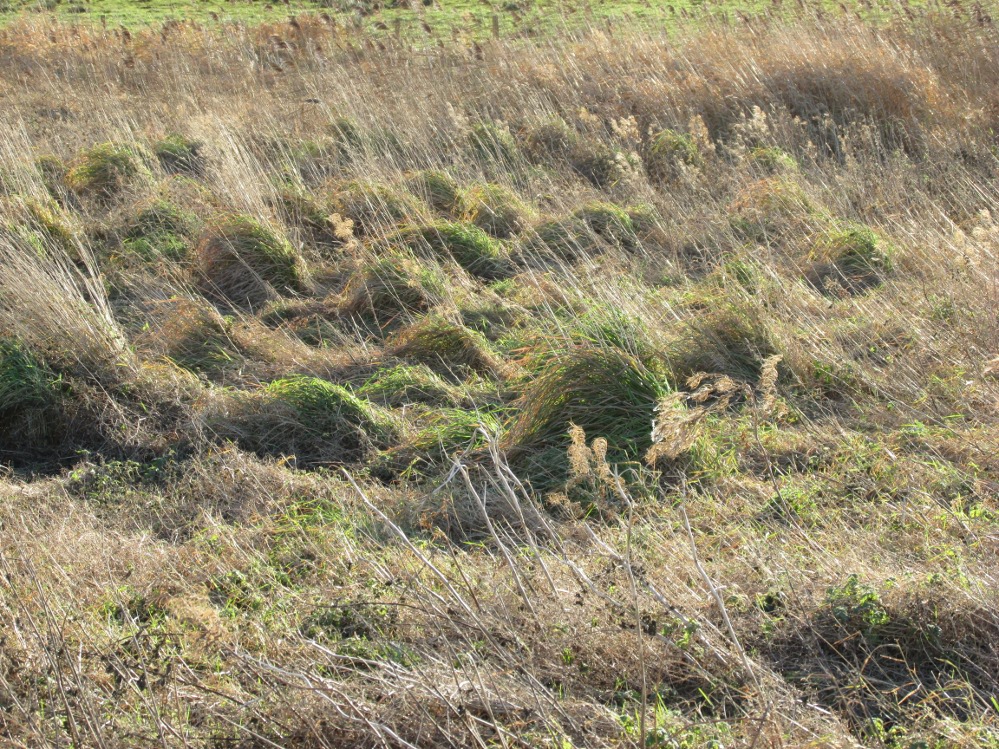
Possible source of the waters
Like Wrangdom Well, half a mile to the north-west, the Bull Spring issues from an area of swampy ground, and the exact place of issue was hard to pinpoint when this writer visited in December (see photo the right). The oblong cairn—if indeed that is what it is—can still be identified, about 2 feet above the marsh, it is firm to stand on but not easy to distinguish owing to the amount of vegetation.
¹ Writing in the January 1883 edition of the The Folk-lore Journal, the Reverend Walter Gregor describes ‘ristin the halla-fire’ a broadly similar Scottish ritual carried on in the Fraserburgh area up to the late 18th century.
References:
Thornber, William, ‘Traces of the Britons, Saxons and Danes in the Foreland of the Fylde,’ in Proceedings and Papers of the Historic Society of Lancashire and Cheshire, Liverpool 1852.
Tithe Map & Schedule Transcript – ‘The Township of Hardhorn with Newton’ Surveyed by Thomas Hull in 1838, with Schedule dated 1839.’
Acknowledgement: My thanks to the staff of the Local Studies Department, Borough of Blackpool Library Services for their assistance.
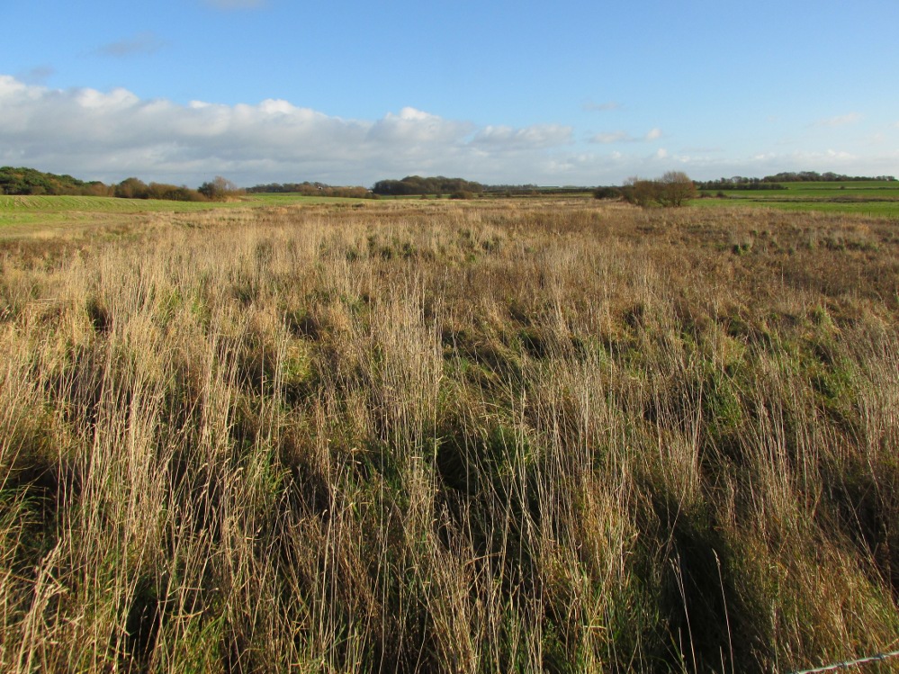
One and a half centuries of neglect have not been kind to the Wrangdomwell, which is now in the middle of a large area of swampy land, reached from Staining village along Mill Lane, turning right at the windmill then walking along Smithy Lane. Just before a derelict piggery on the left go into the field, and Wrong Well Meadow is on the right at the back of the piggery, with the spring issuing from the boggy ground. Be prepared to cross barbed wire fences, and to meet some friendly ponies.
Archaeology & History
Were it not for the researches and writings of an eccentric cleric, this site would almost certainly now be lost to history. The Reverend William Thornber recorded, in his 1837 History of Blackpool that:
“The fairies of our fathers…were kind good natured creatures, at times seeking the assistance of mortals, and in return liberally rewarding them. They had a favourite spot between Hardhorn and Staining, at a cold spring of water, called Fairies’ Well to this day.”
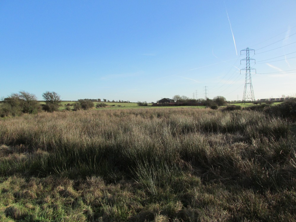
The legendary waters hide in the rushes
Writing in a paper published in 1851, Thornber described the Fairy Well or Wrangdomwell in the context of the “Teanlas”, the enormous Hallowe’en bonfires (4) that were still at that time being lit at ritual cairns of stones in parts of west Lancashire. One of these fire cairns once adjoined the Fairy Well, which in 1850 was still being visited for its,
“sovereign virtue for healing the diseases of men and cattle. To succeed in obtaining a cure, the patient, escorted by his friends, was made to pass through the cairn, then he was sprinkled or dipped in the well, and lastly, he made an offering of a shell, pin, a rusty nail or a rag, but principally three white stones burnt in the Teanla fire. It is surprising in what numbers pieces of iron may be picked up. I have found since the meadows were ploughed, nails, an old shaped knife, leather thongs etc.”
Thornber wrote that the cairn no longer existed, and gave no precise location for the well.
Looking at the area between Hardhorn and Staining on the 1891 25″ OS map revealed only one ‘spring’; in land parcel 295. This parcel of land is recorded in the Schedule to the 1839 Tithe map as ‘Wrong Well Meadow’, occupied by Thomas Dobson, and owned by ‘School of Marton’, a charitable endowment established in 1717. Adjoining Wrong Well Meadow are Old Meadow and Nickers Meadow (‘Old Nick’?), which might appear to show the Wrangdomwell as in the past having been part of a larger heathen ritual locality. Notwithstanding this, the Church was happy to take its tithe.
References:
Thornber, William, The History of Blackpool, Smith Market Place: Poulton-le-Fylde 1837 (republished in 1985 by the Blackpool and Fylde Historical Society).
Thornber, William, ‘Traces of the Britons, Saxons and Danes in the Foreland of the Fylde,’ in Proceedings and Papers of the Historic Society of Lancashire and Cheshire, Liverpool 1852.
Tithe Map & Schedule Transcript, ‘The Township of Hardhorn with Newton’ Surveyed by Thomas Hull in 1838, with Schedule dated 1839.’
Michelle Harris & Brian Hughes, in their ‘The History of the Wyre from Harold the Elk to Cardinal Allen‘ (4th ed. 2007) p35, write – “According to Tom C. Smith’s ‘History of the Parish of Chipping‘ published in 1891: ‘Teanlaes was the name given to fire celebrations, observed until quite recent years on May 1st, Midsummer Day, August 31st, and November 1st.’ These dates, it should be said, are at variance with Henry Taylor who, in his 1899 publication ‘Ancient Crosses of Lancashire’, quotes Atticus as saying: ‘The ceremony observed on Teanlow night, the last night of October, consisted of making bonfires on all the neighbouring hills.'”
Acknowledgements: My thanks to the staff of the Local Studies Department, Borough of Blackpool Library Services for their assistance.
Although cited in all modern archaeology texts as a series of four henge monuments, a recent article by J. Lewis & D. Mullin (2011) inform us that these “are not henges but belong to a tradition of enclosure that predates them and had a different function.” We’ll have to wait and see what they mean by that! In the meantime, we’ll have a quick scurry through the historical accounts of these four impressive ‘henges’ as Burl, Piggott and the others call ’em.
Surrounded at all angles by numerous barrows and tumuli, these four great henge monuments were shown on the 1887 Ordnance Survey map as a row of ‘Supposed Ring Forts’, when such ideas were in vogue, running in a line roughly SSW-NNE; the third one up having a couple of ponds within it. A brief early account of them was given by Harry Scarth (1859)—who was describing the series of nine round barrows a few hundred yards to the south—who told them to be “circular banks” each 500 feet across. The first more detailed account was in A.H. Allcroft’s (1908) classic text, where he wrote the following:
“…Close to the Castle of Comfort Inn, where the high road to Bristol crosses the line of the old Roman road running north-westward towards Charterhouse, there lies immediately west of the high road a series of four circles…all of one size, all of one plan, and all as mathematically exact as circles could well be when executed in such a soil and on such a scale. Although they have suffered greatly from the mining operations which have scarred all the Mendips, as well as from the plough — one of the four is almost obliterated — they are still quite easy to make out. The diameter of each is some 550 feet within the area, which is surrounded by a broad low vallum, and that again by a correspondingly broad and shallow ditch. The height of the vallum above the ditch, where best observable, is some 5 feet. There are no determinable entrances. The most southerly of the group is about 250 feet away from the second ; the second about 200 feet away from the third; and a line joining the centres of the first and third passes through the centre of the second also, and points 17° east of north. The fourth circle lies 1,200 feet away from the third, not in a right line with the others, but slightly to the west. Between the third and fourth circles passes the Roman road. Within the third circle is an old pond of some size.
“With every appearance of being all of one date, and that a venerable one, these circles lack every characteristic of military works. Their peculiar disposition, their painstaking regularity, and their identity of size, all suggest that they must, if really old, be of ritual, and perhaps of astronomical character”
Old drawing of the central hengesHenge 1, recently damaged (courtesy Pete Glastonbury)
Allcroft’s ideas of ritual and astronomy were pretty good for the period, as we take it for granted these days that such events occurred at henges — so the existence of four such sites right next to each other, would have made this one helluva place in neolithic and Bronze Age periods. A few years after Allcroft, the henges were described in Mr Burrow’s (1924) excellent illustrated survey, from which the drawing of the two central henges is taken (the two ‘R’s in the background highlight the line of the Roman road which runs past them). Burrow’s didn’t add much more of any note, simply telling:
“…in the fields north and south, are placed earth-work rings, each about 180 yards in diameter, on a line placed slightly north by east. The most northerly of these rings is almost obliterated, but the three on the west of the road from Chew Stoke to Oakhill are quite clearly defined, as my drawing (above) will show. I have been able to include two of these remarkable rings in my picture, the edge of the bank (which was, when I saw it, fringed with yellow gorse), being about 6 feet above the level of the ditch outside. It is generally supposed that these ringed earthworks were connected with some prehistoric ritual, and Hadrian Allcroft thinks were used for primitive astronomical observations or the construction of a primitive calendar.”
Tratman’s plan of Priddy HengesAnother view of Henge 1 (courtesy Pete Glastonbury)
Many years later when archaeologist K.S. Painter (1964) came to describe these henges, he listed them as “stone circles” (what the hell was he on!?), but this error may derive from the finding of several stones that once existed inside the southernmost Henge 1. These were uncovered following excavation work done here by E.K. Tratman (1967) and his colleagues, who explored and numbered the four henges—running from south to north—as follows:
“Circle 1: This is tolerably complete. A portion of the southwest quadrant has been destroyed by mining and there are three modern gaps in the ring. Mining has involved the ditch on the west and south, and to a small extent on the east. There is an irregular extensive hollow west of the centre and this too is a product of mining and contains a number of large stones so derived. The circle is not quite a true one, being flattened slightly on the west. The circle has a diameter from bank top to bank top of 520ft. The single original entrance is NNE of the centre. Stones 1 and 3-7 were removed by the farmer before excavation, but subsequent ploughing immediately after removal did not reveal any change in soil texture or colour. Stone 8 was placed in its present position quite recently. It is not known where it came from. Other stones have recently been placed on top of the bank east of the entrance by the farmer (1964-5). Stone 2 is in a relatively ancient position.
Circle 2: This is a true circle and its diameter and position of its entrance are similar to Circle 1. It has been considerably disturbed by mining. A group of stones (10-14) and stone 9 represent modern collections from the field. None of them is in its original position. There are two modern gaps in the ring.
Circle 3: This is distinctly flattened on the east and west. The N-S diameter is 520ft and the E-W 490ft from bank top to bank top. The northeast quadrant reported by Allcroft as being levelled is still traceable. The circle has been greatly disturbed by mining… The entrance is SSW of the centre, the opposite pole to circle 1 & 2, and has probably been widened, perhaps by miners. The marsh may be an original feature or the product of mining. The two ponds are certainly modern, and so is a small mound, which is probably spoil from the major pond.
Circle 4: This is incomplete. It has a diameter of 560ft, which is considerably larger than any of the others. The OS map shows only the eastern semi-circle remaining. However, the bank and in part the ditch can be traced…If the visible and proved end of the ditch on the SSW was intended to be at the edge of the causeway, then the entrance would have been in the same position as that of Circle 3.”
Very recently, a local land-owner quite deliberately bulldozed a large portion of the southern henge in this complex, destroying much of it. This act of criminal vandalism will hopefully not go unpunished and is, at the present time, going through the courts.
…to be continued…
References:
Allcroft, A. Hadrian, Earthwork of England, MacMillan: London 1908.
Burrow, Edward J., Ancient Earthworks and Camps of Somerset, E.J. Burrow: Cheltenham 1924.
Lewis, J. & Mullin, D., “New Excavations at Priddy Circle 1, Mendip Hills, Somerset,” in Proceedings of the University of Bristol Speleological Society, volume 25, 2011.
Painter, K.S., The Severn Basin, Cory, Adams & Mackay: London 1964.
Scarth, Harry M., “Some Account of the Investigation of Barrows on the Line of the Roman Road Between Old Sarum and the Port at the Mouth of the River Axe,” in The Archaeological Journal, volume 16, 1859.
There are a number of sacred and healing wells on this small island, but this site in particular was deemed magickal by folk from far and wide. Found on the northwest slopes of Cnoc Largie (around which are other heathen spots) this legendary site had an attendant keeper of the well:
“an aged female direach, or guardian, whose uncanny powers could be commanded by a small offering of silver. Following this the cover of the sacred well would be removed in order that its waters might be ceremonially cleansed with a white clamshell prior to being stirred three times, sunwise, to the accompaniment of ritual incantations. Then three shell-fulls of the sacred water would be hurled aloft in the direction of the desired wind which, before the day was out, invariably appeared.”
This simple ritual obviously tells that it was a heathen site, seemingly one for divination and magick. Another piece of folklore (found at other wells) told that if the cover on the well were left unattended, its waters could overflow and flood the entire island.
References:
Anonymous, Exploring Historic Kintyre and the Isle of Gigha, Harlequin Press: Oban n.d.
Go west through Stanbury village towards Lancashire for a mile till you reach the end of Ponden Reservoir. Where the water ends, follow the small track up to, and past, Whitestone Farm, till you reach the stream. Follow the valley up…
Archaeology & History
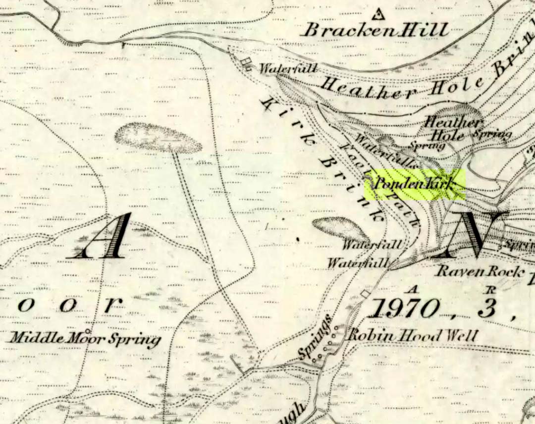
As the great Yorkshire historian J. Horsfall Turner (1879) told, “Ponden Kirk consists of a ledge of high rocks, dry in summer, but forming a stupendous cataract after heavy rain. It was here that Mrs Nicholls (Currer Bell) caught a severe cold shortly before her death.” The site is a fine one – not to be attempted from the base by unfit doods, unless you’re really serious about your climbing! But to those of us who like clambering up rocks and wholesome scenery, walk to the site via the stream (Ponden Clough Beck) and get to the cleft in the rock face. Tis a truly fine place!
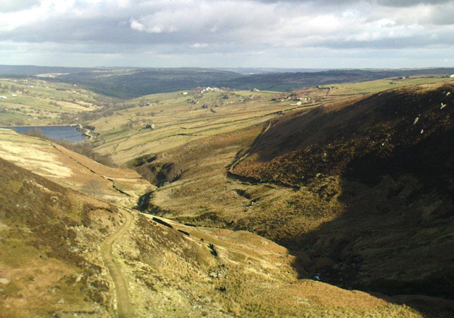
Ponden Kirk from below
In 1913, one writer posited the notion that the opening in the rocks through which local folk crawl (see Folklore, below) “is seemingly artificial” – which aint quite true, sadly.
Once on the tops above the Kirk, you’ve one helluva decent view, be it raining or sunny. On the far northeastern horizon arises the great omphalos of Almscliffe Crags; and next to that is the elongated top of Baildon Hill; and a little further northeast is Otley Chevin. It would be good to visit here on a few of the old heathen days and watch the sunrise, just to see if there are any intriguing solar observations to be made! (take a tent though – or p’raps, if you’re like us, don’t bother, but you’ll be bloody cold for the night!) The only potential sunrises of heathen significance appear to be midsummer and Beltane….
Ponden Kirk on 1851 map
For me at least, one of the things which gives this site an intriguing form of sanctity is the fact that the Kirk itself forms the head at the end of the valley. It is a very fine ritual site and would obviously have had much more to be said of it than just the heathen marriage rites which are left today. The forces of wind and rain scream from its height, and in the valley beneath the chime of the gentlest echoes resonate, giving an altogether different ‘spirit’ amidst the same land. Those old cherubs of ‘male’ and ‘female’ spirit commune potently here – no doubt being the ingredients which gave form to the marriage customs… Those of you into feng-shui (the real stuff, not the modern bollox) and genius loci should spend time with the water and rocks here and you’ll see what I mean. Archaeologists amongst you, if you dare, should amble aimlessly here for sometime…for many hours, a few times, and give yourselves a notion of the ‘ritual landscapes’ you like to write about from the safety of your textbooks, to get a bittova better notion of what ‘experiencing the land’ is actually about.
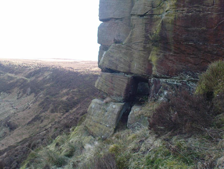
Ponden Kirk’s opening
This rocky outcrop was also said to be the place that Emily Bronte used in her Wuthering Heights novel as the place called Penistone Crags. A couple of other local writers have also added this legendary place in their tales aswell.
Folklore
Alleged by Elizabeth Southwart (1923) “to be of druidical origin,” the first literary note of this great rock outcrop appears to come from the reverend James Whalley (1869) of Todmorden, who in his romantic amblings over the moorlands here, told that if any gentleman wants to get married,
“he must by all means pay a visit to Ponden Kirk… Here ‘they marry single ones!’ Any lady or gentleman who can successfully ‘go through one part of the rock’ (which is quite possible) is declared to all intents and purposes duly married according to the forms and ceremonies of Ponden Kirk.”
The view from the top
His wording here seems to imply that the event of passing through the rocky opening, is in itself a confirmation of the ceremony of marriage, not needing the blessing of some strange christian rites. If so, this tradition would be a very ancient one indeed, making the stone the witness to the marriage event. This would be a rite witnessed by the stones themselves: a universal heathen attribute found in most of the ancient traditional cultures. But this curious unwritten history was to be echoed a decade later by that great Yorkshire historian, J. Horsfall Turner (1879), who told us that,
“at Ponden Kirk, as at Ripon Minster, a curious wedding ceremony is frequently observed. It consists in dragging one’s-self through a crevice in the rock, the successful performance of which betokens a speedy nuptial… The place is now frequently called ‘Wuthering Heights. Apart from the association of such names as Crimlesworth and Oakden (see the Alcomden Stones), fancy easily ascribes a druidical settlement at the Kirk.”
A not unreasonable assumption – though nothing of this nature, of yet, has been found.
That other great Yorkshire writer, Harry Speight — aka Johnnie Gray (1891) — echoed the same folklore telling how,
“The natives of these parts have a saying, ‘Let’s go to Ponden Kirk where they wed odd ‘uns,’ which has its origin in an old custom of passing through an enormous boulder… The belief is that if you pass through it, you will never die single. No one knows how the rock acquired its name, but the Saxon kirk suggests a temple of worship, possibly extending back to the druidical times.”
Ponden Kirk – by T. MacKenzie, c.1923
A few years later, Mr Whiteley Turner came here and he too affirmed the old wedding rites, also telling that “according to tradition, maidens (some say bachelors too) who successfully creep through the aperture will be married within the year.” This bit of info also shows that the rocks also had oracular properties – a function known at countless other sites.
The proximity of Robin’s Hood Well, just a couple of hundred yards away, beckons for association with the Ponden Kirk – which it obviously had… But that’s a tale to be told elsewhere…
")
")

")