In 1897, when Butler wrote his history of the village, he told that a certain well, “adjacent to the Gattaway stream” (thought to be the Nethy Burn which passes Gattaway farm) was known to old locals as Brendan’s Well, with the name still surviving as ‘Bredni Well’. There were a number of large boulders around it that had been scattered by blasting, but which Butler thought were, “in all probability placed originally near the wall as a guide for pilgrims.”
The site was included in Ruth & Frank Morris’ (1982) survey, adding simply that the site was named “after the saint who lived here in the seventh century.” In the christian calendar, St. Brendan’s day was May 16.
When the local antiquarian Paul Hornby looked for the well, a local lady told him that she thought an occasional but regular boggy patch that appeared in her garden was due to the underground waters from St Brendan’s Well.
References:
Butler, D., The Ancient Church and Parish of Abernethy, Edinburgh 1897. Page(s): 102
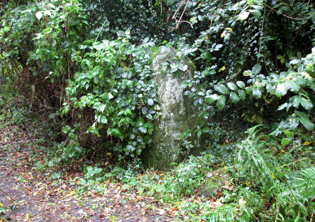
Along the main A913 Perth Road that runs round the northern edge of Abernethy village, as you approach the village from the western side, go right at the mini-roundabout up the Main Street into the village. However, just where this roundabout is, there’s a footpath into the trees known as the Castlelaw. Walk up here, keeping to the left-side of the burn (don’t cross over onto the right-hand side!) and after about 200 yards or so, keep your eyes peeled for a large upright stone, almost overgrown in dark vegetation on your left.
Archaeology & History
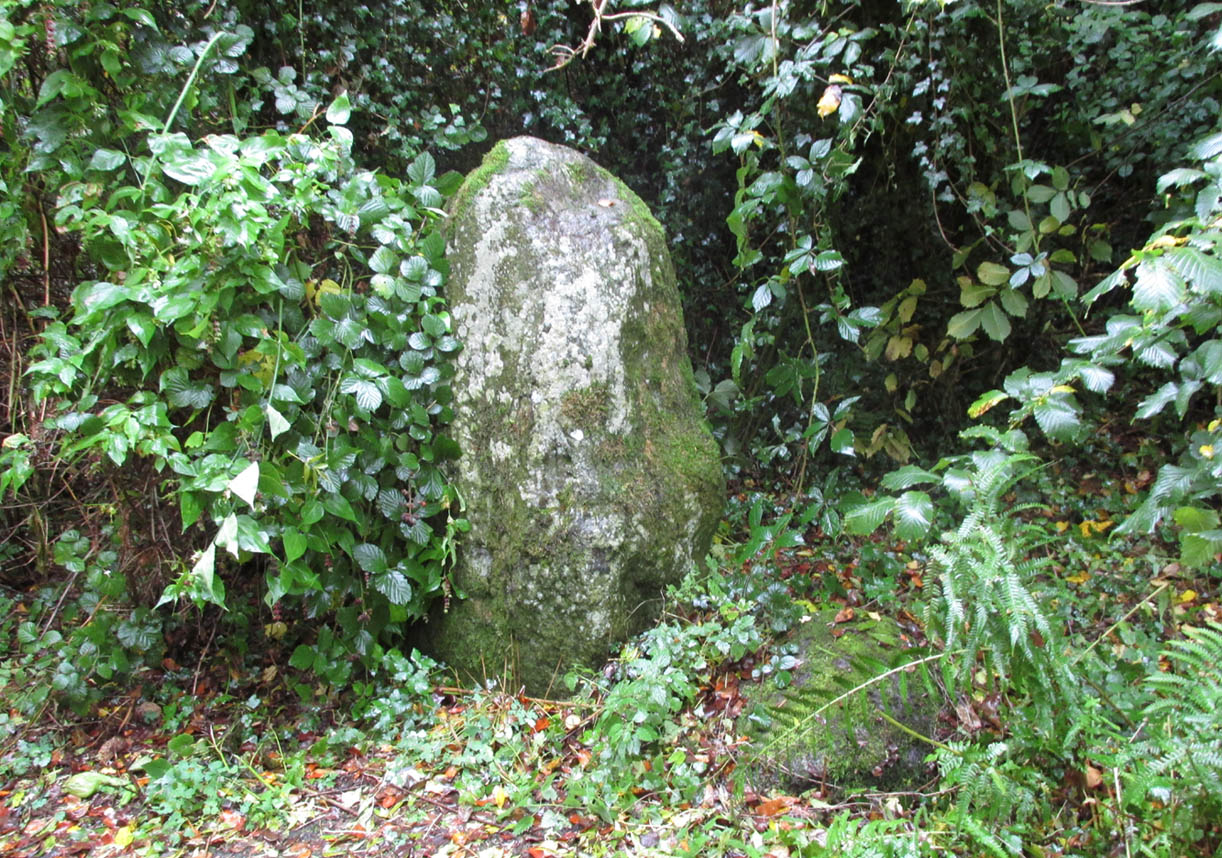
An intriguing standing stone in a most unusual position: a small wooded glen with a steep slope on its immediate eastern side, very enclosed. It’s quite a big thing too, standing some six-feet high with the usual worn rounded crown, typical of olde stones.
The olde stone, unmasked
In the very brief account of this site by Hallyburton & Brown (2000) they describe this “previously unrecorded /lost standing stone and possible ruinous stone circle.” This is also echoed in Canmore’s description. A standing stone we certainly have, but in several visits here there was no evidence of any stone circle either side of the burn. It was suggested that the “circle” may once have been atop of the slope immediately above this stone, but again there is no evidence at all to suggest this and old maps show nothing. I’m extremely doubtful of any megalithic ring here (I’d love to be wrong though).
References:
Hallyburton, I. & Brown, R., “Abernethy Den (Abernethy Parish),” in Discovery & Excavation Scotland, New Series – volume 1, 2000.
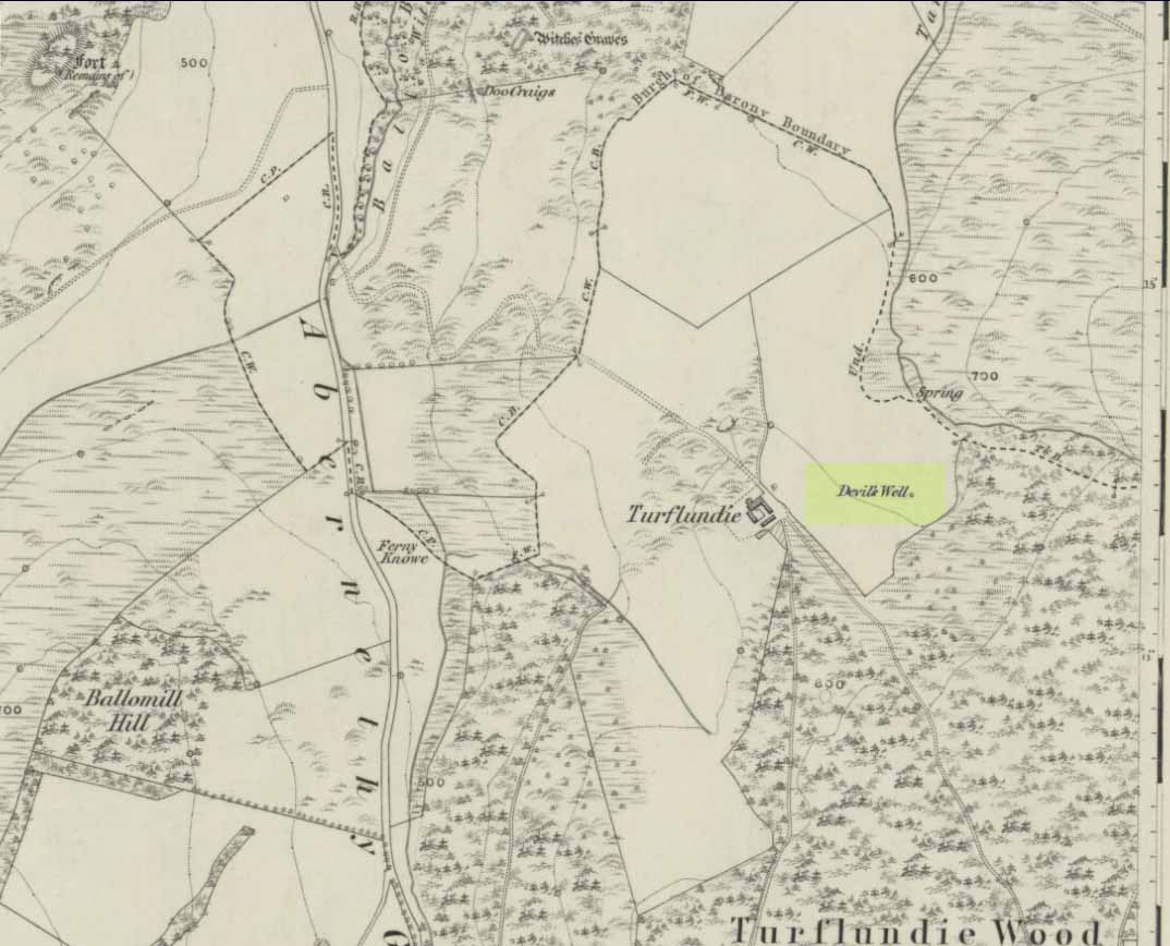
From Abernethy village, go west along the A913 road for half-a-mile, then turn left up the long and winding Glenfoot road up the Abernethy Glen. About a mile up on your left-side is Craigden Farm and, just a bit past this, the forestry plantation. Just before the trees, cut up the field and head uphill, passing the near forest of gorse, until you reach the huge detached house of Turflundie. In the field immediately east, right up against the barbed-wire fence where it meets the depleted forestry, a very small trickle of water emerges beneath a small pile of rocks. You’re here!
Archaeology & History
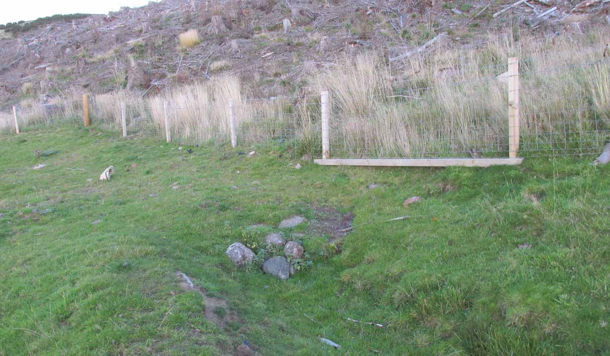
Long since thought to have been lost, the trickling remains of this old Well of the Devil are, in fact, still running beneath the pile of stones just over the barbed-wire fence on the edge of the forestry section. A cluster of other worn rounded rocks scatter the ground just to the rear of where the water first comes out of the ground, suggesting, perhaps, that a small well-house covered the spring; but this is me being speculative, as there’s no mention of this in the early writings of the Ordnance Survey lads, nor is one shown on the first OS-map of the area in 1860. And you’ll see on the OS-map how the well is slightly lower than where it presently trickles, but this is down to the fact that the source of it was piped-off at sometime in the not-too-distant past, as evidenced by remains of such piping laying just over the barbed-wire fence close to the source. In truth, unless you’re hardcore, there’s very little to see.
Folklore
The trickling waters are on the other side of this fence
The dedication of this water-site to the christian ‘devil’ is obviously a corruption of its original traditional name, which may have simply been to the Bodach, or ‘Old Man’ in Gaelic and northern British lore. The bodach‘s consort is the great prima Mater of the northern realms known as the Cailleach, but I can find no dedication to Her anywhere nearby. The best we have are the ‘Witches Graves’ a half-mile to the northwest, below the edge of the geological ridge overlooking Abernethy, where folklore tells us 22 women were murdered and buried by the local christians several centuries ago.
In the Ordnance Name Book of 1859, they recorded that,
“A small Spring well on the farm of Turflundie, so called from the mark of a cloven hoof on a near, supposed to have been made by his Satanic majesty when he stopped to quench his thirst at this well during some of his midnight rambles.”
There’s no apt word that follows the word “near”, but assume it was meant to be a “stone,” although we could find no such stone close by and there are no known petroglyphs that could account for that ingredient.