Holy Well (destroyed): OS Grid Reference – TL 10302 30328
Also Known as:
Hertfordshire Historic Environment Record No. 1926
Archaeology & History
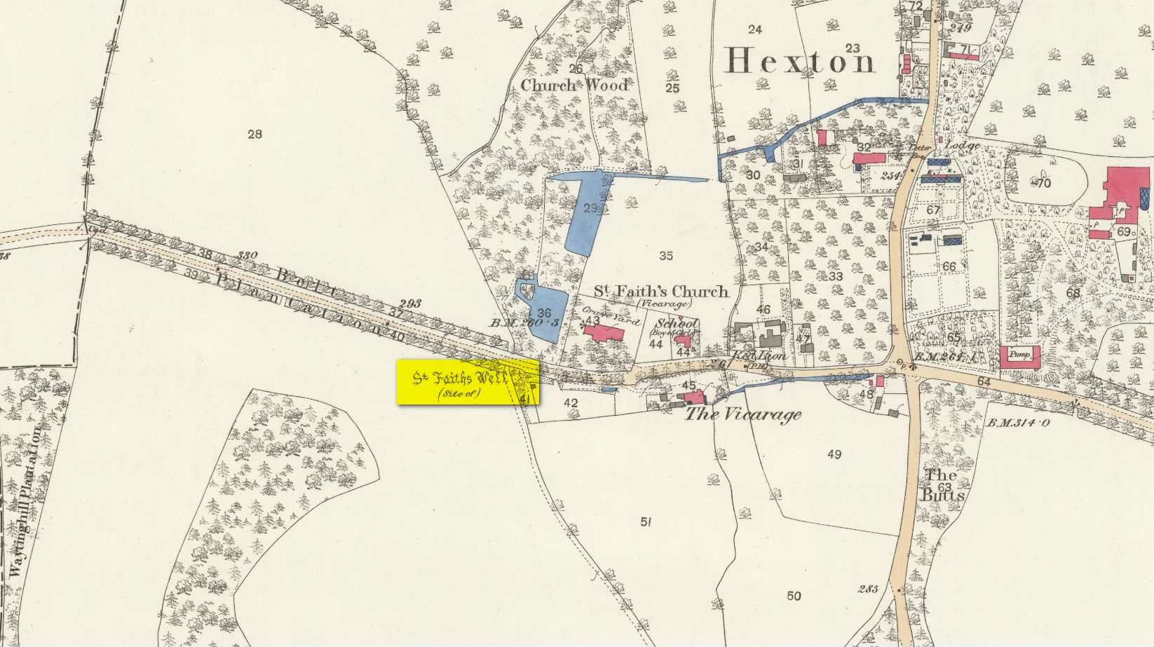
The site of the well is now in the garden of a house on the south side of the B655 Barton Road in Hexton, south west of St Faith’s church. Prior to the Reformation, there was a small chapel of St Faith adjacent to the well containing a shrine to the saint, which was, with the well a place of pilgrimage.
N. Salmon, writing in 1728, told us:
St Faiths Well on 1882 map
“At Ravensborough, within a Quarter of a Mile, is a fine Spring, which runs down to Hexton, and meets there another Stream rising at the Berystede near the church, which is indeed a very remarkable one. It comes pouring out of the Earth in such plenty, that it would turn a Mill in a very little Way; and hath been since the Roman Times thought worthy of a Saint’s Name. It was called St Faith’s Well, to which the church also is dedicated, and the Image of St Faith was placed over it.”
The well is just to the north of the iron age hill fort of Ravensburgh and near the ancient prehistoric roadway of Icknield Way, so would certainly have been a welcome stopping point for prehistoric travellers in these chalk uplands. In line with Salmon’s contention of its having been known since Roman times, Francis Taverner, the 17th century Lord of the Manor of Hexton wrote of the well having been used for oracular purposes by people who would throw an object onto the surface of the water:
“which if swamme above they were accepted and there petition granted, but if it sinke, then rejected which the experienced Prieste had arts enove to cause to swymme or sinke according as himselfe was pleased with the partye, or rather with the offering made by the partye.”
St Faith who was a third century martyr who was beheaded at Agen in Gaul. Her saint’s day is 6th October, and her patronage was invoked inter alia by pilgrims, so the dedication of the well and nearby church may have been to ‘christianise’ a pre-existing oracular place resorted to by travellers on the Icknield Way.
Taverner again:
“There is a small parcel of ground adjoining the churchyard called “St. Ffaith’s Wick Court,” about a pole in measurement, anciently divided from Malewick by a ditch in the same place where now a large moat is made. The greatest parte of this Wick lying upon a bedde of springs, and undrained, was very boggye towards the churchyard; but the west side being higher, the ground was well planted with oaks, willows, and bushes, near adjoyning unto which, the craftye Priests had made a well about a yard deepe, and very cleere in the bottome, and curbed about, which they called St. Faith’s Well.
“Now over this well they built an howse, and in the howse they placed the image or statue of St. Faith, and a cawsey they had mad (which I found when I digged and levelled the ground) for the people to passe who resorted thither from farr and neere to visitt our Lady, and to performe their devotions reverently, kissing a fine-colloured stone placed in her toe. This Lady was trimly apparelled, and I find in an old book of churchwarden’s accounts, in the reign of Henry VIII, that they had delivered unto the St. Ffaith a cote and a velvet tippet. The Lady had no land to maintain her, that I know of, more than i acre lying in Mill Field, called at this day St. Ffaith’s acre, which, as being given to superstitious uses, came to the King’s hands at the dissolution, and is now parcel of the demesnes. The house being pulled down, and the idol cast away, the well was filled up, yet an apparent mention of the place remained till my time, and St. Ffaith’s Well continued as a waste and unprofitable and neglected piece of land till such time as the footpath was turned through the midst of it to the outside on the south by the highway, and their clearing and levelling the ground, having been drained, and sunk the spring, I converted the same, in the year of our Lord 1624, into a little orchard. The Lady Ffaith was a Virgin and Martyr of Agenne, in France, a.d. 1290.”
The well may have had healing properties too. Herbert Tompkins (1902) informed us how,
“…to folk who have never stepped out of Hertfordshire (I have known several such) the well of St. Faith is indeed the “Well at the World’s End.” The waters of that well were of miraculous efficacy, and an image of its saint was long preserved in the chapel of St. Faith Virgin, of which no stone remains.”
The parish church of Hexton remains dedicated to St Faith , as does the parish church of nearby Kelshall. There was another St Faith’s Well at Leven in East Yorkshire.
References:
Clutterbuck, Robert, History & Antiquities of the County of Hertford – volume 3, Nichols Son & Bentley: London 1827.
Farmer, David Hugh, Oxford Dictionary of Saints, Oxford University Press 1987.
Hippisley-cox, R., The Green Roads of England, 6th Edition, Methuen: London 1948.
Hope, Robert c., Legendary Lore of the Holy Wells of England, Elliot Stock: London 1893.
Johnson, Walter, Folk Memory or the Continuity of British Archaeology, Clarendon Press: Oxford 1908.
Jones-Baker, Doris, Old Hertfordshire Calendar, Phillimore: Chichester 1974.
Salmon, N., History of Hertfordshire, London, 1728.
Tompkins, Herbert W., Highways & Byways of Hertfordshire, Macmillan: London 1902.
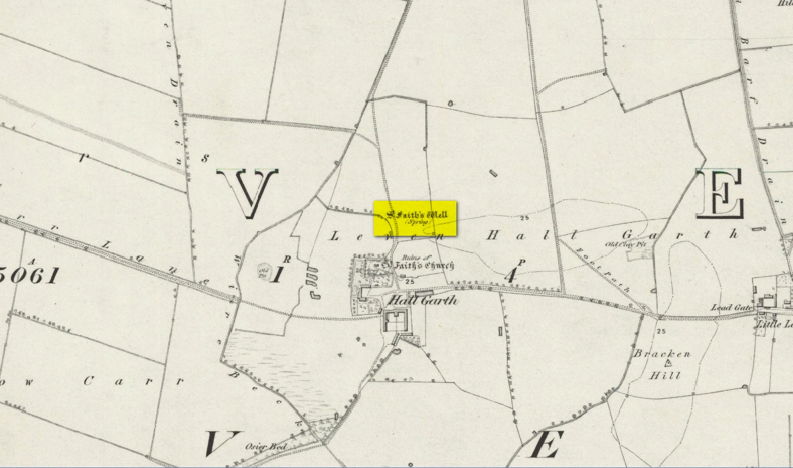
The site of the well is on the Carrs to the west of Leven village, immediately north of the old cemetery adjoining Hall Garth house. Reverend William Smith, writing in 1923, told us:
St Faiths Well on 1855 map
“St Faith’s Well lay on the left of the road known as St Faith’s Lane, which leads to the old churchyard to which the spring was near. St Faith belonged to France, and when quite a young maiden, was martyred because of her christianity. She lived and died in the third century….
“St Faith’s Well was filled in about a hundred years ago and the site lost. This, however, has lately been approximately fixed by the aid of water divining. A Leven man, who can wield the hazel wand, went over the ground near to which the well was thought to have been, and the wand indicated a spot under which, on digging to the depth of about three feet, “the water fairly bubbled up”, and it was judged this was the place where the well lay. St Faith’s Well is said to have given water both pure and abundant, and to have been in the old days the only supply of drinking water to the people of the Carrs.”
St Faith’s Saint’s day is the 6th October and she was a saint whose patronage was invoked by pilgrims, prisoners and soldiers. From this, is it perhaps reasonable to infer that St Faith’s Well may have been a station for pilgrims to the local shrines of St John of Beverley and St Philip Ingleberd at Keyingham? Also a stopping point for fugitives seeking sanctuary at Beverley?
There was another holy well dedicated to St Faith at Hexton in north Hertfordshire.
References:
Cox, J.Charles, The Sanctuaries & Sanctuary Seekers of Mediæval England, George Allen: London 1911.
Farmer, David H., Oxford Dictionary of Saints, Oxford University Press: Oxford 1987.
Smith, Rev. William, Ancient Springs & Streams of the East Riding of Yorkshire, A. Brown: Hull 1923.
Holy Well (destroyed): OS Grid Reference – TA 23584 25549
Archaeology & History
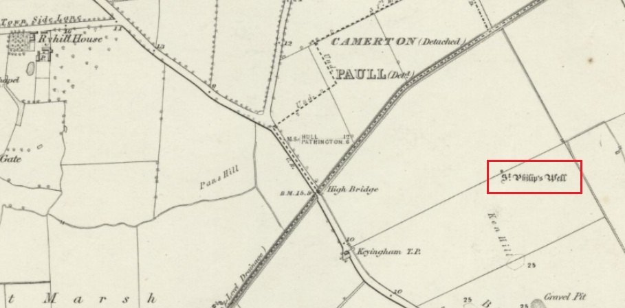
The Well shown on the 1855 6″ OS map
This holy well was formerly on the northern boundary of a field adjoining the north side of the A1033 west of Keyingham.
In view of the surviving folklore relating to the well it seems that its dedication to St. Philip may have been an effort by the Church to ‘Christianise’ it; and the St Philip here is not the Biblical Apostle, but a local saint – Philip Ingleberd (died c.1325 and also known as Philip Inglebred), whose memory was celebrated by a nearby Cross and a shrine at St Nicholas Church in the village. The well and the cross may have been dedicated some time after 1392 following a ‘miracle’ relating to Philip’s tomb. These were destroyed by the mob in the Reformation, although the cross-base survives. It seems the well may have been restored in the late seventeenth century. By the early twentieth century the well was described as laying on the Common to the west of the village, by then filled in, only showing signs it ever existed by making the ground near its site wet and boggy in a rainy season.
Folklore
George Poulson writing in 1841 told that,
“…a few fields more to the west is a well, called St. Philip’s Well; on a small stone are inscribed W. H. W. D. IG67. W. K. It is called the wishing well; and the country lasses were in the habit of dropping pins, or even a sixpence into it, for the purpose of ensuring to themselves either particular or general good luck.”
William Smith (1923) described the well as one of six wishing wells or pin wells in Yorkshire and, moreover, the only ‘Cross Well’ in the East Riding. At none of these wells was evil allowed to be foreshadowed, and the wells were only to show to a girl the portrait of her future husband. He told us that,
“In every case the wish had to be with truthful devotion, and not divulged to any living person, or the desired consummation would not be gained…. Tradition adds that the well was much visited by maidens, who, on dropping their pins or coins, expressed the wish to see their lovers mirrored on its waters. Thus they kept a custom, dating to the time when the well was counted to be under the control of the fairies.”
And as Keyingham Common was once the abode of the fairies, it is worth noting that some 700 yards west of the site of the well a ‘Pans Hill’ is shown on the old maps, although whether this rural spirit of classical myth ever made it up to the East Riding is altogether another matter….
References:
Arrowsmith, Nancy & Moorse, George, A Field Guide to the Little People, Macmillan: London 1977.
Hope, Robert, Legendary Lore of the Holy Wells of England, Elliot Stock: London 1893.
Poulson, George, History and Antiquities of the Seigniory of Holderness, Thomas Topping: Hull 1841.
Smith, Rev. William, Ancient Springs & Streams of the East Riding of Yorkshire, A.Brown: Hull 1923.
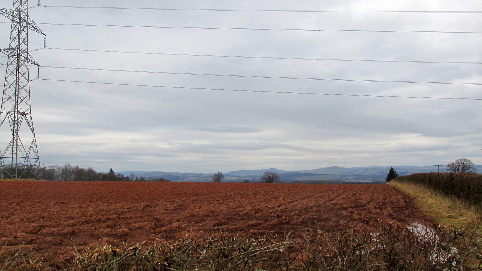
Travelling north from Perth on the A94, take the left hand turn to Strelitz as you go into Burrelton, and follow that road for two miles, and park up about 300 yards past the turning to Gallowhill. The circle stood at the far end (south-east) of the field on your left. Keep the distant gap in the hills in sight and the probable site of the circle is in a dip in the land in front of the ditch.
History & Archaeology
The circle had been destroyed by the middle of the nineteenth century, but was remembered by locals who gave this description to the Ordnance Survey bods:
‘The authorities quoted says that this is the site of a number of standing stones, they formed a circle, and one stood in the centre and according to tradition they were the remains of a Druidical Temple.’
In 1969 an Ordnance Survey archaeologist wrote:
‘There is no trace of this circle, the site being in a level arable field. Immediately to the SE in a ditch running parallel to the fence are about a dozen large boulders cleared from the field, possibly from the site of the circle.’
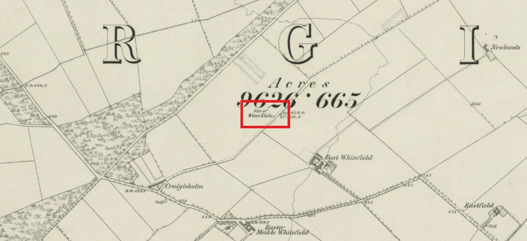
The boulders have now gone but there are some broken stones on the banks of the drainage ditch which may or may not be the sorry remains of some of the stones. There is a depression in the field just in front of the ditch which is the likely site of the circle based on the position shown on the 1867 map.
Left – A faint cropmark which may show the position of the circle in this winter view. Centre – Shattered stones in the ditch bank. Right – View looking south-east from the probable site of the circle – the gap between Black Hill, left and Dunsinane, right
What is interesting is the gap in the horizon facing south east from the site of the circle. On the left of the gap is Black Hill, and on the right Dunsinane Hill of Macbeth fame. My reading of the angle from the probable site of the circle to the gap using a hand held compass was around 135° to 140°, and that may indicate a midwinter sunrise alignment from the lost circle. Something to be checked out when winter comes.
And there is a legend of a giant who leaped from Black Hill to Dunsinane who also tossed a boulder which stands between the two hills – whether this legend has anything to do with the possible solstitial sighting line from East Whitehill is an intriguing question.
Acknowledgements: Big thanks for use of the 1st edition OS-map in this site profile, Reproduced with the kind permission of the National Library of Scotland.
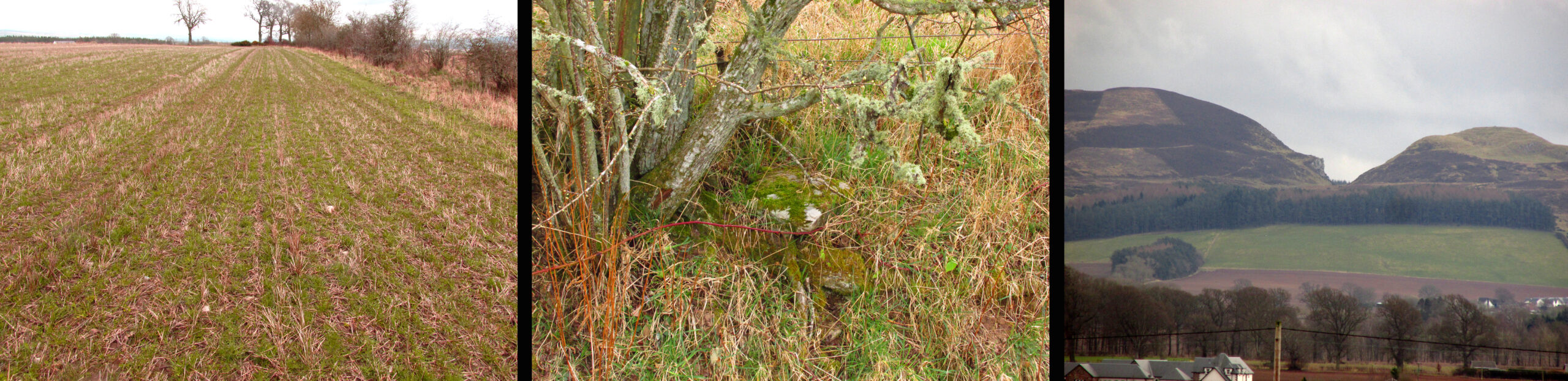
Turn right off the A93 at Cargill onto the side road by Keepers Cottage and up the hill to Gladsfield Wood at the top on your right. Park up at the top side of the Wood and walk straight along the narrow track for around 450 yards until you get to where another track crosses it and turn left along this track and head for the electricity pylon. The well is immediately to the left (north-east) of the pylon.
Archaeology & History
On my first visit I got the impression this weed-choked pool may once have been a holy well. There are stones on the north east side of the pool, some of which look to have been shaped, which may have formed part of a walled enclosure or part of the adjacent Roman road; or they may only be field clearance boulders. There is the tell-tale gnarled hawthorn tree with the thick stump of a what has been a much larger hawthorn next to it. And folklore of a hangman to explain the ‘Hangie’s’ name.
Andrew Jervise, writing in 1863, told that,
“About three hundred yards from the Parish schoolhouse, an old well, now partly filled up, Hangie’s Well, near which, it is said, the parish hangman dwelt, and where, some fifty or sixty years ago, a quantity of human bones were discovered”
But what was going on here before this hangman stalked the land? The well—a spring actually—is at the top of the ridge above the Tay beside the Muthill to Kirriemuir Roman road (the most northerly Roman road in the Empire apparently, says Ivan Margary), and so would have been a welcome stopping point for men and horses using that road; and this being the Roman Empire, the well may have acquired some cultic significance.
In the mediaeval period the Cistercian monks of Coupar Angus built their own Abbey Road adjacent to the well which went from their Tayside estate at Campsie to the Abbey, and which would again have been a welcome stopping point for monks and pilgrims. In the parish there was a local cult of a St Hunnand, this name being thought to be a corruption of Adamnan (and if Adamnan can be corrupted through oral tradition to ‘Hunnand’ then Hunnand can be corrupted to ‘Hangie’?). If this was once a holy well that continued to be venerated after the Reformation, did the wily Presbyterians ‘taint’ it by coming up with a tale of an executioner using it to wash the blood of his victims off his hands? But enough of this speculation, in the absence of proof it must just remain plain old Hangie’s Well! When you’re in the area, give it a look and see what you think.
The Well showing the adjacent stones and the Hawthorn bush.
Folklore
This story was given by the locals to the Ordnance Survey inspectors around 1860:
‘A small well a little to the south west of Gallowhill. According to the tradition of Mrs. Manson & Boyd the Executioner made use of this well for washing his hands after he had performed his duty towards criminals that were condemned to be executed on Gallowshade.’
William Rose writing in the New Statistical Account of 1845:
‘Near the Village of Gallowhill is a field called the Gallowshade, which was a place of execution under the feudal system. And in a field about 100 yards north from the school house is a well, said to have been used by the executioner for washing his hands after being engaged in his bloody work, and which still goes by the name of “Hangie’s Well.”‘
Acknowledgements: Big thanks for use of the 1st edition OS-map in this site profile, Reproduced with the kind permission of the National Library of Scotland.
Take the B936 out of Auchtermuchty, and park at the small car park for Auchtermuchty Common on your right just before Lumquhat Mill. Follow the path through the Common southwards and along the narrow strip until the Common opens out past the boundary stone. Head for the sign board on the right and when you get there turn left and march straight up the hillock and the stone is ahead of you in front of a gorse bush.
Archaeology & History
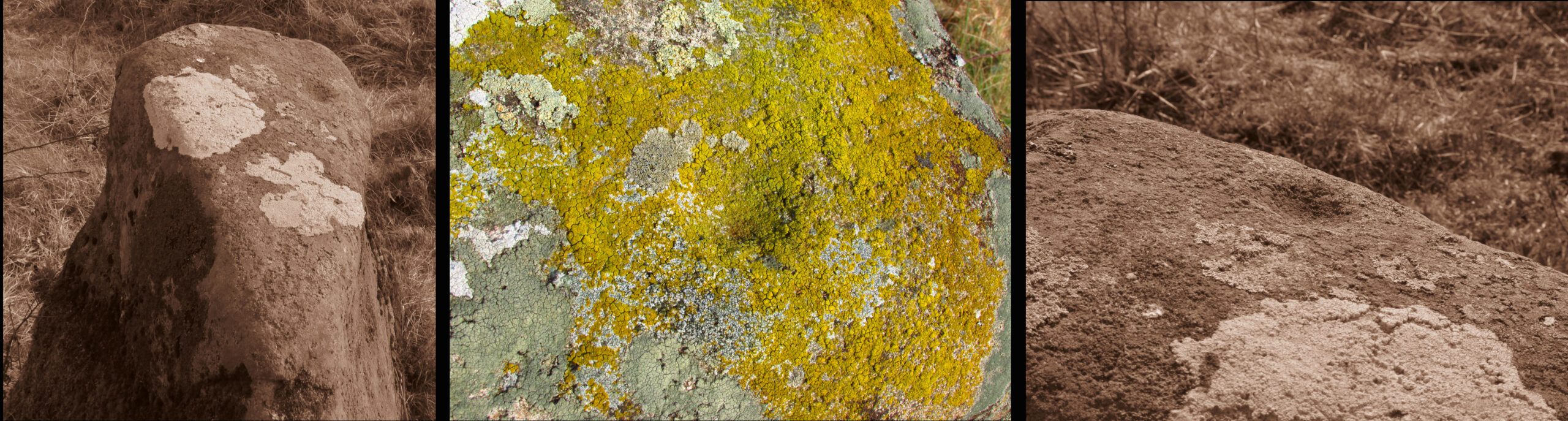
A curious little stone that I found quite by chance. It is wedge shaped in plan, bearing one large cup mark on its top surface. The cup is approximately 2″ in diameter and about ¾” deep. The raised part of the stone is about 3′ high, it is 3′ long and about 13″ wide at the blunt south end, although at ground level it is nearly 3′ wide at this end.
The stone is orientated due N-S, the south end aligning with the peak of East Lomond (a mythic hill of which at least one legend survives), while the north end points to the river port of Newburgh. It gives the impression of having been carved as a direction marker from what was a much larger stone, which, if this is the case may have originally borne more cups.
Left to Right 1.Facing North – the stone looks to have been cut down from a larger boulder. 2. The summit of East Lomond due South. 3. Aligned North – South.The cup mark.
Folklore
The first time I visited, there were three small polished coloured stones at the foot of the rock, while the second time there were four stones within the cup. A long term resident out walking his dog told me he knew of no folklore relating to the stone, but that over the last thirty years he had kept seeing offerings of stones in the cup, so the rock clearly still has some ritual significance for local heathens/pagans…
Travelling north, turn right to Wolfhill off the A93 at Cargill, then up the hill, turning left at the first junction. The stones are buried in the field to your left before the bend.
Archaeology & History
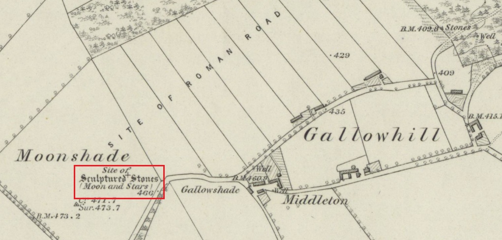
The earliest description of these stones, and the only one written while they were still standing comes from J.P.Bannerman, writing in the Old Statistical Account in 1793:
‘Near the village of Cargill may be seen some erect stones of considerable magnitude, having the figure of the moon and stars cut out on them, and are probably the rude remains of Pagan superstition. The corn-field where these stones stand is called the Moonshade to this day.’
Later writers, who only had verbal reports of the stones from locals who remembered them, gave differing descriptions of them. The people who spoke to the Ordnance Survey name book scouts around 1860, described them as:
‘Moonshade – “This name is applied to an arable field immediately west of Gallowhill. Two large Standing Stones having the representation of the Moon and 7 Stars cut out on one of them were removed from this field about 60 years ago.”‘
The local antiquary Andrew Jervise wrote in 1861 that the stones were:
‘interesting relics….purposely buried below the reach of the plough, appear to have been of the same class of antiquities as the sculptured stones at Meigle and, from the desire which is now being manifested for the preservation of national antiquities, it is hoped that those relics will soon be disinterred, so that their symbols may be properly examined.’
Looking north from the road the stones stood to the right of and beyond the pylon
Or as another writer puts it, they were; ‘dug around and under, and buried, in the agricultural improvement of theground’. For all we know from the written descriptions that have come down to us the stones may be prehistoric monoliths, with it seems only one of them carved. As they stood alongside the Roman road from Muthill to Kirriemuir, the moon and stars may have been cut by the Romans, or they could equally have been from the hand of a Pictish or later mediaeval mason. The field in which they stood was alternatively known as ‘Moonstone Butts’ or ‘Moonbutts’ – where the local archers practised.
Folklore
While the word ‘moonshade’ doesn’t appear in Jamieson’s Scottish Dictionary, nor the online Dictionaries of the Scots Language, the Oxford English Dictionary defines it as an obsolete word for ‘nightshade’, citing a quotation from Sir Francis Bacon’s Sylva Sylvarum of 1627:
‘The Ointment, that Witches use, is reported to be made, of the Fat of Children, digged out of their Graves; Of the juyces of Smallage, Wolfe- bane, And Cinquefoile; Mingled with the meale of fineWheat. But I suppose that the Soperiferous Medicines are likest to doe it; Which are Henbane, Hemlocke, Mandrake, Moone-Shade, Tobacco, Opium, Saffron, Poplar- Leaves.’
Given the stones are in the Perthshire witch country (the Witches Stone of Shakespeare’s Macbeth is only 2½ miles due south of here), this is nevertheless almost certainly a ‘red herring’, with the field deriving its name from the carvings on the stone. Only when we can again see the Moonshade Stones, ‘digged out of their grave’ will we be able to begin to understand them. So will there be any motivation to excavate them?
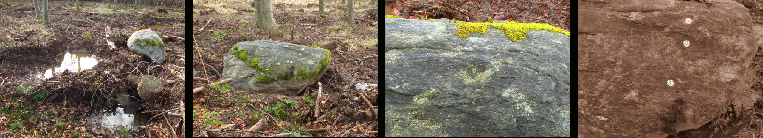
Turn right off the A93 at Cargill onto the side road by Keepers Cottage and up the hill to Gladsfield Wood at the top on your right. Park up at the top side of the Wood and walk straight along the narrow track for around 450 yards and what may be the remains of the stone will be seen between a pair of mature trees.
Archaeology & History
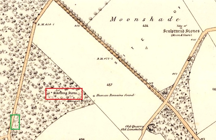
In 1862 the stone was described in the Ordnance Survey Name Book for Perthshire:
‘And about 150 yards from the same object [Hangie’s Well], in a north-westerly direction, there is a small Standing Stone, having the appearance of the ancient monumental standing stones.’
It seems the stone had been removed by the time Fred Coles (1909) came to see it nearly fifty years later. He told us:
“On the day of my visit the mist was so abnormally dense and confusing that it was with considerable difficulty the wood itself was identified; and as its interior is an utter wilderness of trees, shrubs, brambles, broom, wild roses and tall grass, besides being a pheasantry, it is just possible that the monolith searched for evaded my zeal. I think not, however, because, hearing a hedger at work on the Newbigging side of the wood, I made for him; and after plying him with various questions, could get no statement to the effect that he had, though living so near, ever seen any conspicuously tall Stone in the wood.
“On retracing my steps, I searched a fresh portion of the wood, and noticed one biggish block of whinstone lying on the grass in a slight hollow of the ground. It was somewhat cubical, about 2 feet 6 inches square, and fractured. This may he a portion of the former monolith, possibly; and with this dubious result I had to be content.”
In 1967 the archaeologist O.G.S. Crawford described “a sharp-edged boulder standing near the spot marked on the map,” but was not certain if it was the stone. It had no markings on it.
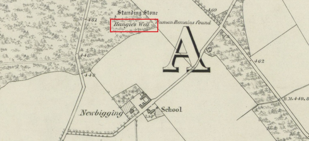
25 in OS map of 1866 showing original position of stone outlined red and position of possible remains of stone in green
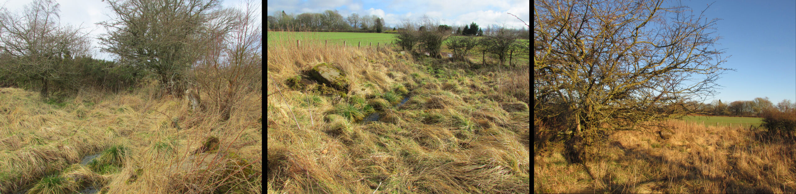
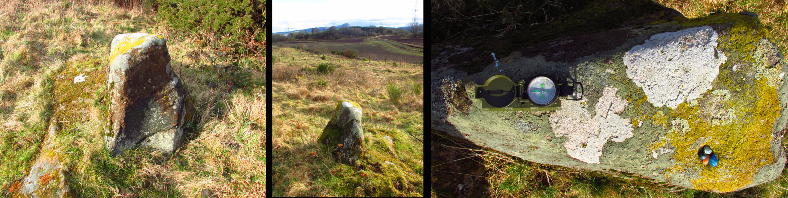
Moving on to 2020, and I found the same impenetrable jungle that Coles described more than a century earlier. When a site has been destroyed I can normally take a photograph of where it once was, but not in this case. I continued westward over difficult and potentially ankle snapping terrain that had recently been replanted with conifer saplings, until I got out of the planting area to a line of mature trees next to the track through the wood.
One large elongated stone presented itself that had clearly lain there for many years judging from the moss growth, a short distance away at NO 15641 35478. Could this be the top part of the standing stone, dragged from its original position some 500 feet to the north-east? It is of grey whinstone, heavily veined at the base, with white quartz and tapering to a pointed tip. It has a squarish base measuring approximately 3 feet across by at least 2 feet deep and is some 7 feet in length. It doesn’t look to be natural, so is it a likely candidate for our missing stone? Felled by a man with a hammer and chisel and dragged by a heavy horse to the edge of the field as part of the ‘improvements’, so beloved of nineteenth century landowners…
We can’t prove it is the remains of Hangie’s Stone which may, after all, still lie buried in the boscage…
The possible remains of Hangie’s Stone
The stone in its original position was next to the Roman road from Camelon via Stirling and Muthill to Kirriemuir near to the junction of a road to Inchtuthill Roman Fort, so may have once been a way marker, although it is not of Roman origin.
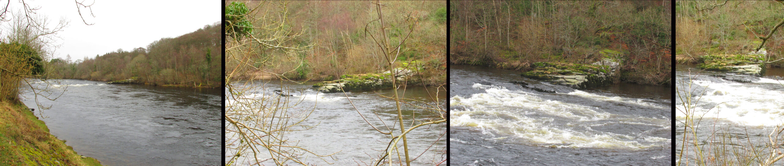
The easiest way to see the site is to stop at the car park at Craighall on the B9099 south of Stanley, and follow the path to the river. The remains of the Brig will be seen on the other side of the Tay from the riverside walk.
Archaeology & History
The Thistle Brig was described in the nineteenth century Ordnance Survey Name Book as:-
‘A remarkable spot in the River Tay, when the breadth of the river becomes suddenly narrow by the protrusion of a bed of trap rock which crosses it at this place.’
Thistle Brig & the quarries for its hard stone on the 1901 25 in OS-map
According to local historian Alexander Scott, the Thistle Brig formed a convenient place to ford the Tay until much of it was blasted away by explosives some time in the mid-nineteenth century in order to improve the flow of the river. Old maps imply that an actual bridge may have spanned the Tay hereabouts at some time in the past. The seemingly little known folklore of this site relates to an invasion by the Danes in the early mediaeval period. Elsewhere there are similar stories, so the truth or otherwise depends on where you are in Scotland, but this one may have more validity as the tale seems to give its name to the place!
The name ‘Thistle Bridge’ has been applied on old postcards to a stone footbridge over a side channel or lade between the road and the River Tay to the south of the Brig, and is not the subject of this profile.
The remains of the Thistle Brig – a hard basalt dyke on the east bank of the River Tay
Folklore
Alexander Scott, writing of the Brig:-
“…tradition holds that here the thistle received the distinction of becoming the national emblem of Scotland. In one of the many invasions the country suffered from foreign armies, the Danes, on one occasion, having landed on the east coast sacked the town of Montrose and continued on their march across the country, burning and pillaging as they went. While crossing the Tay at this ford at night, the incident occurred of one of the leading soldiers arriving on the opposite side suddenly coming in contact with a thistle with his bare leg, which caused him to emit a shreik of pain.
“The noise was heard by the Scots, who had been encamped nearby, and the alarm thus given was the means of securing a victory over their enemies. The thistle was thereafter honoured as the national badge.”
Reference:
Scott, Alexander, St Martins and Cambusmichael, A Parochial Retrospect, Munro & Scott 1911.
Turn right off the A93 at Cargill onto the side road at Keepers Cottage and up the hill. Gladsfield Wood is at the top of the hill on your right. Park up at the top side of the Wood and walk along the narrow track to where it crosses another track, look 45º to your right and you’ll see the stone.
Archaeology & History
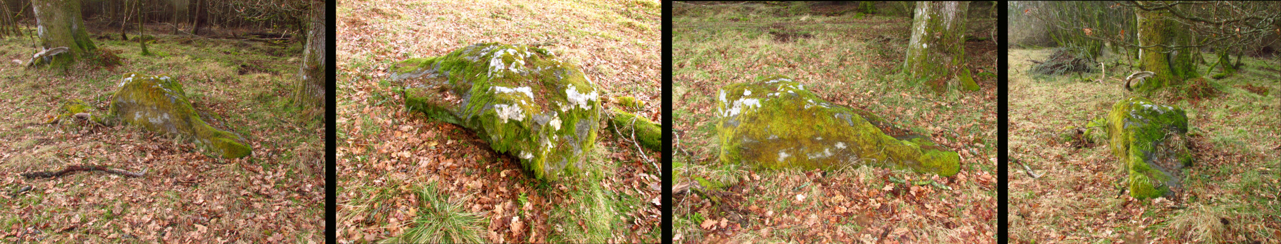
One of those chance finds that turns up when you’re looking for something else. Recent forestry work had dislodged the stone from its original earthfast position of millenia, only a few feet away. It may have been rotated from its original position. The grey whinstone rock measures around 5′ 8″ (1·75 m) long, 3′ 9″ wide (1·15 m ), 2′ 9″ (0·85m) high, and the moss shows its original depth in the ground. Fortunately the cup marks weren’t damaged in what appears to have been a quite brutal move. On what is now the north east facing side there are three definite and one possible very shallow fourth cup mark. The top cup is the most prominent, while the possible fourth cup is just to the left of the bottom one.
L-R 1. The original position of the stone 2. The stone showing the possible fourth cup 3. The prominent top cup 4. The three definite cups
One for the enthusiasts really, in an area of Strathmore quite rich in megaliths and rock art; whatever the future holds for this dislodged stone in the savage world of agri-business, it is now recorded for posterity!