Stag Cottage, Glen Lochay, Perthshire

Cup-and-Ring Stones:  Grid Reference – NN 5320 3584

The carved rocky outcrop

Also Known as:

  1. Duncroisk 1 (Morris 1981)
  2. Duncroisk 4 (Canmore)
  3. Keeper’s Cottage

Getting Here

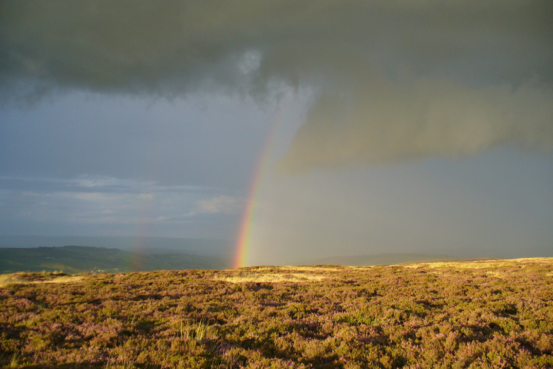
From the north side of Killin, take the minor road next to the Bridge of Lochay Hotel at Killin, past the hydroelectric station, through the wooded section until the fields open out again. The first gorgeous old house you come to is on the right-hand side of the road. Stop here! (I could really do with living here misself – tis a truly superb place!) You can ask the lady at the house where the carvings are and she’s very happy to point them out – they’re on the rocky crag near the bottom-end of the field on the other side of the road.

Archaeology & History

R.W.B. Morris sketch of the main carvings

What a brilliant setting and clump of carvings we have here! As you get to the rocky hillock in the field, you see that there are numerous rocks visible along the ridge, a number of which have carvings on them – some with just cups, but most possess a number of cup-and-rings.  It’s an excellent spot!  Depending on the time of year when you come here will determine whether or not you get a better look at the carvings or not.  I’d recommended April and May as the best time, as the vegetation is at its lowest then.  Visiting the site near the end of summer doesn’t give you as good a view — but even then, if you like your rock art, you’ll still love it!  The rocks here are mainly quartzite schist, with a number of the surfaces being almost pure quartz.  Intriguingly, none of the pure quartz sections appear to have been carved on.

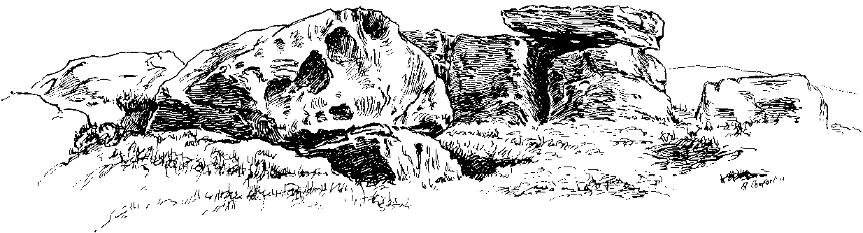
The carvings here were first mentioned in an article by D. Haggart (1895), who described them as “a very remarkable set of incised rock sculptures…discovered lately in this neighbourhood by Mr John McNaughton.”  And remarkable they are indeed!  In Ronald Morris’ (1981) survey of this site — which he labelled Duncroisk 1 — he counted eight separate rock surfaces that had been carved, marking them as carvings a-h, but there are at least eleven of them here; and in all honesty, if we could strip the surface of the hill of its vegetation, we’d probably find a few more hidden away!

Cup-marked stone

As you’ve walked across the field from the road, past the first unrecorded cup-marked stone near the start of the rocky rise, we reach Mr Morris’s ‘stone A’ near the easternmost end of the ridge, which is just a small slab of stone with “at least 6 cup-marks” on its surface.  It’s easily missed in poor light, so watch out.  However, if you reach ‘stone b’ (described below), just walk back ten steps and you’ll see it.

Carved Stone B

Ten yards west is ‘Stone B’, seemingly split into two sections, whereupon we find “a cup-and-two-rings and at least 12 cups-and-one-ring, up to 19cm in diameter – some rings gapped, others not, some with and some without a radial groove from the cup, and some with a “runner” or cup in a ring. There are also at least 58 cups” on this section of rock. ‘Stone C’ can also be missed, this time due to its size and the fact that the larger cup-marked surfaces are ahead of you.  But assuming you don’t miss it, this carving consists of “a well-preserved cup-and-two-complete-rings 25cm in diameter, and a cup.”

Carved Stone D

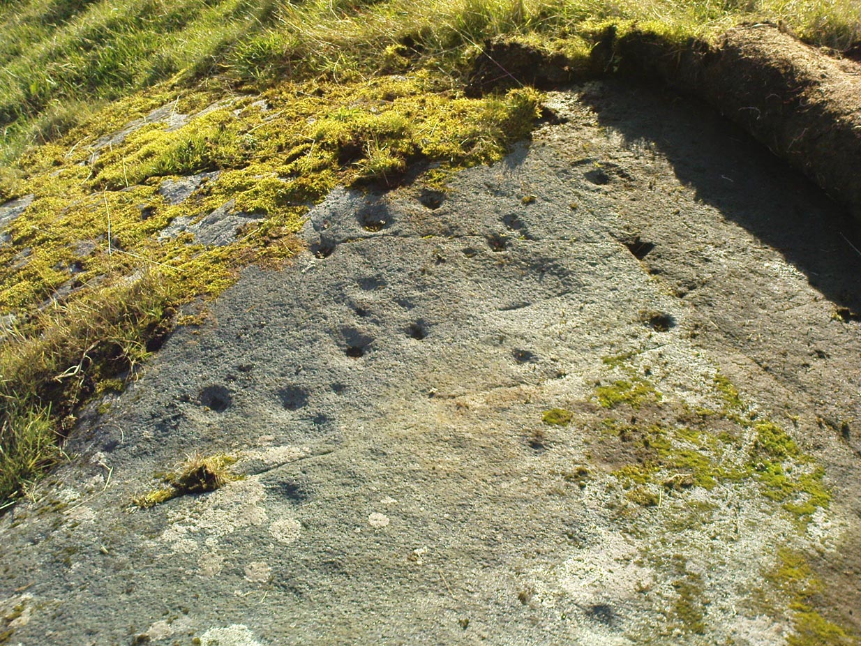
‘Stone D’ is just next to ‘stone C’, but with rather more ornate designs etched upon it.  This is one of the more archetypal petroglyph designs that are found in the photo-guides and textbooks.  Morris (1981) told that it consisted “of a cup-and-two-complete-rings and 2 cups-and-one-complete-ring up to 20cm in diameter, also a cup-and-one-complete-ring and 2 cups.”  The photo here shows it pretty clearly.

Carved Stone E
Curious 'bowl', top-centre
Curious ‘bowl’, top-centre

‘Stone E’ is the next one along, just a foot or two away and Mr Morris (1981) told that the carving consists of “2 cups-and-one-ring up to 13cm in diameters, 1 complete, the others gapped, joined by groove to a cup, and at least 33 cups (C.G. Cash counted 42 in 1911).”  Most of the carved elements on this rock are around the edges of the stone.  A very large faded circular depression, man-made, is also visible on this section of the petroglyph (above left), suggestive of lunar symbolism.

Carved Stone F

‘Stone F’ is less than 10 yards further west and has the greatest number of cup-markings of the entire group here, as Morris described: “3 cups-and-one-complete-ring up to 9cm in diameter, and at least 80 cups, a few of which are widely scattered over a big area sloping steeply further south, beyond the attached diagram.”  It’s perhaps the most notable of the carved rocks along the ridge here — not by virtue of its design, more its geological physique than anything else.

Carved stone G

‘Stone G’ is next along and has a curious look about it, suggestive of more modern times.  At first sight it doesn’t seem to have quite the magnitude that Morris’ description affords it, but on closer inspection by rolling some of the covering turf back away from the rock, you can see what he meant.  This stone has “10 cups-and-one-complete-ring, up to 10cm diameter…and also 15 cups.”  One of the cup-and-rings on this section was found by Morris to have been “the smallest so far recorded by the author in Scotland.”

Then we reach ‘stone H’ at the eastern end of the carved ridge, consisting of simply 3 cup-markings.  One of them has a faint arc pecked around it.  Further along the rock, a complete cup-and-ring is visible close to the edge.

This entire line of petroglyphs is a fine place in a fine setting, perfect for meditative practices!  Other carvings can be found close by: Duncroisk 3 is a coupla hundred yards east across the field just over the fence by the riverside; and Duncroisk 2 is on the other side of the fence down towards the River Lochay on the same side of the adjacent burn less than 100 yards away (though this is trickier to reach). Other prehistoric sites can be found not too far away…

Folklore

Local people tell of having seen curious lights flitting along the edges of the field, river Lochay and roadside close to the carved rocks hereby.

References:

  1. Cash, C.G., “Archaeological Gleanings from Killin,” in Proceedings of the Society of Antiquaries of Scotland, volume 46, 1911-12.
  2. Cormack, E.A., “Cross-Markings and Cup-Markings at Duncroisk, Glen Lochay,” in Proceedings of the Society of Antiquaries, Scotland, volume 84, 1952.
  3. Gillies, William A., In Famed Breadalbane, Munro Press: Perth 1938.
  4. Haggart, D., “Notice of the Discovery of Cup-and-Ring Sculpturings at Duncrosk, near the Falls of Lochay, in Glenlochay,” in Proceedings of the Society of Antiquaries of Scotland, volume 29, 1894-95.
  5. Morris, Ronald W.B., The Prehistoric Rock Art of Southern Scotland, BAR 86: Oxford 1981.

© Paul Bennett, The Northern Antiquarian


Tullich, Glen Lochay, Killin, Perthshire

Enclosure:  OS Grid Reference – NN 5235 3684

Also Known as:

  1. Tirai West
  2. Tullich East
  3. Canmore ID 78043

Getting Here

The ‘stone circle’ of Tullich!

Go through Killin past the Bridge of Lochay pub, turning immediately down the small lane by its side.  After about 3 miles you’ll cross over the small river past Duncroisk.  Keep going for another few hundred yards (if you reach Tullich you’ve gone too far), watching out for the gate on your left.  Walk up to the top of this field, over the wall and up again.  You’ll see a couple of tall trees with distinctive walling next to them, just on a ridge above you.  That’s where you’re heading!

Archaeology & History

This is a fine-looking example of a prehistoric enclosure, perched on the edge of one of the grassy knolls on the far western extremities of the deserted village of Tirai.  If you walk towards it from the derelict village east of here, the elliptical form of the site gives you the distinct impression that you’ve just chanced upon a seemingly unknown stone circle nestled upon the edges of this gorgeous Scottish glen; but this initial excitement is soon dispelled once you get into the heart of the site!

Southern line of walling
Looking east

Although you’ll find a couple of derelict post-medieval buildings on the western side of this structure, the lay-out of this monument would seem to be Iron Age origin, perhaps earlier.  It certainly has all the hallmarks of a walled structure from that period and typifies many others that I’ve explored down the years.

The eastern and southern sections of the walls are in very good states of preservation, although the ground has obviously grown up and around the bases of the stonework.  It has a total outer circumferences of about 95 yards (87m), with the many upright stones measuring between 12 inches to more than 3 feet in height.  The western section of the enclosure is mostly overgrown but easily traced on foot.  Near the centre of the site is a large flattish stone that gave the impression of having an oratory function from where one could speak to the rest of the people sat around the inner edges of the enclosure — but this was a purely subjective impression.

NE sections of enclosure
Outer section & ‘standing stone’

On the southern side of the elliptical structure is another, outer line of walling, or a stone alignment of some sort just a few yards long, consisting of just a few upright stones — one of which stands considerably taller than all the others hereby, giving the impression of a standing stone.  It has a large natural cup-marking on its southern face.

To my limited knowledge there’s been no excavations here, so one wonders whether or how or if the people of Tirai made use of this much earlier building.  The Canmore entry of the place tells:

“The N side of this enclosure is a low turf and stone bank of height 0.3m and is 20m long, spread to about 1.2m. The E side is outlined by large stones set on edge with no evidence of intermediate stone walling or turf. A bank of similar more continuous stone extends to the W from the S of the main enclosure down sloping ground. This type of walling is different from any other on Tirai. The large stones set on end have suggested a prehistoric date for this enclosure.”

References:

  1. Johnstone, A. & Wood, S., “Tirai (Killin Parish), Pre-Enclosure Settlements,” in Discovery & Excavation in Scotland, 1990.

© Paul Bennett, The Northern Antiquarian


Springfield Cursus, Chelmsford, Essex

Cursus Monument (destroyed):  OS Grid Reference – TL 735 084

Also Known as:

  1. Springfield Barnes Cursus

Archaeology & History

The first cursus monument discovered in Essex, archaeologists were fortunate when they came to excavate the site in 1979 as they found it almost complete.  A rarity these days!  Close to the Springfield Lyons causewayed enclosure monument, the cursus here was some 45 yards across and 750 yards long.  Like a number of other cursuses, the Springfield one was dead straight all the way down, running northeast to southwest with squared terminii at both ends. (of the Bi category, as Loveday called them)  And it appears to have had quite a long period of use.

Springfield Cursus (painting by Frank Gardiner)

The ditch that constitutes the very outline of the cursus — averaging between 3-4 feet in depth all round — was cut into the earth in the neolithic period.  It had small ‘entrances’ at certain points along its longer axis, both on the east and west sides.  The flat ends of the cursus were both ‘closed’, without entrances or breaks of any kind.  Some depositional remains were found scattered at different spots along the course of the ditch: neolithic pottery and flints in both the northern and eastern ditches, but archaeologists were unsure whether these deposits were left at the time the monument was in use, or at a later period — though it seemed consensus opinion that the deposits were from a period when the cursus was in use.  Charcoal remains were also found, but these were associated with an internal timber circle that was erected within the northeastern end of the cursus.  The timber circle was found to have consisted of 14 upright wooden posts arranged in a near-complete ring, some 26 metres in diameter.  It seems highly likely that this part of the monument had some ritual or ceremonial function relating to the dead (“mortuary practices” is the term used at the moment!).

Later excavation work here in 1984 found there to be various other linear and pit-like features within the confines of the monument, and what seemed to be the remains of a barrow beyond its eastern end.

Archaeologist David McOmish (2003), thought that “alignment is also significant,” saying that the “Springfield Cursus, 700 metres long, is aligned on a smaller enclosure some 300 metres away.”  The alignment potential here was first suggested by Pennick & Devereux (1989), albeit pointing “to the village of Wexford just over two miles to the southwest.”  McOmish also suggested there may have been some an astronomical reason for the alignment of the monument NE-SW, but I’m not aware whether this has been explored further.

The creation of these huge monuments had obvious relationships with human death rites, the spirits of trees, and celestial gods.  But much more research is needed at these sites if we’re to find out more about the nature of these prehistoric giants in the landscape.

References:

  1. Buckley, D.G., Hedges, John & Brown, N., “Excavations at a Neolithic Cursus, Springfield, Essex, 1979-85,” in Proceedings of the Prehistoric Society, volume 67, 2001.
  2. Hedges, John D. & Buckley, D.G., Springfield Cursus and the Cursus Problem, Essex County Council 1981.
  3. Loveday, Roy, Inscribed Across the Landscape: The Cursus Enigma, Tempus: Stroud 2006.
  4. McOmish, David, ‘Cursus: Solving a 6000-year-old Puzzle’, in British Archaeology, 69, March 2003.
  5. Pennick, Nigel & Devereux, Paul, Lines on the Landscape, Hale: London 1989.

Links:

  1. Unlocking Essex’s Past: The Springfield Cursus and Associated Remains

© Paul Bennett, The Northern Antiquarian


Herder’s Cross, Wycoller, Lancashire

Cross:  OS Grid Reference – SD 94057 39369

Also Known as:

  1. Herders Common Cross

Getting Here

From Laneshaw Bridge, near Colne, take the long country road that goes up above Wycoller to Stanbury and Haworth over the Yorkshire-Lancashire border.  A couple of miles uphill, there’s a parking spot with views across the moors.  Stop here.  Cross the road and walk up for about 100 yards, going thru the rickety gate on the left, and up the field (past the small disused quarry) until you see the large rock looming ahead of you, perched on its own.  That’s it!

Archaeology & History

Herders Cross stone

This is a really curious spot to me.  A large singular boulder sat on the edge of an uninhabited moorland with no real history of heathenism, nor religious practices; yet someone at sometime in the not-too-distant past saw something here that made them cut a large square hollow into the top of this stone, in which they stuck an old cross.  We came across this site a few weeks ago quite by accident, but realised that the deep hollow in the rock was an old cross base; so when I got home I checked Taylor’s (1906) magnum opus, expecting to find some info therein.  But even Taylor seemed to know nothing of this place.

A week or two later, Paul Hornby pointed me in the direction of an unpublished essay by a local chap called Clifford Byrne (1974) who’d studied some of the early christian remains in the region and who wrote the following of what he named “Herders Cross”:

“This cross, or more properly its socket, is probably one of the least known in the area.  It was shown to the writer by Mr Stanley Cookson of Trawden, who discovered the socket in passing, so to speak.  On the road to Haworth from Laneshawbridge, opposite the site of Foster’s Leap rocks, on the east side of the road, is a really huge boulder on the moor top.  In the south side is the cross socket, whilst on the north side of the rock can be made out a right-angled mark which implies that either the socket was being placed on that side in the first instance, or that two sockets were once envisaged…

“Old maps show the rock in situ with a “shaft” protruding from the top.  Some yards west a shallow pony track  bypasses the site, whilst some four or five hundred yards east a very well worn and ancient road, long unused, passes in the direction of Emmot Holy Well.  The cross may thus have been a Wayside Cross showing the way to this Holy spring which is remembered as being propitious in the cure of rheumatism.”

Cross-base socket

This may be so; but I suspect earlier, heathen remains upon the moors here to explain the curious position of both this and another cross-base some 400 yards away.  Some dubious cup-marks can be seen by the side of the stone hollow; and other dubious ones have been found on the moors above here.  There is folklore of a lost stone circle on the hills above here, and a scattering of little-known faerie lore, indicating hidden sites and lost myths.  These ingredients are more likely the reasons that Herders Cross was erected here, overlooking the countryside south and west, with the holy hill of Pendle rising in the centre of the distant landscape…

References:

  1. Byrne, Clifford, A Survey of the Wayside Crosses in North East Lancashire, unpublished 1974.
  2. Taylor, Henry, The Ancient Crosses and Holy Wells of Lancashire, Sherratt & Hughes: Manchester 1906.

© Paul Bennett, The Northern Antiquarian


Dumpit Hill Enclosure, Hebden, North Yorkshire

Enclosure / Settlement:  OS Grid Reference – SE 02884 64062 

Getting Here

Line of enclosure walls

Follow the same directions to get to the Dumpit Hill A stone circle; but instead when you get to the point where you need to walk off-track and into the heather to get to the circle, keep walking up the dirt-track for about another 200 yards, watching diligently thereby for a reasonable sized, fallen, “standing-stone”-like character just yards into the heather on your right (on your left, there’s a U-shaped dip where the wall is).  This is the northern edge of the walled enclosure.  From this fallen ‘standing stone’ follow the overgrown walling along carefully into the heather along and down the slight slope.  You’re now either on the very edge, or perhaps going into the middle of the enclosure.  Look around!

Archaeology & History

East section of walling

There’s no previous written history of this site, discovered for the first time last week on our sojourn to the Dumpit Hill stone circles, by Michala Potts.  She didn’t seem too excited by it at the time, but an amble back to what she’d found got me going! (easily done) With the help of the heather being burned away, open and exposed was a distinct line of prehistoric walling — perhaps Bronze Age, perhaps later.  It’s hard to tell.

Structurally similar to the enclosure walling at Horse Close and Rough Haw, either side of Skipton, a few miles to the south, here we have about 100 yards of walling seeming to enclose the eastern side of the small hilltop, but running into the heather on its southern edge and the moorland track on its northern side, where it disappears again, leaving no trace of what one would assume would be a consistent western section.

From the grid reference for the site, the line of walling runs northwards for about 20 yards before taking a very slight shift in direction for another 20 yards.  Here the walling goes to the left (west) for another 20 yards, before edging slightly northwest and back into the heather.  A section of the walling is visible at each end, though we lose any accurate trace of it after a short distance in the long heather.  However, at the northwestern point in the enclosure walling, a very distinct long stone about 4 feet high leans at an angle in the ling.  It seems apparent that this stone at one point in the not-too-distant past stood upright, making it the tallest stone here.

Northern section of walling
Fallen monolith?

What may be other features can be seen inside this enclosure section: a possible hut circle and other portions of walling were noted.  However, we didn’t spend much time exploring the site in detail, so there is a high probability of other prehistoric remains in and around this enclosure awaiting discovery.  The site’s proximity to the stone circles of Dumpit Hill A and Dumpit Hill B should be noted; along with what the North Yorkshire’s Historic Environment Officer, Robert White, said were “three, possibly four small circular enclosures (about 9m in diameter)” a short distance away.  A further survey of the site is necessary to enable us a better picture of what we’re looking at here.

© Paul Bennett, The Northern Antiquarian


Alcomden Stones, Stanbury Moor, West Yorkshire

Legendary Rocks: OS Grid Reference – SD 97313 35737

Also Known as:

  1. Oakenden Stones

Getting Here

The ‘druidic’ Alcomden Stones

Takes a bitta getting to this spot, but it’s worth the effort!  Make a day of it and walk up here via the little-known Cuckoo Stones monoliths.  From here the walk gets steeper!  Follow the footpath from the standing stones, uphill, to the legendary Wuthering Heights building of Bronte-fame a half-mile ahead of you.  Then walk immediately up the slope at the side of the derelict house higher onto the moor (there’s no real footpath to follow) until the moorland levels out.  From here, look west and walk that way for a few hundred yards where you’ll be seeing a large rock outcrop ahead of you.  That’s where you’re heading! (if you reach the triangulation pillar, take the small path from there along the top of the moor towards this large rock outcrop)

Archaeology & History

Alcomden’s Altar Stone

To those of you who like a bitta wilderness, or healthy normal people I suppose, this is a stunning place!  Even though there’s little by way of archaeology here — save the usual expectations of a few flints and arrowheads — its geomancy, its position in the landscape, makes it excel as a once important ritual site for our ancestors in not-so-distant centuries.  Although local tradition gave these great rocks a prehistoric pedigree, the archaeological record doesn’t say as much — but that doesn’t really mean much up here.  We’ve found a singular Bronze Age cairn on the level at Middle Moor Flat 400 yards northwest (not in the record books), some prehistoric walling on the flat east of here (not in the record books), so a lot more attention is needed hereby to see what more may be hiding in this rocky heathland area.

The main feature amidst this extensive scattering of rocks is the large rocking stone, said to weigh six- or seven-tons, resting upon other glacial deposits.  The rock itself can be made to rock very slightly.  It was described in Lewis’ Topographical Dictionary as a

“cromlech, an evident druidical remain, (which) consists of one flat stone, weight about six tons, placed horizontally upon two huge upright blocks.”

But the placement here was done by Nature and not humans — making it much more important to our ancestors.  This was a site for solace, for ritual and to commune with the gods themselves.  A few visits to this place show this quite clearly — unless you’re unable to relax that is! It’s a place I wanna spend more time working with, as the mythic history around these stones feels strong, despite their absence from written records.

The ‘altar’ resting on rocks
Alcomden’s “altar”

The druidic sentiments espoused by Lewis were all but echoed by our otherwise sober historian, J. Horsfall Turner, in his history of Haworth (1879), where he describes the Alcomden Stones as “the remains of a Druid’s Altar.”  On top of the main ‘altar stone’ are what could be ascribed as worn cup-markings, but it seems they’re Nature’s handiwork once again; though this wouldn’t deny them as having some significance to our ancestors.  A number of other boulders amidst this mass of rocks also have what seem like cup-markings, but none of them can be said with any certainty to have been carved by people.  Indeed, the entirety of this legendary rock outcrop seems to have been created solely by the spirits of Nature.

One view of Earth, from Alcomden
View of Earth, from Alcomden

It was first described as ‘Alconley’ in 1371, then in the 1379 Poll Tax returns as ‘Halcom’, the etymology of which is difficult.  Al- is a cliff or rock, many of which occur here; den is certainly a valley, over which we look to the northeast (to Ponden Kirk, 500 yards away); but the central element of ‘com‘ is the greatest puzzle.  Blakeborough (1911) tells of the old Yorkshire word ‘con’ — found in the 1371 spelling — meaning “to scan, or observe critically,” which one can certainly apply here in a topographical sense, i.e., “observation stones above a valley.”  It’s simple, succinct, and makes sense!

Folklore

As Elizabeth Southwart (1923) rightly said,

“Our forefathers, instinct and imagination more highly developed than knowledge, peopled their woods with fairies and their valleys with ghosts.  On the high, wind-swept spaces they built their altars to Unknown Gods.”

Turner's 1913 drawing
Turner’s 1913 drawing

And such she thought was done at this “heap of rocks called Oakenden Stones.”  It seems likely, as this place is superb for ritual magick and meditative systems.  But all we have are the repeats of numerous old historians, from Whiteley Turner (1913) and his namesake J. Horsfall, to James Whalley, J.W. Parker and more, who recorded what the old locals said: that is was a place of the druids.  There may be a grain of truth in it somewhere…

References:

  1. Bennett, Paul, The Old Stones of Elmet, Capall Bann: Milverton 2001.
  2. Blakeborough, Richard, Wit, Character, Folklore and Customs of the North Riding of Yorkshire, W. Rapp: Saltburn 1911.
  3. Parker, J.W., Guide to the Bronte Country, J.W. Parker: Haworth n.d. (c.1971)
  4. Southwart, Elizabeth, Bronte Moors and Villages: From Thornton to Haworth, John Lane Bodley Head: London 1923.
  5. Turner, J. Horsfall, Haworth, Past and Present, Hendon Mill: Nelson 1879.
  6. Turner, Whiteley, A Spring-Time Saunter round and about Bronte Lane, Halifax Courier 1913.

© Paul Bennett, The Northern Antiquarian


Bruan Broch, Caithness, Scotland

Broch:  OS Grid Reference – ND 31028 39501

Also Known as:

  1. Canmore ID 8934

Archaeology & History

It seems there’s not been a lot of archaeohistory written about this ruined site — nor its companion that was once visible 50 yards to the west.  In Richard Feachem’s (1977) gazetteer he described it simply as:

“a turf-covered stony mound some 10ft in height, standing in the middle of an enclosure formed by a ditch with a wall on its inner lip, which is best preserved on the west.”

Folklore

A common aspect of faerie-lore are incidences of apparent time-lapses — beloved in modern times in certain UFO encounters (Vallee 1969; Keel 1970).  Such was the case here, in the story described at this ruinous old site by George Sutherland (1937).  He wrote:

“Two men carrying a small keg of whiskey for the New Year festivities were passing the church of Bruan. They heard stirring bagpipe music and a few hundred yards further on they came to the Bruan Broch and found it open, and saw a number of the little folk in green dancing merrily to the music. One of the men was eager to join them in the dance and went in. The other man was more cautious and remained outside, and waited patiently until his friend would have his dance. A long weary time passed and his friend was not appearing. He went to the open door of the broch and called to his friend to come out. His friend said, “I have not got a dance yet!” After another long wait he shouldered the keg of whiskey and set out for home, never doubting but that his friend would return home before morning. Next day he called at his friend’s house to see if he had come home, and to his consternation found that he had not. Then he went to the broch in the hope of finding him there, but the broch showed no trace of a door, and no trace or soil or stones having been disturbed since the days of King Brude MacBile, and there was no appearance of man or fairy. It was an old belief that in such a case the same scene would be enacted in the same place in a year after, and accordingly on the anniversary of that day he went to the Bruan Broch. It was open, the music and dancing were going on as before, and his friend was there. He put some iron article in the door to prevent the fairies from closing it… He went to the open door and said to his friend, “Are you not coming home now?” His friend replied, “I have not got a dance yet.” He told his friend that he had been a year in the broch, and that it was surely time for him to come home now, but his friend did not believe that he was more than an hour or so there. The man then made a rush at his friend, seized him, and dragged him out by sheer force, and they set out for home together. It was difficult for him to realise that his sojourn with the fairies was such a prolonged one, but the fact that his own child did not recognise him, together with other changes that had taken place, convinced him.”

References:

  1. Feachem, Richard, Guide to Prehistoric Scotland, Batsford: London 1977.
  2. Keel, John A., UFOs: Operation Trojan Horse, Souvenir Press: London 1970.
  3. Sutherland, George, Folklore Gleanings and Character Sketches from the Far North, John-o-Groats Journal: Wick 1937.
  4. Vallee, Jacques, Passport to Magonia: From Folklore to Flying Saucers, H.Regnery: Chicago 1969.

© Paul Bennett, The Northern Antiquarian


White Stone, Dunblane, Stirlingshire

Standing Stone:  OS Grid Reference – NN 8063 0420

Also Known as:

  1. Glenhead
  2. MacGregor Stone
  3. NN80SW 3 (Canmore)
  4. Whittieston Stone

Getting Here

If you’re not into the walk, get the bus running NE between Dunblane and Greenloaning — the A9 — getting off at the Little Chef on the dual carriageway and cross the road, walking up the track to Upper Whiteston Farm (the owners here are very helpful).  As you walk up the track you’ll notice the large upright in the edge of the field a coupla hundred yards to your right.  That’s the one!

Archaeology & History

This is a mightily impressive site if you’re into yer megaliths!  When it was visited and measured by Mr Hutchinson (1893) in the 19th century he found it to be 9ft 4 in tall; and although it seems quite isolated at first sight, we find that there is another large stone companion laid down not far to the north of here which may have had some relationship with it .  But that aside…  There are also as many as eight cup-markings on the stone’s eastern face: one large one and seven smaller ones, in no particular order as usual!  It was these cup-marks that gave me the impression there was once a burial associated with the stone, but the archaeology records seem silent on such a matter; though folklore tradition tells another story…

Folklore

Mr Hutchinson (1893) told that the legend attached to this stone appears to be “of quite recent date.”  He said how,

“In the district the stone is known as the MacGregor Stone, and the tradition accounting for the name is to the effect that here a countryman was sacrificed by the followers of Rob Roy, when forming for the engagement on Sheriffmuir, in order to satisfy the ancient Highland superstition that first-blood was an infallible omen of success… The tradition is precise enough to state that a man of the name Dawson was seized in the adjoining hamlet of Whiteheadston (for such is the orignal name) as a whig, and therefore a foeman and proper victim.  Dawson, however, suspecting the intentions of the captors, vehemently professed himself a supporter of King James and was left off.  But another inhabitant of the hamlet not so acute or not so hypocritical, was immolated at the stone.”

Hutchinson however, doubts the accuracy of the tale and suggests that the local name of the MacGregor’s Stone derives from the fact that the monolith stands upon land once owned by the MacGregors of Balhaldies, countenancing that the stone “is of much earlier date than the MacGregors of Balhaldie or any other sept of the Children of the Mist.”  I think he’s got a point!

References:

  1. Hutchinson, A.F., “The Standing Stones of Stirling District,” in The Stirling Antiquary, volume 1, 1893.

© Paul Bennett, The Northern Antiquarian


Carmyllie Hill, Greystone, Angus

Tumulus:  OS Grid Reference – NO 545 434

Also Known as:

  1. Fairyfold Hillock
  2. Fairy Folk Hillock

Folklore

An intriguing site this, as it doesn’t appear to be in the Canmore archaeological register – unless it’s the Canmore site 34750.  Yet Alexander MacGregor (1937) mentions the place in his folklore study as being a site where the little people lived.  Shown on the first OS-map of the region as ‘Fairyfold Hillock’, Mr MacGregor (1937) said of it:

“Near the summit of Carmylie Hill is a large barrow or tumulus, which was believed at one time by the natives to be a favourite haunt of the fairies, where, with much splendour, they held their nightly revels. It still bears the name of ‘Fairy-Folk Hillock.'”

However it seems that quarrying operations may have destroyed the site.  The tomb here was probably the same one described by Mr Andrew Jervise in the Journal of the Kilkenny and South East of Ireland Archaeological Society (1864-66), where he wrote:

“Many years ago I took note of another example of these ‘footmarks,’ which was found in the parish of Carmyllie…  This was discovered in the course of making agricultural improvements some thirty-five years ago, on which occasion stone coffins or cists were got, and in one of these was a bronze (?) ring, of about three inches in diameter, now said to be lost.  Apart from the cists there was a rude boulder of about two tons weight; and upon the lower side of it, as my informant told me, was scooped the representation of a human foot. This too was associated with the elves; for the hillock upon which these discoveries were made was called the ‘fairies’ knowe;’ and tradition says that, but for a spirit that warned the workmen to suspend operations when they began to prepare for the foundations of the parish church, the church would have been built upon that spot!”

References:

  1. MacGregor, Alexander, Highland Superstitions, Eneas MacKay: Stirling 1937.

© Paul Bennett, The Northern Antiquarian


Harperstone Circle, Dunblane, Stirlingshire

‘Stone Circle’:  OS Grid Reference – NN 838 032

Archaeology & History

An intriguing entry inasmuch as we don’t know the full history and nature of the site.  Whether this site was the “druidical circle” mentioned in the 1791 Old Statistical Account of Scotland ” upon the heights of Sheriffmuir,”(vol.3, p.210), we cannot be sure.  The site was certainly described by Mr Hutchinson (1893) more than a century ago as a “stone circle”, but earlier still in a short piece in the Stirling Journal of May 5, 1830.  It read:

“About eight miles from Stirling by the Sheriffmuir Road, near a place called Harperstone, there is a remarkable circle of stones, supposed to have been a druidical place of worship of old.  The site of this circle is rather uncommon in this country — being on the back summit of a high hill, one of the Ochils called the Black Hill, and exposed to every wind that blows.  It is about two english miles south of the present roadway.”

The writer’s notes then told of some curious finds by this circle, giving the impression that it may have had another function: perhaps a cairn of sorts; perhaps an ancient building — we may never know.  Nevertheless, his information is intriguing.

“Tradition records two remarkable circumstances connected with this druidical circle, which may perhaps be worthy of being preserved.  About the middle of last century (c.1750) there were dug up at the foot of the larger stones three vessels of clay of antique shapes, containing coins of very ancient date, which were long preserved by Monteath of Park, but are now, we regret to say, lost.  So late as 1770, these coins were, it is said, to be seen at Park House, all of gold.  About the year 1715, some stones on which had been engraved inscriptions were dug up at the same place; and at a previous period specimens of ancient Pictish armour were dug up from the bowels of this hill, which had been carefully deposited of yore some feet below the surface in crypts of curious description.”

When Mr Hutchinson came to explore this region in search of the stone circle, his nose took him to a site a few hundred yards north of nearby Harperstone Farm, where he found a large stone:

“It is 9 feet long by 6 feet across on the top, is 3 feet thick and measures 26 feet round.   This appears to have been a centre stone, and a surrounding circle is traceable more or less distinctly — moreso to the west and north, less so to the east and south.  The radius of the circle is about 15 yard, and a similar distance separates each of the larger stones yet traceable in the circle.  The ground beside the great central stone appears to have been excavated…”

Black Hill, Sheriffmuir, looking east
Arc of 3 stones in large ellipse

But it would seem that Hutchinson’s site and the one described in the Stirling Journal of 1830 are two distinctly separate items if their relative topographical descriptions are to be accepted.  No doubt — like many a-local who’s found these same written accounts — when we visited and wandered back and forth over the Black Hill site in Autumn 2010, we were as puzzled as others before us in finding nothing on the named Black Hill.  Nothing that could remotely be viewed as the circle described was anywhere in evidence.  The only thing that we found of any potential was on the flat below the southern ridge of the hill, heading towards the small copse of trees, where is a possible ring of seven stones, albeit a low one, in an ellipse formation.  The ground was much overgrown and a spring of water emerged from the edge of where might have been an eighth stone.  The photo shown here was the best we could get of the site.  It’s unlikely to be the place which Messrs Hutchinson and company wrote about.

A more detailed examination of the landscape around this ‘Harperstone Circle’ is needed.

References:

  1. Hutchinson, A.F., “The Standing Stones of Stirling District,” in The Stirling Antiquary, volume 1, 1893.

© Paul Bennett, The Northern Antiquarian