If you’re coming by car, Braco’s an easy place to park. Once here, walk up the main road, past the terrace houses until, on your left, you reach the B8033 Feddal Road. About 500 yards on, where the houses end and you reach the small river bridge, you’ll notice a footpath immediately on your left with a small table where you can have a cuppa. Walk past this, into the trees and along the riverside for barely 100 yards, and walk up the hillside on your left. On your way up are a couple of large humps, a bit like a small roller-coaster. You’re here!
Archaeology & History
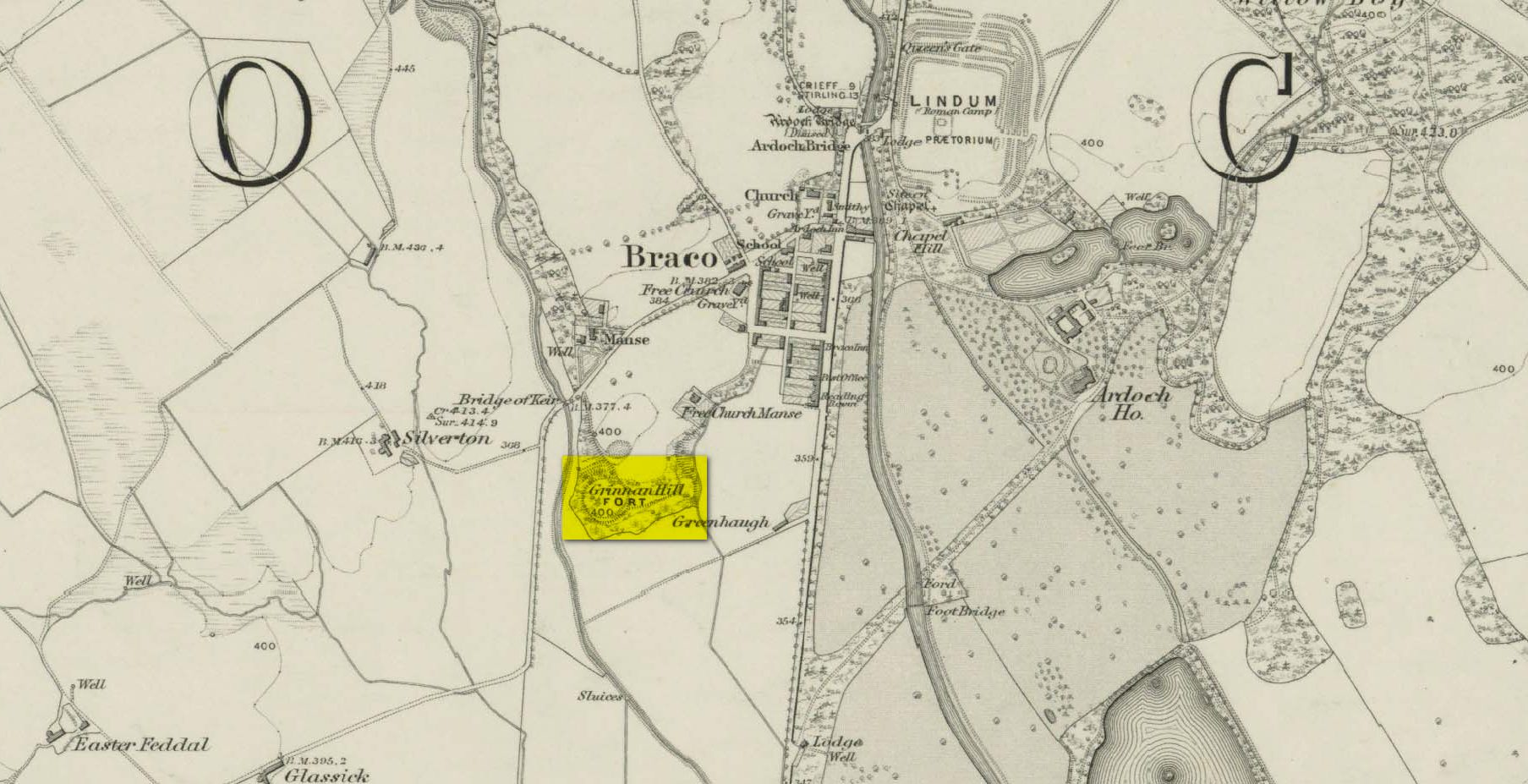
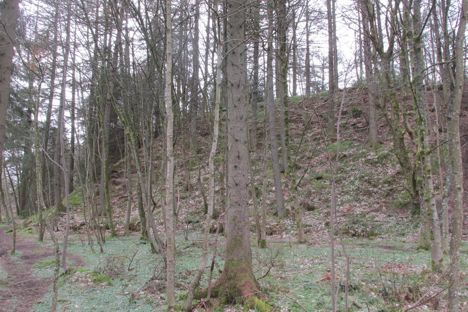
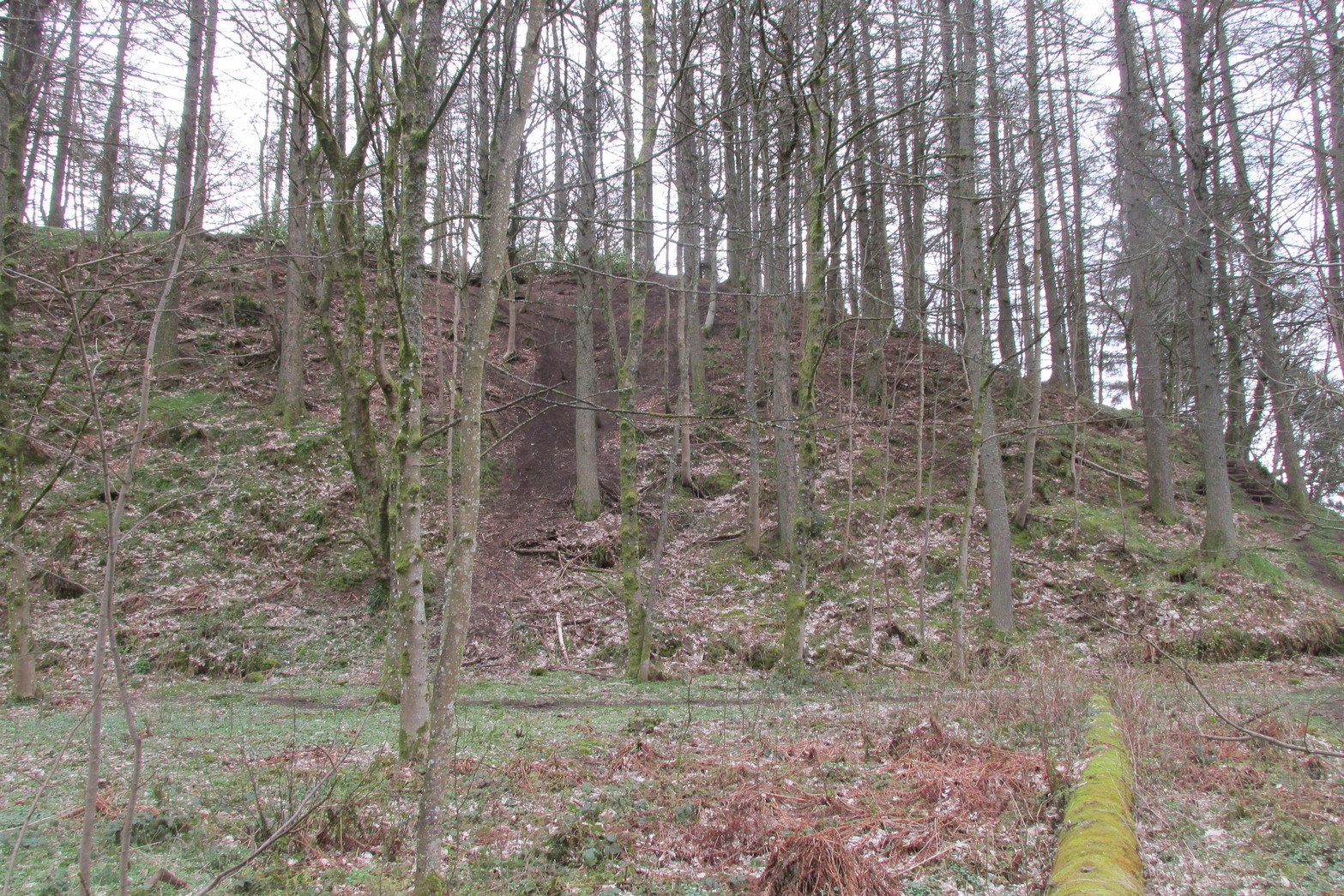
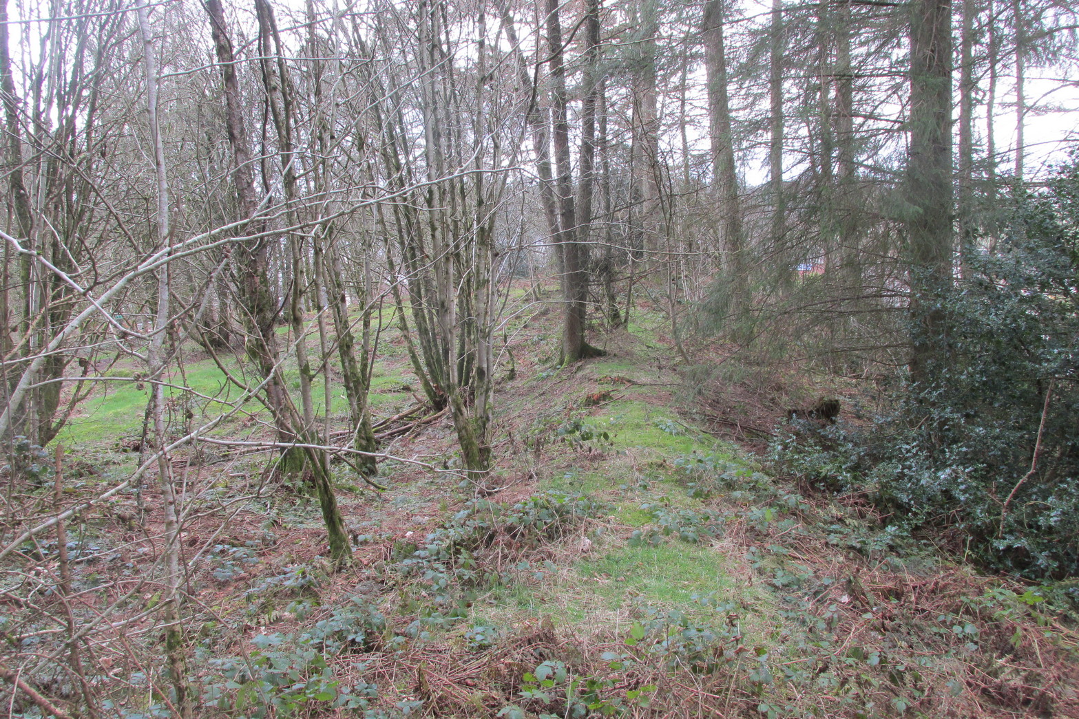
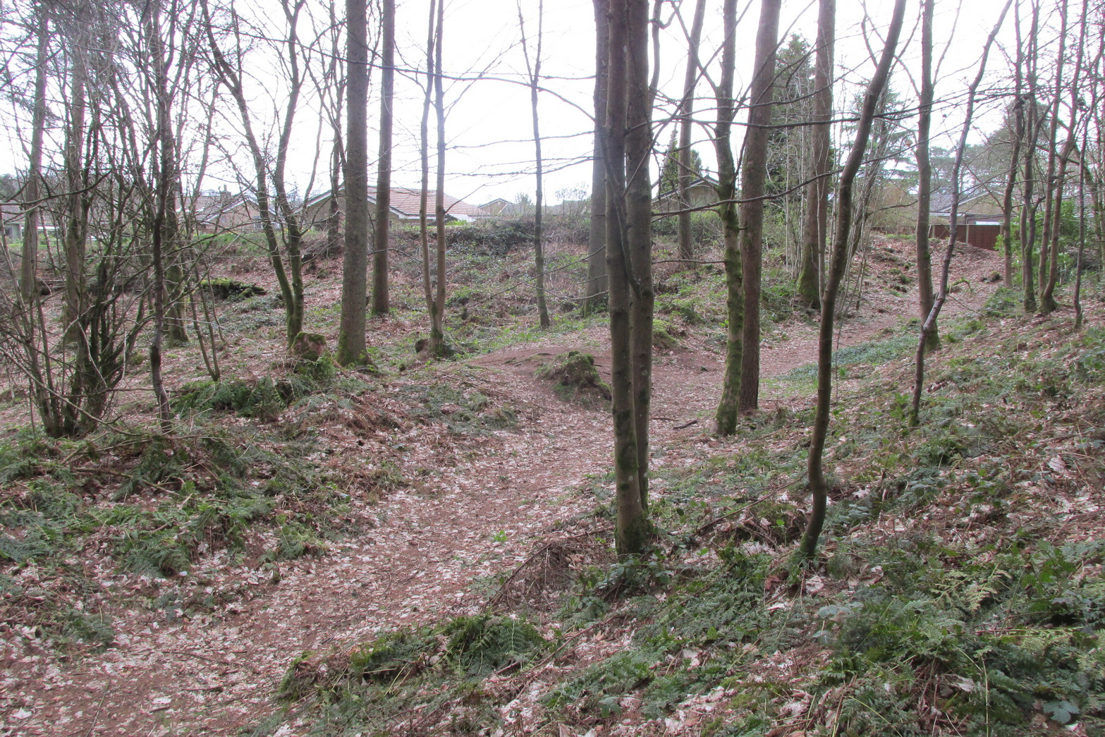
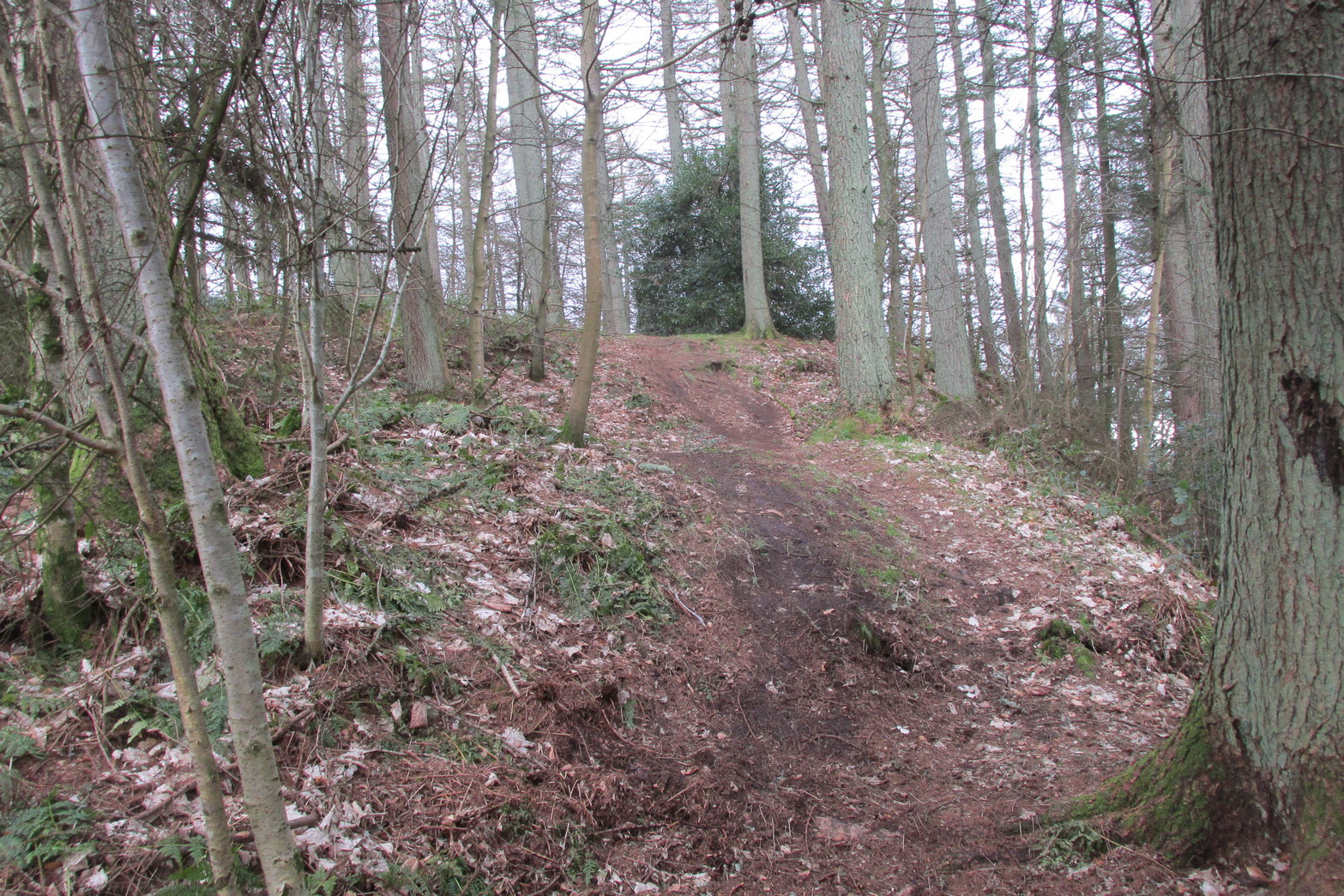
Antiquarians amongst you are gonna love this. It’s huge! Hiding away and all but forgotten in the little village of Braco, overgrown with trees and brambles, this steep wooded defensive structure has a series of large ramparts—three in all—that you’ll walk up and down before hitting a slightly undulating summit.
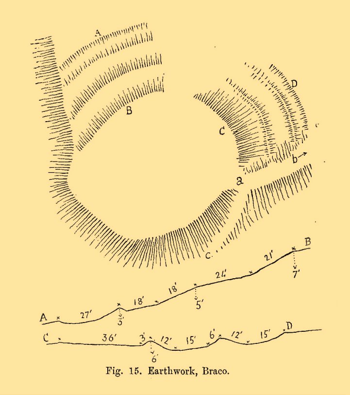
William Roy’s 1793 planChristison’s 1900 plan
The site was shown as an unnamed triple-ringed hill on William Roy’s 1747-52 survey of Scotland, with the lines representing the ramparts of this ‘fortress’. Some years later, Roy (1793) briefly mentioned the site when he was comparing indigenous fortifications with those of the Roman invaders, saying that “the small camp at Ardoch” probably “contained more than a Roman legion, with their auxiliaries.” His sketch and layout of the hillfort (right) is interesting in that it shows the more compete fortified ramparts on the north-eastern sides, which have today been covered by the modern houses. The ramparts in this part of the hillfort were still visible when the brilliant Miss Christian MacLagan (1875) came here; and in a subsequent visit by Mr Christison (1900) they could still be seen, as we can see in in his sketch (left). When we visited recently, it looked as if the lads who’d landscaped the large gardens most probably, unknowingly, used the soil of the ramparts to create them!
Apart from the missing northeastern ramparts, the site today is little different from when our antiquarians wrote of it more than a hundred years back. Read Miss MacLagan for example, who said:
“Near the parish church is an eminence called Grianan Hill, on which are still to be traced the remains of a British fort. The hill is a beautifully wooded knoll to the west of the village of Braco. It appears to be about 100 feet in height above the level of the surrounding land; on three of its sides the ground is perfectly flat, and we could suppose that in the amply days of the fort above, it had been environed on three sides by a lake, which would of course contribute to its strength. The fourth side of the hill, having but little natural strength, has been strongly fortified by three great walls. This is the side which connects the knoll with the neighbouring rising ground which is nearly as high as itself.
“The area enclosed by the innermost circular wall has a diameter of 130 feet. The space between this wall and the second is 37 feet, and the space between the second and third walls 47 feet. Almost every stone of this fort has been removed, but the lines and trenches which mark their former presence are still very distinct.”
Christison (1900) subsequently gave us much the same, with just some additional points here and there:
Looking up at SW sideLooking up at S side
“The site is less than ½-mile SW of Ardoch camp, 420 ft above the sea, on the edge of a steep descent, 40 to 50 ft high, to Keir Burn, but only slightly elevated above the field towards Braco village. It has apparently been an earthwork with a semi-oval triple line of defence…partly ramparted and trenched, partly terraced, the broad oval being rudely completed by the unfortified edge of the steep bank. The entrance, a, is along the narrow crest of a ridge, i, from the E, and it is likewise approached by a rude roadway, c, from the burnside below. Roy’s plan makes the work nearly complete, but the middle half of the lines no longer exists. He says that it may have been a work of the natives before the arrival of the Romans, but calls it a (Roman?) ‘post.’ There can be no doubt that it belongs to a common type of native fortresses. Its extreme length is about 320 ft, and the interior may have been about 200 by 170.”
Southern line of wallingFootpath along rampart
What he failed to point out—and contrary to Canmore’s comment that “the interior is featureless”—is the length of internal walling running nearly halfway through the top of the hillfort, cutting it in half so to speak, roughly southeast to northwest: the eastern area slightly larger than the west, which is a little higher. A ‘gate’ or passage between these two sides seems apparent halfway along this line of walling. This wall, like the long one running along its southern edge, is a couple of feet high and more than a yard across. In the western section a small pit has been dug, about eight feet across and a yard or so deep. Local lore tells that this was an old Roman fire-pit!
Around the very bottom mainly on the west-side of the hill, remains of old walling can be seen for a couple of hundred feet beneath the vegetation, but I’m unsure about the date of this structure. It may well be a 19th century construction, but without an excavation—and none has ever been done here—we will never know for sure.
Undulating ramparts
One final thought on this place is how is may have related with the large Roman forts that are just a few hundred yards away to the northeast. When the invaders came here, local tribal folk no doubt watched them with caution. One wonders whether or not some sort of ‘agreement’ was made between our local folk and the aggressive incomers, with them coming to some sort of nervous truce between them which allowed the Romans to build their camp to the east, as long as they kept their distance from the folk in this hillfort. Just a thought…..
References:
Christison, D., “The Forts, Camps and other Field-Works of Perth, Forfar and Kincardine,” in Proceedings Society Antiquaries, Scotland, volume 34, 1900.
Hogg, A.H.A., British Hill-Forts: An Index, BAR: Oxford 1979.
MacLagan, Christian, The Hill Forts, Stone Circles and other Structural Remains of Ancient Scotland, Edmonston & Douglas: Edinburgh 1875.
Roy, William, Military Antiquities of the Romans in North Britain, W. Bulmer: London 1793.
Acknowledgements: Huge thanks for use of the 1st edition OS-map in this site profile, Reproduced with the kind permission of the National Library of Scotland.
Very little is known about this long-lost site, mentioned just once in Alexander Barty’s (1944) standard history book on Dunblane. Its exact location is difficult to cite with any certainty, although a ‘Well’ is marked on the 1862 OS-map not far from where Mr Barty proclaimed it to be:
“In the close known as Regent’s Square in Braeport, opposite the public school, was a well called Bruce’s Well and also St Blane’s Well, and probably water from this supplied a well in Cathedral Market Garden to the west.”
Position of St. Blane’s Well?
St Blane is a Celtic saint whom tradition says gave his name to the town and whose festival date is August 10. In the area of the Allan Water St Blane was said to have set up his cell, which eventually became the prestigious ceremonial temple known as Dunblane Cathedral (although some evidence points to his original settlement being on the higher ground above the cathedral). Originally born on the Isle of Bute around 565 CE, another St Blane’s Well can be found at Kingarth on his home island.
References:
Armitage, Paul, The Holy Wells of Stirling and District, TNA 2019.
Barty, Alexander B., The History of Dunblane, Eneas Mackay: Stirling 1944.
Towill, Edwin Sprott, The Saints of Scotland, St Andrews Press 2012.
You can come here from either Dunblane to the north, or Bridge of Allan immediately south: either way you reach the site by going along the A9 road until you reach the Lecropt Church, a half-mile north of Bridge of Allan. On the other side of the road is a somewhat battered wooden gate. Go through here and up towards the tree-covered hill, following its edges to the right for a few hundred yards, until you come to another very large mound covered in trees. That’s what you’re looking for!
Archaeology & History
Described on early OS-maps as a “Supposed Roman Camp,” this large fortified stone hillock has more recently been considered a creation of indigenous Scots. Hemmed in and hidden on most sides, by the rises of Knock Hill to the west and Gallows Hill to the east, the only lines of visibility out of the fortress is along a northwest to southeast corridor, keeping the site quite secret to outsiders. It would have been a fine place for a small community in ages not-so-long-ago, keeping the people hidden from the pestilent invasions of both Romans and english in bygone times.
The tree-clad fort, through blizzard
The large raised oval enclosure was walled around its sloping sides and edges, with remains of a walled embankment still visible running around the top of the slopes. What may have been traces of hut circles were on top of the hillock until recent times, but these have been much reduced by some digging near the middle of the site. It would appear that an ‘entrance’ was once visible on the southeastern side of the fort, but when we came here the other day, a lovely blizzard covered the place in snow, so this was difficult to see.
When the Royal Commission chaps came to visit the place in 1979, they didn’t really say much about the place, merely telling of its dimensions, saying:
“This fort measures 48m by 32m within the remains of a single rampart 4.5m thick and 1m high.”
I’m sure there must be much to be said of this lovely old site by local antiquarians, but I haven’t found much as yet. But if you’re wanting a nice quiet spot to sit for a while on the outskirts of Stirling and Dunblane, I’d heartily recommend visiting this place. Badgers and deer also seem to like the place!
References:
Royal Commission on the Ancient & Historical Monuments of Scotland, Archaeological Sites and Monuments of Stirling District, Central Region, Society of Antiquaries of Scotland 1979.
If you’re not into the walk, get the bus running NE between Dunblane and Greenloaning — the A9 — getting off at the Little Chef on the dual carriageway and cross the road, walking up the track to Upper Whiteston Farm (the owners here are very helpful). As you walk up the track you’ll notice the large upright in the edge of the field a coupla hundred yards to your right. That’s the one!
Archaeology & History
This is a mightily impressive site if you’re into yer megaliths! When it was visited and measured by Mr Hutchinson (1893) in the 19th century he found it to be 9ft 4 in tall; and although it seems quite isolated at first sight, we find that there is another large stone companion laid down not far to the north of here which may have had some relationship with it . But that aside… There are also as many as eight cup-markings on the stone’s eastern face: one large one and seven smaller ones, in no particular order as usual! It was these cup-marks that gave me the impression there was once a burial associated with the stone, but the archaeology records seem silent on such a matter; though folklore tradition tells another story…
Folklore
Mr Hutchinson (1893) told that the legend attached to this stone appears to be “of quite recent date.” He said how,
“In the district the stone is known as the MacGregor Stone, and the tradition accounting for the name is to the effect that here a countryman was sacrificed by the followers of Rob Roy, when forming for the engagement on Sheriffmuir, in order to satisfy the ancient Highland superstition that first-blood was an infallible omen of success… The tradition is precise enough to state that a man of the name Dawson was seized in the adjoining hamlet of Whiteheadston (for such is the orignal name) as a whig, and therefore a foeman and proper victim. Dawson, however, suspecting the intentions of the captors, vehemently professed himself a supporter of King James and was left off. But another inhabitant of the hamlet not so acute or not so hypocritical, was immolated at the stone.”
Hutchinson however, doubts the accuracy of the tale and suggests that the local name of the MacGregor’s Stone derives from the fact that the monolith stands upon land once owned by the MacGregors of Balhaldies, countenancing that the stone “is of much earlier date than the MacGregors of Balhaldie or any other sept of the Children of the Mist.” I think he’s got a point!
References:
Hutchinson, A.F., “The Standing Stones of Stirling District,” in The Stirling Antiquary, volume 1, 1893.