Tregulland Cup-Marks, Treneglos, Cornwall

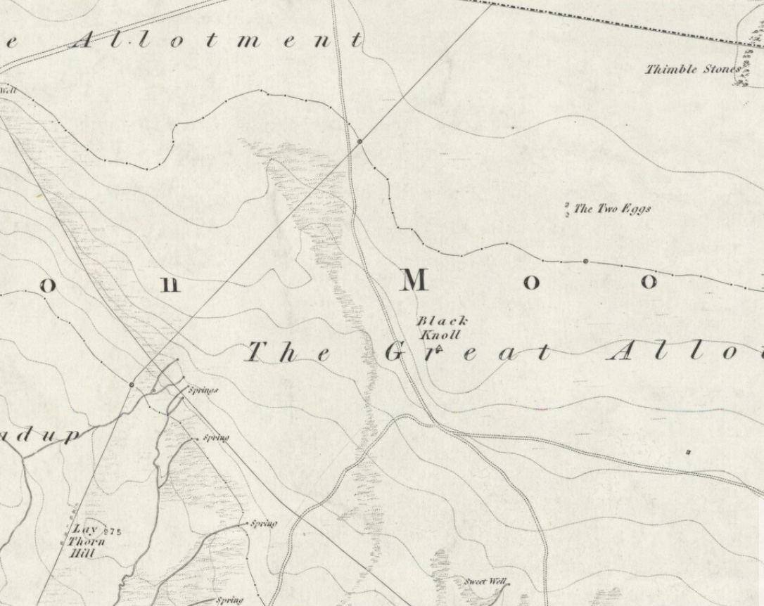
Cup-Marked Stones:  OS Grid Reference – SX 199 868

Fig.1

Archaeology & History

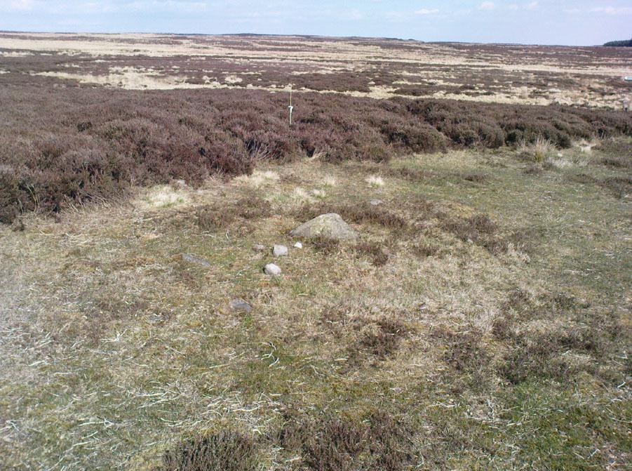
This is an intriguing find inasmuch as cup-marked stones are rare in this part of the British Isles.  Antiquarians have noted examples of such carvings in the Cornish townships of Davidstow, Delabole, Portreath, but very few others are known about.  But in the once-impressive Tregulland Burrow barrow that was found here on the south-side of the road a few hundred yards up from Cold Northcott, just next to the old township boundary line, as many as eighteen carved stones were unearthed!

Fig.2

They were all found inside different sections of the barrow, which was built on top of an earlier cairn structure, which appears to have been built upon an even earlier concentric ring of upright wooden poles.  The cup-marked stones appear to have been introduced, or etched, around the time when the cairn structure was laid on top of the concentric ring of stake-holes.  This “tradition” of adding cup-marked stones to cairns is a feature found at a number of sites in the northern lands of Yorkshire, Northumbria and across the Scottish counties, but such a celebrated event as this in the far southwest is highly unusual! (although the custom is pretty universal and is found, not only in the UK, but in many parts of the world).

Fig.3
Fig.4

In Paul Ashbee’s (1958) excellent essay on this prehistoric tomb, he described the carvings at some considerable length — which is unusual for an archaeologist of that period — noting them as the “cup-marked and ornamented stones”.  I hope that people won’t mind me repeating his lengthy notes on the relevant carved stones found in the tomb, the largest of which was on a big slab near the middle of the cairn that possessed cup-markings “and an ‘eyebrow’ motif”,* (figure 1, above) as he called it.  He described the respective carvings as follows:

From the Cairn-Ring:
1-2.  A hog-backed outlined slate slab (figure 1, above).  The bottom has a straight worked edge which suggests that the form was deliberate.  On the inner face are four close-set cup-marks, and an ‘eyebrow’ device which has been made around a natural flaw, whilst the outer half  has been formed by pecking and bashing to remove an appropriate amount of the laminated slate structure to form a depression.  On the outer face there are four widely set cup-marks, one being connected by a channel to the edge of the slab…
3-4.  A roughly rectangular slate slab.  The upper face bears two cup-marks, one much smaller than the other, together with one abortive cup-mark, the lower a single cup-mark.  Four perforations had been used to remove this slab from a parent block, the halves of these perforations gracing the upper edge.  The slab was incorporated in the upper part of the cairn-ring material stacked against the largest of the sub-megalithic blocks of the cairn-ring.
5.  The slab is hog-backed in outline, resembling No.1 above in general form.  On the upper face, at a right-angle to the straight bottom edge, a channel had been produced by pecking, the marks of a pointed instrument being clearly discernible at the bottom of the channel.  This channel extends almost from edge to edge of the slab, being narrow at the bottom and then expanding, being thus wider and then gradually tapering.  Were it not asymmetrical it could be considered as a dagger representation.
6.  A small block of roughly pentagonal outline, one side being irregular.  The device it bears has been made by pecking an outline and removing the intervening laminated slatey rock.  Found at the base of the cairn-ring on the south side.
7.  A weathered pillow-like lump of a coarse sandstone-like rock.  The plane face bears at least seven small ‘cup-marks.’  On other sides there are more weathered and uncertain marks which may well be natural.  It was found surmounting, in a central position, the faced walling on the western side of the cairn-ring.  Dr F.S. Wallis reports that: “This is evidently a sandstone rock with a large amount of quartz.  This is a very generalized rock and I am afraid that it is not possible to tie it down to any particular part of Cornwall.  The rock is much weathered and, judging from the print, I should say that the pits are entirely natural.  Such a rock would hardly contain fossils and thus the pits could not have an organic origin.”
8.  A roughly rectangular slate slab with opposing ‘cup-marks’ broken through before complete perforation.  In addition there is a single cup-mark on the upper edge. (see figure 2)  It was in the banked stones on the western side of the cairn-ring.

From the soil bank:
1.  An even, rectangular slab bearing a group of three cup-marks in one corner, and single cup-marks in two other corners. (see figure 3) From the outer cup-marks of the group run two channels.  A channel runs from one of the solitary corner cup-marks.  It was found, cup-marks and channels uppermost, almost exactly above the satellite cremation trench-grave.
2.  A roughly triangular slab, bearing on its upper face a single centrally set cup-mark.  Found by the cairn-ring in the eastern quadrant.
3.  A small slab, of pentagonal outline, bearing a single shallow cup-mark.  Found by the cairn-ring in the eastern side.
4.  A thin U-shaped slab which has been battered into shape by edge chipping.  A concavity has been made along the upper edge.

From the ditch infilling:
5.  A tough, quartz-veined slab with a shallow battered cup-mark.  From the western side of the barrow.
6.  A small, tough, even, rectangular piece of slate, bearing an abortive cup-mark.  From the western side of the barrow.
7.  A thin piece of slate bearing a small cup-mark set at a point where laminae of slate have left the piece.  From the eastern side of the barrow.

Unstratified:
All the “unstratified” cup-marked slabs recovered from the central disturbances, both recent and earlier, may well be derived from the destruction of the central grave arrangements.
8.  A thick lozenge-outlined slab bearing one large cup-mark, and one smaller set side-by-side. (figure 4, above)
9.  A roughly square-outlined slab with two cup-marks of even size set across one diagonal. (figure 5, below)  One cup-mark has a smaller one close by it.
10-11.  Irregular pieces of thin slate, bearing traces of perforations on their edges, one bearing cup-marks.
12.  A roughly triangular slab bearing an ? unfinished cup-mark.
13.  An even hexagonal slab that appears to have been, by edge trimming, worked into this form.”

Fig.5

The prolific collection of cup-marked stones in this once-impressive monument would probably indicate that the character buried here was of some significance to the local people, both to those who knew him and, evidently, in the subsequent mythologies surrounding the site (click here for the details of Tregullan Burrow barrow if you wanna know the archaeology and structure of the site).  And although we find, statistically speaking, a lacking of other cup-markings in this region, it’s more than likely there are others that are hiding away amidst other old tombs and rocks…

References:

  1. Ashbee, Paul, “The Excavation of Tregulland Burrow, Treneglos Parish, Cornwall,” in Antiquaries Journal, volume 38, 1958.

* the eyebrow motif description was used by a number of archaeo’s for sometime following publication of O.G.S. Crawford’s book, The Eye Goddess, to which the Antiquity Journal editor speculated some cup-and-rings may have owed their origin.

© Paul Bennett, The Northern Antiquarian


Jeppe Knave Grave, Wiswell, Lancashire

Cairn:  OS Grid Reference – SD 7599 3782

Getting Here

Jeppe Knave Grave on 1848 map

From Sabden, head up the steep Clitheroe Road towards the Nick o’ Pendle, turning left 100 yards before the hilltop and along the dirt-track for a few yards, before veering up the winding footpath to the hilltop.  When you’re at the peak of this little bit o’ moorland, go to your left (west), following the small path into the grasses and heather all the way on for a few hundred yards till you hit the triangulation pillar.  Go past this, over one stile (north) and then immediately at right-angles (west) over another stile and downhill for about 100 yards until you’re on the rough grassland level.  Keep your eyes peeled as you’re walking until you see what looks like a denuded stone-lined pit, much overgrown — with the main feature (showing that you’ve hit the target) being the engraving on one of the larger rocks: “Jeppe Knave Grave”.

Archaeology & History

The Jeppe Knave Grave

First described in early perambulation records of 1326 CE, this is a small but intriguing site found on the far southwestern slopes of Pendle Hill, on the ridge beneath the triangulation pillar of Wiswell Moor.  It’s a small and overgrown cairn with a general archaeological association of prehistory attached—though no detailed excavation has ever been done here, despite local archaeologists having access to a large grant to explore this region a short while ago.¹  But up North, as many of us know, archaeology is given little priority and those who do decent exploratory work under the umbrella of such academic quarters tend to be few and far between.  Thankfully we had the northern antiquarian and local writer John Dixon (1993) nearby who gave us the best overview of the site.  He wrote:

“This landscape feature, known as Jeppe Knave Grave, stands at a place called The Lows high on Wiswell Moor and takes the form of a low grass-covered mound 16M in diameter with a stone filled depression in the centre 5 x 3 M.  This feature appears to be a mutilated cairn and has been tentatively ascribed to the Bronze Age.  The outer ring of stones can be discerned in the rough pasture at the perimeter – yellow in dry conditions, showing the circular shape. Given the large size of the stones here, the cairn may have been of a chambered type/passage tomb of the Neolithic period, and if this was the case the burial (or burials?) was one of great importance.

“Upon the largest stone are inscribed the words ‘JEPPE KNAVE GRAVE and a cross (inscribed by the Scouting Association in the 1960’s). The stone marks the final resting place of Jeppe Curteys (Geoffrey Curtis), a local robber who was decapitated for his crimes in the first year of Edward III, 1327.  The name first occurs in a record of the boundaries between Wiswall and Pendleton dated 1342.

“…In those times the punishment of decapitation was unusual, being reserved for those of noble birth.  So who was this Jeppe Curteys, punished by decapitation and later buried on the high ridge of Wiswell Moor in a pre-Christian burial mound on the then boundary of parishes?  That intriguing story we may never know.  But to be buried in such a manner and place was indeed a great indignity – interment in what might be considered in those times to be a ‘pagan’ or ‘devilish’ spot.  It may be that to bury a man in such a place was to literally ‘send him to the devil’. Alternatively one could ask: ‘Was the site thought then to be the burial spot of some noble ancestor, and Jeppe being of possible noble birth interred with great dignity?  Again we may never know, yet it is significant that this lonely spot is still identified with a man who was executed 700 years ago.

In 1608 it was stated that one Robert Lowe had taken a stone from the grave and used it as a cover of his lime kiln.”

Old codgers from the local Senile Society, inspecting York Minster!
Agatha Lyons’ 1871 sketch

The design of the cairn here is unlike the ones you usually come across on the Lancashire and Yorkshire moorlands.  The edges of the Jeppe Knave Grave are walled and much more well-defined than the large rock piles that we find scattering our uplands.  A similar though larger cairn with features similar to these can be seen in the large Low Hill tumulus on Elslack Moor near Earby, about ten miles northeast of here…

Other prehistoric remains scatter the many rolling hills that you can see from here: mainly prehistoric tombs sat upon hilltops as far as the eye can see.  John pointed out what may be the remains of another tumulus that can be seen on the nearby horizon a few hundred yards NNW from here, overlooking the gorgeous village of Pendleton and the landscape beyond…

References:

  1. Dixon, John, Journeys through Brigantia – volume 9: The Ribble Valley, Aussteiger Publications: Barnoldswick 1993.
  2. Dixon, John, Pendle – A Mythic Landscape, Aussteiger Publications: Barnoldswick 2010.
  3. Whitaker, Thomas Dunham, An History of the Original Parish of Whalley – volume 2, George Routledge: London 1876.

¹ John Dixon informed us how the people in question spent the grant — somewhere in the region of £50,000 — on exploring some modern architectural features, instead of exploring some of the little-known sites and seeking out others on these hills.

* John is the author of many fine historical travel guides, including the Journeys through Brigantia series. See the titles in the Lancashire Bibliography and Yorkshire Bibliography for a more complete listing of all his books to date.  If you wanna buy any of his works, or make enquiries regarding them, email John at: lancashirebooks@fsmail.net – or write to him direct, at: John Dixon, Aussteiger Publications, 21 Lowergate, Clitheroe, Lancashire BB7 1AD.

© Paul BennettThe Northern Antiquarian 


Butt Well, Stirling, Stirlingshire

Healing Well:  OS Grid Reference – NS 7894 9389

Also Known as:

  1. Spout Well

Getting Here

Butt Well in 1898
Butt Well in 1898

Said by John Allan (1907) to be “at the base of the Brandy Hill, about 210 yards west from the parish church,” to get to it from the town centre Stirling Arcade, go across and along the Corn Exchange Road and as it goes down the slope, take the path that leads into the trees on your right-hand side.  Follow this path along to the bottom of the woods.  Once on the level at the bottom, walk on the path in the direction of Stirling Castle and eventually you’ll reach the fancy walling with the dried-up well right in front of you!

Archaeology & History

This much-neglected site got its name from there being a number of archery shooting targets, or butts, which used to be erected in the fields immediately below this once popular drinking spot.  Although the Stirling historian J.S. Fleming (1898) could find no definitive records of the place as a holy or healing well, he told how,

“The copious spring arising in the centre of the rock on which Stirling Town and Castle are built, must have been extensively used during the Royal occupation of the Castle for watering the horses engaged in hunting in the Park…and it must also have been the source from whence the canal or ornamental waters and fountains in the ancient pleasure-grounds of the King’s Knot were supplied, the fall being amply sufficient  for the rise to a considerable height of the latter… The Well had at one time a railing surroundings its then open trough, the marks of the lead used in grouting the rails remaining visible until the last alteration.”

The waters emerging in the field below
The Butt Well

Early accounts of the Butt Well are few and far between.  Ronald James (1899) found it to have been known in earlier centuries as the Spout Well in 1582, but additional descriptions of the place are scant.  The well is not included in the surveys of either MacKinlay (1893) nor the Morris’ (1981), though John Allan (1907) thinks that this site was a “congenial retreat” where “the bard of the chief” would gain insight.  The remains of walling behind the old well he thought may have been the ancient remains of an old hermitage of sorts, but there’s little evidence to prove this.   Today, although dried-up, the site appears much it as did when Fleming described it:

“The Well has had the old wall — formed of granite boulders — rebuilt and cemented, and a rustic ornamental freestone front put on where the spout is inserted, but its stone seat for invalids and other surroundings remains as they were forty years ago.  The Well formed the termination of the early morning walk of the town’s folk for a draught of its cold water, and was at a late period used by the wives and washerwomen of Stirling for washing their clothes, which were then bleached on the green sward lying below the Well, the tenant of the park making a charge according to the extent of the washing.”

If you go behind the walling here you’ll notice a small flow of water which emerges into the field below.  The waters from here, although only a trickle, are still cold, fine and refreshing.

References:

  1. Allan, John, The Days of the Monasteries and Latter Days of Stirling, Stirling 1907.
  2. Fleming, J.S., Old Nooks of Stirling, Delineated and Described, Munro & Jamieson: Stirling 1898.
  3. Ronald, James, Landmarks of Old Stirling, Eneas MacKay: Stirling 1899.

© Paul Bennett, The Northern Antiquarian 


Wallace’s Stone, Dunblane, Stirlingshire

Standing Stones / Stone Row:  OS Grid Reference – NN 83259 02293

Also Known as:

  1. Lairhill Stones

Getting Here

Follow the same directions as to reach the cup-marked Sheriffmuir Carving, which is just a coupla hundred yards away to the southwest.  On a clear day you can see this standing stone from the pub by the roadside, a few hundred yards away!

Archaeology & History

Wallace Stone (photo credit – James Elkington)

This is alleged to be just one standing stone in a straight line of five once-upright monoliths.  Starting at the southwestern end of this row we have the 7ft-long cup-marked Sheriffmuir Carved stone — which certainly looks as if it stood upright in the not-too-distant past — and as we move up the line we pass another that’s been split in half.  Another earthfast-looking rock is the next contender, before we reach our famous Wallace Stone, standing upright and proud on this moorland ridge.  It’s about 6ft tall and 3ft across at its widest and certainly acts as a marker for the line of stones that allegedly stood upright here.  And if we walk just a bit further up we have another big stone laid on the ground which is alleged to be a part of the same alignment.

The split stone (photo credit – James Elkington)

If it is an authentic megalithic row, it’s not included in either the Thoms’ (1990) two-volume work on the subject, nor Aubrey Burl’s (1996) compendium a few years later.  And though the alignment looks good, I’ve found ones just like this in the Pennines where we have just one upright left and then a line of other seemingly prostrate stones running dead straight either side of the singular upright (and have kept mi gob shut about ’em for sensible reasons), so I’m not too sure what to think.

But, alignment aside, the Wallace Stone itself is a damn good standing stone and well worth checking out.  It’s highly probable that other prehistoric remains still lurk, undiscovered, amidst these heaths…like the lost stone circle to be found nearby…

Folklore

A slight variation on a theme about this spot:  in both accounts the stone was named after the legendary Scottish independence fighter, Sir William Wallace.  The folklore tells that he and his fighting clans gathered here in 1297 preceeding the Battle of Stirling Bridge; whilst the variation tells that the stone here was actually erected around that time to commemorate the event.  This tale was first narrated by a local story-teller called Blind Harry and was found by local historian A.F. Hutchinson (1893) to be a case of mistaken identity!

References:

  1. Burl, Aubrey, From Carnac to Callanish: The Prehistoric Stone Rows and Avenues of Britain, Ireland and Brittany, Yale University Press 1993.
  2. Heggie, Douglas C., Megalithic science: ancient mathematics and astronomy in north-west Europe, Thames & Hudson: London 1981.
  3. Hutchinson, A.F., “The Standing Stones and other Rude Monuments of Stirling District,” in Transactions of the Stirling Natural History and Antiquarian Society, 1893.
  4. Royal Commission on the Ancient & Historical Monuments of Scotland, Archaeological Sites and Monuments of Stirling District, Central Region, Society of Antiquaries of Scotland 1979.
  5. Thom, A., Thom, A.S. & Burl, Aubrey, Stone Rows and Standing Stones – 2 volumes, B.A.R.: Oxford 1990.

Acknowledgements:  Big thanks as always to James Elkington for use of his photos in this site profile – prints of which are available from the man himself!

© Paul Bennett, The Northern Antiquarian


Sheriffmuir Carving, Dunblane, Stirlingshire

Cup-Marked Stone:  OS Grid Reference – NN 83074 02143

Getting Here

From Dunblane, head up the Glen Road for nearly a mile, turning left up the Sheriffmuir Road and all the wya on till you reach the pub near the T-junction another couple of miles on.  OK – get thru the gate and onto the moor, roughly in a straight line with the pub behind you for about 400 yards.  You’re damn close! (if you find the nice standing stone known as the Wallace Stone, walk  250 yards southwest from here).

Archaeology & History

Almost nothing has been written of this cup-marked stone, found at the southern end of what’s alleged to be an authentic megalithic stone row alignment, running northeast to southwest — although this alignment isn’t included in either Aubrey Burl’s (1993) or Alexander Thom’s (1990) textbooks dealing with such matters.

Cup-marks highlighted in ice!
Cup-marked rock with the Wallace Stone in the distance

When we came here last winter in temperatures of around -6°C (one helluva good day!), curiously only this and the other stones along this “stone row” were actually uncovered on the moorland.  Quite bizarre to be honest!  Many of the other rocks scattering this small moorland edge were covered in several feet of snow.  We were lucky I s’ppose…though I’ve gotta get back up here again shortly and see the site in summertime (midges up mi crotch, cleggs-a-biting – oh such joy!) cos I can’t believe this is the only cup-marked stone hereby.

The rock itself is more than seven-feet long and has at least twenty archetypal cups carved into its slightly-slanting face — although when we visited the stone, several of these were difficult to see and, as the images show, even more difficult to photograph (of the 20 I took of this stone alone, only one was of any value in highlight the cups) .  The stone gave the impression that it may have stood upright in the not-too-distant past — which would of course give the notion of this as part of megalithic avenue a considerably more potent status.

Some dood alleged that this potential stone row, with this cup-marked stone at its southwestern end, marked an astronomical alignment — but for the life of me I can’t remember who it was! (it’s my age creeping up on me at last!)

References:

  1. Burl, Aubrey, From Carnac to Callanish: The Prehistoric Stone Rows and Avenues of Britain, Ireland and Brittany, Yale University Press 1993.
  2. Heggie, Douglas C., Megalithic science: ancient mathematics and astronomy in north-west Europe, Thames & Hudson: London 1981.
  3. Thom, A., Thom, A.S. & Burl, Aubrey, Stone Rows and Standing Stones – 2 volumes, B.A.R.: Oxford 1990.

© Paul Bennett, The Northern Antiquarian


Stanbury Hill (097), Bingley Moor, West Yorkshire

Cup-and-Ring Stone:  OS Grid Reference – SE 10970 43361

Also Known as:

  1. Carving no.78 (Hedges)

Getting Here

To get here, follow the same directions to reach the ornate Lunar Stone.  Once here, walk about 20 yards west towards where the brow of the hill begins to slope down.  Amble about and you’ll easily find it.

Archaeology & History

This is a fascinating carving.  Fascinating, inasmuch as it seemingly keeps changing appearance when Nature moves her daylight hues and whimsical unpredictability betwixt the hills, surrounding landscape and human observer.  Depending very much where you stand and when you look at this small rock — dappled with unacknowledged veils of sunlights, grey winds and other natural forces — determines what the stone shows you.  This carving as much as any upon this hill shows once again the hugely neglected dynamic between human purveyor and Nature’s powerful subtlety: an organic exchange of moods from stone to man and back again; very much how our ancestors saw things to be…

Pecked lines clearly visible on the far end of the rock
Carving from above

For if we were to merely pay attention to what the reference books tell us about this carving (good reference books though they are!), we’d simply be seeing a rock possessing a “cup and partial ring and two other possible cups”, as Boughey & Vickerman (2003) and other students might do.  But then, if conditions change, only subtly, and we gaze instead of study, other things can emerge.  And just such a thing happened when we came here yesterday…

On my first visit here I could only see a single cup-marking, with another ‘debatable’ close by.  The light of day wasn’t quite right it seemed.  But when we visited here yesterday, the sun, the light, the land and our ambling minds saw much more unveiled from this old grey surface.  Whilst two cups-and-rings seem to link with another cup on the lower end of the stone, amidst the natural cracks and fissures, on the higher end are very distinct carved pecked lines, one of which has been blatantly cut onto, or upon, the long curving crack which runs from one end of the stone to the other.  As this carved line emerges out of the natural crack, it heads upwards.  As it does so, another line has been pecked running off it to the left and then curves back down the sloping rock-face once again.  But in this previously unrecognised carved section, these lines may extend even further up the rock…..it’s hard to say for sure.  We could do with greater analysis of its surface, with further observations under yet more lighting conditions.

References:

  1. Boughey, Keith & Vickerman, E.A., Prehistoric Rock Art of the West Riding, WYAS 2003.
  2. Hedges, John (ed.), The Carved Rocks on Rombalds Moor, WYMCC: Wakefield 1986.

© Paul Bennett, The Northern Antiquarian


Askwith Moor Cairnfield, North Yorkshire

Cairns:  OS Grid Reference – SE 170 507– NEW DISCOVERY

Getting Here

From the large parking spot by the roadside along Askwith Moor Road, walk up (north) 250 yards until you reach the gate with the path leading onto Askwith Moor.  Follow this along, past the triangulation pillar until you reach the Warden’s Hut near the top of the ridge and overlooking the moors ahead.  Naathen — look due south onto the moor and walk straight down the slope till the land levels out.  If you’re lucky and the heather aint fully grown, you’ll see a cluster of stones about 500 yards away.  That’s where you’re heading.  If you end up reaching the Woman Stone carving, you’ve walked 100 yards past where you should be!

Archaeology & History

Discovered on the afternoon of May 13, 2010, amidst another exploratory ramble in the company of Dave Hazell.  We were out looking for the Woman Stone carving and a few others on Askwith Moor, and hoping we might be lucky and come across another carving or two in our meanderings.  We did find a previously unrecorded cup-marked stone (I’ll add that a bit later) — and a decent one at that! — but a new cairn-field was one helluva surprise.  And in very good nick!

Cairn A, looking northwest
Cairn A, looking east

There are several cairns sitting just above the brow of the hill, looking into the western moors.  Most of these are typical-looking single cairns, akin to those found on the moors above Ilkley, Bingley and Earby, being about 3 yards across and a couple of feet high amidst the peat and heather covering.  But two of them here are notably different in structure and size (and please forgive my lengthy description of them here).

We found these tombs after noticing a large section of deep heather had been burnt back, and a large mass of rocks were made visible as a result.  Past ventures onto these moors when seeking for cup-and-ring carvings hadn’t highlighted this cluster, so we thought it might be a good idea to check them out!  As I approached them from the south from the Woman Stone carving (where we’d sat for a drink and some food, admiring the moors and being shouted at by a large gathering of geese who did not want us here), it became obvious, the closer I got, that something decidedly man-made was in evidence here.

Cairn A, looking south

Walking roughly northwards out of the heather and onto the burnt ground, a cairn-like feature (hereafter known as “Cairn A”) was right in front of me; though this seemed to have a ring of small stones — some earthfast, others placed there by people — surrounding the stone heap.  And, as I walked around the edge of this large-ish cairn (about 9 yards in diameter and 2-3 feet tall), it was obvious that a couple of these outlying stones were stuck there by humans in bygone millenia.  The most notable feature was the outlying northernmost upright: a small standing stone, coloured white and distinctly brighter than the common millstone grit rock from which this monument is primarily comprised.  As I walked round it — adrenaline running and effing expletives emerging the more I saw — it became obvious that this outlying northern stone had long lines of thick quartz (or some crystalline vein) running across it, making it shine very brightly in the sunlight.  Other brighter stones were around the edge of the cairn.  It seemed obvious that this shining stone was of some importance to the folks who stuck it here.  And this was confirmed when I ambled into another prehistoric tomb about 50 yards north, at “Cairn B.”

Cairn B, looking north
Cairn B, looking east

Cairn B was 11 yards in diameter, north-south, and 10 yards east-west.  At its tallest height of only 2-3 feet, it was larger than cairn A.  This reasonably well-preserved tomb had a very distinct outlying “wall” running around the edges of the stone heap, along the edge of the hillside and around onto the flat moorland.  Here we found there were many more stones piled up in the centre of the tomb, but again, on its northern edge, was the tallest of the surrounding upright stones, white in colour (with perhaps a very worn cup-marking on top – but this is debatable…), erected here for some obviously important reason which remains, as yet, unknown to us.  Although looking through the centre of the cairn and onto the white upright stone, aligning northwest on the distant skyline behind it, just peeping through a dip, seems to be the great rocky outcrop of Simon’s Seat and its companion the Lord’s Seat: very important ritual sites in pre-christian days in this part of the world.  Near the centre of this cairn was another distinctly coloured rock, as you can see in the photo, almost yellow!  Intriguing…

The smaller “Cairn C”

Within a hundred yards or so scattered on the same moorland plain we found other tombs: Cairns C, D, E, F, G and H — but cairns A and B were distinctly the most impressive.  An outlying single cairn, C, typical of those found on Ilkley Moor, Bingley Moor, Bleara Moor, etc, was just five yards southwest of Cairn A, with a possible single cup-marked stone laying on the ground by its side.

Just to make sure that what we’d come across up here hadn’t already been catalogued, I contacted Gail Falkingham, Historic Environment team leader and North Yorkshire archaeological consultant, asking if they knew owt about these tombs.  Gail helpfully passed on information relating to a couple of “clearance cairns” (as they’re called) — monument numbers MNY22161 and MNY 22162 — which are scattered at the bottom of the slope below here.  We’d come across these on the same day and recognised them as 16th-19th century remains.  The cairnfield on top of the slope is of a completely different character and from a much earlier historical period.

We know that human beings have been on these moors since mesolithic times from the excess of flints, blades and scrapers found here.  Very near to these newly-discovered tombs, Mr Cowling (1946) told that:

“On the western slope of the highest part of Askwith Moor is a very interesting flaking site. For some time flints have been found in this area, but denudation revealed the working place about August, 1935.  There were found some twenty finished tools of widely different varieties of flint.  A large scraper of red flint is beautifully worked and has a fine glaze, as has a steep-edged side-blow scraper of brown flint.  A small round scraper of dull grey flint has the appearance of newly-worked flint, and has been protected by being embedded in the peat…One blade of grey flint has  been worked along both edges to for an oblong tool… The flint-worker on this site appears to have combed the neighbourhood to supplement the small supply of good flint.”

All around here we found extensive remains of other prehistoric remains: hut circles, walling, cup-and-ring stones, more cairns, even a probable prehistoric trackway.  More recently on another Northern Antiquarian outing, we discovered another previously unrecognised cairnfield on Blubberhouse Moor, two miles northwest of here.

References:

  1. Cowling, Eric T., Rombald’s Way: A Prehistory of Mid-Wharfedale, William Walker: Otley 1946.
  2. Jack, Jim, “Ancient Burial Ground and Bronze Age Finds on Moor,” in Wharfedale Observer, Thursday, May 27, 2010.

© Paul Bennett, The Northern Antiquarian


Black Knoll Cross, Morton Moor, West Yorkshire

Cross:  OS Grid Reference – SE 1034 4465

Also Known as:

  1. Black Knowle Cross

Getting Here

Black Knoll on 1851 map

Get up to the Twin Towers right at the top of Ilkley Moor (Whetstone Gate), then walk east along the footpath, past the towers for about another 100 yards, looking out on the other side of the wall until it meets with some other walling running downhill onto Morton Moor.  Follow this walling into the heather for a few hundred yards.  Where it starts dropping down the slope towards the small valley, stop!  From here, follow the ridge of moorland along to your left (east) and keep going till you’re looking down into the little valley proper.  Along the top of this ridge if you keep your eyes peeled, you’ll find the stone cross base sitting alone, quietly…

Archaeology & History

This old relic, way off any path in the middle of the moor, has little said of it.  Whilst its base is still visible — standing on a geological prominence and fault line — and appears to taken the position of an older standing stone, christianised centuries ago, the site is but a shadow of its former self.  When standing upright may centuries back, the “cross” was visible from many directions. We discovered this for ourselves about 20 years back, when Graeme Chappell and I sought for and located this all-but-forgotten monument.  When we found the stone base, what seemed like the old stone cross lay by its side, so we repositioned it back into position on July 15, 1991.  However, in the intervening years some vandal has been up there and knocked it out of position, seemingly pushing it downhill somewhere.  When we visited the remains of the cross-base yesterday (i.e., Dave, Michala Potts and I) this could no longer be located.  A few feet in front of the base however, was another piece of worked masonry which, it would seem, may have once been part of the same monument.

Cross-base, looking north
Close-up of cross-base

Years ago, after Graeme and I had resurrected the “cross” onto its base, I went to visit the Bradup stone circle a few weeks later and found, to my surprise, the upright stone in position right on the skyline a mile to the northeast, standing out like a sore thumb!  This obviously explained its curious position, seemingly in the middle of nowhere upon a little hill.  This old cross, it would seem, was stuck here to replace the siting of what seems like a chunky 3½-foot long standing stone, lying prostrate in the heather about 10 yards west of the cross base.

Stuart Feather (1960) seems to be the only fella I can find who described this lost relic, thinking it may have had some relationship with a lost road that passed in the valley below here, as evidenced by the old milestone which Gyrus and I resurrected more than 10 years back.  Thankfully (amazingly!) it still stands in situ!

If you aint really into old stone crosses, I’d still recommended having a wander over to this spot, if only for the excellent views and quietude; and…if you’re the wandering type, there are some other, previously undiscovered monuments not too far away, awaiting description…

References:

  1. Bennett, Paul, The Old Stones of Elmet, Capall Bann: Chieveley 2001.
  2. Feather, Stewart, “A Cross Base on Rombald’s Moor,” in Bradford Antiquary, May 1960.
  3. Feather, Stewart, “Crosses near Keighley,” in Cartwright Hall Archaeology Group Bulletin 5:6, 1960.

© Paul BennettThe Northern Antiquarian


Tomb Stone (110), Stanbury Hill, Bingley Moor, West Yorkshire

Cup-and-Ring Stone:  OS Grid Reference – SE 11229 43143

Also Known as:

  1. Carving no.93 (Hedges)
  2. Carving no.110 (Boughey & Vickerman)

Getting Here

The larger stone in this cairn is the carved rock

From East Morton village, take the moorland road, east, and up the steep hill.  Where the road levels out there’s a right turn, plus (more importantly!) a trackway on your left which leads onto the moor.  Go up this track and keep walking till you hit a moorland ‘footpath’ signpost.  Just before this walk due west (your left) into the heather for about 10 yards.  Look around! (if the heather’s long and overgrown, you might have trouble finding it)  If you find carved stone 109, you’re less than 10 yards off this one!

Archaeology & History

First reported by Stuart Feather and described in a short note of the Yorkshire Archaeological Register* of 1977.  This was one of two small carved stones next to each other amidst the “denuded remains of a cairn 3m in diameter and 0.35m high.”  The stone we can still see here is a small one, seemingly near the very centre of the cairn, with its carved face looking northwards.  The carving is a simple double-ring surrounding a central cup: an almost archetypal cup-and-ring stone.

Crap photo of the double-ring

The other ancient carved stone that was once seen next to this (catalogued as carving 111) has in recent years been stolen by an archaeological thief no less!  Any information that anyone might have telling us who’s stolen this heritage piece, or where it might presently reside, can be emailed to me in confidence.  Or…the thief who’s taken it can return the carving to the site and put it back where it belongs before we find out where you live.  Simple as!

(Soz about the poor photo of this carving.  For decent ones of this stone you need to get here when the sun’s in a better position.  I’ll hopefully get some better images next time we’re up there when the light’s better.)

References:

  1. Boughey, Keith & Vickerman, E.A., Prehistoric Rock Art of the West Riding, WYAS 2003.
  2. Hedges, John (ed.), The Carved Rocks on Rombalds Moor, WYMCC: Wakefield 1986.
  3. Moorhouse, S. (ed.), “Yorkshire Archaeological Register: 1977,” in Yorkshire Archaeology Journal, volume 50, 1978.

* Does anyone have any idea who you report such new discoveries to so that they can be reported in Yorkshire Archaeology Society’s ‘Register’?  I’ve asked ‘em several times about a number of previously unrecorded sites that we’ve located, so that they can make a record of them, but I never get a reply.

©Paul Bennett, The Northern Antiquarian


Counter Hill, Addingham, West Yorkshire

Enclosure:  OS Grid Reference – SE 051 501

Getting Here

Counter Hill, looking north

You can come from various angles to approach this site, but I reckon the best is from along the old trackway of Parson’s Lane, between Addingham and Marchup.  From Silsden go up the long hill (A6034) towards Addingham until the hill levels out, then turn left on Cringles Lane (keep your eyes peeled!) for about 500 yards until you reach the Millenium Way or Parson’s Lane track, to your right.  As you walk along this usually boggy old track, the rounded green hill ahead, to the left, if where you’re heading.  Less than 100 yards past the little tumulus of High Marchup there’s a stile on your left that takes you into the field.  You’ll notice the depression that runs across near the top, at an angle.  That’s part of the earthworks!

Archaeology & History

The Counter Hill earthworks just over the far western edge of Rombald’s Moor – thought to be Iron Age – are truly gigantic.   More than ¾-mile across along its longest NW-SE axis, and a half-mile from north-south at its widest point, this huge ellipse-shaped earthwork surrounds the rounded peaked hill that gives the site its name: Counter Hill.  And although Harry Speight (1900) thought the hill got its name from the old Celtic conaltradh, or Irish conaltra, as in the ‘hill of debate or conversation’ — a possibility — the place-name master Mr Smith (1961) reckoned its name comes from little other than ‘cow turd hill’!  We may never know for sure…

Earthworks south of Counter Hill
Cowling’s 1946 plan

The Lancashire historian Thomas Dunham Whitaker (1878) appears to have been one of the first people to describe the Counter Hill remains, though due to the sheer size of the encampment he thought that it was Roman in nature.  Within the huge enclosure we also find two large inner enclosures, known as the Round Dikes and the Marchup earthworks.  Whitaker’s description of Counter Hill told:

“There are two encampments, on different sides of the hill, about half a mile from each other: one in the township of Addingham, the other in the parish of Kildwick; the first commanding a direct view of Wharfedale, the second an oblique one of Airedale; but though invisible to each other, both look down aslant upon Castleburg (Nesfield) and Ilkley.  Within the camp on Addingham Moor are a tumulus and a perennial spring; but by a position very unusual in such encampments, it is commanded on the west by a higher ground, rising immediately from the foss.  The inconvenience, however, is remedied by an expedient altogether new, so far as I have observed, in Roman castramentation, which is a line of circumvallation, enclosing both camps, and surround the whole hill: an area, probably, of 200 acres.  A garrison calculated for the defence of such an outline must have been nothing less than an army.  But it would be of great use in confining the horses and other cattle necessary for the soldiers’ use, which, in the unenclosed state of the country at the time, might otherwise have wandered many miles without interruption.  The outlines of these remains is very irregular; it is well known, however, that in their summer encampments the Romans were far from confining themselves to a quadrangular figure, and when we consider their situation near the Street, and the anxious attention with which they have been placed, so as to be in view of Ilkley or Castleburg, there can be little danger of a mistake in ascribing them to that people.”

Counter Hill earthworks, looking west

And though Whitaker’s sincerity and carefully worded logic for the period is quite erudite (much moreso than the greater majority of historians in modern times), his proclamation of the Counter Hill earthworks as Roman is very probably wrong (soz Tom).  The embankments are much more probably Iron Age in nature and are very probably the result of indigenous tribal-folk than that of the incoming Romans.  Most modern archaeologists and historians tend to see the entrenchments as being from such a period and I have to concur.

Folklore

The old antiquarian Edmund Bogg (1904) wrote that the Counter Hill earthworks were built as a result “of the struggle between the Anglians and the Celt,” long ago.  The great Yorkshire historian Harry Speight (1900) narrated similar lore just a few years earlier, but told that the tradition was  “of how the Romans drove the natives from this commanding site of Counter Hill.”

References:

  1. Bogg, Edmund, Higher Wharfeland: The Dale of Romance, James Miles: Leeds 1904.
  2. Cowling, Eric T., Rombald’s Way, William Walker: Otley 1946.
  3. Fletcher, J.S., A Pictureseque History of Yorkshire – Part IX, J.M. Dent: London 1901.
  4. Smith, A.H., The Place-Names of the West Riding of Yorkshire – volume 6, Cambridge University Press 1961.
  5. Speight, Harry, Upper Wharfedale, Elliott Stock: London 1900.
  6. Whitaker, T.D., The History and Antiquities of the Deanery of Craven, 3rd edition, Joseph Dodgson: Leeds 1878.

© Paul Bennett, The Northern Antiquarian