Glenrickard, Brodick, Isle of Arran, Argyll

Chambered Cairn:  OS Grid Reference – NS 00499 34665

Also Known as:
  1. Canmore ID 40204

Getting Here

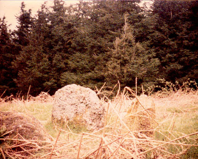
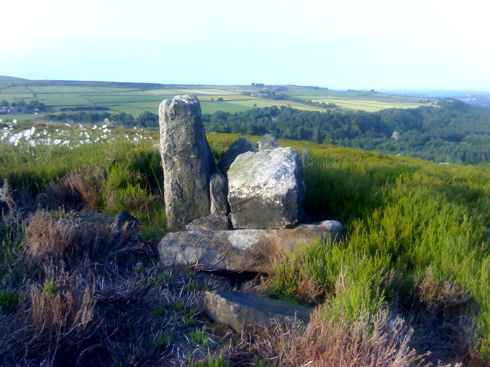
Upright stone at Glenrickard

From Brodick, walk up the Glencloy dirt-track towards the friendly Kilmichael Hotel but turn off on the left shortly before hand, up another footpath, crossing the stream until you eventually reach the derelict house which was built into the edges of this old tomb.  Upon the small rise above here, at the edge of the forestry commission trees, you’ll notice the overgrown ruins of the old tomb.

Archaeology & History

The remains here are somewhat overgrown and ramshackled, but I still like this place and in my younger days used to spend a lot of time here.  It can get quite eerie in some conditions and seems to validate some of the folklore said of it.  The site was described in Balfour’s (1910) magnum opus as:

“Situated in Glen Cloy, on the moor above Kilmichael House, close to a cottage called Glenrickard.  There are no traces of a cairn or of a frontal semicircle. The chamber is formed of rather light flags, with their upper edges nearly on the same level, so that the monument is more like a series of cists than a chamber.  The roof and end stone have gone; there are two portal stones, but the gap between them is only 7 inches.  The chamber is directed N and S, with the portal to the south.  There have been three compartments, but they are rather smaller than usual, the third from the portal being only 3 feet 10 inches long by 2 feet 2 inches broad.  Two feet 6 inches from this compartment is another cist, which is possibly a short cist representing a secondary interment, and 10 feet farther north is a second ruined cist placed at a different angle.  This last has the appearance of a short cist, but it is not carefully constructed and differs little from the component compartments of the chamber.   The structure is anomalous, and may perhaps be regarded as representing a phase of degeneration in the transitional period.”
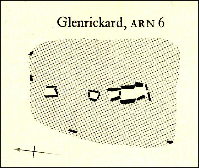
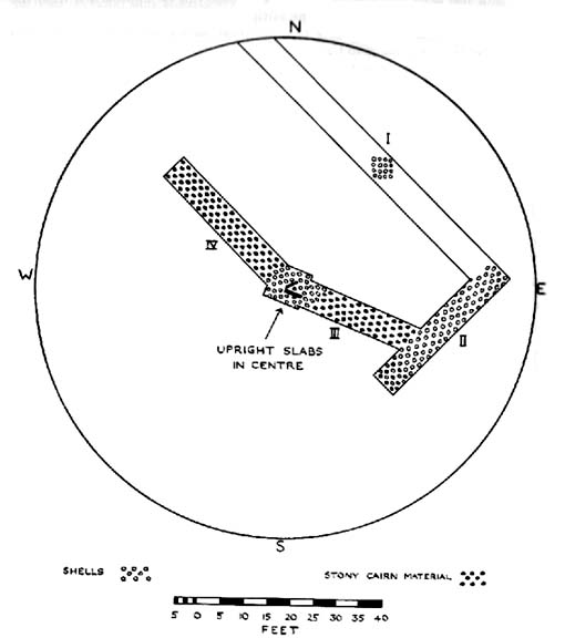
Glenrickard ground-plan (after Henshall 1972)
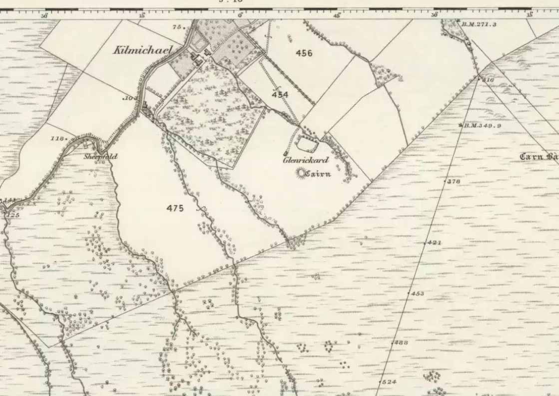
Glenrickard on 1868 map

Audrey Henshall (1972) later descried the site in greater details in her own magnum opus and told that “two rude clay urns of the primitive flower-pot pattern (were) found in the chamber”, along with “calcined bones, said to have been in the two vessels.”

Folklore

Said by local people to be haunted, the spirit of the tomb was said to have been disturbed upon the building of the derelict house below it.  Ghosts of a middle-aged couple and young child have been seen in the house; whilst the spirit of the site can generate considerable fear to those who visit the place when it is ‘awake.’  To those who may visit this out-of-the-way tomb, treat the site with the utmost respect (and DON’T come here and hang a loada bloody crystals around the place in a screwy attempt to “clean” the psychic atmosphere of the place. If you’re that sort of person, don’t even go here! The spirit of the place certainly wouldn’t want you there).

References:

  1. Balfour, J.A., The Book of Arran: Archaeology, Arran Society: Glasgow 1910.
  2. Henshall, Audrey Shore, The Chambered Tombs of Scotland – volume 2, Edinburgh University Press 1972.

© Paul Bennett, The Northern Antiquarian 

Carmyllie Hill, Greystone, Angus

Cairn:  OS Grid Reference – NO 545 434

Also Known as:

  1. Fairyfold Hillock
  2. Fairy Folk Hillock

Folklore

An intriguing site this, as it doesn’t appear to be in the Canmore archaeological register – unless it’s the Canmore site 34750.  Yet Alexander MacGregor (1937) mentions the place in his folklore study as being a site where the little people lived.  Shown on the first OS-map of the region as ‘Fairyfold Hillock’, Mr MacGregor (1937) said of it:

“Near the summit of Carmylie Hill is a large barrow or tumulus, which was believed at one time by the natives to be a favourite haunt of the fairies, where, with much splendour, they held their nightly revels. It still bears the name of ‘Fairy-Folk Hillock.'”

However it seems that quarrying operations may have destroyed the site.  The tomb here was probably the same one described by Mr Andrew Jervise in the Journal of the Kilkenny and South East of Ireland Archaeological Society (1864-66), where he wrote:

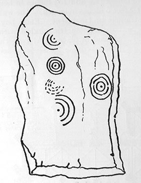
“Many years ago I took note of another example of these ‘footmarks,’ which was found in the parish of Carmyllie…  This was discovered in the course of making agricultural improvements some thirty-five years ago, on which occasion stone coffins or cists were got, and in one of these was a bronze (?) ring, of about three inches in diameter, now said to be lost.  Apart from the cists there was a rude boulder of about two tons weight; and upon the lower side of it, as my informant told me, was scooped the representation of a human foot. This too was associated with the elves; for the hillock upon which these discoveries were made was called the ‘fairies’ knowe;’ and tradition says that, but for a spirit that warned the workmen to suspend operations when they began to prepare for the foundations of the parish church, the church would have been built upon that spot!”

References:

  1. MacGregor, Alexander, Highland Superstitions, Eneas MacKay: Stirling 1937.

© Paul Bennett, The Northern Antiquarian

Carlowrie, Kirkliston, Midlothian

Cup-and-Ring Stone (destroyed):  OS Grid Reference – NT 138 746

Archaeology & History

Lost carving of Carlowrie

Two-thirds of a mile west of the Cat Stane, on land immediately north of the River Almond by Edinburgh Airport in an area that was reported in 1780 to be “filled with the skeletons of human bodies,” this old petroglyph could once be found.  The Scottish Royal Commission (1929) described it as being a covering stone for a short prehistoric tomb near the OS-grid reference cited here, “but when discovered it was much broken by the plough that it does not appear to have been preserved.”  They refer instead to the last report of the site in the Scottish Society of Antiquaries journal, where we were informed that the cover stone was,

“marked with three series at least of concentric circles… The widest diameters of the sets of rings cut on the inside of the lid is about five inches, and each set is composed of five concentric circles.”

All trace of this carving appears to have been lost.  Other carvings reported nearby in the 19th century also appear to have been lost or destroyed.

References:

  1. Morris, Ronald W.B., The Prehistoric Rock Art of Southern Scotland, BAR 86: Oxford 1981.
  2. Royal Commission on Ancient & Historical Monuments, Scotland, Midlothian and Westlothian, HMSO: Edinburgh 1929.
  3. Simpson, J.Y., The Cat-Stane, Edinburghshire, Neill & Co: Edinburgh 1862.
  4. Simpson, J.Y., “On Ancient Sculpturings of Cups and Concentric Rings,” in Proceedings of the Society of Antiquaries, Scotland, volume 6, 1864-66.

© Paul Bennett, The Northern Antiquarian

Serpent Mound, Scallasaig, Glen More, Inverness-shire

Cairn:  OS Grid Reference – NG 848 202

Folklore

I’m presuming that this burial site is the right one, described in the fine Mr MacGregor’s Peat Fire Flame (1937) as being “by the roadside up near Scallasaig.”  There certainly doesn’t appear to be another alternative site close by (though if I’ve got it wrong, someone please lemme know!).  This place was, said MacGregor, a site “where the people in olden times used to worship the serpent.”

MacGregor spoke with a local man about the myths here and asked how long it had been associated with serpents.

“Och, about two thousand years,” said Mr John MacRae. “The mound was in the shape of a serpent, and when the chief of the people would die, he would be buried in the head of the serpent..”

He continued, saying, “One from London, that was going about searching things like that, opened the mound, and they found in the mound a big stone coffin with a big stone slab on the top. And there the bowl was found with the ashes of the chief of the people at that time. The bowl was taken to the Manse. That’s about fifty years ago. It was there for a few months; and they took it to Edinburgh, to some museum or something. They were saying that there was a funny noise in the Manse when the bowl was lying there. If there was any treasure in the bowl, or in the grave along with the bowl, it was taken out before. You see, had he any treasure – the chief like – guns and money and the like – I’m sure they wouldn’t be putting much money in the grave. It would be going into the grave with the dead man, so, when he would rise in the next world, he would be ready to start at the same game as he was carrying on here on Earth.”

This sounds a little like the folk-memory of an idea of a heathen afterlife – and of course it’d make sense finding such lore here at a tomb.

I’ve come across references to several other serpent mounds scattering the western side of Scotland, but their exact locations have proven hard to pin down. It makes y’ wonder how many more there once were before the christian paradigm became entangled in the myths of the country people.

References:

  1. MacGregor, Alisdair Alpin, The Peat-Fire Flame: Folk-Tales and Traditions of the Highlands and Islands, Ettrick Press: Edinburgh 1937.

© Paul Bennett, The Northern Antiquarian


Reddicar Clough, Hallam Moor, South Yorkshire

Long Cist:  OS Grid Reference – SK 2624 8688

Also Known as:

  1. Ash Cabin Long Cist

Getting Here

Despite a footpath being marked on the OS map, there’s none I could find and the only way to get there is to make your way through the heather.  Park at the Wyming Brook nature reserve car park on Redmires road, take the signposted path besides the notice board and follow the line of the dry stone wall. Go through the gate and continue till you come to the end of the wall where a path leads off to your left through the broken wall, follow the path through the boggy bit and head uphill till you get to the highest point of the path by another wall with a path the other side.  From here it gets a little tricky! You’ll now need to go off path heading NNE and down hill till you come to the post-and-wire fencing where you should pick up a slight path heading WNW (your left) and head for the high point about half a mile in front of you. Just before you come to the high point you’ll have to cross the stream (easily done). The cist lays on the flat ground just beyond the brow of the rise.

Archaeology & History

A long cist around 3 feet wide and 6 feet long in a well preserved condition aligned almost — but not quite — East/West on a prominent position on Hallam Moor, commanding views over Ash Cabin flat, Rivelin Valley and the A57 road.  The only restricted view is to the northwest, where the moor rises then drops down again towards the Headstone.

There are 3 side-stones still in situ: the largest around 1 metre tall, the others still in place being about 70cm.  The stones that would have made up the rest of the walls lay close by.

When you’re at the site it’s obvious why it’s in this location: the views are spectacular and afford excellent views of the surrounding area.  A burial site with a vista truly fit for a king!

Archaeologically there’s not much info kicking around that I can find and I’m indebted to Stubob for alerting me to it’s presence.  It’s very unlikely you’d be walking this area for any reason other than to visit the site, as there are decent paths across the moor to the most popular site in this area, the Headstone off to the North West.  Remains of the Ash Cabin Flat stone circle are about 750 yards southeast of here.

A real gem of a site and a “must see” if your in the area.

© Geoff Watson, The Northern Antiquarian


Fairy Knowe, Crarae, Minard, Argyll

Cairn:  OS Grid Reference – NR 9874 9736

Also Known as:

  1. Canmore ID 40010

Archaeology & History

Fairy Knowe (Campbell 1923)

Just over 100 yards northeast of the chambered cairn in Crarae Garden we can see the denuded remains of this old mound, long ago held as the dwelling place of the little people. When it was first described in 1865, a standing stone was reported as surmounting the tomb, but this can no longer be seen.  Further excavations made by Sir George Campbell in 1923 and reported in the Oban Times, showed the cairn to have been 108 feet across and nearly 6 feet tall at the centre — beneath which a “stone coffin” was found.  It was said that two passages ran from this middle chamber: one to the southwest and the other roughly southeast.  Deposits of shells, antlers, and the bones of cattle, deer, horses and sheep were also found here.

References:

  1. Royal Commission on the Ancient & Historical Monuments, Scotland, Argyll – volume 6: Mid-Argyll and Cowal, HMSO: Edinburgh 1988:61.
  2. Scott, J.G., “Excavation of the Chambered Cairn at Crarae, Loch Fyneside,” in Proceedings of the Society of Antiquaries, Scotland, volume 94, 1961.

Links:

  1. The Fairy Knowe, Crarae – on Scotland’s Places

© Paul Bennett, The Northern Antiquarian


Douglas Terrace, Cambusbarron, Stirlingshire

Cairn (destroyed):  OS Grid Reference – NS 782 929

Archaeology & History

At the bottom of the ridge from the (supposedly) singular King’s Park cup-and-ring stone,” in a sand-pit adjoining Douglas Terrace,” we could once find the remains of a now lost prehistoric tomb.  First described in the Stirling Natural History Society’s Transactions in 1907, the Scottish Royal Commission lads (1963) told us that, “an urn from this cist was taken to the Smith Institue, Stirling, in a broken condition.” Anymore information about this site, or images of the fragmented urn, would be hugely appreciated.

It does seem very probable that the King’s Park cup-and-ring stone at the top of the ridge from here did relate to local neolithic or Bronze Age burial sites, as I suspected.  It’s highly likely that other carvings were (are?) hidden beneath, or round the edges of this Douglas Terrace and Kings Park region, as I suggested a few months ago.  It’s imperative that archaeologists in the district pay attention to this area before giving the go-ahead of any further landscape destruction.

References:

  1. Royal Commission on Ancient & Historical Monuments, Scotland, Stirlingshire – volume 1, HMSO: Edinburgh 1963.

© Paul Bennett, The Northern Antiquarian


Birkhill House, Cambusbarron, Stirlingshire

Cairns (destroyed):  OS Grid Reference – NS 780 926

Archaeology & History

In times past, there were at least two prehistoric tombs in land either side of old Birkhill House, now covered by the M9 motorway.  The Scottish Royal Commission lads described the first as being “in the garden of Birkhill House,” continuing:

“This cist contained bones and an urn which measured 5in in height and 6in in diameter, and was ornamented with zigzag lines.”

They think, from its description, that “it may have been a food vessel.”  There were also the remains of another tomb to be found in “rising ground to the west side of” Birkhill House.  Both of these finds were first described in the local Transactions of the Stirling Natural History and Antiquarian Society in 1880.  It seems that little else is known about them. (Thanx again to Paddybhoy for prodding my attention here.)

References:

  1. Royal Commission on Ancient & Historical Monuments, Scotland, Stirlingshire – volume 1, HMSO: Edinburgh 1963.

© Paul Bennett, The Northern Antiquarian


Coneypark Nursery, Cambusbarron, Stirlingshire

Cairns (destroyed):  OS Grid Reference – NS 783 926

Archaeology & History

At least two old tombs that could once be seen here are long-gone by all accounts.  They could be found 200 yards south of the remaining King’s Park cup-and-ring stone.  The first was described by the Royal Commission lads (1963) as a well-defined cist, “situated within a gravel mound and (it) contained a skeleton.”  Another tomb site was described a few years later:

“A second short cist was found just within the cairn material 3m SE x E from cist no.1.  It consisted of a capstone set on built-up side walls, the bottom courses being five slabs on edge.  The internal measurements were 64cm long and 48cm wide and 60cm deep.  This second cist was orientied NE-SW with its floor made of small pebbles on which lay a late incised beaker and a small piece of human skull.”

References:

  1. Royal Commission on Ancient & Historical Monuments, Scotland, Stirlingshire – volume 1, HMSO: Edinburgh 1963.
  2. Thompson, J.K., “Coneypark: Bronze Age Cairn,” in Discovery & Excavation in Scotland, 1972.

© Paul Bennett, The Northern Antiquarian


Barnhill, Jura, Argyll

Cairn:  OS Grid Reference – NR 7057 9700

Archaeology & History

Very close to being at the top of the island.  If you do manage to get here take a gander at the legendary Gulf of Corryvreckan: one of the largest whirlpools on Earth, where the cailleach swirled her stuff when angry! This is the ‘hill where sorrel grows,’ and where George Orwell wrote 1984 – but more important for us is where the Royal Commission for Historic & Ancient Monuments of Scotland (Argyll, vol.5) designated that,

“a stony mound about 5.5m in diameter and 0.5m high, situated on the crest of the ridge east of Barnhill, appears to be a prehistoric burial cairn.”

Sadly I never managed to check this out when I was last up here as I didn’t know it was here!

References:

  1. Royal Commission on the Ancient & Historical Monuments of Scotland, Argyll: volume 5 – Islay, Jura, Colonsay and Oronsay, HMSO: Edinburgh 1984.

© Paul Bennett, The Northern Antiquarian