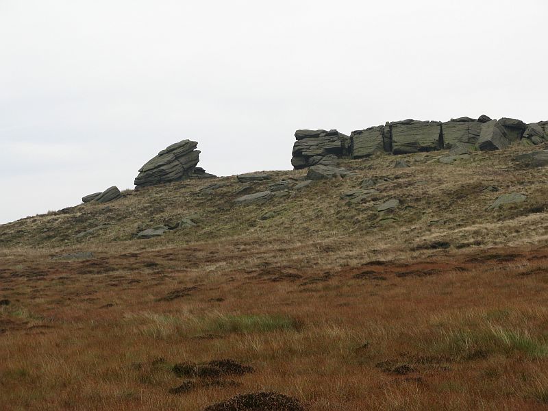
Reap’s Cross, Heptonstall Moor, West Yorkshire

Cross:  OS Grid Reference – SD 94360 30269

Also Known as:

  1. Long Stoop
  2. Ralph’s Cross

Getting Here

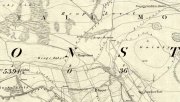
Reaps Cross on 1851 OS-map

Reaps Cross on 1851 OS-map

From Hebden Bridge go up the Heptonstall road, going round the village and onto and through Slack, keeping straight on the road until it goes uphill for a short distance, then levels out; then watch out for the small right-turn at Colden and the single-track road heading to a dead-end.  Go right to the end, the very end, and go through the gate and walk up the track onto the moor.  As you reach the ridge and the moorlands open up before you, note the small ‘standing stone’ on your right, about 10 yards off-path— and there, 100 yards the opposite direction to your west, the tall upright Reaps Cross is sat on the moortop.  Y’ can’t miss it!

Archaeology & History

Found in the middle of a beautiful nowhere not far from the prehistoric standing stone on Standing Stone Hill, this old tall monolith was said to have stood as a marker beside the old road which ran from Halifax over the moors to Colne, until the more recent Widdop Road became the more preferred route.  Known locally as the Long Stoop, in 1900 George Tyack said of it,

“This stone, which is composed of millstone grit, lay for a long tine broken and overthrown, but has in recent years been replaced on its original site and restored.  It is a simple Latin cross standing twelve feet high amidst the heather of the Yorkshire moors.”

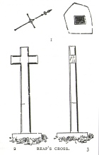
Longbottom's 1897 sketch

Longbottom’s 1897 sketch

Waddington's 1884 sketch

Waddington’s 1884 sketch

Shortly before Tyack’s description, the local historian John Longbottom (1897) wrote a series of articles on the old stone crosses of the region and gave us this old sketch of the site (right).  Even in his day the cross had been “wilfully thrown down” (probably by the screwy Puritans at that time), but a short time later it had been “repaired and restored to its original position.”  In Longbottom’s day there were short ‘arms’ extending outwards from near the top of the obelisk, defining it as a distinct ‘cross’, but these have subsequently been lost following further local demolition attempts. He told how,

“Reaps Cross is known locally to shepherds, gamekeepers and farmers at ‘T’ Long Stoop’, and…apart from its religious associations, it forms an important landmark, now as in ancient times, to many a poor weary traveller crossing the dreary and lonesome hills between Lancashire and Yorkshire.”

The cross keeps getting knocked over, by both lightning and idiots of various persuasions; but thankfully the old fella keeps getting resurrected and put back in its place. It’s history is a curious one.  When Clifford Byrne (1974) wrote about the site in his unpublished survey, he told how

“This cross appears to be of medieval origin and…in 1973 the monolith lay broken, one section lying in the grass, whilst the other section still stood in the pedestal.  It is seen to have been broken once before, for the remains of iron clamps are seen on both sections.  The arms have been broken off in some age… A local farmer insisted that the correct name was Ralphs Cross not Reaps Cross, and it should be noted that a section of moor at Widdop (the valley with the high cliffs) is named after a Ralph.”

Standing some 12 feet tall, this is the highest of all the crosses in West Yorkshire and obviously some considerable work went into its creation all those centuries ago.  Nobody is sure when it was first made, but the educated guess is 12th century.  Why it was erected here, way off from anywhere in the middle of the wild moors, is equally puzzling.  It may have had something to do with the nearby medicinal springs; it may have been as a guide-post to travellers—”to Rastric Greave”, according to Waddington (1884); it may have marked an ancient religious route; or it may have distracted people away from the prehistoric upright that gave its name to Standing Stone Hill, a short distance to the west  We simply don’t know.  It’s well worth visiting though, as the moorland landscape up here is truly expansive and civilization seems thankfully centuries away…

Folklore

Local tradition told that the cross marked an old corpse route, along which the dead were carried before being buried at Heptonstall.  Here at Reaps Cross, the bodies were rested by the weary travellers.  If this is true, it is probable that the ancient standing stone more than half-a-mile to the west once had something to do with such old rites and routes.

References:

  1. Bennett, Paul, The Old Stones of Elmet, Capall Bann: Milverton 2001.
  2. Byrne, Clifford, A Survey of the Ancient Wayside Crosses in North-East Lancashire, unpublished MS, 1974.
  3. Longbottom, John, “Ancient Crosses in Halifax Parish – Part 2,” in Halifax Naturalist, 2:8, June 1897.
  4. Taylor, Henry, The Ancient Crosses and Holy Wells of Lancashire, Sherratt & Hughes: Manchester 1906.
  5. Tyack, George, The Cross in Ritual, Architecture and Art, William Andrews: London 1900.
  6. Waddington, J. Arthur, “The Crosses in and Around Burnley,” in Transactions of the Burnley Literary & Scientific Club, volume 1, 1884.

© Paul BennettThe Northern Antiquarian


Walshaw Dean, Wadsworth Moor, West Yorkshire

Stone Circle:  OS Grid Reference – SD 9647 3355

Getting Here

Walshaw Dean stone circle

The site is usually invisible, being under the waters of Walshaw Dean Middle Reservoir.  But in good droughts you can catch a glimpse of the place.  So take the Widdop road as it’s known locally, from either Hebden Bridge up past Heptonstall, or from Burnley, Nelson & Colne side, and park-up by the pub a few hundred yards east of Widdop Reservoir.  Walk a few hundred yards back down the road (east) and take the dirt-track on the other side of the road on the Calder-Aire link leading to the Pennine Way.  Walk up past the first reservoir, keeping to its west-side, until you reach the Lodge house where the second lake appears.  Now, if the water’s down, walk along its western-edge for about 50 yards, looking into the dried flat ahead of you and you’ll see the loose ring of small stones.  That’s it!  Or as Mr Roth described the place in 1906, “The position of the circle is on the left-hand side of the valley going up, a few yards above the dam of the second reservoir.”

Archaeology & History

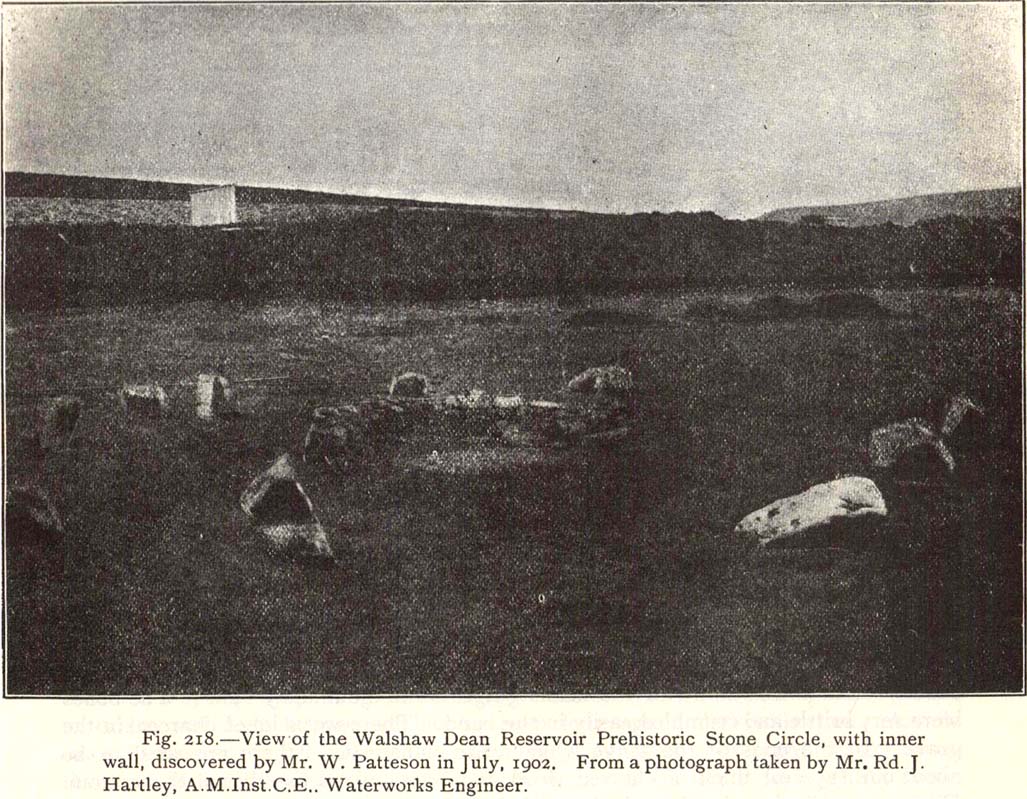
Earliest photo of the circle

This is a somewhat bizarre archaeological site, whose nature we may never fully recover.  Although listed and scheduled as a plain stone circle by Aubrey Burl (2000) and others, both the placement and structure of the site implies a more funerary aspect to it.  This was suggested by Ling Roth (1906) when he first wrote about it.  But for me, the position of the site in the landscape calls into question the archetypal ‘stone circle’ category, as it is somewhat hemmed-in both east and west, with limited views north, and only a good view of open lands to the south (summer).  It’s just a bit odd when compared to other megalithic rings in the Pennines.  But perhaps this ‘privacy’ was intended — as there is only scattered evidence of other human activity in this valley and on the moors above.  Perhaps this site was meant to be ‘cut off’ from the rest of the world.  We might never know…

There is also the peculiar addition inside this stone circle of an arc of walling facing southeast, which is unique in this part of Britain.  But this walling seems to have been a later addition and has the hallmarks of being some small shelter, or even an early grouse-shooting butt (there’s tons of game-birds here, and this would be an excellent spot to shoot from)  This internal wall may have been constructed from stone that came from the circle itself: perhaps in a rubble wall, perhaps an internal cairn.  It seems likely.  Mr H. Ling Roth (1906) also mentions this feature in what was the first description of the site, where he told:

“The stone circle at Walshaw Dean Reservoir…was discovered by Mr W. Patteson, the resident engineer, in July 1902.  The circle consists of ten irregular stones apparently local rock, varying considerably in size, one measured 6ft 3in (1.9m) long and stood about 30 inches (76cm) above the clay when the peat surface was removed.  Whether the stones are deeply embedded has not been ascertained, but where they were covered by the peat a clear white band is apparent.  The circle is 36 feet (11 metres) is diameter and of very fair exactitude.  Inside the circle as shewn on the plan and in the view there was a rouhg carved wall which measured across the ends 12ft (3.7m).  The wall had been partly pulled down and reset immediately before examination by a party of visitors soon after the discovery.  Its presence in the circle may be fortuitous, but after the two unsystematic disturbances to which the ground had been subjected, it is not possible to form an opinion about it.  That something had been buried in the centre of the circle is probable when we bear in mind the circumstances of stone circles elsewhere, but an examination shewed only that the ground had been disturbed and Mr Patteson explained to me that such disturbance was not of recent date.”

To my knowledge, no subsequent excavation of the site has ever been done, but it would appear that the waters have washed part of the site away and any remains that may once have been found within the ring have been discarded by more than a century of erosion.  Traces of small walled structures have also been noted close to the circle in recent years, suggestive of settlement remains.  On a TNA outing last year, we also found previously unrecorded prehistoric remains on this hills above here.  When Geoffrey Watson (1952) wrote his survey on prehistoric Calderdale, he suggested that the Walshaw Circle may have been placed alongside the branch of an early trade route running along the northern edge of the valley.  Not so sure misself…

References:

  1. Bennett, Paul, The Old Stones of Elmet, Capall Bann: Milverton 2001.
  2. Burl, Aubrey, The Stone Circles of Britain, Ireland and Brittany, Yale University Press 2000.
  3. Roth, H. Ling, The Yorkshire Coiners, 1767-1783; and Notes on Old and Prehistoric Halifax, F.King: Halifax 1906.
  4. Watson, Geoffrey G., Early Man in the Halifax District, HSS: Halifax 1952.

Links:

  1. Walshaw Dean Stone Circle on The Megalithic Portal

© Paul Bennett, The Northern Antiquarian 

King Common Rough, Heptonstall, West Yorkshire

Cup-and-Ring Stone:  OS Grid Reference – SD 95303 30997

Also Known as:

  1. Black Scout carving

Getting Here

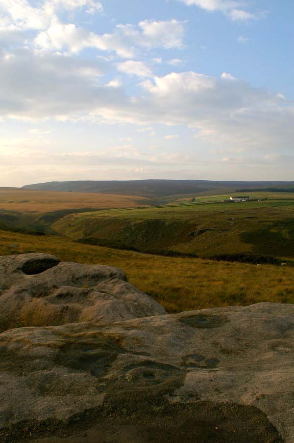
The carved rock in its setting

From Hebden Bridge, take the Heptonstall road and go past the legendary Slack Bottom (no lies!), until a few hundred yards further on at Slack Top, take the Widdop road on the right. Amble the long and winding road for a mile – mebbe a bit more – until the valley on your right runs out of trees! (on the OS-map this is called Hebden Dale, but it’s generally known as Hardcastle Crags [after the name of the rock outcrop halfway up]). Just about here there’s a track to your left, by the rather desolate bus-stop! If you hit the wibbly hair-pin bend by the Blake Dean scout-hut, you’ve gone too far. Walk along the track for a coupla hundred yards and take the first opportunity you have to cross the deep dike on your immediate left. Then just walk along the edge of the stream itself until you reach the large rocks another few hundred yards along.

Archaeology & History

As Richard Stroud’s photo above shows, this is a beautiful spot — when the weather is good anyway!  Much of the landscape around you is scattered with occult history and folklore: boggarts, witches, corpse routes, spirit animals, old stone crosses, standing stones and more! A damn good day out can be had in this area by any enthusiastic antiquarian or enquiring heathen.

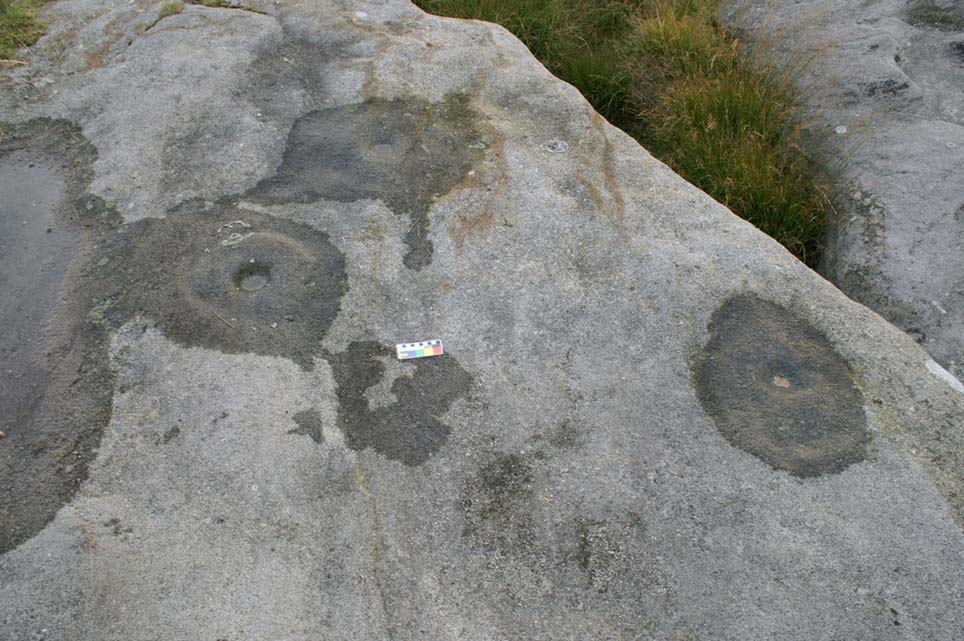
Cups and faint rings

The carving we have here is an almost typical cup-and-ring stone, but it’s pretty isolated with no other ringed companions anywhere on these hills.  It was first described in David Shepherd’s (2003) survey of prehistoric remains of the region — although I was initially a little cautious about the veracity of David’s findings, as some cup-marked stones in his survey are probably natural and some “standing stones” he cites nearby are simply natural earthfast rocks.  But this particular carving seems man-made with large faint rings encircling at least one of the cup-marks, as you can see in Richard Stroud’s photo here.  In Mr Shepherd’s survey, he said of this site:

“A prominent double boulder.  On the top surface are two eroded cup marks by the south edge and one by the north edge.  Two eroded cup marks with rings are on the northwest segment.”

References:

  1. Shepherd, David, “Prehistoric Activity in the Central South Pennines,” in Transactions of the Halifax Antiquarian Society, new series, volume 11, 2003.

Acknowledgements:  With thanks to Richard Stroud for use of his photos in this site profile.

© Paul Bennett, The Northern Antiquarian

Alcomden Stones, Stanbury Moor, West Yorkshire

Legendary Rocks: OS Grid Reference – SD 97313 35737

Also Known as:

  1. Oakenden Stones

Getting Here

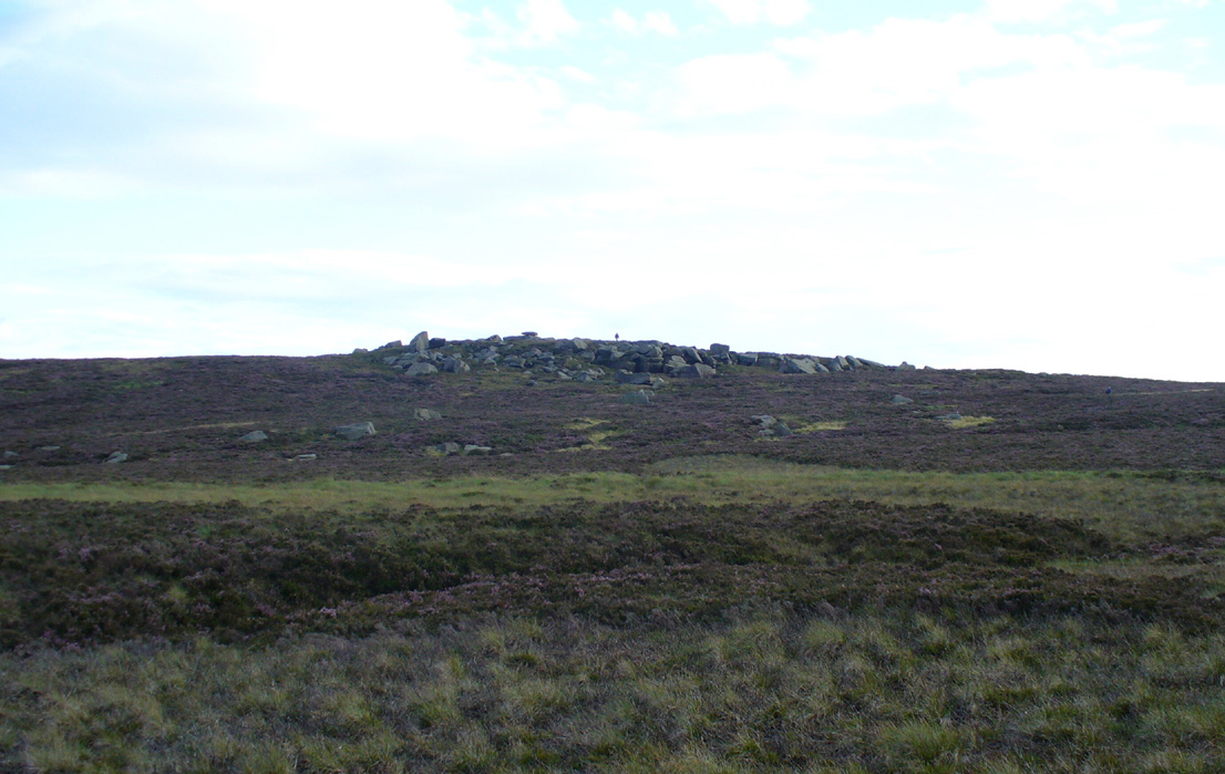
The ‘druidic’ Alcomden Stones

Takes a bitta getting to this spot, but it’s worth the effort!  Make a day of it and walk up here via the little-known Cuckoo Stones monoliths.  From here the walk gets steeper!  Follow the footpath from the standing stones, uphill, to the legendary Wuthering Heights building of Bronte-fame a half-mile ahead of you.  Then walk immediately up the slope at the side of the derelict house higher onto the moor (there’s no real footpath to follow) until the moorland levels out.  From here, look west and walk that way for a few hundred yards where you’ll be seeing a large rock outcrop ahead of you.  That’s where you’re heading! (if you reach the triangulation pillar, take the small path from there along the top of the moor towards this large rock outcrop)

Archaeology & History

Alcomden’s Altar Stone

To those of you who like a bitta wilderness, or healthy normal people I suppose, this is a stunning place!  Even though there’s little by way of archaeology here — save the usual expectations of a few flints and arrowheads — its geomancy, its position in the landscape, makes it excel as a once important ritual site for our ancestors in not-so-distant centuries.  Although local tradition gave these great rocks a prehistoric pedigree, the archaeological record doesn’t say as much — but that doesn’t really mean much up here.  We’ve found a singular Bronze Age cairn on the level at Middle Moor Flat 400 yards northwest (not in the record books), some prehistoric walling on the flat east of here (not in the record books), so a lot more attention is needed hereby to see what more may be hiding in this rocky heathland area.

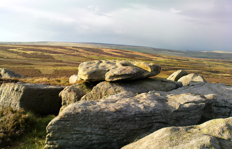
The main feature amidst this extensive scattering of rocks is the large rocking stone, said to weigh six- or seven-tons, resting upon other glacial deposits.  The rock itself can be made to rock very slightly.  It was described in Lewis’ Topographical Dictionary as a

“cromlech, an evident druidical remain, (which) consists of one flat stone, weight about six tons, placed horizontally upon two huge upright blocks.”

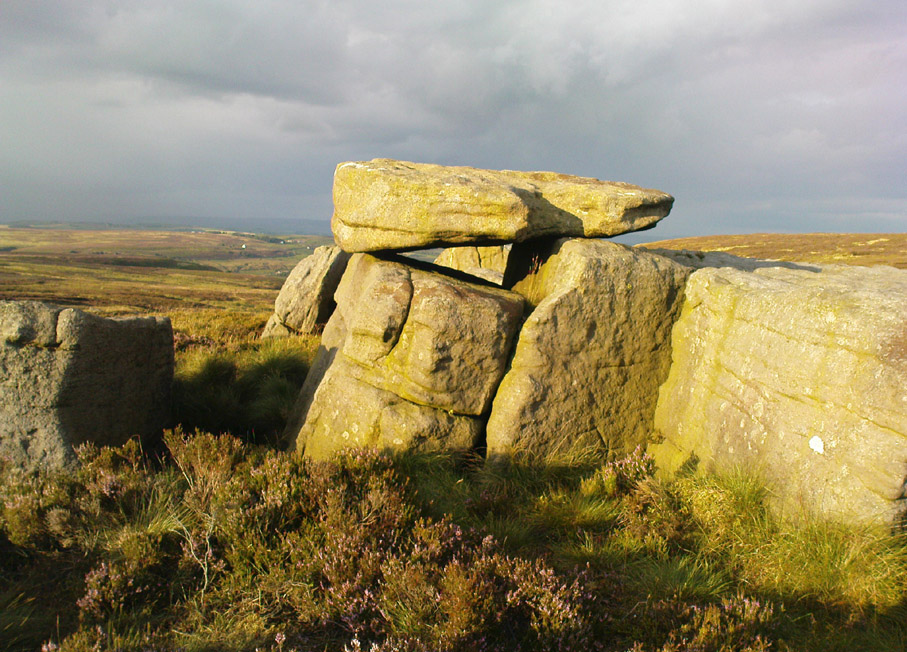
But the placement here was done by Nature and not humans — making it much more important to our ancestors.  This was a site for solace, for ritual and to commune with the gods themselves.  A few visits to this place show this quite clearly — unless you’re unable to relax that is! It’s a place I wanna spend more time working with, as the mythic history around these stones feels strong, despite their absence from written records.

The ‘altar’ resting on rocks
Alcomden’s “altar”

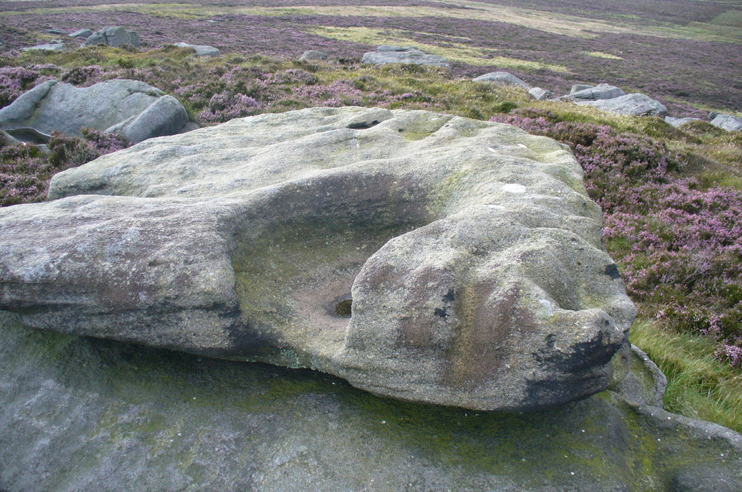
The druidic sentiments espoused by Lewis were all but echoed by our otherwise sober historian, J. Horsfall Turner, in his history of Haworth (1879), where he describes the Alcomden Stones as “the remains of a Druid’s Altar.”  On top of the main ‘altar stone’ are what could be ascribed as worn cup-markings, but it seems they’re Nature’s handiwork once again; though this wouldn’t deny them as having some significance to our ancestors.  A number of other boulders amidst this mass of rocks also have what seem like cup-markings, but none of them can be said with any certainty to have been carved by people.  Indeed, the entirety of this legendary rock outcrop seems to have been created solely by the spirits of Nature.

One view of Earth, from Alcomden
View of Earth, from Alcomden

It was first described as ‘Alconley’ in 1371, then in the 1379 Poll Tax returns as ‘Halcom’, the etymology of which is difficult.  Al- is a cliff or rock, many of which occur here; den is certainly a valley, over which we look to the northeast (to Ponden Kirk, 500 yards away); but the central element of ‘com‘ is the greatest puzzle.  Blakeborough (1911) tells of the old Yorkshire word ‘con’ — found in the 1371 spelling — meaning “to scan, or observe critically,” which one can certainly apply here in a topographical sense, i.e., “observation stones above a valley.”  It’s simple, succinct, and makes sense!

Folklore

As Elizabeth Southwart (1923) rightly said,

“Our forefathers, instinct and imagination more highly developed than knowledge, peopled their woods with fairies and their valleys with ghosts.  On the high, wind-swept spaces they built their altars to Unknown Gods.”

Turner's 1913 drawing
Turner’s 1913 drawing

And such she thought was done at this “heap of rocks called Oakenden Stones.”  It seems likely, as this place is superb for ritual magick and meditative systems.  But all we have are the repeats of numerous old historians, from Whiteley Turner (1913) and his namesake J. Horsfall, to James Whalley, J.W. Parker and more, who recorded what the old locals said: that is was a place of the druids.  There may be a grain of truth in it somewhere…

References:

  1. Bennett, Paul, The Old Stones of Elmet, Capall Bann: Milverton 2001.
  2. Blakeborough, Richard, Wit, Character, Folklore and Customs of the North Riding of Yorkshire, W. Rapp: Saltburn 1911.
  3. Parker, J.W., Guide to the Bronte Country, J.W. Parker: Haworth n.d. (c.1971)
  4. Southwart, Elizabeth, Bronte Moors and Villages: From Thornton to Haworth, John Lane Bodley Head: London 1923.
  5. Turner, J. Horsfall, Haworth, Past and Present, Hendon Mill: Nelson 1879.
  6. Turner, Whiteley, A Spring-Time Saunter round and about Bronte Lane, Halifax Courier 1913.

© Paul Bennett, The Northern Antiquarian


Dove Stones, Widdop Moor, West Yorkshire

Legendary Rocks:  OS Grid Reference – SD 9333 3479

Also Known as:

  1. Dew Stones

Getting Here

Dove Stones (after ‘QDanT’)

Get to Widdop reservoir in the hills west of Hebden Bridge and park up. The great rock faces to your right (north) is where you’re going. Clamber to the top until the moor levels out, making sure you head NNW for less than a mile. The moors you’re now on are supposed to be private – but folk like me pay no attention!  There are no footpaths to this great outcrop, only the heathlands and scattered stones – but keep walking for a half-mile north and you’ll get to them!

Archaeology & History

Erroneously ascribed by the place-name masters Eilert Ekwall and A.H. Smith (1961) as being ‘a place where doves gathered,’ this gigantic rock outcrop on the Yorkshire-Lancashire border — as shown on early maps — is actually the Dew or Black Stones (from the Gaelic, dubh).  It’s an awesome place!  Takes a bitta getting to, but it’s well worth the venture.

Dove Stones on 1848 map

This long geological ridge, rising higher as you walk along it to the north, has the occasional cup-mark on it, with the giant Dove Stone at the very end having a cup-and-half-ring on its crown (be careful not to fall off). From here, you look across a huge, desolate, U-shaped valley, the far side of which we rise to 1700 feet and the grand setting of the Lad Law.

Folklore

The folklorists Harland and Wilkinson (1882) included this in their survey of druidical sites, mentioning the several cup-markings, or druid basins as they called them. (though most of ’em on here are Nature’s handiwork)

For me, this is an incredible place – full of raw power and magick. It has a curious geomantic relationship with the Whinberry Stones, a couple of miles to the south, around which should be a ring of stones…though none can be found.

References:

  1. Bennett, Paul, The Old Stones of Elmet, Capall Bann: Chieveley 2001.
  2. Harland, John & Wilkinson, T.T., Lancashire Folk-lore, John Heywood: Manchester 1882.
  3. Smith, A.H., Place-Names of the West Riding of Yorkshire – volume 3, CUP 1961.

Links:

  1. More images of the Dove Stones

© Paul Bennett, The Northern Antiquarian